“Whiskey’s for drinking and water’s for fighting,” a popular adage from the chronicles of the American West that’s starting to come back into vogue.
The world’s megacities are on a knife’s edge of water stress.
Climate change is clobbering water resources and testing the nerves of the world, especially megacities; e.g., Mexico City (pop. 22 million) could run dry this summer. Nearly 90% of greater Mexico City is in severe drought. The country has been in widespread drought since 2021-22. Subsidence is causing the city to sink 20 inches per year because of rapid groundwater extraction supplanting low reservoirs. The Metro is sinking unevenly. The rails are wobbly. The massive city could go dry this year.
Bogotá, a city of 8 million located in a humid patch of the northern Andes Mountains surrounded by cloud forests, has instituted water rationing as of April 15, 2024. The Chingaza Reservoir System is 15% full and if rains do not return soon, it’ll run out of water in two months. The mayor recommended eliminating daily personal showers, with several other suggestions.
Human-caused climate change is enemy number one, and it all starts at the Arctic, influencing the entire Northern Hemisphere, too hot for too long melting reflective ice, upsetting an age-old interchange with jet streams at 30,000 feet that drive weather patterns. Like a drunken sailor, the jet streams don’t know which way to go and neither do weather systems. Result, rains for Mexico City reservoirs are horribly weak, if at all, following years of unprecedented drought.
The United Nations General Assembly, NY was briefed last year by leading scientists: “Conflict, Climate and Cooperation.” It’s been 4,500 years since an actual war has broken out over water rights. It took place between two Mesopotamian city-states in what is now called Iraq.
Like 4,500 years ago, tensions over water are on the rise and climate change is largely to blame as fossil fuels lurk in the background. Major cities of the world are at risk of drying out and climate change is the problem, too hot for too long with drought on a rampage, festering big time trouble of Day Zero, as taps go dry. Leading candidates: Mexico City, Johannesburg, Cape Town, Jakarta, São Paulo, Beijing, Cairo, Bangalore, Tokyo, London, Bogotá, Moscow, Istanbul (Sources: Euronews and World Resources Institute Aqueduct).
Global warming is impacting a very sensitive touch-and-go relationship between major cities and diminishing water resources. Extreme heat shrinks reservoirs combined with decades of neglect as water infrastructure crumbles and climate change shifts precipitation patterns making once wet regions drier than ever.
The 2024 World Water Development Report claims that nearly one-half of the world’s population experiences “at least temporary severe water scarcity.” Meanwhile, tensions over water are exacerbating conflicts worldwide. (Source: Press Release: Water Crises Threaten World Peace, UNESCO, March 2024.) More to the point, 2.2 billion people don’t have access to “safely managed drinking water.” This is a guaranteed formula for trouble as desperate people take desperate measures… to survive.
Recent water wars have spilled bloodshed in India, Kenya, and Yemen. And on the Iran-Afghanistan border, conflict rages over water from the Helmand River.
Based upon studies by the Pacific Institute, over the past 18 months there have been 344 instances of water-related conflicts in the world. According to Peter Gleick of Pacific Institute: “We also see a worrying increase in violence associate with water security worsened by drought – climate disruptions, growing populations, and competition for water.” (Source: “Water Increasingly at the Center of Conflicts from Ukraine to the Middle East”, LA Times, December 28, 2023.)
Climate change is creating a war path, forcing major urban centers to change lifestyles, living with less, and butting heads with a worldwide neoliberal capitalistic economic system that promotes endless growth at any and all costs.
By ignoring the dreadful influence of fossil fuels spewing CO2 whilst powering endless growth that rips apart predictable climate systems of the ages, which has now turned viciously unpredictable, the end may be in sight.
The ineptitude of world leadership to properly judge and deal with human-generated global warming, despite decades of warnings by top notch scientists, and their blatant kowtowing to the fossil fuel interests, is leading down a very difficult pathway. As a result, there are rumblings about how to change direction, for example, The Climate Revolution broadcast on the Climate Emergency Forum featuring Roger Hallam, co-founder of Extinction Rebellion, who suggests a changing of the guard: https://www.youtube.com/watch?v=Pc8KS89lG8Y&t=276s
Across Laos, a drop in the average amount of rainfall over the last five years is seriously affecting agricultural and electricity production, government officials told Radio Free Asia.
Farmers haven’t been able to plant rice or vegetables after a heat wave in April and May further hardened the ground and lowered water levels for rivers and streams down to just a trickle, several provincial officials said.
“We can do nothing,” a Department of Agriculture and Forestry official in southern Champassak province said. “We can’t plow. All we can do is wait. Wait for water or rainfall.”
This trend has been in place for several years – an ominous sign on World Environment Day, which is also Lao National Environment Day, which falls on Wednesday. Rivers and smaller streams have been too dry and the weather has been too hot to begin the rainy season planting.
Also, the rainfall shortage has left Laos’ dam reservoirs at just 30 percent water capacity, causing electricity production to drop 10 percent from last year, according to an official from the state-owned power company, Electricite du Laos.
The effects of deforestation are seen in Laos in this undated photo posted to social media April 25, 2024. (Laophattana News via Facebook)
“Every month, we have a meeting to discuss the water situation in the country – more specifically, about the amount of water we need and the amount of water that is available,” said a Lao Ministry of Natural Resources and Environment, who like other sources in this report requested anonymity for safety reasons.
“However, until now, we haven’t found any solution to the shortage,” he said.
The deforestation challenge
Lao Prime Minister Sonexay Siphandone said at a Cabinet meeting last month that his government is stepping up its monitoring of climate change and its impacts.
On Monday, he called on Laotians to stop cutting down trees, saying that illegal logging and deforestation have led to increased forest fires, degraded soil and flooding.
The prime minister restated the government’s goal of increasing nationwide forest coverage from 40% to 70%.
“Deforestation, land degradation, land clearance and forest fire have been intensifying in our country,” he said. “Together we can stop destroying forests to restore soil and fight against drought and floods.”
Because trees and soil can absorb carbon, forest restoration is believed to be an important way to counter climate change. But revitalized forests can also play a role in reducing heat and regulating rainfall patterns, according to the World Resources Institute.
The Lao government has issued several directives banning illegal logging and the illegal export of wood, including a strongly worded decree in 2015. But deforestation has continued, including by farmers who use slash-and-burn tactics to clear land to grow rice or cassava.
In practice, it’s very difficult for government officials to tell people that they can’t use nearby land to make a living, a Lao environmentalist said.
“Stopping deforestation is a big challenge,” he said. “Most Laotians are poor farmers who rely on the forest for survival.”
The data
More deforestation could mean a continuation of Laos’ declining rainfall rate. Before 2019, Laos usually received an average of 3,000 millimeters (118 inches) of rainfall a year, according to the World Bank.
But in 2019, only 1,460 millimeters (57 inches) fell. In 2020, it was 1,834 millimeters (72 inches), and in 2021 and 2022, there were 1,755 millimeters (69 inches) and 2,038 millimeters (80 inches) of rainfall, according to the World Bank
The trend continued into 2023 and the first five months of this year, according to the Champassak provincial official
“It’s rained only once in this area this year, “ he said. “If you look at rice fields right now, you’ll see only weeds, but no water.”
Translated by Max Avary. Edited by Matt Reed and Malcolm Foster.
This content originally appeared on Radio Free Asia and was authored by By RFA Laos.
Summers keep getting hotter, and the consequences are impossible to miss: In the summer of 2023, the Northern Hemisphere experienced its hottest season in 2,000 years. Canada’s deadliest wildfires on record bathed skylines in smoke from Minnesota to New York. In Texas and Arizona, hundreds of people lost their lives to heat, and in Vermont, flash floods caused damages equivalent to a hurricane.
Forecasts suggest that this year’s upcoming “danger season” has its own catastrophes in store. On May 23, scientists from the National Oceanic and Atmospheric Administration announced that the 2024 Atlantic hurricane season could be the most prolific yet. A week earlier, they released a seasonal map predicting blistering temperatures across almost the entire country.
One driving force behind these projections are the alternating Pacific Ocean climate patterns known as El Niño and La Niña, which can create huge shifts in temperature and precipitation across the North and South American continents. After almost a year of El Niño, La Niña is expected to take the reins sometime during the upcoming summer months. As climate change cooks the planet and the Pacific shifts between these two cyclical forces, experts say the conditions could be ripe for more extreme weather events.
“We’ve always had this pattern of El Niño, La Niña. Now it’s happening on top of a warmer world,” said Zeke Hausfather, a climate scientist at Berkeley Earth, an environmental data science nonprofit. “We need to be ready for the types of extremes that have not been tested in the past.”
During an El Niño, shifting trade winds allow a thick layer of warm surface water to form in the Pacific Ocean, which, in turn, transfers a huge amount of heat into the atmosphere. La Niña, the opposite cycle, brings back cooler ocean waters. But swinging between the two can also raise thermostats: Summers between the phases have higher than average temperatures. According to Hausfather, a single year of El Niño brings the same heat that roughly a decade of human-caused warming can permanently add to the planet. “I think it gives us a little sneak peek of what’s in store,” he said.
The air shimmers during a 2023 heatwave in Pheonix, Arizona. Mario Tama/Getty
Since the World Meteorological Organization declared the start of the current El Niño on July 4, 2023, it’s been almost a year straight of record-breaking temperatures. According to the National Centers for Environmental Information, there’s a 61 percent chance that this year could be even hotter than the last, spelling danger for areas prone to deadly heat waves during the summer months. An estimated 2,300 people in the U.S. died due to heat-related illnesses in 2023, and researchers say the real number is probably higher.
All this heat has also settled into the oceans, creating more than a year of super-hot surface temperatures and bleaching more than half of the planet’s coral reefs. It also provides potential fuel for hurricanes, which form as energy is sucked up vertically into the atmosphere. Normally, trade winds scatter heat and humidity across the water’s surface and prevent these forces from building up in one place. But during La Niña, cooler temperatures in the Pacific Ocean weaken high-altitude winds in the Atlantic that would normally break up storms, allowing hurricanes to more readily form.
“When that pattern in the Pacific sets up, it changes wind patterns around the world,” said Matthew Rosencrans, a lead forecaster at NOAA’s Climate Prediction Center. “When it’s strong, it can be the dominant signal on the entire planet.”
This year’s forecast is especially dangerous, as a likely swift midsummer transition to La Niña could combine with all that simmering ocean water. NOAA forecasters expect these conditions to brew at least 17 storms big enough to get a name, roughly half of which could be hurricanes. Even a hurricane with relatively low wind speeds can dump enough water to cause catastrophic flooding hundreds of miles inland.
“It’s important to think of climate change as making things worse,” said Andrew Dessler, climate scientist at Texas A&M University. Although human-caused warming won’t directly increase the frequency of hurricanes, he said, it can make them more destructive. “It’s a question of how much worse it’s going to get,” he said.
Over the past 10 months, El Niño helped create blistering temperatures in some parts of the United States, drying out the land. Drought-stricken areas are more vulnerable to severe flooding, as periods without precipitation mean rainfall is likely to be more intense when it finally arrives, and soils may be too dry to soak up water. As desiccated land and soaring temperatures dry out vegetation, the stage is set for wildfires.
While the National Interagency Fire Center expects lower than average odds of a big blaze in California this year, in part due to El Niño bringing unusually high rainfall to the state, other places may not be so lucky. The agency’s seasonal wildfire risk map highlights Hawaiʻi, which suffered the country’s deadliest inferno partly as a result of a persistent drought in Maui last August. Canada, which also experienced its worst fire season last summer, could be in for more trouble following its warmest ever winter. This May, smoke from hundreds of wildfires in Alberta and British Columbia had already begun to seep across the Canadian border into Midwestern states.
“We are exiting the climate of the 20th century, and we’re entering a new climate of the 21st century,” Dessler said. Unfortunately, our cities were built for a range of temperatures and weather conditions that don’t exist anymore.
To get ready for hurricanes, Rosencrans said people who live in states along the Gulf Coast and Atlantic Ocean should go to government disaster preparedness websites to find disaster kit checklists and advice about forming an emergency plan. “Thinking about it now, rather than when the storm is bearing down on you, is going to save you a ton of time, energy, and stress,” he said.
In Mexico City, more and more residents are watching their taps go dry for hours a day. Even when water does flow, it often comes out dark brown and smells noxious. A former political leader is asking the public to “prioritize essential actions for survival” as the city’s key reservoirs run dry. Meanwhile, 2,000 miles south in the Colombian capital of Bogotá, reservoir levels are falling just as fast, and the city government has implemented rotating water shutoffs. The mayor has begged families to shower together and leave the city on weekends to cut down on water usage.
The measures come as a so-called heat dome sitting atop Mexico is shattering temperature records in Central America, and both Central and South America are wasting beneath a drought driven by the climate phenomenon known as El Niño, which periodically brings exceptionally dry weather to the Southern Hemisphere. Droughts in the region have grown more intense thanks to warmer winter temperatures and long-term aridification fueled by climate change. The present dry spell has shriveled river systems in Mexico and Colombia and lowered water levels in the reservoirs that supply their growing cities. Officials in both citieshave warned that, in June, their water systems might reach a “Day Zero” in which they fail altogether unless residents cut usage.
In warning about the potential for a Day Zero in the water system, both cities are referencing the famous example set by Cape Town, South Africa, which made global headlines in 2018 when it almost ran out of water. The city was months away from a total collapse of its reservoir system when it mounted an unprecedented public awareness campaign and rolled out strict fees on water consumption. These measures succeeded in pulling the city back from the brink.
Six years later, Cape Town stands as a success story in municipal crisis management, but experts say its playbook will be hard for Mexico City and Bogotá to replicate. Instead of focusing primarily on changing public behavior, these cities will need to make big investments to improve aging infrastructure and shore up their water supplies. How they fare in these endeavors will in turn inform future efforts to make the world’s fast-growing cities resilient to increasing climate volatility.
“The bigger question, and what’s relevant for other cities, is now that we’ve experienced this, what can we do going forward to make sure that this doesn’t happen again?” said Johanna Brühl, a water expert at the nonprofit Environment for Development in South Africa who has studied Cape Town’s water crisis.
Coining the very phrase “Day Zero” was part of Cape Town’s solution to a water crisis that many officials had seen coming for years. As reservoir levels fell between 2015 and 2017 amid a drought, city leaders released dozens of statements urging residents to reduce water usage, but no one paid much attention. Only in early 2018, when officials started talking in increasingly apocalyptic terms about a collapse of the municipal water system, did residents — and international media outlets — start to pay attention.
The city rolled out a set of measures to enforce cuts, including a tariff system that charged more thirsty users a higher price per gallon plus a door-knocking campaign to shame the biggest water hogs. But it was the rhetoric around Day Zero that seemed to be the most effective tool to slash water usage, experts who studied the crisis told Grist. When the local government warned that residents would have to pick up buckets of water from public collection points managed by the military, consumption plummeted. The effort to stave off a water crisis began to look like a grassroots movement, with residents sharing conservation tricks like flushing the toilet with water captured from the shower.
By April 2018, water usage had fallen to about half of what it was three years earlier, a decline that astonished even city officials. As consumption dropped, the city pushed the estimated date of the apocalypse out by a few days, then a few weeks. When a big rain arrived in the early summer and began to refill the reservoirs, the government turned off the countdown altogether, declaring the crisis at a temporary end.
“The big take-home point for any city in terms of navigating that kind of crisis is just to change the culture and to get the needle moving in the right direction,” said Eddie Andrews, the deputy mayor of Cape Town, who was a city council member during the Day Zero affair. “Culture is really important — making sure that you remain on message.”
Political leaders in Mexico and Colombia have both been sending out the same dire warnings: One prominent Mexico City politician warned in March that the city is “at the edge of the precipice,” and last month Bogotá’s mayor announced that the city had only around 50 days of water remaining, with residents looking at “weeks and months” of water rationing.
A police officer inspects an empty public swimming pool in Cape Town, South Africa. The city government managed to beat a drought crisis in 2018 by reducing domestic water usage to unprecedented lows.
Morgana Wingard / Getty Images
But Cape Town’s grassroots conservation success will be difficult to replicate. In order for such messaging to work, residents have to trust their government. Indeed, other large South African cities like Johannesburg and Durban have struggled to spur usage reductions during periods of water stress, in part because they are governed by the African National Congress, or ANC. While the ANC has been the country’s dominant political party since its heroic 1994 victory over the apartheid regime that had ruled South Africa for decades, popular enthusiasm for the party has plummeted in recent years as corruption scandals have engulfed its top ranks. Unlike the governing bodies of South Africa’s other major cities, the Western Cape government that oversees Cape Town is led by an opposition party that enjoys far more local support than the ANC.
Manuel Perló Cohen, a professor who studies water infrastructure at the National Autonomous University of Mexico in Mexico City, said the government in Mexico City doesn’t enjoy the same kind of goodwill, meaning the government’s available tools may be limited to things like mandatory water restrictions.
“It won’t work here, because there’s a lack of confidence in the government,” he told Grist. “People don’t believe in most of what the government says, even if it’s the truth.” Mexico is just weeks away from a major election, and the incumbent leaders in Mexico City as well as the federal government have tried to downplay the water issues even as their opponents seize on it for campaign fodder.
To really have control over the future of its water, a city also needs to have control over its physical infrastructure. But Mexico City loses almost 40 percent of its municipal water to leakage from pipes and canals, one of the highest rates in the world. This means that residential conservation efforts can only have a limited effect on the overall water budget, according to Perló Cohen. The city has also seen a rise in water theft from canals and reservoir systems: Organized crime groups siphon off public water and use it to grow avocados or resell it to water-starved households at a high markup. Locals call this huachicoleo de agua, using a term coined to describe fuel theft.
While the city government of Bogotá has both the public trust and the political power to implement rotating water shutoffs — which has helped protect reservoir levels — the city’s conservation campaign is lacking another crucial ingredient: enthusiasm. As in Cape Town, residents shared novel ways to reduce water usage during the first week of the crisis, but since then the local media has stopped devoting as much attention to the shutoffs. Water usage has begun to tick back up.
“These types of campaigns are difficult to get across to people,” said Laura Bulbena, a Bogotá-based advocate with the environmental nonprofit World Resources Institute. “It’s rained a little in Bogotá, two weeks passed, and actually the numbers show that water consumption went up. So not only there isn’t enough reduction, there’s not enough water coming into the reservoirs.”
But there are other lessons from Cape Town’s water crisis, ones that any city could follow. In its aftermath, the city diversified its water system and reduced reliance on the main reservoirs that shrank during the drought. Officials now plan to build multiple seawater-desalination plants and recharge groundwater aquifers with treated wastewater. This will put the city on far better footing for future dry spells.
“Every single crisis presents opportunities,” said Andrews, the deputy mayor of Cape Town. “We’ve seen that you can’t just rely on the rainfall. You have to augment.”
A tree trunk is visible on a now-dry section of the El Guavio reservoir near Bogotá, Colombia. Reservoirs across the country are emptying out thanks to a major drought caused by the El Niño weather pattern. Diego Cuevas / Getty Images
Bogotá relies on reservoirs for almost its entire water supply, and officials had long believed that the reservoir system was resilient to drought. Now, they may change course and invest in alternate supplies. Experts say bringing in new water sources wouldn’t break the bank; the local water utility could tap the healthy underground aquifer beneath the city, and Bulbena’s team at World Resources Institute has shown that restoring a natural environment in the nearby Bogotá River could help clean that river’s water for drinking.
“The water system is overall very good in Bogotá, but the city must invest in a backup system, because this El Niño system will probably be repeated frequently,” said Armando Sarmiento López, a professor of ecology at Javeriana University in Bogotá.
Alejandra Lopez Rodgriguez, a policy advocate at the Nature Conservancy in Mexico City, said that the government of that city could also fix its severe leakage problem and build wastewater treatment plants — if officials choose to prioritize those projects.
“We have resources and we have access to financing,” she told Grist. “There are resources available. It just also takes a will and an interest to want to invest in these issues.”
The Nature Conservancy runs a water investment fund in Mexico City that has financed conservation efforts in the pine forests surrounding the metropolis; these forests capture water and help recharge the city’s collapsing groundwater aquifers.
Recharging aquifers and building desalination plants is one thing, but the water crises in these cities have also revealed a stark fact: For many of the poorest residents in a metropolis like Cape Town, clean water was never available in the first place.
The wealthy and middle-class areas of Cape Town receive piped water from reservoirs, but residents who live in the vast townships outside the city have to get water from communal standpipes — the very fate that so frightened middle-class residents of the city in the leadup to Day Zero. In the eastern neighborhoods of Mexico City, many taps have never released water for more than a few hours each day, according to Lopez Rodriguez, and much of that water is from contaminated sections of the aquifer. Lopez Rodriguez speculates that the crisis in Mexico City has drawn international attention because it has begun to affect upper-class neighborhoods that are accustomed to reliable water deliveries from the reservoir system.
Even during the peak of the Day Zero affair, many of the worst-off residents of Cape Town pointed to the same disparity, said Richard Meissner, a professor of political science at the University of South Africa who has studied the city’s response to the 2018 drought.
“I remember that some of the less affluent people in the city said that the campaign is aimed at the more affluent portions of Cape Town,” he said. “They said, ‘They don’t care about us, because for us every day is a Day Zero.’”
The Colorado River Indian Tribes now have the ability to lease their water rights off-reservation, a move that could ease pressures on communities facing the effects of climate change through drought. The option may prove to be financially beneficial for the Colorado River Indian Tribes, also known as CRIT, but experts say the ability of the tribe to enter the water market is an outlier: For Indigenous Nations in the Southwest with a desire to sell their water, the process is so convoluted, it may take years before tribes, or non-tribal communities to see any financial benefit or much needed water.
This month, CRIT leadership, Interior Secretary Deb Haaland, and Arizona Governor Katie Hobbs signed a historic agreement on the banks of the Colorado River, allowing their water to be leased to off-reservation parties like government entities and corporations. “This is a significant event in the history of CRIT. These agreements clear the path for CRIT to be finally recognized as a central party in all future decisions regarding the Colorado River,” Chairwoman Amelia Flores wrote in a press release.
But it wasn’t easy to get here.
CRIT comprises four tribes: the Mohave, Chemehuevi, Hopi, and Navajo, who, in 1964, secured their water rights along the river — 719,248 acre feet of water annually, making CRIT the largest water rights holders in the basin. Today, CRIT maintains a number of agricultural projects on about 80,000 acres of land, growing alfalfa, cotton, potatoes, and wheat. But much of the water infrastructure used to support those operations was built in the late 1800s and suffers from problems like unlined canals and deteriorating irrigation gates.
Around 2018, CRIT became interested in leasing water to nearby communities as a way to make money and potentially conserve water, and in 2022, Congress passed the Colorado River Indian Tribes Water Resiliency Act, legislation that would allow CRIT to enter into water sharing agreements with the federal government and the state of Arizona. But this need for legislation is the central issue: Indigenous Nations are not allowed to lease or sell their lands or water without congressional approval due to the Indian Non-Intercourse Act passed in 1834. According to Daniel Cordalis, an attorney with the Native American Rights Fund, it’s a law that has long outlasted its usefulness.
“Tribes should be able to manage and derive benefit from all their water rights and be an active part of solving the Colorado River’s water use puzzle,” said Cordalis. “As it stands now, only a few tribes can participate in a truly meaningful way.”
Another tribal community, the Gila River Indian Community, a few hours southwest of CRIT, has been able to lease water for decades. After securing their water rights in 2004, Gila River negotiated a settlement in exchange for federal funding for water infrastructure and access to water delivery systems to the tune of $850,000. Originally they asked for 2.1 million acre feet of water, but they received 653,500 acre feet. The state and Interior still have a say in what they are allowed to do with their water.
But again, these two tribes are the outliers — most tribes still can’t lease their water. In order to get on the water market, tribes have to figure out how much water is theirs, have their right to that water recognized by the federal government, petition Congress for permission to lease some of that water, then get state and federal officials to sit down and sign an agreement that allows that tribe to enter into additional agreements that must then be approved by those same state and federal officials.
Liliana Soto, the press secretary for Arizona Governor Katie Hobbs, she said that water agreements with tribes could lead to water conservation, shortage mitigation, and alternatives to groundwater use.
“The state’s collaboration with CRIT has been key to making this leasing possibility a reality, and Governor Hobbs sees this as one of the many ways we are strengthening partnerships with tribal nations,” she said.
Another solution to this long water leasing process is to create a uniform system for tribes to enter into off-reservation leasing. Samuel Joyce is an attorney with a focus on tribal law, who this year published in the Stanford Law Review about the issue with CRIT’s situation and the larger implications. As the Colorado River Indian Tribes Water Resiliency Act only applies to one tribe, Joyce argued that Congress could pass legislation that would make it easier for tribes to enter the water market.
Joyce also recognizes that legislation should be coupled with a streamlined process to settle water rights for nearly a dozen tribes that are currently awaiting court decisions.
“Reforms to make it easier for tribes to quantify their water rights should accompany leasing authorization,” Joyce wrote. “Even though tribes have senior water rights, political opposition will only grow as non-Indian users expand and climate change further reduces available water in the Colorado basin, putting priority on quantifying tribal water rights now.”
In another paper released last year, written by Bryan Leonard, a professor of environment and natural resources at the University of Wyoming, tribes were estimated to earn between $938 million and $1.8 billion in revenue a year if they were able to use all of their water allocations. Currently, tribes use only about 8 percent of their allocated water, and the rest flows downstream to users who essentially get it for free.
“Markets are only as good as the underlying property rights and institutions,” Leonard said. “The unfortunate thing for reservations is that they’re saddled with colonial-era institutions to manage their resources.”
Per the Colorado River Indian Tribes Water Resiliency Act, the tribe can only lease water in the Lower Basin, which is most of the state of Arizona. With a population boom in Phoenix, only a few hours away from CRIT, the tribe’s water could help the next influx of those flocking to the West.
Every email you send has a home. Every uploaded file, web search, and social media post does, too. In massive buildings erected from miles of concrete, stacked servers hum with the electricity required to process and store every byte of information that modern lives rely on.
In recent years, these data centers have been rapidly expanding in the United States. But the gargantuan facilities do more than keep cloud servers running — they also guzzle absurd amounts of water to run cooling systems that protect their components from overheating. Now, as artificial intelligence applications become ubiquitous, they’re using more water than ever.
Northern Virginia is the data center capital of the globe, where more than 300 facilities process nearly 70 percent of the world’s digital information, a job that requires ever more electricity. A utility that serves the area, Dominion Energy, announced during a May 2 earnings call that the industry’s demand for electricity had more than doubled in recent years. The week before that call, Google announced a billion-dollar expansion of three Virginia facilities, following a $35 billion investment by Amazon Web Services in the same area last year. State lawmakers and environmental groups have begun worrying about what this industry boom means for the area’s supply of water.
“Some of these data centers will use resources equivalent to a small city for energy and water,” said Ann Bennett, chair of data center issues in the Sierra Club’s Virginia chapter. “They are being built on a scale that we just haven’t seen in the past.”
Large data centers are resource hogs, using as much as 5 million gallons of water a day. Big companies, such as Google, Microsoft, and Meta, have faced public backlash for sucking up groundwater in regions plagued by droughts, such as in Arizona. But warming temperatures and more heat waves are driving increased water scarcity even in states that are not used to shortages. Last summer and fall, Virginia suffered a monthslong drought. The worst of the dry spell was in the same watershed as “data center alley,” part of Loudoun County where thousands of technology companies make use of the greatest concentration of data centers in the world, in area the size of 100,000 football fields.
“I think as we look towards climate change and drought, somebody has to start asking these questions about how that impacts water supply and future increasing need,” said Kyle Hart, a program manager of the National Parks Conservation Association in Alexandria, one of the groups involved in the recently formed Virginia Data Center Reform Coalition. Many environmental advocates say that because companies often don’t divulge details about their water use, calling attention to these issues is a challenge.
Amazon data centers being built 50 feet from residential houses in the Loudoun County, Virginia.
Jahi Chikwendiu / The Washington Post via Getty Images
Data centers rank among the top 10 water-consuming industries in the United States, according to a 2021 study from Virginia Tech that looked at their environmental cost. And the next generation of technology will only make these facilities thirstier, as servers that run AI algorithms generate more heat. Compared with traditional computing, the average neural network needs six times more kilowatts per rack. And AI scales exponentially: Large-scale algorithms, used by the likes of Google, Amazon, and Microsoft, consume at least 100 times more computing power and process millions of more data points than simpler kinds of machine learning.
In Virginia, the scramble to stake land for data centers has some residents concerned. In December, local officials in Prince William County approved a $40 billion land-development project that will turn the county into the world’s largest data center hub. The public debate took 27 hours and drew nearly 400 citizens who raised questions about water availability, effect on the grid, and noise pollution.
Dozens of climate advocacy and historical preservation organizations formed the Virginia Data Center Reform Coalition at the end of last year over concerns that data centers were being built without prior understanding of the consequences. Julie Bolthouse, director of land use at Piedmont Environmental Council, one of the members of the coalition, says without more information about the resources these facilities consume, it’s difficult to draw a line from data centers to water issues. “We just don’t know. And that’s the biggest problem: We need more transparency around this industry,” she said. “And yet we’re approving them because of the promise of increased revenue.”
“Data centers are really secretive about their operational details,” said Md Abu Bakar Siddik, an engineering doctoral student who co-authored the Virginia Tech study. In 2022, Google became the first company to publicize its water use data in The Dalles, Oregon, following a lengthy legal battle. While a handful of other tech giants, like Microsoft, have followed suit, most companies remain tight-lipped.
Ben Townsend, head of infrastructure and sustainability at Google, says the tech giant has some of the most sustainable data centers in the industry. And if a drought hit the area, Townsend said that Google would work with the local utilities “well in advance to understand what behaviors need to be taken to best support the watershed.”
Last month, Bolthouse learned from a Freedom of Information Act request that data centers serviced by the Loudoun water utility had increased their use of drinking water by more than 250 percent between 2019 and 2023. The documents also showed that water usage peaked during the summer months when the risk of drought is the highest.
Recycled water is being used at some data centers, such as a Google facility in Colorado. But Siddik says fresh water is usually necessary to keep cooling systems running smoothly.
Members of the Virginia Data Center Reform Coalition during a press release last December.
Hugh Kenny / Piedmont Environmental Council
Shaolei Ren, an engineering professor at University of California, Riverside, said that instead of returning the water to a city wastewater system, like the one connected to your drains at home, many data centers use cooling methods that rely on evaporation. A study he co-authored last year found that just training Open AI’s flagship product, GPT-3, might have directly evaporated more than 700,000 liters of clean fresh water. “Whether the water is recycled, saline, or fresh water, afterwards the water is just gone,” Ren said.
Some Virginia lawmakers have tried to hold companies accountable for their impact on the environment. In February, Josh Thomas, a Democrat in the Virginia House of Delegates, introduced several data center reform bills, including one that would require counties to conduct water studies before approving new developments. Although the legislation made it through the Virginia House in February, the Senate vote was eventually postponed until 2025, effectively killing it. According to Thomas, industry groups lobbied against the bill. By the time he reintroduces it during next year’s legislative session, lawmakers and the Data Center Reform Coalition expect an environmental impact study, commissioned by Virginia, will be complete.
“I think it’s very fair to paint a picture of a very obstinate industry that is opposed to any type of check on its growth,” Thomas said. “If we don’t do something quickly, there may be a tipping point where anything we do might not have an impact.”
In Washington, a dozen dams dot the Columbia River — that mighty waterway carved through the state by a sequence of prehistoric superfloods. Between those dams and the hundreds of others that plug the rivers and tributaries that lace the region, including California and Nevada, the Western United States accounts for most of the hydroelectric energy the country generates from the waters flowing across its landscape. Washington alone captures more than a quarter of that; combined with Oregon and Idaho, the Pacific Northwest lays claim to well over two-fifths of America’s dam-derived electricity. So when a drought hits the region, the nation takes notice.
That happened in 2023 when, according to a recent report, U.S. hydroelectric power hit its lowest level in 22 years. While the atmospheric rivers that poured across California provided the state with abundant energy, the Pacific Northwest endured low summer flows after a late-spring heat wave caused snowpack to melt and river levels to peak earlier than normal. Though dam turbines kept spinning throughout the year — proving that even during a drought the nation’s hydro system remains reliable — last year offered energy providers in the West a glimpse of the conditions they may need to adapt to as the world warms and seasonal weather patterns shift.
While models predict climate change will plunge California and the Southwest deeper into drought, what awaits Washington and Oregon is less clear. The Pacific Northwest will get warmer. That much is certain. But in terms of the rain that places like Seattle and Portland are known for, things get fuzzier.
“Whenever you bring in water precipitation and you’re looking at climate model results, they go in all directions,” said Sean Turner, a water resources and hydropower engineer with Oak Ridge National Laboratory. The Evergreen and Beaver states could get drier or wetter — or both, depending on the time of year.
Nathalie Voisin, chief scientist for water-energy dynamics at the Pacific Northwest National Laboratory, said much of the latest research suggests an increase in total annual hydroelectric power in the region, but, as Turner noted as well, uncertainties remain. “So as a trend, we see an increase” in annual precipitation, Voisin said, “but we also see an increase in variability of very wet years and very dry years.”
Even during wet years, however, the water won’t fall in a gentle mist evenly distributed from new year to year end. The bulk of it, Voisin said, is expected to come from atmospheric rivers streaming overhead between fall and spring, with rivers running low in late summer as the snow and ice in the mountains that rim the region melt ever earlier and no longer keep the waters as high as they historically have.
These are things that the Bonneville Power Administration — the federal agency responsible for selling energy from the 31 federally owned dams along the Columbia and its tributaries to utilities throughout the region — has a keen eye on. In a fact sheet detailing the agency’s plans to ensure its hydropower resources remain resilient, the administration wrote, “By the 2030s, higher average fall and winter flows, earlier peak spring runoff, and longer periods of low summer flows are very likely.” Those times of lower hydroelectric generation will coincide with periods when rising temps are expected to drive people to demand more from their thermostats to keep comfortable.
The Grand Coulee Dam is seen through the windows of the dam’s visitor center.
Don and Melinda Crawford / Education Images / Universal Images Group via Getty Images
Given this, if Western states like California, Washington, and Oregon are to meet the 2045 goals for 100 percent clean energy they’ve set, their utilities are going to have to get creative. As it is, when hydropower fails to meet demand, methane, also known as natural gas, tends to fill the gap — even if power companies can’t say for sure that that’s their backstop.
Seattle City Light, for instance, which provides electricity to over 900,000 people across much of the Seattle area, reportedly has been carbon neutral since 2005 thanks in large part to an energy mix that is nearly 90 percent hydropower — around half of which is supplied by Bonneville Power. But with its standard fleet of hydroelectric plants generating below average, Siobhan Doherty, the utility’s director of power management, said it has had to procure new sources of energy to ensure it can comfortably meet customers’ needs. A fair portion of that power comes from other dams in the area, but some of it is also provided by what Doherty called “unspecified” sources purchased from other providers.
Across the West, when utilities like Seattle City Light purchase energy to cover hydropower shortfalls, most of it comes from gas-powered peaker plants, according to Minghao Qiu, an environmental scientist at Stanford University. As a result, emissions rise. Over the 20-year period examined in a study of how droughts impact grid emissions, Qiu and his colleagues found that temporary prolonged hydropower declines led to 121 million tons of carbon emissions. Qiu also found that the plants belching all that pollution often lay far from where the energy is needed.
While the seemingly obvious solution to this challenge is to rapidly deploy wind and solar, Qiu found that this didn’t actually solve the problem.
“So what really happened there is an implicit market that whoever can generate the electricity with the lowest costs are going to generate first,” Qiu said. This means that solar and wind will send all the energy they can because they’re by far the cheapest; hydropower then provides what it can, followed by fossil fuels like methane to plug any holes. “So when hydropower sort of declines,” Qiu said, “the wind power and solar power is already maxed out,” typically leaving gas plants as the remaining option.
Nonetheless, in a bid to keep its grid carbon-free in the long term, Seattle City Light recently signed agreements to buy energy from two independent solar projects, each with at least 40 megawatts of capacity, and is negotiating other, similar arrangements. The fact Bonneville Power has seen a sharp rise in requests from renewable energy developers to connect to its transmission lines suggests other utilities in the region are exploring similar deals.
While those solar farms, in a sense, address the demands that hydro alone can’t meet, the West’s dams help make utility-scale renewables work. Regardless of the inevitable expansion and improvement of turbine and photovoltaic technology, wind and solar will always be intermittent and weather-dependent. In those moments when the gusts stop blowing and the sun stops shining, something has to top off the grid. “Hydro does that better than anything,” Turner said.
Many of the dams administered by Bonneville Power are already equipped to spin up or down as demand dictates, and their ability to meet these moments was perhaps no more apparent than during the lethal heat dome that gripped the Pacific Northwest for one blistering week in June 2021. As streets cracked and power lines melted, the region’s homebound populations drove electricity demand to record levels. To keep the grid going, Bonneville Power relied on the controversial dams along the lower Snake River. The agency released a statement a month after the heat wave, revealing how critical the four lower Snake River dams were during that disaster. At times, they provided well over 1,000 megawatts of power, which is roughly the average draw in Seattle. And while there are credible reasons to remove the dams, Bonneville Power said that without those resources it likely would have had to resort to rolling blackouts to ensure the system wasn’t pushed past its limits.
That experience, and the many more like it that are sure to come, suggest that even as year-to-year dips impact the nation’s dams, the power they provide will long remain a critical component of a carbon-free future.
Manzanita, with its peeling red bark and delicate pitcher-shaped blossoms, thrives on the dry, rocky ridges of Northern California. The small, evergreen tree or shrub is famously drought-tolerant, with some varieties capable of enduring more than 200 days between waterings. And yet here I was, gently lowering an 18-inch variety named for botanist Howard McMinn into the damp soil of Tacoma, a city in Washington known for its towering Douglas firs, bigleaf maples, and an average of 152 rainy days per year.
It’s not that I’m a thoughtless gardener. Some studies suggest that the Seattle area’s climate will more closely resemble Northern California’s by 2050, so I’m planting that region’s trees, too.
Climate change is scrambling the seasons, wreaking havoc on trees. Some temperate and high-altitude regions will grow more humid, which can lead to lethal rot. In other temperate zones, drier springs and hotter summers are disrupting annual cycles of growth, damaging root systems, and rendering any survivors more vulnerable to pests.
Greened larches stand in the city forest between larches already dead from bark beetle infestation. The persistent high temperatures and the drought also create a special stress situation for the native forest. Jonas Güttler / Picture Alliance via Getty Images
Dead Joshua trees lie in the dust on the eastern Mojave Desert on August 28, 2022. Scientists say that climate change will likely kill virtually all of California’s iconic Joshua trees by the end of the century. David McNew / Getty Images
The victims of these shifts include treasured species from around the globe, including certain varietials of the Texas pecan, the towering baobabs found in Senegal, and the expansive fig trees native to Sydney. In the Pacific Northwest, I’ve seen summer heat domes turn our region’s beloved conifers into skeletons and prolonged dry spells wither the crowns of maples until the leaves die off in chunks.
The world is warming too quickly for arboreal adaptation, said Manuel Esperon-Rodriguez, an ecologist at Western Sydney University who researches the impact of climate change on trees. That’s especially true of native trees. “They are the first ones to suffer,” he said.
A group of people sit underneath a tree for shade amid an intense heatwave on August 31, 2022 in Calexico, California.
Ariana Drehsler / Getty Images
While the best solution would be to stop emitting greenhouse gases, the world is locked into some degree of warming, and many regional governments have begun focusing on building resilience into the places we live. Urban botanists and other experts warn that cities are well behind where they should be to avoid overall tree loss. The full impact of climate change may be decades away, but oaks, maples, and other popular species can take 10 or more years to mature (and show they can tolerate a new climate), making the search for the right varieties for each region a frantic race against time.
In response, scientists and urban foresters are trying to speed up the process, thinking strategically about where to source new trees and using experiments to predict the hardiness of new species. Beyond that, many places are moving past the idea that native species are the most sustainable choice by default.
“Everybody is looking for the magic tree,” said Mac Martin, who leads the urban and community forestry program at Texas A&M’s Forest Service. He went on to say that one kind of tree isn’t enough. We need “a high number of diverse trees that can survive.”
In other words, a whole new urban forest.
In late 2023, that quest took Kevin Martin, no relation to Mac, to the arid forests of Romania. As the head of tree collections at the Royal Botanical Gardens, Kew, he spent a week hiking through pine-scented forests to gather beech acorns. He brought seeds from seven species back to the U.K. and planted them in individual pots at the botanical garden’s nursery. Now, he waits.
He hopes the trees will thrive in London’s drier springtime soils, which are making it hard for old standbys like the English oak to survive the hotter summers that follow. The research is part of a bigger change for the botanical garden, Martin said, which historically focused on collecting rare plant specimens. “We’re flipping that on its head and looking at what we want to grow,” he said. “We want a good outcome for humanity.”
A group of people trek through a wooded area of Romania looking for trees for the Royal Botanic Gardens, Kew, that might thrive in a future London climate. Thomas Freeth
Under normal conditions, trees are among the best defenses against heat, and not just because they provide a shady place to rest. As their leaves transform sunlight into energy, trees give off water vapor through tiny holes called stomata, cooling the air around them with “nature’s own air conditioning,” Martin said.
But increasingly hot temperatures can shut down this process. In extreme dry heat, the cells slacken and the stomata close, stopping water from escaping. The point at which this happens is called the turgor loss point, and it’s like the leaves on a houseplant wilting. If a stressed tree doesn’t get water, its leaves will overheat and die before the fall, sometimes across entire sections of the crown. In highly humid conditions, the air holds too much water vapor to absorb any more, leaving leaves waterlogged and beckoning rot. Even if a tree in this condition looks healthy, it can’t cool cities as well as it used to. Making matters worse, distressed plants are more vulnerable to pests like the borer beetle.
Native trees are particularly at risk for climate stress, and in many cities, they make up a significant chunk of urban tree cover. Eighty-seven percent of the trees in Plano, Texas, are native species, for example. That number is 66 percent in Santa Rosa, California, and 30 percent in Providence, Rhode Island.
To be sure, non-native trees have been a part of human settlements for a long time. Plants often spread with human migration, and European colonists brought many species to other continents. Many of these newcomers grow faster than the indigenous varieties, and some have proven better suited to urban areas.
Dead leaves hang on a holly tree branch in London in August 2022 as a result of stress caused by heat and lack of rain.
Mike Kemp / In Pictures via Getty Images
However, flora introduced from far away can also experience climate shock. Currently, non-native trees typically come from climates similar to those trees they now stand alongside. Until the seasons started going haywire, this made them well-suited to their adopted homes. For example, the London plane, a cross between an American sycamore and a plane tree from western Asia, lines streets in temperate zones around the world. Now, scientists are worried about the tree’s future in its namesake city as dry springs and hot summers leave them weak and susceptible to pests.
To find solutions, researchers are studying which trees could do better than those currently struggling in rapidly warming cities, with an eye toward species that have already adapted to drier regions hundreds or even thousands of miles away. In Canada, for example, scientists have matched trees from the northern United States with the expected climates in cities including Vancouver, Winnipeg, and Ottawa. Urban foresters in Sydney are considering the trees in Grafton, an Australian city about 290 miles closer to the equator.
An researcher from the Royal Botanic Gardens, Kew, bends over his notes while hunting for beech acorns in Romania. Thomas Freeth
Thinking of a future U.K., Kevin Martin started evaluating trees from the steppes of Romania more than 1,000 miles away. To find the right places to collect acorns, Martin looked at both temperature and the amount of water available in the soils of Romanian forests, explaining that trees in moist soils in tropical rainforests or near rivers will keep going even in hot conditions.
He will have to wait two years for the acorns to sprout and grow into saplings. Only then can he begin stress-testing the specimens to see if the trees are a good fit for the growing conditions of London in 2050 and beyond. Martin plans to study at what point the trees’ leaves hit turgor loss in dry, hot conditions. But crucially, the trees must also be able to adapt to London’s cold winters, which are expected to stay freezing even as drought and heat waves increase.
Seedlings grow in the arboretum at Royal Botanic Gardens, Kew.
Courtesy of Royal Botanic Gardens Kew
Examining leaf turgor loss can’t be used to assess trees for every neighborhood in a city. Parts of Sydney are facing increasingly humid summers in an otherwise temperate climate. With this in mind, the municipal forestry department used a database that matches a far-off location’s current humidity with what experts expect for the city in 2050. In addition to considering temperature, officials hope to increase tree canopy to cover 27 percent of the city in the next quarter century. They are also mindful that the climate will change gradually and have laid out a phased planting plan. Trees that thrive in the Sydney of 2060 may struggle in 2100.
Such factors are on Mac Martin’s mind as his department updates Texas A&M’s online tree selector, a statewide database that recommends species, to include varieties that are likely to flourish in the future.
Texas is slated to experience a triple climate whammy of hotter summers, colder winters, and changing humidity, with some places becoming intolerably dry and others getting more muggy. It’s a complex weather pattern to plant for — and that’s assuming cities are prepared to adapt once the right species are identified.
As risky as it may seem to hold on to endemic species in the face of climate change, some governments continue to create policies that favor native trees over non-natives. Canada, for example, has funded the planting of thousands of native trees in urban areas through its 2 Billion Trees project.
Botanists like Henrik Sjöman, who oversees collections at the Gothenburg Botanical Gardens in Sweden, say native-only thinking can leave cities unprepared to adapt to climate change. But he doesn’t believe cities must completely abandon native species. He hopes that some species can be saved with a process he calls “upgrading.” The idea is to find trees from the same species that are already growing in harsher conditions, and propagate seeds from those plants. To grow more resilient English oaks in the U.K., for example, scientists could grow them from acorns sourced from western Asia, where the tree also grows. These acorns would come from trees thriving in a more arid region, so they could potentially yield hardier varietals that will one day thrive in a drier London.
Additionally, locale-adapted native species might continue thriving in woodlands like large city parks or green spaces. Sjöman said it’s possible that trees in undeveloped areas will have more time to adapt to climate change, because rainfall more easily soaks into the ground and fills the water table. That’s not the case in highly paved and built-up neighborhoods, where decreasing rainfall hurts trees more.
“Everything’s pushed to its limit in urban environments,” Sjöman said.
That reality has many locales taking a “block-by-block” approach to planting guidelines. Toronto, for example, plants trees from the region’s ecosystem whenever possible, said Kristjan Vitols, the city’s supervisor of forest health care and management. That’s especially true of its iconic ravines, where newly planted trees must be endemic — and raised from locally sourced seeds when possible. But the city is also open to non-native species where plants face harsh conditions along streets.
The rules for Toronto’s ravines are based on the idea that a species will develop traits specific to a location as they grow over many generations. As a result, trees grown from seeds gathered in Toronto may be more likely to blossom when native pollinators are active than seeds from the same species grown at a lower latitude.
Foresters say there’s another valid argument for trying to keep as many native trees as possible. For some First Nations and Indigenous people with deep ties to particular varieties, phasing them out could add to the long history of cultural and physical dispossession.
In the Pacific Northwest, for example, the Western redcedar (written as one word because it’s not a true cedar) is central to Native American cultural practices for many local tribes. Some groups refer to themselves as the “people of the cedar tree,” using the logs for canoes, basketry, and medicine.
A dead branch is visible on a Western redcedar tree in Oregon in October 2023. Amanda Loman / AP Photo
But drying soils mean the tree is no longer thriving in many parts of Portland, Oregon, said Jenn Cairo, the city’s urban forestry manager. The city has faced deadly heat domes and drier conditions in recent years. As a result, Portland only recommends planting the species in optimal conditions in its list of approved street trees. “We’re not eliminating them,” she said, “but we’re being careful about where we’re planting them.”
A similar tactic is being used in Sydney, where the Port Jackson fig tree is struggling, but a close relative, the Moreton Bay fig, is thriving. Head of urban forestry Karen Sweeney said the city is looking at irrigated parklands as potential homes for native species that are dying elsewhere in the city. “We often say we’re happy to do it where we can find a location,” she said.
When introducing new tree species to supplement the urban canopy, they must be sure any newcomers won’t spread invasively — dominating their new habitats and causing damage to native species.
There are plenty of examples of what to avoid. The Norway maple, native to Europe and western Asia, has escaped the bounds of North American cities, creating excessive shade and crowding out understory plants — they’re one of the invasive species pushing out natives in the ravines of Toronto. Tree of heaven, native to China, deposits chemicals into the soil that damage nearby plants, letting it establish dense thickets and drive out native species; it is illegal to plant in parts of the U.S., including Indiana, where residents are urged to pull it up wherever they see it. The highly flammable eucalyptus, native to Australia, has put down roots all over the world, bringing increased wildfire danger along with it.
Urban tree experts don’t expect introduced species to cause major disruptions to native wildlife. Done right, adding some variety to cities dominated by one kind of tree could reduce the problems caused by waves of pests or disease. A patchwork of species could create a buffer against tree-to-tree infection among the same species. While it’s possible that new plant species displace plants used by animals that depend on one kind of plant to survive, those cases are the exception, Esperon-Rodriguez, the ecologist at Western Sydney University, said.
Some native animals do surprisingly well alongside their new plant neighbors. Introducing trees that are closely related to what’s already there could provide additional food and shelter for the local fauna. Animals might already be eating fruit from a new tree that grows somewhere else in their range.
The manzanita tree in my yard is still growing strong as of April 2024.
Laura Hautala
If it thrives, my Howard McMinn manzanita could attract Anna’s hummingbird with its pale blossoms in the Pacific Northwest, just as it would in its native California hills.
For now, my manzanita is a small bush. (Manzanita straddles the line between shrub and tree, which is not clear-cut distinction. The definition of a tree is something that ornithologist David Allen Sibley said “one could quibble endlessly over.”) The plant made it through a cold snap this winter, and I was happy to see the bright green new leaves growing at the tips of its little branches after temperatures warmed.
Eager for a sign of spring, I leaned in close and found what I was looking for: clusters of tiny, unopened flower buds.
In much of the United States, groundwater extraction is unregulated and unlimited. There are few rules governing who can pump water from underground aquifers or how much they can take. This lack of regulation has allowed farmers nationwide to empty aquifers of trillions of gallons of water for irrigation and livestock. Droughts fueled by climate change have exacerbated this trend by depleting rivers and reservoirs, increasing reliance on this dwindling groundwater.
In many places, such as California’s Central Valley, the results have been devastating. As aquifers decline, residential wells start to yield contaminated water or else dry up altogether, forcing families to rely on emergency deliveries of bottled water. Large-scale groundwater pumping has also caused land to sink and form fissures, threatening to collapse key infrastructure like roads, bridges, and canals. These local impacts have been the price of an economic model that provides big farmers with unlimited access to cheap water.
At a tense twelve-hour hearing that lasted well into the night on Tuesday, California officials struck a big blow against that model. The state board that regulates water voted unanimously to take control of groundwater in the Tulare Lake subbasin, one of the state’s largest farming areas, imposing a first-of-its-kind mandatory fee on water pumping by farmers in the area.
The decision to place the basin’s water users on “probation,” a punishment for not managing their water effectively, could force some of the region’s largest land barons to pay millions of dollars in fees or stop cultivating huge sections of their farmland.
The vote sets up a high-stakes enforcement fight with some of the state’s most powerful farmers, who have foughtfor years to avoid state intervention on their profitable dairy pens and tomato fields. The state will start measuring water usage and collecting fines later this year, but it has never attempted any such enforcement action before, and there is no way to know yet whether farmers will comply with the fees.
The larger question is whether the state’s policing effort will succeed in forcing a long-term reduction to groundwater usage in the state’s agricultural areas. The success or failure of this effort matters not just for California but also for many other pasture-rich states, from Nevada to Nebraska, that are trying to police their groundwater. If the Golden State can cut water usage without causing political or economic upheaval, it will leave a blueprint for other states trying to manage scarce water.
“Groundwater is one of these collective resources where your pumping has an impact on a lot of other people, and you have to have a mechanism to manage that,” said Ellen Hanak, an economist and water expert at the Public Policy Institute of California, a think tank. “I seriously doubt that the state wants to be taking over basins and managing them, but there has to be a backstop.”
The probation vote for Tulare Lake comes almost a decade after the California lawmakers passed the landmark Sustainable Groundwater Management Act, which requires water users in threatened areas across the state to draft plans for healing their depleted aquifers by 2040. The Central Valley pumps around 7 million acre-feet of groundwater per year, enough to supply more than 15 million average American households, and almost all of it is used for agriculture.
The vast majority of the state’s 89 troubled groundwater basins have already created viable plans for dealing with the crisis, agreeing to fallow some farmland or replenish aquifers by capturing rainwater.
But six laggard basins in the Central Valley have never presented the state with adequate plans for fixing their groundwater deficits. Tulare Lake in particular has slow-walkeditsplanning, even as aquifer levels in the area have plummeted and huge sections of land have sunk by several feet. Water officials from the area have submitted several different water management plans with the state over the past few years, and during Tuesday’s hearing even said they would soon unveil another plan that includes a commitment to use less water for farming. But none of this documentation convinced the state that it could trust local officials to stop the rapid decline of the area’s aquifers.
The probation will force all significant water users in the basin to measure their well water usage starting in July, something that has never been done or even attempted in the Central Valley. It will charge these users a fee of $20 for every acre-foot of water they use, with exceptions for individual households, impoverished communities, and public institutions like schools. That fee is lower than the fees that water officials in other basins have voluntarily imposed on large users.
The basin could exit probation within months if local water leaders present the state with a plan that endorses major usage reductions. One state official said he hoped the probation period would be “short.”
“The reality is that probation is a step in the process,” said E. Joaquin Esquivel, the chair of the state water board. “It’s the forcing of something that the locals aren’t willing to do.”
The major forces in the Tulare Lake area are J.G. Boswell, a massive farming company that has dominated Central Valley politics for almost a century, and Sandridge Partners, another large farming enterprise owned by the Bay Area real estate magnate John Vidovich. These two companies together own tens of thousands of acres of tomatoes, nuts, and dairy farms. They both have representatives on the agencies charged with managing groundwater in the Tulare Lake basin. (A representative for the group of groundwater agencies in the basin didn’t immediately respond to a request for comment.)
The farmland owned by these two companies sits atop the former site of Tulare Lake, once the largest body of freshwater west of the Mississippi River. Farmers drained the lake in the late 19th century so they could cultivate the fertile soil beneath it, but the lake reappears during wet years as flooded rivers roar down from the Sierra Nevada mountains and fill the Central Valley. When the lake reappeared last year, Boswell and other landowners erected makeshift levees to protect their valuable crops.
Enforcement of the Sustainable Groundwater Management Act will transform this landscape and the rest of the fertile Central Valley. Despite recent investments in more efficient drip irrigation systems and recharge projects that can refill aquifers, most areas in the state will have no choice but to farm less land in order to comply with the law by 2040. According to one study from the Public Policy Institute of California, the law will eliminate between 500,000 and 1 million acres of irrigated crops in the valley, or between 10 and 20 percent of the valley’s agricultural land.
Tulare Lake farmers who spoke at the hearing said the fees could devastate their industry.
“My concern is with the fiscal strain you’re placing on the small farmers,” said Aaron Freitas, a fourth-generation nut farmer who helps run a smaller operation in the basin, at the hearing. “It’s just not encouraging for us to continue our work or protect the future for our children.”
The state believes this reduction is necessary in order to protect low-income communities and critical infrastructure from the devastating effects of subsidence. But enforcing the transition won’t be easy, especially because the major farmers have drawn water with impunity for so long. Some observers worry that the decision to send Tulare Lake into probation could lead to a dangerous confrontation between state regulators and local agricultural interests.
“There may have to be some kind of law enforcement agency out there when the state goes to meter wells for the fees,” said a person who has been closely involved with implementing the groundwater law, who spoke anonymously because they weren’t authorized to speculate about the consequences of the probation decision. “That’s the worst case-scenario.”
Facing drought and saltwater intrusions in southern Vietnam, Prime Minister Pham Minh Chinh called on authorities to ensure people have sufficient drinking water, a government dispatch said Monday.
Through mid-May, the Mekong Delta region could experience three waves of saltwater intrusion – when ocean water seeps into sources of freshwater – and so far in 2024, the problem has been much worse than normal, the dispatch said.
The government’s communique came after TV footage showed residents of an apartment complex in Thu Duc, a subcity of Ho Chi Minh City, lined up around the block on April 3, buckets in hand, to get water from a truck.
The facilities’ 4,000 residents had received a notice that their water would be turned off for maintenance, but experts told Radio Free Asia that water supply issues like these could be caused by a drought in the region and saltwater intrusion.
Experts acknowledged the problem, but were not alarmed, saying that there would be very little effect on agriculture, and issues with water supply to homes would not be too serious.
The management board for the Ehome Phu Huu Residential Complex said on April 4 that water had been restored to the apartment building. RFA Vietnamese contacted the board on April 5, and the person who answered the phone confirmed that water was running but was not able to answer questions about why the water had been shut off.
Residents of Ehomes Phu Huu apartment complex, Phu Huu ward, Thu Duc city, Ho Chi Minh City use buckets and basins to collect water from tankers due to water outages April 3, 2024. (laodong.vn)
The Thu Duc Water Supply Company, which provides water to many areas of the city, had announced several suspensions of service on its website, saying that shutting off the water was to “maintain or construct water pipelines” or to “coordinate with the construction of other projects.”
Calls by RFA to the company went unanswered.
Water cuts have been a recurring problem in the city, a resident who wished to remain anonymous due to security reasons, told RFA.
“The situation has been worsening recently. Water cuts often start at 5:30 a.m., and sometimes by 11:00 p.m. we haven’t seen the water back or have only a few drops,” he said. “Having water cuts is terrible. We don’t even have water to wash our hands, not to mention other things.”
Saltwater intrusion
The recurring water cuts are likely the result of saltwater intrusion, Ho Long Phi, the former Director of the Center for Water Management and Climate Change at the National University in Ho Chi Minh City, told RFA.
“According to my assessment, saltwater is intruding further and further inland, affecting water supply plants and, therefore, shortening water supply times,” he said, adding that the effect is most pronounced in the Mekong River Delta in the country’s south, and the Dong Nai River are which flows through Ho Chi Minh City.
He said the problem is not serious enough to bring about water shortages yet, but it does affect the capacity of water supply plants.
Residents of Ehomes Phu Huu apartment complex, Phu Huu ward, Thu Duc city, Ho Chi Minh City use buckets and basins to collect water from tankers due to water outages April 3, 2024. (laodong.vn)
The shortage may also be because the drought has dried out some of the places where water is pumped out of the ground, Le Anh Tuan, the Deputy Director of the Climate Change Institute at Can Tho University, told RFA. Can Tho is the largest city in the Mekong Delta region in Vietnam.
He said that because these places are drying out, supply plants in Ho Chi Minh City and other places must transport water from elsewhere, which cuts into that location’s supplies.
Additionally coastal areas have to get water from elsewhere as theirs has become too salty, he said, adding that in some cases, the water coming from the tap is salty.
Residents of Ehomes Phu Huu apartment complex, Phu Huu ward, Thu Duc city, Ho Chi Minh City use buckets and basins to collect water from tankers due to water outages April 3, 2024. (laodong.vn)
Tuan said that the current drought was not as serious as the one in 2016.
He said that people in the region will have to endure shortages for the next four to six weeks until the rainy season begins.
“Agricultural activities have almost finished, therefore, the damage to agriculture is not significant,” he said. “What concerns me the most is the damage to water supply infrastructure.”
“Consequently, residents (in these rural areas) rely on on-site groundwater, which is neither cost-effective nor environmentally sustainable.”
Translated by Anna Vu. Edited by Eugene Whong and Malcolm Foster.
This content originally appeared on Radio Free Asia and was authored by By RFA Vietnamese Service.
The World Meteorological Organization (Geneva, Switzerland) State of Climate 2023 Report by Celste Saulo, secretary general, was issued on March 19th, 2024.
“As secretary general of the World Meteorological Organization, I am now sounding the Red Alert about the state of the climate.”
The WMO has issued an annual State of the Climate Report for more than 30 years. Accordingly, Dr. Celste Saulo’s release of the Flagship Report: “The year 2023 set new records for every single climate indicator. This annual report shows that the climate crisis is the defining challenge that humanity faces, closely intertwined with the inequality crisis as witnessed by growing food insecurity, population displacement, and biodiversity loss.”
According to WMO Secretary-General Saulo (Ph.D. Atmospheric Sciences, University of Buenos Aires): “Scientific knowledge of climate change has existed for more than five decades, and yet we’ve missed an entire generation of opportunity. We must base today’s decisions upon future generations rather than short-term economic interests.”
Economic interests might consider taking a back seat by adjusting, considerably lower, its “infinite growth as soon as possible” footprint so the planet can catch its breath. Short-term economic interests as a feature of the neoliberal brand of capitalism are antithetical to the staid principles of climate science. They simply don’t mix.
The inherent antagonism between neoliberalism’s free market dictates of “follow the money” versus the planet’s complex ecosystems that don’t need money is addressed in Global Social Challenges d/d May 4, 2021, The University of Manchester: “It seems then, that in order to prevent total ecological breakdown, we need to radically change our relationship with the way we produce and use resources. Any system that provides profit as an incentive, seems to always lead to exploitation of the earths finite resources. The idea of unlimited growth continuing indefinitely is the key culprit in climate breakdown.”
What’s more important for life: Profits or Mother Nature?
Accordingly, economic interests risk sudden failure, blindsided without the support of planetary ecosystems, i.e., planetary infrastructure which is increasingly under attack like never before. Throughout the biosphere, ecosystems struggle, rainforests emitting CO2, ice caps melting, Greenland a basket case, permafrost methane bubbling to surface, glaciers clobbered, and severe drought repeatedly hitting nations of the world, everywhere worldwide, Europe much harder, especially Spain subject to risk of 75% desertification with temperatures running in-excess of +2°C pre-industrial throughout the EU.
Some highlights of WMO’s State of the Climate:
Climate change is an existential threat to vulnerable populations everywhere: “The cost of climate action may seem high, but the costs of climate inaction are much higher.”
Glaciers, as of 2023, had the largest loss on record. Yet, glaciers are the “water towers of the world, and we’re losing them fast. They are freshwater reservoirs.”
A separate report by the Swiss Academy of Sciences, coincided with WMO’s Red Alert: “Swiss glaciers are melting at a rapidly increasing rate. The acceleration is dramatic, with as much ice being lost in only two years as was the case between 1960 and 1990. The two extreme consecutive years have led to glacier tongues collapsing and the disappearance of many smaller glaciers. For example, measurements of the St. Annafirn glacier in the canton of Uri had to be suspended as a result.”
On a positive note, according to the secretary-general: “A glimmer of hope… in 2023 clean renewable energy increased nearly 50% over 2022.” Africa has huge renewable potential that is only using 1% of renewable investments. “We must focus on renewables for Africa.”
Omar Badur, WMO Head of Climate Monitoring
A key climate Indicator: Global temperatures 2023 were the warmest on record at 1.45°C above 1850-1900 average. Past 9 years, warmest 9 years on record. This trend appears endless.
Sea ice loss in Antarctica was one of the major climate features reported in 2023. As a result, 2023 saw the highest rise in sea level ever. The rate doubled. In previous decades it was 2.13 mm per year. The recent decade recorded 4.17 mm/yr., nearly double.
The most extreme climate events for the year related to heat and extreme precipitation:
Extreme heat during the summer occurred (1) Japan had the hottest summer on record (2) Australia the hottest July-Sept on record (3) unprecedented wildfires in Canada (4) SE Asia extreme heat April/May (5) All-Europe extreme heat in summer (6) SE United States exceptionally hot summer (7) Mid-South America March, September extreme heat waves. All of which led to excessive mortality and massive forest fires.
WMO’s discussion of extreme precipitation and deficit precipitation references the impact on agricultural food security and flooding. Most of South America, Central America, and North America experienced extreme dry episodes. North Africa experienced a long drought with some dam reservoirs at nearly zero percent of capacity. Water deficits are defining significant parts of the African continent.
Meanwhile, pervasive flooding was seen throughout, especially in China and New Zealand, the worst flooding in recorded history. For example, in August 2023 more than 1,000,000 were forced to flee homes in China’s northeastern Hebei province, thereafter over one month to recede.
A major concern, maybe most significant of all, and most hidden from sight, major changes in the oceans, over time, become irreversible. According to WMO’s report, 80-90% of the oceans recorded marine heatwaves in 2023. Like drought on land, excessive heatwaves lead to desertification of the oceans. However, in contrast, changes in the ocean are not as fast as atmospheric changes, and as such. once a change is established in the oceans, it’s irreversible. This is an extremely worrying trend as 80-90% experienced heatwaves.
Confirming WMO’s observations, according to the Institute of Atmospheric Physics at the Chinese Academy of Sciences and the U.S. National Oceanic & Atmospheric Administration, 2o23 ocean temperatures were, in the words of researchers: “Off the charts.” (Source: “Astounding Ocean Temperatures in 2023 Intensified Extreme Weather, Data Shows”, The Guardian, January 11, 2024.)
According to Secretary General Celste: “We are having temperatures that are way above what we used to have, and our populations are not prepared to cope with that. Their infrastructure is not prepared. Their homes are not prepared. That’s why we spoke about a Red Alert.”
Future UN climate conferences should consider focusing on adaptation measures for countries infrastructure to withstand the onslaught of drought, wildfires, floods, and sea level rise. After all, insurance companies are raising rates and, in some areas, dropping coverage altogether to adapt to climate change’s impact on bottom line profits, but in the harshest fashion, leaving the public to fend for itself, hopefully finding state-sponsored support.
In contrast to insurance companies, which are running for the hills as global warming slashes profits, after 30 consecutive years of UN climate meetings, every issue brought before the plenary body of experts ends up worse until the following annual meeting, when it is again discussed one more time as an existential threat that gets progressively worse by the next annual session, on and on it goes. Yet, nothing about adaptation.
In fact, the UNEP Adaptation Gap Report 2023 found the world underfinanced, underprepared, with inadequate investment and thus exposed to “slow progress on climate adaptation.”
Adaptation to the forces of climate change at UN climate conferences, as a major focus, would likely be a welcomed relief and a more appropriate topic than whining about excessive fossil fuel CO2 emissions now that climate change/global warming is starting to look more and more like an out-of-control freight train barreling down the mountainside.
In line with publication of WMO’s 2023 flagship report, January 2024 was the hottest January on record.
Moreover, as reported by NOAA, February 2024 was the hottest February on record. February is the ninth consecutive month of record heat.
Now that the climate system is setting new hottest temperature records month-by-month, it goes without saying, it’s a deadly dangerous affair.
Will carbon capture technology bail society out of the latest version of greenhouse gas emissions, CO2 suddenly doubling its rate of increase when compared to the past decade, in breathtaking fashion, thus overheating the ocean and the Arctic and Antarctica and hammering Greenland?
The relationship between greenhouse gas emissions and carbon capture technology is best seen as a metaphor of athletes in the Olympic games: Team Emissions is setting world records in the 100-meter dash; Team Carbon Capture is still training for the 10,000-meter marathon.
Direct Air Capture (DAC) and Carbon Capture and Storage (CCS) fall far short of meeting timelines as global emissions are outrunning all timelines, increasing two-fold within only one year, see: “CO2 Bursting into the Atmosphere” (3-22-2024). CO2 is on a rampage like never before and heating things up. Brazil’s heat index hit 144°F recently.
According to MIT, to stay “even-with-the-board on CO2 annually,” nearly 20 billion tons needs to be captured each year. It’s overwhelming. Meanwhile, Earth soaks up half of the 37 billion metric tons of CO2 emissions per annum. With all of that, it still leaves too much CO2 already in the atmosphere to take the heat off global warming.
Since 1850, approximately 1,000 gigatons of human-generated CO2 is hanging out in the atmosphere, which is 1,000 billion metric tons out of a total of 2,400 billion metric tons emitted (the planet absorbing more than one-half). A large amount needs to be removed to lower atmospheric CO2 ideally to at least 350 ppm from 426 ppm. All-in, CO2 removal is a multi-billion-ton job. It’s generational work kinda like building Notre Dame Cathedral, started in 1163, finished in 1345.
Total CO2 captured by current Direct Air Capture (DAC): “To date, 130 DAC plants are under development worldwide, with 27 commissioned and 18 completed (according to the International Energy Agency.) All of these are small-scale facilities with a current collective CO2 removal capacity of about 11,000 metric tons annually” (“”U.S. Unveils Plans for Large Facilities to Capture Carbon Directly from Air”, Science, August 11, 2023.)
“Every second about 1,079 metric tons of CO2 are released worldwide due to burning fossil fuels.” (NASA) Meaning, current capacity removes 11 seconds worth per year.
The IRA Biden plan aims to create four DAC hubs over the next 10 years, each capable of removing and storing at least 1 million tons of CO2 each year. As part of the program’s rollout, DOE officials also announced funding for an additional 19 conceptual and engineering studies of potential future DAC plants. (“U.S. Unveils Plans for Large Facilities to Capture Carbon Directly from Air”, Science, August 11, 2023.).
In strong opposition to DAC, Mark Jacobson, Professor of Civil and Environmental Engineering, Stanford University says DAC is a waste of funds. His book “100% Clean, Renewable Energy and Storage for Everything describes a 100% renewable energy economy. Nevertheless, there’s still a problem of too much CO2 already in the atmosphere, which is already upending the climate system; 100% renewables will not remove it. There are no easy answers.
Meanwhile, the oil and gas industry claims it can continue to produce as much oil and gas as it wants to because Carbon Capture and Sequester -CCS- will effectively neutralize CO2 emissions. No, it will not.
According to the Institute for Energy Economics and Financial Analysis: “Even if realized at its full potential, CCS will only account for about 2.4% of the world’s carbon mitigation by 2030, according to the Intergovernmental Panel on Climate Change (IPCC).”
The real issue is not whether carbon can be captured; it can be captured; however, in the big picture, the real world, carbon emissions are hardened over centuries; carbon capture is a fledgling, mostly in a testing phase.
According to the International Energy Agency, 40 commercial facilities are already in operation applying Carbon Capture, Utilization, and Storage (CCUS). Since January 2022 developers have announced plans for 50 more operations capturing around 125 Mt CO2 per year. “Nevertheless, even at such a level, CCUS deployment would remain substantially below (about 1/3rd) the 1.2 Gt CO2 per year that is required in the Net Zero Emissions by 2050 (NZE) scenario.” (“Carbon Capture, Utilization and Storage”, IEA50.)
To seriously make a big dent in atmospheric carbon dioxide or CO2, which is 76% of all greenhouse gas emissions, technology is going to have to accelerate considerably, in fact, beyond considerably.
On a hopeful note, some R&D looks promising, even though still likely falling into the too little, too late category. For example, Klaus Lackner, founding director, Center for Negative Emissions, has designed a prototype Mechanical Tree, on display at the Our Future Planet exhibition at the Science Museum, London from May 2021 until September 2022. The tree is constructed of sorbent tiles which cyclically extend into the air and then retract for regeneration, passively soaking up CO2 from the air using Passive Direct Air Capture (PDAC), supposedly 1,000 times more efficient than natural trees that use photosynthesis. The captured CO2 can be sequestered in underground geological formations or sold for industrial use.
MIT on carbon removal: “… a nearly impossible task”, says Charles Harvey, an MIT professor of civil and environmental engineering who has studied both natural and technological ways to take CO2 out of the atmosphere. “Removing CO2 is one of the hardest and most expensive ways we could address climate change—far more difficult than simply emitting less carbon in the first place.” (“How Much Carbon Dioxide Would We Have to Remove from The Air to Counteract Climate Change?” Climate Portal, MIT October 26, 2023.)
“In fact”, says Harvey, “the energy demands of direct air capture are so great that ‘canceling out’ humanity’s emissions this way would take more energy than we’re getting from burning fossil fuels in the first place.” (Ibid.)
“Today’s approaches can capture only a tiny fraction of what’s needed: around 2 billion tons of carbon dioxide annually, according to one recent study.” (Smith, S.M, et al, “The State of Carbon Dioxide Removal”, 1st Edition, 2023.)
“To ‘turn back the clock’ on climate change, we would need to capture today’s emissions plus this enormous backlog. To reach 350 parts per million, the level of atmospheric carbon dioxide in 1988, humans would need to remove more than 500 billion tons. To get the atmosphere back to where it was before humans began to burn fossil fuels en masse would mean catching and storing more than 900 billion tons.” (MIT Climate Portal.)
Based upon a reasonably comprehensive study, it appears that carbon capture technology is/will be too little too late. Global warming is not waiting around.
Nevertheless, R&D is in a fluid state, hopefully (fingers crossed) it meets the challenge (big question mark) because global warming has morphed into global heat way ahead of schedule, and climate change has become a regular on nightly national news programs, featuring (1) entire boreal forests burning like a furnace (2) floods demolishing thousands of homes in China and Pakistan, killing thousands (3) droughts impeding commercial barge traffic on Europe’s famous rivers (4) as nuclear power plants (France) power-down because of low river water flow (5) and thirsty Europeans standing in line for bottled water in France and Italy in the summer of ’22.
Meanwhile, March 2024 news items of interest: 7,200 miles away from Europe, similar issues: “Persistent Drought is Drying Out Chile’s Drinking Water”, Reuters News, March 20, 2024. And on another continent, Johannesburg (pop. 5.6M) CBS News headlines March 21, 2024: “South Africa Water Crisis Sees Taps Run Dry across Johannesburg”.
That’s just for starters as UN analysts claim 75% of Spain is subject to desertification.
Climate change is literally changing the face of the world.
And that’s not even mentioning one of the biggest concerns of the Northern Hemisphere. Greenland’s northern-most glaciers are very tipsy way too early. The icy island is on the ropes; surprisingly, it rained at Greenland’s summit (10,500 feet) for the first time ever as the entire ice infrastructure goes off-the-charts with a summertime melt rate of 30,000,000 tons per hour or 720,000,000 tons per day, 20-25% more than previously thought, according to recent studies.
And don’t even think about West Antarctica or Brazil’s Amazon rainforest. According to NASA: “The rainforest doesn’t react like it used to. It does not have enough time between droughts to heal itself and regrow. Throughout all recorded history, this has never been witnessed.”
What to do?
Everybody’s hopeful that human ingenuity; i.e., technology, will bail us out. Will it?
Meantime: “Every major global climate record was broken last year and 2024 could be worse.” (Celeste Saulo, secretary-general, World Meteorological Organization.)
There are three main forces driving the conflict on the Colorado River. The first is an outdated legal system that guarantees more water to seven Western states — Arizona, California, Colorado, Nevada, New Mexico, Utah, and Wyoming — than is actually available in the river during most years. The second is the exclusion of Native American tribes from this legal system, which has deprived many tribes of water usage for decades. The third is climate change, which is heating up the western United States and diminishing the winter snowfall and rainwater that feed the river.
The states and tribes within the Colorado River basin have been fighting over the waterway for more than a century, but these three forces have come to a head over the past few years. As a severe drought shriveled the 1,450-mile river in 2022, negotiators from the seven states crisscrossed the country haggling over who should have to cut their water usage, and how much. As the arguments dragged on, the Biden administration chastised states for letting the water levels in the river’s two main reservoirs fall to perilous lows. The Navajo Nation, the largest tribe on the river, went before the Supreme Court to argue for more water access.
These issues are all converging ahead of this fall’s presidential election, which could upend negotiations by ushering in a new Congress and new leadership at the federal Bureau of Reclamation, which controls the river. With the clock running out, two major deals are now taking shape. They could fundamentally alter the way states and tribes use the river, bringing about a fairer and more sustainable era on the waterway — if they don’t fall apart by November.
The first deal would see the states of the river’s so-called Lower Basin commit to lowering their water usage by as much as 20 percent even during wetter years, addressing a decades-old water deficit driven by Arizona and California. There are still questions about how much water the states of the Upper Basin, led by Colorado and Utah, will agree to cut, but state leaders expressed optimism that a final agreement between all seven states will come together in the next few months.
“This is not a problem that is caused by one sector, by one state, or by one basin,” said John Entsminger, the lead river negotiator for Nevada, in a press conference announcing the Lower Basin’s plan to cut water usage. “It is a basin-wide problem and requires a basin-wide solution.”
The second deal would deliver enough new river water to the Navajo Nation to supply tens of thousands of homes, ending a decades-long legal fight on a reservation where many residents rely on deliveries of hauled water.
If both of these deals come to fruition, they would represent a sea change in the management of a river that supplies 40 million people with water. But neither one is guaranteed to come together, and the clock is ticking as the election nears.
The last time the seven river states drafted rules for how to deal with droughts and shortages was in 2007, long before the current megadrought reached its peak, and these rules are set to expire at the end of 2026. This deadline has triggered a flurry of talks among state negotiators, who are trying to reach a deal on new drought rules this spring. This would give the Biden administration time to codify the new rules before the presidential election in November, which states fear could tank the negotiations by thrusting a new administration into power.
The furious pace of negotiation is nothing new, but states have until now only managed to agree on short-term rules that protect the river over the next three years. Last summer, the states agreed to slash water usage in farms and suburbs across the Southwest in exchange for more than a billion dollars of compensation from the Inflation Reduction Act passed by Congress. That agreement helped stave off a total collapse of the river system, but it never represented a permanent solution to the river’s water shortage.
As the states turn their attention to a long-term fix, the political coalitions on the river have shifted. The marquee conflict last year was between California and Arizona, the two largest users, who disagreed over how to spread out painful water cuts. California argued that its older, more senior rights to the river meant that Arizona should absorb all the cuts even if it meant drying out areas around Phoenix. Arizona argued in turn that California’s prosperous farmers needed to bear some of the pain. In the end, the money from the Inflation Reduction Act helped paper over those tensions, as did a wetter-than-average winter that restored reservoir levels.
But now California and Arizona are on the same side. The two states, which along with Nevada make up the river’s “Lower Basin,” have pledged to cut water usage by as much as 1.5 million acre-feet even when reservoir levels are high, without federal compensation like that provided by the Inflation Reduction Act. The details still need to be hashed out, but these cuts would likely mean far less cotton and alfalfa farming in the region around Phoenix, tighter water budgets in many Arizona suburbs, and a decline in winter vegetable production in California’s Imperial Valley, an agricultural hub that is considered the nation’s “salad bowl.”
This cut would free up enough water to supply almost 3 million households annually and would address the longstanding issues in the river’s century-old legal framework, which relied on faulty measurements of the river’s flow and thus guaranteed too much total water to the states. Experts have estimated the overdraft to be around 1.5 million acre-feet, the same amount that the Lower Basin is now signaling that it’s willing to give up, even before drought measures kick in.
An irrigation canal carries water from the Colorado River to irrigate a farm growing leaf lettuce and broccoli near Yuma, Arizona. The states of the Lower Basin have agreed to give up a large chunk of their water even during wetter years. Jon G. Fuller / VWPics / Universal Images Group via Getty Images
The harder question is what to do during the driest years. The Lower Basin states are arguing that the seven states of the river should reduce their water usage by almost 3.9 million acre feet during the driest years, equivalent to about a third of the river’s total average flow. The Upper Basin states of Colorado, Utah, Wyoming, and New Mexico have a very different view: in a competing plan also released on Wednesday, they argued that the Lower Basin states should absorb the entirety of that 3.9 million acre-feet cut.
“If we want to protect the system and ensure certainty for the 40 million people who rely on this water source, then we need to address the existing imbalance between supply and demand,” said Becky Mitchell, the lead Colorado River negotiator for the state of Colorado, in a press release following the release of the Upper Basin’s plan. “That means using the best available science to work within reality.”
A representative from Colorado said the Upper Basin would keep investing in voluntary programs that pay farmers to use less water, but insisted that Arizona and California should bear the brunt of drought response.
Disagreement between the two regions is nothing new. The Upper Basin has often argued during past dry spells that, since it’s the Lower Basin that pulls water from Lake Powell and Lake Mead, it’s the Lower Basin that should cut usage when those reservoirs run low.
But the commitment by Arizona and California to slash their water consumption for good even during wet years represents a significant breakthrough from previous talks, according to John Fleck, a professor at the University of New Mexico who has studied the Colorado River for decades. Fleck believes the Upper Basin states should make a voluntary commitment in turn, even though they have never used their full share of the river’s water.
“The idea behind what the Lower Basin is proposing is, ‘We recognize that we have to forever and permanently fix the structural deficit,’” he said. “That’s huge. My concern is that the Upper Basin’s approach to these negotiations is passing up an opportunity for a really useful compromise.”
Entsminger, the Nevada negotiator, conceded that wide gaps remain between the Upper Basin and Lower Basin proposals, but expressed optimism that the states would find an agreement.
“I know the sexy headline is going to be, ‘four versus three, states on the brink,’ but we are at one step in this process,” he said.
The other major water deal coming into focus would also rectify a longstanding issue in the river’s legal framework: its exclusion of Native American tribes. The dozens of tribal nations along the Colorado River have theoretical rights to river water, but they must sue the federal government to realize those rights, under a precedent known as the Winters doctrine. Some of those tribes, like Arizona’s Gila River Indian Community, have settled with the government for huge volumes of water, but others have been tied up in court for years.
The Navajo Nation, whose reservation stretches across much of Arizona and New Mexico, is among the largest tribes with so-called un-settled rights. The tribe has been suing the federal government for decades to obtain rights to the Colorado River as well as other waterways. Last year, the Supreme Court appeared to deal the Nation a serious setback when it ruled that the Biden administration didn’t have an obligation to study the Nation’s potential rights to the Colorado River.
In the aftermath of that Supreme Court defeat, tribal leaders set to work hashing out a landmark settlement that covers not only the Colorado River but also several of its tributaries, working with federal and state governments to resolve decades of litigation across numerous different court cases.
The work has now culminated in a sprawling legal agreement between the Navajo, the neighboring Hopi and San Juan Southern Paiute Tribes, the Biden administration, Arizona, and more than a dozen other water users in the Southwest. The agreement would deliver at least 179,000 acre-feet of fresh water to parts of the reservation that currently rely on depleted aquifers or bottled water deliveries, enough to supply almost half a million average homes annually. This new water would come from entities like the state of Arizona and the Salt River Project water utility, who are voluntarily giving up their water to the Navajo to avoid the threat of further litigation. (The average Navajo Nation household uses around 7 gallons of water per day, less than a tenth of the national average.)
Not only would the settlement revolutionize water access on the Navajo and Hopi reservations, it will also resolve a huge uncertainty for Lower Basin states. A trial victory for the Navajo Nation would likely have slashed Arizona’s water supply, potentially reallocating much of Phoenix’s water system to the tribe.
“Given the background of climate change and the [seven-state] negotiations, just knowing what rights everyone has is really good,” said Heather Tanana (Diné), a law professor at the University of Utah who studies tribal water rights. “There’s this certainty now.”
But the success of this deal is far from a foregone conclusion, Tanana added. The settlement needs to be ratified by Congress and signed by the president. Congress must also provide billions of dollars for infrastructure that would pipe water from the Colorado River and its tributaries across the reservation. Tribal leaders are optimistic that the current Congress will support the deal, but they’re anxious that lawmakers won’t push it through before the November election. Past water settlements on the reservation have taken years to secure congressional approval and decades to actually construct.
The outlines of a potential solution are visible in both the interstate negotiations and the Navajo settlement, but both deals are a long way from being finalized. Time is of the essence; many observers are concerned that a second Trump administration would take a more lax approach to water management on the Colorado River than the Biden administration has, and that a shift in the control of Congress could scramble support for the Navajo deal.
The political jockeying of the next few months will go a long way toward determining the river’s future, said Elizabeth Koebele, a professor of political science at the University of Nevada, Reno, who studies water negotiations.
“These decisions now are very consequential for whether we’re going to pivot toward long-term sustainability in the basin,” she said.
Colorado’s Glenwood Canyon is as busy as it is majestic. At the base of its snowy, near-vertical walls, the narrow chasm hums with life. On one side, the Colorado River tumbles through whitewater rapids. On the other, cars and trucks whoosh by on a busy interstate.
Pinched in the middle of it all is the Shoshone Generating Station.
“It is a nondescript brown building off of I-70 that most people don’t notice when they’re driving,” said Amy Moyer, director of strategic partnerships at the Colorado River District. “But if you are in the water world, it holds the key for one of the most interesting and important water rights on the Colorado River.”
Beneath a noisy highway overpass, Moyer looked at the hydropower plant through a chain-link fence. Her group, a taxpayer-funded agency founded to keep water flowing to the cities and farms of Western Colorado, is poised to spend nearly $100 million on rights to the water that flows through the Shoshone facility.
The purchase represents the culmination of a decades-long effort to keep Shoshone’s water on the west side of Colorado’s mountains, settling the region’s long-held anxieties over competition with the water needs of the Front Range, where fast-growing cities and suburbs around Denver need more water to keep pace with development.
Even though the Shoshone water rights carry an eight-figure price tag, the new owners will leave the river virtually unchanged. The river district will buy access to Shoshone’s water from the plant operator, Xcel Energy, and lease it back as long as Xcel wants to keep producing hydropower.
The Shoshone Hydroelectric Facility sits beneath a busy stretch of Interstate 70 on Jan. 26, 2024. The Colorado River District is poised to spend $98.5 million on rights to its water in an effort to keep the Colorado River flowing for farms and cities in Western Colorado.
Alex Hager / KUNC
The water right is considered “non-consumptive,” meaning every drop that enters the power plant is returned to the river. The river district wants to keep it that way as long as they can and ensure the water that flows into the hydroelectric plant also flows downstream to farmers, fish, and homes.
The river district is rallying the $98.5 million sum from local, state, and federal agencies. The district has secured $40 million already, with deals in the works for the remainder. It’s rare for a big-money water deal to find this kind of broad approval from a diverse group of water users. But the acquisition is seen as pivotal for a wide swath of Colorado, and has been co-signed by farmers, environmental groups, and local governments.
“It’s so much more than, ‘We’re going to spend $100 million to do nothing,’” Moyer said. “We’re keeping native flows in the river for so many benefits on the West Slope.”
Why Shoshone?
To understand why this unassuming power plant wields so much clout, you have to take a look at its history.
About 40 million people across seven Western states rely on the Colorado River. It supplies big cities like Los Angeles, Las Vegas, Phoenix, and Denver. It supports a multi-billion dollar agriculture industry. But it’s governed by a century-old legal document and a management system that has proven frustratingly difficult to adapt for today’s policymakers.
Core to that management system is the concept of “prior appropriation,” which means that those who were first to use water will be the last to have their water curtailed in times of shortage. It often ignores Indigenous people who were using the river’s water before white settlers ever arrived. But under the rules white settlers drew up and modern governments still use today, it means older water rights are more powerful.
Pedestrians walk across a bridge spanning the Colorado River in Grand Junction, Colorado on Jan. 25, 2024. The Colorado River District says buying the Shoshone water right will bring more predictable flows to the river’s ’15 mile reach.’ Alex Hager / KUNC
Shoshone’s water right is one of the oldest and biggest in the state, giving it preemptive power over many other rights in Colorado.
Even in dry times, when cities and farms in other parts of the state feel the sting of water shortages, the Shoshone Hydroelectric Plant can send water through its turbines. And when that water exits the turbines and re-enters the Colorado River, it keeps flowing for myriad users downstream.
The hydro plant itself produces relatively little energy. Its 15 megawatt capacity is only a small fraction of Xcel Energy’s total Colorado output of 13,100 megawatts. Shoshone’s capacity is enough to serve about 15,000 customers, which is less than a quarter of the population of Garfield County, where the plant is located.
But the power plant has held legal access to water from the Colorado River since 1902, and can claim seniority over the vast majority of other water owners in the state.
That kind of seniority means power and certainty for whoever owns it. And that has raised the hackles of Western Colorado water users, who worry that water users in other parts of Colorado might be interested in buying Shoshone’s water right.
Colorado’s Front Range — functionally the metro area from Fort Collins to Pueblo — only exists in its current capacity because of a complex network of canals, pipes, and tunnels cut through the mountains, carrying water against gravity to the places where it’s needed. About 80 percent of the state’s water falls on the west side of the mountains, but 80 percent of its people live on the east side.
Cities on the Front Range have been able to grow significantly over the past century, despite often having access to a finite supply of water. Their Western Colorado counterparts worry that future growth could lead those cities to spend big on more water from the West Slope and say securing Shoshone’s water blocks Eastern Colorado water users from the chance to snatch it up themselves.
Fish and farms
The Colorado River District’s plans to buy Shoshone’s water have rallied widespread support, largely because of the transfer’s widespread benefits.
Perhaps no constituency will benefit from the move as much as the one that lives in the river itself.
“Anything that results in more water in the river is good for fish,” said Dale Ryden, a biologist with the U.S. Fish and Wildlife Service.
Fish biologist Dale Ryden holds a razorback sucker on Jan. 26, 2024. The endangered fish species lives in the Colorado River, and proponents of the Shoshone water right transfer say the fish will benefit from increased flows to a portion of its habitat.
Alex Hager / KUNC
Standing on the banks of the Colorado River in Grand Junction, Ryden looked out over a murky, meandering stretch of water. It’s part of the “15 mile reach,” a critical section of the river about 80 miles west of the Shoshone plant. The reach is filled partly by water exiting Shoshone’s turbines.
Ryden explained that this section of river is home to a variety of species, some of which are endangered, and some which are found nowhere else on earth besides the upper portions of the Colorado River.
Those species — with funky names like the flannelmouth sucker and the humpback chub — rely on this stretch of river for virtually every aspect of life.
“Back in the day, before there were people here and there was a lot of water and snowpack, the ’15 mile reach’ was kind of the place to be if you were an endangered Colorado pikeminnow or a razorback sucker,” Ryden said. “The adults live here, they spawn here, they feed here. It’s just a really highly-used and good section of river for the adult endangered fish.”
Because the fish are protected by the federal Endangered Species Act, people who use water from this section of the Colorado River are legally required to leave enough behind for fish. That means dry conditions and water shortages would force farmers and ranchers in the nearby Grand Valley to play a tricky balancing game between their own water needs and the legal protections afforded to endangered fish.
“We can’t have farming without taking care of those fish,” said Tina Bergonzini, manager of the Grand Valley Water Users Association, one of a handful of agricultural irrigation districts near Grand Junction. “They go hand in hand.”
Mesa County, which contains the Grand Valley, has an annual agricultural output of about $94 million. It’s the state’s top producer of fruits and berries, including the regionally-famous peaches from Palisade.
Bergonzini says the farmers and ranchers who contribute to that total will be able to depend on a steady water supply year after year once Shoshone’s water is guaranteed to keep flowing their way.
“I think peace of mind is the number one most important thing that it’s going to be able to bring to the Grand Valley,” she said.
The Grand Valley Water Users Association was among 21 groups that co-signed the river district’s plan to buy the Shoshone water right.
Other potential suitors
The river district describes the deal as ‘protecting’ the Shoshone water right, but hasn’t detailed who exactly they’re protecting it from. History provides more than a few examples of Front Range cities and agriculture looking West for new water supplies, but it’s unclear which diverters, exactly, would have wanted to buy Shoshone.
This 1968 photo shows two large tubes, known as penstocks, which carry Colorado River water into the Shoshone hydropower facility from pipes within the canyon wall.
Historic American Engineering Record / Library Of Congress
Denver Water, the state’s largest water utility, would have been a potential candidate to buy access to Shoshone’s water, but forfeited that opportunity in 2013 when the agency inked the “Colorado River Cooperative Agreement” along with the Colorado River District. In fact, Denver Water agreed to support the acquisition of the Shoshone water right by a West Slope entity.
Representatives from Denver Water, Aurora Water, and Northern Water — which serves eight counties north and east of the Denver metro — declined to comment on the transfer of Shoshone’s water rights. A spokeswoman for Colorado Springs Utilities said the agency was “aware of the Colorado River District’s efforts to acquire the Shoshone water rights and would not oppose the transfer of those rights.”
Mark Hermundstad, a retired water lawyer who helped craft the Colorado River Cooperative Agreement, said he was not aware of any particular water agency that was poised to buy the Shoshone right but that threats may have still existed. He even floated the idea that an East Coast hedge fund could theoretically attempt to buy Shoshone’s water.
“There’s always been a possibility that someone with a lot of money could come in and buy it and try to do something with it,” he said.
Following the funds, and what comes next
Almost all of the $98.5 million for the river district’s acquisition of Shoshone’s water will derive from public funds.
The vast majority of that money, about $49 million, is set to come from the federal government. The river district plans to request a chunk of money from a $4 billion pool given to the Department of the Interior in 2022 for Colorado River projects. The extraordinary infusion of federal money has so far been used to fund a number of incentive programs designed to pay water users — mostly farmers and ranchers — in exchange for reduced water use.
Cattle graze in the Grand Valley on Jan. 25, 2024.
Alex Hager / KUNC
Twenty million dollars will come from the river district’s own coffers. The agency is funded by taxes from 15 counties in Western Colorado. In 2020, voters in those counties overwhelmingly approved a rate hike for payments to the river district, designed to bring in an extra $5 million each year.
Another $20 million will come from the state of Colorado. The state’s water management arm, the Colorado Water Conservation Board, recently voted to approve that spending from its annual “water projects bill,” bringing the river district one step closer to its fundraising goals.
Besides wrangling the formidable sum, the main hurdles left for the river district concern permitting, regulation, and a court hearing. Both the river district and state officials say they are optimistic that all the necessary paperwork will get stamped without issue.
“I don’t expect that there’s going to be entities or individuals that come out of the woodwork vocalizing any strong opposition to us moving forward in this way,” Lauren Ris, director of the Colorado Water Conservation Board, said.
Only one aspect of the transfer appears to present a potential wrinkle: the river district’s ability to own an “instream flow.” That designation refers to water that is owned but not used, in the traditional sense. Instead, it’s left in rivers and streams to “preserve the natural environment.” The state is usually the only entity allowed to own that type of water right.
In a recent Colorado Water Conservation Board (CWCB) meeting, Phil Weiser, the state’s attorney general, pointed out that it would be unusual for the river district — rather than the state board itself — to own Shoshone’s water and keep it as an instream flow.
In an interview with KUNC, Ris pointed to a short list of other times the board made exceptions to its usual policy about instream flow ownership. Ris said the Colorado River District’s takeover of Shoshone is big and important enough that it makes sense to “think creatively” and consider adding Shoshone’s water to that list.
“The easiest way to have an instream flow water, right, is for the CWCB to outright own it and operate it,” she said. “But that doesn’t mean that it’s the only way, and this is such an outlier unique situation.”
‘Long-term, permanent solutions’
The past few decades have seen the Colorado River governed by a patchwork of short-term agreements. The region’s top water policymakers have appeared reluctant to agree on more permanent measures to significantly correct a growing imbalance between supply and demand. Instead, they’ve put together temporary deals designed to stave off catastrophe at the nation’s largest reservoirs.
While the Shoshone water right transfer likely won’t change much for tense negotiations about water management between states that use the Colorado River, it’s a rare moment of durability and stability for at least one area that uses the river’s water.
“Now more than ever, there is a desire to look for long-term permanent solutions on the Colorado River,” said the Colorado River District’s Amy Moyer. “This is one that exists for Colorado.”
Across the Colorado River Basin, that imbalance and the growing harm of climate change have also compelled environmental groups to raise alarm about potential damage to ecosystems for plants and animals. Management decisions about the river’s water tend to prioritize cities and agriculture over the natural world.
Proponents of the Shoshone water right transfer say it will help push back on the harms of water shortages, at least on one stretch of the Colorado River.
“Being able to stabilize or make permanent existing rights is very helpful as we look at addressing and dealing with climate change and its impact on streams,” said Bart Miller, healthy rivers director at the conservation group Western Resource Advocates. Miller’s group receives funding from the Walton Family Foundation, which also supports KUNC’s Colorado River coverage.
Policymakers are struggling to make significant reductions to the amount of water used by cities and farms, and climate change means less water will enter the river system in the future. Environmental advocates say the Colorado River District’s ownership of the Shoshone water provides some insurance against those realities by adding predictability and protection to a stretch of the Colorado River.
This story is part of ongoing coverage of the Colorado River, produced by KUNC and supported by the Walton Family Foundation. It was produced in partnership with The Water Desk, an independent initiative of the University of Colorado Boulder’s Center for Environmental Journalism.
Indigenous nations, farmers, and ranchers throughout the Klamath Basin in the Pacific Northwest reached an agreement on Wednesday to collaborate on ecosystem restoration projects and to improve water supply for agriculture.
The memorandum between the Klamath Tribes, Yurok Tribe, and Klamath Water Users Association, which represents agricultural producers across 17,000 acres in both California and Oregon, serves as a major step in a long-running battle over access to water as the Klamath River dries up and federal officials cut flows to tribes and producers.
Drought in the region has often pitted Indigenous peoples and endangered fish against more than 1,000 farms that rely on the same water for their crops. In 2001, the Bureau of Reclamation shut off irrigation water to farmers in the midst of a drought, prompting protests from farmers and illegal water releases. Two decades later, amid another drought, the agency cut water to farmers to preserve endangered suckerfish, again heightening tensions. ”It’s not safe for Natives to be out in farmland during a drought year,” Joey Gentry, a member of the Klamath Tribes, told Inside Climate News after the 2021 water cuts.
In 2022, tribes won a long-running campaign to convince the federal government to remove four dams that stopped salmon from reaching their spawning grounds, marking a major win for Indigenous communities that rely on the Klamath. Now, Clayton Dumont, chairman of the Klamath Tribes, says the new agreement goes even further.
“We’re nowhere near finished, but this is a really strong beginning,” he said. “Getting adversaries like this together in a room and having to sit through a lot of bitterness to get to a point where we are now, I think it’s not just commendable, it’s pretty miraculous.”
Klamath Tribes were forced to cede 23 million acres in Oregon and California to settlers in exchange for a reservation, but an 1864 treaty gave the tribe the right to hunt and fish on those ceded lands forever. However, fishing hasn’t been consistently possible with drought and conflicting demands for water.
“What’s at stake is our very livelihood, our culture, our identities, our way of life,” Dumont said.
In the next month, tribes and agricultural producers will meet to decide on restoration projects that could be completed within the next two years and supported through existing federal or state programs. After the priorities are decided, officials from the U.S. Department of the Interior will identify both existing funding and new funding sources for the projects. The agency also plans to release more than $72 million to modernize agricultural infrastructure and restore the ecosystem in Klamath Basin.
Officials from the Klamath Water Users Association said in a press release that working together with the tribes will make both parties more effective in obtaining state and federal funding to support the region.
“I am hoping that this MOU will be the first step to bring all the different entities together to work on a solution to the conflicts over water that have hampered this region for decades,” said Tracey Liskey, president of the Klamath Water Users Association Board of Directors. “The water users want fish in our rivers and lakes and water in our irrigation ditches. This way, we all can have a prosperous way of life in the basin.”
Dumont says it helped that the administrations locally, statewide, and federally were all supportive of this agreement. However, he added that there’s no guarantee that the MOU will have any staying power after November.
“If the election goes the wrong way, all of this could dry up really quickly,” Dumont said.
Last week, a long, narrow section of the earth’s atmosphere funneled trillions of gallons of water eastward from the Pacific tropics and unleashed it on California. This weather event, known as an atmospheric river, broke rainfall records, dumped more than a foot of rain on parts of the state, and knocked out power for 800,000 residents. At least nine people died in car crashes or were killed by falling trees. But the full brunt of the storm’s health impacts may not be felt for months.
The flooding caused by intensifying winter rainstorms in California is helping to spread a deadly fungal disease called coccidioidomycosis, or Valley fever. “Hydro-climate whiplash is increasingly wide swings between extremely wet and extremely dry conditions,” said Daniel Swain, a climate scientist at University of California, Los Angeles. Humans are finding it difficult to adapt to this new pattern. But fungi are thriving, Swain said. Valley fever, he added, “is going to become an increasingly big story.”
Cases of Valley fever in California broke records last year after nine back-to-back atmospheric rivers slammed the state and caused widespread, record-breaking flooding. Last month, the California Department of Public Health put out an advisory to healthcare providers that said it recorded 9,280 new cases of Valley fever with onset dates in 2023 — the highest number the department has ever documented. In a statement provided to Grist, the California Department of Public Health said that last year’s climate and disease pattern indicate that there could be “an increased risk of Valley fever in California in 2024.”
“If you look at the numbers it’s astonishing,” said Shangxin Yang, a clinical microbiologist at the University of California, Los Angeles. “About 15 years ago in our lab, we only saw maybe one or two cases a month. Now it’s two or three cases a week.”
Valley fever — named for California’s San Joaquin Valley, where the disease was discovered in a farm worker in the late 1800s — is caused by the spores of a fungus called Coccidioides. When inhaled, the spores can cause severe illness in humans and some animal species, including dogs. The fungus is particularly sensitive to climate extremes. Coccidioidesdoesn’t thrive in regions of the U.S. that get year-round rain, nor can it withstand persistent drought.
Patients in California undergo treatment for Valley fever. Brian Vander Brug / Los Angeles Times via Getty Images
The oscillation between extreme dryness and extreme wetness causes Coccidioides to flourish. During rain events, flushes of fungi colonize the soil. As the ground dries out, the invisible spores can be lifted out of the soil by a bulldozer, a rake, a hiking boot, an earthquake, or even a strong gust of wind. When those flying spores land in soil, they begin to reproduce. If they’re sucked through an open mouth or nostril, they colonize the lungs.
The progression of the illness in humans depends on the strength of the individual’s immune system: The majority of people who contract Valley fever — some 60 percent — will never know they crossed paths with killer spores, because their immune system is able to rapidly vanquish the fungal intruder. But quashing Valley fever isn’t always a given, even for healthy individuals. The disease disproportionately impacts Latinos, Fillipinos, Black people, Native Americans, and pregnant people for reasons researchers and physicians are still trying to puzzle out.
When it causes symptoms, Valley fever starts with a fever, headache, or cough — similar to the symptoms of COVID-19, a disease it is often confused with. If the immune system can’t fight off the Coccidioidesspores, the illness can move past its initial phase and become a chronic condition that produces a severe cough, chest pain, weight loss, pneumonia, and nodules in the lungs. This stage, known as disseminated Valley fever, can also cause skin lesions and ulcers, swollen joints, meningitis — swelling of the membranes surrounding the spinal cord and brain — and even death. Between 1 and 5 percent of Valley fever cases reach the disseminated stage. Antifungal medications can help hold Valley fever at bay, but recovery ultimately depends on the individual’s immunological defenses. There is no cure for the disease, and approximately 200 people in the United States die from disseminated Valley fever every year.
Researchers surveying for Coccidioides collect samples from rodent holes in the Carrizo Plain National Monument in Santa Margarita, California. Carolyn Van Houten/The Washington Post via Getty Images
There’s evidence that Coccidioides is already taking advantage of a warming U.S. The Centers for Disease Control and Prevention report that Valley fever cases in the U.S. rose from 2,271 in 1998 to 20,003 cases in 2019 — a 780 percent increase. In Arizona, where two-thirds of Valley fever diagnoses typically occur, cases rose 600 percent. But Coccidioides spores have cropped up in new regions in recent years, expanding through southern California and into northern California, even up into the drier parts of Oregon and Washington states. The rate of growth of Valley fever in California is higher than in Arizona; cases there rose more than 1,000 percent over the same time period. “What kind of disease do you see a 1,000 percent increase in a matter of two decades?” Yang asked. “This is one of the few.”
Some percentage of these cases can be attributed to increased public awareness of the disease and a related uptick in testing for it. But the size of the spike, experts told Grist, cannot be explained by testing rates alone. Climate change, researchers hypothesize, is supercharging Valley fever, and increasingly intense atmospheric rivers — responsible for roughly 50 percent of the West Coast’s annual water supply — are creating ideal conditions for the spores to spread.
The scale of Valley fever in California in the coming years depends in large part on what happens to the state’s soil. “Many areas that have blooms of the Valley fever fungus never get disturbed, so it’s not an issue,” said Antje Lauer, an environmental microbiologist at California State University Bakersfield. Housing and energy infrastructure and other landscape-level changes kick up soil and produce dust. She worries that as developers build more infrastructure and expand into virgin areas of the state, and as climate change creates ever more convenient conditions for Coccidiodes, Valley fever will pose an increasingly profound threat to public health. Last year was a harbinger of things to come, Lauer said. “We will see more cases.”
This story was originally published by Inside Climate News and is reproduced here as part of the Climate Desk collaboration.
One by one, leaders from across Arizona gave speeches touting the importance of water conservation at Phoenix City Hall as they celebrated the announcement of voluntary agreements to preserve the declining Colorado River in November.
“The two largest foreign-based multinational mining companies in the world intend to construct the massive Resolution Copper Mine near Superior,” said Etpison, the vice chairman of the San Carlos Apache Tribe. “This mine will use, at a minimum, 775,000 acre feet of groundwater, and once the groundwater is gone, it’s gone. How can this be in the best interests of Arizona?”
The question is one the state and the Southwest must answer. Mine claims for the elements critical to the clean energy transition are piling up from Arizona to Nevada to Utah. Lithium is needed for the batteries to store wind and solar energy and power electric vehicles. Copper provides the wiring to send electricity where it will be needed to satisfy exploding demand. But water stands in the way of the transition, with drought playing into nearly every proposed renewable energy development, from solar to hydropower, as the Southwest debates what to do with every drop it has left as the region undergoes aridification due to climate change and decades of overconsumption.
Mining opponents argue the proposals could impact endangered species, tribal rights, air quality and, of course, water—both its quantity and its quality. Across the Southwest, the story of 2023 was how water users, from farmers in the Colorado River Basin to fast-growing cities in the Phoenix metropolitan area, needed to use less water, forcing changes to residential development and agricultural practices. But left out of that conversation, natural resource experts and environmentalists say, is the water used by mining operations and the amount that would be consumed by new mines.
The San Carlos Apache Tribe has fought for years to stop Resolution’s proposed mine. It would be built on top of Oak Flat, a sacred site to the Apache and other Indigenous communities, and a habitat of rare species like the endangered Arizona hedgehog cactus, which lives only in the Tonto National Forest near the town of Superior. The fate of the mine now rests with the U.S. District Court in Arizona after the grassroots group Apache Stronghold filed a lawsuit to stop it, arguing its development would violate Native people’s religious rights.
But for communities located near the mine and across the Phoenix metropolitan area, the water it would consume is just as big of an issue.
Throughout the mine’s lifespan, Resolution estimates it would use 775,000 acre feet of water—enough for at least 1.5 million Arizona households over roughly 40 years. And experts say the mine would likely need far more.
“By pumping billions of gallons of groundwater from the East Salt River Valley, this project would make Arizona’s goal for stewardship of its scarce groundwater resources unreachable,” one report commissioned by the San Carlos Apache Tribe reads. In one hydrologist’s testimony to Congress, water consumption was estimated to be 50,000 acre feet a year—about 35,000 more than the company has proposed drawing from the aquifer.
The Resolution copper mine isn’t the only water-intensive mining operation being proposed. Many of what the industry describes as “critical minerals,” like lithium and copper, are found throughout the Southwest, leading to a flurry of mining claims on the region’s federally managed public lands.
“Water is going to be scarcer in the Southwest but the mining industry is basically immune from all these issues,” said Roger Flynn, director and managing attorney at the Western Mining Action Project, which has represented tribes and environmental groups in mining-related lawsuits, including the case over Oak Flat.
President Ulysses S. Grant signed the bill into law as a way to continue the country’s development westward, allowing anyone to mine on federal lands for free. To do this, all one needs to do is plant four stakes into the ground where they think there are minerals and file a claim. Unlike other industries that make use of public lands—such as the oil and gas industry—no royalties are paid for the minerals extracted from the lands owned by American taxpayers.
Flynn referred to mining as the last of the “Lords of Yesterday”—a term coined by Charles Wilkinson, a long-time environmental law professor at the University of Colorado who died earlier this year—referring to the industries like oil and gas drilling, ranching and logging that were given carte blanche by the federal government to develop the West after the Civil War and push Indigenous populations off the land. All of those industry regulations have changed, Flynn said, except mining.
That’s led mining to be viewed as the top use of public lands by regulators who give it more weight than conservation or recreational activities, he said.
“You don’t have to actually demonstrate that there are any minerals in a mining claim, you don’t have to provide any evidence that there is a mineral there at all,” said John Hadder, the executive director of Great Basin Resource Watch, an environmental group based in Nevada that monitors mining claims. “You can just be suspicious—and there’s a lot of suspicion going around.”
Most of Nevada is completely reliant on groundwater, an increasingly scarce resource. Without water, companies hunting critical minerals can’t mine, Hadder said, so they look to acquire water rights from other users, typically by buying up farms and ranches, changing the economics and demographics of a community. When the mines are developed, they can impact local streams, groundwater levels and the quality of the water as toxins seep into aquifers and surface supplies over the years. Now, with the clean energy transition gaining traction, there’s a new mining boom, prompting increasing concerns over how local ecosystems will be impacted. In Nevada alone, there are more than 20,000 mining claims related to lithium, the biggest of which are, of course, drawing controversy.
Now, Canada-based Rover Metals is looking to drill a lithium exploration project near the Ash Meadows National Wildlife Refuge, a wetland habitat in Nevada near the California border that supports a dozen endangered and threatened species and is one of the most biodiverse places on the planet, which environmentalists call “the Galapagos of the desert.”
“Nevadans almost more than any other state have had to wrestle with the availability or lack thereof of water for development for its entire history,” said Mason Voehl, the executive director of the Amargosa Conservancy, an environmental group that has helped lead the push to protect the refuge. “This is sort of compounding that already really complex challenge.”
Opponents of the proposal successfully sued the Bureau of Land Management over its approval of the drill site without consulting other agencies about the potential impact on the groundwater supply critical for the refuge. The BLM rescinded its approval, but the company behind it is still pursuing permitting. “A huge win in this world is basically a delay,” Voehl said.
“We see that [the company] claimed this water is going to be nonconsumptive,” said Tyson Roper, a civil engineer with the Bureau of Reclamation, the federal agency that oversees hydropower and water in the West, at a hearing over Anson’s water right. “All the data out there says water will be consumed.”
That could have big implications for other users and water programs in the region, he said, a concern other federal agencies and environmentalists have raised as well.
“This has the potential to impact much larger operations and allocations established by not only the Green River Block Water Exchange but the Colorado River Storage project as well,” Roper said at the hearing. “The same project that provides water to 40 million people, 5.5 million acres of irrigation, 22 tribes, four recreation areas and 11 national parks.”
These and other proposed mines in the Southwest are critical pieces in U.S. efforts to puzzle together a domestic supply of critical minerals for the clean energy transition. But the mining projects also pose what many view as not only another serious burden on dwindling water supplies in the Southwest, but one that doesn’t face the same scrutiny that other major water users face. To some, the water for mines highlights a tension between the impacts and solutions of climate change as farmers and cities across the region are asked to accept dramatic cuts to their water supplies in the rapidly drying region, and clean energy developers endeavor to exponentially increase the amount the Southwest’s abundant solar and wind resources they harvest.
The world’s groundwater aquifers are taking a beating. Decades of unrestrained pumping by thirsty farms and fast-growing cities have drained these underground rock beds, which hold more than 95 percent of the planet’s drinkable water, pushing countries like Iran to the brink of humanitarian disaster. Aquifer health is also suffering in the United States, where groundwater overdraft in states such as Arizona has dried out wells and caused land to sink and rupture.
But a new study published in the scientific journal Nature this week highlights the few places in the world where groundwater levels are actually recovering. Using 40 years of measurement data from 170,000 groundwater wells, a team of researchers identified a few key policies that can stop water tables from crashing — and even restore them. These policies are all difficult to execute, and each has its own economic costs, but the new data offers hope to areas like California’s Central Valley, which are struggling to slow down massive groundwater declines.
“Much of the dialogue linked to groundwater has focused on depletion, and the novelty in this work lies in our ability to profile some of these cases where groundwater levels have recovered,” said Scott Jasechko, a professor of water resources at the University of California, Santa Barbara, and the lead author of the study. “Although they are rare, these provide informative examples of ways that things might be turned around elsewhere.”
To create a map of aquifer changes around the world, the authors liaised with dozens of governments and compiled more than 1,300 different studies. The more than 40 countries from which they got data account for more than 75 percent of the world’s groundwater usage. After they created the map, Jasechko and his team zoomed in on places where water levels were rising and followed up with local governments in those areas, to see how they’d done it.
The first solution the researchers hit on is obvious: If you’re running out of groundwater, find another water source. The authors point to the success of Albuquerque, New Mexico, which relied on its aquifers to support rapid urban growth over the course of the late twentieth century. When new studies showed the aquifers had much less water than officials thought, they turned to the tributaries of the Colorado River for an alternative supply, building a treatment plant and a series of pipelines to import river water and give the aquifers a break.
“In the eighties and early nineties, there was an idea that Albuquerque was sitting on top of a Lake Superior level of water, and then in the nineties they found out that wasn’t true,” said Mark Kelly, the water resources manager at Albuquerque’s water utility. “That was like a wake up call, and we changed our strategy.”
The Biden administration has sought to replicate this solution in other parts of the country, spending more than $8 billion to create new reservoirs and pipelines for rural areas that depend on groundwater. But these projects are far too expensive for local governments to pursue without federal help; in the case of New Mexico, the cost of importing Colorado River water ran to more than $450 million, financed by utility cost increases on Albuquerque residents. Furthermore, as the recent history of the Colorado River shows, surface water isn’t always a sure bet — the river itself reached record lows during a recent dry spell in 2022 and forced some farmers in the West to turn back to groundwater for irrigation.
“Further tapping of the Colorado River and moving that water elsewhere can deplete the availability of water in the Colorado itself,” said Jasechko. “I think it would be too generous to call that a solution.”
The second way of halting aquifer decline is to replenish underground water through a strategy known as “managed aquifer recharge,” which involves pushing water down into an aquifer to refill a depleted rock bed. This strategy has already taken off in some water-stressed parts of the U.S. West. In Tucson, Arizona, local officials stored Colorado River water underground to help restore water levels that had been declining for years, giving them a bank they can draw on during extreme droughts. Here, too, it helps to have a substitute surface water source such as a river, though some governments have found alternate supplies. In central Spain, for example, a series of recharge pilot projects have used rooftop runoff and reclaimed wastewater to refill aquifers.
The third solution doesn’t rely on a substitute water source, but it has its own costs. The researchers highlight the case of Bangkok, Thailand, which imposed stringent restrictions on groundwater pumping toward the end of the twentieth century after huge chunks of the city’s land started to sink. In the years since, the city’s water table has recovered, and parts of its land have even started to rise again. This improvement didn’t come without a cost: In order to protect its land from sinking, Bangkok had to curb the construction of new factories and industrial plants, meaning it may have lost out on economic growth.
“The measures that have been put in place have helped them a little to recover,” said Jasechko, “but also at the expense of industrial development, and potentially jobs.”
Despite the high cost of importing surface water and the political difficulty of cracking down on groundwater usage, the study’s authors say many countries will need to implement these solutions in order to forestall the even worse consequences of aquifer depletion. The loss of residential wells can make whole neighborhoods unlivable, a risk that has already become real for some residents in Arizona. And if agricultural wells go dry, as happened in Iran, it can threaten regional or national food supplies.
While the case studies of recovery provide blueprints for other areas, climate change might make replicating them difficult, said Helen Dahlke, a professor of hydrology at the University of California, Davis. As the earth warms, precipitation totals in dry areas will fall, and the decline in rain might cancel out some of the positive effects of groundwater regulation.
“The measures that they’re talking about would be that much more impactful if they were able to counterbalance the decline in precipitation,” she said. “You’re playing a game of, ‘how much is coming in, and how much is going out?’”
The ultimate consequences of global warming are difficult to truly understand by the public, policymakers and by pretty much everybody. In their hearts, they do not want to believe it’ll cause an extinction event. That’s simply too hard to believe, going too far. People cannot wrap their minds around the idea that civilization, poof, is gone. After all, extinctions are not features of human civilization. Or are they?
Archeologists tell us otherwise. Climate change and natural disasters have led advanced civilizations into utter ruin, extinction events. The Mayan Civilization, population 7-10 million, skilled as advanced astronomers that built elaborate cities without the use of modern-day machinery around 1500 BC went extinct. Archeologists believe the causes were: (1) environmental degradation (2) deforestation (3) soil erosion and (4) climate change altered rain patterns to bring devastating drought and famine.
And one of the greatest civilizations of all time, the Indus Valley Civilization (2500-to-1700 BC) more than five million people with some of the world’s best architecture and amazing technology, cities of 50,000 with roads and advanced sewage systems, homes with private bathrooms, 3,500 years ago went extinct. Researchers studied isotopic concentrations of stalagmites, and other archeological evidence, analyzing 5,700 years of rainfall patterns for the region, discovering evidence of severe drought at the time the civilization ended.
A fascinating historical study of collapsed civilizations was published by the BBC: Are We on the Road to Civilization Collapse: February 18, 2019. Excerpts to follow:
The great historian Arnold Toynbee (1889-1975, London School of Economics and King’s College London) in his 12-volume magnum opusA Study of History analyzed the rise and fall of 28 different civilizations. He concluded: “Great civilizations are not murdered. Instead, they take their own lives.”
Our deep past is marked by recurring failure: “Collapse can be defined as a rapid and enduring loss of population, identity, and socio-economic complexity. Public services crumble and disorder ensues as government loses control of its monopoly on violence. Virtually all past civilizations have faced this fate.”
“Collapse may be a normal phenomenon for civilizations, regardless of their size and technological stage. We may be more technologically advanced now. But this gives little ground to believe that we are immune to the threats that undid our ancestors. Our newfound technological abilities even bring new, unprecedented challenges to the mix. And while our scale may now be global, collapse appears to happen to both sprawling empires (the Roman Empire for example) and fledgling kingdoms alike. There is no reason to believe that greater size is armour against societal dissolution. Our tightly coupled, globalized economic system is, if anything, more likely to make crisis spread.”
Archeologists claim the following categories mostly influence collapse: (1) climatic change (2) environmental degradation (3) inequality and oligarchy (4) complexity, meaning how society functions; e.g., too heavy of a bureaucracy (5) external shocks like famine and plagues. Hmm.
As of today, whether an extinction event is in the cards or not, and science has clearly shown us that extinctions do happen with well-developed civilizations, the most pressing concern is rapidly rising fossil fuel emissions and global temperature that disrupts, dislodges, and upends life. Alas, many signals indicate it’ll get worse.
James Hansen, Earth Institute/Columbia University, predicts much higher global temperatures much sooner than the International Panel on Climate Change (IPCC), which is the UN body politic of climate change.
For decades now, Hansen’s prescience has effectively been global warming’s equivalence of Yoda-speak. As the lead NASA scientist in 1988 Hansen testified to the US Senate that the greenhouse effect had been detected, indicating that the climate was changing. Human activity, specifically burning fossil fuels, was changing the chemistry of the atmosphere and not for the better.
Thirty-five years later, November 2023, Hansen has issued yet another warning but with much greater gravity and resonance than his 1988 warning. His landmark 1988 speech about changing the atmosphere’s chemistry has now become reality: it’s immediately before us. That warning has turned real through imagery, in real time, of massive wildfires, massive atmospheric rivers, massive droughts, extraordinarily floods, as unprecedented climate events regularly appear on nightly TV news programs.
Now Hansen is warning that scientists are underestimating how fast the planet is warming. In fact, he’s concerned enough that he believes the impending crisis necessitates geoengineering the planet’s atmosphere. For many scientists this is not acceptable, unproven, and unnecessary.
A recent Time magazine article “We Need Geoengineering to Stop Out of Control Warming Warns Climate Scientist James Hansen”, Time, November 2, 2023, claims few scientists share his belief that geoengineering will be necessary. Researchers challenge its efficacy and safety profile, expecting deleterious unintended consequences.
But, as Hansen readily states, we’ve been inadvertently geoengineering the atmosphere for as long as we’ve spewed greenhouse gases, like CO2. As a society, we’re effective at changing the atmosphere’s chemistry, even though it’s not intentional. Therefore, why not re-geoengineer in the opposite direction?
Seriously, cars, trains, planes, and industry have been geoengineering the atmosphere with CO2 for over 100 years.
According to Hansen, something must be done soon. He believes we’ll surpass 1.5C next decade and 2C by mid-century. These are global temperature markers above pre-industrial levels that manifest big challenging issues, and far ahead of what mainstream science expects.
For example, warming in-excess of 2C could unleash collapse of West Antarctica ice sheets, which are already compromised. The Antarctic continent is a standout feature of the planet containing 95% of the planet’s fresh water trapped in ice melted equal to 200 feet higher sea levels. Nothing more needs to be said about that.
In fact, forget the 200 feet, which would take centuries, just the first several feet will turn the world upside down, flooding the world’s major coastal cities. High tide will become high water flood levels in the streets of America’s coastal cities. Some of this is already starting to happen; e.g., Portland’s high tide broke all-time records, reaching 14 feet at the same time as record-breaking floods hit the US East Coast, January 14th, 2024. NOAA expects sea levels along US coasts to rise as much over the next 10 years as they did over past 100 years.
Recent flooding events are setting new all-time records. These are not run of the mill normal flooding events, not normal at all. An extreme example of the climate system’s new rambunctiousness is Pakistan’s 2022 massive flood covering one-third of the country with water, 33 million people impacted, 8 million displaced, 2 million homes destroyed, 1,700 killed, 12,867 injured, and a year later 1.5 million still displaced.
What would be the aftermath if 2 million US homes were destroyed by flooding?
In a recent webinar, Hansen cautioned: “The 2°C warming limit is dead, unless we take purposeful actions to alter the earth’s energy imbalance.” It’s a strong statement that few, if any, climate scientists have the guts to make.
However, breathing the word “geoengineering” raises the hackles of many climate scientists. Michael Mann of Pennsylvania State University calls Hansen’s arguments for the necessity of solar geoengineering “a misguided policy advocacy.” (Time, November 2, 2023.) According to Mann, the climate situation is extremely dire. But it can be handled by concerted efforts to decarbonize our economy, without resorting to geoengineering.
Whereas Hansen claims: “Emissions cuts alone will not be enough to ensure a safe climate in future years, according to Hansen and his collaborators. governments will have to impose carbon fees to help rapidly draw down emissions, they argue, adding it will also be necessary to research and deploy techniques to reduce incoming solar radiation, also known as solar geoengineering.” (Time, November 2, 2023.)
Looking ahead, how should society approach a very spooky climate system that blindsides humanity with surprise after surprise? For example, according to The Weather Network: “Atmospheric rivers are becoming so intense that we need to rank them like hurricanes.” That’s a first as atmospheric rivers are a normal feature of the climate system but like all normal features these days, human activity, goosing up global warming, has intensified normal features by a factor of 10-to-100 times. Multiply 10 times anything… it’s a lot, or how about 100 times?
There’s paleoclimate evidence that today’s rate of CO2 emissions at over 2.0 ppm/year with resultant global warming “matching the results” of 1,000 years at 0.02 ppm/year occurring millions of years ago when only nature was involved. 2.0 ppm is 100 times faster than 0.02 ppm. That’s 100 times faster than nature, which is the crux of the global warming problem.
Nowadays, massive atmospheric rivers are competing with melting glaciers with flooding that can spur serious damage that major insurance companies never anticipated, as rates go up and up with some insurance coverage dropped in select states. And it’ll get worse unless and until human activity works to mitigate the interrelationship between fossil fuel emissions and global warming. James Hansen is saying we must enhance the planet’s albedo to reflect solar radiation back to outer space. There are ways to do this, maybe successful, maybe not.
According to Hansen, Earth’s energy imbalance is completely out of whack with more energy than ever before coming into the planet as absorbed sunlight rather than going out as heat radiated to outer space. This imbalance has doubled within only one decade, according to a study by NASA and the US National Oceanic & Atmospheric Administration. Doubling over only 14 years is downright alarming: “A positive energy imbalance – which is what we have – means the earth system is gaining energy, causing the planet to heat up.” This is no small problem; it’s big; it’s new; it threatens life-supporting ecosystems.
Going forward, a very big question is whether a world consensus will be reached about whether, or not, geoengineering will be officially endorsed. Meanwhile, several tenuous ecosystems; e.g., Greenland’s northern-most glaciers recently discovered as “surprisingly tipsy,” implies an outlook of hesitatingly “keeping one’s fingers crossed.” According to climate scientists, there are multitudes of ecosystems bordering on dangerous tipping points.
Yet, fortunately for all concerned, at least the planet is good at snapping back from adversity, surviving five extinction events, but what of human civilization in the face of similar adversity? According to Toynbee, the track record is lousy.
When a small Arizona community called Rio Verde Foothills lost its water supply one year ago, forcing locals to skip showers and eat off paper plates, it became a poster child for unwise desert development. The rural neighborhood of about 2,000 people north of Phoenix had relied on trucked-in water deliveries from the nearby city of Scottsdale, but the city elected to stop deliveries to conserve its own water amid a climate-fueled drought on the Colorado River.
Last month, after months of public debate over how to resolve the crisis in Rio Verde Foothills, the state government approved a deal that will restore permanent water access to the beleaguered community, albeit with much higher bills than residents are used to. But when the new legislative session begins next week, the Republican-led chamber may actually weaken the standards that govern new development, rather than tightening them, clearing the way for thousands more homes to pop up on water-insecure outskirts of Phoenix and Tucson.
“The broader solutions are tougher, and people may not be ready to contemplate what really fixing the problem would require,” said Priya Sundareshan, a Democratic state senator who represents part of Tucson.
When Arizona developers build six or more homes on a tract of land, they have to demonstrate that they can supply water to those homes for at least a hundred years. This rule exists to protect home buyers from the kind of land fraud that was notorious in the state for decades, but over time some landowners have found a way around it. The developers of so-called “wildcat” subdivisions split large parcels of land into smaller chunks and sell hundreds of those chunks off one by one, skirting the requirement to ensure a long-term water supply.
Rio Verde Foothills is one such subdivision. Some residents of the neighborhood have residential wells that pump water from underground. But because there isn’t much water in the area’s aquifers, most rely on trucks that deliver water from the city of Scottsdale, which has rights to water from the Colorado River. When Scottsdale shut off the water last year, Rio Verde had nowhere to turn for substitute supplies: There was no spare groundwater, and all the water from the Colorado River was spoken for. Home values plummeted, and locals who found alternate water haulers had to pay monthly bills that were larger than their mortgage payments.
As the media frenzy around Rio Verde Foothills reached a fever pitch last summer, the state legislature passed a bill that forced Scottsdale to provide water to the neighborhood through 2025. A few months later, a state regulator approved a long-term agreement between the community and a large utility called Epcor, which agreed to build a new water standpipe in the neighborhood and import a new water supply from elsewhere in Phoenix. Rio Verde Foothills residents will pay for the $12 million project through water bills that could be double or triple current rates. The deal also limits future growth in the neighborhood, allowing for just 150 additional homes to access the standpipe.
“It’s been an exhausting, exhausting fight for this community, and people are not happy with how much it costs,” said John Hornewer, a Rio Verde resident who runs the neighborhood’s largest water hauling company.
But the state legislature’s fix doesn’t address the larger problems presented by wildcat subdivisions. While Democrats and some Republicans in the legislature sought to add language that would have limited when and how developers can exploit the wildcat loophole, they couldn’t get enough support to send it to the governor’s desk. Democratic Governor Katie Hobbs initially held out for a fix to the loophole — she vetoed an initial bill in May that didn’t tackle the wildcat issue — but she ultimately signed a Rio Verde-focused bill that reached her desk the following month, acknowledging that the neighborhood needed immediate help.
“The bill did not do anything to fix the underlying problem,” said Sundareshan, the state senator from Tucson. “We could find ourselves with many more communities … in the same situation.”
John Hornewer delivers water from his truck to a residential water tank in Rio Verde Foothills, Arizona. The neighborhood lost its water access last year as the Colorado River drought worsened.
Frederic J. Brown / AFP via Getty Images
Hobbs has continued to push for broader reform on the wildcat issue. Last year she created a “water policy council” made up of experts and industry leaders and tasked it with alleviating the state’s water woes, including the wildcat loophole. The council released its final recommendations in December, calling on the legislature to clamp down on these subdivisions and give local governments more power to regulate them. It isn’t clear how many such subdivisions exist, but they have been popping up outside Phoenix and Tucson for at leasttwo decades.
Democratic lawmakers will make another push once the state’s legislative session starts next week, but Hobbs’s proposed reforms still face stiff opposition. Many members of the state legislature oppose more government involvement in water regulations, and the state’s home building lobby has fought against previous efforts to clamp down on the kind of lot-splitting that enables wildcat development.
“There’s an appetite for [reform], but I think that will be lost in the shuffle,” said John Kavanagh, a Republican state senator who represents the Rio Verde Foothills area. “The home builders will be aggressively lobbying against a lot-split bill, and you’ve got some members with a more libertarian slant who believe in the right to property being almost unlimited.”
Indeed, home builders are now pushing the legislature to move in the other direction, arguing that the 100-year water supply standard is holding back the state’s economic growth. Back in June, Hobbs’s administration paused new water supply approvals in the Phoenix area, declaring that the city’s aquifers didn’t have enough water to support future development over the next century. This has left several major development projects in limbo, with builders unable to move forward on tens of thousands of homes.
Hobbs’s administration has since moved to loosen the moratorium in response to protest from the real estate industry, and regulators may soon allow builders in fast-growing suburbs like Buckeye to resume construction on stalled projects. But the state’s builders are seeking more comprehensive changes to the 100-year water supply standard: They argue that lawmakers should create an incentive for replacing water-intensive crop fields with residential neighborhoods, which require far less water than large-scale agriculture. The builders also argue that lawmakers should tweak the state’s model for calculating groundwater shortages, which they say is too pessimistic.
“If the legislature and the governor’s office don’t agree to the necessary changes to resolve this issue this year, that would be very devastating to our housing affordability, our housing supply, and our economy,” said Spencer Kamps, the vice president of legislative affairs for the Home Builders Association of Central Arizona.
The future of the 100-year requirement is likely to take center stage this year, along with a parallel debate over how to regulate the kind of intensive groundwater pumping that has dried up wells and caused land to sink in rural areas such as Cochise County. That issue became so contentious last year that two members of Hobbs’s water policy council with ties to the agriculture industry, which is responsible for some of the most aggressive pumping, resigned before the council even finished its recommendation.
Until the legislature reforms the wildcat subdivision statute, though, there’s nothing to stop developers from creating more vulnerable neighborhoods in the middle of the desert. Hornewer, the Rio Verde Foothills water hauler, said he’s sure his neighborhood’s crisis will play out again somewhere else.
This story was produced by Grist and co-published with Fresnoland.
The land of the Central Valley works hard. Here in the heart of California, in the most productive farming region in the United States, almost every square inch of land has been razed, planted, and shaped to support large-scale agriculture. The valley produces almonds, walnuts, pistachios, olives, cherries, beans, eggs, milk, beef, melons, pumpkins, sweet potatoes, tomatoes, and garlic.
This economic mandate is clear to the naked eye: Trucks laden with fertilizer or diesel trundle down arrow-straight roads past square field after square field, each one dense with tomato shrubs or nut trees. Canals slice between orchards and acres of silage, pushing all-important irrigation water through a network of laterals from farm to farm. Cows jostle for space beneath metal awnings on crowded patches of dirt, emitting a stench that wafts over nearby towns.
There is one exception to this law of productivity. In the midst of the valley, at the confluence of two rivers that have been dammed and diverted almost to the point of disappearance, there is a wilderness. The ground is covered in water that seeps slowly across what used to be walnut orchards, the surface buzzing with mosquitoes and songbirds. Trees climb over each other above thick knots of reedy grass, consuming what used to be levees and culverts. Beavers, quail, and deer, which haven’t been seen in the area in decades, tiptoe through swampy ponds early in the morning, while migratory birds alight overnight on knolls before flying south.
Corn for silage grows in a field next to a restored floodplain and riparian habitat at Dos Rios Ranch Preserve on September 21, 2021. Brian van der Brug / Los Angeles Times via Getty Images
Austin Stevenot, who is in charge of maintaining this restored jungle of water and wild vegetation, says this is how the Central Valley is supposed to look. Indeed, it’s how the land did look for thousands of years until white settlers arrived in the 19th century and remade it for industrial-scale agriculture. In the era before colonization, Stevenot’s ancestors in the California Miwok tribe used the region’s native plants for cooking, basket weaving, and making herbal medicines. Now those plants have returned.
“I could walk around this landscape and go, ‘I can use that, I can use this to do that, I can eat that, I can eat that, I can do this with that,’” he told me as we drove through the flooded land in his pickup truck. “I have a different way of looking at the ground.”
You wouldn’t know it without Stevenot there to point out the signs, but this untamed floodplain used to be a workhorse parcel, just like the land around it. The fertile site at the confluence of the San Joaquin and Tuolumne rivers once hosted a dairy operation and a cluster of crop fields owned by one of the county’s most prominent farmers. Around a decade ago, a conservation nonprofit worked out a deal to buy the 2,100-acre tract from the farmer, rip up the fields, and restore the ancient vegetation that once existed there. The conservationists’ goal with this $40 million project was not just to restore a natural habitat, but also to pilot a solution to the massive water management crisis that has bedeviled California and the West for decades.
Austin Stevenot leans on his pickup truck near Dos Rios Ranch Preserve, a restored floodplain in California’s Central Valley. Cameron Nielsen / Grist
Like many other parts of the West, the Central Valley always seems to have either too little water or too much. During dry years, when mountain reservoirs dry up, farmers mine groundwater from aquifers, draining them so fast that the land around them starts to sink. During wet years, when the reservoirs fill up, water comes streaming down rivers and bursts through aging levees, flooding farmland and inundating valley towns.
The restored floodplain solves both problems at once. During wet years like this one, it absorbs excess water from the San Joaquin River, slowing down the waterway before it can rush downstream toward large cities like Stockton. As the water moves through the site, it seeps into the ground, recharging groundwater aquifers that farmers and dairy owners have drained over the past century. In addition to these two functions, the restored swamp also sequesters an amount of carbon dioxide equivalent to that produced by thousands of gas-powered vehicles. It also provides a haven for migratory birds and other species that have faced the threat of extinction.
“It’s been amazing just getting to see nature take it back over,” Stevenot said. “When you go out to a commercially farmed orchard or field, and you stand there and listen, it’s sterile. You don’t hear anything. But you come out here on that same day, you hear insects, songbirds. It’s that lower part of the ecosystem starting up.”
Water flows through part of Dos Rios nature preserve.
Cameron Nielsen / Grist
Water flows through part of Dos Rios Ranch Preserve. The former farmland now acts as a storage area for floodwaters during wet years. Cameron Nielsen / Grist
A “No Trespassing” sign stands on the Dos Rios Ranch Preserve, California’s largest single floodplain restoration project in Modesto, Calif., on Wednesday, Feb. 16, 2022.
Rich Pedroncelli / AP Photo
Austin Stevenot walks through Dos Rios Ranch Preserve. Stevenot manages the restored floodplain site. Cameron Nielsen / Grist. The floodplain, which is off limits for hunting, fishing, or dumping, absorbs excess water from the San Joaquin and Tuolumne Rivers. Rich Pedroncelli / AP Photo
Austin Stevenot walks through Dos Rios Nature Preserve in Modesto, California.
Cameron Nielsen / Grist
Stevenot’s own career path mirrors that of the land he now tends. Before he worked for River Partners, the small conservation nonprofit that developed the site, he spent eight years working at a packing plant that processed cherries and onions for export across the country. He was a lifelong resident of the San Joaquin Valley, but had never been able to use the traditions he’d learned from his Miwok family until he started working routine maintenance at the floodplain project. Now he presides over the whole ecosystem.
This year, after a deluge of winter rain and snow, water rolled down the San Joaquin and Tuolumne rivers, filling up the site for the first time since it had been restored. As Stevenot guided me across the landscape, he showed me all the ways that land and water were working together. In one area, water had spread like a sheet across three former fields, erasing the divisions that had once separated acres on the property. Elsewhere, birds had scattered seeds throughout what was once an orderly orchard, so that new trees soon obscured the old furrows.
The advent of the restoration project, known as Dos Rios, has worked wonders for this small section of the San Joaquin Valley, putting an end to frequent flooding in the area and altering long-held attitudes about environmental conservation. Even so, it represents just a chink in the armor of the Central Valley, where agricultural interests still control almost all the land and water. As climate change makes California’s weather whiplash more extreme, creating a cycle of drought and flooding, flood experts say replicating this work has become more urgent than ever.
But building another Dos Rios isn’t just about finding money to buy and reforest thousands of acres of land. To create a network of restored floodplains will also require reaching an accord with a powerful industry that has historically clashedwithenvironmentalists — and that produces fruit and nuts for much of the country. Making good on the promise of Dos Rios will mean convincing the state’s farmers to occupy less land, irrigate with less water, and produce less food.
Cannon Michael, a sixth-generation farmer who runs Bowles Farming Company in the heart of the San Joaquin Valley, says such a shift is possible, but it won’t be easy.
“There’s a limited resource, there’s a warming climate, there’s a lot of constraints, and a lot of people are aging out, not always coming back to the farm,” Michael said. “There’s a lot of transition that’s happening anyway, and I think people are starting to understand that life is gonna change. And I think those of us who want to still be around the valley want to figure out how to make the outcome something we can live with.”
Members of several conservation groups gather on the Dos Rios Ranch Preserve property in 2013. It took a conservation nonprofit around a decade to restore the site. Michael Macor / The San Francisco Chronicle via Getty Images
You can think of the last century of environmental manipulation in the Central Valley as one long attempt to create stability. Alfalfa fields and citrus orchards guzzle a lot of water, and nut trees have to be watered consistently for years to reach maturity, so farmers seeking to grow these crops can’t just rely on water to fall from the sky.
In the early 19th century, as white settlers first claimed land in the Central Valley, they found a turbulent ecosystem. The valley functioned as a drain for the mountains of the Sierra Nevada, sluicing trillions of gallons of water out to the ocean every spring. During the worst flood years, the valley would turn into what one 19th-century observer called an “inland sea.” It took a while, but the federal government and the powerful farmers who took over the valley got this water under control. They built dozens of dams in the Sierra Nevada, allowing them to store melting snow until they wanted to use it for irrigation, as well as hundreds of miles of levees that stopped rivers from flooding.
But by restricting the flow of the valley’s rivers, the government and the farmers also desiccated much of the valley’s land, depriving it of floodwaters that had nourished it for centuries.
“In the old days, all that floodwater would spread out over the riverbanks into adjacent areas and sit there for weeks,” said Helen Dahlke, a hydrologist at the University of California, Davis, who studies floodplain management. “That’s what fed the sediment, and how we replenish our groundwater reserves. The floodwater really needs to go on land, and the problem is that now the land is mainly used for other purposes.”
The development of the valley also allowed for the prosperity of families like that of Bill Lyons, the rancher who used to own the land that became Dos Rios. Lyons is a third-generation family farmer, the heir to a farming dynasty that began when his great-uncle E.T. Mape came over from Ireland. With his shock of gray hair and his standard uniform of starched dress shirt and jeans, Lyons is the image of the modern California farmer, and indeed he once served as the state’s secretary of agriculture.
Bill Lyons stands for a portrait on the banks of the Tuolumne River at Dos Rios Ranch Preserve in 2021. Lyons, a prominent Central Valley farmer, owned the farmland that became Dos Rios. Brian van der Brug / Los Angeles Times via Getty Images
Lyons has expanded his family’s farming operation over the past several decades, stretching his nut orchards and dairy farms out across thousands of acres on the west side of the valley. But his territory straddles the San Joaquin River, and there was one farm property that always seemed to go underwater during wet years.
“It was an extremely productive ranch, and that was one of the reasons it attracted us,” said Lyons. But while the land’s low-elevation river frontage made its soil fertile, that same geography put its harvests at risk of flooding. “Over the 20 years that we owned it, I believe we got flooded out two or three times,” Lyons added.
In 2006, as he was repairing the farm after a flood, Lyons met a biologist named Julie Rentner, who had just joined River Partners. The conservation nonprofit’s mission was to restore natural ecosystems in river valleys across California, and it had completed a few humble projects over the previous decade, most of them on small chunks of not-too-valuable land in the north of the state. As Rentner examined the overdeveloped land of the San Joaquin Valley, she came to the conclusion that it was ready for a much larger restoration project than River Partners had ever attempted. And she thought Lyons’ land was the perfect place to start.
Floodwaters pool at Dos Rios Ranch Preserve earlier this year. As water passes through the site, it recharges groundwater aquifers in the area. Cameron Nielsen / Grist
Most farmers would have bristled at such a proposition, especially those with deep roots in a region that depends on agriculture. But unlike many of his peers, Lyons already had some experience with conservation work: He had partnered with the U.S. Forest Service in the 1990s on a project that set aside some land for the Aleutian goose, an endangered species that just so happened to love roosting on his property. As Lyons started talking with Rentner, he found her practical and detail-oriented. Within a year, he and his family had made a handshake deal to sell her the flood-prone land. If she could find the money to buy the land and turn it into a floodplain, it was hers.
For Rentner, the process wasn’t anywhere near so easy. Finding the $26 million she needed to buy the land from Lyons — and the additional $14 million she needed to restore it — required scraping together money from a rogues’ gallery of funders including three federal agencies, three state agencies, a local utility commission, a nonprofit foundation, the electric utility Pacific Gas & Electric, and the beer company New Belgium Brewing.
Julie Rentner, president of the nonprofit River Partners, stands by a small grove of trees at Dos Rios Ranch Preserve. Rentner spent the better part of a decade raising money for the floodplain restoration project. Rich Pedroncelli / AP Photo
“I remember taking so many tours out there,” said Rentner, “and all the public funding agency partners would go, ‘OK, so you have a million dollars in hand, and you still need how many? How are you going to get there?’”
“I don’t know,” Rentner told them in response. “We’re just gonna keep writing proposals, I guess.”
Even once River Partners bought the land in 2012, Rentner found herself in a permitting nightmare: Each grant came with a separate set of conditions for what River Partners could and couldn’t do with the money, the deed to Lyons’ tract came with its own restrictions, and the government required the project to undergo several environmental reviews to ensure it wouldn’t harm sensitive species or other land. River Partners also had to hold dozens of listening sessions and community meetings to quell the fears and skepticism of nearby farmers and residents who worried about shutting down a farm to flood it on purpose.
Floodbase
Floodbase
It took more than a decade for River Partners to complete the project, but now that it’s done, it’s clear that all those fears were unfounded. The restored floodplain absorbed a deluge from the huge “atmospheric river” storms that drenched California last winter, trapping all the excess water without flooding any private land. The removal of a few thousand acres of farmland hasn’t put anyone out of work in nearby towns, nor has it hurt local government budgets. Indeed, the groundwater recharge from the project may soon help restore the unhealthy aquifers below nearby Grayson, where a community of around 1,300 Latino agricultural workers has long avoided drinking well water contaminated with nitrates.
As new plants take root, the floodplain has become a self-sustaining ecosystem: It will survive and regenerate even through future droughts, with a full hierarchy of pollinators and base flora and predators like bobcats. Except for Stevenot’s routine cleanup and road repair, River Partners doesn’t have to do anything to keep it working in perpetuity. Come next year, the organization will hand the site over to the state, which will keep it open as California’s first new state park in more than a decade and let visitors wander on new trails.
“After three years of intensive cultivation, we walk away,” said Rentner. “We literally stopped doing any restoration work. The vegetation figures itself out, and what we’ve seen is, it’s resilient. You get a big deep flood like we have this year, and after the floodwaters recede what comes back is the native stuff.”
Dos Rios has managed to change the ecology of one small corner of the Central Valley, but the region’s water problems are gargantuan in scale. A recent NASA study found that water users in the valley are over-tapping aquifers by about 7 million acre-feet every year, sucking half a Colorado River’s worth of water out of the ground without putting any back. This overdraft has created zones of extreme land subsidence all over the valley, causing highways to crack and buildings to sink dozens of feet into the ground.
Fixing the state’s distorted water system for an era of climate change will be the work of many decades. In order to comply with California’s landmark law for regulating groundwater, which will take full effect by 2040, farmers will have to retire as much as a million acres of productive farmland, wiping out billions of dollars of revenue. Protecting the region’s cities from flooding, meanwhile, will require spending billions more dollars to bolster aging dirt levees and channels.
In theory, this dual mandate would make floodplain restoration an ideal way to deal with the state’s water problems. But the scale of the need is enormous, equivalent to dozens of projects on the same scale as Dos Rios.
“Dos Rios is good, but we need 50 more of it,” said Jane Dolan, the chair of the Central Valley Flood Protection Board, a state agency that regulates flood control in the region. “Do I think that will happen in my lifetime? No, but we have to keep working toward it.” Fifty more projects of the same size as Dos Rios would span more than 150 square miles, an area larger than the city of Detroit, Michigan. It would cost billions of dollars to purchase that much valuable farmland, saw away old levees, and plant new vegetation.
Members of the California Conservation Corps plant new vegetation on the Dos Rios Ranch Preserve in 2013. After a decade of restoration work, the floodplain now functions as a self-sustaining ecosystem. Michael Macor / The San Francisco Chronicle via Getty Image
As successful as Rentner was in finding the money for Dos Rios, the nonprofit’s piecemeal approach could never fund restoration work at this scale. The only viable sources for that much funding are the state and federal governments. Neither has ever devoted significant public dollars to floodplain restoration, in large part because farmers in the Central Valley haven’t supported it. But that has started to change. Earlier this year, state lawmakers set aside $40 million to fund new restoration projects. Governor Gavin Newsom, fearing a budget crunch, tried to slash the funding at the start of the year, but reinserted it after furious protests from local officials along the San Joaquin. Most of this new money went straight to River Partners, and the organization has already started to clear the land on a site next to Dos Rios. It’s also in the process of closing on another 500-acre site nearby.
But even if nonprofits like River Partners get billions more dollars to buy agricultural land, creating the ribbon of natural floodplains that Dolan describes will still be difficult. That’s because river land in the Central Valley is also some of the most productive agricultural land in the world, and the people who own it have no incentive to forgo future profits by selling.
“Maybe we could do it some time down the road, but we’re farming in a pretty water-secure area,” said Cannon Michael, the sixth-generation farmer from Bowles Farm whose land sits on the upper San Joaquin River. The aquifers beneath his property are substantial, fed by seepage from the river, and he also has the rights to use water from the state’s canal system. “It’s a hard calculation because we’re employing a lot of people, and we’re doing stuff with the land, we’re producing.”
Even farmers who are running out of groundwater may not need to sell off their land in order to restore their aquifers. Don Cameron, who grows grapes in the eastern valley near the Kings River, has pioneered a technique that involves the intentional flooding of crop fields to recharge groundwater. Earlier this year, when a torrent of melting snow came roaring along the Kings, he used a series of pumps to pull it off the river and onto his vineyards. The water sank into the ground, where it refilled Cameron’s underground water bank, and the grapes survived just fine.
The farmer Don Cameron stands near a pump on the Kings River in 2021. The pump moves water from the Kings onto Cameron’s grape fields, flooding them in order to recharge the groundwater aquifers beneath them. Brian van der Brug / Los Angeles Times via Getty Images
This kind of recharge project allows farmers to keep their land, so it’s much more palatable to big agricultural interests. The California Farm Bureau supports taking agricultural land out of commission only as a last resort, but it has thrown its weight behind recharge projects like Cameron’s, since they allow farmers to keep farming. The state government has also been trying to subsidize this kind of water capture, and other farmers have bought in: According to a state estimate, valley landowners may have caught and stored almost 4 million acre-feet of water this year.
“I’m familiar with Dos Rios, and I think it has a very good purpose when you’re trying to provide benefits to the river, but ours is more farm-centric,” said Cameron.
But Joshua Viers, a watershed scientist at the University of California, Merced, says these on-farm recharge projects may cannibalize demand for projects like Dos Rios. Not only does a project like Cameron’s not provide any flood control or ecological benefit, but it also provides a much narrower benefit to the aquifer, focusing water in a small square of land rather than allowing it to seep across a wide area.
“If you can build this string of beads down the river, with all these restored floodplains, where you can slow the water down and let it stay in for long periods of time, you’re getting recharge that otherwise wouldn’t happen,” he said.
As long as landowners see floodwater as a tool to support their farms rather than a force that needs to be respected, it will be difficult to replicate the success of Dos Rios. It’s this entrenched philosophy about the natural world, rather than financial constraints, that will be River Partners’ biggest barrier in the coming decades. In order to create Viers’ “string of beads,” Rentner and her colleagues would have to convert farmland all across the state.
It’s one thing to do that in a northern area like Sacramento, where officials designed flood bypasses on agricultural land a century ago. It’s quite another to do it farther south in the Tulare Basin, where the powerful farm company J.G. Boswell has been accused of channeling floodwater toward nearby towns in an effort to save its own tomato crops. River Partners is funneling some of the new state money toward restoration projects in this area, but these are small conservation efforts, and they don’t alter the landscape of the valley like Dos Rios does.
To export the Dos Rios model, River Partners will have to convince hundreds of farmers that it’s worth it to give up some of their land for the sake of other farmers, flood-prone cities, climate resilience, and endangered species. Rentner was able to build that consensus at Dos Rios through patience and open dialogue, but the path toward restoration in the rest of the state will likely be more painful. California farmers will need to retire thousands of acres of productive land over the coming decades as they respond to rising costs and water restrictions, and more acres will face the constant threat of flooding as storms intensify in a warming world and levees break. As landowners sell their parcels to solar companies or let fallow fields turn to dust, Rentner is hoping that she can catch some of them as they head for the exits.
“It’s going to be a challenge,” said Rentner. “We’re hopeful that some will think twice and say, ‘Wait, maybe we should take the time to sit down with the people in the conservation community and think about our legacy, think about what we’re leaving behind when we make this transaction.’ And maybe it’s not as simple as just the highest bidder.”
You may not remember the tornado that swept through western Mississippi on the night of Friday, March 24, but Eldridge Walker does.
Walker, who is both the mayor and the funeral director of the town of Rolling Fork, said it’s still hard to fathom the destruction it caused in his town. The twister killed 17 people and injured another 165. It destroyed dozens of houses as well as City Hall, the fire and police stations, post office, elementary school, high school, and hospital — not to mention Walker’s home and business. The damages exceeded $100 million, and the cost of the storm that spun off the cyclone approached $2 billion.
Nine months later, the recovery remains a work in progress.
“It’s still going on, and it’s going to be going on as long as I’m mayor,” he told Grist this week. The tornado drew a flurry of national attention and a spot on Good Morning America, but aid was slower to arrive. Just a handful of the more than 700 people who lost their homes have managed to rebuild, and dozens still live in hotels, waiting on the federal government to find them temporary housing.
“They’ve got a lot going on to facilitate what they do for cities and municipalities after storms,” Walker said of the Federal Emergency Management Agency, or FEMA, which had to respond to a string of disasters in the months after Rolling Fork’s devastation. “I’m just pleased with the fact that I’ve had communication with them.”
While Walker waits, the destruction of Rolling Fork has vanished beneath headlines about wildfires, floods, and heat waves elsewhere. Millions of people have come to feel his pain: A November poll found that three-quarters of Americans experienced some kind of extreme weather in 2023.
By some metrics, this year was among the worst for climate disasters. The U.S. saw more weather events that caused at least a billion dollars in damage than at any other time on record. The emergence of an El Niño weather pattern pushed global temperatures higher than ever before in recorded history and caused a spate of deadly heat waves as well as catastrophic floods.
By other metrics, it was no more than an average year for a world that has warmed by more than 1 degree Celsius. No large hurricanes made landfall in big cities, and the western continental United States stayed free of megafires thanks to a wet winter. The year’s extreme weather has so far caused a cumulative death toll of around 373 people, much lower than last year’s tally of 474. Recent years, such as 2017, which saw multiple major hurricanes including Harvey and Maria, were many times deadlier and more expensive.
Even though media coverage of disasters tends to focus on superlatives such as “largest,” “deadliest,” and “most,” it’s not always helpful to compare one year to another, said Samantha Montano, a professor of emergency management at Massachusetts Maritime Academy and an expert on disaster response policy.
“I don’t know that there’s a ton of value in comparing one year to the next,” she said. “The way that disasters unfold, and the way that climate change unfolds, is in averages — we’re looking at how things evolve over time. When you start taking snapshots year to year, you know, that’s less useful.”
The National Oceanic and Atmospheric Administration, or NOAA, has maintained a tally of billion-dollar disasters since 1980, providing some of the most comprehensive data about the economic impact of extreme weather. This year saw 25 such disasters, the most on record, and NOAA’s map shows they left almost no corner of the country untouched. Maui saw the deadliest wildfire in modern U.S. history in August, the South baked beneath a monthslong drought, and Vermont experienced weeks of summer flooding. These catastrophes caused more than $80 billion in damages combined.
President Joe Biden delivers remarks as he visits an area devastated by the West Maui wildfires — the deadliest in modern U.S. history — in August. Mandel Ngan / AFP via Getty Images
The number of billion-dollar disasters is increasing even when NOAA adjusts for inflation: There have been an average of eight-and-a-half such events annually since the agency started maintaining records in 1980, but the last three years have seen an average of 18 cross the billion-dollar threshold each year.
There are a few key reasons for this, says Adam Smith, the researcher at NOAA’s National Centers for Environmental Information who leads the agency’s work on such disasters. The first and most obvious is that climate change is making such catastrophes more severe.
“A large majority of our country was built and designed during the 20th century, but now exists in a 21st-century climate,” he said.
At the same time, said Smith, more people have moved into areas that are vulnerable to fires and flooding, raising the overall risk profile of the country and ensuring higher damages.
“You also have increasing vulnerability,” he said. “Where we build, how we build, and even more importantly, how we rebuild is increasingly important.”
Perhaps the most notable development from this year is the rising number of “severe convective storm” events in the South and the Midwest. These thunderstorms often spew hail and spin off tornadoes as they rip across open land. There were at least a dozen such storms that caused a billion dollars or more in damages this year, many of them in the spring and early summer, accounting for around half of the 10-figure disasters recorded in the last 12 months.
In a report that surveyed disasters in the first half of 2023, the insurance group Aon listed the emergence of these storms as one of the most surprising developments.
“As opposed to large, catastrophic events, which occasionally drive extreme losses from primary perils,” these storms are “characterized by higher (and increasing) frequency of smaller and medium-sized events.” Research suggests that convective storms tend to form more often and do more damage as the climate warms, since hotter air can hold more moisture.
In most years, the costliest disaster is a hurricane or a wildfire, but this year it was a drought in the central and southern United States: The dry spell stretched from Illinois to Louisiana, causing more than $10 billion in damages as it killed staple crops and forced farmers to sell livestock that had become too expensive to feed. It also lowered water levels on the Mississippi River, making river freight costlier. The fact that a drought claimed the top spot highlighted how much worse the year could have been, said Smith.
Even so, numbers don’t tell the whole story. Many of the most dramatic and harmful disasters of the year aren’t on NOAA’s roster at all, because the damage they caused is difficult to quantify. The most obvious example is the string of heat waves that baked cities from Chicago to Phoenix, which endured a month of consecutive 110-degree days. Searing temperatures sent hundreds of people to the hospital and killed dozens, but didn’t do as much damage to property and crops as a storm.
The wildfire smoke that blanketed eastern cities as it drifted in from Canada is another example. Even brief exposure to all those particulates can cause serious health effects for the elderly and people with lung disease, but such impacts are almost impossible to quantify.
Beyond the immediate financial impact for people who lose their homes, the knock-on effects can be harder to see. A big wildfire or storm can cause financial turmoil for insurance companies, which may raise prices or flee dangerous markets, as has happened in Florida and California. A widespread crop failure can raise domestic and international food prices. And the destruction of school buildings can cause learning loss for students, as happened in the rural communities outside Oklahoma City after a tornado outbreak in April.
“This is a solid, conservative estimate, using the best public- and private-sector data, but we’re not able to measure everything,” said Smith. “So the losses are actually higher than what we’re able to quantify.”
Even so, the news from 2023 isn’t all bad. The annual toll of climate disasters continues to rise, but the U.S. is spending more money than ever on climate adaptation. FEMA handed out more than $2 billion this year to help communities protect against coastal flooding and armor homes against wildfires, and these payments will continue in coming years under the 2021 bipartisan infrastructure bill. FEMA had to pause these projects over the summer as its all-important disaster fund ran low due to congressional inaction, but they’ve resumed.
A person sits in a stalled truck along a flooded street in Fort Lauderdale, Florida, in April. Nearly 26 inches of rain fell on the city over a single day.
Joe Raedle / Getty Images
An unexpected disaster can often come with a kind of silver lining, since it encourages local officials to rethink how they build and prepare for future losses. A big flood can expose hidden risk in a neighborhood or a certain kind of infrastructure. New York state invested in larger sea walls after 2012’s Superstorm Sandy, for instance, and Colorado’s legislature has recently tried to curb sprawl development after the 2021 Marshall Fire.
This was the case in Fort Lauderdale, Florida, which saw historic flooding in April when a sudden storm dropped more than 25 inches of rain on the city in a single day, submerging the airport and inundating several neighborhoods.
“I think everybody was taken off guard,” said Jennifer Jurado, the chief resilience officer for Broward County, which encompasses Fort Lauderdale. “Whether it was the county or the city, I don’t think that anyone could have fathomed what was about to take place.”
The city’s main thoroughfare went underwater, as did many commercial boulevards, and the on-ramps leading to the main interstate highway flooded too, which meant no one could move. The county had already been trying to raise money to upgrade its stormwater system in residential communities, but now officials knew they also had to invest in more pumps and drains for key highway entrances and commercial districts.
“Had we had an evacuation order, nobody could have left,” said Jurado. “That’s a startling circumstance to think that under the right conditions, you can’t evacuate.”
The April storm offered Fort Lauderdale a glimpse of what’s to come. In an eerie coincidence, the county’s resilience committee held a previously scheduled meeting hours before the flood. Jurado happened to unveil new computer models that showed what municipal flooding could look like in a world with three feet of sea-level rise, a large hurricane storm surge, and a big high tide. They predicted a flood that largely resembled the one that was about to happen right outside the county offices. Later, when Jurado tried to drive to the airport, she almost lost her car in the water.
Montano says the federal government needs a similar wake-up call. Congress has long punted on reforming FEMA and the nation’s disaster relief policy, but it’s only a matter of time before there’s a disaster bad enough that legislators feel pressure to act. That catastrophe didn’t arrive this year, but it is surely coming.
Just weeks after the deadliest wildfire in modern U.S. history ripped through the coastal town of Lāhainā, Native Hawaiian taro farmers, environmentalists, and other residents of West Maui crowded into a narrow conference room in Honolulu for a state water commission hearing.
The chorus of criticism was emotional and persistent. For nearly 12 hours, scores of people urged commissioners to reinstate an official who had been key to strengthening water regulations and to resist corporate pressure to weaken those regulations. One after another, they calmly and deliberately delivered scathing criticism of a developer named Peter Martin, calling him “the face of evil in Lāhainā” and “public enemy number one.”
One person summed up the mood of the room when he said, “F— Peter Martin.”
More than 100 miles away on Maui, Martin followed parts of the hearing through a livestream on YouTube. Despite the deluge of criticism, he wasn’t upset. He wasn’t even surprised. After nearly 50 years as a developer on Maui, he’s used to public criticism.
“When you’re around a gang of people, a mob, the commissioners just listen to the mob, they don’t listen to reasoned voices,” Martin told Grist. “I’m not comparing these people to Hitler; I’m just saying Hitler got people involved by hating, hating the Jews.”
Martin, who is 76, has long been controversial. He moved to Maui from California in 1971 and got his start picking pineapples, teaching high school math, and waiting tables. Before long, he began investing in real estate. His timing was perfect: Hawaiʻi had become a state just 12 years earlier, and Maui’s housing market was booming as Americans from the mainland flocked there. By 1978, local headlines were bemoaning the high price of housing, and prices only went up from there.
Developer Peter Martin West Maui Land Company displays a map during an interview with Grist reporter Anita Hofschneider.
Cory Lum / Grist
Developer Peter Martin told the New Yorker that protecting water for Native Hawaiian cultural practices was “a crock of shit,” and that invasive grasses and “this stupid climate change thing” had “nothing to do with the fire.”
A bible stands on top of a stack of papers next to West Maui Land Company developer Peter Martin.
Cory Lum / Grist
Martin points to a map of West Maui, indicating an area where he hopes to build homes. Next to him is his Bible, which he often quotes in conversations and emails. Cory Lum / Grist
Developer Peter Martin West Maui Land Company points to development locations on a map of west Maui during the interview. September 18, 2023.
Cory Lum / Grist
Over the last five decades, Martin has made millions of dollars off this real estate boom, building a development empire on West Maui and turning hundreds of acres of plantation land into a paradise of palatial homes and swimming pools.He owns or holds interest in nearly three dozen companies that touch almost every aspect of the homebuilding process: companies that buy vacant land, companies that submit development plans to local governments, companies that build houses, and companies that sell water to residents. His real estate brokerage helps find buyers for homes built on his land, and he’s even got a company that builds swimming pools.
Companies associated with Martin own more than 5,500 acres of land around Lāhainā, according to an analysis of county records, making him one of the area’s largest private landowners, and his web of businesses wields immense influence in West Maui, which is home to about 25,000 people. He drives his white Ford F-150 around the island with a large, black Bible on the center dashboard and peppers his conversations and emails with quotes from Scripture or libertarian economist Milton Friedman. He once served on the Maui County salary commission, where he helped determine pay for elected officials and county department heads, and he has donated $1.3 million to the Grassroot Institute of Hawaii, a libertarian think tank that has fought Native Hawaiian sovereignty. So extensive is the reach of his land empire that the command center for the response to the August wildfires is located on land owned by a company in which he has a stake.
Development on Maui, where the median home price now exceeds $1 million, often sparks controversy, and Martin is far from the only builder who has inspired opposition. But his staunch ideological commitment to free market capitalism and Christianity, coupled with his companies’ persistent pushback against water regulations intended to protect Native Hawaiian rights, has evoked particularly passionate distaste among many locals. “F— the Peter Martin types,” reads one bumper sticker spotted in Lāhainā.
And that was before the wildfire. Just two days after the outbreak of a blaze that would go on to kill 97 people, fueled in part by invasive grasses on Martin’s vacant land, an executive at one of Martin’s companies sent a letter to the state water commission. Glenn Tremble, who works for West Maui Land Company, wrote that the company’s request to fill its reservoirs on the day of the fire had been delayed by the state. He also asked the commission to loosen water regulations during the fire recovery.
“We anxiously awaited the morning knowing that we could have made more water available to [the Maui Fire Department] if our request had been immediately approved,” he wrote.
Residents of Martin’s West Maui developments have gorgeous views of the Pacific Ocean — and now many also look out on the burned remains of Lāhainā. Cory Lum / Grist
Tremble’s letter implied that a state official key to implementing local water regulations — and the first Native Hawaiian to lead the state water commission — had impeded firefighting efforts. He soon walked back the claim, but his first letter had immediate effect. The state attorney general launched an investigation into the official, the governor suspended water regulations, and the official was temporarily reassigned. Critics saw it as an attempt to capitalize on the grief of the community for profit.
It didn’t help that within weeks, when the Washington Post asked about the role the invasive grasses on Martin’s land played in the deadly wildfire, Martin said he believed the fire was the result of God’s anger over the state water restrictions.
Most people in West Maui get water from the county’s public water system. But Martin-built developments such as Launiupoko, a community of a few hundred large homes outside of Lāhainā, draw their water from three private utility systems that he controls, siphoning underground aquifers and mountain streams to fill swimming pools and irrigate lawns. More than half of all water used in the Launiupoko subdivision, or around 1.5 million gallons a day, goes toward cosmetic landscaping on lawns, according to state estimates. Just over a quarter is used for drinking and cooking.
The scale of this water usage is stunning: According to state data, Launiupoko Irrigation Company and Launiupoko Water Company deliver a combined average of 5,750 gallons of water daily to each residential customer in Launiupoko, or almost 20 times as much as the average American home. The development has just a few hundred residents, but it uses almost half as much water as the public water system in Lāhainā, which serves 18,000 customers.
Martin says he didn’t set out to make Launiupoko a luxury development, but that its value spiked after Maui County imposed rules that limited large-scale residential development on agricultural land. Martin’s development was grandfathered in under those restrictions, and demand for large homes drove up prices in the area. He says criticism of swimming pools and landscaped driveways is rooted in envy.
“People come over and make their land beautiful by using water,” he said.
Martin also maintains that there’s more than enough water for everyone, but that doesn’t seem to be the case. Annual precipitation around Lāhainā declined by about 10 percent between 1990 and 2009, drying out the streams near Launiupoko, and now Martin sometimes can’t provide water to all his customers during dry periods. The underground aquifer in the area is also oversubscribed, according to state data, with Martin’s companies and other users pumping out 10 percent more groundwater than flows in each year on average. Climate change could exacerbate this shortage by worsening droughts along Maui’s coast: Projections from 2014 show that annual rainfall could decline by around 15 percent over the coming century under even a moderate scenario for global warming.
In response, the state water commission has intervened to stop Martin and other developers from overtapping West Maui’s water, setting strict limits on water diversion and fining his companies for violating those rules. Last year, the state took full control of the region’s water, potentially jeopardizing the future of Martin’s luxury subdivisions and making it harder for him to build more in the area.
Now, though, Martin is poised to play a key role as West Maui recovers from the Lāhainā wildfire, which destroyed 2,200 structures, including six housing units Martin had developed. Nine of his employees lost their homes. As of early November, more than 6,800 displaced people on Maui remained in hotels or other temporary lodging. Millions of dollars in federal funds are expected to flow into the state for reconstruction. Martin, with his dozens of development companies and thousands of acres of vacant land, is perfectly positioned to build new homes. And his concerns about water regulations slowing development may find a more sympathetic audience as local officials seek to address a post-fire housing crisis.
Moreover, he is itching to build. Before the fire, county and state officials were shooting down most of his new building proposals amid a concern about overdevelopment, even the ones that Martin pitched as affordable workforce housing. Martin thinks he can mitigate West Maui’s fire risk and and its housing crisis by getting rid of the barriers that prevent developers like himself from building more houses with irrigated farms and green lawns.
“What I just want is the water to be able to be used on the land, which God intended it to,” he said.
Daniel Kuʻuleialoha Palakiko doesn’t know what deity Martin is referring to.
“Ke Akua is a God of love and restoration and abundant life,” he told the water commission during September’s hearing, using the Hawaiian word for God. Palakiko had flown to Honolulu with many other Maui residents to urge the state officials to uphold their responsibility to protect water.
Daniel Kuʻuleialoha Palakiko kneels next to a taro plant on his family farm. The starch is a traditional part of the Native Hawaiian diet and is also spiritually important: Indigenous histories describe Hawaiians as being descended from the plant, known as kalo. Cory Lum / Grist
Palakiko doesn’t take his land, or water, for granted. He was a teenager in Lāhainā in the 1980s when his family started getting priced out by rising rents. That’s when his dad remembered that his own father had once shown him the family’s ancestral land in nearby Kauʻula Valley. According to Palakiko’s grandfather, the family had been forced out by the Pioneer Mill sugar plantation, which had diverted the Palakikos’ water to irrigate crops. Palakiko’s family still owned the title to the land, and his father was determined to find a way to reclaim it.
First they cleared brush by cutting firebreaks and burning the overgrowth, controlling the flames with five-gallon buckets of water hauled from a nearby river. Once they had opened enough land to build a house, the Palakikos worked out a deal with Pioneer Mill to restore free water access to their property, connecting their home to the plantation’s water system with a series of 1½-inch plastic pipes.
Access to that water meant that the Palakikos could live on their ancestral land for the first time in generations. Back then, Palakiko says, their property felt isolated from Lāhainā, accessible only by old cane field roads that could take 45 minutes to reach town. But the family didn’t mind. It was enough to be able to stay on Maui when so many other Native Hawaiians were forced by economic necessity to leave.
That isolation didn’t last. In 1999, Pioneer Mill harvested its last sugar crop, ending 138 years of cultivation in Lāhainā. The abandoned fields turned brown and Palakiko heard that the company was selling off thousands of acres. Where once the Palakikos had seen Filipino plantation workers tending to crops, they noticed fair-skinned strangers and surveyors exploring the fallow grounds.
The Palakikos soon realized that the land was now in the hands of Peter Martin, who had joined other local investors to buy everything he could of the old plantation land. These new owners soon subdivided the land and sold parcels at ever higher prices as demand for the area known as Launiupoko kept increasing. It didn’t matter that the area was zoned for agriculture: Like many other developers, Martin took advantage of a legal provision that allowed homeowners to build luxurious estates on such land as long as they did some token farming of crops like fruit or flowers, no matter how perfunctory it might be.
Daniel Kuʻuleialoha Palakiko walks walks through his family’s land in West Maui, which they’ve owned since before the U.S. overthrew the Kingdom of Hawaiʻi. Their farm relies on water from Kauaʻula Stream, from which Martin also pulls water. Cory Lum / Grist
By the time Martin finished the development, which included around 400 homes on around 1,000 acres, he was diverting almost 4 million gallons from the stream every day, according to state data, almost as much as the 4.8 million gallons Pioneer Mill had diverted each day before it shut down.
Some days the Palakiko family would wake up to find no water running through the pipes. By the afternoon, puddles along the stream would evaporate and fish would flop on the hot rocks, suffocating. It wasn’t just the Palakikos who were suffering, but the whole river system: As Martin diverted water from the mountains, the waterway dried up farther downstream, threatening the native fish and shrimp that lived in it. Palakiko appealed to Martin’s new water utility, Launiupoko Irrigation Company, but he said the company was hostile. First it tried to shut off the water the family had been receiving through plastic pipes, then asked the family to pay for water they’d always drawn for free, only relenting after the Palakikos fought back.
In addition to diverting water away from Native Hawaiian families, Martin has tried to force some from their land. In 2002, his Makila Land Company filed a so-called “quiet title” case against the Kapus, another farming family whose land borders the Palakikos, seeking to claim a portion of the family’s ancestral land as its own. This legal strategy, which allows landowners to take control of properties that may have multiple ownership claims, later gained notoriety when Mark Zuckerberg used it to consolidate his holdings on Kauai.
Water gushes behind Daniel Kuʻuleialoha Palakiko on its way to his family’s taro patch, known as a loʻi. Farther behind him is a stretch of dry, invasive grass, similar to the grass that fueled the Lāhainā fire. Cory Lum / Grist
When the Kapus fought back, the company kept them in court for almost two decades, appealing over and over to gain the rights to a 3.4-acre parcel. The situation between Martin and the Kapu family became so tense that in 2020, Martin sought a restraining order against one member of the family, Keeaumoku Kapu, accusing him of “verbally attack[ing] me with an expletive-laced tirade” and blocking Martin’s access to the disputed land. The court imposed a mutual injunction against Martin and Kapu later that year; two years later, Kapu finally prevailed in court and secured the title to his property.
Martin’s companies filed multiple quiet-title lawsuits over the years as Martin sought to consolidate control of the land around Launiupoko. Just after it began litigation against the Kapus, Makila Land Company made a similar claim against a neighboring taro farmer named John Aquino, seeking to seize a portion of the land belonging to Aquino’s family. The company won the slice of land in an appellate court in 2013, but the Aquino family stayed put. Police arrested Aquino in 2020 after two of Martin’s employees drove a semi onto the land; Aquino had smashed the truck’s windows with a baseball bat. Makila later filed a trespassing lawsuit in 2021 against Brandon and Tiara Ueki, who also live near the Kapus. The parties agreed to dismiss the case the following year after an apparent settlement. More recently, Martin has fanned even more frustration by selling properties with contested titles, prompting at least one ongoing legal battle.
The offices of West Maui Land Company, the firm at the center of Peter Martin’s development enterprise. The company has been the subject of multiple lawsuits in the wake of the August wildfire. Cory Lum / Grist
Meanwhile, Martin and his fellow investors sought to expand to other parts of West Maui with several large-scale developments in areas along the coastline. In one instance, he and another pair of developers named Bill Frampton and Dave Ward proposed building 1,500 homes, including both single and multifamily housing units, in the small beachfront town of Olowalu, even though water access in the area is minimal and rainfall is declining. The developers later scrapped the project following protests from environmental activists, but in the meantime, Martin sold off a few dozen more lots in Olowalu, where he has a home. He also created another utility, Olowalu Water Company, to supply homes in the area with stream water.
Hawaiʻi, like most of the Western United States, allocates water using a “rights” system: A person or company can own the right to draw from a given water source, often on land they own, but they can’t own the water source itself. In states like Oregon and Arizona, this system has led to conflicts between settlers and tribal nations, but in Hawaiʻi the law provides explicit protection for Native Hawaiian users. State law stipulates that traditional and cultural uses, such as taro farming, “shall not be abridged or denied.” In times of shortage, Native users have the highest priority.
In 2018, the state water commission imposed so-called “flow standards” on several West Maui streams, capping the amount of water that Launiupoko Irrigation Company and Olowalu Water Company could divert at any given time. Palakiko had mixed feelings about this: He didn’t want to cede more control over the water that his family had used for generations, but it felt necessary in order to ensure someone could hold the companies accountable.
Even after these rules took effect, though, Martin’s water utility companies violated them dozens of times. When the state threatened to fine the companies, Launiupoko Irrigation Company stopped taking water from its stream completely. Residents of the lush Launiupoko subdivision soon had to ration irrigation water, and the Palakikos lost their access altogether. Their pipes stayed dry for more than a week until a judge ordered Martin’s company to turn on the tap back on.
West Maui Land Company has been struggling in recent years to secure approval for new developments. The wildfire could now spur a surge in housing construction on Maui. Cory Lum / Grist
The new restrictions started to hamper Martin’s development activities. Last year, his Launiupoko Water Company applied to the state’s utility regulator for permission to deliver water to a new area near Lāhainā. The company said it had agreed to supply a nearby landowner with potable water for 11 new homes, and told the state it needed to increase its groundwater pumping by at least 65,000 gallons per day. The regulator rejected the expansion plan, saying the company had omitted “basic information” about where it would get this new water. The landowner that would have received the water was another company in which Martin has an ownership stake.
Even as his companies’ plans faced headwinds, Martin continued to benefit. He loaned Launiupoko Irrigation Company a total of $9 million in recent years as the company tried to expand its Lāhainā well system, charging 8 percent interest. The company tried in 2021 to secure a bank loan for the project, but three banks turned it down, with one noting that the company’s “interest payments to Pete” were “substantial.”
Glenn Tremble, a top executive at West Maui Land Company, the company at the center of Martin’s development empire, said in response to a list of questions that Grist’s statements were “generally false and often libelous.” Tremble noted that Martin has built affordable housing units on West Maui and donated to churches. He said that Martin is “well positioned to assist with recovery and efforts to rebuild.”
If Martin’s track record with water and land made him infamous in Lāhainā, it also invigorated local support for even stricter water controls. Palakiko’s long campaign for more attention to the region’s water problems finally bore fruit last year when the state designated West Maui as a “water management area.” Instead of just setting limits on how much water Martin’s companies could take from West Maui streams at any given time, the state water commission announced that it would revamp the area’s entire water system, giving highest priority to Indigenous cultural uses like taro farming. That may mean limiting access for Martin’s luxury developments, though Tremble disputes this.
“We’ve heard a lot from the community about the development of West Maui Land’s holdings in Launiupoko,” said Dean Uyeno, the interim chair of the state water commission, about the decision. “To continue building in these types of ways is going to keep taxing the resource.” The question, Uyeno said, is whether developers “can … find a way to [be] building more responsible development that balances the resources we have.”
A worker checks on a water well that serves one of Martin’s housing developments in West Maui. Cory Lum / Grist
Martin thinks the argument that water is a scarce resource is a “red herring.” He argues that the market is calling for more housing, not more water for native fish that rely on the streams.
“All the people [who] ever come to me say, ‘Peter, can you get me a house? I want a place to live,’” he said. “They don’t go, ‘Oh, I wish I had [shrimp] for dinner.’ That’s not what people tell me. They say, ‘Can’t you give me some house, some land?’ I go, ‘I’d love to but the government won’t let me.’”
In the days before the wildfire, Martin’s executives worked long hours in his West Maui Land Company office filling out 30 state applications justifying their current water usage and seeking more, in accordance with the state’s revamp of the area’s water system. They submitted the applications just days before the state’s August 7 deadline. The day after the deadline, Lāhainā burned.
To Martin, this is not a coincidence. He believes the state water commission’s efforts to more strictly regulate water enabled the fire by preventing more construction of homes with irrigated lawns — in other words, more development would have made West Maui more resilient to fire. The day before the water commissioners met in September, he wondered if the commissioners would acknowledge their responsibility for the wildfire deaths and regretted not pushing harder against their restrictions.
“I feel I actually have blood on my hands because I didn’t fight hard enough,” he said.
Developer Peter Martin told Grist that concern about invasive grass fueling wildfires is a “red herring,” and asked, “How could this stuff that’s 8 inches, or 10 or 12 inches, or very low on the ground be the culprit?” Cory Lum / Grist
There’s no evidence that the state management rules, which are still in the process of going into effect, had any bearing on the fire. When Grist relayed this argument to the interim leader of the state’s water commission, he was stunned.
“That actually leaves me speechless,” said Uyeno. “I don’t know how to respond to that.”
Palakiko and his family spent the day of the fire watching the smoke rising from the coastline, watering the grass on their property and praying the winds wouldn’t shift, sending the flames their way. Five years earlier, another fire fueled by a passing hurricane had burned down two homes on their land.
That day, their prayers were answered. But when Palakiko’s son, a firefighter, came home shaken from his shift fighting the blaze, the family realized that the West Maui they had known their whole lives was gone.
Two days later, Palakiko received another shock when he read Tremble’s letter accusing Kaleo Manuel, the deputy director of the water commission, of delaying the release of firefighting water. The letter argued that Manuel had waited to release water to West Maui Land Company’s reservoir until he had checked with the owners of a downstream taro farm. That farm belongs to the Palakikos.
The company’s allegations were explosive. The state attorney general launched an investigation and requested that the commission reassign Manuel, who had been instrumental in establishing the Lāhainā water management area and was the only Native Hawaiian to ever hold that position. Governor Josh Green temporarily suspended the rules that limit how much water Martin’s companies and other water users can draw from West Maui streams. The state later reinstated Manuel and restored the rules. In a statement to Grist, Tremble said he respects Manuel’s “commitment and his integrity” and said that “the problem is the process, or lack thereof, to provide water to Maui Fire Department and to the community.”
A reservoir owned by one of Peter Martin’s water utilities in the hills outside Lāhainā. The reservoir delivers water to a subdivision built by another of Martin’s companies. Cory Lum / Grist
While there was no evidence that filling the reservoir would have stopped the fire from destroying Lāhainā, and firefighting helicopters wouldn’t have been able to access the reservoir due to high winds on the day in question, there’s a growing consensus among scientists in Hawaiʻi that one factor in its rapid spread was the proliferation of nonnative grasses on former plantation lands — including lands that Peter Martin owns.
Before the overthrow of the Hawaiian Kingdom in 1893, before the dominance of the sugar industry allowed plantations to divert West Maui’s streams, Hawaiian royalty lived on a sandbar in the midst of a large fishpond within a 14-acre wetland in Lāhainā, which was known as the Venice of the Pacific.
After plantation owners diverted streams for their crops, the royal fishpond became a stagnant marsh, and later was filled with coral rubble and paved over. Now, Palakiko imagines what it would be like if the streams were allowed to resume their original paths: what trees would grow, what native grass could flourish, what fires might be stopped. He doesn’t think this vision is at odds with the need to address Maui’s housing crisis.
For Palakiko, the fight over the future of water in Lāhainā is about more than just who controls the streams in this section of Maui. It’s also in some ways a referendum on what future Hawaiʻi will choose: one that reflects the worldview of people like Palakiko, who see water as a sacred resource to be preserved, or that of people like Martin, who sees it as a tool to be used for profit.
To Martin, such a shift is unsettling.
“I mean, for a hundred years, you could take all the water, and all of a sudden these guys come in, and say, ‘Oh, you can’t take any water,’” Martin said. “And they made it sound like I’m this terrible person.”
This story was originally published by the Arizona Mirror.
In an effort to address the ongoing drought affecting the Southwest, the Gila River Indian Community is taking an innovative step forward by launching its Solar Canal Project to construct the country’s first solar-over-canal project.
“A tribe is leading the way,” Gila River Indian Community Governor Stephen Roe Lewis said, adding that the shovel-ready project will immediately address water conservation.
The Gila River Indian Community and the U.S. Army Corps of Engineers signed an agreement on Thursday in Sacaton, Arizona, kicking off construction on the first phase of the Pima-Maricopa Irrigation Project Renewal Energy Pilot Project, which is expected to be completed in 2025.
“This new technology fits and supports our culture and tradition as we look forward to being sustainable in the future in a very real way,” Lewis said. The project may break new ground for the tribe, but he said it furthers their role as stewards of their water.
Lewis said they’re looking at this in terms of a Blue-Green Tribal Agricultural Economy, in which blue represents conserving water and green symbolizes renewable energy.
The GRIC has over 150 miles of canal that could ultimately be covered with solar panels, and this project could be a game-changer for creating energy.
The first phase of the project involves the construction of solar panels over a portion of the GRIC’s Interstate 10 Level Top canal, according to the tribe, and the project works to conserve water and generate renewable energy for tribal irrigation facilities.
David Deyoung, the director of the Pima-Maricopa Irrigation Project, said there are two ways this project can conserve water: reducing the evaporative water losses and minimizing water use for power generation. The combination, he said, will save about 200 acre-feet a year.
The project is expected to produce approximately 1 megawatt of renewable energy to offset energy needs and costs for tribal farmers, according to the GRIC.
The solar panels are expected to cover more than 1,000 feet of the canal as part of phase one of the project. Lewis said he hopes to launch phase two in December, which involves installing solar panels on top of more canals near Casa Blanca.
Lewis said it’s great to see all the plans come to fruition, and he believes that the Gila River Indian Community is setting new ground for other tribes to follow.
Water is hard to come by on the Rocky Boy’s Reservation, and it has been for a long time. The Chippewa Cree tribe members who live on this reservation in north-central Montana get most of their water from a thin underground aquifer that is insufficiently replenished by occasional rainfall, and they’ve been under some form of water restriction for several decades. There’s only enough groundwater for cooking and hygiene, so residents aren’t allowed to water their yellowing lawns or run sprinklers. It’s illegal to operate a car wash.
“It’s been in place for most of my life,” said Ted Whitford, the director of the tribe’s water resources department. “And if we get a water main break on our main line, what happens is it drains the tanks, and pretty much puts everyone that’s on that system out of water.”
When the tribe reached a deal to obtain water rights for the reservation in 1997, the federal government agreed to pipe in water from a reservoir on the Marias River, almost 60 miles away, replacing the aquifer water. But for more than 20 years, that project proceeded at a crawl, with the government spending only enough money each year to build a small portion of the pipeline. In the meantime, the reservation’s water problems grew more dire with every spell of drought.
That changed last year. The federal Bureau of Reclamation, flush with money from the bipartisan infrastructure bill that Congress passed in 2021, directed $57 million to the Rocky Boy’s Reservation for the project. This year, the Bureau spent another $77 million, allowing construction crews to complete a new water treatment facility at the reservoir and build several miles of pipeline, extending the project closer to the reservation. In the coming years, the feds will pay more than 90 percent of the total project costs.
“When I became familiar with the project, in my mind, it was doomed from the beginning because it was a project that was scheduled to be completed over a 40- to 50-year period,” said Whitford. “We were getting spoon-fed funding. Now we can accelerate that process.” While he once doubted that the pipeline would reach the reservation’s central town of Box Elder in his lifetime, it now looks like the pipe could reach there as soon as 2025.
A looming depletion of groundwater across the U.S. has drawn nationwide attention in recent years, as local officials in states from Kansas to Arizona struggle to manage dwindling water resources even as homes and farms get thirstier. However, the federal government’s surprisingly robust push to address this crisis has drawn far less attention. With little fanfare, the Biden administration is funneling billions of dollars to a suite of infrastructure projects designed to break the country’s dependence on vanishing groundwater. An infusion of money from the 2021 infrastructure bill is now being deployed, reviving long-dormant proposals for pipelines, reservoirs, and treatment facilities in rural areas across the U.S. West.
These rural areas have long relied on underground aquifers as their only source of water, lacking access to the major rivers and reservoirs that sustain cities such as Denver, Colorado, and Los Angeles, California. As climate change leads to worsening droughts, the water level in these aquifers has fallen as there’s less rainfall to recharge them. As a result, many of these communities have suffered dire water access issues: Some have found their aquifers contaminated with unhealthy chemicals, while others have lost water access altogether as irrigated farms drain water away from household wells.
The $8.3 billion in funding from the infrastructure bill should help change that. By building pipelines to import clean water or facilities to treat contaminated groundwater, the administration will help address the sins of over-pumping in rural areas, cleaning up the mess made by a century of intensive agriculture. Under ordinary circumstances, the Bureau of Reclamation, which has managed Western water infrastructure for more than a century, would never have found the money to support big construction projects in cash-poor rural areas. The infrastructure bill has made the math for these projects much easier.
“We have had steady funding for these projects in our discretionary budget, but you need these bursts of investment because of the scope,” said Camille Camimlim Touton, the Bureau’s commissioner, in an interview with Grist. “It’s the octane to getting these done.”
Even though federal, state, and local officials all agree on the need for water projects like the one at Rocky Boy’s, the money for it only arrived thanks to the $550 billion legislative package that Democrats (and a small number of Republicans) passed before losing control of Congress in last year’s midterm elections. The new money is far from sufficient to address all the groundwater issues in the West, and there’s no guarantee that Congress will give Reclamation another burst of funding down the road. In the meantime, though, the Bureau has been able to complete projects that have languished for decades.
The largest of these projects — and the best indication of how Reclamation seeks to use its new windfall — is a $610 million pipeline effort called the Arkansas Valley Conduit. The 130-mile pipeline will deliver melted snow from a reservoir in the suburbs of Denver to a dry valley of southeast Colorado, relieving a long-standing water crisis in that area. Much of the Arkansas Valley’s groundwater contains high amounts of selenium, which can cause hair loss and cognitive impairment, as well as radionuclides that can increase cancer risk if consumed over long periods. Prolonged drought periods made this contamination even worse.
“Almost everybody down there drinks bottled water, because they can’t drink the water out of their faucets,” said Chris Woodka, the senior policy and issues manager at the Southeastern Colorado Water Conservancy District, which is managing the project. “They have to replace their appliances all the time because they get caked up with minerals. A lot of farmland has disappeared, and in some communities people have had to move out.”
Workers install a segment of pipeline near Pueblo, Colorado, as part of the Arkansas Valley Conduit project. The project is being funded by the bipartisan infrastructure bill Congress passed in 2021.
U.S. Bureau of Reclamation
Congress first tried to tackle this problem more than half a century ago when it authorized the Fryingpan-Arkansas Project in 1962 — then-president John F. Kennedy visited the valley that year to commemorate the effort — but funding for the project never materialized, and Reclamation had to shelve it. Aside from some preliminary construction in the 1980s, there was no progress on fixing the valley’s water issues. The amount of water needed to supply the parched communities was minuscule, but the area’s population was so sparse — most towns along the pipeline’s 100-mile length have just a few hundred residents — that providing the water was insurmountably expensive.
That changed last year when Reclamation announced its first suite of infrastructure grants. The Bureau pledged to fund around 80 percent of the dormant project, finished the final paperwork, and soon there were shovels in the ground. Woodka told Grist that the whole line should be operational by 2031, years earlier than previously projected.
“There are people who’ve been working on this for their careers who didn’t believe that it would happen,” said Touton. “So to be out there with six miles of pipe waiting to be put in the ground was just an amazing feeling.”
The new money has also been a game-changer in the llanos of eastern New Mexico, where federal dollars are helping to build a pipeline that will carry fresh mountain water from a reservoir called Ute Lake to two farming counties on the Texas border. In this case, the issue is quantity rather than quality: As big farming operations have expanded across the area in recent years, farmers have drained the local aquifers at an unprecedented rate, accounting for more than 90 percent of water usage in the area. Many of the area’s 73,000 residents have grown concerned that their wells will soon grow dry. After years of stasis, the local water authority is moving forward on an $666 million, 151-mile pipeline, with the federal government paying around 75 percent of the cost.
Grayford Payne, a deputy commissioner of the U.S. Bureau of Reclamation, speaks at the groundbreaking for the Ute Lake pipeline project in New Mexico. Reclamation allocated $160 million to the project last year. U.S. Bureau of Reclamation
Over the course of the next five years, as Reclamation doles out dozens of new grants, it will reach areas where federal investment is almost nonexistent. The beneficiaries include small towns in central Montana such as Ryegate and Lavina, which have populations of 223 and 136 respectively, and tribal nations such as the Jicarilla Apache, who have fought for water access on their remote New Mexico reservation for decades. Had it not been for the jump in funding, these areas might never have seen long-promised upgrades and repairs.
Even so, Reclamation’s focus on bolstering water supply has critics in some areas, who argue that reservoirs holding surface water are no more reliable than underground aquifers. Many of the Bureau’s projects are holdovers from a previous era when large water infrastructure projects such as dams and pipelines were more common. In recent years, this “water buffalo” policy — a term referring to politicians who solved water issues by seeking out new supplies — has given way to a focus on reducing usage and increasing water recycling.
In the case of the New Mexico pipeline, some in the area think the better solution to the area’s water problems is to reduce irrigation demand rather than importing new supply. Warren Frost, an attorney for rural Quay County, opposes the Ute Lake pipeline and is suing to stop it. He argues that the local governments in the region should buy out some of the farmers and ranchers that are using up the area’s groundwater and repurpose that water for residential use.
“They haven’t taken any steps to buy water rights from the irrigators,” Frost told Grist. “They’re not trying to save their groundwater there. They’re just letting them pump it while they’re building this pipeline.” Frost said that buying out agricultural water rights would be much cheaper than the pipeline, and furthermore that the surface water supply from Ute Lake isn’t reliable given future drought: As has become clear on the Colorado River, even large river reservoirs are vulnerable to overuse and can vanish during drought periods.
Meanwhile, in California, environmentalists have criticized a long-standing proposal to create a new reservoir in the mountains north of Sacramento, arguing it will help perpetuate a pattern of unsustainable water use for farms and ranches. The Bureau has spent $60 million on that effort.
Touton acknowledged that the United States has a water demand problem as well as a supply problem. Even so, she said, the projects will ease or prevent dire health concerns in rural areas that have no other options for firming up their water supplies.
“We’re the largest water deliverer, that’s our mission, and we look to use these tools to meet our mission,” said Touton. “But that also means that we need to have water to deliver, and part of that is recognizing that it has to be a sustainable system.”
This story was originally published by The Guardian and is reproduced here as part of the Climate Desk collaboration.
Arizona, stressed by years of drought, has declared its house-building boom will have to be curbed due to a lack of water, but one of its fastest-growing cities is refusing to give up its relentless march into the desert — even if it requires constructing a pipeline that would bring water across the border from Mexico.
The population of Buckeye, located 35 miles west of Phoenix, has doubled over the past decade to just under 120,000, and it is now priming itself to eventually become one of the largest cities in the U.S. West. The city’s boundaries are vast — covering an area stretching out into the Sonoran Desert that would encompass two New York Cities — and so are its ambitions.
Buckeye expects to one day contain as many as 1.5 million people, rivaling or even surpassing Phoenix — the sixth largest city in the U.S. that uses roughly 2 billion gallons of water a day — by sprawling out the tendrils of suburbia, with its neat lawns, snaking roads, and large homes, into the baking desert.
Arizona’s challenging water situation appears a major barrier to such hopes, however. In June, the state announced that new uses of its groundwater have essentially hit a limit, placing restrictions on house building, just a few months after the state lost a fifth of its water allocation from the ailing Colorado River.
There isn’t enough water beneath Buckeye to support homes not already being built, Arizona’s water department has said. But the city is embarking upon an extraordinary scramble to find water from other sources — by recycling it, purchasing it, or importing it — to maintain the sort of hurtling growth that continues to propel the U.S. West even in an era of climate crisis.
People golf by new homes under construction at a housing development near undeveloped Sonoran Desert on June 8, 2023 in Buckeye, Arizona.
Mario Tama/Getty Images
“Personally, my view is that we are still full steam ahead,” said Eric Orsborn, Buckeye’s ebullient mayor. Orsborn said he understands the state has to be “really careful” with water resources but that the city is exploring “options to keep us going and allow us to continue to grow at the rate that we want to grow.”
Some of the grander options are ambitious to the point of appearing outlandish, such as a plan to bring desalinated seawater from Mexico to Arizona via a lengthy, uphill pipeline. Arizona may, instead, pipe in water west from California, or from 1,000 miles east, from the Missouri River. Buckeye has already shown it is prepared to spend big to achieve its dreams — in January the city council agreed to spend $80 million for a single acre of nearby land, an area smaller than a football pitch, just to secure its attached water rights.
“We’ll be as big or larger than Phoenix, ultimately — we don’t have to have all that water solved today,” Orsborn said in city hall, which itself may have to be upsized to deal with Buckeye’s growth. On his office wall is a map of the vast expanse of untouched desert that sits within the city’s voluminous territory.
Courtesy of the Guardian
“What we need to figure out is what’s that next crazy idea that’s out there,” said the mayor, who also owns a construction company. “We’re just hustling to get to that point, to keep things moving along.”
Perhaps the most “crazy” of the ideas is the one that would involve building a desalination plant in the Mexican town of Puerto Peñasco, perched on the edge of the Gulf of California, to suck up seawater and then send the treated water in a pipeline several hundred miles north to Arizona. Much of the pipeline’s proposed route is uphill and will traverse an international border, a federally protected area famed for its cactus and several small towns.
Environmentalists have already criticized the plan for its potential ecological impact upon both land and sea — the salty brine left over would be dumped back into the Gulf of California, altering its composition and potentially harming its marine life. The odds may be against the pipeline, given the cost and opposition. But IDE, the Israeli company that proposed the $5 billion plan, has said the pipeline would be “transformative” for Arizona, would provide enough water for the entire state and “secure Arizona’s future growth.”
Arizona’sWater Infrastructure Finance Authority (or WIFA), the agency tasked with implementing a new inflow of water to the state, is assessing the Mexico idea, as well as other options. Chuck Podolak, director of the agency, has his own office map that helps him envision other possible stupendous infrastructure undertakings, such as a pipeline running from another desalination plant, in California, or a pipeline that could convey water from the distant Missouri River to the thirsty desert.
“Those are big, audacious ideas, but I don’t think any are off the table,” said Podolak. “We’re going to seek the wild ideas and fund the good ones.”
Podolak acknowledged any pipeline from Mexico will face numerous hurdles — Wifa has been in touch with lawmakers in Mexico, some of whom are unfavorable to the idea — but insisted Arizona will continue to push for a new, leviathan project to make up its water shortfall.
“I just want to see multiple projects and figure out the best one for us. If we want to have that long-term security, we do need a new bucket, so to speak, a new source of supply outside of the state. This is a fantastic place to live.”
A sign advertises land for sale in the Sonoran Desert on June 7, 2023, in Buckeye, Arizona. Mario Tama/Getty Images
Podolak points out such big ideas are in keeping with previous monumental, and seemingly impossible, projects. “We dammed up the Colorado River and built the Hoover Dam, we have an artificial river that runs from Lake Havasu to Tucson uphill 300 miles — it’s called the Central Arizona Project,” he said.
“All these things seemed audacious, but now they’re part of the landscape. We’ve been doing it for 100 years.”
Such grandiose plans are being mulled because Arizona faces pressures like never before. The state has been in the teeth of a drought, spurred by global heating, that is the worst the U.S. Southwest has seen in approximately 1,200 years. About a third of the state’s water supply comes from the Colorado River, which has shrunk as temperatures have risen. Last year, under a mechanism where Arizona shares water with other states, its allotment of Colorado River water was cut by 21 percent.
Arizona’s other major water source — from underground aquifers, sucked up by wells — has become depleted in some parts of the state and, in the rapidly growing areas on the fringes of Phoenix, have been entirely laid claim to by developers who have to show under law that there is a reliable 100-year supply of water before erecting new homes on the cheap desert land.
In June, in a sobering dose of reality, the state declared there was not enough water for all current planned construction in the Phoenix region — amounting to a 4 percent shortfall over the next century — and that all future housing developments will have to find some other source of water. Already approved projects, and new housing within Phoenix itself, could still continue, the state stressed. “We are not out of water and we will not be running out of water,” said Katie Hobbs, Arizona’s governor.
While the decision won’t halt Arizona’s growth — which has been fueled by relatively cheap housing, fine weather, and fresh jobs brought by firms such as Intel and newcomer battery manufacturers — some see the end of an era in which sprawling homes, swimming pools, lawns, and water-intensive crops could endlessly unfurl into the desert.
“It’s a clear sign that this sprawl was never sustainable and that there is just no more groundwater left to do that,” said Christopher Kuzdas, senior water program manager at Environmental Defense Fund who argues Arizona should better conserve its own groundwater before turning to new pipelines.
“We are at a real crossroads as to how Arizona grows,” he said. “There just aren’t many easy options left when it comes to water.”
For Buckeye, the conversion of farmland to new housing will subsume existing irrigation rights — agriculture takes up more than 70 percent of Arizona’s water, after all, with Hobbs recently removing state land from being used to grow alfalfa, a particularly thirsty, and controversial, crop in order to protect what she called the state’s “water future.”
Beyond that, as the city expands into virgin desert, there is water recycling, where waste water is treated and reused, or perhaps a raising of the dam on the nearby Verde River to collect more water. Any new water pipeline from further away will take many years, and billions of dollars, if it happens at all. But Orsborn insists the city will find a way.
“I’m not saying it’s not going to be a challenge, but it’s not going to break that growth,” said the mayor. “For thousands of years, water’s been moved from one point to another point. We just have to continue to do that.”
Driving around Buckeye — there isn’t really any other option to get around — can feel rather disjointed. The city’s downtown is somewhat threadbare but then at the periphery there is a frenzy of building activity, with rows of new beige and cream colored houses with piles of roof slates being put in place, swarms of machinery preparing dusty tracts of ground, flags fluttering with legends such as “new homes” and “now selling.”
Courtesy of the Guardian
Drive a further 30 minutes north into the desert, a mix of scrubland dotted with saguaro cacti and two starkly beautiful mountain outcrops, you’re somehow still in Buckeye and work is under way to conjure up a massive new development called Teravalis — meaning “land of the valley” — that calls itself a “city of the future” that will eventually house 300,000 people and various businesses.
“We are effectively building a small city,” said Heath Melton, president of the Phoenix region for the developer, the Howard Hughes Corporation. Teravalis will reclaim water and be cautious with its use of turf and irrigation, according to Melton. “We want to enrich people’s lives and be good stewards of the environment,” he said. “Buckeye is very bullish on its growth and it’s good for them to be bullish.”
For the optimists, Arizona’s past is instructive. The state has found spectacular fixes to secure the water that has catapulted its growth and is getting better at saving it — somehow Arizona uses less water than it did in the 1950s despite now having 500 percent more people.
But past conditions bear a dwindling resemblance to Arizona’s future. This summer was, globally, probably the hottest that humans have ever experienced. In Phoenix, there were a record 31 consecutive days above 100 degrees F (37 degrees C) and the seasonal monsoon season was the driest since 1895. It will only get hotter and drier. Arizona may be able to move the sea from Mexico, but somehow out-engineering the climate crisis in the longer term will be an even more grueling feat.
“I think Buckeye has some real challenges and the degree of their success will depend on the degree to which people are willing to pay for those more expensive solutions,” said Kathryn Sorensen, an expert in water policy at Arizona State University.
“But it’s absolutely feasible,” she adds. “We pave over rivers, we build sea walls, we drain swamps, we destroy wetlands, we import water supplies where they never would have otherwise gone. Humans always do outlandish things, it’s what we do.”
Global warming is consuming vast portions of the planet with a swagger that defies all expectations. Rivers in the Amazon rainforest are drying up. This is not supposed to be happening to such an extent, even during the dry season. After all, it’s a “rainforest” famous for sparkling dew, thick, wet fog with moisture dripping in midair surrounded by an eerie stillness that’s occasionally interrupted by a caw, buzz, shriek, scuttle or click.
“Despite still being in winter, Brazil is expected to record one of the highest temperatures in the world this weekend, comparable to places such as Iran and Iraq. A heat wave has affected all regions of the country, and is mainly causing harm to the Amazon region, which is experiencing one of its driest periods in recent years.” (“Heat Wave Turns Amazon States Into ‘Smoke Belt’,” Brazilian Report, September 22, 2023)
Global-warming-enhanced drought has turned into a monster that has battered the Amazon Rainforest every 3-5 years with frequency and severity never before witnessed that puts into question the survivability of large portions of one of the world’s major carbon sinks that’s essential for meeting international targets to limit global warming established at Paris ‘15. Which may already be passé.
According to NASA: “The rainforest doesn’t react like it used to. It does not have enough time between droughts to heal itself and regrow. Throughout all of recorded history, this has never been witnessed.” (“Amazon Rainforest is Drying Out. How Much More Abuse Can It Take?” DownToEarth, June 29, 2020) That was two years ago; it’s gotten worse.
“In 2021 it was discovered that due to deforestation, parts of the rainforest started emitting more carbon than it held.” (“Amazon Deforestation—How much of the Rainforest Is Left?” Sentient Media, October 13, 2023)
In only 50 years, twenty percent (20%) of the rainforest has been purposely destroyed. Scientists believe this is uncomfortably close to the “breaking point” when the forest collapses in on itself, transitioning to a scrubby savannah. The worldwide implications are impossible to describe and likely horrifying.
NASA’s GRACE satellite system shows an Amazon in tenuous condition in an unprecedented state of breakdown. GRACE has detected large areas of the Amazon classified as “Deep Red Zones” with severely constrained water levels.
Whereas, elsewhere in the world of normal everyday life people wake up every morning in cities like LA and NYC and Atlanta and Dallas and go about daily routines, the same ole, same ole, hop into a new EV, motor the freeway to an underground parking garage, up an elevator 2o floors to air-conditioned offices for 8 hours and then reverse the process. These people do not live where climate change devastates ecosystems. Urban ecosystems mainly consist of concrete, asphalt, glass, and a sprinkling of flora. What’s to harm other than people? And the reality of an urban resident visualizing a failing rainforest is difficult. In their mind’s eye, a rainforest landscape is like “painting by numbers,” a one-dimensional piece of fine art that only serves to fool the foolish.
S0uth of the equator, indigenous people are desperately urging the national government to declare a climate emergency for survival. Life is brutal. Indigenous tribes need government help just to survive. Villages have no drinking water, food, or medicine due to brutal drought that is drying up rivers that are vital to travel in the rainforest. Drought, excessive heat, has killed thousands upon thousands of fish that they depend upon. Rivers have turned into muddy streams.
Brazil is experiencing a more serious version of the unprecedented drought that nearly dried up Europe’s famed rivers like the Rhine, Po, Loire, and Danube in the summer of 2022, demonstrating the overarching reach of this new more pronounced cycle of global warming that’s haunting the planet.
APIAM, an organization that represents 63 tribes, has reached out to the national government for help. After all, the tribes did not emit tons of CO2 into the atmosphere, causing global heat that’s killing flora and fauna, as outsiders illegally burn vast swaths of rainforest to grow crops and raise cattle that’s sent north. Frankly, the north/south juxtaposition demonstrates moronic neocolonialism to an extreme.
“The Rio Negro, Solimoes, Madeira, Jurua, and Purus rivers are drying up at a record pace, and forest fires are destroying the rainforest in new areas in the lower Amazon reaches, APIAM said in a statement.” (“Amazon’s Indigenous People Urge Brazil to Declare a National Emergency as Rivers Dry Up,” Reuters, October 10, 2023)
“The level of the Rio Negro is dropping by 1 meter (3 feet) every three days, something that has never been recorded before.” (“Amazon Drought Cuts River Traffic, Leaves Communities Without Water and Supplies,” Mongabay, October 2023)
“The Madeira River to the southwest is no longer navigable in its upper reaches, isolating Indigenous villages and non-Indigenous communities that rely on collecting fruit in the rainforest but cannot move their produce out… the smoke from forest fires is worse than ever, aggravating the climate crisis and affecting the health of the elderly and children. It is not just the El Nino current. Deforestation continues with the fires… The agricultural advance does not stop. They are destroying everything, as if they do not see what is happening to nature,” Ibid. In Amazonas state, nearly 7,000 fires were reported in September alone, the second-highest figure for the month since satellite monitoring began in 1998.
It’s not just indigenous tribes that suffer. Big ag companies Cargill, Bunge, and Amaggi are reducing loads of grains on river barges as a precaution as several got stuck in mud. And the shipping logistics group Moller-Maersk warned customers that navigation to Manaus, the largest Amazonian city, population 2 million, is not possible. Maersk said in a separate statement that severe drought has hit 60 of the 62 municipalities in Amazonas state, temporarily suspending cabotage service to and from Manaus.
“Communities dependent on the Amazon rainforest’s waterways are stranded without supply of fuel, food, or filtered water. Dozens of river dolphins perished and washed up on shore. And thousands of lifeless fish float on the water’s surface. These are just the first grim visions of extreme drought sweeping across Brazil’s Amazon. The historically low water levels have affected hundreds of thousands of people and wildlife and, with experts predicting the drought could last until early 2024, the problems stand to intensify.” (‘Without Water, there is no Life’: Drought in Brazil’s Amazon is Sharpening Fears for the Future, AP News, October 8, 2023)
“Our results show that overall, the Amazon Basin is becoming almost neutral in terms of carbon balance because deforestation, degradation, and the impacts of warming, frequent droughts, and fires over the past two decades release carbon dioxide to the atmosphere.” (NASA).
Yet all of humanity depends upon the wonders of the rainforest to absorb and store carbon and release refreshing oxygen as well as its powerful hydrology system, forming clouds and rain that travel as far away as the cornfields of Iowa. But the rainforest is stunted and beaten down onto her knees. This radical, abrupt change of the rainforest clashes with everything that Paris ’15 stands for. Global warming has become public enemy number one.
Will COP28/Dubai, the big UN climate conference of nations coming up soon, do something constructive that helps the once-spectacular Amazon rainforest, or will it continue the well-worn COP tradition of all-talk, no walk?
And when is it too late? Nobody knows. It depends upon whether humans can exist in a sterilized world without nature’s ecosystems for support. The first ever apocalyptic science fiction to depict a sterilized world: The Last Man (1805) by Jean-Baptiste Francois Xavier Cousin de Grainville is more relevant than ever before, 218 years later.
“In the magic mirrors thou beholdest around, the last man will stand revealed to thy sight. There, as on a stage, where the actors represent heroes who are no more, thou shalt hear him converse with the most illustrious personages of the last ages of the world, read in his soul his most secret thoughts and be the witness and judge of his last actions.” (from chapter 1 – The Last Man)
A record-breaking number of wildfires are blanketing the Amazon with smoke, choking some Brazilian cities and further isolating many Indigenous villages. Over 2,700 wildfires have been reported in the region in the first 11 days of the month — the highest number for any October since 1998, when the record-keeping began.
Air quality became so poor last week in places like Manaus that officials had to postpone the city’s annual marathon, and major universities canceled classes. Philip Fearnside, research professor at the National Institute for Research in Amazonia, said hospitals in the city are full of people who are having respiratory issues. “That should be a wake up call to actually change government policies and individual behavior to actually contain global warming,” he said.
Part of the issue is that the Amazon is in the middle of a severe drought. Water levels in the region’s major rivers have become so low as to be unnavigable, leaving many Indigenous river communities without any way to obtain certain foods, drinking water, or medicine, according to Reuters. Commercial shipping has also been impacted as vessels from the Denmark headquartered company Maersk suspended service in Manaus, after a barge ran aground on the Rio Negro river last month.
“It’s a very worrisome situation,” said Marcia Macedo, an associate scientist at the Woodwell Climate Research Center. “We’ve seen large fish kills [an event in which numerous dead fish are suddenly observed in a body of water], water levels dropping way faster than normal — lake levels, river levels, like 6 meters below what would be expected at this time of year. And definitely the potential for it to get a whole lot worse before it gets better.”
On Wednesday, Indigenous tribes in the region called for the Brazilian government to take more formal action. “We ask the government to declare a climate emergency to urgently address the vulnerability Indigenous peoples are exposed to,” read a statement from the Indigenous umbrella group APIAM, which represents over 60 Amazonian tribes.
As of Friday, almost all of the 62 cities in the state of Amazonas, which includes Manaus, had declared a state of emergency.
Tree loss is not the only factor contributing to the current crisis. Climate change as well as El Niño, a weather phenomenon which results in a mass of warm water traveling east over the Pacific and crashing into South America, are also driving dry conditions. “Deforestation contributes to global warming, although fossil fuels globally are the main cause,” said Fearnside. “But global warming is changing climate all over the world, including here in the Amazon.”
El Niño, climate change, and extreme heat
El Niño is a natural weather phenomenon that fuels above-average global heat and more intense natural disasters in parts of the world. It is characterized by warmer-than-normal sea surface temperatures in the eastern Pacific Ocean. The hottest years on record tend to happen during El Niño.
The planet’s weather over the past three years has been dominated by El Niño’s opposite extreme, La Niña, which has had a cooling effect on the globe. Even so, the past eight years were the hottest in recorded history, the result of the warming effects of climate change.
Now, in conjunction with accelerating climate change, El Niño means a wide array of exacerbated hazardsmay be coming down the pike. El Niño’s impacts differ by region but can range from extreme rainfall to severe drought and increased wildfire risk.
Macedo warns that if the cycles that maintain the Amazon rainforests trademark wet, rainy, cloudy conditions start to dissipate, the forest could be permanently altered
“If you get beyond a certain amount of deforestation, you start to affect that recycling of rainwater back to the atmosphere that helps to kind of cool the land surface and also seed new rain clouds,” she told Grist. “If fires get out of control, then you have less forest cover and these droughts are even more intense and so on and so forth.”
While the system is fairly well understood, Macedo says it’s difficult to pin down at what point things will stop working as usual.
“It’s not linear. It’s not it’s not a simple process to kind of pin down,” said Macedo.
This story is co-published with Arizona Luminaria and is part of The Human Cost of Conservation, a Grist series on Indigenous rights and protected areas. This transcript has been edited for length and clarity.
On a breezy spring day, Lorraine Eiler, a member of the Hia-Ced O’odham tribe, walked with me around the border of Quitobaquito Springs — a strawberry-shaped oasis in the Sonoran Desert near Pima County, Arizona. Her family has lived in the area for generations.
“If you do research on Quitobaquito, the majority of times you will read about the cattlemen that lived here in the area, about the people that went through Quitobaquito,” she said. “You hear nothing about the fact that it’s an old Indian village. It was abundant. Now, it’s just … well, you see what it looks like.”
The first thing you notice most about Quitobaquito Springs is the trees. It’s the only source of water for miles in the desert and the lush vegetation around it is stark against the dry tan and khaki landscape and occasional organ pipe cactus. The second thing you notice: the border wall, 30 feet tall, just feet from the water’s edge. I asked Eiler how the landscape compares to her early memories of the site.
“Barren,” she said, “very, very barren.”
For thousands of years, people have used Quitobaquito as a place to trade, to grow food, and to rest. The springs also provided water for animals in a region where it’s hard to come by. Quitobaquito’s springs are still sacred to O’odham people today and several of Eiler’s relatives, for example, are buried here.
“It has always been a place of refuge, a place of survival for anybody and anything that’s ever crossed through that territory,” said Amy Juan, a member of the Tohono O’odham Nation and the Tohono O’odham Hemajkam Rights Network, a collective of college students and youth focused on issues impacting Tohono O’odham peoples.
In the 1900s, the springs and the surrounding area were selected by the U.S. government for conservation and given one of the highest levels of environmental protection in the world. But today, Quitobaquito’s sacred springs are drying up. So what went wrong?
Quitobaquito Springs is part of the O’odham people’s traditional homelands — especially the Tohono and Hia-Ced O’odham nations. Before it was part of a National Park, before Arizona became a state in 1912, and even before there was an international border, the springs were really more like a marsh. Water flowed into the wetlands, feeding the gardens of squash, corn, and melons in the middle of the desert.
But settlers, warfare, and political decisions in the 1800s dispossessed the O’odham of their lands and carved the region into pieces. First, the U.S.–Mexico border split O’odham communities, separating families and cutting people off from their lands. Decades later, the U.S. government seized O’odham lands by congressional act, and, without a treaty, pushed the Tohono O’odham onto a reservation. Meanwhile, lawmakers created more policies intended to protect Quitobaquito’s fragile ecosystem. In 1937, President Franklin Roosevelt used the newly claimed lands surrounding Quitobaquito Springs to create Organ Pipe Cactus National Monument.
In the early days of the National Park Service, parks were mostly created with entertainment, sightseeing, and aesthetic beauty in mind. The agency believed that these areas should be kept wild, and protected from human interference.
But what they missed was that places like Quitobaquito were already a product of thousands of years of human maintenance — and that the park still had people in it. For instance, the Oroscos, a Hia-Ced O’odham family, were living in Quitobaquito Springs at the time when the park was created. They stayed in the area long after many tribal members were pushed out.
The family’s animals, buildings, and machinery didn’t match the agency’s vision of a wild, peopleless park. Finally, after decades of pressure, the National Park Service purchased the land for $13,000, bulldozed the Oroscos’ home, dug out a bigger collecting pond for water from the spring, and built a parking lot nearby to attract visitors.
“There was this idea that you would take the people out of living in these protected spaces, but they could come and they could visit and they could enjoy the natural environment, and we would protect that environment up to an extent,” said Rebecca Tsosie, an attorney and professor at the James E. Rogers College of Law at the University of Arizona. “But Indigenous presence is vital to the stewardship of the land.”
Without livestock to graze by the water’s edge, cattails invaded the pond, decreasing water flow. The decrease in water flow led to sediment build up, and in 1962, that increased sediment prompted park officials to dredge the pond. But dredging made the water too deep and too cold for the Sonoyta pupfish, one of the two endangered species endemic to the area. This forced the Park Service to build a kind of shelf in the pond so the fish could live in warmer waters.
At the same time, the nearby parking lot meant visitors had easy access to the water, and one park visitor released a golden shiner into the pond — a fish so well suited to the springs it started outcompeting the pupfish and driving it toward extinction. Once park officials realized this, they removed the pupfish, poisoned the pond to get rid of the golden shiners, refilled the pond, and then put the pupfish back in.
On a recent visit to Quitobaquito, I managed to spy a few pupfish — brown slivers of movement in the shallow waters of the springs. Tyler Coleman, a biologist and researcher with the National Park Service, told me that one of the biggest threats to the species today is low water levels. Ever since the 1990s, which saw a long term drought in the region, Quitobaquito has been drying up.
“So the little water that is produced in the Sonoran Desert is really valuable,” he told me. He pointed to the main springhead, a trickle of water which he described as a crack in the side of the mountain. “Any amount lost is going to be a problem.”
The decline of the springs has been attributed to drought, climate change, and the expansion of nearby farming that taps into the natural underground aquifers.
Then the border wall came.
In 2020, the U.S. government began building the controversial wall along the U.S.–Mexico border, 30 feet high, that cut across the entire southern edge of the park. Crews drilled for groundwater near the declining springs that they used to make cement.
“Unfortunately, during that period of time, the water levels started going down and the pond itself right in the center just became dry, which was something new,” Eiler said.
It’s not entirely clear if border wall construction caused water levels to drop. And we may never know, because the Trump administration waived all environmental assessments in the name of national security.
“The United States has some of the best environmental laws of any nation in the world,” said Tsosie. “But on the border, they wanted a full-scale, speedy construction of the border wall. So they bypassed all of those things.”
In 2022, the Park Service relined the pond, with support from the International Sonoran Desert Alliance, a nonprofit organization that Lorraine Eiler works with. People from U.S. government agencies and the Tohono O’odham nation worked to delicately scoop the turtles and pupfish into holding tanks until the lining was replaced and the pond was refilled.
But restoration is ongoing and it’s not yet clear whether or not these efforts will restore water levels — or how long that fix will last.
“Whatever was here is gone,” Eiler said. “We can try to make it. We’ll never get to the point of what it used to look like. And it all depends on water.”
Around the world, in the face of biodiversity loss and climate change, there are calls to expand protected areas like Quitobaquito — though, as the springs show, a designation doesn’t guarantee protection. Last December, 196 countries agreed to “30×30,” a global goal to conserve 30 percent of the world’s lands and waters by 2030. The U.S. has its own version of that project, called “America the Beautiful.” Many of the areas targeted for protection under these policies are in Indigenous territories or on lands integral to Indigenous peoples’ livelihoods, and many have not sought consent from those communities or integrated their knowledge or practices in protection plans.
“I think a lot of the border violence, a lot of the impacts on the Tohono O’odham, those are invisible when you’re visiting [Quitobaquito],” Tsosie said. “That cultural landscape is part of the environmental landscape. And we need to steward that and protect it and care for it just as we do those endangered species.”
Amy Juan agrees that Quitobaquito needs to be protected, but from a country that has caused more harm to the springs than good, not from the people who have cared for it for generations.
“Sometimes it feels out of our hands,” she said. “But what we can control and what we can continue to do is make sure that we maintain these traditions, these ceremonies, these connections, because once we let go of them, once we lose them, once we don’t maintain them, that just continues to hurt who we are as O’odham. We’re desert people. We have to take care of all these things that make us who we are.”

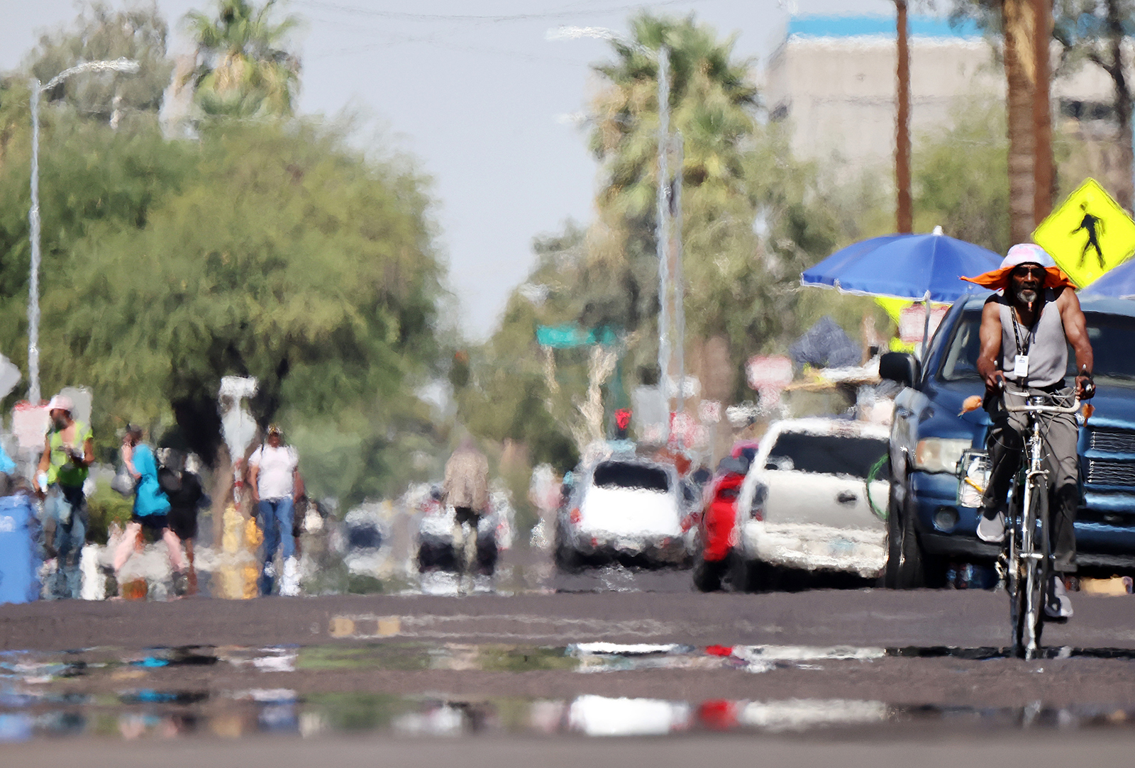
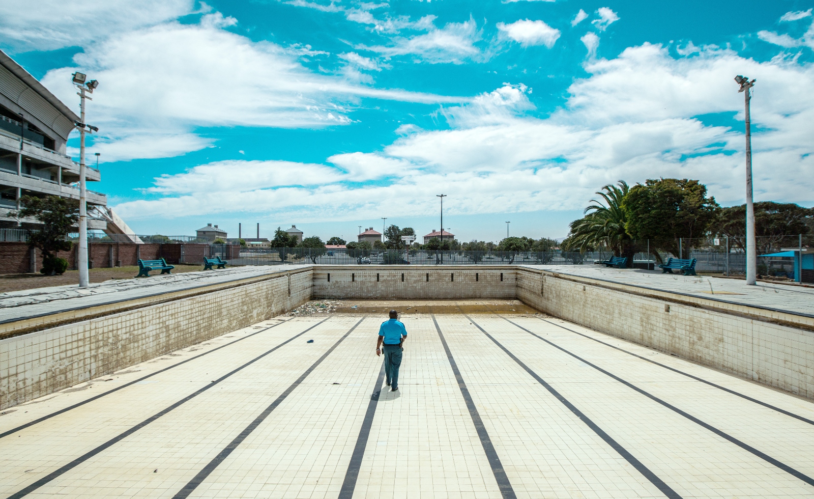
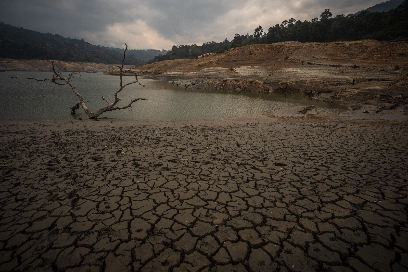
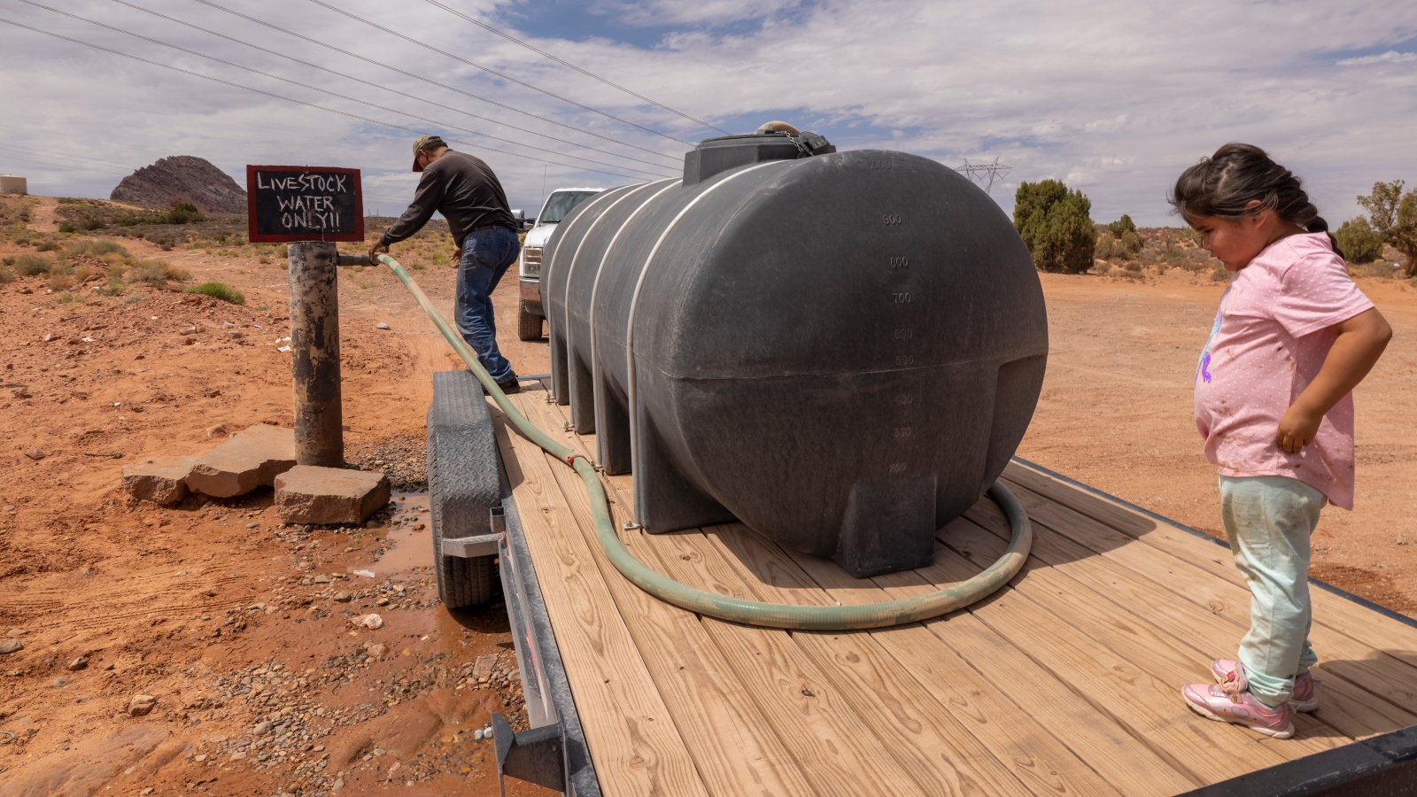
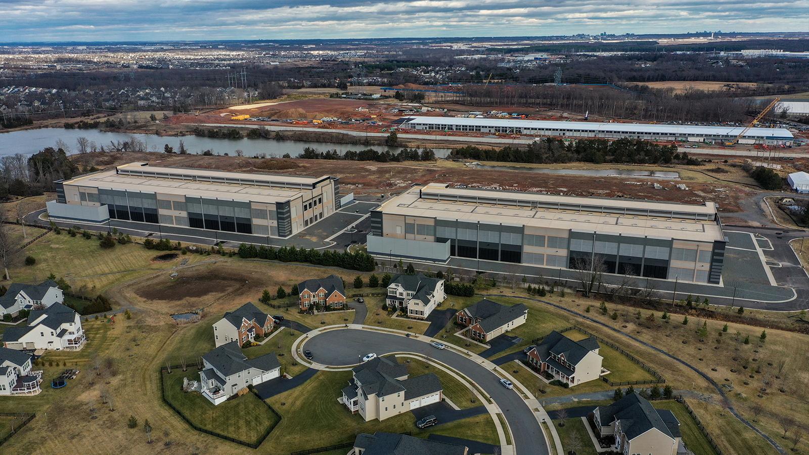
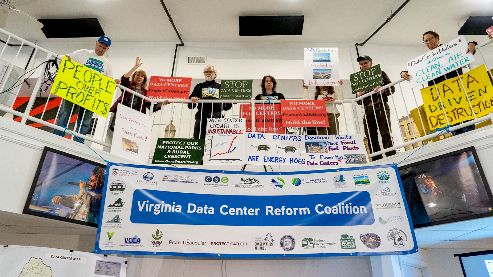
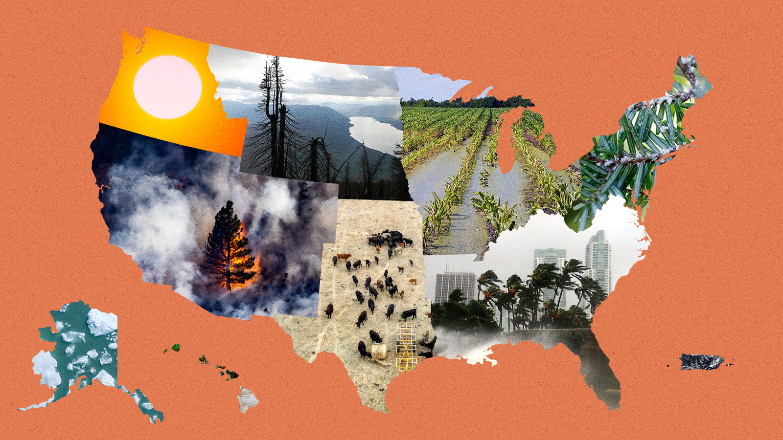
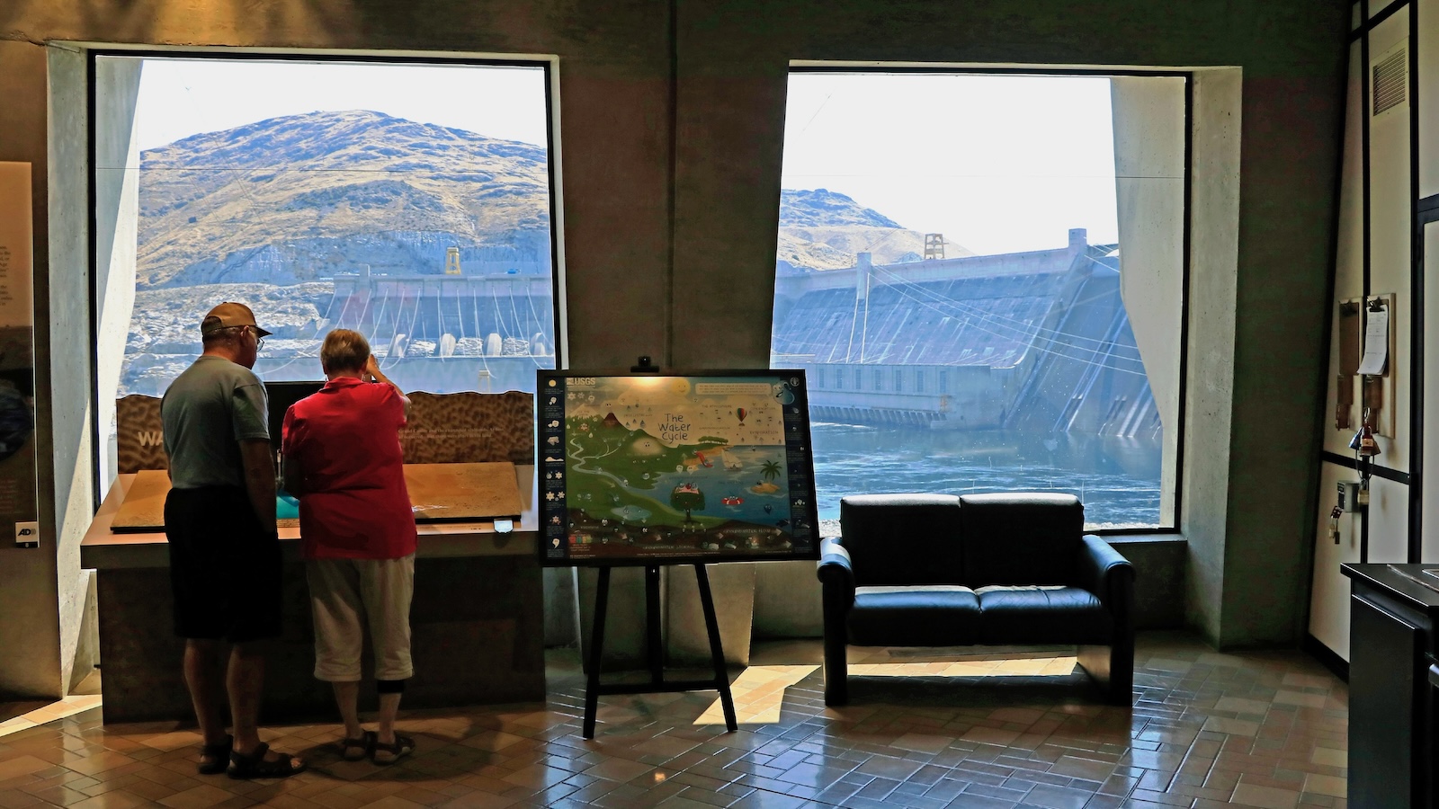
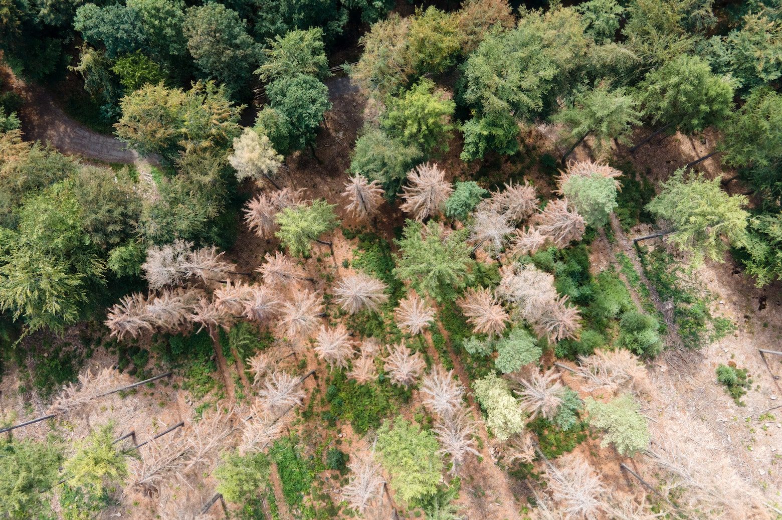
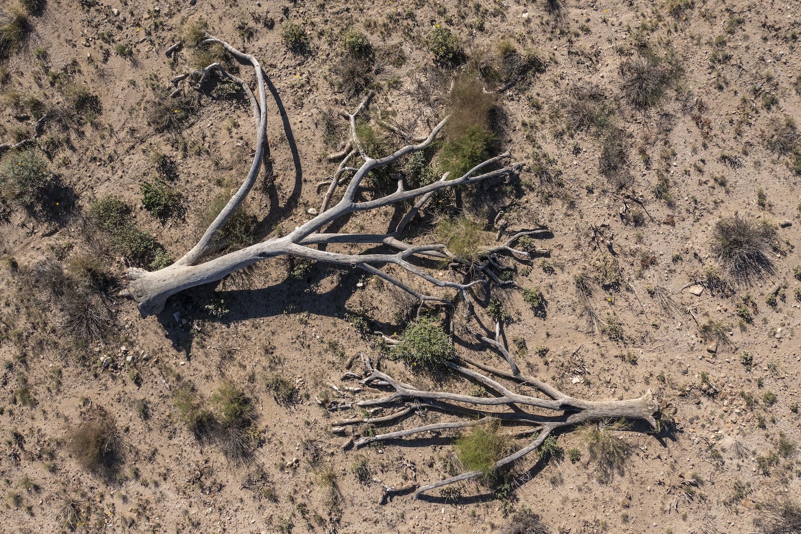
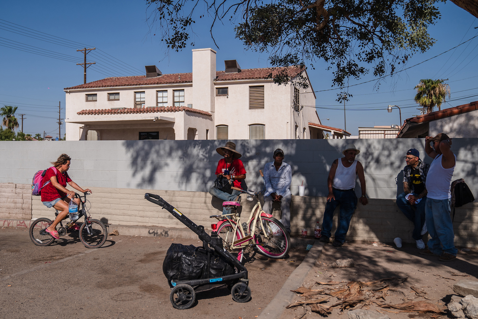


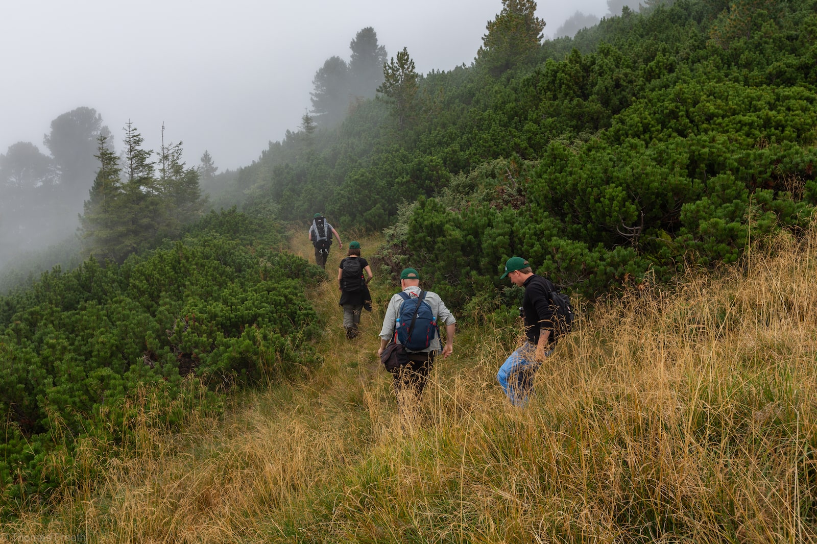

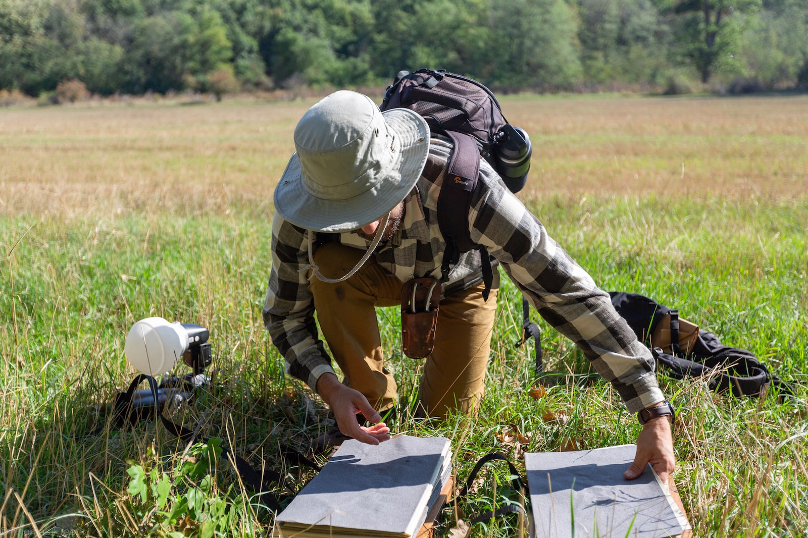


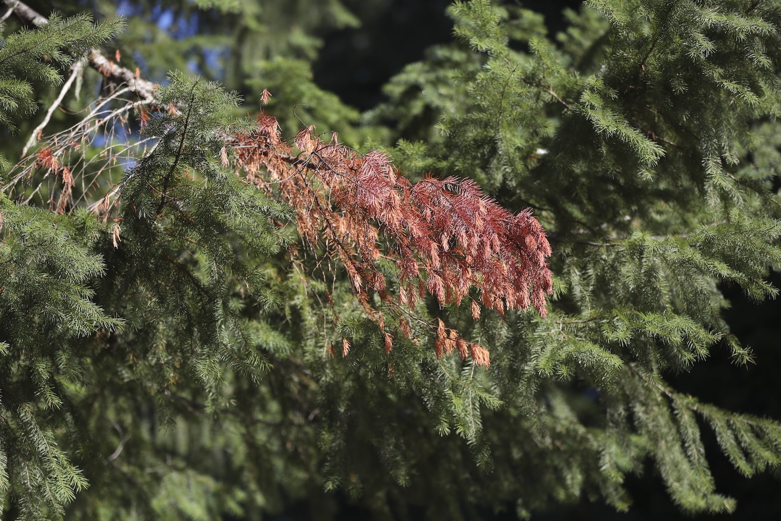


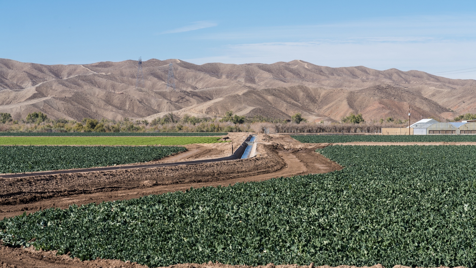
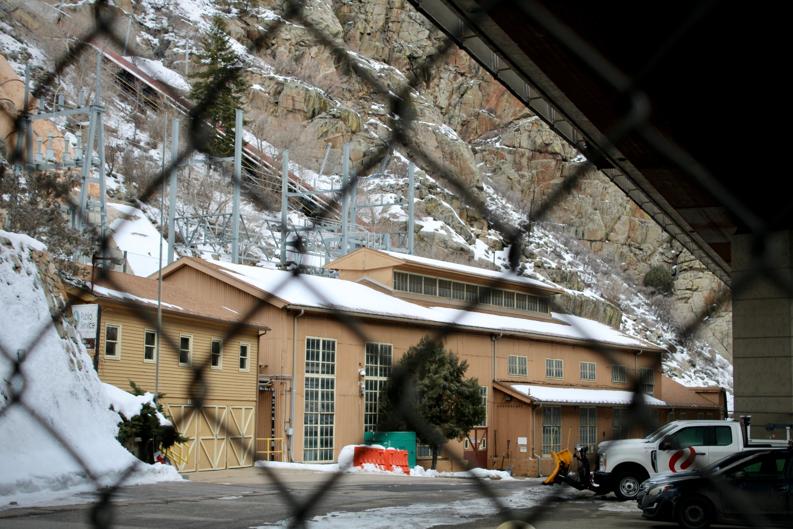
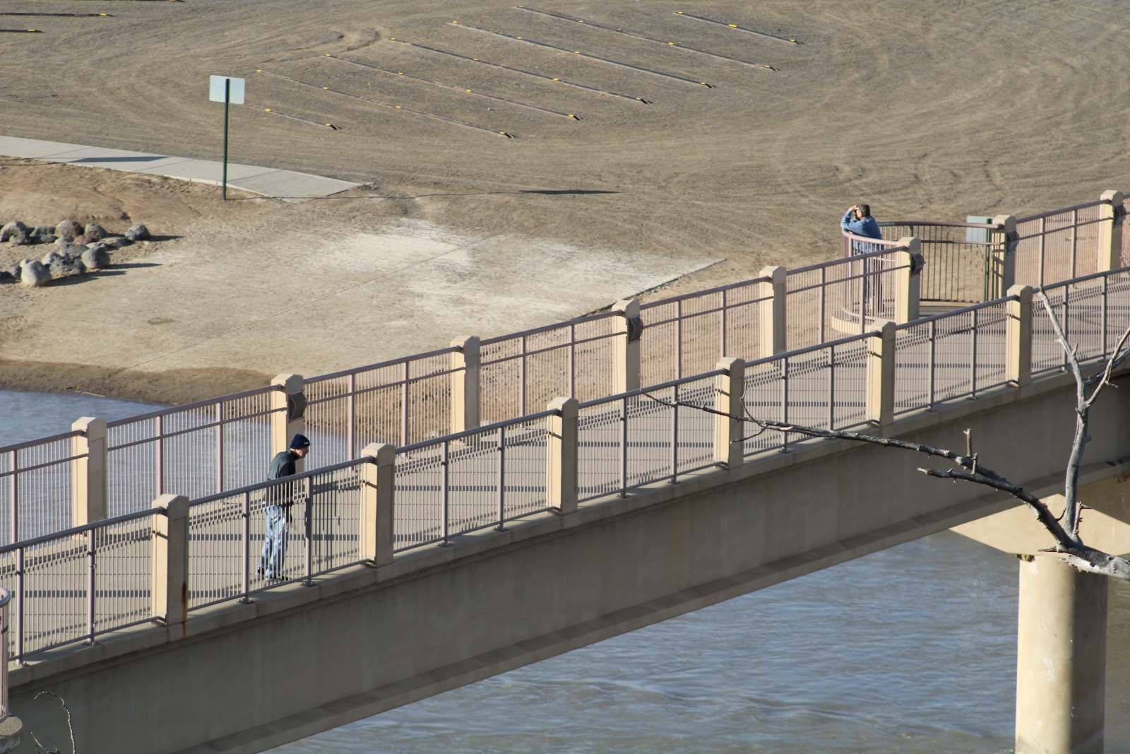
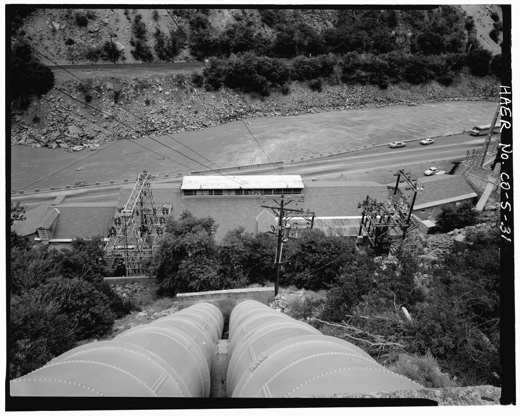
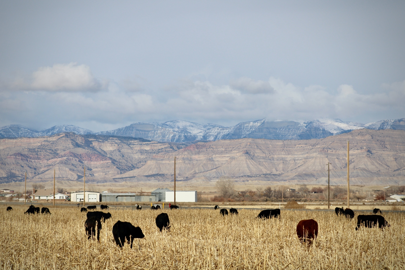
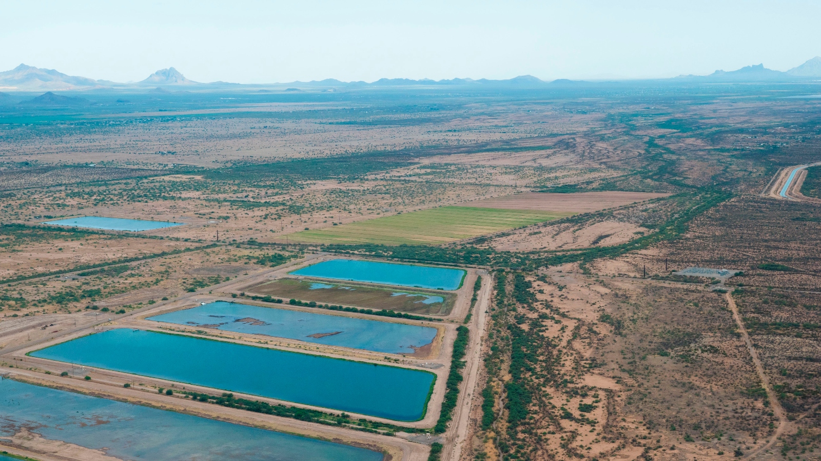

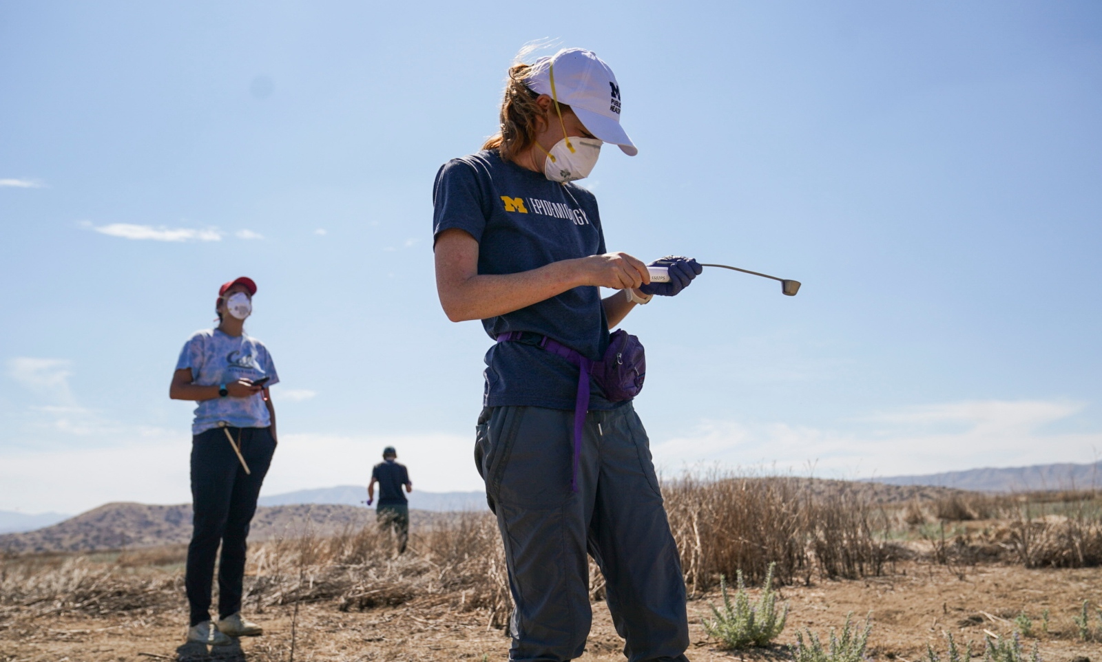

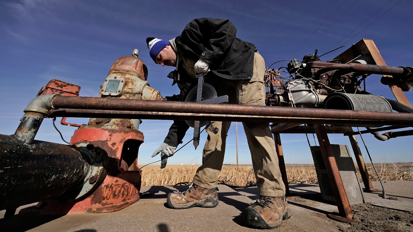
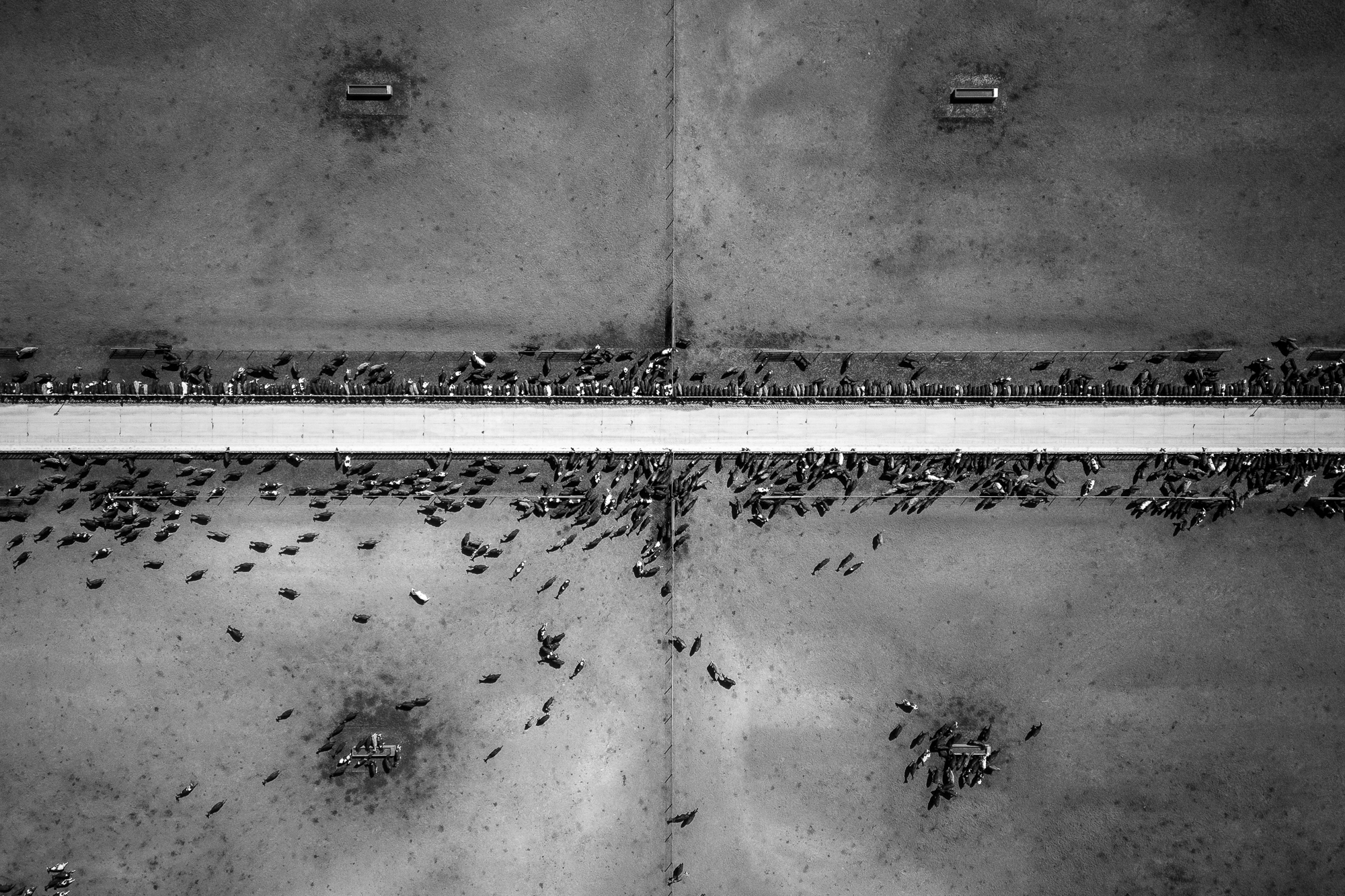
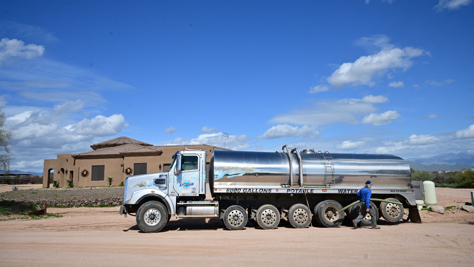
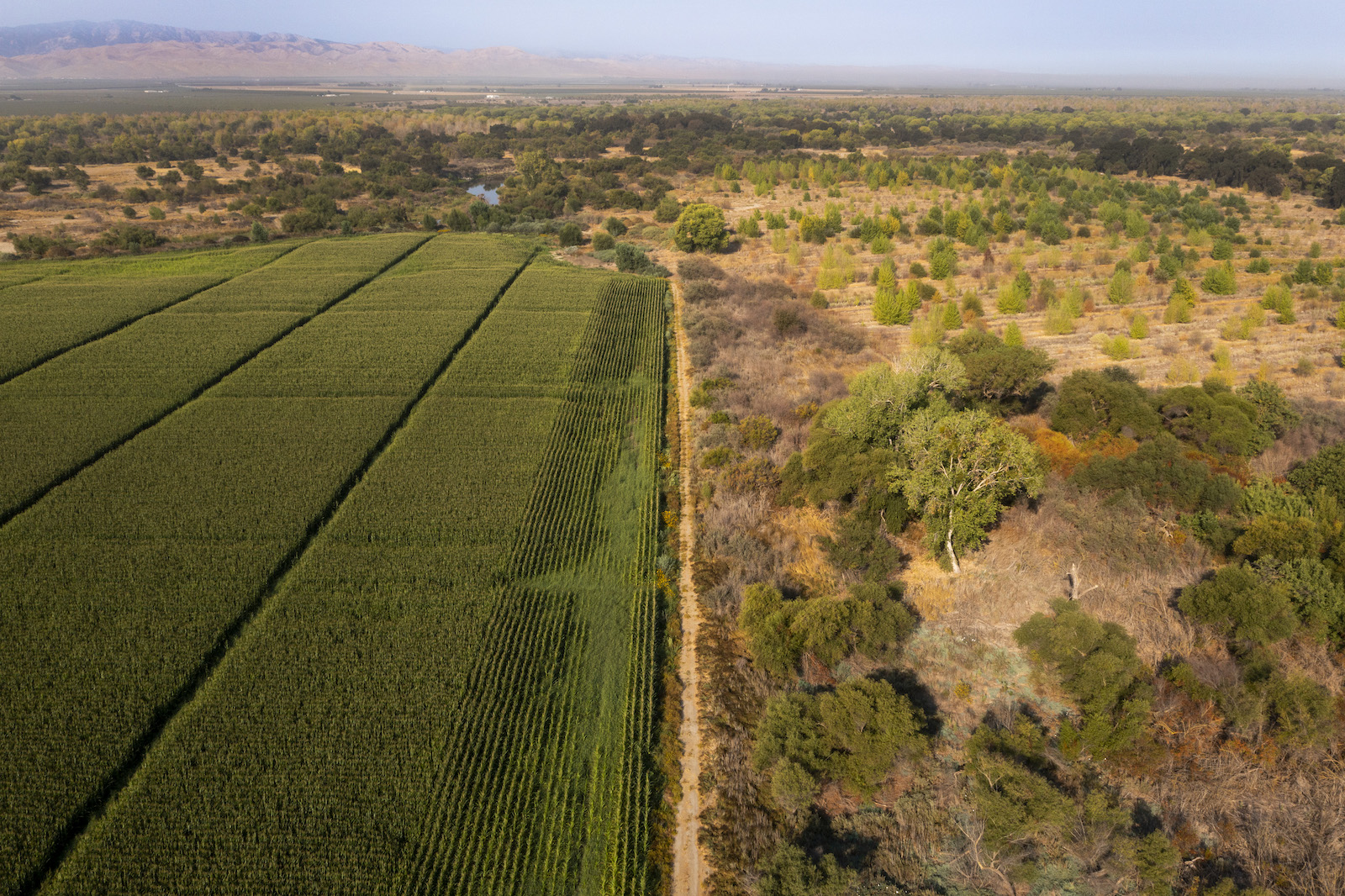
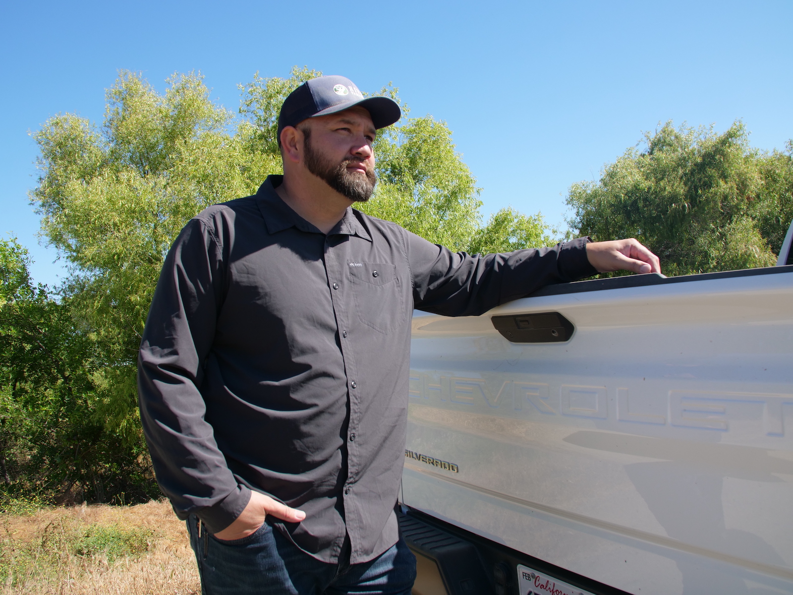
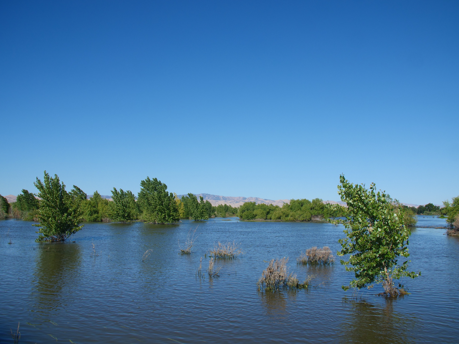
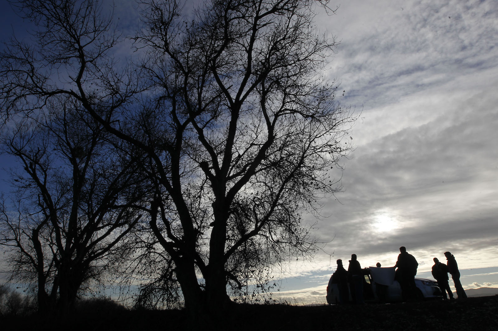
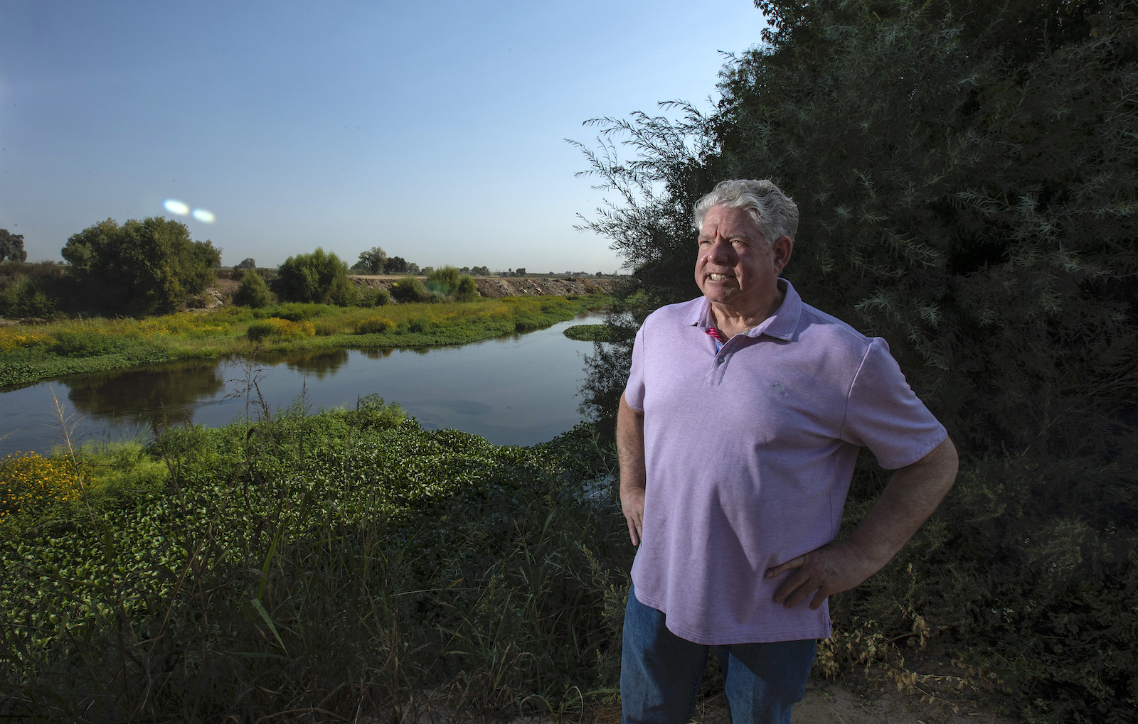
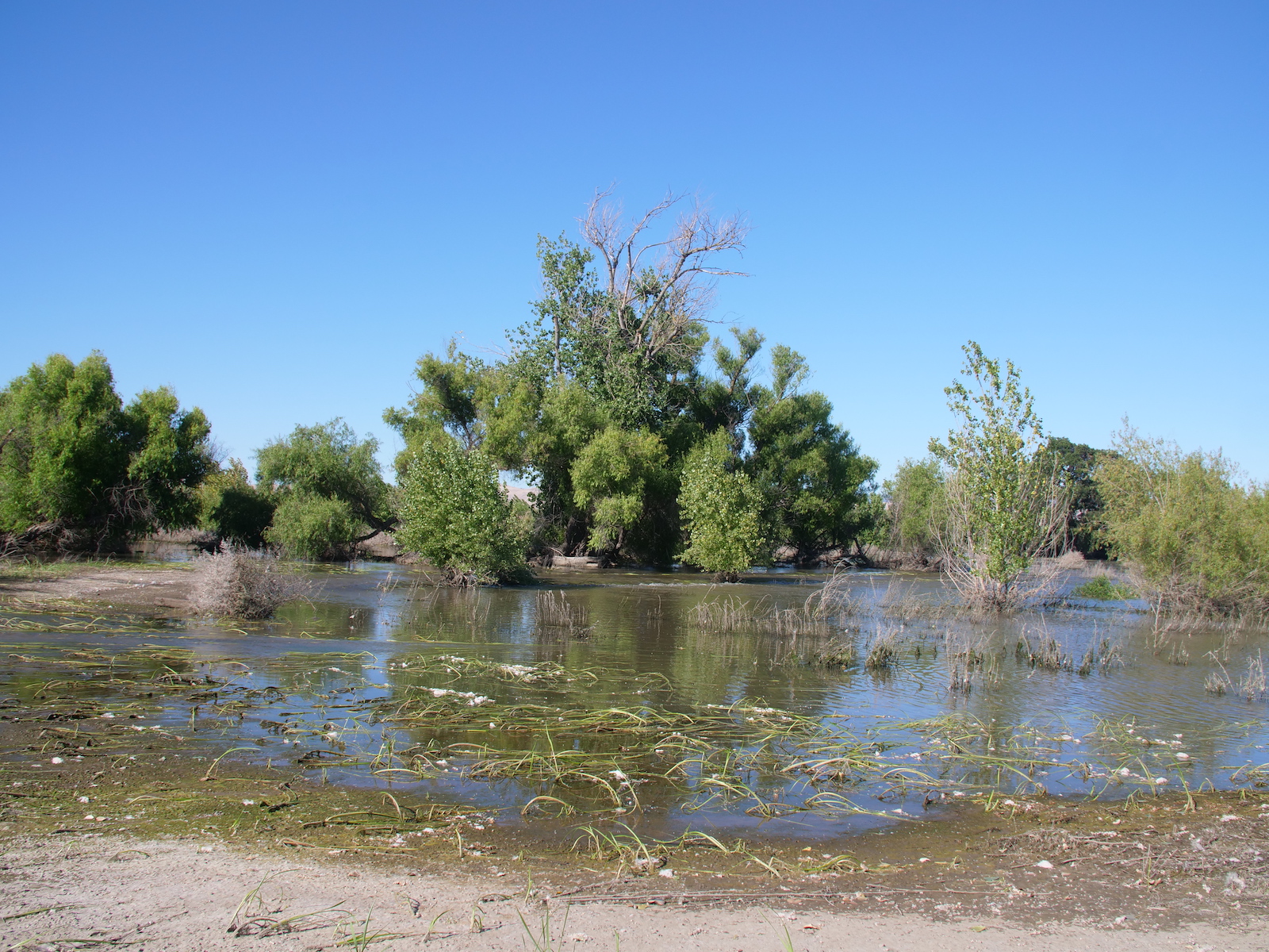
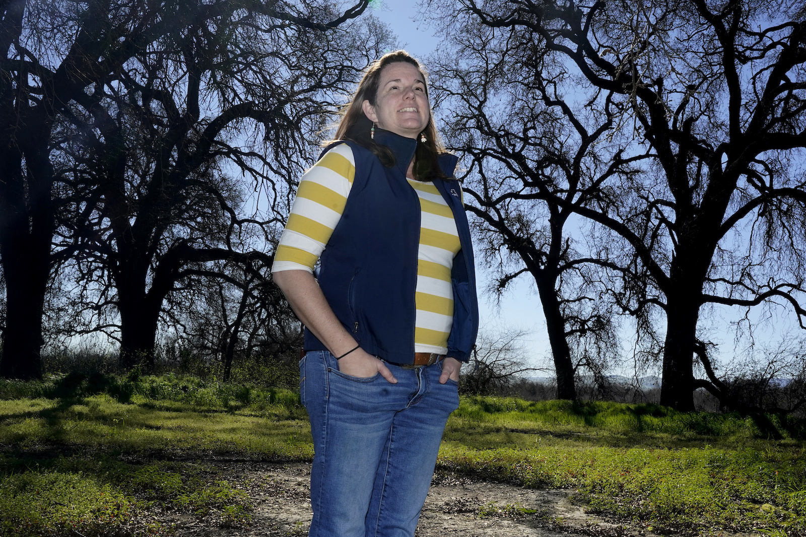
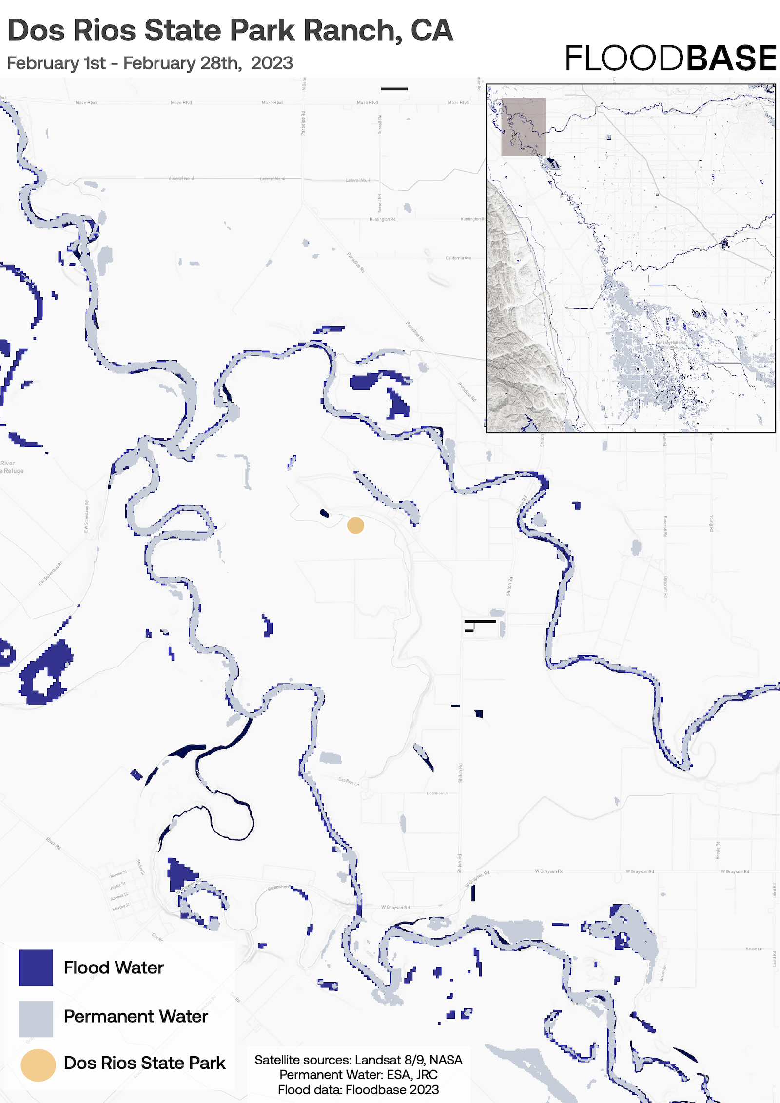
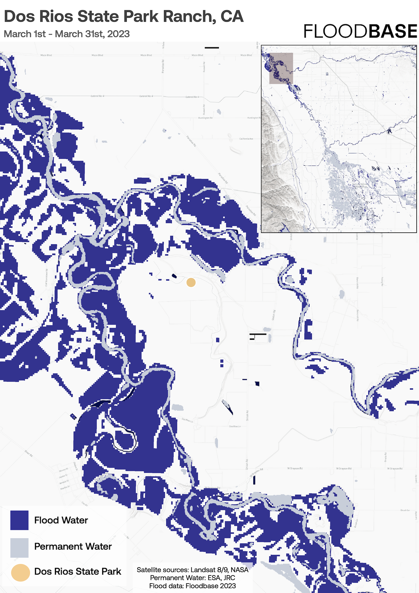
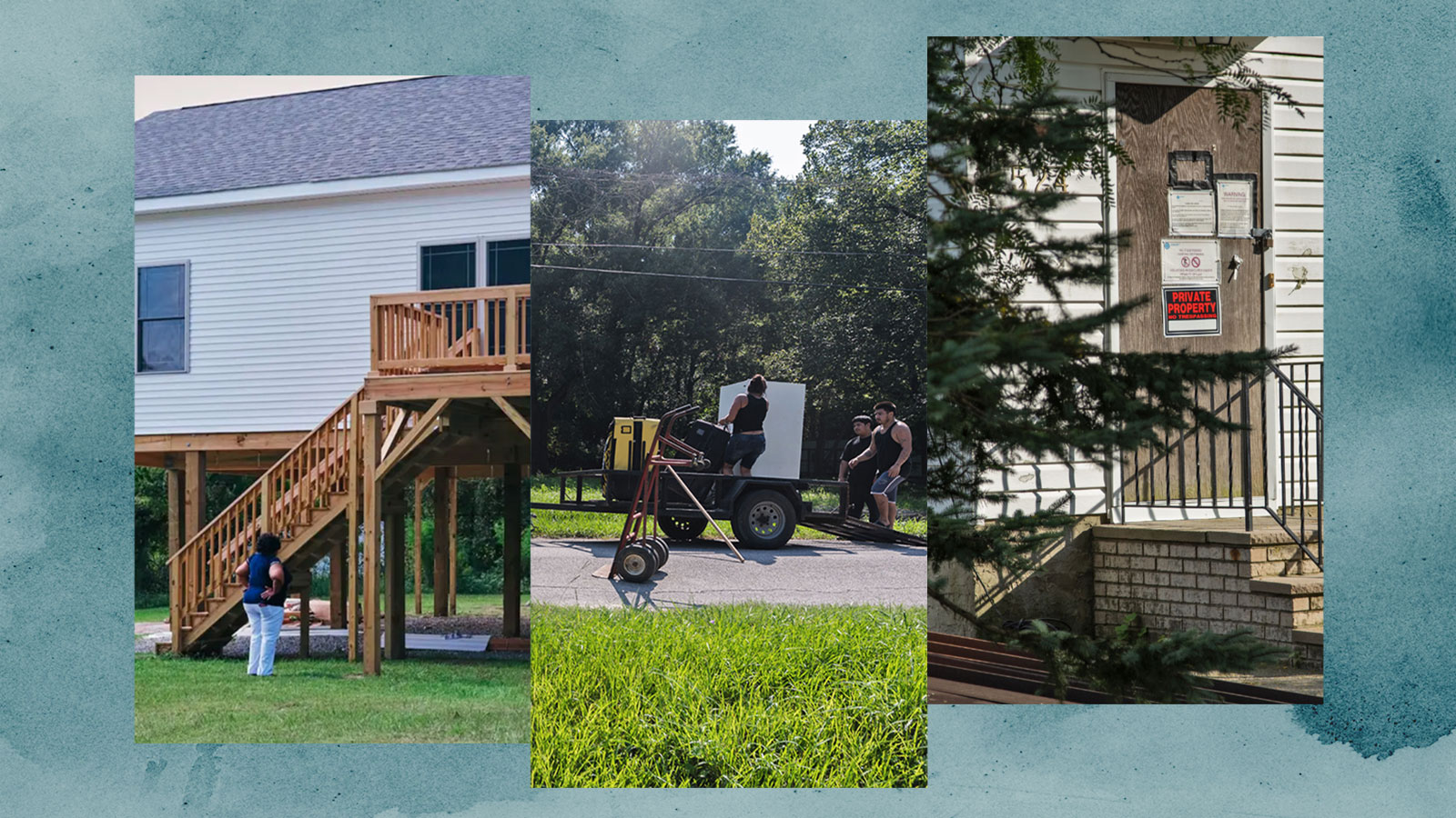
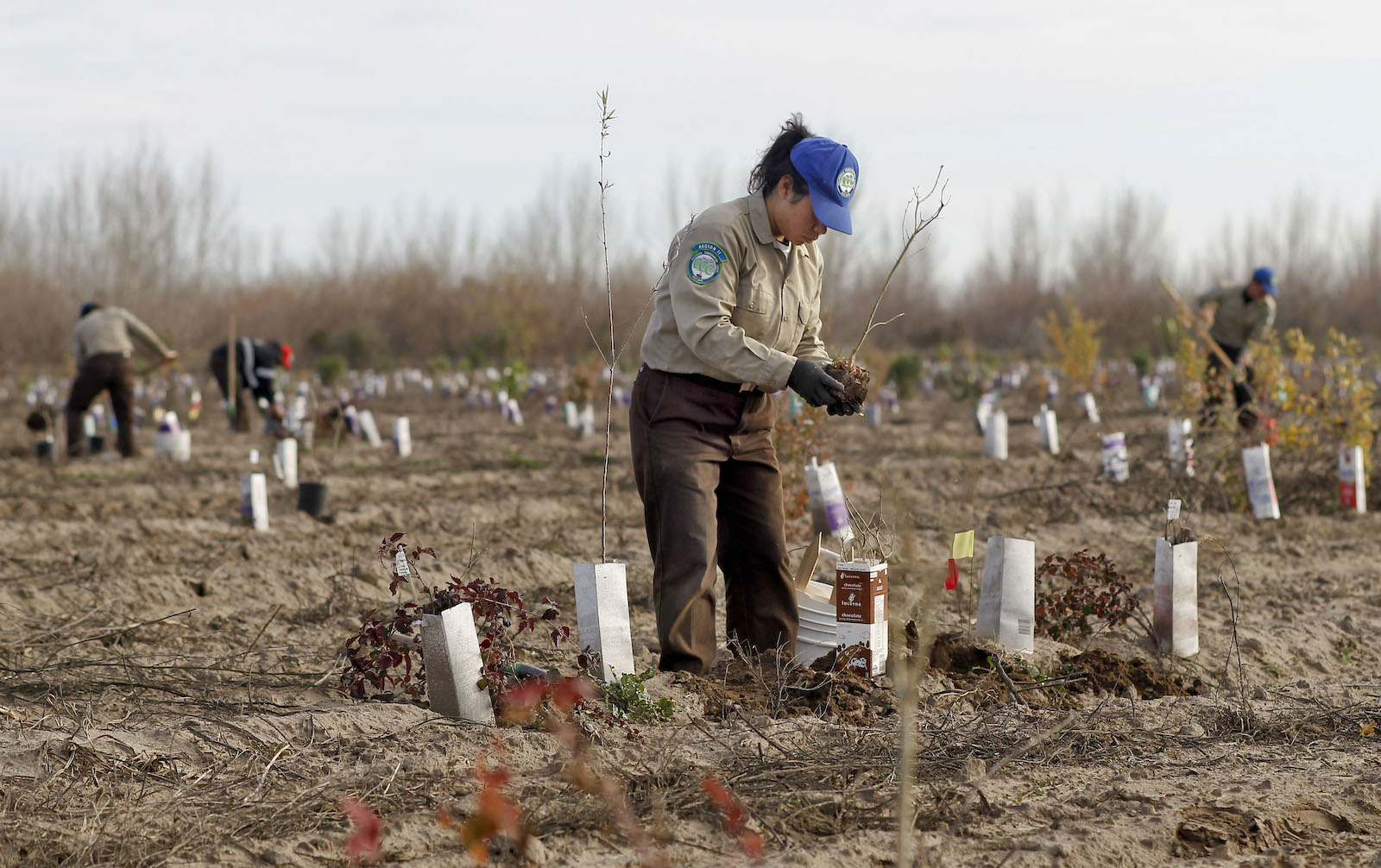
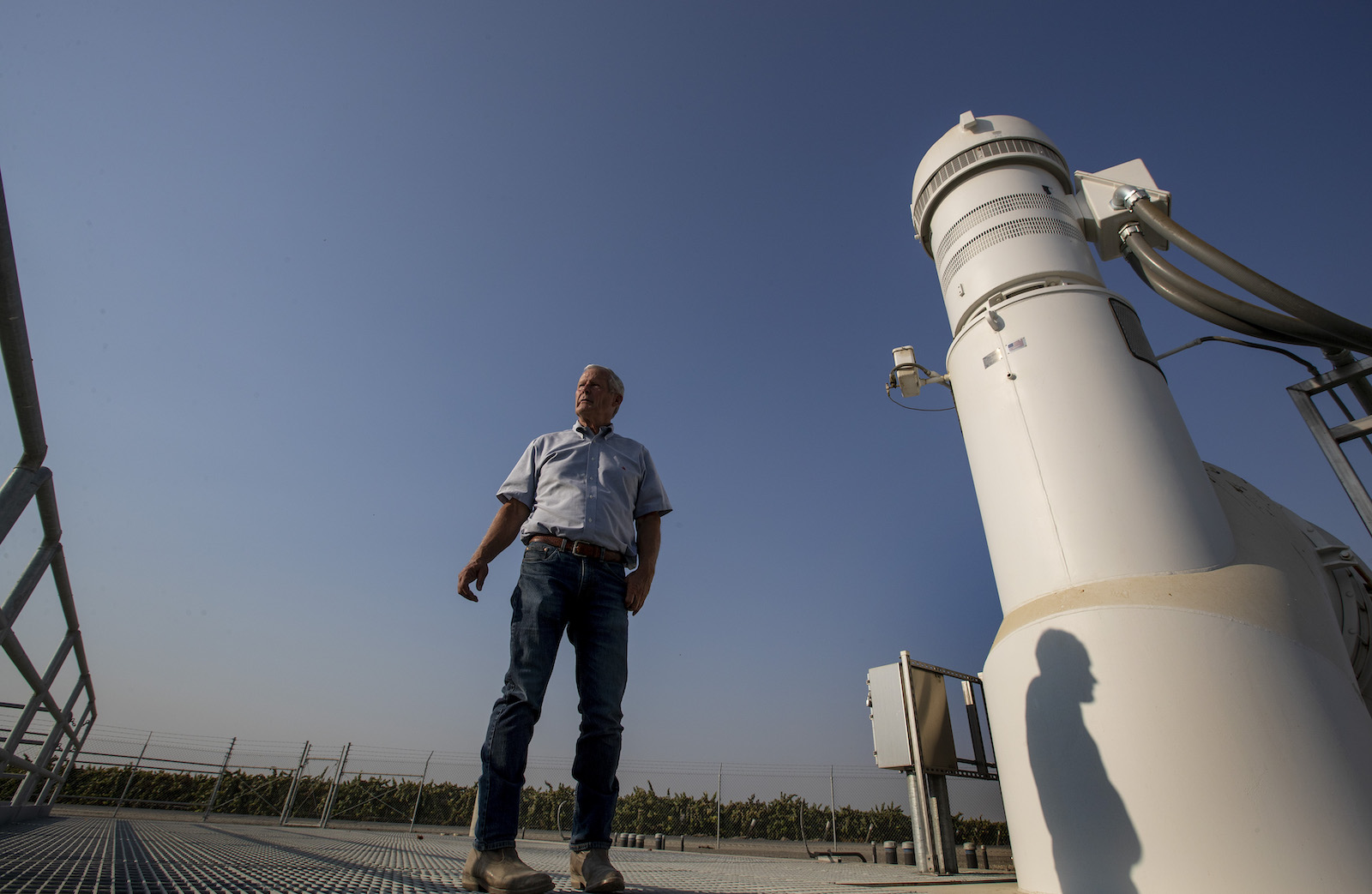

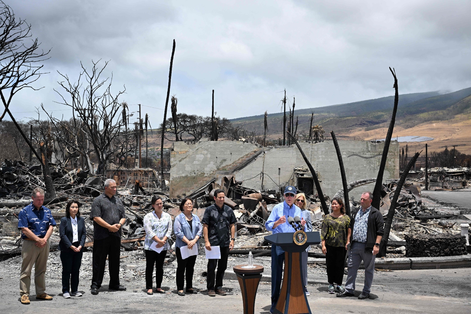
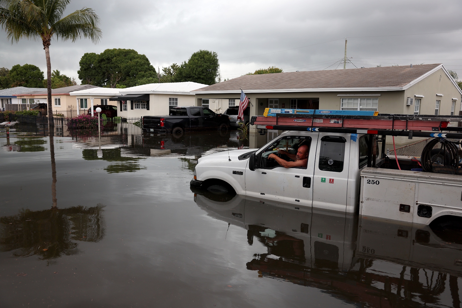
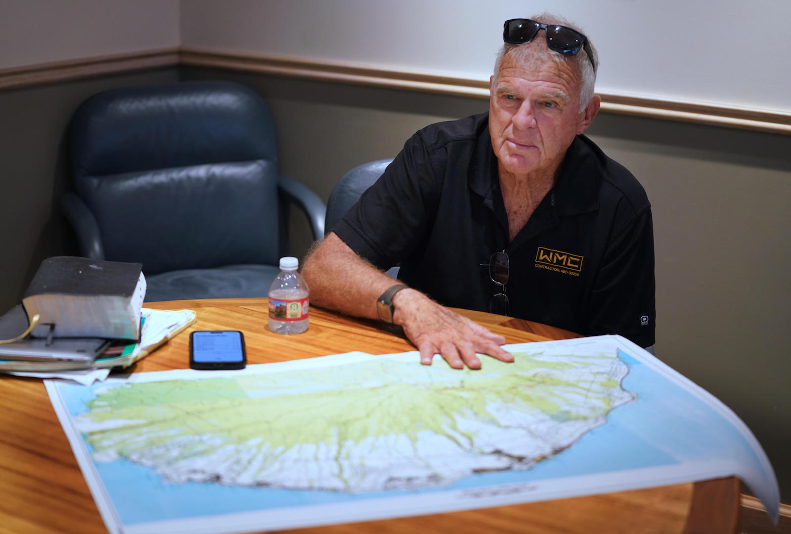

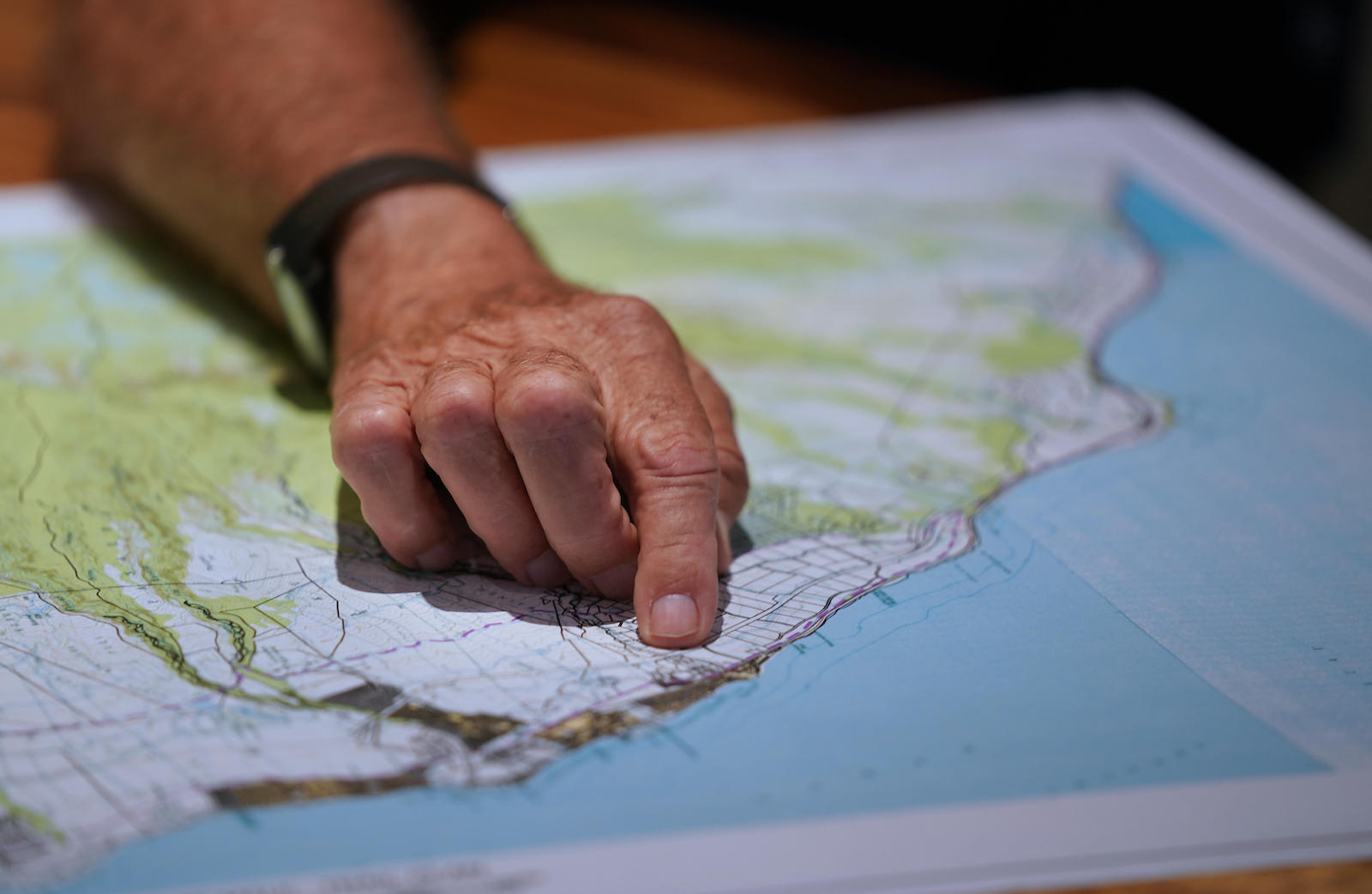
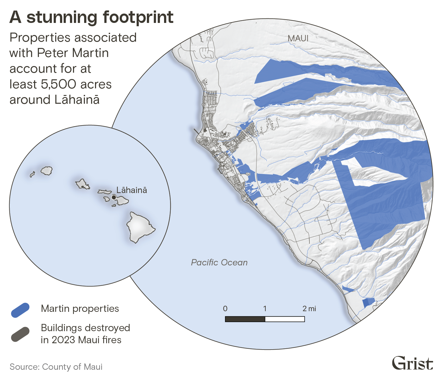
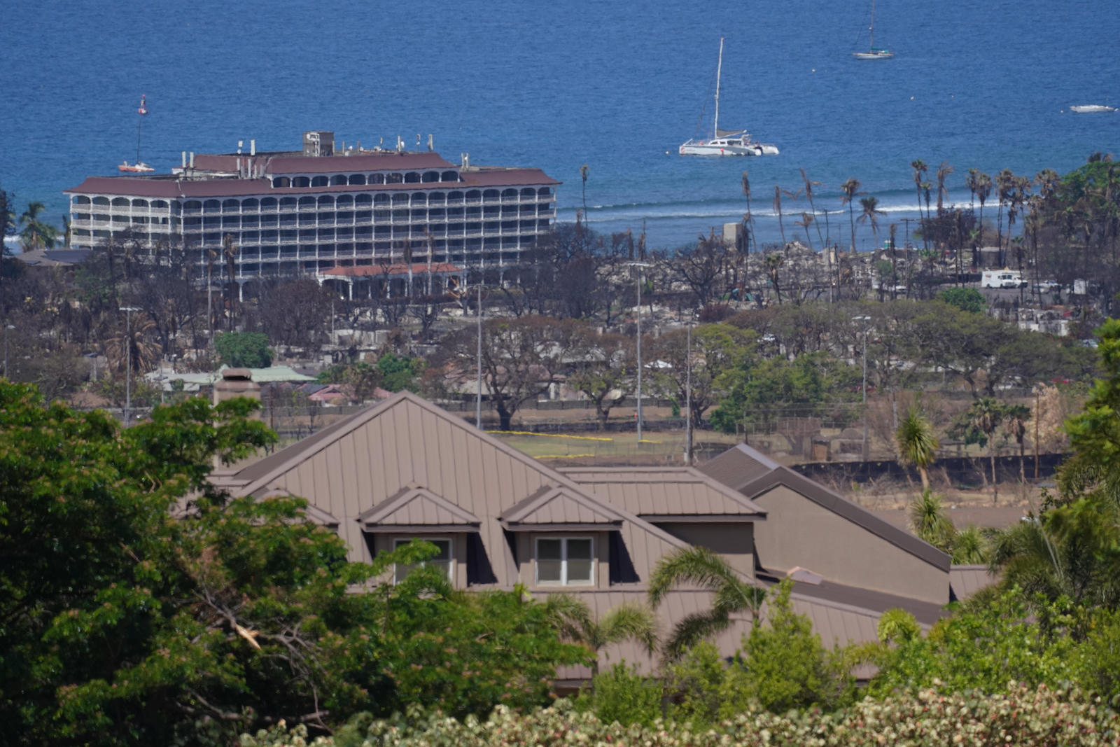
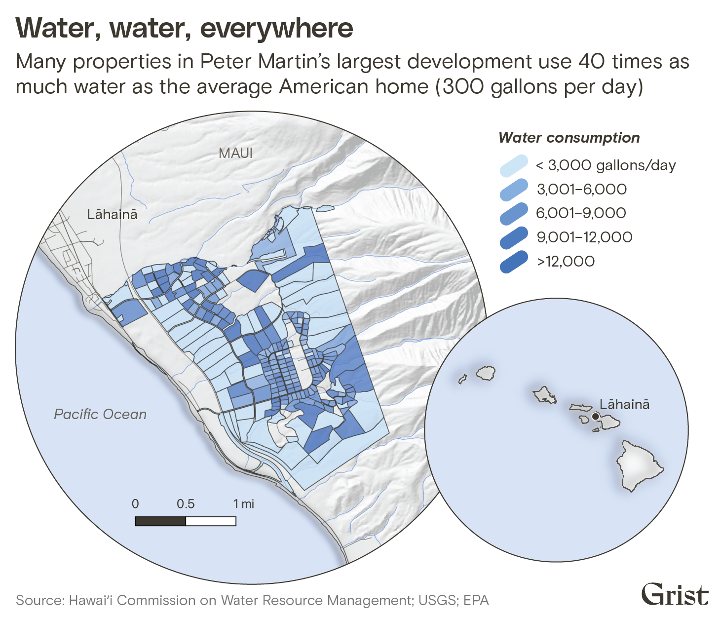
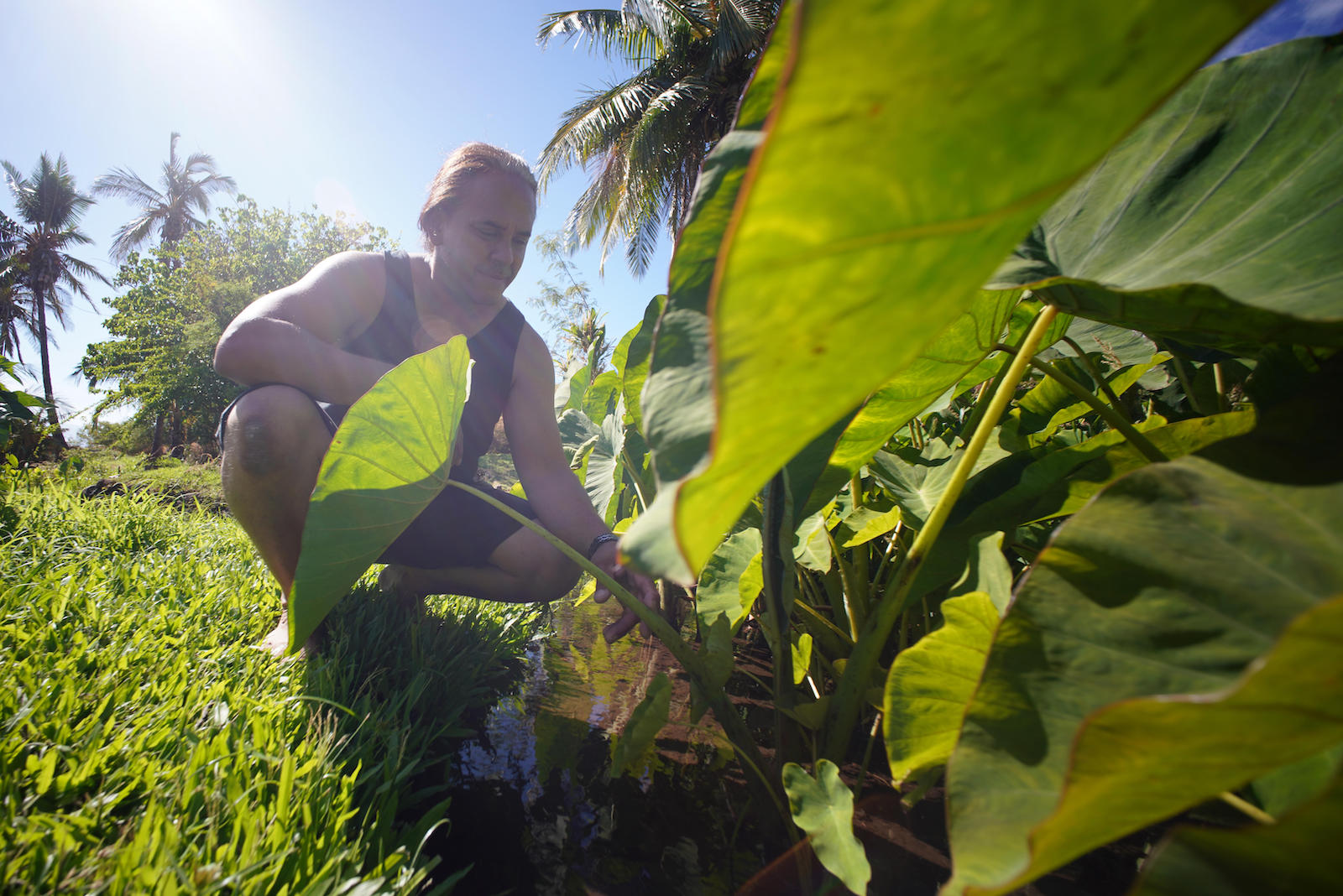

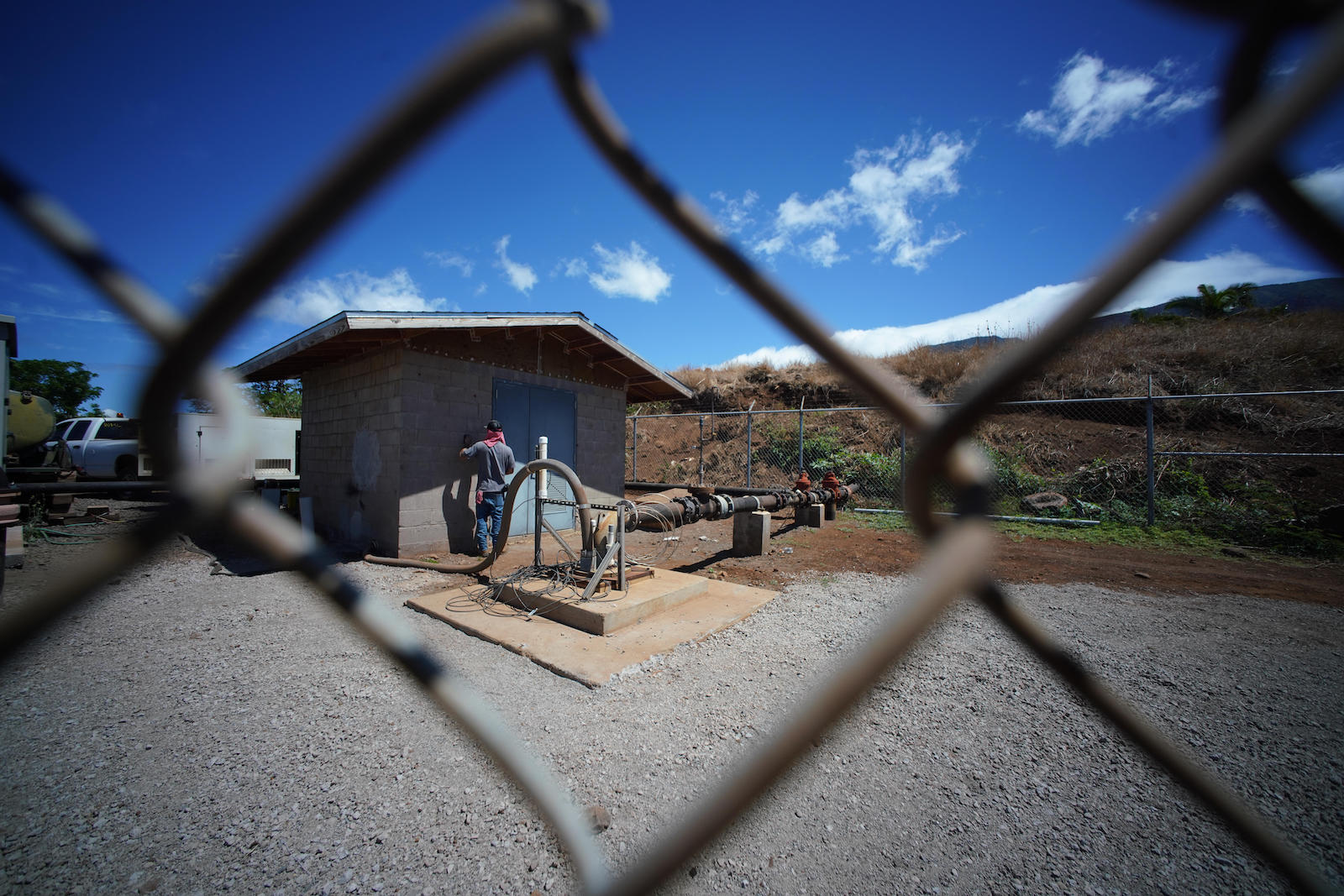

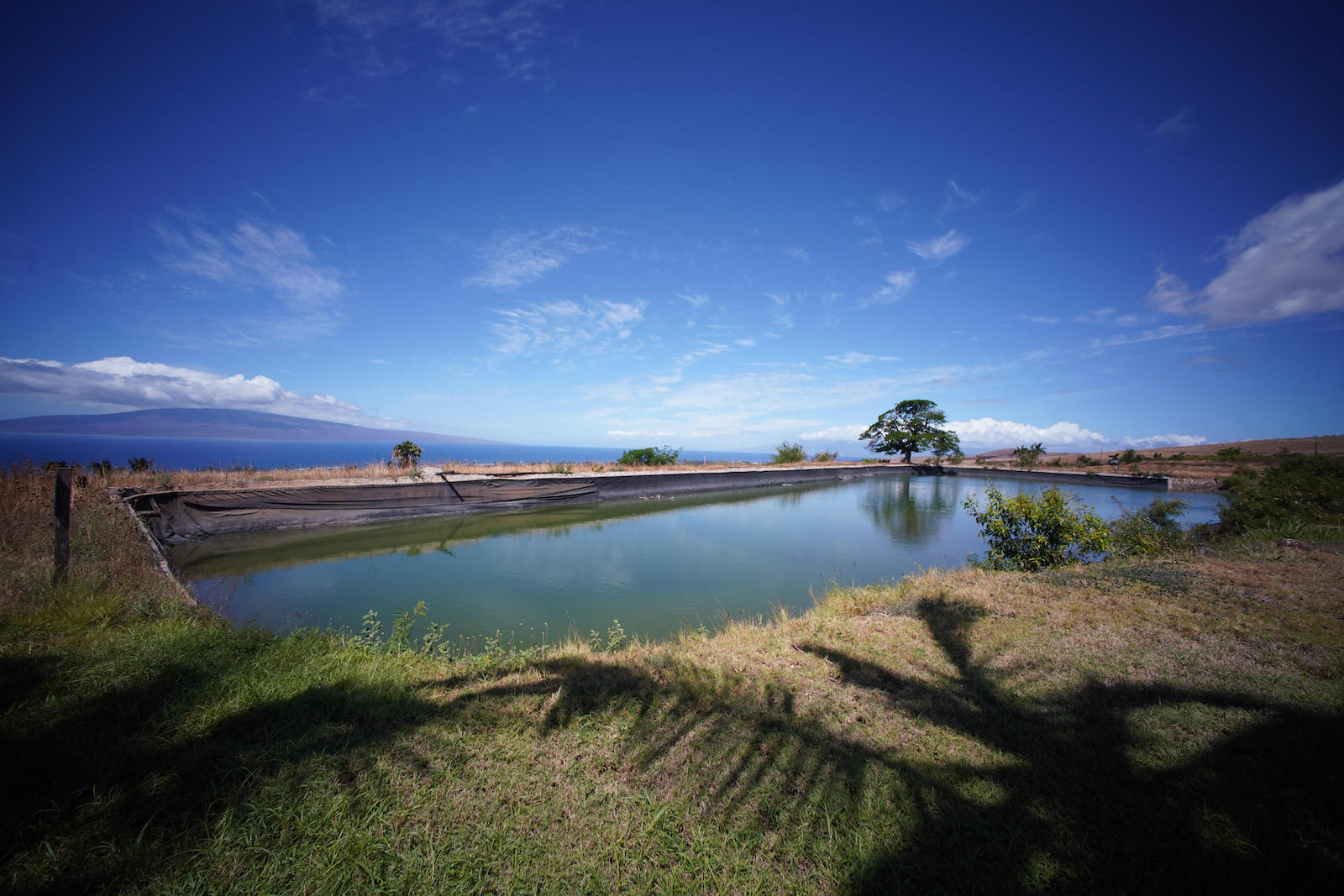
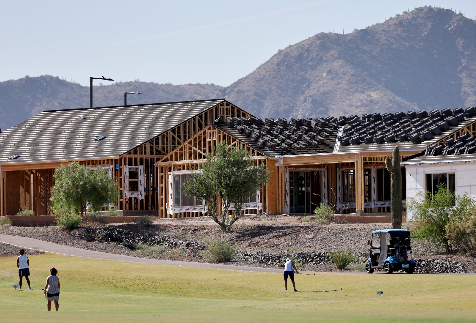
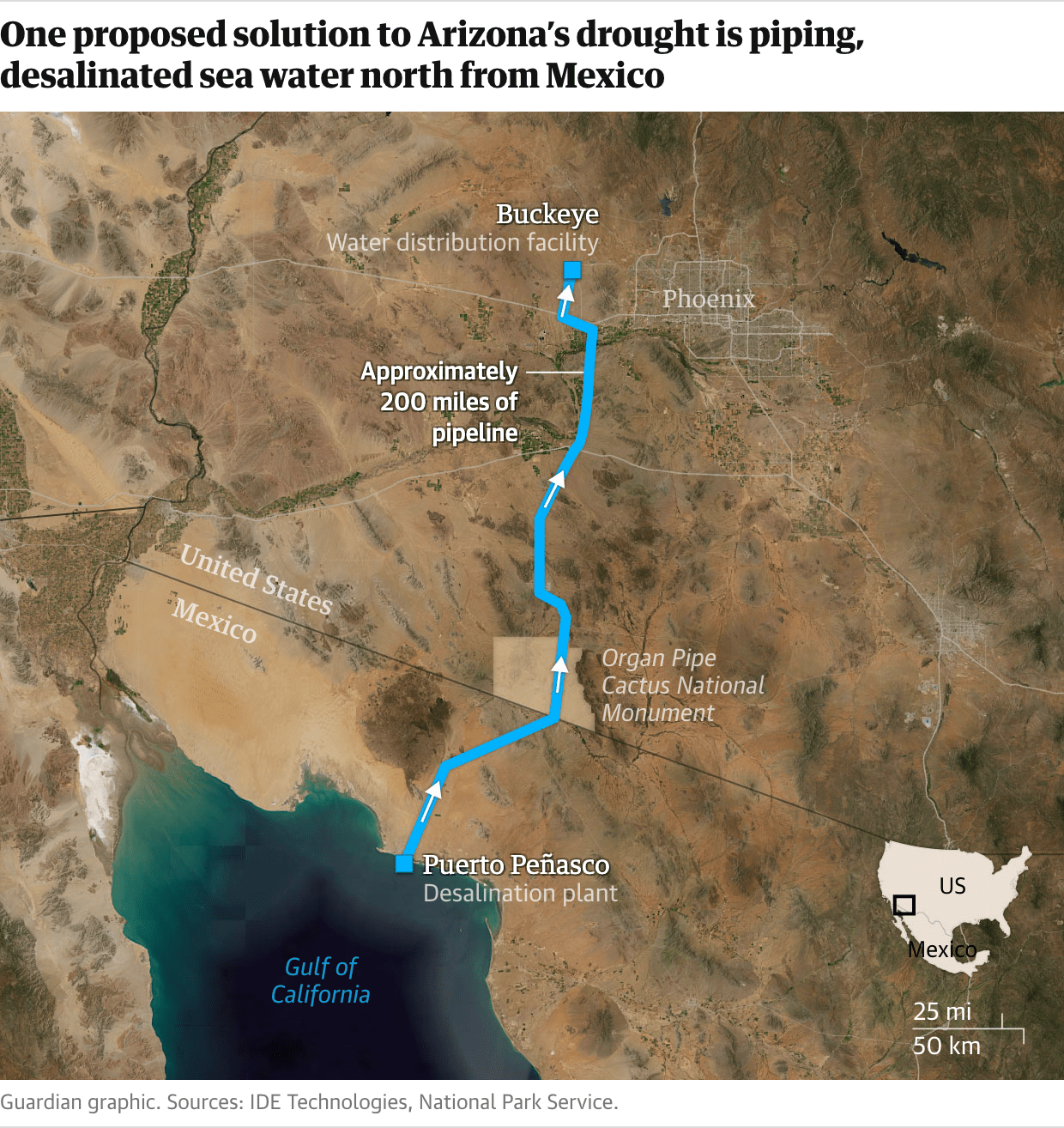

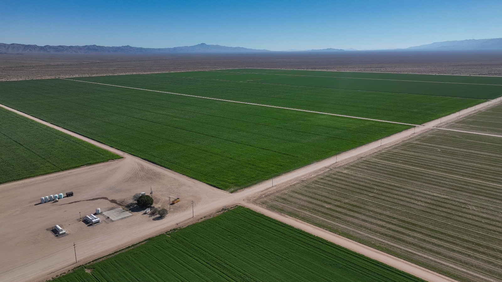


