As Arizona struggles to adapt to a water shortage that has dried out farms and scuttled development plans, one company has emerged as a central villain. The agricultural company Fondomonte, which is owned by a Saudi Arabian conglomerate, has attracted tremendous criticism over the past several years for sucking up the state’s groundwater to grow alfalfa and then exporting that alfalfa to feed cows overseas.
Governor Katie Hobbs responded to those calls for action on Monday when she canceled one of Fondomonte’s four leases in the state’s rural Butler Valley and pledged not to renew the other leases when they expire next year. Hobbs, a Democrat who took office earlier this year, said in a statement about the decision that the company “was operating in clear default” of its lease and had violated state laws around hazardous waste. She also pledged to “hold defaulting, high-volume water users accountable” and “protect Arizona’s water so we can sustainably grow for generations to come.”
That will require Hobbs to tackle a problem that is larger than just one company. Agriculture accounts for around three-quarters of Arizona’s water use, and alfalfa is one of the most water-intensive crops in the West. The state may have managed to fend off one egregious company, but fixing the region’s overall water deficit will involve much harder political and economic choices.
“I think the governor was looking for a reason to cancel these leases,” said Kathleen Ferris, a senior research fellow at Arizona State University’s Kyl Center for Water Policy and an architect of the state’s landmark 1980 groundwater law. “But the bigger problem is unregulated use of groundwater in rural areas of the state. That’s the big elephant in the room — we are just not addressing this use of groundwater, and it’s finite.”
Fondomonte’s aggressive water use in Butler Valley has drawn attention to Arizona’s lax groundwater regulations and the high water demand of crops like alfalfa. The state has set limits on groundwater pumping around population centers like Phoenix and Tucson, but companies in rural areas can still pump as much as they want with no restrictions, even if that means sucking water away from neighboring homes and businesses.
To make matters worse, the Saudi-owned company operates on a section of state-owned land in a valley northwest of Phoenix, and it pays just $76,000 per year to lease that land from the state. In most parts of Arizona, it’s illegal to move water from one basin to another, but state lawmakers had marked the Butler Valley in the 1980s as one of two places that might someday send water to thirsty Phoenix. (Saudi Arabia outlawed the production of alfalfa and other crops in 2018 amid a severe water shortage in the country.)
Fondomonte has said it will appeal Hobbs’ decision, but even if Arizona succeeds in forcing out the company, the state will still have a big alfalfa problem. The hay plant is one of the most water-intensive crops in the United States, requiring about five acre-feet of water per acre each year. An acre-foot of water is equivalent to 326,000 gallons, or enough water to supply two average homes for about a year. Fondomonte told the state government in a letter in February that it grows about 7,000 acres of alfalfa in Arizona.
Producing the crop was a big business in Arizona before the Saudis arrived around a decade ago, in large part because the state’s warm climate allows farmers to achieve much bigger yields than they do in other parts of the country. The state produced more than 2 million tons of alfalfa in 2021, or about 8.2 tons for every acre planted. That’s much more than the national average of 3.2 tons per acre. Fondomonte’s production accounted for a small part of that: In its February letter, a company official said the firm produced only 70,000 tons of the crop every year, or 2.5 percent of the state’s overall output.
Tackling the larger water footprint will be far more difficult. Fondomonte was operating on state land that it had acquired at cut-rate prices, but most of the state’s alfalfa production takes place on private land. That’s the case in Cochise County, on the state’s southeast edge, where rural residents have lost out on well water since corporate giant Riverview Dairy started growing alfalfa in the area. Other foreign nations have also gotten in on the business: A United Arab Emirates-based company called Al Dahra grows and exports alfalfa in La Paz County, with support from the state’s own pension fund. Fondomonte itself has other operations on private land in Vicksburg, near Butler Valley.
Hay is dried and stored at the Fondomonte alfalfa farm in Vicksburg, Arizona. The state’s governor canceled multiple Fondomonte leases on state-owned land this week, citing the company’s excessive water usage. Photo by Caitlin O’Hara for The Washington Post via Getty Images
“We have a church that’s just up the road from them in Vicksburg, and they haven’t had water for three years,” said Holly Irwin, a member of the La Paz County Board of Supervisors who has fought Fondomonte. She praised Hobbs for canceling the lease, but worried that the state could lease the same acreage to another company that might take over the farm.
“Moving forwards, they’re going to have to evaluate how things are done, and maybe restrict the amount of water that comes out of each well,” she said.
Foreign corporations aren’t the only ones responsible for Arizona’s groundwater shortage, though. The state exported around 22 percent of its alfalfa crop last year, up from almost none in 2011, but the vast majority of its crop still goes to feed dairy cows within the state or in other parts of the West. Moreover, most of the state’s largest groundwater pumpers, such as Riverview and Peacock Nuts, a massive nut farm operation in the western part of the state, are owned and based in the U.S. Without action from lawmakers, Hobbs can’t do anything about this overdraft on private land, even though these companies may be taking just as much water as Fondomonte.
“Our concern is that one of the things that the governor mentioned in her press release was the idea that the water use was one of the determining factors in canceling those leases,” said Philip Bashaw, the CEO of the Arizona Farm Bureau, which advocates for the state’s farmers. “We are concerned about the precedent this might set for other agricultural leases on state land.” The state leases about 150,000 acres of its trust lands for agriculture, or 1.6 percent of its total acreage.
In a statement to Grist, Fondomonte said the company hadn’t broken the terms of its state lease and vowed to appeal Hobbs’s decision. A spokesperson said the company “remains committed to progressive, efficient agricultural practices on all operations.”
In some cases, locals have fought back against thirsty corporations, but progress has been difficult. Residents of Cochise County voted last year to impose new water restrictions in one overtapped groundwater basin, but the basin’s largest dairy and nut farms would be grandfathered in under the new rules, and they won’t have to slow down their pumping. Another referendum in a nearby basin failed after organizations backed by Riverview mounted a lobbying campaign to oppose it.
There aren’t any other takers right now for the water in Butler Valley, but alfalfa’s water demand presents an acute problem in the state’s population center of Maricopa County, which in 2017 produced around 30 percent more alfalfa than La Paz County, where Fondomonte operates, according to USDA statistics. Farms in the Phoenix area have been draining groundwater for decades to grow alfalfa and other crops, and until the turn of the 21st century they used more water than the county’s 4 million residents did. That’s despite the fact that Phoenix has far stricter groundwater regulations than rural areas like Butler Valley.
It’s not only Arizona that has embraced the crop. California, Oregon, Idaho, Colorado, and Utah all boast alfalfa farms that stretch across thousands of acres, and the crop has guzzled up plenty of water in these states, too. According to one estimate, alfalfa and other silage crops account for as much as 55 percent of water usage in the Colorado River basin, and more than half the water usage in Utah, the nation’s second-driest state.
The reason for this is simple: Alfalfa is a lucrative business. The hay product fetched about $320 per ton in 2022, up from $210 the year before, making it more lucrative than other large-scale crops like wheat. It provides nutritious and healthy feed for cattle and dairy cows, which means there’s significant demand for it both in the United States and overseas in places like Saudi Arabia.
“The vast majority of the alfalfa that’s grown in Arizona is grown to support our local agriculture industry, which is there to support the urban areas,” said Bashaw, adding that the hay feeds cows that produce goods like milk, cheese, and beef, and that more than 70 percent of those goods are sold within the state. “Alfalfa is a really critical part of being able to source dairy products locally for a large metropolitan area.”
For as long as companies can harvest ample water from underground aquifers, or from the Colorado River, they’re likely to keep growing it wherever they can, and water sources across the region will keep dwindling.
“The longer this goes on, the bigger the problem,” Ferris told Grist, “because the more land that gets put into cultivation, the harder it is to do anything to control the depletion. As long as farmers have the ability to pump water, they grow what they think is the most valuable crop.”
The Mississippi River is a connected system. If farms dump fertilizer into the river’s tributaries in Ohio, that waste ends up in the Gulf of Mexico. If heavy rains make the river’s level rise in Illinois, it puts pressure on flood levees in Arkansas.
And if a hot, dry summer sweeps across the Midwest, drying the river out for hundreds of miles downstream, something very strange happens in southern Louisiana.
For the past month, as the water level on the lower Mississippi River sinks lower amid an extreme drought stretching from Nebraska to Ohio, a mass of salt water has been pushing upriver from the Gulf of Mexico toward New Orleans, filling the space where fresh water should be. Salt water is heavier than freshwater, so the water forms the shape of a wedge pressing against the bottom of the river. The wedge has already slithered more than 50 miles upstream, passing several small communities in rural Plaquemines Parish, and experts say it will likely reach New Orleans by the end of the month. Even as local and federal officials rush to slow down the wedge, they’re finding themselves powerless against the laws of nature.
The wedge poses a serious threat to the drinking water supply in communities along the river. Salt water has already begun to contaminate local water systems in the towns of Port Sulphur and Pointe à la Hache, and by the end of next week it will likely reach suburban Belle Chasse, home to around 10,000 people. Rural communities in lower Plaquemines Parish have been drinking bottled water and showering in salty tap water for multiple weeks, and it was only this week that officials installed reverse-osmosis filters at the parish’s treatment plant to remove salt from the local water supply.
When humans drink salty water, the elevated sodium in their blood can raise their blood pressure and make their kidneys work harder. This can be harmful for children and pregnant women, as well as those who need to maintain low-sodium diets for medical reasons.
“There is not a firm black line when it becomes unhealthy,” said Joseph Kanter, the state health officer for Louisiana, in a recent interview with the New Orleans Times-Picayune. For sensitive groups, he added, “it wouldn’t be bad advice to switch over to bottled water” when the salinity of local water supplies exceeds 250 parts per million, about the threshold at which water starts to taste salty.
The wedge could cause even more significant health problems as it reaches New Orleans. The city has some 50,000 drinking-water pipes that are made out of lead, and the corrosive salt water would permanently damage those pipes as it moved through the system, allowing lead and other chemicals to leach into water. Research shows that drinking water contaminated with heavy metals can significantly increase one’s risk of brain damage, liver damage, kidney damage, and cancer. Exposure is most dangerous for young children.
Louisiana has dealt with several of these so-called wedges before during drought years. The last time a wedge threatened the city of New Orleans was in 1988, when salt water came within a few miles of the freshwater intake valve in the city’s Carrollton neighborhood, the largest source of drinking water for the city. Residents rushed to stock up on bottled water, buying so much of it that a local bottler ran out of stock. State leaders tried to stop the panic, with one health official telling the media that the water contained “less salt than a box of Popeyes Fried Chicken.”
Barges on the Mississippi River undertake dredging operations to build an underwater sill in Plaquemines Parish. A wedge of salt water is moving up the river toward New Orleans.
AP Photo / Gerald Herbert
The federal government has already begun sending resources to Louisiana, but its options are limited. The Federal Emergency Management Agency, which resumed funding all disaster projects this week thanks to a last-minute infusion of money from Congress, has agreed to help four river parishes manage the costs of responding to the disaster. Local officials will be able to seek reimbursement from FEMA in the coming months for money they spend on bottled water or treatment infrastructure.
The Army Corps of Engineers, the federal civil works agency that manages the river, is working to dilute the salt contamination in local water supplies by hauling in fresh water on barges. The agency delivered its first barge of water to Plaquemines Parish on Monday, dropping off 500,000 gallons at the Port Sulphur treatment facility, where officials have been dealing with contamination for weeks. The agency says it will soon be able to deliver 36 million gallons of water a day to the region, which is more than enough to dilute water for towns downstream of New Orleans.
But the imported water won’t be enough to stop contamination at the much larger water intake facilities in New Orleans. Instead, local officials with the city’s Sewerage and Water Board are hoping FEMA will reimburse them for the cost of building a 12-mile pipeline that would pump water to the city from further upstream, near the city of Kenner. Sewerage and Water Board officials have said the pipeline could cost more than $150 million and begin operations by the end of the month. A spokesperson for the agency told Grist that the agency is in the process of reviewing bids from construction firms and that it expects FEMA to cover the cost of construction. In the meantime, neighboring Jefferson Parish has already begun preliminary construction on its own pipeline.
As far as stopping the wedge itself, that’s almost impossible to do. The Corps has constructed a “sill,” or underwater levee, to stop the progress of the water. The barrier should slow down the saltwater intrusion for a few weeks, but there’s no way to prevent the water from moving upstream without damming the river altogether, which is impossible.
It will take a heavy round of rainfall in the Upper Midwest to put a permanent end to the crisis, and that might not arrive for months. The Mississippi’s current flow is about 150,000 cubic feet per second, about half of what officials say is necessary to push the salt water back out into the Gulf. Forecasts in the Mississippi and Ohio River watersheds call for around an inch of rain over the coming week, but it could take as much as 10 inches to restore the river’s normal flow.
It was this inescapable truth that informed Kanter’s other main piece of advice.
“Pray for rain in the Ohio Valley,” the state health official told the Times-Picayune.
The Great Salt Lake, home to millions of migratory birds and the source of $2.5 billion in annual economic activity in Utah, has been rapidly shrinking for years. A new lawsuit filed by conservation groups on Wednesday says the Utah government directly contributed to the lake’s decline by authorizing excessive diversions of water for agriculture, industry, and other uses.
The lawsuit hinges on the public trust doctrine, a legal principle that says states shoulder the responsibility to protect public resources like shared waters and lands. The plaintiffs have asked a district court in Utah to declare the state’s actions a violation of that public trust duty and to direct officials to restore the lake to healthy water levels. Without immediate action, they warn, heavy metals and sediments from the drying lakebed will blow downwind and into the lungs of Utah residents, turning the lake into a “toxic dust bowl.”
“Wherever you have an environmental nightmare, if you look hard enough or wait long enough, you’re going to have a public health nightmare,” Brian Moench, president of Utah Physicians for a Healthy Environment, one of the plaintiff groups in the case, told Grist. “And that’s exactly what we fear.”
The lake relies on upstream water flowing from several rivers and streams to maintain its water levels. But out of the approximately 3 million acre-feet of water that would normally flow into the lake each year, more than 2 million acre-feet are diverted for various purposes. Around three-quarters of that water is used for irrigating alfalfa and other crops. The industrial extraction of minerals, including salt, directly from the lake accounts for another 9 percent. Other industries and cities use another 9 percent, with 90 percent of citybound water destined to water lawns and other decorative outdoor plants. Meanwhile, climate change has increased evaporation and worsened drought in the Southwest, accounting for about 10 percent of the lake’s overall decline.
Researchers warned earlier this year that the Great Salt Lake may completely disappear in five years if water loss continues at current rates. As of last year, the Great Salt Lake had lost 73 percent of its water and 60 percent of its surface area compared to baseline historical levels.
Aerial view of the Great Salt Lake on August 02, 2021, near Corinne, Utah.
Justin Sullivan / Getty Images
Moench and other health advocates worry that without intervention, the Great Salt Lake will end up like the Aral Sea, located between Kazakhstan and Uzbekistan. Once the fourth largest lake in the world, today it is now almost completely dried up after decades of water diversions for agriculture. Toxic dust and water pollution, along with declining economic conditions, led to a significant rise in respiratory illnesses, cancer, and other chronic diseases in the region. According to a 2003 study, overall life expectancy for nearby residents dropped 13 years as the lake shrank.
In Utah, the drying lakebed has already led to deadly dust storms in the region. While in the short term, dusty air may only lead to itchy eyes, a cough, and difficulty breathing, Moench says that long-term exposure to air pollution raises the risk of many leading causes of death, including heart disease, lung disease, strokes, and cancer. Sediment from a dried up Great Salt Lake also contain pollutants like arsenic, mercury, lead, and nickel — potent neurotoxins that can impair brain function and development and cause cancer.
In addition to the public health risks, a depleted lake would also harm the Utah economy and environment. The Great Salt Lake supports brine shrimp fishing, recreation, and other industries. The ecosystem sustains around 9,000 local jobs and even boosts Utah’s skiing businesses by increasing annual snowfall through its evaporation.
Scientists and even Utah state officials say that for the Great Salt Lake to return to sustainable water levels, the government would need to reduce the amount of upstream water allocated toward agriculture, mineral extraction, and other activities. But the plaintiffs say the state’s Department of Natural Resources, Division of Water Rights, and Division of Forestry, Fire, and State Lands have been reluctant to adopt any strategy that limits existing uses of water. Utah leaders have also failed to include tribal nations in formal discussions about protecting the Great Salt Lake, even though Indigenous peoples including the Ute, Shoshone, and Paiute nations have lived near and managed the lake for thousands of years.
Stu Gillespie, an attorney at Earthjustice and lead counsel for the lawsuit, told Grist that as climate change and human activities continue to deplete water resources, state governments will be held increasingly accountable for their responsibility to protect public waters like the Great Salt Lake. Reminding them of their obligations under the public trust doctrine, he said, could be a viable way to get state governments like Utah’s to finally act.
“The public trust is being increasingly called upon to address this crisis, and it’s up to the courts to enforce it,” said Gillespie.
Mike Strain, the commissioner who runs the Louisiana Department of Agriculture and Forestry, stared out the window of a Black Hawk helicopter on Tuesday, hovering over land that had become unrecognizable. From thousands of feet up in the air, he could observe the transformative effects of the drought that had gripped the state all summer long. Lakes and ponds lay completely empty, their beds cracked. Swatches of earth that would be, on a normal year, lush and green had turned brown. Acres of evergreen trees — oaks and magnolias and azaleas, signatures of the state — had begun to wither.
“It looks like West Texas,” Strain told Grist, the surprise evident in his voice.
These dry conditions have helped to ignite a spate of wildfires across the state. In an average year, wildfires burn roughly 8,000 acres in Louisiana; fires in August alone have set alight more than 60,000. The worst of them, the Tiger Island Fire, currently burning near the southwest border with Texas, has taken out 30,000 acres so far, and is being called the largest wildfire that Louisiana has seen in 80 years. Two towns near that fire have been evacuated, and Strain announced a state-wide burn ban as his agency and the state Fire Marshal’s office have struggled to respond to a kind of natural disaster uncommon in the swampy state, one of the country’s wettest.
The fires follow a summer of record breaking heat and dryness across Louisiana. Shreveport in northwest Louisiana had its second warmest summer on record, New Orleans had its second driest. According to Danielle Manning, a lead meteorologist at the National Weather Service New Orleans/Baton Rouge forecast office, the city of Alexandria in Central Louisiana had its warmest summer on record by a large margin — by nearly two full degrees — and a nearby fire led the police to close roads over the weekend.
Manning traced the unusually hot and dry conditions to late May, when a system of high pressure air parked over the state and stuck around since. Some places haven’t seen rain since the spring.
“It’s not unusual to be underneath high pressure [air] at times during the summer but for it to be as persistent as it was this summer is extremely unusual,” Manning said, adding that the frequency of extreme conditions like these are expected to increase in a warming climate.
The drought, in combination with record breaking heat, has sucked many of Louisiana’s characteristic bayous dry. Stock ponds that farmers have relied on for generations to water their cattle are empty. The detritus left from hurricanes in recent years have made these conditions even riper for wildfires — fallen timber from Hurricane Laura, Delta, and Ida lay across approximately one million acres of the state, according to Strain. In such conditions, wildfires start easily, Manning said. A single lighting strike or trailer chains dragging along a highway could set one off.
Officials that Grist spoke to said that they plan to request help from the state to fight future wildfires, in case this summer’s conditions turn out not to be an anomaly. Strain hopes to expand his fire fighting force by 50 personnel and to obtain additional fire-fighting equipment like bulldozers and air tankers. Ashley Rodrigue, a spokesperson in the state Fire Marshal’s office, said that while her agency has never dealt with wildfires of this magnitude before, the experience of working in a disaster prone state has helped to mobilize quickly.
“You can think of it like football — the game is the same,” Rodrigue said. “But the play calling based on where you’re at in the game is what changes, and in this instance, the play is for wildfires.”
Nonetheless, there have been some challenges.: When a fire department is depleted of energy or equipment, the Fire Marshal’s office is supposed to step in and support them by finding additional resources. One of the things that they’re finding, Roderigue said, is that some fire departments don’t always know what to ask for, because they haven’t dealt with anything of this scale before.
The National Climate Prediction Center has forecasted a 50 to 60 percent chance that conditions across Louisiana return to normal by mid-September. The Tiger Island Fire doubled in size over the weekend, but in a visit to the town of DeRidder on Tuesday, Governor John Bel Edwards, a Democrat, said that recent rain has slowed the blaze. That fire was 50 percent contained as of Tuesday.
The announcement of a partnership between the New Zealand government and the world’s biggest investment manager BlackRock in a NZ$2 billion climate infrastructure fund suggests the company is expecting renewable energy in New Zealand to increase its own profitability.
The new fund is the first country-specific renewable investment BlackRock has made, following its 2022 acquisition of New Zealand company SolarZero, which produces solar battery storage and other energy services.
The initiative also underpins the government’s aspirational goal of having 100 percent of electricity generated by renewable sources by 2035.
The purpose of this fund is to accelerate investment from Crown companies and agencies to speed up decarbonisation. But will it cut costs to consumers?
New Zealand is isolated and relies on shipping and air travel, which makes it vulnerable to carbon pricing. Image: Wikimedia, CC BY-SA
Given New Zealand’s isolation and reliance on exports and tourism, the country remains vulnerable to climate change impacts and carbon pricing designed to help cut emissions.
Aside from storm and drought damage from climate change that disrupts food production, both imports and exports are likely to increase in price, and carbon-based tariffs may adversely affect New Zealand’s economy.
To address climate change threats in New Zealand will require more than mobilising private investment with a focus on renewable energy. It will need a comprehensive and collaborative approach that acknowledges dependencies on shipping and air travel, which continue to depend on fossil fuels.
Here are ten broad areas that must be considered when tackling the specific and sometimes unique challenges New Zealand faces in the years ahead:
Because wind and solar power are intermittent, they must be integrated with hydro power. Image: Shutterstock/Dmitry Pichugin
1. Maximising renewable energy Most of New Zealand’s electricity comes from hydro power as well as wind and solar power. It is already over 80 percent renewable, but the grid is topped up by coal.
Promoting renewable electricity is essential but likely not enough. Energy for industrial processes (heating, drying, steel production) still relies on fossil fuels, and we need to make more use of abundant solar and wind resources.
Because these resources are intermittent, they must be integrated with hydro power to serve as a “battery” by storing water behind a dam. This requires a national, publicly owned entity whose goal is to maximise renewable energy production (not profits in private companies).
2. Rethinking travel New Zealand has a growing fleet of electric vehicles, but the transport system still largely runs on fossil fuels. It is one of the country’s largest sources of greenhouse gas emissions, responsible for 17 percent of gross emissions.
Apart from improving public transport and promoting cycling and walking, simply avoiding unnecessary travel becomes essential. The covid pandemic has shown the way with teleconferencing and virtual meetings.
3. Reduce shipping emissions If shipping were a country, it would be sixth in total emissions. Last month, the International Maritime Organisation (IMO), a UN agency that regulates global shipping, agreed to a new climate strategy to reach net-zero greenhouse gas emissions “close to 2050”.
Already, penalties are being implemented to prevent use of high-sulphur oil. A carbon tax or levy is likely, starting in the European Union in 2024. Biofuels, methanol and perhaps even wind power may help shipping.
4. Trains versus planes For international air travel, development of sustainable aviation fuels is progressing. Further optimising air traffic and flight routes and promoting the use of fuel-efficient aircraft and technologies is essential.
It seems likely carbon offsets may be required, and these could be expensive. For domestic travel, trains may become more viable.
5. Prepare for tourism declines Ecotourism is likely to grow, and operators will have to abide by sustainability certifications and limits to fragile ecosystems areas. Off-peak and new, dispersed destinations seem likely.
Offsetting carbon may become mandatory and the cost is likely to go up, with adverse effects on New Zealand’s economy.
6. Better carbon offsets The need for quality offsets for fossil fuel use is likely to increase. The main potential is wood in trees, since plants take up carbon dioxide from the atmosphere.
However, trees have a finite lifetime and this can only be a temporary fix. Indigenous trees grow more slowly and can lock up carbon for more than a century. But considerable care is needed to avoid forest fires and disease, or the offset value diminishes rapidly.
7. Strategic forestry Protecting and restoring existing native forests helps conserve biodiversity. It also helps limit runoff and erosion. Large-scale afforestation and reforestation efforts to expand forest cover should continue, as strategic planting of native trees will enhance carbon sequestration and restore ecosystem balance.
Implementation of sustainable forest management practices, emphasising selective logging and reforestation after harvesting, will ensure a continuous carbon sink, preserve biodiversity and protect sensitive ecosystems.
8. Greener cities and towns Urban forestry can counteract urban heat island effects and enhance air quality. Planting trees in public spaces and along streets in residential areas can reduce energy consumption for cooling and improve people’s wellbeing.
9. Biofuel development As well as using wood to temporarily sequester carbon, it can be used as a biofuel. Torrefaction is a thermal process that involves heating biomass in the absence of oxygen to produce a more energy-dense and stable material.
This process can be applied to various types of biomass, including wood chips, slash, agricultural residues and other organic materials. The resulting torrefied biomass has several advantages, including improved grindability, increased energy density and reduced moisture content.
It is currently used at the Huntly power station in place of coal but the torrefied wood chips are imported. Instead, this could be an important fuel and an export, given the shortages in Europe arising from the Ukraine war.
10. Incentives for better land use Regenerative farming, agroforestry and silvopasture techniques integrate trees with agricultural practices. This enhances carbon sequestration, improves soil health and provides additional income streams for farmers.
New Zealand should implement financial incentives and regulations to encourage private landowners to participate in tree planting and sustainable forest management. Tax incentives, carbon offset programmes and grants can drive private investment in climate-friendly practices.
A more self-sufficient future Addressing climate change threats in New Zealand requires acknowledgement of the dependencies on shipping, air travel and tourism. Planning for the consequences of climate change and building resilience are both essential.
New Zealand needs to become a lot more self-sufficient and reduce volumes of exports by increasing domestic processing and manufacture. These changes may be hastened by international tariffs on trade based on carbon content.
By transitioning to green shipping, transforming air travel and fostering sustainable tourism, New Zealand can mitigate its carbon footprint, protect natural ecosystems and ensure long-term socioeconomic prosperity. Public-private partnerships and robust policy implementation are crucial.
As rural Arizonans face the prospect of wells running dry, foreign firms are sucking up vast amounts of the state’s groundwater to grow hay for Saudi Arabia and other wealthy nations. Now it turns out that a key investor in this water transfer scheme is Arizona’s own employee retirement fund.
In La Paz County, a rural community about 100 miles west of Phoenix, Al Dahra Farms USA has been running a 3,000-acre farming operation in the Sonoran desert, draining down the same groundwater that the county’s residents rely on to fill their wells. The Emirati-owned farming company tapped into a former public water supply in 2013 to grow hay that gets shipped to countries in Asia and the Middle East.
The state of Arizona helped fund the land deal that allowed Al Dahra to tap into the groundwater in La Paz County, according to records obtained by Reveal from The Center for Investigative Reporting. The state’s retirement system invested $175 million in 2012 into an East Coast company that bought about 20 square miles of land that had previously been set aside as a public water source. The company, International Farming Corporation, then leased some of the land to Al Dahra.
Al Dahra is now a key player in the booming business of tapping into Arizona’s limited water to grow hay that gets shipped overseas, which economists say is the equivalent of exporting the state’s scarce water. A Saudi-owned farm, which is also in La Paz County, has made international news for growing hay in the parched Sonoran desert even as Saudi Arabia has severely restricted its own hay production due to its water scarcity. But in Arizona, hay exports have increased nearly 100-fold in the last 10 years. The water used to grow the exported hay last year was equivalent to the water used by about one million people in the state, according to a recent paper from researchers at the University of Arizona.
The state’s investment into exporting its own water comes as the region faces ongoing water shortages. Arizona Governor Katie Hobbs announced this year that parts of the metro Phoenix area don’t have enough water to continue building new houses amidst ongoing groundwater depletion. The state also faces the likelihood of further reductions in water supplied from the dwindling Colorado River.
Since the state-funded investment company bought the land in La Paz County, it has drilled new, deeper wells. People living nearby say they are now losing access to their only source of water, their groundwater, as the water table drops as a result of the intensive farming. As their wells go dry, they are faced with tough choices. Some homeowners spend tens of thousands of dollars to drill their wells deeper, or have water trucked in. Others just leave.
“The stakes are our future,” said Holly Irwin, one of three elected supervisors in La Paz County who has been pushing back against the expanding hay farm. “We have a right to be here too, and not just those with the big bucks.”
Irwin said the state-funded project is threatening to destroy the rural way of life in this part of the Sonoran desert. She was outraged when presented with documents from the Reveal investigation showing her own retirement money was invested in the very scheme she was fighting to stop.
“It makes me angry, you know. It’s unbelievable that the state can do that with our retirement fund,” Irwin said. “I’ve been fighting for years to keep the water here, and it’s just frustrating everywhere you look around, you know that this water is being depleted and alfalfa hay is being shipped overseas.”
La Paz County Supervisor Holly Irwin, who is fighting to conserve groundwater in rural Arizona, talks about water issues with diners at Don’s Historic Cactus Bar & Restaurant in Salome, Ariz., in 2020. Credit: Jonathan Ingalls
Despite Water Impact, State Prioritized ‘Maximizing Returns’
La Paz County is a largely low-income part of the state, but it has a very valuable asset: an aquifer with water that has been targeted by wealthy cities, billion-dollar investment and farm companies, and the state’s own $49 billion retirement fund.
Many communities in the county rely entirely on the aquifer to supply their homes with water for drinking, showering and all their other needs. Arizona law allows homeowners, businesses and farms to drill wells on their own properties and pump up as much water as they want. The unregulated aquifer has attracted investors and farmers from far and wide.
In 1986, the roughly 20 square miles of land in La Paz County was purchased by the city of Phoenix to serve as a backup for its own municipal water supply. The city estimated it could use the land to tap into the groundwater, pump it to a canal, and deliver water for up to about 150,000 homes. But Phoenix never tapped the resource, and instead leased the land to a local Arizona farmer who grew less water-intensive crops.
The city assessed the aquifer in 2011 and found that the desert monsoon rains recharged the aquifer enough each year to allow the current homeowners in La Paz County to live there indefinitely, but that as a result of agricultural use, the water table was dropping up to 5 feet per year. Eventually, it would run out and homeowners would lose access to the vital water source.
In 2012, the city decided to sell the land atop this public water supply for $30 million to the North Carolina-based International Farming Corporation, which manages about $2.2 billion in agricultural investments. That same year, the Arizona State Retirement System invested $175 million with the firm.
Managers at the state retirement system knew that part of their investment was going directly into the land deal in La Paz County. The retirement system – as a key investor in the deal – was given the first right to make an offer on the farmland and the underlying water rights if International Farming Corporation decided to sell.
The state’s retirement system has about 600,000 members, such as teachers and other state and county government employees, and is one of the biggest investors in the La Paz County land deal orchestrated by International Farming Corporation. The state provided nearly half of the $430 million that the IFC-controlled fund aimed to raise for investments in farmland and associated water rights, according to state and federal records.
The state’s $175 million investment was commingled with money from other investors into a limited partnership fund controlled by IFC called U.S. Farming Realty Trust II. The fund then purchased farmland across the country, including the land in La Paz. Retirement money for the IFC-controlled fund also came from New York City teachers, union workers in California and Michigan, and even money from Carnegie Hall, the storied concert venue in New York City. All were invested directly or indirectly in the Arizona land deal, part of a growing trend by retirement funds and other institutional investors to fund large-scale farm deals that control water supplies at a time when scarcity of both food and water is expected to worsen.
In particular, investors are increasingly targeting water rights in arid regions of the United States. In a 2022 prospectus shared with potential investors, IFC wrote that the water rights associated with land deals are a key component of the value of any potential investment and that “water rights in Southern California and Arizona are expected to increase in value.”
International Farming Corporation executives also declined to be interviewed by Reveal. In a statement, they wrote that IFC complies with state water laws, uses advanced irrigation systems and is committed to the long-term success of the local agricultural communities that it’s part of.
The company listed the 14,000-acre property in La Paz County for sale in 2020 for $100 million dollars, more than three times what it paid for it less than a decade earlier. The state-funded investment property remains for sale today, according to IFC, although it declined to provide the current list price.
State Employees’ Money Used to Worsen Crisis
Almarai, a Saudi dairy company, owns a hay farm in La Paz County, Ariz. Credit: Débora Souza Silva
After Reveal broke the story in 2015 about the nearly 10,000 acre Saudi-owned farm growing and exporting hay in La Paz County, it became a central campaign issue in Arizona for both Republican and Democratic candidates, who criticized the farm and its use of the state’s scarce water. Now, through the Al Dahra farm, politicians find themselves invested in the same use of water they have campaigned against.
Attorney General Kris Mayes called the Saudi land deal “one of the greatest scandals in the history of Arizona,” in a recent interview with Reveal. She now expects Arizonans will be just as outraged that she and other public employees’ retirement funds are invested in a deal that further drains the state’s precious water.
“It just exacerbates an already terrible situation and shows again the abject failure of our government to protect our people and to protect our future,” Mayes said. “Our very survival as a state depends on our doing better when it comes to water.”
Mayes, who was elected in 2022 and took office this year, said she planned to look into the investments made by the state’s retirement fund.
Ironically, in making the investment in the land deal, the state of Arizona is capitalizing on its own lax water laws in rural communities, which allows landowners to pump unlimited amounts of groundwater.
Kathy Ferris is the former head of the state’s water department and helped craft the state’s 1980 Groundwater Management Act that protected aquifers in urban areas such as Phoenix, but not in rural areas such as La Paz County – a compromise between those who saw the need to regulate water across the entire state, and those who didn’t want any regulation. Now with the increased investment into pumping out Arizona’s rural water, Ferris said lawmakers need to update the state law to protect the rural aquifers.
“I’m disappointed. I’m disappointed in the lack of action,” Ferris said. “People will continue to come here and sink deep wells in these unregulated areas and do what they want with that groundwater because they can. Or until the groundwater runs out. And then they will leave.”
Michael Montgomery contributed reporting. This story was edited by Kate Howard and copy edited by Kim Freda.
It’s a relentlessly sunny day in Isiolo County, Kenya, and a few hundred villagers are gathered under an acacia tree, its leafless branches so dense they still provide shade. Set against the dusty, beige landscape, the women’s beads are an oasis of vibrant color. They’ve come from across Lengurma — a sprawling network of communities …
This story was originally published by High Country Newsand is reproduced here as part of the Climate Desk collaboration.
High winds tore at Gothic Mountain as the sleeping giant watched over the cabins nestled in Gothic, Colorado, a remote outpost accessible only by skis during the valley’s harsh alpine winters. The plumes of snow that lifted from the peak briefly appeared to form a cloud and then disappeared.
To many, the snow that seemed to vanish into thin air would go unnoticed. But in a region where water availability has slowly begun to diminish, every snowflake counts. Each winter, an unknown percentage of the Rocky Mountain West’s snowpack disappears into the atmosphere, as it was doing on Gothic Mountain, just outside the ski resort town of Crested Butte.
In the East River watershed, located at the highest reaches of the Colorado River Basin, a group of researchers at Gothic’s Rocky Mountain Biological Laboratory (RMBL) are trying to solve the mystery by focusing on a process called sublimation. Snow in the high country sometimes skips the liquid phase entirely, turning straight from a solid into a vapor. The phenomenon is responsible for anywhere between 10 percent to 90 percent of snow loss. This margin of error is a major source of uncertainty for the water managers trying to predict how much water will enter the system once the snow begins to melt.
Although scientists can measure how much snow falls onto the ground and how quickly it melts, they have no precise way to calculate how much is lost to the atmosphere, said Jessica Lundquist, a researcher focused on spatial patterns of snow and weather in the mountains. With support from the National Science Foundation, Lundquist led the Sublimation of Snow project in Gothic over the 2022-’23 winter season, seeking to understand exactly how much snow goes missing and what environmental conditions drive that disappearance.
“It’s one of those nasty, wicked problems that no one wants to touch,” Lundquist said. “You can’t see it, and very few instruments can measure it. And then people are asking, what’s going to happen with climate change? Are we going to have less water for the rivers? Is more of it going into the atmosphere or not? And we just don’t know.”
The snow that melts off Gothic will eventually refill the streams and rivers that flow into the Colorado River. When runoff is lower than expected, it stresses a system already strained because of persistent drought, the changing climate and a growing demand. In 2021, for example, snowpack levels near the region’s headwaters weren’t too far below the historical average — not bad for a winter in the West these days. But the snowmelt that filled the Colorado River’s tributaries was only 30 percent of average.
“You measure the snowpack and assume that the snow is just going to melt and show up in the stream,” said Julie Vano, a research director at the Aspen Global Change Institute and partner on the project. Her work is aimed at helping water managers decode the science behind these processes. “It just wasn’t there. Where did the water go?”
As the West continues to dry up, water managers are increasingly pressed to accurately predict how much of the treasured resource will enter the system each spring. One of the greatest challenges federal water managers face — including officials at the Bureau of Reclamation, the gatekeeper of Lake Powell and Lake Mead — is deciding how much water to release from reservoirs to satisfy the needs of downstream users.
While transpiration and soil moisture levels may be some of the other culprits responsible for water loss, one of the largest unknowns is sublimation, said Ian Billick, the executive director of RMBL.
“We need to close that uncertainty in the water budget,” Billick said.
Doing it right
The East River’s tributaries eventually feed into the Colorado River, which supplies water to nearly 40 million people in seven Western states as well as Mexico. This watershed has become a place where more than a hundred years of biological observations collide, many of these studies focused on understanding the life cycle of the water.
Lundquist’s project is one of the latest. Due to the complexity of the intersecting processes that drive sublimation, the team set up more than 100 instruments in an alpine meadow just south of Gothic known as Kettle Ponds.
“No one’s ever done it right before,” Lundquist said. “And so we are trying our very best to measure absolutely everything.”
Throughout the winter, the menagerie of equipment quietly recorded data every second of the day — measurements that would give the team a snapshot of the snow’s history. A device called a sonic anemometer measured wind speed, while others recorded the temperature and humidity at various altitudes. Instruments known as snow pillows measured moisture content, and a laser imaging system called “Lidar” created a detailed map of the snow’s surface.
From January to March, the three coldest months of the year, Daniel Hogan and Eli Schwat, graduate students who work under Lundquist at the University of Washington, skied from their snow-covered cabin in Gothic to Kettle Ponds to monitor the ever-changing snowpack.
Their skis were fitted with skins, a special fabric that sticks to skis so they can better grip the snow. The two men crunched against the ground as they made their near-daily trek out to the site, sleds full of gear in tow. It was a chilly day in March, but the searing reflection of the snow made it feel warmer than it was. When Hogan and Schwat arrived, they dug a pit into the snow’s surface, right outside the canopy of humming instrumentation.
The pair carefully recorded the temperature and density of the snow inside. A special magnifying glass revealed the structure of individual snowflakes, some of them from recent storms and others, found deeper in the pit, from weeks or even months before. All of these factors can contribute to how vulnerable the snowpack is to sublimation.
This would be just one of many pits dug as snow continued to blanket the valley. If all of the measurements the team takes over a winter are like a book, a snow pit is just a single page, Hogan said.
“Together, that gives you the whole winter story,” he said, standing inside one of the pits he was studying. Just the top of his head stuck out of the snowpit as he examined its layers.
Lundquist’s team began analyzing the data they collected long before the snow began to melt.
They hope it will one day give water managers a better understanding of how much sublimation eats into the region’s water budget — helping them make more accurate predictions for what is likely to be an even hotter, and drier, future.
A Saudi-owned farm in the middle of the Arizona desert has attracted national attention and criticism since Reveal’s Nate Halverson and Ike Sriskandarajah first broke this story eight years ago. The farm is using massive amounts of water to grow hay and export it to Saudi Arabia in the midst of a water crisis in the American West.
Since then, megafarms have taken hold here. And the trend isn’t fueled just by foreign companies. Many people have no idea that their retirement funds are backing massive land deals that result in draining precious groundwater. Halverson uncovers that pension fund managers in Arizona knew they were investing in a local land deal, which resulted in draining down the aquifer of nearby communities. So even as local and state politicians have fought to stop these deals, their retirement fund has been fueling them.
And it’s not just happening in Arizona. Halverson takes us to Southern California, where retirement money also was invested in a megafarm deal. This time, the farm was tapping into the Colorado River to grow hay and ship it overseas. And it was happening as the federal and state governments have been trying to conserve river water.
Halverson’s investigation into water use in the West is just one slice of his reporting into a global scramble for food and water, which is featured in an upcoming documentary, “The Grab” by director Gabriela Cowperthwaite. “The Grab” will be coming soon to a theater or screen near you.
This story was originally published byProPublica, a nonprofit newsroom that investigates abuses of power.
In September 2020, the Hopi Tribe’s four-decade effort to secure its right to water culminated in a court proceeding. The outcome would determine how much water the arid reservation would receive over the next century and whether that amount would be enough for the tribe to pursue its economic ambitions. Under rules unique to Arizona, the tribe would have to justify how it would use every drop it wanted.
The monthslong ordeal in Arizona’s Superior Court unfolded in video calls over shaky internet connections.
Chairman Timothy Nuvangyaoma called it “the fight of our lives.”
The U.S. Supreme Court ruled in 1908 that reservations have an inherent right to water. In the rest of the country, courts grant tribes water based on the amount of arable land on their reservations, relying on a 1963 U.S. Supreme Court precedent. But in 2001, Arizona developed its own method that was ostensibly more flexible to individual tribes’ visions for how they wanted to use their water by examining their culture, history, economy and projected population.
This new standard offered tribes an opportunity to shape their plans for economic development and growth beyond farming. But the Hopi case, the first adjudicated under this process, showed it also came at a high cost with uncertain outcomes.
Court records show that at the trial, experts brought in by the tribe, state and corporate water users argued over how many Hopi had lived in the area going back centuries and how much water they had used for crops and livestock. They debated the correct fertility rate of Hopi women and the viability of the tribe’s economic projects. And the court examined lists of sacred springs — sites the Hopi traditionally kept secret to preserve them — to decide how much water could be drawn from them for future religious ceremonies.
The legal battle, one of the tribe’s largest expenses in recent years, resulted in May 2022 with the court awarding less than a third of the water sought by the Hopi Tribe. That was the amount needed, the court said, “to provide a permanent homeland.”
“I would define it as modern-day genocide,” Nuvangyaoma said. “Withholding water, which is life for the Hopis, until an undetermined time is really a position to kill off a tribe that’s been here since time immemorial.”
The trial and decision carry profound implications for other Colorado River Basin tribes seeking water, especially in Arizona, where 10 out of 22 federally recognized tribes have outstanding claims. Water awarded to these tribes often comes out of the allocation states can use, leading to inherent conflict between tribes and states over the scarce resource. If the Hopi decree survives the tribe’s planned appeal, other tribes will be subjected to the same scrutiny of their way of life, said Rhett Larson, a professor of water law at Arizona State University.
“It’s a big deal for the history of water law in the United States of America and what it means to be a Native American tribe,” Larson said.
“To provide for our existence”
The Hopi Tribe has inhabited villages in northeastern Arizona for more than 1,100 years. In the time since white settlers arrived, the Hopi Tribe’s water supply has been decimated by drought and coal companies’ unchecked groundwater pumping.
The reservation, established by the U.S. government in 1882, is entirely surrounded by the Navajo Nation. Both tribes use the same aquifer, with wells reaching thousands of feet into the ground. Three-fourths of the Hopi citizens living on the reservation rely on well water tainted with high levels of arsenic, according to tribal leaders and studies conducted with the Environmental Protection Agency. A heavy metal that leads to increased risk of developing cancer, cognitive developmental disorders and diabetes, arsenic is naturally present throughout Arizona, but pumping can increase its concentration in groundwater.
According to Dale Sinquah, a member of the Hopi Tribal Council, concerns about the aquifer make it hard not only to find drinking water, but they also limit the construction of new homes and businesses allowing the community to grow.
The only other available water on the reservation is inconsistent, running in four major streambeds that are dry most of the year. Those four washes, which empty into the Little Colorado River, have likely been impacted by drought, with two showing a “significant decreasing trend” in recent years, according to the U.S. Geological Survey.
“We need another source of water off-reservation to provide for our existence in the future,” Sinquah said.
The case involving Hopi water rights began in 1978, when the Phelps Dodge mining company filed suit against the state and all other water users to protect its claims in the Little Colorado River watershed. Under Arizona law, the only way to quantify a single water claim was to litigate all regional claims at once. Soon, the Hopi Tribe and thousands of others with claims became parties to the case in the Superior Court of Arizona.
The tribe put the court case on hold twice as it attempted to get water through out-of-court settlements. Those talks though would have required compromising with other users making claims to that water, including the Peabody Western Coal Co., which until 2019 pumped groundwater from the aquifer for its mining operations. Between 1965 and 2005, Peabody accounted for 63 percent of the water pumped out of the aquifer, and 31 percent between 2006 and 2019, according to the United States Geological Survey. Peabody did not respond to requests for comment.
In 2012, the Hopi Tribe appeared on the brink of a settlement with the state that would have provided the tribal nation with $113 million for pipelines and other infrastructure to bring groundwater to communities on the reservation. But that effort fell through when Hopi leaders refused to sign off on a guarantee in the settlement allowing Peabody continued access to the aquifer until 2044.
“We don’t think that’s feasible for you”
Unable to reach a settlement, the Hopi Tribe’s pursuit of water for its homeland continued in court through Arizona’s untested legal process.
Due to the large number of parties and the underfunding of both the state courts and Arizona’s Department of Water Resources, the case moved at a snail’s pace. The department filed a key technical report on water availability in 2008. It took until 2015 for the department to finalize it for the court.
By then, the case had been overseen by four judges. They appointed three separate special water masters, who are key to producing a proposed decree for the court. Susan Ward Harris, the water master who delivered the 2022 decree, was appointed in 2015. Harris did not respond to requests for comment.
When its day in court finally came, the Hopi Tribe explained it wanted water for an economically vibrant future with farms, cattle operations, coal mines and power plants.
More than 90 witnesses testified. They included a long line of experts — for the tribe; the federal government; the state; the northern Arizona city of Flagstaff; and the Little Colorado River Coalition, which represented small cities, utilities, ranchers and commercial interests. They discussed the tribe’s projected population, argued over the accuracy of the census count of the Hopi and offered predictions of what the numbers would be in the future.
In the end, the court went with the lowest population projections put forward by Flagstaff and the state, and it decided to only include people living on the reservation full time.
The reservation’s population, currently about 7,000, would peak at 18,255 by 2110, Harris decided.
She also decreed the tribe would get water to only irrigate 38 percent of farmland it planned to. It was denied water for a cattle operation, saying it “would not be feasible, practical, or provide economic benefits,” based on the court’s assessment of the current market. Harris also declared the coal operations were not “economically feasible.” Some $10 billion in economic development projects, presented in detail to the court, were deemed unrealistic.
Water for ceremonial and subsistence gardens was also denied. The court publicly listed nearly 100 sacred springs with limits on how much water the tribe was entitled to use for religious ceremonies.
In total, the tribe had requested at least 96,074 acre-feet a year of water, and the Arizona water master recommended awarding just 28,988 acre-feet, all of it from the same depleted, contaminated aquifer and seasonal streams the Hopi already use. After four decades, they ended up in the same precarious position they’d started.
Nuvangyaoma said the decree suggested the state and non-Native parties believed the tribe was incapable of carrying out its ambitious economic plans. It closed the door on future growth and, overall, was “insulting.”
By refusing to count members who live part time on the reservation as part of the population, the court ignored the connection many Native Americans have with their land, even when they don’t live there permanently, he said. Many leave so they or their children can pursue an education; for work; or to live in homes with reliable electricity and water. In short, Nuvangyaoma said, they seek the very things Hopi leaders hoped that the settlement would help bring to the reservation, and that the tribe needed water to do. But the court said that because the reservation was not growing at the speed the tribe claimed it could, it couldn’t have the water — a circular logic that hobbles the Hopi.
“It’s very frustrating that you’re told that your population will peak at a certain amount when we don’t see it that way,” Nuvangyaoma said.
Even with Harris’ decree on the books, the Hopi Tribe still faces a long road to access its allotted 28,988 acre-feet of water. Funding for dams, pipes and other infrastructure will likely require congressional action and involve more negotiation with other water users, including the Navajo Nation, which draws from the same groundwater. “I suspect I will not be alive when it comes to fruition,” Sinquah, the tribal council member, said.
Nuvangyaoma said the tribe will still pursue its plans for economic development, but with the understanding it cannot look to the state or federal governments for support.
Cities across the Southwest have, with government support, pursued economic development and growth in the ways they want, he said, whether it’s coal mining, raising cattle or farming the desert using water brought from far away.
“So why are we putting limitations on Hopi and making a decision for us saying, ‘Oh, well, we don’t think that’s feasible for you all?’” Nuvangyaoma asked. “Who has that right to tell us what is and what is not feasible for us?”
Growth in global demand for electricity is expected to slow down in 2023 due to falling electricity consumption in advanced economies, while strong growth is observed in developing and emerging economies like China and India, a report released by a Paris-based energy watchdog said Wednesday.
The increasing global electricity demand is being driven by the electrification of energy systems gaining momentum as part of the ongoing efforts to decrease global emissions, the International Energy Agency said in its latest Electricity Market report.
Additionally, with rising temperatures, there is a notable surge in the adoption of air conditioning, further straining world power systems, especially since summers with extreme temperatures are becoming more frequent in many regions.
“The world’s need for electricity is set to grow strongly in the years to come,” Keisuke Sadamori, the IEA’s director for energy markets and security, said in a statement.
“And we’re encouraged to see renewables accounting for a rising share of electricity generation, resulting in declines in the use of fossil fuels for power generation.”
Electricity demand is set to drop to the lowest level in 20 years in the European Union, while it will slow down in the United States and Japan, largely due to the ongoing effects of the global energy crisis and an economic slowdown, the report said.
The IEA said renewable energy’s contribution to global electricity generation will surpass one-third by next year. Moreover, if favorable weather conditions persist, 2024 might be the first year when renewables outpace coal in worldwide electricity generation.
Growth and drought pressures Chinese grid
Following a modest 3.7% yearly rise in electricity demand in 2022, China is projected to experience a 5.3% surge in 2023, according to the IEA.
Despite the economic recovery not matching some initial expectations after the relaxation of strict pandemic measures, electricity demand is expected to receive an additional boost due to rising cooling requirements during the summer of 2023.
In 2024, China’s electricity demand will grow at 5.1%, the IEA said.
As of 2022, 30% of the world’s hydropower generation was in China but the country suffered from droughts in 2022 and 2023, which decreased hydropower output by 23% in the first half of 2023.
That means more coal-fired generation to fill the gap, estimated to have increased by almost 8% in the first half of 2023 amid significant growth in demand.
The IEA said coal-fired output will likely increase by 4.5% over the rest of the year and then stay roughly flat in 2024, as strong growth in renewables and nuclear power help tackle reliance on coal.
Wind generation grew by about 20% in the first half of this year, supported by installed capacities and favorable weather growth.
Migrant workers carrying shovels walk to have lunch near a construction site in Beijing, China, April 18, 2011. Credit: AP
According to the China Electricity Council, peak electricity demand is projected to reach 1,370 Gigawatts in 2023, an 80 GW increase compared to 2022, with the maximum power load expected to rise by an additional 20 GW in the event of extreme weather.
To prepare for potential large-scale power outages, China conducted its first emergency drill in collaboration with the National Energy Administration and regional governments from East China in June 2023, with various stakeholders participating, including energy regulators, power grid and generation companies, the Shanghai subway network, hospitals and the chemical industry.
India sees rising demand due to cooling requirements
In 2022, India experienced a remarkable 8.4% surge in electricity demand due to a robust post-pandemic recovery and intense heat waves.
The strong growth trend is projected to continue in 2023, at 6.8% and 6.1% in 2024, when India’s electricity consumption is expected to surpass that of Japan and South Korea combined.
According to the IEA, the rising usage of household appliances, a growing reliance on electrical machinery, increasing adoption of electric vehicles, and the expansion of cooling systems all contribute to the sustained growth in India’s electricity needs.
In March, India’s Central Electricity Authority said that certain sub-regions might face power supply deficits ranging from 4% to 11.3% of their respective peak demand, which could be balanced to some extent since the regions are expected to experience this at different times.
India is anticipated to possess a slim 0.7% surplus to fulfill peak electricity demand, which is estimated to be around 230 GW. This indicates a precarious supply situation. Notably, in June 2023, there was already a peak demand of 223 GW, driven by escalating temperatures.
A worker quenches his thirst next to power lines as a heatwave continues to lash the Indian capital, New Delhi on May 2, 2022. Credit; AP
Though India installed robust solar generation capacity, it is not enough for evening peaks when the sun is not shining, but temperatures remain high.
The IEA said India recorded a 3.8% increase in coal-fired generation in the first half of 2023 due to strong demand growth and reduced hydropower output, which decreased by 8%. It is likely to continue increasing until 2024.
With heat waves expected to cause surges in peak demand due to increased cooling, the government ordered coal plants to run at full capacity from mid-March until the end of September to increase the security of supply.
Edited by Mike Firn.
This content originally appeared on Radio Free Asia and was authored by Subel Rai Bhandari for RFA.
California’s Imperial Valley is one of the few places where a 95-degree day can be described as unseasonably cool.
In the shade of a sissoo tree, with a dry breeze rustling its leaves, JB Hamby called the weather “pretty nice” for mid-June. Over his shoulder, sprinklers ticked away over a field of onions. Every few minutes, a tractor rumbled across the broiling asphalt of a nearby road.
Hamby is a water policy bigwig, especially around these parts. He helps shape policies that define how water is used by arguably the most influential water users along the Colorado River. Hamby holds two jobs – he serves on the board of directors for the Imperial Irrigation District (IID) and was recently appointed to be California’s top water negotiator.
And he’s only 27 years old.
The Colorado River is governed by more than a century of legal agreements, most of which were hammered out by generations of older white men. The ranks of the river’s top policy negotiators have begun to diversify in recent years, including more women and people of color, but still tend to skew older. Hamby’s inclusion marks the first time a member of Generation Z will be at the negotiating table, making deals for the Southwest’s most important water source.
“I think every generation has an opportunity to do it better or worse than the prior one,” Hamby said. “My hope, at least, is being one representative of a generation about trying to make things better.”
The Imperial Valley holds a special place in the Colorado River conversation. It uses more water than any other single entity along the river – which includes dozens of farming districts and big cities like Los Angeles, Phoenix, and Denver. Using that allocation, the valley produces about $3 billion in crops and livestock each year. The district has been described as brash, combative, and eager to push back on its critics.
The district is situated in California, the state with the largest allocation of the river. During negotiations in the winter of 2022-2023 the state became the lone holdout to a watershed-wide consensus deal to reduce uses along the dwindling river, much of that due to reluctant agricultural districts like IID.
JB Hamby browses old documents inside an archival vault at Imperial Irrigation District headquarters on June 21, 2023.
Alex Hager / KUNC
As climate change shrinks the Colorado River’s water supply, the Imperial Valley is increasingly in the crosshairs. Water managers from the seven states that use the river are squeezing every last drop out of a finite supply, and looking for new ways to conserve. They’ve turned to IID, and other farm districts, and cranked up pressure to cut back on agricultural water use as states draw up new rules for water use before 2026, when the current guidelines expire.
Hamby was elected as chairman of the Colorado River Board of California in January, giving him a seat at the river’s most important negotiating tables alongside other state delegates generations his senior – representing nearly half of the river’s roughly 40 million users.
And he’s taking that seat at one of the most critical moments in the river’s management, where users are collectively trying to figure out how to get by with a lot less water by making decisions that could upend generations of policy and attitudes around the West’s water.
Agricultural roots
Hamby was raised in Brawley, California, where about 25,000 people live amidst a sea of sprawling crop fields. Hamby’s family has lived in the Imperial Valley since his great grandfather left Texas during the Great Depression. He got a job digging irrigation ditches for the same water district his descendant now helps run.
“This blasting hot, tough place with tough people that have struggled and made hardscrabble existences in time and have had dreams to be made and dashed and made a living and a life out of hardscrabble desert,” Hamby said, “I think it shapes all of us. And I don’t think I’m any different.”
Hamby’s passion for water issues goes hand in hand with his interest in history. He was a history major during his time at Stanford University, and unlike many students, long nights in the library have lingered long after graduation.
Now, he spends a lot of free evenings among stacks of leather-bound documents and rolled-up maps in the district’s archives.
During some downtime between meetings on a June afternoon, Hamby twisted a dial and swung open the antique vault door that seals off a dusty room full of papers going back more than a century. In here, he’s spent hours rifling through minutes from the district’s earliest meetings.
“There’s really nothing new under the sun in the Colorado River space,” he said. “People change, some of the words we use to describe things change, but the core themes and issues are the same ones we deal with now than as we did 100 years ago.”
Hamby plucked a stiff maroon folder from a chest-high shelf in the corner of the vault.
“Here’s a good one,” he said, leafing through the yellowed pages within.
Hamby began reading from a handout given to local farmers in the 1940s or 50s during an information campaign against the Central Arizona Project, warning them of “subversive attempts” to “mislead” California growers on Colorado River issues.
The Imperial Irrigation District and the Central Arizona Project, a canal that carries water to Phoenix through more than 300 miles of desert, have carried their tensions into the 21st century.
Rows of crops grow in Imperial Valley, California on June 20, 2023. The scorching hot valley produces about $3 billion in crops and livestock each year using the Colorado River’s largest single water allocation.
Alex Hager / KUNC
“Your own experience is a very painful and expensive teacher,” Hamby said. “So it’s good to learn off of other people’s expense.
A seat at the table
Even decades before the current supply-demand imbalance put Colorado River water users in a bind, meetings were heated. Hamby recalled hearing about a particularly “spirited discussion” where the district’s board members sat around a table, each stashing a gun in the drawer in front of them.
While this century’s water negotiations have perhaps included fewer firearms, contentious and well-publicized water debates played out during Hamby’s childhood in the Imperial Valley. His curiosity grew as negotiators drew up the Colorado River’s current managing guidelines in 2007, and then re-upped its rules with the drought contingency plan in 2019. When he got old enough to get involved himself, Hamby felt it was important to help prepare the Imperial Valley and the state of California for the next wave of negotiations.
“I had a real strong interest in history,” Hamby said. “Particularly of our region and the history of the Colorado River and happened to grow up in the very place that really kick started all these discussions about a century ago.”
Armed with that robust knowledge of the past, Hamby plays his youth close to the chest.
“I’m sure other people occasionally think about it,” he said. “But it’s not something I really dwell on.”
Hamby’s colleagues agree that his age isn’t a hindrance.
“I think he’s turned it into a positive and brought sort of our fresh look at things,” said Tina Shields, IID’s water department manager. “You do things for so long and you do them because you’ve always done them. And I think he can shake things up a little from that perspective.”
Shields said the group of people shaping Colorado River policy has a long way to go in terms of diversity, but already looks different than it did in the early days of her career, when she would attend meetings in Las Vegas and be treated “like a cocktail waitress.”
“Maybe the diversity isn’t where it needs to be,” she said. “But I think it’s not the old white guys you see in the pictures from the old days.”
Hamby has had to balance any fresh perspective he brings to negotiating rooms with the needs of the people he represents. Right in his backyard, legions of growers make big money on farms that have belonged to their families for generations.
John Hawk, a farmer and county-level politician, took Hamby under his wing around 2019, when he first ran for the district’s board with the campaign slogan “Water is Life.”
“Some of the growers in the valley look at the value of the water as far as dollars and cents,” Hawk said. “But many of us in the farm community look at it as the value of producing crops. And I think JB looks at it that way.”
Perhaps Hamby’s most arduous task is to dig in his heels and try to keep water in California, just like so many of the state’s water negotiators before him. California’s Colorado River allocation isn’t just the largest among the seven Colorado River basin states – it’s also the most legally untouchable.
The 1922 Colorado River Compact dictates how water is shared in the arid Western watershed. The legal system prioritizes older uses of water, like agricultural districts, meaning their shares will be the last to be shut off in times of shortage. The legal scaffolding built on top of the compact shields the Imperial Valley’s voluminous uses.
California’s biggest water users would like to see that legal priority stay in place. When pressed on their role in negotiations about the river’s future, Hamby and other California water managers point to existing laws and say they should be followed. Water policy experts say California’s protected status on the river is unlikely to change without messy court battles, which states generally agree are best avoided.
“[Hamby] looks at the letter of the law and he says ‘It’s written, this is legal, and let’s support it,” Hawk said. “And I think you can’t ask for much more than that.”
Hamby seems to be sticking to that letter-of-the-law approach so far. Both California and the Imperial Irrigation District have signed on to conservation deals in recent months, but their contributions still lag behind Arizona’s agreed-to cutbacks.
In October 2022, the district was one of four agencies which agreed to cut back on water use by a combined 400,000 acre-feet each year from 2023 to 2026, reducing California’s total water use by about 9 percent. Imperial is allotted 2.6 million acre-feet each year, and is set to contribute more than half of the state’s entire conservation commitment.
JB Hamby speaks at a conference in Boulder, Colorado on June 8, 2023. Hamby, along with delegates from the other six states that use water from the Colorado River, must agree on new water sharing rules by 2026.
Alex Hager / KUNC
In January of 2023, just weeks after Hamby began his tenure as California’s top water negotiator, the state was the lone holdout on a water conservation proposal signed by all six of the other states which use water from the Colorado River.
After that proposal was released, Hamby told KUNC the process by which it was created was “horribly broken,” and not carried out in good faith.
Since then, Hamby said he’s worked to build better relationships with water leaders from other states, making things more conversational and less adversarial.
In May, California, Arizona, and Nevada agreed to conserve a combined 1 million acre-feet each year until 2026. They did so once promised at least $1.2 billion in federal funds, designed to help incentivize farmers to pause some water use.
Arizona’s top negotiator, Tom Buschatzke, credited his relationship with Hamby as a factor that helped clinch the deal among the two feuding states.
“JB and I met in Yuma and kind of just had a good one on one conversation. It wasn’t really even business. It was just, let’s lay our cards on the table personally, get to know each other and build a relationship,” Buschatzke said at a recent University of Colorado river symposium. “And I think that jump started where we got among Arizona and California in the end.”
That rings true from Hamby’s perspective as well.
“The Colorado River is history,” Hamby said. “It’s science, it’s law, but it’s relationships that are perhaps equal, if not greater than any of those things.”
This story is part of ongoing coverage of the Colorado River, produced by KUNC and supported by the Walton Family Foundation.
The Dilkon Medical Center, a sprawling, $128 million facility on the Navajo Nation in Arizona, was completed a year ago. With an emergency room, pharmacy and housing for more than 100 staff members, the new hospital was cause for celebration in a community that has to travel long distances for all but the most basic health care.
But there hasn’t been enough clean water to fill a large tank that stands nearby, so the hospital sits empty.
The Navajo Nation has for years been locked in contentious negotiations with the state of Arizona over water. With the tribe’s claims not yet settled, the water sources it can access are limited.
The hospital tried tapping an aquifer, but the water was too salty to use. If it could reach an agreement with the state, the tribe would have other options, perhaps even the nearby Little Colorado River. But instead, the Dilkon Medical Center’s grand opening has been postponed, and its doors remain closed.
For the people of the Navajo Nation, the fight for water rights has real implications. Pipelines, wells and water tanks for communities, farms and businesses are delayed or never built.
ProPublica and High Country News reviewed every water rights settlement in the Colorado River Basin and interviewed presidents, water managers, attorneys and other officials from 20 of the 30 federally recognized basin tribes. This analysis found that Arizona, in negotiating those water settlements, is unique for the lengths it goes to extract concessions that could delay tribes’ access to more reliable sources of water and limit their economic development. The federal government has rebuked Arizona’s approach, and the architects of the state’s process acknowledge it takes too long.
The Navajo Nation has negotiated with all three states where it has land — Arizona, New Mexico and Utah — and has completed water settlements with two of them. “We’re partners in those states, New Mexico and Utah,” said Jason John, the director of the Navajo Nation Department of Water Resources, “but when it comes to Arizona, it seems like we have different agendas.”
The U.S. Supreme Court ruled in 1908 that tribes with reservations have a right to water, and most should have priority in times of shortage. But to quantify the amount and actually get that water, they must either go to court or negotiate with the state where their lands are located, the federal government and competing water users. If a tribe successfully completes the process, it stands to unlock large quantities of water and millions of dollars for pipelines, canals and other infrastructure to move that water.
But in the drought-stricken Colorado River Basin, whatever river water a tribe wins through this process comes from the state’s allocation. (The basin includes seven states, two countries and 30 federally recognized tribes between Wyoming and Mexico.) As a result, states use these negotiations to defend their share of a scarce resource. “The state perceives any strengthening of tribal sovereignty within the state boundaries as a threat to their own jurisdiction and governing authority,” said Torivio Fodder, manager of the University of Arizona’s Indigenous Governance Program and a citizen of Taos Pueblo.
While the process can be contentious anywhere, the large number of tribes in Arizona amplifies tensions: There are 22 federally recognized tribes in the state, and 10 of them have some yet-unsettled claims to water.
*Congress has not yet ratified the treaty that would create a reservation for the San Juan Southern Paiute Tribe out of land that is currently part of the Navajo Nation. Boundaries of reservations and trust land are from the 2018 U.S. Census.
Lucas Waldron/ProPublica
The state — through its water department, courts and elected officials — has repeatedly used the negotiation process to try to force tribes to accept concessions unrelated to water, including a recent attempt to make the state’s approval or renewal of casino licenses contingent on water deals. In these negotiations, which often happen in secret, tribes also must agree to a state policy that precludes them from easily expanding their reservations. And hanging over the talks, should they fail, is an even worse option: navigating the state’s court system, where tribes have been mired in some of the longest-running cases in the country.
Arizona creates “additional hurdles” to settling tribes’ water claims that don’t exist in other states, said Anne Castle, the former assistant secretary for water and science at the U.S. Department of the Interior. “The tribes haven’t been able to get to settlement in some cases because Arizona would impose conditions that they find completely unacceptable,” she said.
Neither Gov. Doug Ducey, a Republican who left office in January after two terms, nor his successor, Democratic Gov. Katie Hobbs, responded to requests for comment on the state’s approach to water rights negotiations. The Arizona Department of Water Resources, which represents the state in tribal water issues, declined to answer a detailed list of questions.
Shirley Wesaw, a citizen of the Navajo Nation, lives near the yet-to-open Dilkon Medical Center. She eagerly watched as it was built, anticipating a time when her elderly parents would no longer have to spend hours in the car to see their doctors off the reservation after it was completed in June 2022. But Wesaw is familiar with the difficulty accessing water in the area. Shared wells are becoming less reliable, she said. It’s most difficult during the summer, when some of her relatives have to wake up as early as 2 a.m. to ensure there’s still water to draw from a community well.
“When it’s low, there’s a long line there,” Wesaw said, “and sometimes it runs out before you get your turn to fill up your barrels.”
Pipe dream
One impact of Arizona’s negotiating strategy was particularly evident at the outset of the pandemic.
More than a decade earlier, as the tribe was negotiating its water rights with New Mexico, Arizona officials inserted into federal legislation language blocking the tribe from bringing its New Mexico water into Arizona until it also reaches a settlement with Arizona. John, with the tribe’s water department, said the state “politically maneuvered” to force the tribe to accept its demands.
A multibillion-dollar pipeline that the federal government is building will connect the Navajo Nation’s capital of Window Rock, Arizona, to water from the San Juan River in New Mexico. But without a settlement in Arizona, the pipe can’t legally carry the water. The restriction left the tribe waiting for new sources of water, which, during the pandemic, made it difficult for people to wash hands in communities where homes lacked indoor plumbing.
“For the State of Arizona to limit the access of its citizens to drinking water is unconscionable, especially in the face of the coronavirus pandemic,” then-Navajo President Jonathan Nez and Vice President Myron Lizer wrote to the governor. Nez and Lizer included with their letter a proposed amendment that would change a single sentence in the law. They asked Ducey to help persuade Congress to pass that amendment, allowing enough water for tens of thousands of Diné residents to flow onto the reservation.
Arizona rejected the request, according to multiple former Navajo Nation officials.
The Department of Water Resources did not provide ProPublica and High Country News with public records related to the state’s denial of the Navajo Nation’s request for help getting its water to Window Rock. Hobbs’ office said it could not find the communications relating to the incident.
Land and water
Nearly half of the tribes in Arizona are deadlocked with the state over water rights.
The Pascua Yaqui Tribe has 22,000 enrolled members, but limited land and housing allow only a third to live on its 3.5-square-mile reservation on the outskirts of Tucson. A subdivision still under construction has just started to welcome some Pascua Yaqui families to live on the reservation. But the new development isn’t nearly enough to house the more than 1,000 members on a waiting list. More than 18,000 additional acres of land would be needed to accommodate the tribe’s future population, according to a 2021 study it commissioned.
The grounds of the Casino Del Sol Hotel on the Pascua Yaqui Indian Reservation, Arizona.
Jahi Chikwendiu/The Washington Post via Getty Images
But Arizona has used water negotiations with tribes to curtail the expansion of reservations in a way no other state has.
It’s state policy that, as a condition of reaching a water settlement, tribes agree to not pursue the main method of expanding their reservations. That process, called taking land into trust, is administered by the Bureau of Indian Affairs and results in the United States taking ownership of the land for the benefit of tribes. Alternatively, tribes can get approval from Congress to take land into trust, but that process can be more fraught, requiring expensive lobbying and travel to Washington, D.C.
The policy will force the Pascua Yaqui “to choose between houses for our families and water certainty for our Tribe and our neighbors,” then-Chairman Robert Valencia wrote to the Department of Water Resources in 2020. “While we understand that our Tribe must make real compromises as part of settlement, this sort of toll for settlement that is unrelated to water is unreasonable and harmful.”
For tribes across Arizona and the region, building homes and expanding economic opportunities to allow their members to move to reservations is a top priority.
The Pueblo of Zuni was the first tribe to agree to Arizona’s land requirement when it settled its water rights with the state in 2003. The Zuni had hoped to take into trust more land they own near their most sacred sites in eastern Arizona, but that will now require an act of Congress. Since the Zuni settlement, all four tribes that have settled water rights claims with Arizona have been required to agree to the same limit on expansion, according to ProPublica and High Country News’ review of every completed settlement in the state.
In a 2020 letter, the Navajo Nation’s then-attorney general called the state’s opposition to expansion “an invasion of the Nation’s sovereign authority over its lands and so abhorrent as to render the settlement untenable.”
The Department of the Interior, which negotiates alongside tribes, has agreed, objecting on multiple occasions in statements to Congress to Arizona’s use of water negotiations to limit the expansion of reservations. In 2022, as the Hualapai Indian Tribe settled its rights, the department called the state’s policy “contrary to this Administration’s strong support for returning ancestral lands to Tribes.”
Tom Buschatzke, director of the state’s Department of Water Resources, explained the reasoning behind Arizona’s stance to state lawmakers, noting it’s based on Arizona’s interpretation of a century-old federal law that Congress is the only legal avenue for tribes to take land into trust. “The idea of having that tribe go back to Congress is so that there’s transparency in a hearing in front of Congress so the folks in Arizona who might have concerns can get up and express those concerns and then Congress can act accordingly,” he told the Legislature, adding that the Bureau of Indian Affairs’ process, meanwhile, puts the decision in “the hands of a bureaucrat in Washington, D.C.”
The state water department has even gone outside water rights negotiations to challenge reservation expansion without an act of Congress. When the Yavapai-Apache Nation filed a trust land application with the Bureau of Indian Affairs in 2001, the Department of Water Resources fought it, according to documents obtained via a public records request. The department went on to argue in an appeal that the trust land transfer would infringe on other parties’ water rights. A federal appellate board eventually ruled in favor of the tribe, but the state’s opposition contributed to a five-year delay in completing the land transition.
Pascua Yaqui Chairman Peter Yucupicio has watched non-Indigenous communities grow as he works to secure land and water for his tribe. “They put the tribes through the wringer,” he said.
Tribes in Arizona Often Wait Decades To Secure Water Rights
Seven federally recognized tribes in Arizona have filed but not settled any of their claims for water rights. The settlement process can take decades and wind through courts and Congress.
Dates for the chart reflect the first year a tribe filed a claim for comprehensive water rights, known as Winters rights, after the 1908 Supreme Court decision that ruled reservations have inherent water rights meant to support a tribal homeland. In some cases, those rights are recognized through a court ruling, in others through an out-of-court settlement. Some tribes’ Winters rights, like the Tohono O’odham Nation’s, have only been partially settled. Data provided by Leslie Sanchez, a postdoctoral fellow at the U.S. Forest Service’s Rocky Mountain Research Station.
Lucas Waldron/ProPublica
Arizona’s demands
No one has defined the terms of water negotiations between Arizona and tribes more than former U.S. Sen. Jon Kyl.
Before entering politics, he was a long-time attorney for the Salt River Project, a water and electric utility serving parts of metro Phoenix. During that time, he lobbied for and consulted on state rules that force tribes to litigate water disputes in state court if they’re unable to reach a settlement. After landing in the Senate, Kyl and his office oversaw meetings where parties hashed out disputes, and he viewed his role as that of a mediator. He helped negotiate or pass legislation for the water rights of at least seven tribes.
“I wasn’t taking a side,” Kyl told ProPublica and High Country News, “but I was interested in seeing if they could all reach agreements.”
Tribes, though, often didn’t see him as a neutral party, pointing especially to his handling of negotiations for the Navajo Nation and the Hopi Tribe. He was shepherding a proposed settlement for the tribes through Congress in 2010 when he withdrew support, saying the price of the infrastructure called for in the proposal was too high to get the needed votes. A 2012 version of the tribes’ settlement also died after he added an extension to allow a controversial coal mine to continue operating.
Even when Kyl wasn’t directly involved, tribes were pushed to accept concessions, including limits on how they used their water. Settlements across the basin, including in Arizona, typically contain limits on how much water tribes can market, leaving unused water flowing downstream to the next person in line to use for free.
And several tribes in Arizona were asked to give up the ability to raise legal objections if other users’ groundwater pumping depleted water underneath their reservation.
Tribes also often have had to trade the priority of their water — the order in which supply is cut in times of shortage like the current megadrought — to access water. The Bureau of Reclamation recently proposed drastic cuts to Colorado River usage, and, in one scenario based on priority, a quarter of the proposed cuts to allocations would come from tribes in Arizona.
“Some of the Native American folks had a hard time with the concept that they had to give up rights in order to get rights,” Kyl said, adding that tribes risked getting nothing if they kept holding out. “If you’re going to resolve a dispute, sometimes you have to compromise.”
Given the long list of terms Arizona typically pursues, some tribes have been hesitant to settle — which can leave them with an uncertain water supply — so the state has tried to push them.
In 2020, Arizona legislators targeted the casino industry — the economic lifeblood of many tribes. Seven Republicans, including the speaker of the House and Senate president, introduced a bill to bar tribes from obtaining or renewing gaming licenses if they had unresolved water rights litigation with the state. The bill failed, but Rusty Bowers, the House speaker at the time, said the legislation was intended to put the state on a level playing field with tribes. “Where is our leverage on anything?” Bowers said. If tribes weren’t using the water, then others would do so amid a drought in the growing state, he said.
The state’s economic and population growth has presented tribes with other challenges. They must now negotiate not only with the state and federal governments but also with the businesses, cities and utilities that have in the interim made competing claims to water.
It has taken an average of about 18 years for Arizona tribes to reach even a partial water rights settlement, according to a ProPublica and High Country News analysis of data collected by Leslie Sanchez, a postdoctoral fellow at the U.S. Forest Service’s Rocky Mountain Research Station, who researches the economics of tribal water settlements. The Arizona tribes that filed a claim but are still in the process of settling it have been waiting an average of 34 years.
Chairman Calvin Johnson of the Tonto Apache Tribe — with a small reservation next to the Arizona mountain town of Payson — remembers as a child watching his uncle, then the chairman, begin the fight in 1985 to get a water rights settlement.
Still without a settlement, the tribe hopes to one day plant orchards for a farming business, build more housing to support its growing population and reduce its reliance on Payson for water, Johnson said. But, faced with Arizona’s demands, the tribe has not yet accepted a deal.
“The feeling that a lot of the older tribal members have is that it’s not ever going to happen, that we probably won’t see it in our lifetime,” Johnson said.
Turning to the courts
Tribes that hope to avoid Arizona’s aggressive tactics can instead go to court — an even riskier gamble that drags on and takes the decision-making out of the hands of the negotiating parties.
The Kaibab Band of Paiute Indians is the only federally recognized tribe in Arizona yet to file a claim for its water. It has a reservation near the North Rim of the Grand Canyon, but with 400 members and minimal resources, the tribe would face a daunting path forward. To settle its rights, the tribe would have to engage in court proceedings to divvy up Kanab Creek, the only waterway that crosses its reservation; bring to the courtroom anyone with a potential competing claim to the creek’s water; find money to complete scientific studies estimating historical flows; and then, because the waterway spans multiple states, possibly face interstate litigation before the Supreme Court.
“It’s about creating and sustaining that permanent homeland,” said Alice Walker, an attorney for the band, but the path between the tribe and that water “boils down to all of those complex, expensive steps.”
Arguing before the Supreme Court on behalf of Arizona and other parties in 1983, Kyl successfully defended a challenge to a law called the McCarran Amendment that allowed state courts to take over jurisdiction of tribal water rights claims.
“Tribes are subject to the vagaries of different state politics, different state processes,” explained Dylan Hedden-Nicely, director of the Native American Law Program at the University of Idaho and a citizen of the Cherokee Nation. “As a result, two tribes with identical language in their treaties might end up having, ultimately, very different water rights on their reservations.”
Some states, such as Colorado, set up special water courts or commissions to more efficiently settle water rights. Arizona did not. Instead, its court system has created gridlock. Hydrological studies needed from the Department of Water Resources take years to complete, and state laws add confusion over how to distinguish between surface and groundwater.
Two cases in Arizona state court that involve various tribes — one to divide the Gila River and another for the Little Colorado River — have dragged on for decades. The parties, which include every person, tribe or company that has a claim to water from the rivers, number in the tens of thousands. Just one judge, who also handles other litigation, oversees both cases.
Even Kyl now acknowledges the system’s flaws. “Everybody is in favor of speeding up the process,” he said.
After years of negotiations that failed to produce a settlement, the Navajo Nation went to court in 2003 to force a deal. Eventually, the case reached the Supreme Court, which heard it this March. Tribes and legal experts are concerned the court could use the case to target its 1908 precedent that guaranteed tribes’ right to water, a ruling that would risk the future of any tribes with unsettled water claims.
The Navajo Nation, according to newly inaugurated President Buu Nygren, has huge untapped economic potential. “We’re getting to that point in time where we can actually start fulfilling a lot of those dreams and hopes,” he said. “What it’s going to require is water.”
Just across the Arizona-New Mexico border, not far from Nygren’s office in Window Rock, construction crews have been installing the 17 miles of pipeline that could one day deliver large volumes of the tribe’s water to its communities and unlock that potential. Because of Arizona’s changes to the federal law, that day won’t come until the state and the Navajo Nation reach a water settlement.
For now, the pipeline will remain empty.
Editor’s note: Last week in a 5-4 decision, the U.S. Supreme Court denied the Navajo Nation’s request that the federal government be forced to act in a timely manner to help the tribe quantify, settle, and access its water rights.
Mohamad Mohamud lives in Garissa County — a remote, arid region of Kenya that spans hundreds of miles with little vegetation. Many who live there are pastoralists: people who rely on goats, sheep and camels to provide them with meat, milk and a means to support themselves. Most years, two rainy seasons are a welcome …
The Ogallala Aquifer is buried deep throughout the High Plains. The water flowing underneath is as good as gold for farmers in the region, serving as a lifeline in years when the drought and Texas heat wither crops.
It is a critical resource for the agricultural industry — not just in Texas, but in the other seven states that it lies beneath.
“At the end of the day, the Ogallala is propping us all up,” said Eric Simpson, the farm manager at At’l Do Farms on the outskirts of Lubbock. “No matter what, I’ll probably have to use water from it this summer because, without that, I don’t think we could grow much in West Texas unless it’s a cactus or a mesquite tree.”
Following several years of dry land and hardly any rainfall, farmers like Simpson in the High Plains are depending more on the aquifer. And that has consequences that are coming into focus.
On the heels of Texas’ worst drought in a decade, a report from the High Plains Underground Water Conservation District shows water levels in the Ogallala Aquifer, also known as the High Plains Aquifer, have dropped consistently in the region over the last five years. More than 1,300 wells were measured earlier this year, including ones from the smaller Edwards-Trinity Aquifer, all of which show varying degrees of decline. The biggest decrease was in Parmer County, which sits on the New Mexico border in between Lubbock and Amarillo, where there was a decline of 1.30 feet in the water levels.
This has caused concern for the future of agriculture in the High Plains. Scientists have found that climate change has pushed average temperatures higher in Texas, making heat waves and droughts worse. And with the warm temperatures continuing at night — and offering less relief — it’s harder to get the bountiful crops of cotton, grapes and corn the region is known for.
“Out here in West Texas, the one thing that they’re so dependent on to grow crops is water,” said Melanie Barnes, a senior research associate in geosciences for Texas Tech University. “That’s the one thing that really controls whether you can economically survive out here.”
With only a finite amount of water to be shared throughout the U.S. High Plains region — Texas, Colorado, New Mexico, Kansas, Nebraska, Oklahoma, Wyoming and South Dakota — the Ogallala running dry could have devastating consequences nationwide. The aquifer provides water for about 30 percent of the nation’s irrigation systems, boosting up the farms and ranches that supply a quarter of the nation’s agricultural production. And for 82 percent of the people who live within the aquifer’s boundaries, it supplies their drinking water too.
With agriculture and domestic use, the aquifer is not naturally refilling from precipitation nearly as fast as the water is being taken out. According to the National Climate Assessment, the groundwater is being pumped for irrigation 10 times faster than it can be refilled from rain or snow.
Without rainfall in the Texas High Plains, the chances the aquifer can recharge are low.
“Some areas of the aquifer, you have a lot of water because of the Rocky Mountains, or you don’t have very much because you’re up on the banks of the river instead of the middle of it,” Barnes explained. “We do not get that recharge from runoff.”
The region was hit with rainfall for weeks, particularly in the Panhandle, where the national weather service reported between 10-20 inches of rain, which has caused flooding. But that doesn’t mean the ground is suddenly moisturized and ready for a good growing season — extremely dry, cracked soil can’t retain water and instead causes runoff.
In recent years, Simpson’s family has started incorporating regenerative agriculture techniques at At’l Do Farms, such as growing various crops year-round, that help the soil hold the water when it does rain.
“The rain can be like a silver bullet for our problems as farmers if we’re ready for it,” Simpson said. “But most of the time, we’re not ready for a big rain because we’re thinking about how to make one crop work really well.”
Simpson’s family grows corn, a crop known for needing a lot of water to grow, and runs the At’l Do Farms Corn Maze, an annual attraction near Shallowater, just 12 miles outside of Lubbock, that brings in visitors from around the state. It’s become a huge part of their business, so they notice when there’s a change, like stunted corn that can’t fill the maze.
“My dad and I kept talking about how, year after year, our corn is getting shorter,” Simpson recalled. “We’re having to overwater it, and the Ogallala is depleting to such an extent that the quality is becoming poor and making the soil more unhealthy. The soil just turns into a brick.”
The family decided to experiment last year, using cover crops to put various nutrients back into the soil. They planted sorghum-sudangrass, a substitute that looks like corn but doesn’t need as much water and can survive the drought.
It wasn’t easy, Simpson said, but those changes turned their parched land into a vibrant mix of plants and vegetables.
“Even with the one good rain we got that summer, our crop grew taller, greener and denser than any corn we’ve grown,” Simpson said. “Seeing that made me realize this can be done.”
Because of the declining aquifer levels, the mindset in the plains has become more focused on conservation. The High Plains Underground Water Conservation District publishes information on groundwater availability regularly, and most of its audience is connected with agriculture in some way. Informing people outside of agriculture, such as business and real estate developers, hasn’t been an easy task.
”It’s important for everyone to promote awareness of this,” said Jason Coleman, manager for the HPWD. “If you’re building a new shop for your business or whatever it is, you’re going to rely on groundwater. You need to have some understanding of the water resources.”
At’l Do Farms has already planted some crops this year. Simpson plans on growing cotton, broomcorn and pumpkins to prepare for the visitors this fall. He’s confident his family can keep the business going in a sustainable manner, even if the drought amps back up.
“Hopefully as farmers, we just pay attention to what our environment is telling us,” Simpson said. “Look for patterns and how the plants are responding to what we’re doing, and then make changes the next year as best we can.”
Disclosure: Texas Tech University has been a financial supporter of The Texas Tribune, a nonprofit, nonpartisan news organization that is funded in part by donations from members, foundations and corporate sponsors. Financial supporters play no role in the Tribune’s journalism. Find a complete list of them here.
Experts say recent extremes are being influenced by a hodgepodge of distinct factors. Climate change is involved, but natural variations in global weather, and an unfortunate dose of serendipity, are also at play.
“Global warming itself hasn’t suddenly accelerated this year,” Daniel Swain, a climate scientist at the University of California, Los Angeles, said in a live briefing on Monday. “Part of what’s going on is random bad luck.”
Last week, the U.S. National Atmospheric and Oceanic Administration announced that El Niño conditions — above average sea-surface temperatures that spur higher-than-usual warmth in many parts of the world — were officially present in the Pacific Ocean. The swing from La Niña, El Niño’s opposite extreme, to an El Niño means a much warmer year is in store for the entire globe. But the cycle, which is associated with extremes such as drought and severe storms, also has localized impacts. In eastern and southern Africa, the Horn of Africa, Latin America, the Caribbean, and parts of the Asia-Pacific region, El Niño can spur famine, outbreaks of infectious disease, and heat stress. The natural weather phenomenon may also be having an impact, Swain said, on record-breaking land surface temperatures in Canada that have helped to fuel its devastating fire season so far.
At the same time, scientists have been keeping tabs on a separate phenomenon unfolding in the Atlantic Ocean. Temperatures in the Atlantic hurricane region have been anomalously high for three months now. They are currently 82 degrees Fahrenheit on average — 35 percent higher than a prior record set in 2005.
“There has never been any day in observed history where the entire North Atlantic has been nearly as warm as it is right now,” Swain said. The rest of the Atlantic Basin — the Gulf of Mexico and the Eastern Seaboard — is also warmer than average, which means an active Atlantic hurricane season may be on tap. Generally, El Niño suppresses hurricane activity in the Atlantic and leads to a more severe typhoon season in the Pacific, but above-average Atlantic Ocean temperatures may negate El Niño’s dampening effects and fuel big Atlantic hurricanes this year.
A third factor, a volcanic eruption that occurred at the beginning of 2022 in the southern Pacific Ocean, is also contributing to above-average global temperatures. Volcanic eruptions typically have a temporary cooling effect on the planet because they shoot soot and other sun-blocking particles into the air. But the Hunga Tonga–Hunga Haʻapai eruption in the Tongan archipelago wasn’t a typical volcanic eruption. “This was a sub-oceanic, huge, massively explosive eruption that essentially vaporized huge quantities of sea water,” Swain said. The volcano’s plume was so intense that it shot vaporized water into the stratosphere, where the vapor has been having a warming effect on the planet.
All of this means we’re in for a period of accelerated warming due to the convergence of these factors. The good news is that the warming effect that El Niño and the Hunga Tonga eruption are having on the planet is temporary. El Niño lasts between nine and 12 months and the vaporized water in the stratosphere will fade in a few years.
The bad news is that climate change, which experts say contributed to the formation of this year’s El Niño and may be behind the record-breaking ocean temperatures in the North Atlantic, is still churning in the background. It isn’t going away anytime soon.
“The long-term trend is not going to stop,” Swain said. “We are stair-stepping up on our way to much warmer oceans and a much warmer climate.”
Phoenix, Arizona, is facing not one but two water crises. Around a third of the desert city’s water comes from the beleaguered Colorado River. Thanks to a decades-long megadrought fueled by climate change, the city stands to lose much of that supply in coming years as the river dries up and the state faces water cuts.
Another third of the metro’s water comes from underground aquifers — and that water is running out, too. Earlier this month, Arizona’s water department published a new report assessing how much water remains in the aquifers below Phoenix. The data was alarming: The state found that it has allocated more groundwater to cities and farms over the next hundred years than is actually present in the aquifers. If the Phoenix area keeps pumping water at its current rate, those aquifers will tap out over the next century, according to the department. The total shortfall amounts to almost 5 million-acre feet, or around 1.6 trillion gallons, that were permitted for use over the next hundred years but may not exist at all.
In response to these findings, the state government just took the drastic step of limiting new housing construction in Phoenix and its suburbs, telling developers they can no longer rely on groundwater for new subdivisions. In order to build homes in Arizona, developers typically must first show they can have access to a hundred years’ worth of water for those homes. For decades, most of them have met that standard by drilling for groundwater. Now the state is cutting them off.
The announcement sent a shock wave through Arizona’s housing market and raised questions about the future of the sprawling Phoenix metroplex, which is one of the nation’s fastest-growing metro areas with nearly 5 million residents and counting. Developers have already planned thousands of new homes across dozens of cities and towns within the region. The state’s moratorium won’t make future growth impossible, but it will make it much harder and much more expensive, jeopardizing the profitable real estate business that has fueled the city’s expansion.
“The pattern of growth will change,” said Sharon Megdal, a professor of environmental science who is also the director of the University of Arizona’s Water Resources Research Center. “This pronouncement has uneven implications across the Phoenix metropolitan area.” In short, cities and suburbs that have access to river water and recycled wastewater will be able to grow for some time, but many of the far-flung cities that rely only on groundwater will face severe challenges growing further unless they spend big on alternate sources.
New construction won’t come to an immediate halt anywhere. The moratorium on new development doesn’t include some 80,000 homes that the state has already approved, and it will take a few years to build all those homes out. More than 27,000 new homes were completed in Phoenix’s Maricopa County last year. Even if that pace slows in the next few years, developers will likely run through their backlog by the end of the decade.
And once developers build all the homes for which they’ve already secured water, that doesn’t actually mean there’s no groundwater left in the Phoenix area — but it does mean that real estate companies will have to wrest groundwater from the hands of farmers who have been using it for decades. Municipal water use in the Phoenix area surpassed agricultural water use decades ago, but agriculture still makes up the largest share of groundwater usage in the metroplex, because many cities rely on the Colorado and Salt Rivers for their water. Farms accounted for about 41 percent of aquifer pumping in the area in 2021, compared to around 38 percent for cities.
Cities and farms have long been on a collision course when it comes to groundwater. When Arizona first regulated aquifer withdrawals back in the 1980s, the state all but banned new agricultural water usage, freezing the growth of the state’s thirsty cotton and alfalfa industries. But the law allowed existing farms to keep pumping in perpetuity, even as it carved out a loophole for developers to keep building new subdivisions.
Lawmakers assumed that as Phoenix expanded, developers would buy up farmland and build on it, turning water-intensive alfalfa fields into relatively water-efficient suburban streets. It hasn’t happened that way: Instead of concentrating new development on existing farmland, real estate tycoons have flocked to empty desert on the far outskirts of Phoenix and mined shallow aquifers there, leaving the farmers to continue growing their alfalfa and cotton. At the same time, industrial operations like mines and semiconductor facilities have slurped up more groundwater.
“There’s so much groundwater use that was grandfathered in,” said Kathleen Ferris, a senior research fellow at Arizona State University’s Kyl Center for Water Policy who was an architect of the state’s original groundwater law. “And because we then subsequently allowed new development to take place on groundwater, we’ve made the problem worse.”
Even so, the state’s forecast is very conservative. The groundwater analysis published last week assumes that all the farms, homes, and mines around Phoenix will keep taking water out of the ground at the same rate for the rest of the century, but that likely won’t be the case. More homes in the area are using recycled wastewater, cutting down on aquifer demand, and growers have retired thousands of acres of agricultural land over the past few decades as the economics of farming have gotten worse. If those trends continue, they would free up more groundwater for further development.
Phoenix-area farmers withdraw around 300,000 acre-feet of groundwater for irrigation every year. Even a small reduction of that total could sustain additional residential development for a time. Since an acre-foot can supply around four new homes for a year, just 10 percent of Phoenix’s agricultural groundwater could support more than 100,000 new homes for the required 100 years — about as many as the metro area has added over the past five years.
“That’s the flaw,” said Spencer Kamps, vice president of legislative affairs for the Home Builders Association of Central Arizona, which represents large home building companies. “The unmet demand [in the state’s model] is really just a midsize farm. We can make that number go away just by letting growth occur over the next, you know, three years. If the retirement of ag was recognized in the model, it would literally go away.”
The question is whether the state will allow developers to take advantage of that wiggle room. In the press conference about the new data, Governor Katie Hobbs left the door open for the state to conduct new modeling in the future.
“They’re explicit that [the model is] based on assumptions, and there could be some additional future modeling,” said Megdal. “That may change the conclusions regarding groundwater availability.”
Back in 2019, the state identified a massive groundwater shortage in the farm-heavy suburbs of Pinal County, just south of Phoenix, but a group of stakeholders in the county produced a competing model that suggested the deficit was half as large as the state said it was. The state later revised down its shortage estimates.
“We’re looking forward to the conversation,” said Kamps.
Looking beyond groundwater, however, growth only gets trickier. Once developers have claimed all the groundwater, there isn’t an easy alternate water source to sustain Phoenix’s rapid expansion. The Colorado River was supposed to offer Phoenix and Tucson a renewable water supply, but it’s more vulnerable than ever: Of all the states that rely on the river, Arizona will be first in line for future water cuts thanks to its junior legal status on the river, the result of a decades-old compromise with neighboring California.
Lawmakers have proposed numerous other solutions to shore up Phoenix’s water supply, and the state has set aside $1 billion to explore them in the coming years. Some legislators have suggested raising the height of a major dam on the Salt River that runs through Phoenix, allowing for more water storage in the river’s main reservoir. Others have thrown their weight behind the idea of building a desalination plant in Mexico and piping treated water to the United States. Meanwhile, some cities have bought into a plan to import groundwater from a valley in a remote desert region west of Phoenix.
These solutions are all viable in theory, but they would cost enormous amounts of money, and the water they would deliver would likely be more expensive than the cheap groundwater that enabled Phoenix’s growth spurt. In other words, developers and homeowners would absorb the cost of new infrastructure. The question, according to Ferris, is how much developers are willing to spend to keep building — and at what point it ceases to be profitable to build in Phoenix at all.
“None of these solutions are quick turnarounds, so I would hope that we’d be conservative in our approach for the next ten years,” said Ferris. “We have to learn to live within our means. The question is: What is that?”
If you want to see the Colorado River change in real time, head to Lake Powell.
At the nation’s second-largest reservoir, water levels recently dipped to the lowest they’ve been since 1968. As the water recedes, a breathtaking landscape of deep red-rock canyons that cradle lush ecosystems and otherworldly arches, caverns and waterfalls is emerging.
On a warm afternoon after the reservoir had dipped to a record low, Jack Stauss walked along a muddy creek bed at the bottom of one of those canyons. He works as the outreach coordinator for Glen Canyon Institute, a conservation nonprofit that campaigns for the draining of the reservoir and highlights the natural beauty of Glen Canyon, which was flooded in the 1960s to create Lake Powell.
“I call this the moon zone,” Stauss said, as his shin-high rubber boots splashed through cold pools and eddies. “There are ecosystems that thrive in these side canyons, even when they’ve been de-watered for just, like, four years. You start to see stuff come back on a really unprecedented scale.”
A pontoon boat is tied up at the shore of a recently-revealed beach in one of Lake Powell’s side canyons on April 10, 2023. The evening sunlight casts a reflection of the canyon’s “bathtub rings” on the still water.
Alex Hager / KUNC
Lake Powell is already receiving a major springtime boost. Until July, snow from an epic winter in the Rocky Mountains will melt and flow into the reservoir, and portions of those side canyons will flood anew. But for a brief moment in the late winter and early spring of 2023, Powell was creeping lower by the day. The falling water levels have created a harrowing visual reminder. Climate change has put the West’s key water supply on the ropes. At the same time, the drop reveals a spectacular landscape that environmentalists have heralded as a “lost national park.”
Stauss – an environmentalist who refers to Lake Powell as “the reservoir” – invited a small group of adventurous water wonks to chronicle its historically low water levels. He ambles along through the ankle-deep water, pointing up toward the infamous “bathtub rings,” chalky white mineral deposits on the canyon walls that serve as visual markers of the reservoir’s heyday.
“It’s staggering,” Stauss said. “The scale is hard to wrap your head around. The fact that the whole time we were just hiking, we would have been underwater, is shocking.”
The high water line, set in the early 1980s, is more than 180 feet above our heads. Even last summer’s high water mark is about eye level.
Reminders of Glen Canyon’s return to some form of pre-reservoir normal aren’t always as static as the bathtub rings on canyon walls. All around our feet, the shallow water teems with life. The crystal-clear creeks are full of spindly bugs that float on the water’s surface. Occasionally, toads jump from the stream’s sandy banks. Lizards bask in patches of sun. Bird calls echo off the smooth walls and melt into a distorted chorus.
Teal Lehto, who makes short videos about the Colorado River on TikTok under the name “WesternWaterGirl,” was also on the expedition. She pushed past a dense thicket of willows as we hiked through the canyon.
“It’s really, really interesting seeing the way that the ecosystem is recovering,” Lehto said. “And then there’s a little bit of heartbreak knowing that this area is probably going to be submerged again in a couple of months.”
After spending decades under mostly-still water, these canyons are laden with heaps of sediment that settled onto on the lake’s floor. Towering, crumbly banks of sand and dirt line the bottom of each side canyon, often high enough that some of the group’s ski enthusiasts try to carve down, sliding across the loose deposits in their sandals.
As those sandy banks start to erode, they also reveal traces of human activity. Old beer cans, golf balls, and other tattered bits of unidentifiable trash poke through the sediment, leaving lasting reminders of Powell’s double-life: a bustling haven for recreation, and a key piece of water storage infrastructure.
Jack Stauss of the Glen Canyon Institute dashes through a thicket on April 10, 2023. “It’s a scary future for water in the West,” he said. “But as far as Glen Canyon goes, it’s a pretty amazing silver lining.”
Alex Hager / KUNC
‘Nature bats last’
The group’s boat – a rented pontoon boat with plenty of space for the camera gear, camping setups and loaded coolers we’ve piled towards the back – wasn’t particularly agile. Stauss carefully piloted the craft through a “ghost forest,” where the blackened, skeletal tips of cottonwood trees are just seeing the light of day after decades underwater.
“Every time you come down here, it’s sort of a different game of steering the boat through stuff,” he said. “It’s kind of exciting, actually, like a little puzzle.”
After a slow cruise around the eerie labyrinth of treetops, Stauss leaned the accelerator back into neutral. The boat idled in front of the messy, muddy delta of the Escalante River. The river carries snowmelt about 90 miles through Southeast Utah before it runs into Lake Powell, in an area which was once the free-flowing Colorado River.
Another member of the expedition, Len Necefer, was in this same spot last year. Necefer, a member of the Navajo Nation, founded the consulting and media group NativesOutdoors and holds a PhD in engineering and public policy.
“It’s constantly changing,” he said. “In a few weeks you’ll be able to motor around and go up to Willow Canyon and all that. But right now it’s in this sort of crazy zone of transition.”
The group ponders a trek out onto the delta itself but decides against venturing into the mud, where footing looks uncertain. As the boat cruised into a U-turn, Necefer posited that “nature bats last.”
“Bottom of the ninth, end of a baseball game, nature is at bat and basically has the final say on what happens,” he said.
Nature is taking its last licks in nearly every corner of the sprawling reservoir. Elsewhere, a natural stone arch, once completely submerged, is now so high above the water that you can drive a boat underneath.
Water in Lake Powell shimmers on the underside of Gregory Natural Bridge on April 11, 2023. Once completely submerged, the arch is far enough out of the water to drive a boat underneath.
Alex Hager / KUNC
At the reservoir’s marinas, receding water has thrown a curveball to Lake Powell’s powerhouse recreation industry. In 2019, Glen Canyon National Recreation Area attracted 4.4 million visitors, more than Yellowstone National Park. The National Park Service says tourism brought $502.7 million to local economies.
But the recreation area – a world-renowned hotspot for houseboaters, wakeboarders, and jet skiers – has taken a hit.
At marinas along Lake Powell, the distance between the parking lot and the shore of the reservoir has gotten dramatically longer over the past two decades.
At Bullfrog Marina, where Stauss rented the pontoon boat, what was once a gentle ramp right next to the parking lot is now a strip of concrete hundreds of feet long. Docks and buoys once moored in water dozens of feet deep now lie crooked and dusty on the desert ground.
In the past few years, the National Park Service has had to make the Bullfrog Marina ramp even longer, chasing the water as it recedes. Further upstream, the Hite Marina, once a busy put-in for boats, is stranded so far away from the water that it is now shuttered.
Len Necefer, a member of the Navajo Nation and founder of Natives Outdoors, takes a picture in Glen Canyon on April 10, 2023. At the muddy, messy delta where the Escalante River meets Lake Powell, Necefer posited that “nature bats last.” Alex Hager / KUNC
‘Speechless’ at the Cathedral
Each hike into a new side canyon was the same. Stauss pushed the bow of the pontoon boat into the muddy shore, and the group hopped out clad with backpacks full of cameras. At each new mooring, the path was only visible a few dozen yards up the canyon before a dramatic curve obscured the route ahead.
On one hike, an extra-squishy patch of mud turned out to be quicksand. The trekkers tap danced across it, careful not to sink too deep, but egged each other on to test its limits. Filmmaker Ben Masters, a member of the expedition, wriggled around until he was waist deep and needed a hand to get unstuck.
“Indiana Jones taught me to stop resisting,” Lehto said as Masters pulled himself out of the muck.
After about a half hour of strolling, the crew got what it came for – a rare glimpse of Cathedral in the Desert.
Awe-inspiring as they are, the side canyons can blur together after a few hours of plodding through relatively indistinct curves in the rock.
This one is different.
The hikers round a corner and come upon a red-rock cavern. The group, chatty on the way in, falls silent for a moment.
Jack Stauss and filmmaker Ben Masters walk into Cathedral in the Desert on April 10, 2023. At one point, Lake Powell was so high that people could drive boats nearly 100 feet above Cathedral’s distinctive waterfall.
Alex Hager / KUNC
“I’m kind of speechless, which is really funny for me, because I always have something to say,” said Lehto, the TikTok creator. “But it is gorgeous. It’s amazing to me to imagine that this was all underwater, and it will be underwater again soon.”
The canyon tapered into a kind of dome, where only narrow slivers of sunlight peek through. In one corner, at the foot of a giant sand mound, a thin waterfall trickled from above. The rivulet snaked through a crack in the rock before it dribbled into a frigid, still pool and echoed through the cavern.
“I kind of wish there was a choir here because I think it would be really beautiful,” Lehto said. “Anybody know how to sing?”
Nobody in the group chimes in. Most are silent, staring up toward the top of the waterfall and contemplating the best way to position their cameras.
After a few minutes of silent marveling, Stauss provides some context.
Cathedral in the Desert made a brief above-water appearance in 2005, only to be submerged again until 2019. Since then, fluctuating water levels have flooded in and out of the pocket, limiting the waterfall’s height.
“People used to boat up 100 feet above the waterfall,” he said. “It’s something we’ve been waiting for for a long time. It’s another one of these markers of restoration to see Cathedral come back and to know that it’s not just a fraction of what it once was, but it’s going to be full size.”
After the fall, a rise
Standing under the Cathedral’s ceiling of smooth desert stone, Stauss pondered the future of a region where Lake Powell, and the rest of the Colorado River’s sprawling network of storage infrastructure, are due for an overhaul.
“I don’t think we should just think that the drawdown of these reservoirs is over,” he said. “I think we should use the moment to rethink completely how we store, use and conserve water across the West—and I think Glen Canyon should be at the heart of that conversation.”
Canyon walls at Cathedral in the Desert are reflected in a small stream on April 10, 2023. Cathedral in the Desert made a brief above-water appearance in 2005, only to be submerged again until 2019.
Alex Hager / KUNC
In some circles, Glen Canyon is a major thread in conversations about water management. Environmentalists argue that Powell should be drained and Glen Canyon should be allowed to return completely. Recreators disagree, and water managers have shown reluctance to break so sharply from the status quo.
But the Colorado River’s rapid drying has pushed the idea of draining Lake Powell from the fringe and given a semblance of legitimacy to water management ideas once considered far-fetched. The river, which supplies tens of millions across the Southwest, has faced dry conditions since around 2000. The seven U.S. states which share its water have been caught in a standoff about how to cut back on demand.
This year, deep mountain snow promises a serious boost, the likes of which have only been seen a handful of times in the past two decades. Runoff is expected to raise the reservoir’s surface by about 50 to 90 feet by this July.
But even the most cautious runoff estimates would leave the reservoir less than 40 percent full. Its levels will again begin to drop over the fall and winter.
One year of strong snow won’t be nearly enough to pull the reservoir out of trouble. Climate scientists say the Colorado River would need five or six winters like this one to rescue its major reservoirs from the brink of crisis.
The past few springs delivered relatively low runoff, leading to summers fraught with mandatory water cutbacks and emergency releases from smaller reservoirs – efforts primarily focused on keeping water in Lake Powell.
A lizard sunbathes in a side canyon of Lake Powell on April 10, 2023. As water retreats from the reservoir, once-submerged side canyons are beginning to harbor lush ecosystems.
Alex Hager / KUNC
Water managers are under pressure to keep water flowing through hydroelectric turbines within Glen Canyon Dam, which holds back Powell. After decades as a rock-solid emblem of the nation’s Cold War era expansion into the West, dropping water levels are threatening one of the dam’s primary functions. If water dips too low, the federal government could be forced to shut off hydropower generators that supply electricity to 5 million people across seven states.
This wet winter will ease some of that pressure, although water managers have publicly emphasized the need to avoid “squandering” the benefits of an unusually snowy year. The favorable conditions could relieve the need for emergency changes to Colorado River management, allowing the seven states which share its water to wait until 2026 for broader changes. The current operating guidelines for the river are set to expire that year, and water managers are expected to come up with more permanent cutbacks to water demand before that happens.
Amid tense negotiations and pre-2026 posturing, environmentalists like Stauss and his colleagues at Glen Canyon Institute are arguing for a future which cuts out a need for Lake Powell entirely – decommissioning Glen Canyon Dam and storing Powell’s water in other reservoirs.
Snowy mountains loom behind lake Powell near Hall’s Crossing on April 10, 2023. The nation’s second-largest reservoir expects a big boost from snowmelt this year, but scientists say one wet winter will not be enough to turn around the Colorado River’s supply-demand crisis.
Alex Hager / KUNC
In the meantime, Stauss relished the brief glimpse at what that might look like.
“It’s a scary future for water in the West,” he said. “But as far as Glen Canyon goes, it’s a pretty amazing silver lining.”
This story is part of ongoing coverage of the Colorado River, produced by KUNC, and supported by the Walton Family Foundation.
Almost half of all the water that flows through the Colorado River each year is consumed by just two states: Arizona and California. Over the past year, as the Biden administration has scrambled to respond to a decades-long drought that has sapped the river, these two states have known a reckoning is coming. In order to stabilize the river, both of them will have to use less water.
At a press conference overlooking the Hoover Dam on Tuesday, the administration unveiled two plans to achieve those cuts, promising to reach a final conclusion by August. One plan would divide future cuts equally between Arizona and California, a potential violation of California’s stronger legal rights to the river. The other plan would recognize the Golden State’s seniority and reduce Arizona’s water allocation by more than half its current size during the driest years.
Both scenarios would be unprecedented in scale and severity, requiring at least some big reductions from both states as well as neighboring Nevada. The mandatory cuts would force farmers in these states to take land out of service and would raise water prices in cities and suburbs. They might also hinder industries such as mining and semiconductor fabrication.
In Arizona’s case, the risks are existential. The pro-California plan would all but dry up the federal canal that moves water to Phoenix and Tucson, eliminating a primary water supply for millions of people in those areas. Under that plan, Arizona’s labor market would lose around half a billion dollars in wages thanks to job loss in agriculture and other industries, and the state would also lose millions in tax revenue. Meanwhile, in the plan that spreads cuts evenly between the states, California’s economy would lose around $170 million as major vegetable and alfalfa farmers in the state’s Imperial Valley planted fewer crops.
Tommy Beaudreau, the deputy secretary of the U.S. Department of the Interior, hinted during the press conference that the pro-California plan — the plan that most fully complies with legal precedent for dividing up the river — was not likely to prevail.
“I don’t know that I’ve ever heard anyone advocate straight priority,” he said. “But it’s important for everyone to see what that would look like.” The administration can still consider options beyond the two plans it published Tuesday.
The government’s aim in drafting these new cuts is to prevent the collapse of the river’s two main reservoirs, Lake Powell and Lake Mead, which have shriveled during the recent climate-change-fueled drought. If the water level in these man-made lakes falls much lower, their dams will stop producing electricity. In the worst-case scenarios, water would no longer be able to move through the dams at all, causing a humanitarian crisis across the Southwest.
The river states began planning for severe drought more than 15 years ago, agreeing to trim water usage little by little as Powell and Mead emptied. But the two reservoirs have fallen much farther and faster than anticipated, making previous cut agreements obsolete and forcing states into emergency negotiations.
The negotiations began last June when a senior administration official ordered the seven states to cut their water consumption by between 2 and 4 million acre-feet, or as much as a third of total usage. After the states failed to reach an agreement on new cuts, the administration threatened to impose its own cuts.
That threat led six states to endorse a plan that would see California, Nevada, and Arizona all lose more than a quarter of their Colorado River water during the driest years. California alone objected to that plan, arguing that the law requires Arizona to shoulder the burden of the shortage, and proposed a set of cuts that was more forgiving to the Golden State. The two plans that federal officials unveiled on Tuesday largely reflect those two blueprints.
In the months since the states drafted those plans, a massive amount of snow has fallen in the mountains that feed the river, brightening the outlook for Lakes Powell and Mead. Once that snow melts, water levels in the two reservoirs will likely rise, taking the worst-case scenarios off the table. But even after a wet winter, the structural deficit remains.
“We’re thankful for this winter snow and rain,” Beaudreau said. “But everyone who lives and works in the basin knows that one good year will not save us from more than two decades of drought.”
Responding to that drought will require the federal government to make a painful choice between two plans that would both inflict serious economic harm on the Southwest. Beaudreau tried to strike a positive note, though, saying the crisis had brought about unprecedented collaboration between the states.
“Some of the commentary has depicted an us-versus-them dynamic in the basin,” he said. “I don’t see that at all. I see commitment, collaboration, and problem solving.”
Whether or not that spirit of collaboration can survive the implementation of historic water cuts remains to be seen.
A United Nations panel composed of the world’s top scientists is set to release its latest climate assessment on Monday as governments fail to heed repeated, increasingly urgent warnings that the window for action to prevent catastrophic global heating is nearly shut. The landmark report from the Intergovernmental Panel on Climate Change (IPCC) will come after a year in which planet-warming CO2…
Droughts and floods are already intensifying as the world warms, putting solid observational data behind a trend scientists have long predicted and one that’s becoming increasingly visible to ordinary people.
Over the past 20 years, there’s been a sharp increase in both the wettest and driest weather events on the planet, according to a study published Monday in the journal Nature Water. The research relies on satellite data from NASA’s Gravity Recovery and Climate Experiment, used to measure subtle changes in Earth’s stores of water, including groundwater, surface water, snow, ice, and soil moisture.
It’s a sign of more extremes ahead, said Matthew Rodell, a co-author of the study and a hydrologist at NASA, with the data providing “strong evidence” that climate change is amplifying droughts and floods. “This has been something that’s very difficult to prove,” Rodell said.
The most intense floods and droughts on Earth began occurring more frequently in 2015, at a rate of about four per year instead of three, the study found. The ensuing years have been the eight hottest on record. Climate change was the largest driver of this shift in dry and wet events, outweighing the effects of the planet’s natural swings between hotter and cooler years caused by the El Niño and La Niña climate patterns.
Looking at more than 1,000 drought and flood events around the globe from 2002 to 2021, researchers analyzed their size, duration, and severity. Previous research tended to focus on averages, which are easier to measure than extremes, Rodell said. The new satellite data was able to capture slower-moving disasters that could last months or years.
According to the study, the most severe event of the last two decades was the extreme rain that hit sub-Saharan Africa beginning in 2020. Months of precipitation caused water levels at Lake Victoria to rise by about three feet and flood into the surrounding area. In terms of intensity, it was three times as large as the next biggest rain event: the floods that covered much of the Midwestern and Eastern United States starting in 2018.
The most severe drought took place in northeastern South America from 2015 to 2016, followed by the ongoing drought in the Cerrado region of Brazil.
So how is climate change making the world both drier and wetter at the same time? It comes down to the way that hotter air affects the weather. Warmer air can suck moisture out of the soil, amplifying droughts. On the flipside, warm air can also hold more moisture, meaning that it can transport more water into an already wet region.
Researchers had to exclude some areas from the study. In places like California’s Central Valley and Northern India, the fast rate of groundwater depletion messed with the data, making it hard to untangle drought from overzealous water usage. In Greenland and Antarctica, melting ice sheets posed similar problems.
The research did not analyze recent events, such as the flooding in Pakistan or the atmospheric rivers drenching California and causing widespread damage after years of extreme drought. Swings between these dry and wet extremes, sometimes called “weather whiplash,” is becoming common in some regions, another pattern that scientists have anticipated.
The increase in extreme flooding and drought could hold “dire consequences” for human health, crops, and regional unrest, according to the study. Understanding the kinds of intense weather events that lie ahead is “really important in order to build resiliency, prepare, and prevent future hardship and economic and agricultural damage,” Rodell said.
The intensity of extreme water cycle events such as floods and droughts correlates with global warming, a new study has shown. Researchers used satellite observations to quantify and rank more than a thousand extreme weather events over the last 20 years that previously defied easy measurement. The results from the novel method – known as GRACE-FO – agreed with a recent report released by the Intergovernmental Panel on Climate Change (IPCC).
The report, published by Nature Water journal on 13 March, showed that events such as drought and flooding have increased as global temperatures have risen. Co-author Matthew Rodell of NASA told Agence France-Presse (AFP) that:
Warm air increases evaporation so that more water is lost during droughts, and warm air also holds and transports more moisture, increasing precipitation during wet events. So what we are seeing – greater intensity of extreme wet and dry events as the world warms – makes sense.
Since 2015, the frequency of the highest category extreme events has increased to four per year. The study said that the previous 13 years had three such events per year.
Nonetheless, the way in which the pace of global warming closely mirrored the intensity of water cycle disruption events surprised the researchers. The impact was even stronger than the naturally occurring El Niño and La Niña weather phenomena.
Prepare better for future floods and droughts
The findings leave little doubt that increasing temperatures will cause more frequent, widespread and severe droughts and precipitation events in the future. Earth’s surface has warmed, on average, 1.2C since the late 19th century. With current governmental policies worldwide, it is on track to heat up 2.8C above that benchmark by 2100.
The largest extreme event of the past 20 years was a sustained deluge over central Africa that “dwarfed” all the others measured. It caused Lake Victoria to rise by over a metre. Furthermore, it was still ongoing in 2021 when the study concluded. The water level rise led to severe floods in Kenya, Uganda and Tanzania.
Roughly a third of the top 30 wet and dry events globally occurred in South America. More broadly, the correlations were particularly strong in tropical climates. The most intense dry event registered happened in the Amazon during 2016, the hottest year on record.
Extreme droughts and floods are ranked as some of the world’s worst disasters. They have huge impacts on economies, societies, and agriculture. Nature Water study author Matthew Rodell told AFP:
The conclusion of this study suggests that preparation and adaptation will be that much more important in the future.
The Nature Water research offered concrete support for the IPCC’s most recent assessment report, published in August 2021. It found that the severity of extreme water cycle events is increasing. Regarding the IPCC report, PBS reported that:
it is clear that the severity of climate change impacts are closely linked to greenhouse gas emissions: Reducing emissions will reduce impacts. Every fraction of a degree matters.
After months of tense negotiation, a half-dozen states have reached an agreement to drastically cut their water usage and stabilize the drought-stricken Colorado River — as long as California doesn’t blow up the deal. The plan, which was developed without the input of Mexico or Native American tribes that rely on the river, seeks to stave off total collapse in the river for another few years, giving water users time to find a comprehensive solution for the chronically-depleted waterway.
On Monday, six out of the seven states that rely on the Colorado announced their support for steep emergency cuts totaling more than 2 million acre-feet of water, or roughly a quarter of annual usage from the river. The multi-state agreement, prodded into existence by the Biden administration’s threats to impose its own cuts, will likely serve as a blueprint for the federal government as it manages the river over the next four years, ushering in a new era of conservation in the drought-wracked Southwest. While the exact consequences of these massive cuts are still largely uncertain, they will almost certainly spell disaster for water-intensive agriculture operations and new residential development in the region’s booming cities.
But California, which takes more water than any other state, has rejected the proposal as too onerous, instead proposing its own plan with a less stringent scheme for cutting water usage. If the federal government does adopt the six-state framework, powerful farmers in California’s Imperial Valley may sue to stop it, setting up a legal showdown that could derail the Biden administration’s drought response efforts.
Nevertheless, the general consensus on pursuing immediate, dramatic water cuts is unprecedented.
“It puts something down on the table that we haven’t had before,” said Elizabeth Koebele, an associate professor at the University of Nevada-Reno who studies the Colorado River. “The states are saying, ‘We recognize just how bad it is, and we’re willing to take cuts much, much sooner than we had previously agreed to.’”
The Colorado River has been oversubscribed for more than a century thanks to a much-maligned 1922 contract that allocated more water than actually existed, but it has also been shrinking over the past 20 years thanks to a millennium-scale drought made worse by climate change. Last year, as high winter temperatures caused the snowpack that feeds the river to vanish, water levels plummeted in the river’s two key reservoirs, Lake Powell and Lake Mead, threatening to knock out electricity generation at two major dams.
Federal officials intervened in June, ordering the seven Colorado River Basin states to find a way to reduce their annual water usage by between 2 and 4 million acre-feet. This was a jaw-dropping demand, far more than the states had ever contemplated cutting, and they blew through an initial August deadline to find a solution. The feds upped the pressure in October, threatening to impose unilateral cuts if state officials didn’t work out a solution.
A century-old agreement divides the Colorado River Basin into two sections, the Upper Basin and the Lower Basin, which are now at odds over how to handle a climate-fueled drought. Grist / Amelia Bates
As the interstate talks proceeded, long-buried conflicts began to resurface. The first major conflict is between the Upper Basin states — Wyoming, Colorado, New Mexico, and Utah — and the Lower Basin states: Nevada, Arizona, California, and Mexico. The Upper Basin states argue that the Lower Basin states should be the ones to cut water in response to the drought. These states use much more water, the argument goes, and they also waste a lot of water that evaporates as it flows downstream through reservoirs and canals. The Lower Basin states, meanwhile, argue that no states should be exempt from cuts, given the scale of reductions needed.
The other main conflict is between Arizona and California, the two largest Lower Basin water users and the main targets of future cuts. California’s water rights trump Arizona’s, and therefore the Golden State argues that Arizona should shoulder almost the whole burden of future cuts. Arizona argues in turn that its farms and subdivisions have already cut their water usage in recent years as the drought has gotten worse, and that water-rich farmers in California should do more to help.
In the middle of these warring parties is Nevada, which takes only a tiny share of the river’s water and has emerged as the Switzerland of the Colorado River system over the past year. Water officials from the Silver State have been trying since late summer to broker a compromise between the Upper and Lower Basins and between Arizona and California, culminating in an intense session of talks in Las Vegas in December.
The talks were only partly successful. Officials managed to work out a framework that meets the Biden administration’s demands for major cuts, bringing an end to a year of uncertain back-and-forth. The proposal would cut more than a million acre-feet of water each from Arizona and California during the driest years, plus another 625,000 acre-feet from Mexico and 67,000 acre-feet from Nevada, adding new reductions to account for water that evaporates as it moves downstream. In return for these Lower Basin cuts, the Upper Basin states have agreed to move more water downstream to Lake Powell, helping protect that reservoir’s critical energy infrastructure — but they haven’t committed to reduce any water usage themselves.
Grist / Jessie Blaeser
“It seems like the Lower Basin states conceded to the Upper Basin,” said Koebele. An earlier version of the six-state proposal called for the Upper Basin to reduce water usage by a collective 500,000 acre-feet, but that call was absent from the final framework.
While the fight between the Upper and Lower Basin states appears neutralized, the conflict between the Lower Basin’s two biggest users is ongoing. Around 40 percent of the agreement’s proposed reductions come from California, where state officials have slammed it as a violation of their senior water rights, derived from a series of laws and court decisions known collectively as the “law of the river.”
“The modeling proposal submitted by the six other basin states is inconsistent with the Law of the River and does not form a seven-state consensus approach,” said J.B. Hamby, California’s lead representative in the talks. Hamby argued that penalizing California for evaporation losses on the river contradicts the legal precedent that gives California clear seniority over Arizona.
Officials from the Golden State released their own rough framework for dealing with the drought on Tuesday. The plan offers a more forgiving schedule than the six-state framework, saving the largest cuts for when Lake Mead’s water level is extremely low, and it forces more pain on Arizona and Mexico. The framework only requires California to cut around 400,000 acre-feet of new water, which the biggest water users already volunteered to do last September in exchange for federal money to restore the drought-stricken Salton Sea. Water users in the state haven’t made new commitments since.
If the Biden administration moves forward with the plan, it may trigger legal action from the Imperial Irrigation District, which represents powerful fruit and vegetable farmers in California’s Imperial Valley. The district sued to block a previous drought agreement back in 2019, and its farmers have the most to lose from the new framework, since they’ve been insulated from all previous cuts. The state’s other major water user, the Metropolitan Water District of Southern California, has signaled tentative approval for the broad strokes of six-state formula, indicating that a compromise between the two plans might be possible, although it’s not clear such a compromise would please Imperial’s farmers.
“I don’t see how we avoid Imperial suing, other than a bunch of big snowpack,” said John Fleck, a professor of water policy at the University of New Mexico. In response to a request for comment from Grist about litigation, an Imperial spokesperson emphasized the need for “constructive dialogue and mutual understanding.” If Imperial did sue and win, the outcome would likely be even further pain for Arizona and Mexico, where farmers and cities are already struggling to deal with previous cuts.
Grist / Jessie Blaeser
Koebele told Grist that while the exact numbers may change, federal officials will likely adopt some version of the six-state proposal by the end of the summer. Even a modified version would alter life in the Southwest over the next four years, imposing a harsh new regime on a region whose water-guzzling produces a substantial portion of the nation’s vegetables and cattle feed. Major cities like Phoenix, Los Angeles, and Tijuana would also see water cuts, threatening growth in those places.
Steep as the new cuts are, though, they will only last until 2026, when basin leaders will gather again to work out a long-term plan for managing the river over the next two decades. Unlike the current round of emergency talks, that long-term negotiation will include representatives from Mexico and the dozens of Native American tribes that rely on the river.
Koebele said that the questions in those talks will be even more difficult than the ones the states are debating now. Instead of just figuring out who takes cuts in the driest years, the parties will have to figure out how to apportion a perennially smaller river while also fulfilling new tribal claims on long-sought water rights. The present crisis has only delayed progress on those bigger questions.
“Because of the dire situation, we’ve really had to turn our attention to managing for the present,” she said. “So these actions feel more like a Band-Aid to me.”
From southern Ethiopia to northern Kenya and Somalia, around 22 million people are at risk of hunger as the worst drought in four decades grips the Horn of Africa. The overall figure for people at risk has almost doubled from 13 million at the start of 2022, the UN’s World Food Programme said in a report on 23 January.
In the afflicted areas, the inhabitants – who mainly make a living mainly from herding and subsistence farming – are experiencing their fifth consecutive poor rainy season since the end of 2020.
The United Nations says 12 million people in Ethiopia, 5.6 million in Somalia, and 4.3 million in Kenya are “acutely food insecure”. Across the region, 1.7 million people have been driven from their homes by a lack of water and pasture.
Climate shocks
The Horn of Africa is one of the regions most vulnerable to climate change, and extreme weather events are occurring with increased frequency and intensity. The people there are among those least responsible for the climate crisis.Resource use linked to rich countries, particularly the use of fossils fuels, overwhelmingly to blame.
In other words, people in poorer countries are bearing the brunt of a crisis that rich countries created. Wealthy nations, along with their financiers and polluting industries, also continue to expand activities – such as fossil fuel exploration and production – that will worsen the crisis. Africa is a big target for such expansion plans.
Since 2016, eight of the 13 rainy seasons in the Horn of Africa have seen below-average rainfall, according to data from the US-based Climate Hazards Center.
The last famine was declared in Somalia in 2011, when 260,000 people – half of them children under the age of six – died of hunger. This was partly because the international community did not act fast enough, according to the UN.
At that time, the region had encountered two poor rainy seasons, compared to the five in the current drought. Crops – which locusts readily devoured between 2019 and 2021 – have been wiped out, and farm animals have suffered a similar fate.
The UN’s humanitarian agency – the Office for the Coordination of Humanitarian Affairs (OCHA) – estimated in November that 9.5 million cows had perished.
Humanitarian groups warn that the situation is only likely to worsen, with the next rainy season from March to May also expected to be below average.
Dire conditions in the Horn have been amplified by the war in Ukraine, which has contributed to soaring food and fuel costs and disrupted global supply chains. It has also diverted aid money away from the region.
Somalia: the epicentre
Somalia is the hardest-hit country, with the drought affecting more than half of its population, about 7.85 million people.
In December, the OCHA said the troubled nation was technically not yet in the grip of full-blown famine thanks to the response of local communities and aid agencies.
However, people were nevertheless suffering “catastrophic” food shortages, it said. It also warned that if assistance is not scaled up, famine would be expected in southern Somalia between April and June.
The OCHA warned that by June, the number of people at the highest level on the UN’s five-point food insecurity classification was expected to more than triple to 727,000 from October. This means that they have dangerously little access to food, and could face starvation.
Children in danger
According to the UN children’s agency UNICEF (United Nations International Children’s Emergency Fund), almost two million children across Ethiopia, Kenya and Somalia require urgent treatment for severe acute malnutrition, the deadliest form of hunger.
It said in September 2022 that 730 children had died between January and July in nutrition centres in Somalia, but that the real numbers were likely much higher.
Lacking water, milk, and food, and often living in poor conditions, the youngest become so weak they are vulnerable to diseases such as measles and cholera, and their long-term growth can be restricted. Some 2.7 million children have also stopped going to school, it said.
Appeals for aid
Xavier Joubert, Ethiopia director for the British charity Save the Children, said:
There is no end in sight for the hunger crisis and hope is slowly fizzling out
“There’s no doubt that the need has grown to an enormous scale,” he said, adding that more funds were urgently required.
Currently only 55.5% of the $5.9bn sought by the United Nations to tackle the crisis has been funded.
This story is part of the Cities + Solutions series, which chronicles surprising and inspiring climate initiatives in communities across the U.S. through stories of cities leading the way. For early access to the rest of the series, subscribe to the Looking Forward climate solutions newsletter.
Standing under a shady tree drooping with pomegranates late last year, Brad Simmons, a retired metal fabricator who has lived in Healdsburg, California, for 57 years, showed off his backyard orchard. Along with the apple, cherry, and peach trees, he’s packed one pear tree, two lemon trees, and a century-old olive tree into his bungalow’s compact garden.
Of course, the small grove requires plenty of water — an increasingly scarce resource in a state that continues grappling with a historic drought despite recent torrential rains. Yet Simmons, like many of his fellow 12,000 residents, has managed to keep much of this wine country community north of San Francisco looking verdant while slashing the city’s water use in half since 2020.
Healdsburg benefits from an invaluable resource that keeps gardens, trees, and vineyards irrigated: free, non-potable water produced by its wastewater-reclamation facility. The plant recycles 350 million gallons of effluent drained and flushed in the city every year, according to city officials, or slightly more than half its annual water consumption. The reused H₂O is used in irrigation, construction, and other applications that require lower levels of treatment than drinking water. This eases pressure on regional reservoirs and wells while enlisting a wide pool of users in promoting an ethos of conservation, all the while helping manage the amount of treated wastewater discharged into the Russian River.
“I worry about water all the time,” Simmons said as he dragged a hose across his parched grass to an enormous box filled with 275 gallons of reclaimed water. The washer-and-dryer-size containers have become a standard lawn fixture around town. “So this is a real lifeline.”
Healdsburg resident Brad Simmons relies on the city’s supply of free recycled wastewater to keep his small orchard of fruit trees verdant.
Naoki Nitta
California’s wastewater projects
Currently, California treats and reuses approximately 728,000 acre-feet, or approximately 18 percent, of the yearly wastewater it produces. But the state has higher ambitions for increasing water security: New goals call for a near threefold increase by 2030 to 2 million acre-feet annually.
Backed by initiatives such as the California Water Board’s Clean Water State Revolving Fund and federal support, including a $750 million grant program, several large projects are in the pipeline. Orange County, for one, is upping capacity on its potable water-purification plant — already the world’s largest — to recycle 130 million gallons of effluent daily. The Metropolitan Water District of Southern California is eyeing a new $3.4 billion recycling facility that would secure a renewable source of drinking water for 19 million customers in the Los Angeles area.
For smaller communities or those with limited resources, however, a more modest approach can be just as effective, says Anne Thebo, senior researcher at the Pacific Institute, a nonprofit water conservation think tank in Oakland, California.
“The local context can really give communities flexibility in developing their water-reuse plans,” she notes. Agricultural communities hold an advantage here, she says, because many forms of irrigation don’t require recycled water that’s clean enough to drink. But all communities have some flexibility in their ability to use treated effluent, because water used to irrigate timber or lawns can be lower in quality than that used for pasture grass like alfalfa or crops that can be eaten raw, such as strawberries and lettuce. Developing a water-recycling plan that suits the needs of the community can diversify a region’s water portfolio and offset overall demand.
Healdburg’s approach
Reuse wasn’t Healdsburg’s main priority when it upgraded the wastewater plant in 2008. The city needed to comply with environmental discharge regulations into the Russian River, which included meeting a higher threshold of nutrient and pathogen removal. The $29.3 million enhancement added pathogen-filtering membranes and UV light to a process that already included filtration and a microbial scrubbing. The additional measure purifies wastewater to near-drinking quality, making it clean enough to release into the 1,485-square-mile watershed.
Still, even at that quality, regional water authorities limit discharge to October through mid-May, when rain typically swells river volumes and reduces the risk of negative impacts. For the remaining months, “we have to figure out what to do with it,” says Healdsburg’s water and wastewater engineer Patrick Fuss. This became the core challenge, and eventual success, of Healdsburg’s program — ensuring that there’s enough demand for that supply.
“I worry about water all the time.”
– Brad Simmons
Although state regulations allow the agricultural use of triple-treated water, they also require permits that outline specific uses, largely to ensure the safety of groundwater and the public. Healdsburg’s original permit included wine-grape irrigation along with residential, landscaping, and industrial use. But finding sufficient takers for the treated water was, for years, a challenge, Fuss says. While the recycled water is free, it’s non-potable and requires separate plumbing and tubing, making for a potentially expensive outlay. Others had unfounded concerns about nitrate, mineral, and chemical residues in the supply tainting their prized grapes.
As a result, treated wastewater continued to cascade into the river until three years ago, when municipal actions driven by the escalating drought pushed the city into full compliance with the discharge rules. The multifaceted approach tightens the amount of wastewater coming into the system through water-conservation measures, while increasing demand for recycled water.
Fuss laid some of the groundwork for that by enlisting vintners through a door-to-door campaign, and engaging potential participants in planning a pipeline extension for easier delivery to them. Meanwhile, the city required the use of reclaimed water in all construction projects, making it available at two fill stations. Finally, as state and regional water restrictions tightened last year, Healdsburg started free residential deliveries of up to 500 gallons per subscriber every week.
Accommodating a diverse range of users is crucial, says Fuss, to balancing supply and demand. “We know we can achieve compliance during a drought, when the influent — the amount of wastewater we need to treat — is reduced because people are conserving, while the demand on the other end is greater,” he says. A wet or normal year would flip the equation, which, without sufficient spigots, would quickly overflow the system.
Managing wastewater discharge quality is actually a major motivator of water-recycling projects in California, says Thebo. And as a rule, developing multiple benefits seems to be the common driver to success. “They’re at the core of the partnerships that form between cities, growers, environmental groups, and the slew of other stakeholders. And they’re also what gets the community and local politicians engaged.”
In Healdsburg, there seems to be no shortage of community engagement. Popularity, in fact, killed the residential delivery program, which at its peak served more than a quarter of city households. “It was [financially] untenable as a long-term strategy,” says water and wastewater superintendent Rob Scates, “but it definitely helped get the word out.” The water is still given away at filling stations, and several hauling companies deliver for a small fee (Simmons reports paying $40 for each biweekly delivery).
The purple swatch at the base of the pipe indicates where De La Montanya Vineyard connects to Healdsburg’s reclaimed, non-potable supply. The vineyard uses the recycled water to irrigate its pinot noir and chardonnay grapes.
Naoki Nitta
The city, however, isn’t taking chances. As extra insurance, it recently broadened permissible uses to include pastures, commercial orchards, and nondairy livestock. And plans are in the works to extend the pipe network — painted purple to denote the non-potable supply — directly into town for municipal irrigation, thanks to a $7 million state grant. “Word’s gotten out that the water quality is very good, and it’s a pretty reliable system,” says Scates. “Now [users] are really hooked on it. They keep us in compliance.”
As an early adopter, Dennis De La Montanya, owner of De La Montanya Vineyards, has no apprehension. He’s been irrigating the grapes that produce his award-winning pinot noir and chardonnay off the purple pipes for years. “It’s been a real boon in terms of water availability. And we don’t put a strain on groundwater resources or the public water system,” he says. “It’s a win-win.”
Tangible outcomes like this make the real value of recycled water apparent, says Thebo. “So many of the challenges of water scarcity can feel intractable. But when people can see solutions that impact their daily life, I think it becomes a point of pride for the community.”
Scientists are warning Utah officials that the Great Salt Lake is shrinking far faster than experts previously believed, and calling for a major reduction in water consumption across the American West in order to prevent the lake from disappearing in the next five years.
Researchers at Brigham Young University (BYU) led more than 30 scientists from 11 universities and advocacy groups in a report released this week showing that the lake is currently at 37% of its former volume, with its rapid retreat driven by the historic drought that’s continuing across the West.
Amid the climate crisis-fueled megadrought, the continued normal consumption of water in Utah and its neighboring states has led the Great Salt Lake to lose 40 billion gallons of water per year since 2020, reducing its surface level to 10 feet below what is considered the minimum safe level.
“Goodbye, Great Salt Lake,” tweeted the Environmental Defense Fund on Friday.
\u201cGoodbye, Great Salt Lake\ud83d\udc4b Megadrought and mismanagement have cost the lake 73% of its water. Now experts are warning it could dry up in the next 5 years. And \u201cIts disappearance could cause immense damage to Utah\u2019s public health, environment, and economy\u201d\nhttps://t.co/oecZ0qQ8C0\u201d
Scientists previously have warned that increased average temperatures in Utah—where it is now about 4°F warmer than it was in the early 1900s—are to blame for a 9% reduction in the amount of water flowing into the lake from streams.
The authors of the BYU study are calling on Utah officials to authorize water releases from the state’s reservoirs and cut water consumption by at least a third and as much as half to allow 2.5 million acre feet of water to reach the lake and prevent the collapse of its ecosystem as well as human exposure to dangerous sediments.
“This is a crisis,” BYU ecologist Ben Abbott, a lead author of the report, told The Washington Post. “The ecosystem is on life support, [and] we need to have this emergency intervention to make sure it doesn’t disappear.”
The shrinking of the Great Salt Lake has already begun creating a new ecosystem that is toxic for the shrimp and flies that make it their habitat, due to the lack of freshwater flowing in. That has endangered millions of birds that stop at the lake as they migrate each year.
The loss of the lake may also already be exposing about 2.5 million people to sediments containing mercury, arsenic, and other toxins.
“Nanoparticles of dust have potential to cause just as much harm if they come from dry lake bed as from a tailpipe or a smokestack,” Brian Moench, president of Utah Physicians for a Healthy Environment, told the Post. Last month, Moench’s group applauded as Republican Gov. Spencer Cox’s administration, under pressure from residents, walked back its position supporting a plan to allow a magnesium company to pump water from the Great Salt Lake.
Abbott called the rapid shrinking of the lake “honestly jaw-dropping.”
“The lake’s ecosystem is not only on the edge of collapse. It is collapsing,” Abbott toldCNN. “The lake is mostly lakebed right now.”
This post was originally published on Common Dreams.
Russia’s war on Ukraine, climate change-intensified drought, and other factors drove global food prices to a record high and worsened hunger around the world in 2022, the United Nations Food and Agriculture Organization said Friday.
The FAO Food Price Index—which tracks monthly changes in the international prices of grain, vegetable oils, and other commonly traded food commodities—averaged 143.7 points last year. That marked the highest level since records began in 1961 and an increase of 14.3% over the 2021 average, according to the Rome-based U.N. agency.
Russia’s invasion of Ukraine in February exacerbated a food crisis because the two countries were leading global suppliers of wheat, barley, sunflower oil, and other products, especially to nations in parts of Africa, the Middle East, and Asia that were already struggling with hunger.
In the month of December, the FAO Food Price Index fell to an average of 132.4 points, a slight decrease from the previous year. The U.N. attributed most of the decline to a recent drop in the price of palm, soy, rapeseed, and sunflower oils. Lower vegetable oil prices, which hit an all-time high in 2022, came as a result of reduced global import demand, expectations of a seasonal boost in soy oil production in South America, and declining crude oil prices, according to the FAO.
While world prices of wheat and maize surpassed previous records in 2022, the price of both cereals declined slightly in December, the organization said, thanks to ongoing harvests in the Southern Hemisphere, which increased global supply.
The price of rice, however, rose last month, as did the price of sugar and cheese, FAO noted. Beef and poultry prices fell slightly in December, but that came at the end of a year in which dairy and meat prices reached their highest levels since 1990.
“Calmer food commodity prices are welcome after two very volatile years,” FAO Chief Economist Maximo Torero said in a statement. “It is important to remain vigilant and keep a strong focus on mitigating global food insecurity given that world food prices remain at elevated levels, with many staples near record highs, and with prices of rice increasing, and still many risks associated with future supplies.”
This post was originally published on Common Dreams.
Now the state’s weather has taken a violent swing in the other direction. A series of powerful “atmospheric river” storms — so called because they look like horizontal streams of moisture flowing in from the Pacific — have brought record-breaking precipitation to the Golden State over the last two weeks, dropping almost a foot of rain in the San Francisco Bay Area, overwhelming the state’s rivers, and bringing several feet of snow to the Sierra Nevada mountain range in the eastern part of the state. The storms have caused widespread devastation, destroying critical roadways in the Bay Area and killing at least five people.
Though it has come at a tremendous cost, the past few weeks of rain have helped to refill the reservoirs that supply much of the state’s water, and snowpack levels in the Sierra Nevada are now well above their average levels for this time of year, meaning that major rivers will be much more robust after the snow melts in the spring. Barring a major dropoff, this year will be much wetter than the last few.
“I’m cautiously optimistic,” said Jered Shipley, the general manager of the Anderson-Cottonwood Irrigation District, which provides water to pasture owners in the northern part of the state. “It gets us on track.” Shipley’s district takes water from Lake Shasta, the state’s largest reservoir, which all but bottomed out during the drought but has started to rebound over the past month.
If the reservoirs fill up as predicted, that will be great news for farmers and cities up and down the state, from Chico all the way to San Diego. Come spring and summer they’ll release the stored-up precipitation to cattle ranchers, nut farmers, and local water utilities around the state, ending a three-year spell of privation.
“To put it very bluntly, it’s been total devastation,” said Shipley. “This drought was a natural disaster. You may not have seen apartment buildings on fire or communities underwater, but [there were] displaced families, migrant workers not having jobs, businesses closing because nobody needed to service their tractors, feed stores closing.”
Even if 2023 does end up a wet year, it won’t prevent an ongoing water crisis, because surface precipitation is only one pillar supporting the state’s water needs. Since the reservoirs can’t hold more than a year of water, officials don’t have the option of holding it back to conserve for future years. And the other two pillars ensuring regular water availability in the Golden State — groundwater and the Colorado River — are facing crises that even a wet year won’t fix.
“This will fill our reservoirs, so that’s the good news,” said Jeffrey Mount, a senior fellow at the Public Policy Institute of California’s Water Policy Center, who studies atmospheric rivers and their impact on California’s water. “But we have been in a really dry period for the last 20 years, and that hasn’t come to an end yet.”
A false-color satellite image shows the flooding caused by an “atmospheric river” rain event that struck California around New Year’s Day. NASA Earth Observatory
In the agriculture-heavy Central Valley, for instance, many farmers rely on water deliveries from a federal canal that funnels water westward from the Sierra Nevada. But households in this area also depend on groundwater withdrawn from underground aquifers, and recent research shows that these aquifers are drying up at an alarming rate. This dropoff has led to a surge in the number of dried-up wells in recent years and has forced some towns to rely on deliveries of bottled water.
A deluge of snow may help recharge the reservoirs that supply major Central Valley irrigators, but it won’t refill the underground aquifers in the region, in part because most valley communities don’t have the ability to store excess water. In other parts of the country like Arizona, officials can bank water from wet years in underground aquifers, but any extra rainfall in the Central Valley just gets lost.
Cities in the Los Angeles metropolitan area face a similar two-pronged challenge. The region gets about a third of its water from the State Water Project, a canal system that diverts water from the reservoirs in the northern part of the state, and these deliveries have declined in recent years, forcing some cities to make drastic cuts.
The current bout of rain will help fill up those reservoirs, but the rest of the water used by these cities comes from the Colorado River, which snakes through the arid western United States. The river’s two main reservoirs in Nevada and Arizonaare both in danger of bottoming out this year, and the federal government may soon slash California’s water allotment to stop that from happening. The rainfall from this week’s atmospheric river event won’t do anything to alleviate that crisis, although it will make the most dire scenarios for Los Angeles much less likely.
“Our focus tends to be on filling of surface reservoirs, and everybody declares the drought over,” said Mount. “That’s just fundamentally wrong.”
Atmospheric river storms like the one that struck California this week account for as much as half of all West Coast precipitation even in normal years, which makes them critical for bringing the region out of prolonged drought periods. The most recent forecasts suggest that this year’s wetter trend will persist through the winter, but there’s still a small chance that “the door slams shut,” as Mount puts it, and rain stops altogether. The northern Sierras also saw high precipitation totals in November and December of 2021, but then the rain flatlined in January and February of last year, leaving the state well short of average rainfall.
“It doesn’t look like that right now,” Mount told Grist. “None of the models I’m aware of are saying that it’s going to stop.”
The year 2022 will be remembered across the U.S. for its devastating flooding and storms — and also for its extreme heat waves and droughts. By October, the U.S. had already seen 15 disasters causing more than US$1 billion in damage each, well above the average. The year started and ended with widespread severe winter storms from Texas to Maine, affecting tens of million of people and causing…
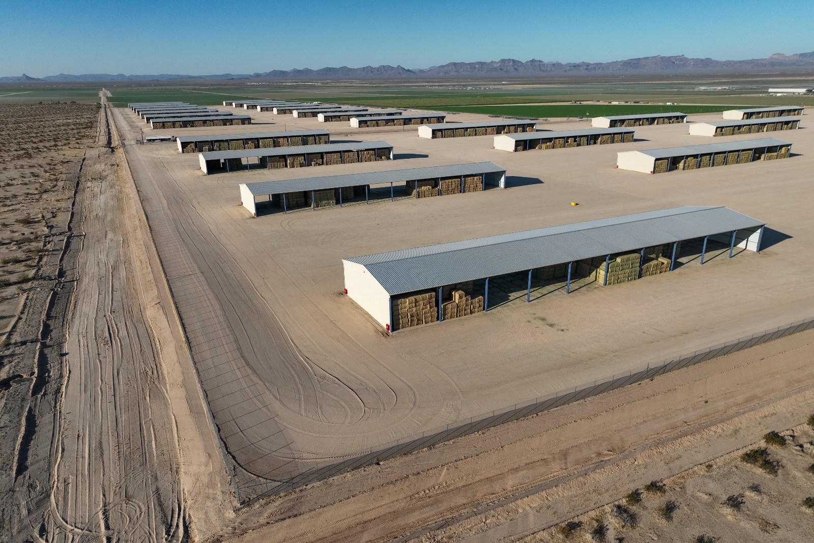
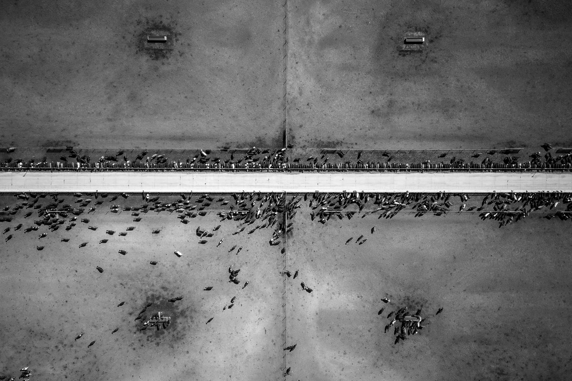
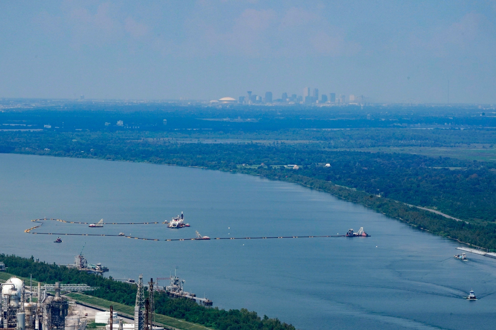
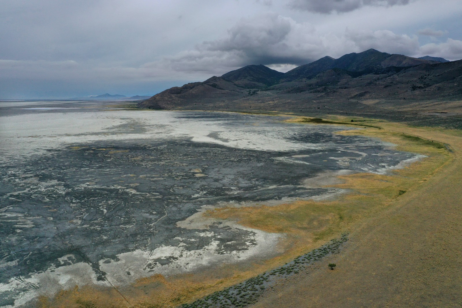
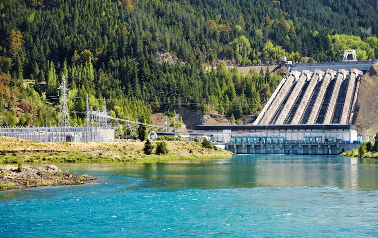


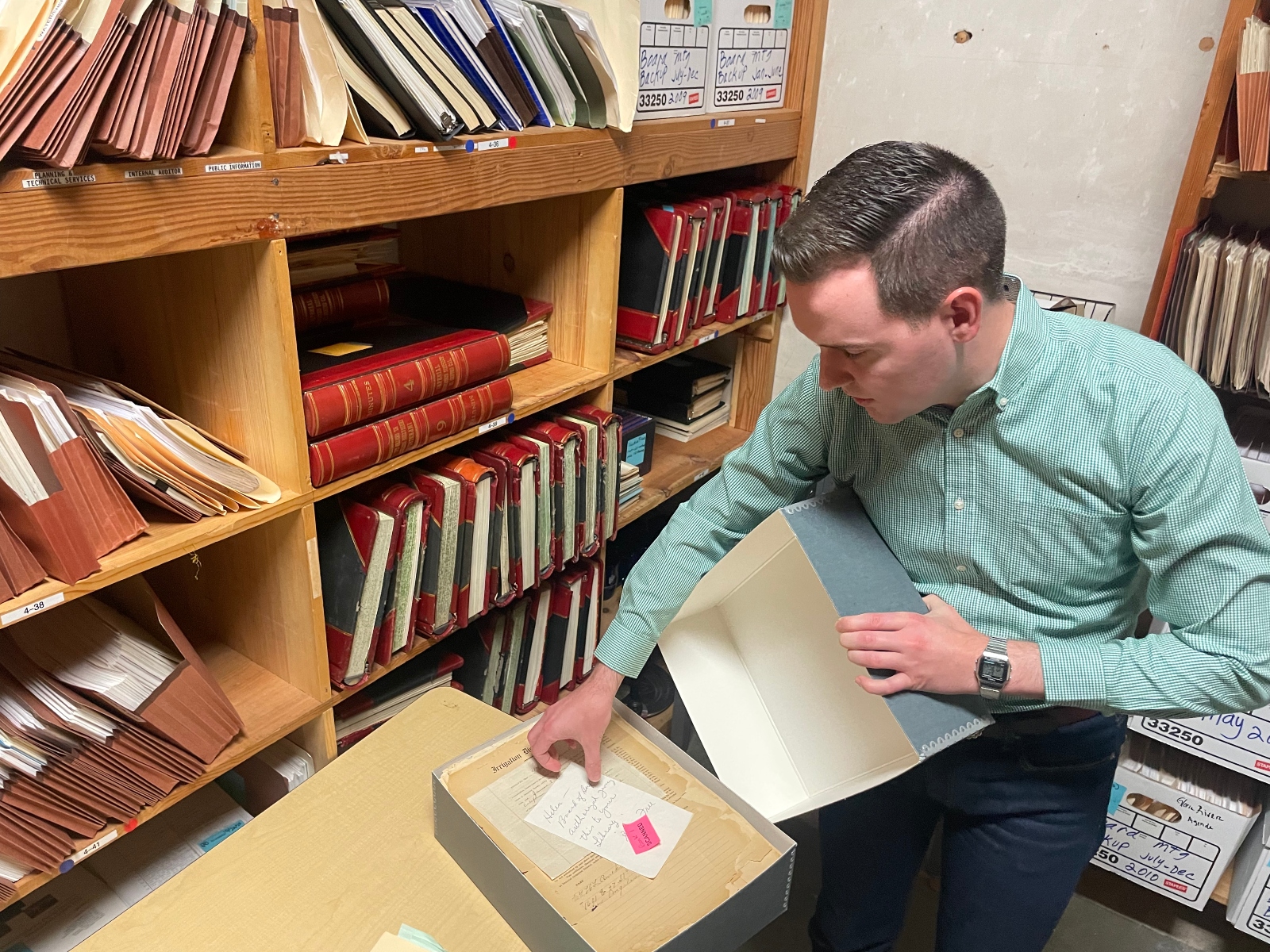
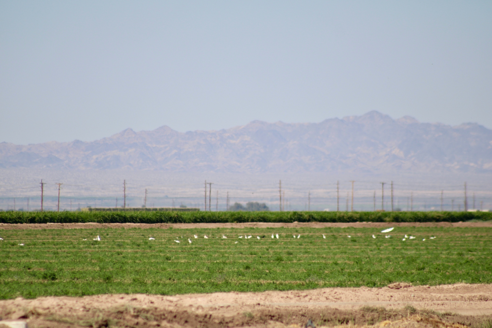
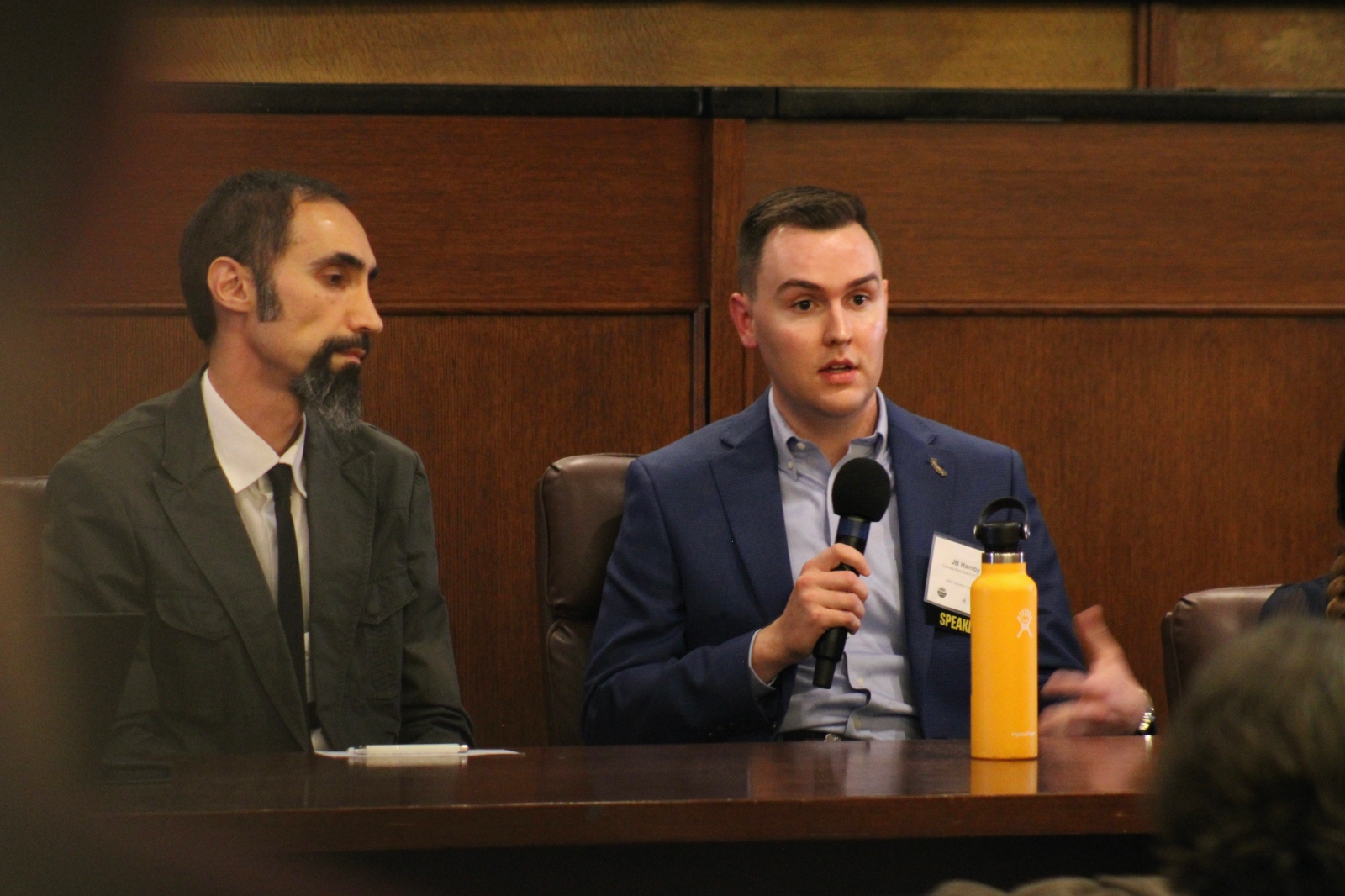
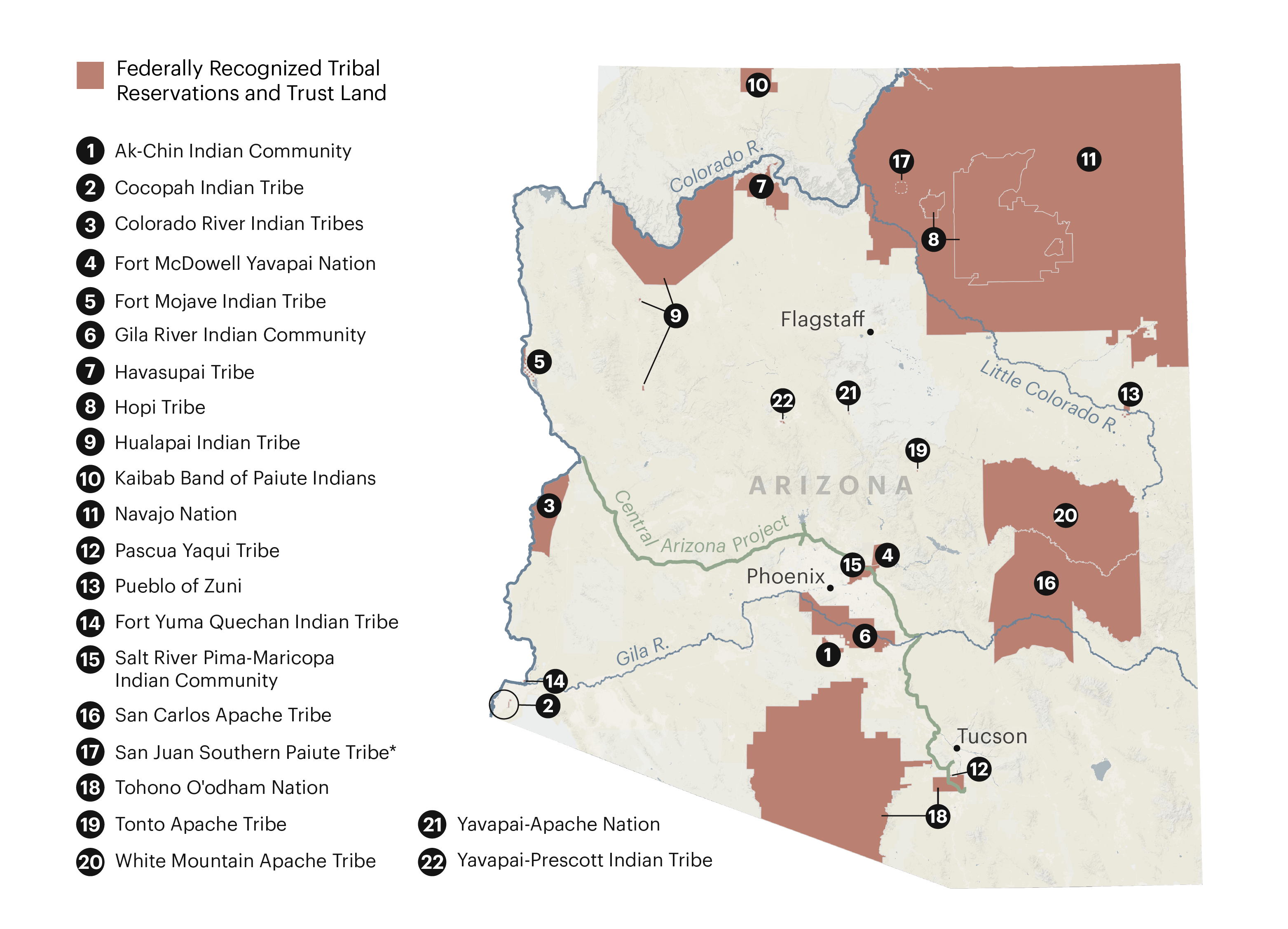
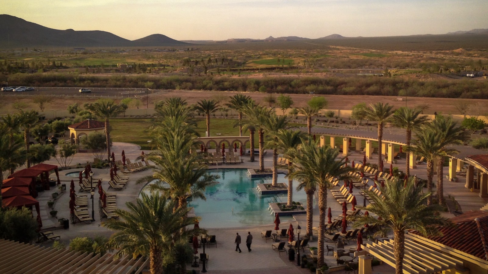
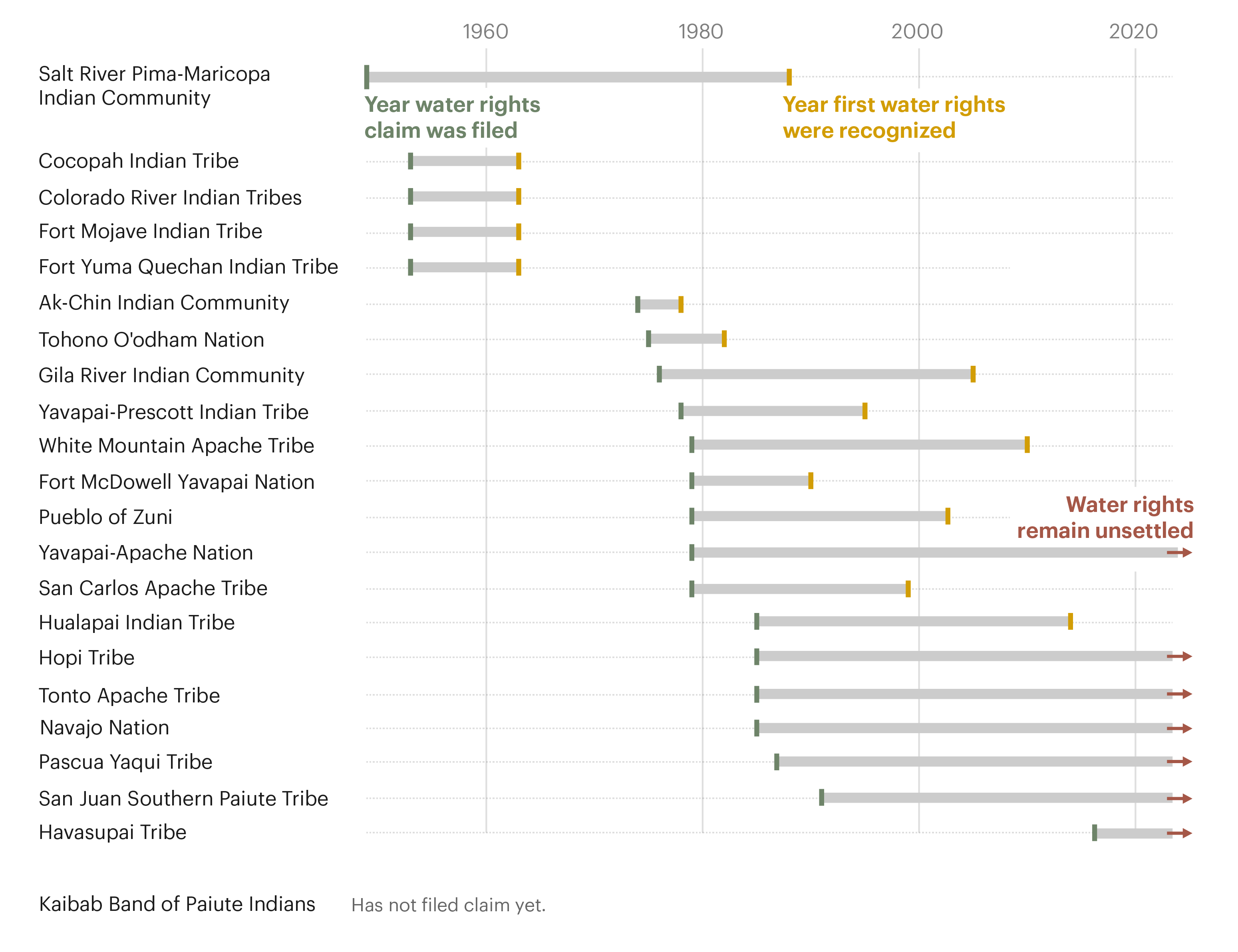

 (@DrTELS)
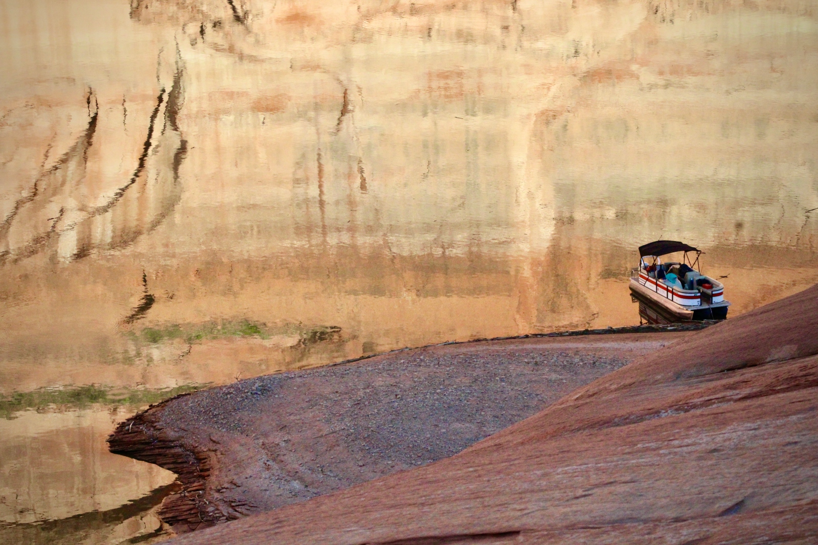
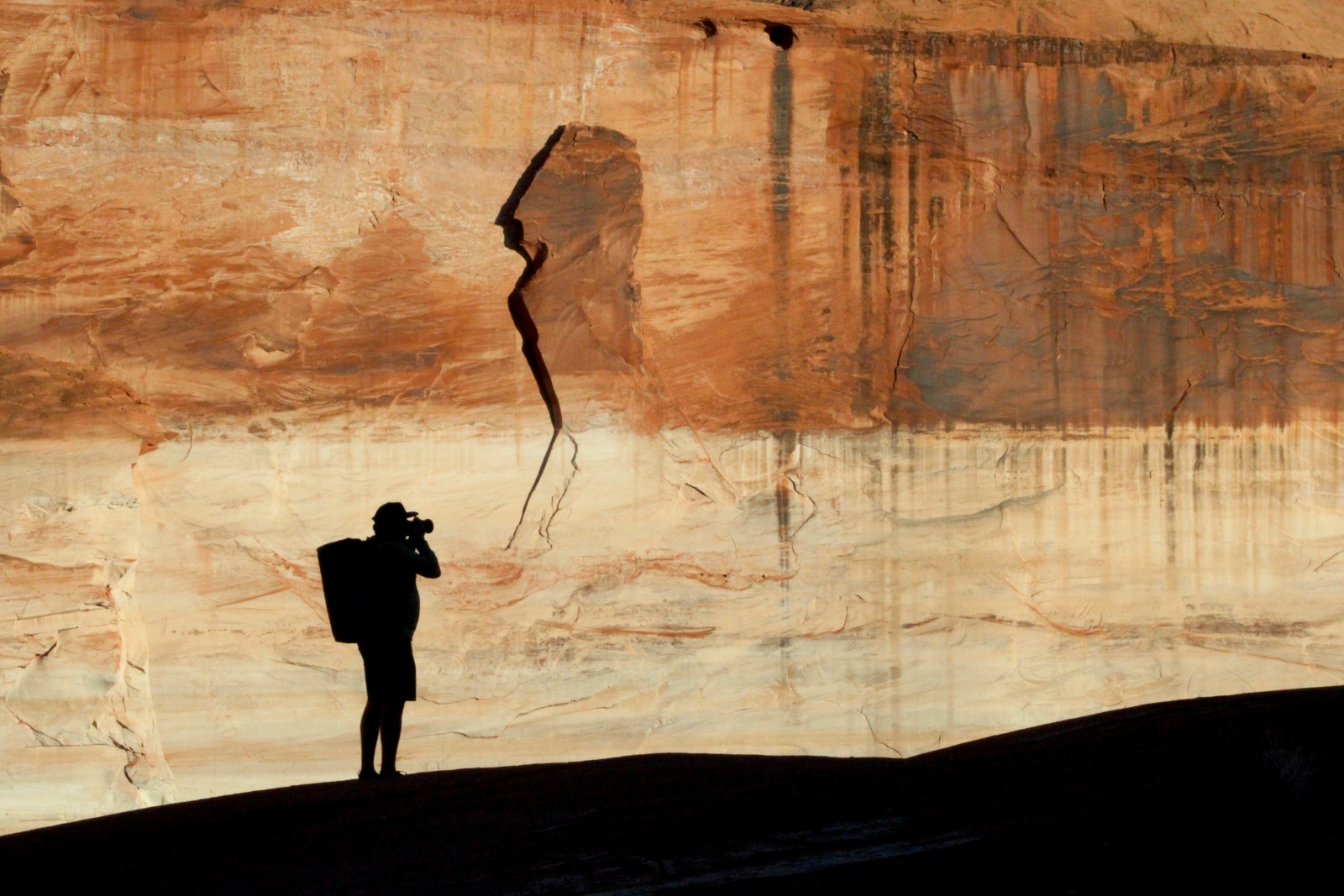
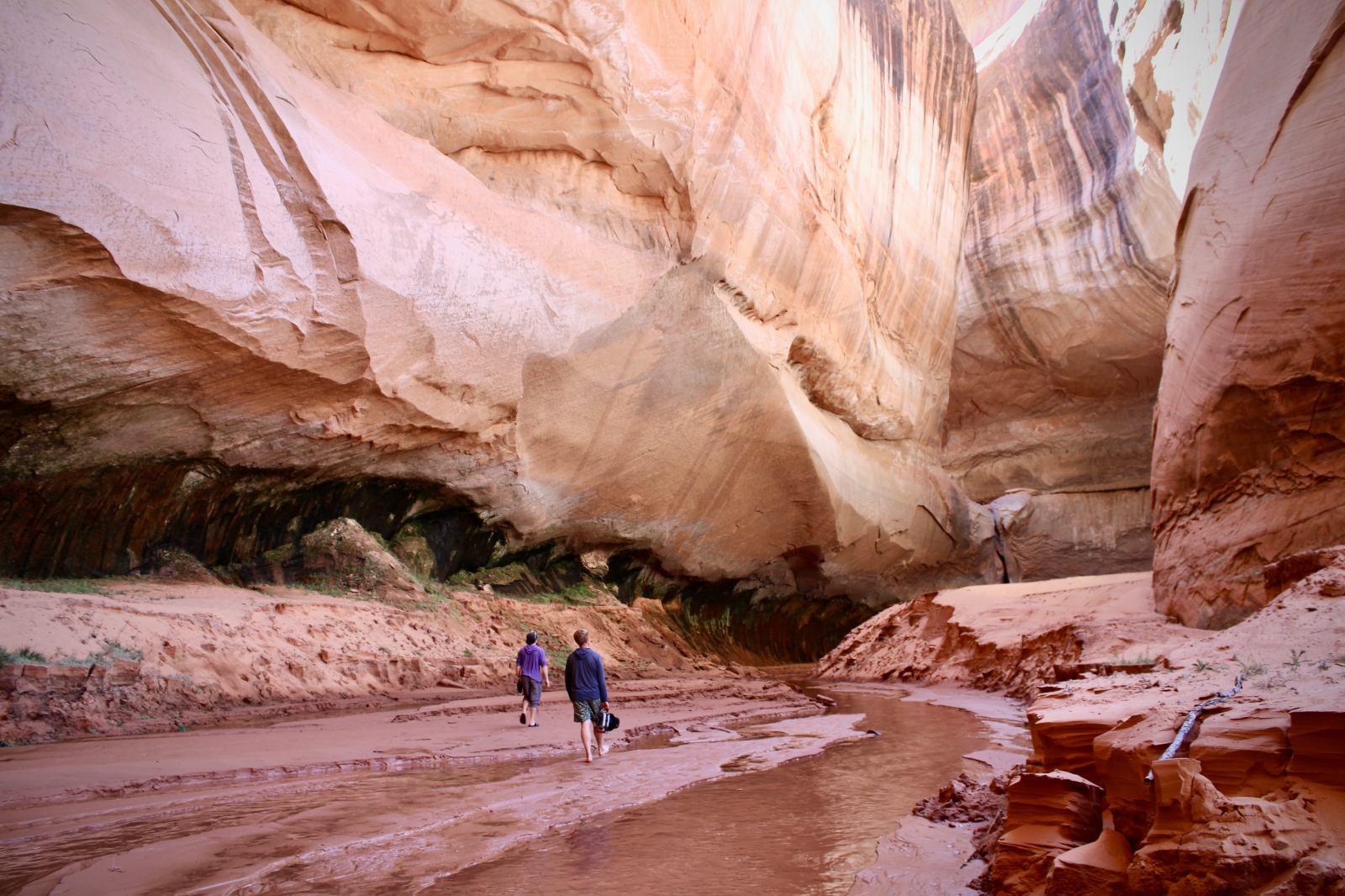

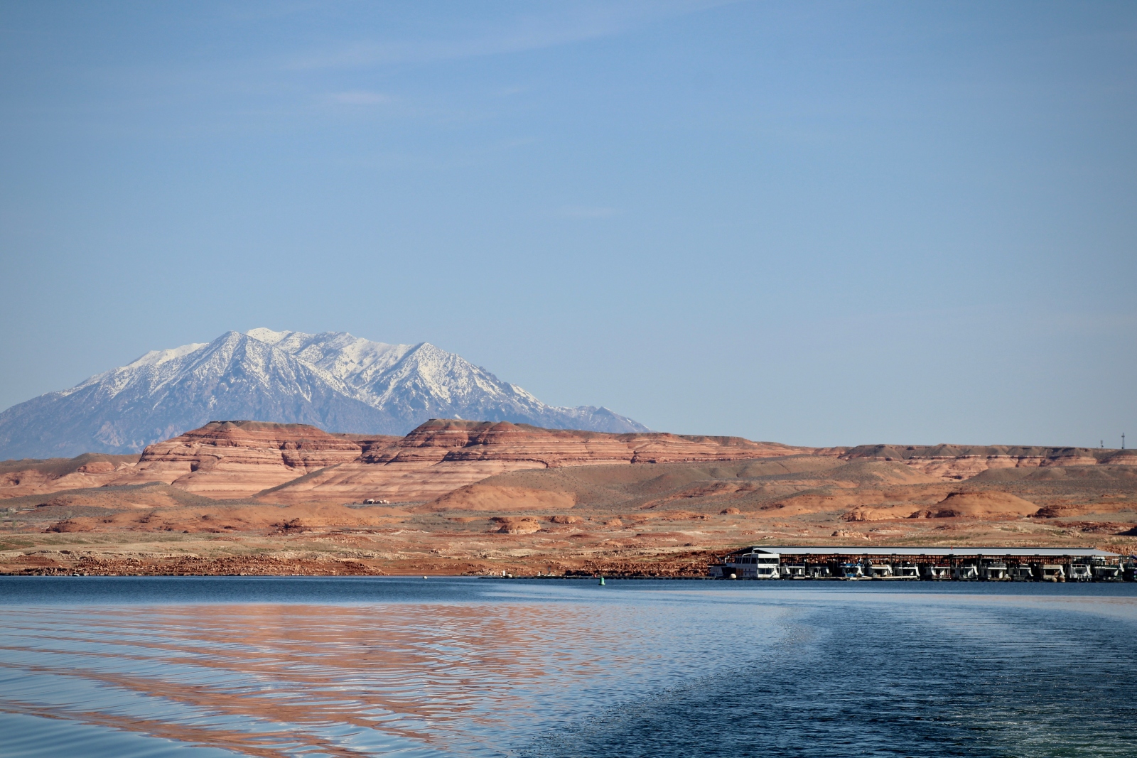
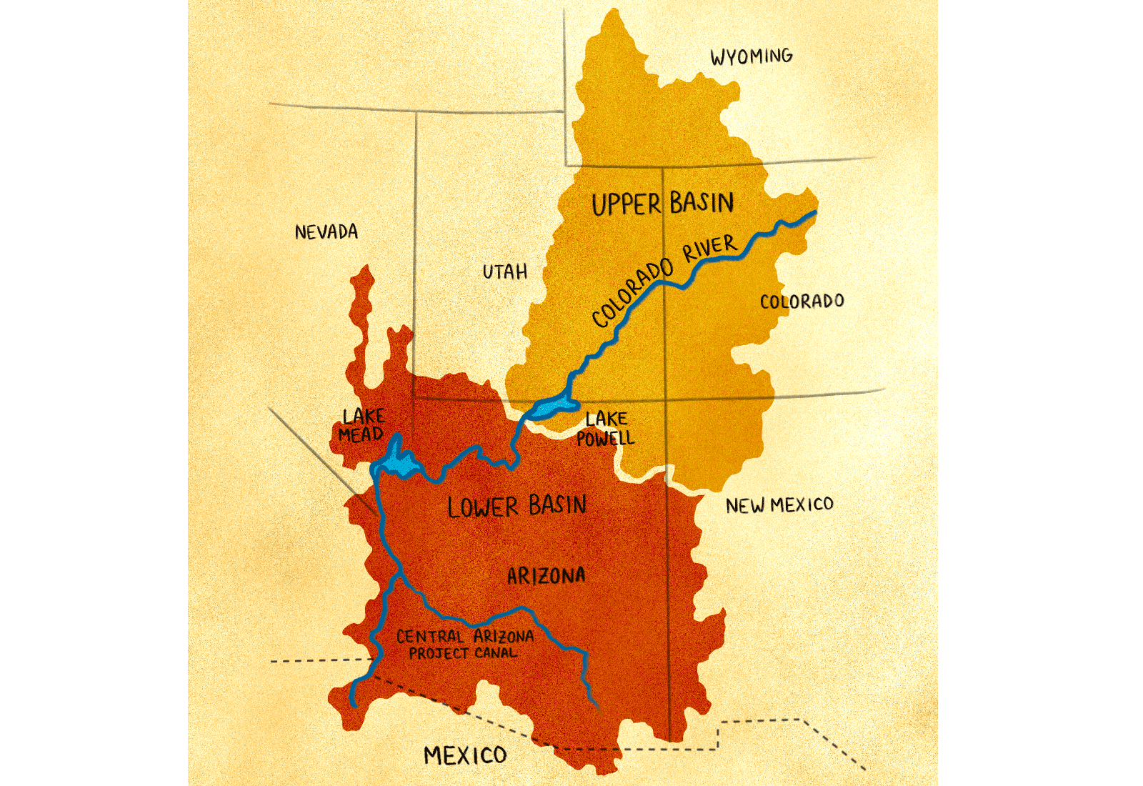

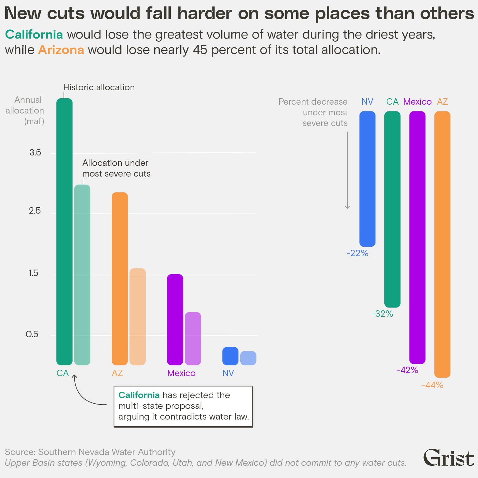


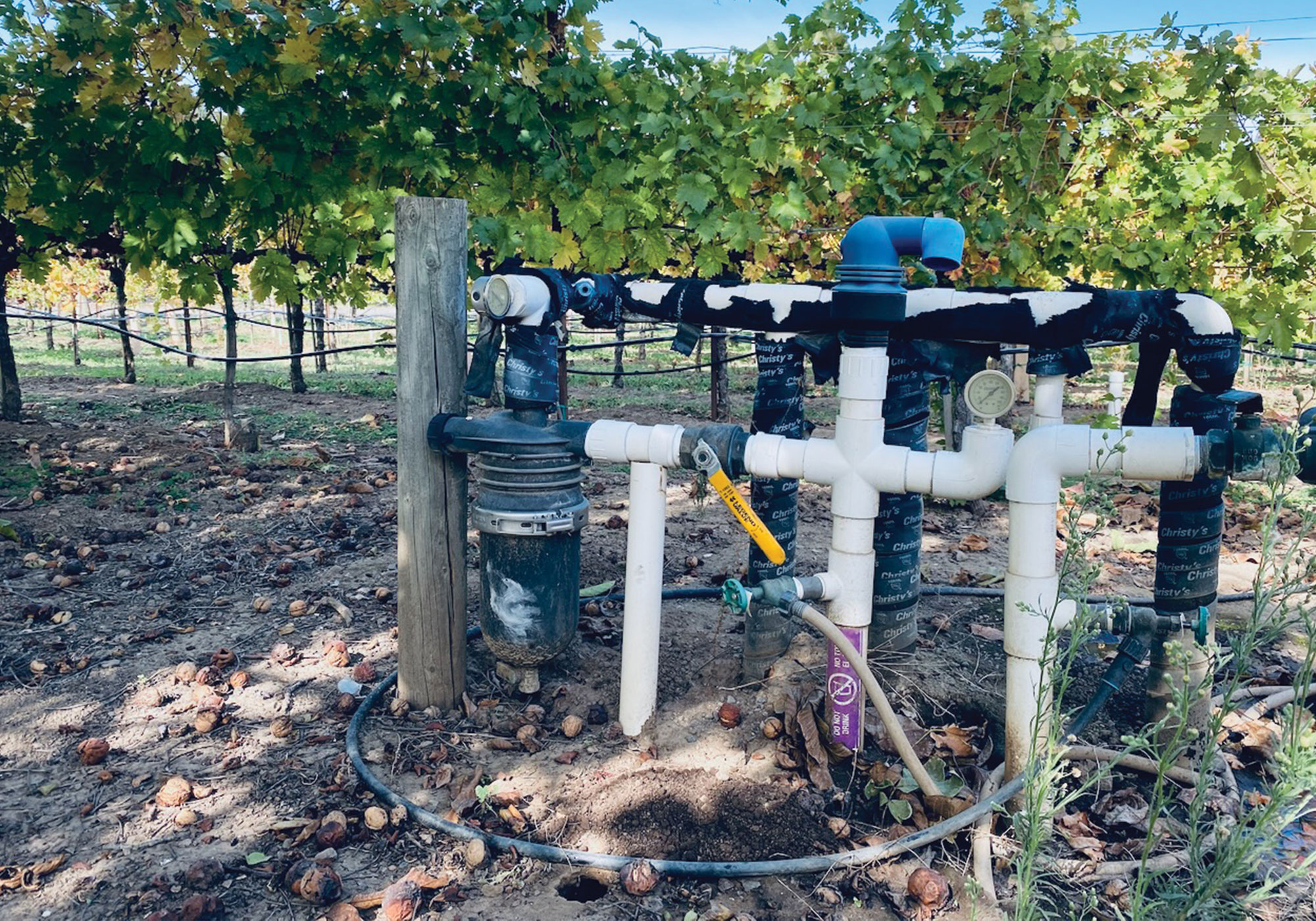
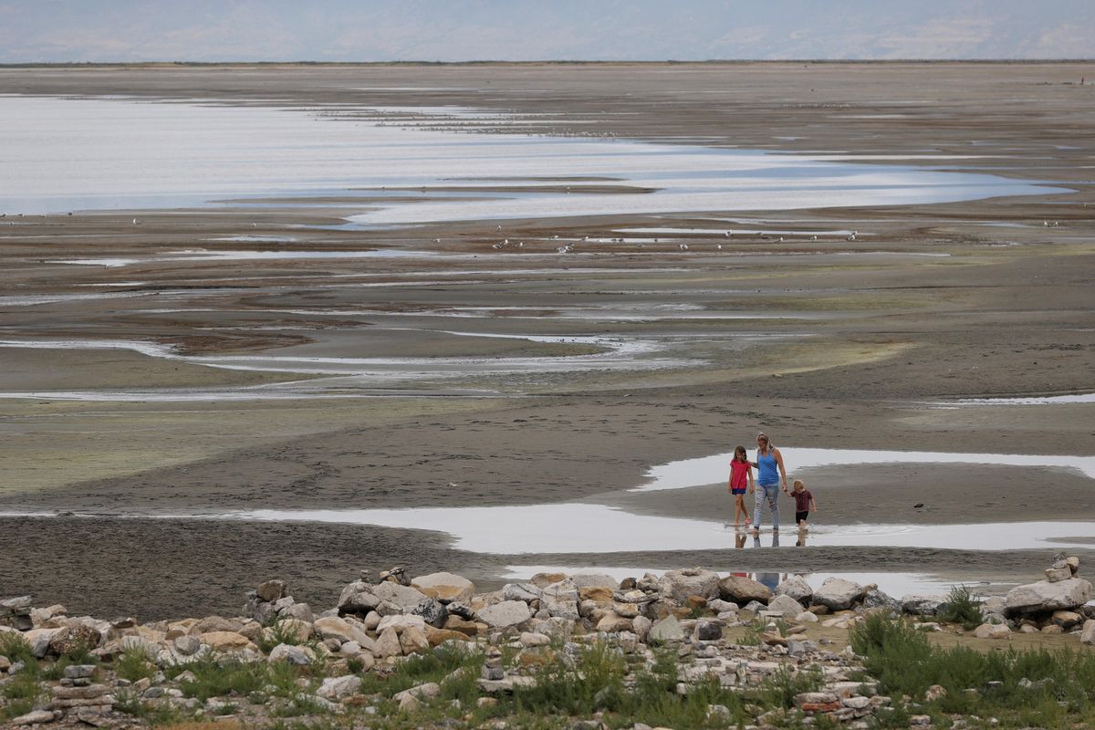
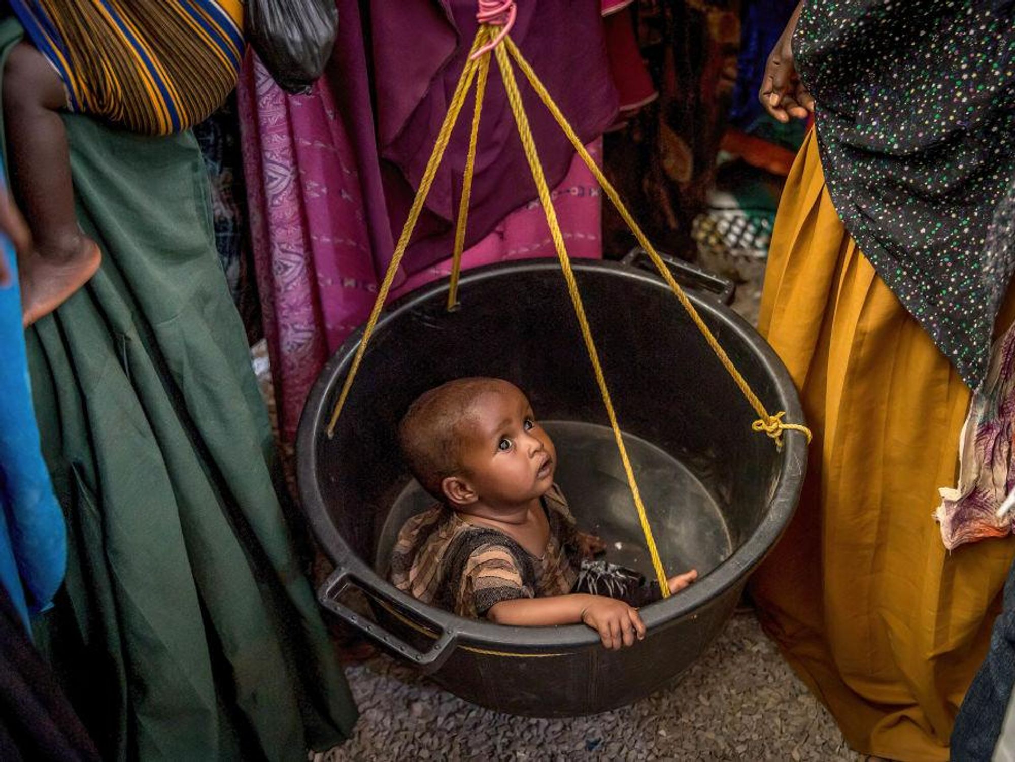
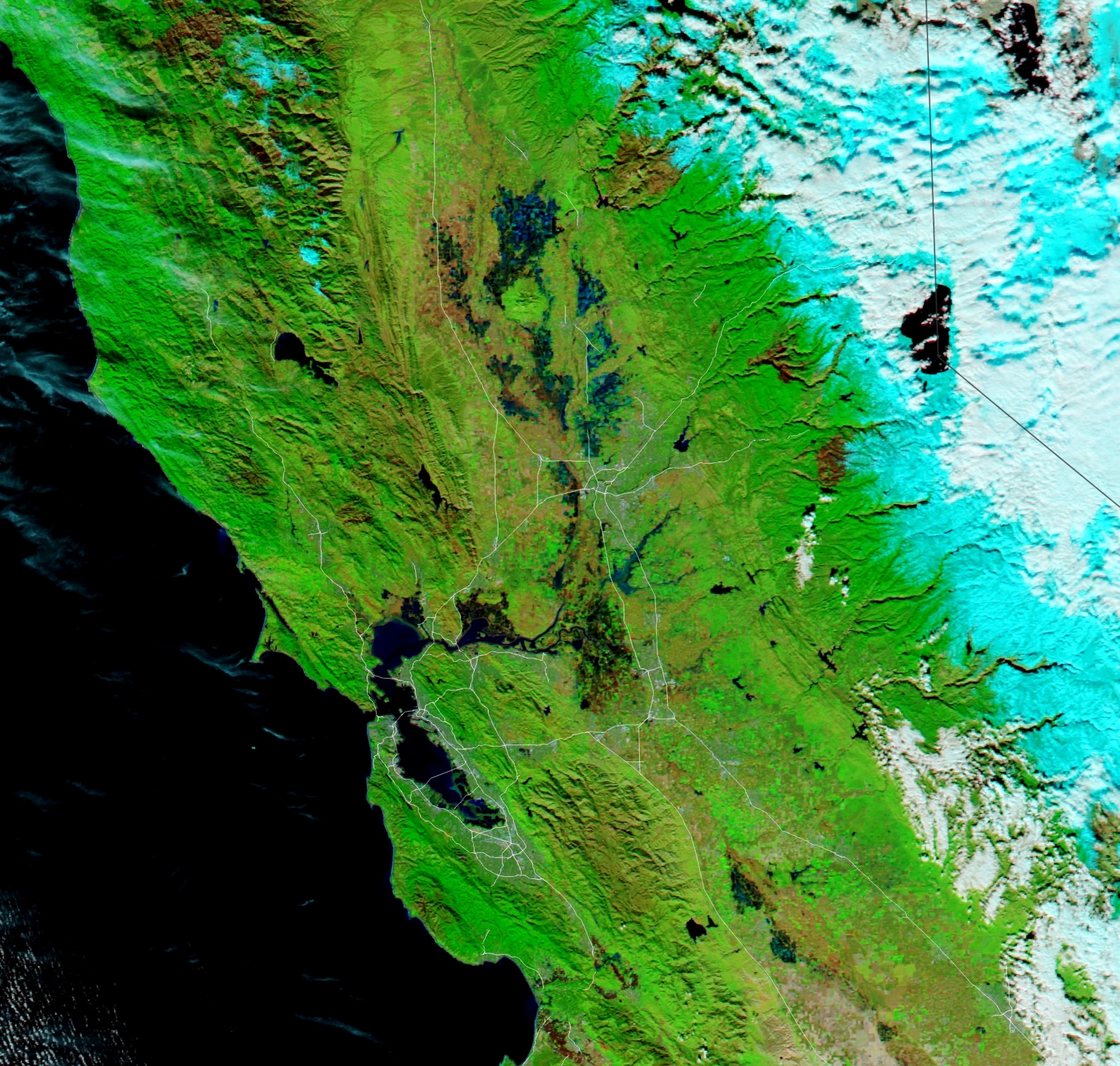