“The cells don’t have any heat. So, they’re sleeping with their clothes on,” a woman named Regina told Truthout of her son’s experience in Hill Correctional Center in Illinois in early December. “They’re not heating the tiers. There’s no heat in the day room. There’s no heat outside the showers.… The water is cold. You can let it run for a little while and you may get a little warm. But it’s not…
In the three months since Hurricane Ian struck Florida, the state’s fragile property insurance market has been teetering on the brink of collapse. The historic storm caused over $50 billion in damage, more than any disaster in U.S. history other than Hurricane Katrina. It also dealt a body blow to an industry that was already struggling to stay standing: Several insurance companies had already collapsed this year even before the hurricane, and major funders are now poised to abandon those that remain.
In recognition of this crisis, Florida Governor Ron DeSantis convened the state’s Republican-controlled legislature last week for a special session devoted to stabilizing the insurance market. In a matter of days, lawmakers passed a package of bills aimed at doing so. The package includes bills that will cut down on litigation and fraudulent claims that raise costs for insurers, but it also provides insurance companies with a $1 billion public subsidy to help them stay afloat next year. That’s on top of another $2 billion the legislature rolled out earlier this year.
One might think that this handout would be opposed by a legislature where Republicans enjoy supermajorities in both chambers — and by a governor who has styled himself a future leader of the Republican Party — but the state’s lawmakers don’t have many other options. DeSantis may trumpet Florida as a free-market success story, but the insurance market has all but abandoned it.
The problem is that taxpayers will end up footing the bill for all this, even if they don’t own homes that are at significant risk — or don’t own homes at all.
“If the state has to step in every year to help insurers stay in the market, that’s a problem, unless everyone in Florida is willing to keep paying more and more as these events occur,” said Patricia Born, an academic at Florida State University who studies risk management. DeSantis and his allies in the legislature can shift the cost burden from risky insurance customers to taxpayers or vice versa, but they can’t get rid of that burden altogether.
In a typical market, property insurance companies take in money from all their customers’ premiums and pay out to the subset of customers whose homes suffer damage. The revenue from premiums is supposed to guarantee that a company can pay out customers even under the most catastrophic circumstances. But that has become impossible for most Florida insurers to do: A huge share of homes in the state are vulnerable to hurricanes, which leave insurers liable for massive payouts — and the specter of climate-change-driven effects like “rapid intensification” means that storms that might once have petered out before landfall can suddenly become devastating. Insurers in the state have also seen a surge of costly litigation over roof damages thanks to a Florida-specific legal loophole.
In theory, companies could raise prices to account for these costs, but in practice those prices would be too high for most customers to afford. Instead, many nationwide companies like State Farm have fled Florida altogether, leaving behind only small local carriers. When the crisis began after Hurricane Andrew in 1992, the state government created a public insurance company called Citizens that now serves as a provider of last resort to people who can’t get coverage from private companies. Citizens has doubled in size over the past four years as more of these companies collapse, and in some parts of the state it controls more than half of the insurance market.
In the weeks since Hurricane Ian, the biggest concern for the surviving private insurers has been the cost of reinsurance, which is insurance purchased by insurance companies. Just as a bank requires a homeowner to buy an insurance policy so she can cover sudden damages to her home, Florida requires insurers to buy their own insurance policies so they can afford to make big payouts after a storm.
Unlike the Florida-specific companies that currently sell home insurance to state residents, reinsurance companies are global corporations, many headquartered in Bermuda. These companies backstop the insurance markets in the world’s riskiest places, but the devastation from Ian is making many of the largest reinsurance providers cagey about operating in Florida. Industry analysts expect that these companies will pull as much as $100 billion of coverage off the Florida market next year, which could cause reinsurance rates in the state to rise by 10 percent or more.
When reinsurance gets more expensive, it spells trouble for small insurance companies like the ones that dominate Florida, said Sridhar Manyem, a researcher at the credit rating agency AM Best and the co-author of a recent report on the Florida market.
“They might have to drop some customers, they might have to raise rates, they might have to borrow more money at a pretty atrocious cost to buy reinsurance,” Manyem told Grist.
This situation could get out of hand fast. Florida’s property insurance premiums are already about three times higher than the national average, and analysts expect them to rise another 20 or 30 percent next year. Companies that can’t raise more money through loans or price hikes will collapse, forcing more people to join Citizens. As that public insurance program keeps growing, it will get more vulnerable to a big storm, potentially putting the state on the hook for billions of dollars that it will have to raise from taxes.
President Joe Biden and First Lady Jill Biden listen to Florida Governor Ron DeSantis speak in Fort Myers, Florida, after Hurricane Ian.
Olivier Douliery / AFP via Getty Images
The state legislature approved a few measures last week that are designed to stop this downward spiral. One measure eliminates the unusual attorney’s fees that are driving the surge of roof litigation, a change lawmakers hope will help tempt insurers back to the market. Another measure would force every Citizens customer to buy flood insurance (even if they aren’t in a flood zone), and a third will slow down the growth of Citizens by requiring some potential customers to buy private insurance instead, even if it means they pay more. (Democrats in the legislature decried the lack of financial assistance for residents who face these new mandates.)
But the elephant in the room is the looming rise in reinsurance prices, which will make it even harder for Florida insurers to turn a profit next year. Reinsurance costs account for about half of the actual premiums that Florida homeowners pay, and that number is likely to rise.
“Right now that doesn’t look really good for any major carriers that might be thinking about writing in Florida, or even carriers that have been writing and might be thinking about leaving,” said Born.
Florida’s government has been propping up the primary home insurance market for decades, but the toll of weather disasters is forcing the state’s conservative government to go even further by propping up the reinsurance market as well. The state already maintains a $17 billion reinsurance fund that helps insurers cover the largest hurricane claims, but Ian will just about wipe that fund clean. Refilling it before next hurricane season will not be easy. Earlier this year the state created an additional $2 billion reinsurance fund, and lawmakers added another $1 billion fund last week, pumping more money into the languishing market to protect the remaining private carriers.
Top Republicans in the state have tried to frame the public funding as a stopgap measure.
“It would be temporary, and it has to be contingent on getting major reforms so we actually fix the situation,” Paul Renner, the incoming speaker of the state House of Representatives, told reporters last month before the special session. “I do not want to be in a situation where we make any kind of new long-term taxpayer commitment to underwrite insurance.”
But funding a long-term solution to the insurance gap may be easier said than done. Even if the new package of bills does solve the litigation issue, hurricane risk is only going to increase as more people move to coastal cities and warm oceans make landfalling storms more powerful. As long as that trend continues, it will be difficult if not impossible for lawmakers to engineer a functioning private market.
That means that the state government, and by extension state residents, will foot the bill for protecting billions of dollars in vulnerable property. Unless something changes, a “long-term taxpayer commitment” is all but a certainty, and that burden will fall hardest on the Floridians with the least resources.
When Hurricane Ian hit Central Florida last fall, Milly Santiago already knew what it was like to lose everything to a hurricane, to leave your home, to start over.
For her, that was the outcome of Hurricane Maria, which struck her native Puerto Rico in September 2017, killing thousands of residents and leaving the main island without power for nearly a year.
So in September 2022, nearly five years to the day when Maria tossed her life apart, Santiago was in suburban Orlando, visiting a friend. As torrents of heavy rain battered the roof of her friend’s home, and muddy waters flooded the streets, she realized they were trapped.
And that her life was going to change, again.
“It created such a brutal anxiety in me that I don’t even know how to explain,” she said in Spanish.
In the aftermath of Hurricane Maria, Santiago was one of more than 100,000 Puerto Ricans who left Puerto Rico and relocated to places like Florida, seeking safety, economic opportunities, and a place to rebuild their lives. Only now, with displacement caused by Hurricane Ian, as well as one of the worst housing crises in the country, the stability for Puerto Ricans in hurricane-battered Florida has never felt more at risk. With those like Santiago twice displaced, many are finding their resilience and sense of home tested like never before.
Homes damaged by Hurricane Maria stand in an area without electricity on October 15, 2017 in San Isidro, Puerto Rico.
Mario Tama via Getty Images
Santiago’s life right before Maria was based in Canóvanas, a town on the outskirts of Puerto Rico’s capital of San Juan. There, she lived with her teenage daughter and son. Hurricane Irma visited first, grazing the United States territory in early September and causing widespread blackouts. When Hurricane Maria hit on September 20, it ultimately took the lives of more than 4,000 Puerto Ricans, making it the most devastating tropical storm to ever hit the region. It would take 11 months for power to be fully restored to Puerto Rico’s main island, home to the majority of the territory’s population of just over 3 million.
Santiago lost her business as a childcare provider in the wake of the devastation to Puerto Rico’s economy and infrastructure. She decided she had no other option but to leave. By mid-October of that year, Santiago, with her children — and their father —relocated to metro Orlando.
It took her years to adjust to her new life. And then Ian happened.
“It was already a nightmare for me,” said Santiago, “because it was like reliving that moment when Maria was in Puerto Rico.” In the aftermath of Ian, Santiago was displaced from a rental home where she had lived for only a week.
Santiago’s déjà vu is not unique among Puerto Rican survivors of Maria living in Central Florida. Many are still reeling from the trauma of economic hardship, poor relief efforts, and displacement that was only now starting to be addressed in Puerto Rico itself.
“There are people who feel like, ‘Man, I just came here from Puerto Rico and here I am in this situation again,’” said Jose Nieves, a pastor at the First United Methodist Church in Kissimmee, a suburb of Orlando. Nieves’ work in recent years has extended to supporting immigrant families affected by natural disaster displacement in Central Florida.
Central Florida is home to large Latin American and Caribbean communities. Many members work in low-wage and low-skilled jobs in the area’s robust tourism industry, which is nonetheless vulnerable to the economic fallout from natural disasters like Ian. Puerto Ricans and other Latin Americans are also among the millions of Florida residents who live in homes without flood insurance.
Earlier waves of Puerto Ricans had relocated to the mainland primarily for economic reasons. Along with those who came to Florida directly from the main island, thousands more had moved in recent years from other long-established Puerto Rican communities in New York and other parts of the Northeast.
By the time Santiago and her family arrived in Orlando in 2017, the metro area was already one of the fastest growing regions in the country. Over one million people of Puerto Rican origin now live in Florida, surpassing the number in New York. In Central Florida, Puerto Ricans make up the largest community of Latinos. Among them are sizable Colombian, Venezuelan, and other Latin American nationalities.
The Super 9 motel in Kissimmee, Florida, which became home to a number of Puerto Rican families displaced by Hurricane Maria in 2017.
Ricardo Ramirez Buxeda via Getty Images
Like many other Puerto Ricans who had come before her, Santiago thought that a new life in Florida would provide what Puerto Rico couldn’t: wages that they could live well on, stable housing and infrastructure, and a local government that was responsive to their needs and that would uphold their rights as U.S. citizens. There was also the benefit of a large network of Spanish speakers who could provide support and share resources on how to navigate social and civic life on the mainland. And perhaps above all, there was also a sense that in Florida their vulnerability to the devastation of tropical storms like Maria would be lessened.
At first, Santiago and her family settled at her sister’s house in Kissimmee. World famous theme parks like Walt Disney World and Universal Studios were minutes away, as was Orlando’s international airport. In December 2017, after finding out that the local government was providing hotel accommodation for those displaced by Maria, Santiago and her family moved into a local Super 8, one of several motels along Highway 192, Kissimmee’s main drag. Its concentration of hotels and motels has earned Kissimmee the moniker of “the hotel capital of Central Florida.”
In August of 2018, after more than eight months living at the Super 8, Santiago and her family started looking for more permanent places to stay. “By then the rents had skyrocketed and they were asking for $50 to $75 [a night] per head of family,” Santiago said of the motels. Landlords were also asking for two to three months rent for a deposit, a standard practice in Florida but one that took Santiago by surprise. “We said if we plan to stay we are going to [need] that money,” she said, “because we left Puerto Rico only with what little we had.” The family eventually settled in an apartment in Orlando.
Ian hit at a time when the cost of living in Central Florida had soared, housing had become more unaffordable, and wages had stagnated. “We’ve just seen this massive spike in the cost of rent and in the cost of everything else,” said Sam Delgado, the programs manager at Central Florida Jobs with Justice, or CFJWJ, an Orlando-based workers’ rights organization.
“They say we have California’s expenses and Alabama’s wages.”
Sam Delgado, program manager at Central Florida Jobs with Justice
Delgado explained that the timing of Hurricane Ian at the end of the month left many local families struggling with whether to prioritize emergency expenses or rent. In the wake of the storm’s devastation, many households were forced to use rent money to buy non-perishable food items and gasoline, or temporarily relocate their families to hotels. “People just don’t have enough money for an emergency,” he said.
Florida’s affordable housing crisis, as in the rest of the U.S., is the result of several factors: limited housing stock, zoning laws restricting construction of new rental housing, and stagnant wages that have not kept up with the cost of living. “They say we have California’s expenses and Alabama’s wages,” said Delgado.
Central Florida’s low-income Latino communities are among the hardest hit by the state’s housing crisis. They have some of Florida’s fewest financial and social resources to both prepare for disasters before they happen and to respond adequately after they do. Many live in properties such as mobile homes that are more affordable but less resilient to wind or flood damage.
For families that have previously been evicted or have a poor credit history, it’s even more difficult to secure housing in the traditional rental market. Throughout Orange County (of which Orlando is a part), Osceola County immediately south (home to Kissimmee), and even the Tampa Bay area along the Gulf Coast, the last option for these families is to move into hotels or motels. A number of such makeshift apartment complexes also became micro-communities for Puerto Ricans displaced by Hurricane Maria. The award-winning 2017 film, “The Florida Project,” dramatized the life of a family living in a motel in Kissimmee. But few see this trend as sustainable. “It’s expensive to be poor here because it costs way more to rent a hotel [room],” said Delgado.
And it’s only getting more expensive, as more extreme weather and displacement is putting pressure on the rental market. Prices for apartments are rising higher and higher to meet this demand. After recently looking for an apartment for she and her daughter, Santiago returned to her friend’s home, having had no luck at finding anything affordable. One place she looked at was asking $2,500 per month. “I don’t know what they were thinking,” she said.
In many ways, the housing crisis has faced no greater urgency. Coupled with the lack of affordable housing, many in the Puerto Rican and larger Latino communities feel that the local and state government is not doing enough to support those who have been displaced.
“If you were out of your house for 15, 20 days because of the flood, because you didn’t have electricity or services, it shows that [the state] was negligent,” said Martha Perez, who is a resident of Sherwood Forest, a RV resort community in Kissimmee. Perez was forced to leave her home, where she lived alone, after Ian’s floodwaters made her community uninhabitable for weeks. Both Milly Santiago and Perez, a Mexican citizen, have received material support from Hablamos Español Florida, a social services organization geared to Latino immigrant families in the state.
“When our community gets hit by a hurricane, the recovery doesn’t take days or weeks. I mean, the reality is that many of those families are going to be struggling with the effects of the hurricanes for the next two years,” said Nieves of First United Methodist Church in Kissimmee. He says that the damage from Hurricane Ian has taken hundreds of homes off of the housing market, further exacerbating the affordability crisis.
For many locals and advocates, the needs that have arisen around housing, wages, and climate resilience are effectively the result of an unwillingness from those in power to address the needs of the state’s most vulnerable communities. And social support organizations and volunteers can only do so much. “Every time it’s a nonprofit organization responding to these immediate needs in communities, it looks more like a policy failure than it does a community coming together to help people,” said Delgado.
“What do I want from the government?” said Santiago. “I want them to be more fair with us, because there is a lot of injustice.”
When you think of the Arctic, wildfires, rain, and typhoons probably don’t spring to mind. But all of these events came for the Far North this year, and scientists say more freak weather events are in store.
The last seven years in the Arctic were the hottest on record, according to the National Oceanic and Atmospheric Administration’s annual “report card” released this week, the work of nearly 150 scientists. The Arctic, warming four times faster than the planet overall, is rapidly destabilizing — with troubling consequences for the people who live there as well as global weather patterns.
Warmer weather is already messing with the Arctic’s seasons. Snow cover is melting earlier on in the spring, allowing wildfires to get an early start and to tear through new areas. By June, fires had already burned 1 million acres, a record for that time of year.
The region is losing snow cover at a rate of nearly 20 percent every decade since the late 1960s and receiving more rain. In a new finding, the NOAA report’s authors documented an increase in precipitation over the entire Arctic region, with more frequent downpours. This year was the third-wettest for the Arctic in the past 72 years. As the ocean warms up and loses sea ice, more moisture is heading to the atmosphere, allowing for more rainfall. In September, for example, a typhoon fueled by unusually warm waters in the North Pacific struck Alaska, bringing a destructive storm surge that knocked coastal homes off their foundations.
That same month, a heat wave caused an outburst of melting across more than a third of Greenland’s ice sheet. Soon afterward, the remnants of Hurricane Fiona — after battering Puerto Rico and Canada’s east coast — once again sent warm air over Greenland’s southern ice sheet, prompting the worst melting event the area had ever experienced in late September.
Turning up the heat in the Arctic can cause far-reaching consequences. Once dubbed the “refrigerator” of the northern hemisphere, the region plays a key role in stabilizing weather further south — an ability that it’s losing. As the Arctic warms, it raises sea levels, alters the atmosphere’s circulation patterns, and sends strange weather across the globe. For instance, warm temperatures in the Far North can cause the polar jet stream to dip south, bringing bitter cold across parts of the northern hemisphere. The more unpredictable weather brought on by ice loss is already hurting crop production, instability that could raise food prices — another example of “heatflation.”
For the 400,000 Indigenous people who live in the Arctic, the effects of warming are especially acute. NOAA’s report card included the most comprehensive look in its 17-year run at how Indigenous communities in the Arctic are feeling these changes. “Our homes, livelihoods, and physical safety are threatened by the rapid-melting ice, thawing permafrost, increasing heat, wildfires, and other changes,” Jackie Qatalina Schaeffer, an Iñupiaq from Kotzebue, Alaska, who contributed to the report and directs climate initiatives for the Alaska Native Tribal Health Consortium, told the New York Times.
Extreme weather events have caused an estimated $115 billion in insured financial losses around the world this year according to Swiss Re, the Zurich-based reinsurance giant. That’s 42 percent higher than the 10-year average of $81 billion.
The firm estimates that $50 billion to $65 billion of the total losses are a result of Hurricane Ian, the category 4 storm that pummeled parts of Florida’s west coast in late September with torrential rain, a 10-foot storm storm surge, and winds topping 140 miles per hour. Swiss Re ranks Ian as the second costliest natural disaster ever, in terms of insurance losses, after Hurricane Katrina struck south Louisiana in 2005.
It’s not just severe storms causing the damage. In February and March, torrential downpour inundated vast swaths of northeastern Australia and racked up an estimated 4 billion in financial damages, more than any other natural disaster in the country’s history. In June, a series of fierce thunderstorms in France sent large hailstones tearing through roofs and destroyed miles of vineyards. The total insured losses were estimated to be around $5 billion. All of them combined to pushed losses above $100 billion for the second year in a row.
Swiss Re conducts this analysis as part of providing reinsurance, a type of financial protection for insurance companies hoping to shield themselves from absorbing all the risk in their portfolios. Climate change has begun to pose major challenges to the industry, as increasingly frequent and severe storms generate unprecedented financial losses.
In a press release announcing the findings, Martin Bertogg, head of catastrophe perils at Swiss Re, noted the steady increase in extreme weather events over the past several decades, and underscored the importance of using updated models so the industry can more accurately predict damages in a given year.
“When Hurricane Andrew struck 30 years ago, a USD 20 billion loss event had never occurred before,” Bertogg said. “Now there have been seven such hurricanes in just the past six years.”
Approximately 33 million homes on the U.S. Gulf Coast and the eastern seaboard are at risk of hurricane damage, according to the property intelligence firm CoreLogic, with a total estimated replacement cost of $10.5 trillion. The country’s coastal communities tend to be underinsured, and chronically outdated federal flood maps fail to capture the risk to many flood-prone homes. Though uninsured homeowners can apply for federal funding after natural disasters, they are typically only able to recover a small fraction of their total losses.
The Federal Emergency Management Agency estimates that climate change will cause the size of areas with a high flood risk to increase by 55 percent along U.S. coastlines and up to 45 percent along major river systems by the end of the century.
Puerto Rico could get $3 billion dollars for rooftop solar energy and battery storage if Congress approves a Biden administration request made earlier this week. The help is sorely needed.
The archipelago has been repeatedly hit by blackouts after a series of devastating hurricanes that crippled the electricity grid. In 2017, Hurricane Irma, which narrowly missed the main island but caused widespread blackouts, was followed by another — Maria — which killed over 4,000 people. Maria’s damage to Puerto Rico’s grid was so great that it took 11 months for power to be fully restored to the main island.
Both Puerto Rican activists and United States officials believe that investing in solar energy systems will help residents keep power on in their homes during what are certain to be more frequent and destructive storms in the Caribbean. Puerto Rico’s energy grid has been criticized for years for its unreliability under normal circumstances, even without the storm damage to power lines and generators.
While a growing number of Puerto Rican households are taking the initiative to install solar panels on their rooftops, the majority of households continue to rely on electricity through the mainstream power grid, or run diesel-powered generators. Generators, however, are expensive and pollute the air.
But high costs and environmental considerations are only part of the picture. Electricity blackouts on Puerto Rico in the wake of tropical storms have exacerbated the already devastating public health and safety crises that followed. Researchers have estimated that in the three months after Hurricane Maria there was a 62 percent increase in mortality,
Many deaths following the hurricane occurred in isolated and mountainous regions where residents were unable to access outside water or medical facilities. But the lack of electricity at home may have been the biggest factor in the high mortality, as residents were unable to boil water, refrigerate food and certain medicines, or run air-conditioning in their houses.
While a growing number of Puerto Ricans are installing solar panels on their rooftops, it remains too expensive for many.
Dennis M. Rivera Pichardo via AP Images
In San Juan, Puerto Rico’s capital, the average cost to install solar panels for a household is nearly $12,000. While that’s less than what the average household on the U.S. mainland would have to pay for home solar, the cost is too much for most Puerto Ricans; the territory’s median household income is around $21,000.
Before Hurricane Maria in 2017, household adoption of solar energy on Puerto Rico appeared to be more motivated by reducing electricity bills. Now, simply being able to turn the lights on has become just as strong a motivation. The archipelago is also considered a favorable location for widespread solar power adoption.
A preliminary study in 2021 from the National Lab of Renewable Energy concluded that transitioning to rooftop solar energy could produce up to four times the current energy needs of Puerto Rico. This potential is largely due to its high amount of exposure to sunlight throughout the year.
While some Puerto Ricans may acknowledge the value of allocating financial resources to rooftop solar energy, others are not convinced that relying on federal funds will lead to any fundamental changes on the ground.
“Since Maria, the U.S. government has made many allocations of funds that never arrive or their impacts are not seen in Puerto Rico,” said Arturo Massol Deyá, the executive director of Casa Pueblo, a Puerto Rican organization that supports community self-management projects.
Instead, Massol Deyá said, Casa Pueblo and other organizations are working to develop an independent electricity grid centered on solar energy projects that are run for and by local communities in Puerto Rico.
“We’re working to break the dependency model,” he said.
With wildfires growing more intense and frequent, the United States is burning through funds in an attempt to manage the costly blazes. In the last decade, the Department of the Interior and the Forest Service — the two federal agencies most often involved in wildfire preparedness, suppression, and recovery — have nearly doubled their combined spending, according to data collected by The Pew Charitable Trusts.
But wildfire management is not just a federal funding issue. States, localities, tribes, and in some cases, nonprofits and private property owners all share the burden, depending on the task at hand and the circumstances surrounding an actual fire. And according to a new report from Pew, there is not enough data readily available about how much fires are costing states.
“As fires have grown, so has public spending on wildfire management,” said Pew, a non-partisan research group.
States lack a uniform tracking system for wildfire management spending, including comprehensive costs incurred before, during and after fires. Without this intel, they must make less-than-informed decisions about how best to budget for fire risk. They may be unable to determine return on investment for long-term wildfire mitigation efforts or fail to allocate enough money to fire suppression.
As costs associated with wildfire management increase, many states have had to pull from their general funds — those collected from state taxes and fees and intended for general operations — in order to deal with blazes.
In Washington state, for example, annual average spending on wildfire suppression has nearly tripled in the course of a decade. The average tally reached up to $83 million for the period between 2015 and 2019, according to the Washington Department of Natural Resources. Over a third of Washington’s spending on wildfire suppression came from the state’s general operations fund.
“That is inherently detracting from other priorities that the state could put that funding towards,” said Colin Foard, an author of the report and manager of the fiscal federalism initiative at Pew.
The entity responsible for paying for a fire largely depends on who owns the land where the fire starts; if a fire begins on federal land, the federal government is responsible for suppressing the ensuing flames. But because fires do not stop burning neatly along property lines, a single blaze can incur costs for nearly every level of government. More often than not, states are the ones to front the necessary funds.
There are hundreds of cooperative agreements between local, state and federal governments around wildfire cost sharing and federal grant money and emergency funds also play a role in determining the final balance sheet. As a result, getting to the bottom of who owes what can take months to years.
Tracking and reporting these costs is critical, Foard said, but it is also impossible to know states’ full wildfire costs at any given moment. For example, a state could be incurring costs from a fire burning in the present, while also waiting on federal reimbursements associated with a fire from the previous year. At the same time, that state could also be in the process of paying the federal government back for costs associated with a different wildfire.
“You have so many different activities happening concurrently,” Foard said. Without insight into the total wildfire management costs (and changes in those costs), states are flying blind when making budget decisions for the following year.
Four of the six states Pew studied use previous years’ wildfire suppression costs as their baseline for making future wildfire management appropriations. But fire suppression is only one part of wildfire management and does not reflect the price tags associated with preparation, mitigation and recovery activities.
“Almost every state Pew studied experienced fire seasons in recent years where appropriations proved insufficient,” the report’s authors wrote.They found that in 2019, Washington state needed $80.5 million in additional funds for wildfire management beyond the state’s historical average spending; earlier this year, the Florida legislature approved over $90 million in additional funds for wildfire management.
Part of the problem, the Pew authors argue, is that states are using a reactive approach to budgeting and are not taking into account the increasing risk of wildfires. If officials were able to to understand changes in spending over time, they might be better able to plan for increases still to come.
“The demand for this type of information is growing,” Foard said, particularly among policymakers facing increasing wildfire costs. “[They are] seeing the communities that they represent being affected by fires and wanting to think about solutions to start to address those rising risks.”
Shortly before the English national team took the field in Qatar for its 2022 World Cup debut, its official Twitter account posted a video of players flocking to the sidelines of a training session, dripping in sweat and taking turns cooling down in front of a mist machine. “It was hard,” English defender Conor Coady told press after the practice. “It was something we needed as a team, to get used to [the heat], to feel it, to understand it.”
World Cups are usually held in early summer, but this year’s competition was delayed because of the Middle East’s searing heat. Even still, outdoor temperatures hovered in the low 90s as hopeful teams arrived in Qatar in early November.
FIFA’s decision to hold the event in Qatar has been controversial, from the host country’s treatment of migrant workers, thousands of which died of heat stroke building hotels and stadiums for the event, to its position on LGBTQ+ rights. The health risks associated with its extreme heat added to these other concerns.
But it is not the only major sporting event grappling with extreme conditions: This fall, the women’s Alpine Ski World Cup was delayed for over a month and moved to another venue after unseasonable rain made the course unsafe to ski. Earlier this summer, a historic heat wave required organizers of the Tour du France to spray water to keep the roads from melting.
From soccer to skiing, climate change is disrupting how and where sports can be played — from the most elite levels to neighborhood youth leagues. “If we do not change the nature of sport and these events to adapt,” said Walker Ross, a lecturer in sports management at the University of Edinburgh, “nature itself will move on without sport.”
A member of the Italian Paralympic snowboarding team rides a chairlift in Cervinia, Italy in 2020. COVID-19, a lack of snow, and high temperatures have made it hard for ski resorts to stay open and athletes to train. Mauro Ujetto/NurPhoto via Getty Images
Rapidly changing conditions are already forcing teams to rethink how they prepare for competition. At a recent workshop at the Columbia Climate School, United States women’s national soccer player Samantha Mewis described the intensive preparations the team took to handle the heat in Tokyo prior to the 2020 summer Olympics (the event was held in 2021 due to the COVID-19 pandemic).
“We weighed ourselves pre- and post-training, to track our water loss,” she explained, including testing their urine for hydration levels. Immediately before traveling to Japan, the team also conditioned themselves for the heat, which she said included repetitively riding a bike in a really hot room, practice for keeping their core body temperature elevated for extended periods of time. “It was exhausting.”
“Generally, exercising in heat puts much greater demand on your body,” said Rebecca Stearns, chief operating officer of the Korey Stringer Institute, a research and advocacy organization founded to honor the legacy of the Minnesota Vikings lineman, who died from exertional heat stroke. To cool off, blood flow has to be diverted from muscles to places that help the body regulate heat, like the skin. But some conditions can make that process more difficult.
“The body’s main mechanism to dissipate heat is sweating,” Stearns explained. In humid environments, sweat is slower to evaporate. Athletes get dehydrated, because they’re still sweating, losing electrolytes, but they aren’t effectively cooling off. “That’s when you hit the danger zone.”
Soccer is one of many sports now paying close attention to something called the wet bulb globe temperature (WBGT), which combines heat, humidity, and other variables like wind speed. When the wet bulb temperature breaks 89.6 degrees Fahrenheit, FIFA now requires cooling breaks in both halves, and officials are allowed to suspend or cancel the match. The rules were first instituted before the 2014 Brazil World Cup, when cooling breaks were used for the first time during the Netherland v. Mexico game, as well as more recently during the Euro2020 competition. “Heat stroke is one of the top causes of death in sport,” Stearns said.
But extreme heat and humidity also pose similar — if not worse — risks for amateur athletes. “At a youth level,” where the coach might be a parent or teacher, said Andrew Grundstein, a geographer and climatologist at the University of Georgia, whose research focuses on heat and human health. “You’re also unlikely to have medical staff like an athletic trainer available.” The consequences can be deadly: Between 1980 and 2009, 58 football players died from heat-related illnesses — the majority of them high school students.
Grist / Clayton Aldern
Grundstein explains athletes need to acclimatize to heat over time, meaning ramping up practices, rather than jumping right in with daily doubles in hot weather. “Coaches should adjust practices based on weather conditions,” he said, modifying things like length and intensity. And if something does happen, it’s critical to have an emergency management plan. Exertional heat stroke is largely survivable if the person can be rapidly cooled. (Grundstein recommends having a tub that can be filled with ice or cold water.) Georgia once had some of the worst heat-related death rates among student athletes in the country. But in 2012, the Georgia High School Association implemented rules and safety measures to help protect student athletes; there have been no heat-related deaths in football players there since.
The Korey Stringer Institute recently developed an assessment of states’ policies for high school athletes. These standards will become more important, Grundstein says, as regions that weren’t historically hot start to see more heat waves. “A lot of times, they’re really unprepared, because they’re not used to it,” he said. Coaches don’t know what warning signs to look for, and athletes are less used to exercising in extreme heat.
While state sport associations can dictate safety measures for high school teams, those for younger athletes are often made on an ad-hoc basis. “It’s like the Wild West,” Stearns said. “There are just not a lot of protections in place.” Still, many youth leagues are voluntarily adapting to changing conditions: The Seattle Youth Soccer Association, for example, now has both a heat cancellation policy and a “bad air guidance,” developed because of the West’s worsening wildfire smoke.
A trainer applies a cold towel to a student-athlete during a morning football practice at Father Ryan High School in Nashville, Tennessee in 2011.
AP Photo/Mark Humphrey
Real-world conditions are often a combination of factors, making it even harder to develop rigorous protections for athletes. During heat waves for instance, naturally occurring air pollution called ozone can be concentrated — something not as immediately noticeable as visible wildfire smoke, but capable of triggering asthma, another cause of sudden death.
“If youth sport is the next generation of professional sport, then we are potentially not safeguarding that future,” Ross, of the University of Edinburgh, said.
Looking ahead, some of the world’s largest sporting competitions are facing an uncertain fate. Qatar spent over $200 billion to prepare for the World Cup, including investing in technologies like air diffusers under seats that brought A.C. to the open-air fields and stadiums. Athletic venues are increasingly discussing these kinds of climate adaptations — but there’s only so much technology can do. Ross recently published a study finding that if greenhouse gas emissions continue as usual, by 2050, there will only be 10 locations capable of reliably hosting the winter Olympics. It offers a poignant example of what is at stake for the future of sport.
It’s not easy enforcing water regulations in the West. Just ask the officials in California who have been trying for almost a decade to penalize a man who took water from the river system that feeds San Francisco and bottled it for sale to stores like Starbucks.
It sounds like a tall tale, but it’s illustrative of just how hard it is to stop scofflaws from using water the rest of the state needs during a water crisis.
In 2015, at the height of a severe drought, California’s state water agency received a series of complaints about water theft on a small tributary of the Tuolumne River, the source of the Hetch Hetchy reservoir that supplies most of San Francisco’s water.
G. Scott Fahey, the owner of a water bottling company called Sugar Pine Spring Water, was siphoning water from the spring and loading it on trucks, the complainants said. Fahey’s company had been tapping the spring for more than a decade—he supplied water to a company named on Starbucks’s list of water bottle suppliers at the time—but the state had imposed drought restrictions on the Tuolumne that year, which barred Fahey from using it.
The state issued a cease-and-desist order to Fahey within weeks, and a few months later investigators began gathering information to prosecute him. It looked like a slam-dunk case. In the end, though, it would take the state more than six years to complete the prosecution—long enough for the 2015 drought to end and another drought to begin. During that time Fahey would appeal the state’s initial decision and sue the state for wrongful prosecution, dragging the case out for years in an effort to avoid paying $215,000 in damages.
In the fall of last year, just as the state was nearing the end of the prosecution, officials received another complaint about Fahey—according to the complainant, he was stealing water from the same river again, undeterred by the full force of California’s prosecution.
Across the West, major water users are subject to strict regulations that govern how and when they can draw water from rivers and streams. These rights vary from state to state, but the general principle is always the same: older water users have stronger rights than newer users, and the state has the authority to curtail water usage during drought periods. (Thanks to the colonial foundations of water law, tribal water rights date from the creation of tribal reservations, not from when a tribe started using a water source. In theory these rights are senior to those of private water users, but in practice many tribes face steep barriers to realizing these rights.)
But enforcing those rules is easier said than done. Over the past decade, as more states have clamped down on water usage, water managers across the west have found themselves struggling to monitor all potential violations, and to implement water rights law that they’ve never had to use before. Even a large and well-funded state like California can’t keep track of all illegal water diversions, and attorneys often have trouble prosecuting even those violations they do identify. Even when the state has an airtight case, its enforcement powers are limited, and the punishments it can mete out often aren’t severe enough to deter potential violators.
That means that many water users who violate drought restrictions may get off with just a slap on the wrist, if the state notices them at all. This makes it difficult or impossible to protect vulnerable waterways from being overtapped.
“Their capacity is minuscule compared to what they’re expected to do, and I think the water rights unit has been systematically underfunded from day one,” said Felicia Marcus, the former chair of California’s State Water Resources Control Board, also known as the “Water Board,” which regulates water in the state.
The first challenge the state faces is measuring water withdrawals in the first place. An investigation from the Sacramento Bee found that the state has just a thousand working water gauges to monitor almost 200,000 miles of river, and furthermore found that just 11 percent of water users comply with a 2015 law that requires them to report their water usage. Without an accurate sense of who’s using what, it’s hard to know where to look.
But the bigger problem for the Water Board is that its enforcement staff is too small to enforce even the portion of water violations that it does end up detecting. The Water Board’s enforcement division has only 50 permanent staff members, and just three are dedicated to enforcing water rights violations. The division receives hundreds of complaints a year, but it can only investigate a few of them, and only 10 percent of received complaints lead to any enforcement action.
Representatives for the Water Board argue this is in part because the department receives a high volume of repeat complaints, but also acknowledge that the state can’t investigate everything.
“Just like the IRS doesn’t audit every single taxpayer, we do not conduct a detailed enforcement investigation into tens of thousands of water rights,” said Ailene Voisin, a spokesperson for the Water Board. “We use our limited resources and our enforcement discretion to conduct investigations where circumstances warrant it.”
During drought periods, investigators focus on monitoring streams where the state has issued restrictions, but even then it’s difficult for them to check on more than a fraction of all the water users under restriction.
Still, some divisions have more resources than others. Of the fourteen cease-and-desist orders the state has issued since the last drought, seven were issued to cannabis growers. That’s because the cannabis enforcement unit has a bulkier budget, as well as five dedicated employees, compared to three for all other rights violations. When California voters approved a recreational marijuana referendum in 2016, the state government plowed extra funds into regulating the newly legal pot market. In fact, many of the water enforcement actions against producers result from unrelated drug busts against illegal grow operations.
Even when the state knows who’s breaking the rules, bringing offenders to heel can be difficult. That’s in large part because the state’s water rights system is large and multifaceted, and officials have never comprehensively quantified and sorted all the different kinds of rights in the state. This has made it difficult to enforce the letter of the law during drought periods.
The Fahey case was a textbook example. Investigators found Fahey had diverted about 25 acre-feet of water illegally—as much as 25 to 50 households use in a year, but not an enormous amount in the grand scheme of things. State officials managed to schedule a hearing date for Fahey within a few months of getting the first complaints. But thanks to the complexities of the water rights system, and the historical quirks of Fahey’s specific water rights, it took another three years for the administrative board to reach a decision ordering Fahey to pay the state back for his theft in the form of either water or cash. The facts of Fahey’s diversion were clear, but the complex nature of the water rights system made it difficult to arrive at a swift decision, and even after the decision came down, Fahey appealed for a reconsideration of his case. It took until March of this year for the board to refuse his request, again because of the legal complexities involved. Now Fahey is suing the state water board over its decision, which will lead to yet another trial, this one in civil court.
This process took so long that it may have allowed Fahey to violate the law again. In October of last year, the state received another complaint that Fahey was diverting it illegally. Records obtained by Grist show that a complainant said they “witnessed water trucks going and coming from [the] Sugar Pine facility.”
“Have been following his case through the water board,” the anonymous complainant wrote, “and last [I]looked, he had been ordered to cease and desist.”
In theory, state officials should have investigated the complaint, but Fahey was in the middle of petitioning for reconsideration, and the state couldn’t enforce its cease-and-desist order while his case was in legal limbo. State officials told Grist they decided not to investigate the new complaint against Fahey so as to avoid derailing the ongoing prosecution from the last drought. The state’s powers were so limited, and the enforcement process was so time-consuming, that the state couldn’t stop Fahey from violating drought restrictions, even after it had caught and prosecuted him for doing so. (Starbucks stopped sourcing spring water from California a few months after the case began. Fahey could not be reached for comment.)
“California, which prides itself on being ahead of other states on a lot of issues of climate change and water quality, is way behind when it comes to the water rights system,” said Marcus. “Having tried to implement it during that last drought, it’s very difficult to do. They don’t have enough staff to be able to manage a wieldy system, let alone an unwieldy system.”
The limitations of the state’s enforcement power were on display again this year during a conflict between ranchers and indigenous tribes over a vulnerable river in the northern part of the state.
This past summer, the Water Board imposed drought restrictions on the Shasta River, a winding mountain waterway near the Oregon border. The state has conflicting responsibilities on the Shasta: it must release some water from the river every summer to irrigate farms and ranches in nearby valleys, but it also has to hold back enough water in the mountains to protect vulnerable salmon populations. In drought times, the salmon are supposed to take priority.
This summer, the ranchers upset that balance. After the state imposed the curtailment on the Shasta, the irrigated fields in nearby valleys started to dry up, jeopardizing the health of crops and cattle. A group of ranchers decided to violate the order on purpose, and wrote a letter to the state announcing their intentions to start diverting water in violation of the curtailment. They turned on their spigots and drained water from the river, filling up the ponds and fields on their property. Within hours, the water level at the river’s main gauge had dropped precipitously, and it continued to drop over the coming days, throwing the survival of the salmon into jeopardy.
Leaders from the state-recognized Karuk tribe of Indigenous people, who are the stewards of the mountain salmon, pleaded with the state to intervene and stop the ranchers’ violation of water law. As with Fahey, the state issued a cease-and-desist order almost at once, but the order was toothless. For the first twenty days after an order is issued, the state can only impose fines of around $500 a day, which the ranchers were more than capable of paying. A few days after they turned on the water, the ranchers turned it off, claiming victory.
The case was emblematic of the shortcomings Marcus identifies. Even when there was clear evidence of wrongdoing, the state didn’t have a big enough “stick” to enforce the letter of the law. The Shasta case set a disturbing precedent for future drought years: if there’s no real punishment for violating water rights, why shouldn’t everyone just take what they want?
The ranchers seemed to understand this too.
“At $500 a day, it would probably be worth it, I’ll be quite honest,” one of the ranching association leaders told CalMatters in August when asked about potential fines from the violation. “It’d probably be more than affordable.”
A few months later, in November, the state hit the ranchers with a fine of $4000, or about $50 per rancher. It was the maximum allowable fine.
Chico, California, needs housing. The booming city of just over 100,000 issues just a few hundred building permits every year, and it’s rare to see more than a few dozen homes on the market at any given time. Housing costs have risen by double digits since 2018, and homelessness has spiked.
A new development on the outskirts of town, however, promises 3,000 new homes: single-family buildings, multifamily apartments, and “residential cottages,” plus a dense and walkable commercial district. Containing hundreds of acres of open meadows, oak forests, streams, and trails, it was designed with the belief that “places for people to live and work can exist in harmony with nature” — the very reason many people moved to Northern California in the first place.
There’s just one problem: Four years ago, a wildfire ignited in the Sierra Nevada foothills that shadow the meadow where the development will lie. The Camp Fire incinerated thousands of buildings, killed 85 people, and roared down the hills toward Chico. It stopped right in the middle of the meadow. Another wildfire almost reached the meadow ten years earlier, and another one a few years before that.
For two years, Chico’s leaders have been debating whether or not to let the housing development, which is called Valley’s Edge, move forward. On one side are the developer and a number of civic organizations, who claim the development will help grow the city’s economy and alleviate a dire housing crisis. On the other are a group of conservationists and anti-development advocates who say the risk of wildfire in the area is too great, and that new housing should be built elsewhere. It will be up to the Chico city council to decide between the two sides.
The wildfires that have raged across the U.S. West over the past decade have exposed new dangers in the area known as the wildland-urban interface, or WUI, the vulnerable territory that sits between developed residential areas and dense, flammable forests. These areas have long been considered some of the most desirable places to build, since they offer natural beauty and distance from urban congestion, plus land that is cheap relative to cities like San Francisco and Los Angeles. But they are also the most vulnerable to wildfire.
City governments across the region are wrestling with questions about whether and how to shift new housing development away from these areas. At the same time, opponents of development are using fire risk as a justification to cancel even projects that are designed to be resilient to fire.
Bill Brouhard, the real estate developer behind Valley’s Edge, has been working on the project for more than 15 years, even before wildfires became a major political issue in Northern California. But even during the Camp Fire, as he watched flames race to the site, he didn’t waver in his resolve to get it done.
“I was out there standing at the edge with residents as the area was burning,” he told Grist. When Brouhard imagined the wildfire racing toward his finished subdivision, he envisioned a series of firebreaks stopping the blaze in its tracks before it reached any homes. “The condition that was happening would be a mile away from the homes, and they wouldn’t be threatened,” he said.
Brouhard added that the development itself would act as a natural firebreak for the rest of the city, thanks to ample parks and trails outfitted with fire-resistant vegetation and pavement. By building Valley’s Edge, he said, “we’re reducing the risk of wildfire to the existing residents of Chico, not increasing it.”
To be sure, Valley’s Edge is far from a cookie-cutter planned community. The east side of the development features rambling open space, and the highest-density housing will be farthest away from the fire-prone hills. The development will be built in compliance with the latest California fire construction regulations and will be an accredited member of the Firewise program, a nationwide initiative designed to promote fire-safe building practices. There will be wide roads to accommodate evacuating cars, plus reservoirs to provide fire trucks with water and trails to serve as firebreaks; Brouhard also plans to clear all the flammable pines from the area and leave only the hardy oaks.
In a notable concession to fire risk, Valley’s Edge scrapped an original plan for a residential neighborhood at the far eastern end of the project, which would have sat right next to the only road out of Paradise, the town destroyed by the 2018 Camp Fire. There were concerns that the added congestion might lead to backups on the road during evacuation events, with deadly results.
Conservation advocates and anti-development activists in the Chico area say that’s nowhere near enough to make the development safe.
“Any structures that are built there, they would serve as fuel for the fire to burn the existing developments to the west,” said Grace Mervin, an activist who organizes with the area’s Sierra Club chapter and a local group called Smart Growth Advocates that is advocating against Valley’s Edge. “In terms of the fire, I don’t know how much they can do about it.”
Indeed, the Valley’s Edge site occupies land that Cal Fire, the state fire agency, classifies as facing “moderate” fire risk, and it is surrounded by areas that the state deems part of the wildland-urban interface. Officials have periodically conducted prescribed burns in the area to clear away flammable vegetation. Other developments in the area have had close shaves with fire before: When the Camp Fire blew into the valley in 2018, it burned the very last house in a development just north of the Valley’s Edge site, then stopped short of spreading further.
Kevin Ciotta looks over the burned out community center at the Butte Creek Mobile Home Park in Chico, California, after the 2018 Camp Fire.
Mason Trinca / Washington Post via Getty Images
Megan Mowery, an urban planner who has consulted with cities on how to design for fire resilience, told Grist that it’s possible to build safe developments in a city like Chico, but everything depends on the details.
“It’s not to say we can’t live in these places, because so much of the West is wildfire-prone,” she said. “We can’t move out of the WUI — the WUI will be there. It’s just: How do we live in the WUI?” Mowery cited the need to clear flammable vegetation from around dense housing areas, bury power lines so they can’t spark up, and ensure that houses are built with fire-resistant walls and windows — all things that Brouhard plans to do in Valley’s Edge.
Brouhard and his opponents may disagree about the vulnerability of the development to wildfires, but they also disagree about a more fundamental question over what kind of housing Chico should build. Mervin thinks the city should prioritize dense, affordable construction on land in the city center, rather than large suburban-style projects such as Valley’s Edge.
“What we’d like to see is affordable infill development in the downtown area, as well as frequent public transportation,” said Mervin. “You’d need to have a certain amount of means in order to afford [Valley’s Edge], so I don’t see how it’s going to meet Chico’s housing needs. It would bring more people here, more congestion, more fire danger, and more traffic.”
“Honestly I think that what the city wants is for wealthy people from the Bay Area who can afford that housing to come here and pay more in taxes,” said Mervin. “They would really like that, and it would add to the bottom line of Chico, but I don’t think there’s many people in Chico who can afford it.” Brouhard said that the development will include hundreds of affordable units, but it isn’t yet clear what the entry-level price point for the development will be.
Brouhard told Grist that he supports center-city infill development as well, but he contends that Chico doesn’t have enough open space downtown to pursue the “grow up, not out” program that people like Mervin advocate. Decades ago, the city imposed a moratorium on all development in the expanse of farmland that borders it to the west, and many of the fire-prone hills to the east are on protected lands, which means there are few other directions where the city can expand. Much of Chico is zoned exclusively for single-family homes, and most buildings downtown are only a few stories tall. To build the number of housing units proposed for Valley’s Edge in the city center would require significant zoning changes that have long been controversial in California.
“You’d run out of infill very quick, even if you could develop it all — and the reality is, you can’t develop it all,” Brouhard said. “I don’t think it’s a serious plan to accommodate a community in a very sustainable manner. If you implemented that plan, what you would find is you can’t provide enough housing.”
The city has been failing to provide enough housing for some time: The homeowner vacancy rate in Chico was already hovering between 1 and 2 percent even before the Camp Fire, on par with New York City. A report later found that the city added only 15 low-income housing units between 2014 and 2019, and 2,000 for wealthier income tiers. Home sale prices and rental rates increased by as much as 20 percent in the first few months after the fire — and never came all the way back down. New development since then has been minimal.
Chico is not the only city where developers are trying to build in the WUI: A recent study from the U.S. Forest Service and the University of Wisconsin-Madison found that more than 6 million homes have been built in vulnerable areas nationwide over the past two decades, with much of the growth in eastern California. This pro-development mentality doesn’t seem to change in the aftermath of major fires, either: A U.S. Forest Service survey of California wildfires from 1970 through 2009 found that more than half of all buildings destroyed in wildfires were rebuilt within six years, and that there were “minimal trends toward lower risk areas” in where cities chose to place new buildings. The riskiness of new construction “either did not change significantly over time or increased.”
This casts doubt on the idea that traumatic events like the Camp Fire might jolt cities to diminish their zeal for WUI development. On the other hand, the California attorney general’s office released new guidelines last month that discourage local governments from approving developments on fire-prone slopes and other vulnerable places.
It remains to be seen whether Chico will follow the trend of pushing forward with housing development even after big fires. Brouhard presented the Chico city council with a final environmental impact report for the project last month, but it will be a new crop of city council members elected earlier this month who will determine the development’s fate: The attorney general’s new guidelines aren’t black-and-white, and it will be up to the council to determine whether Valley’s Edge meets them. In the district that contains the Valley’s Edge site, two candidates staked out opposite sides of the issue — one called it a “terrific project,” while the other “strongly opposes [it] as it is not what Chico needs.” The pro-Valley’s Edge candidate won.
A evacuee encampment at a Walmart parking lot in Chico, California. The encampment emerged after the 2018 Camp Fire.
Josh Edelson / The Washington Post
If the council does approve the development, Mervin said that she and her fellow activists plan to sue under the California Environmental Quality Act, or CEQA, a 1970s-era law that is often used to challenge housing developments. CEQA is the reason why Brouhard’s environmental impact report for the project stretches to almost 700 pages, but the development’s opponents will likely try to poke holes in the review and allege that Brouhard hasn’t considered all the negative impacts of the development. Suing to stop development over concerns about fire risk has become more common in recent years: The California attorney general’s office has joined environmental organizations to file lawsuits against proposed developments in San Diego, Los Angeles, and Lake County, north of the Bay Area. All three challenges were successful.
Even if the CEQA lawsuit fails, Brouhard admits that it will take years to finish permitting for the development, which will also require him to secure approval from the Army Corps of Engineers to build on federal wetlands. It will be at least a decade beyond that before the whole project is completed.
It’s difficult to imagine now what Chico will look like in another 15 years, but fire danger is only going to keep rising. If Brouhard’s opponents are right, the developer’s pet project could someday become another Paradise. If the project isn’t built, however, the housing crisis in Chico may only get more painful.
“It’s very easy for a lot of people to say: Let’s just not build in these places,” said Mowery, the urban planner. “But is that really a long-term solution to all of the other realities that the West is going through with housing affordability? There are different ways that [risk] can be mitigated, and I think there is a lot of room to say: If it can be mitigated, then it can be built.”
The deadly rainfall and flooding that devastated parts of West Africa this fall was 80 percent more likely to happen because of climate change, according to an international climate science collaborative.
The study from the World Weather Attribution, or WWA, also concluded that 2022’s seasonal rainfall in two major West African water regions, the Lake Chad and Niger Basins, was 20 percent wetter due to the impacts of climate change. Nigeria, Niger, Chad, and Cameroon, all of which have territories within either of the two basins, were the most impacted by the flooding.
The team of researchers used historic weather data and computerized climate models to compare the likely intensity of seasonal rainfall in the Lake Chad Basin with and without human activities altering the climate. They found that the region’s extreme rainfall would have been unlikely without human-caused warming. Now, such rain is likely to occur once every 10 years.
West Africa’s monsoon season occurs from May to October and frequently causes severe flooding in much of the region. However, the devastation caused by the historic flooding, the WWA’s researchers noted, was far greater due to the proximity of human settlements and agriculture to flood plains. High rates of poverty, as well as political instability in the region, has increasingly driven communities to settle in geographic areas that are more vulnerable to flooding and other natural disasters. Somewhat paradoxically, the climate in the Lake Chad and Niger River Basins is also getting drier due to desertification, as the Sahara desert to the north continues to encroach south. This phenomenon is also contributing to impoverished communities moving closer to flood plains in order to survive.
Flood vulnerability has also increased the risk of water-born diseases being transmitted to communities. Cholera outbreaks were feared in Nigeria in the aftermath of September’s flooding. In Pakistan, where the summer’s monsoon rains displaced millions and submerged a third of the country, malaria, diarrhea, and other diseases spiked in flood-ravaged communities.
The disproportionate impacts of climate change on the developing world have become a rallying cry for activists from Africa, Asia, and parts of the Americas as this year’s United Nations climate conference, known as COP27, continues in Egypt. Lake Chad and Niger Basin countries are among the nations least responsible for greenhouse gas emissions, which are the largest contributing factor in human-caused climate change. “Africa accounts for only four percent of global emissions, so polluters should not be allowed to influence decisions for their good,” said Adenike Oladosu, a Nigerian climate activist who attended COP27. “Rather, decisions should be taken in favor of vulnerable countries, like mine, that are affected the most by the climate crisis.”
Ninety percent of all counties in the United States have experienced a weather disaster over the past decade, and these climate-fueled events have caused more than $740 billion in damages, according to a new report from the climate adaptation group Rebuild by Design.
The “Atlas of Disaster,” a first-of-its-kind study published on Wednesday, analyzes a decade of federal disaster spending to reveal which parts of the country have been hit hardest by climate change, and which are most vulnerable to future catastrophes. The report finds that the federal disaster relief system is both underfunded and inefficient: The government lacks the authority and resources to help communities fully recover after disasters, and it also spends too much money on rebuilding in risky areas.
“It shows unequivocally that climate change is here and that all taxpayers are paying for it,” said Amy Chester, the managing director of Rebuild by Design. The organization began as a federal government initiative to help the Northeast recover from Hurricane Sandy, and is now housed at New York University’s Institute for Public Knowledge.
States like Florida and California often draw the most attention for enduring extreme climate disasters like hurricanes and wildfires, but the Rebuild by Design report reveals that almost every part of the U.S. has been touched by disaster: Nine out of 10 counties experienced a flood, fire, windstorm, or other disaster severe enough to merit federal assistance between 2011 and 2021. Only the temperate Upper Midwest and the dry inland reaches of the Great Basin largely avoided widespread damage.
Even that estimate is too low, since it excludes two major climate events: heat and drought. Because heat waves don’t cause property damage, they don’t trigger federal disaster declarations, and federal spending on drought primarily covers major impacts to crop production.
The federal government is on the hook to help rebuild after these disasters, and the costs of recovery are enormous. The Federal Emergency Management Agency, or FEMA, and the Department of Housing and Urban Development, or HUD, have together spent almost $100 billion on disaster recovery over the past decade, and other agencies like the Department of Agriculture have spent billions more. The lion’s share of this money has flowed to coastal states like Louisiana, where the feds spent $1,736 per capita on disaster recovery between 2011 and 2021, according to the new report.
As a warming world creates more severe disasters and as more people move into vulnerable areas, these costs are only going to increase. The report suggests that flood damages alone could cost the U.S. another $72 billion over the next 10 years. That’s equivalent to the combined annual budgets of Delaware, New Hampshire, Vermont, South Dakota, Wyoming, and Alaska.
Eye-popping as these numbers might seem, they only include a fraction of total disaster damages. FEMA funds for rebuilding go to homeowners to repair property damaged by disaster, but the agency can’t spend money to address long-term crises like pollution and sea-level rise. Renters are also left out of the vast majority of these payments, which hampers recovery in low-income areas where fewer people own property. HUD can provide supplemental aid for long-term recovery, but Congress must approve this funding on a case-by-case basis, which makes it subject to political whims.
In addition, says Chester, most disaster spending is inefficient, and serves to rebuild what existed before rather than make communities more resilient to disasters.
“How much is enough? No one has been able to answer that question,” said Chester. “But we know that throwing money [at] the last storm isn’t a good investment.” Chester says the solution is to channel more money toward strategies such as flood walls, forest thinning, and voluntary relocation out of flood zones, all of which can reduce the cost of future disasters.
Even for a country as rich as the U.S., it will be far from easy to raise money for all that, especially given how much of the country faces imminent disaster risk. Part of the answer is for Congress to fund FEMA and HUD at higher levels, but Chester says states should also take steps to raise their own funds. The report suggests that states impose a two-percent surcharge on all property insurance policies to help fund resilient infrastructure. Florida already imposes such a surcharge, and the U.S. could raise $287 billion over 10 years if every other state followed suit. Voter-approved bond issuances like the $4 billion measure that just passed in New York could also help complement federal aid.
After years of complaints from Puerto Rican officials about air and water pollution, the Environmental Protection Agency announced last week it would test for contamination in the southern part of the island.
The tests would be the first conducted by the EPA on Puerto Rico’s southern coast.
Community leaders in the city of Guayama, located on the Caribbean shoreline, had requested federal assistance to investigate the groundwater near a coal ash burial site run by a local power plant, according to the Associated Press. In response, the EPA said it would invest $100,000 in two pilot projects that would sample air and drinking water wells near the site and also test for contaminants.
Environmental advocates have also expressed concern that historic flooding caused by Hurricane Fiona in September has exacerbated groundwater contamination on the United States territory.
In Puerto Rico, as in other parts of the U.S. and its territories, communities that have traditionally been underserved have suffered the most from environmental hazards and damage from increasingly powerful and destructive storms.
Coal combustion residue, or coal ash, is primarily produced by the burning of coal and is one of the largest types of industrial waste produced in the U.S. and Puerto Rico. More than 100 million tons of it is generated each year and is disposed of by utilities in open-air storage pits and landfills. These coal ash disposal sites are often unlined, meaning there is no mesh or other protective material to prevent the leaking of their toxic chemicals into local drinking water wells, streams, lakes, and rivers.
A report released last week from Earthjustice, an environmental law organization, found that 91 percent of U.S. coal plants contaminate groundwater with high levels of arsenic and other chemicals. These contaminants have been proven to cause multiple types of cancer and impede brain development in children.
EPA officials said that although the site in Guayama where the coal ash was buried by the local power plant was lined, they have yet to determine the quality of the liner. The Associated Press also reported that the EPA had in the past issued air and coal combustion residue law violation notices to the company that runs the plant.
The EPA will also investigate whether Hurricane Fiona damaged landfills in Puerto Rico when it made landfall in September. Many of the island’s landfills are overcapacity, due to a combination of poor investment in maintenance and the proliferation of debris from previous natural disasters. Fiona caused the entirety of Puerto Rico to lose power for days, left over one-third of its population without drinking water, and caused major damage to Guayama and the neighboring city of Salinas. The storm struck almost exactly five years after the devastation of Hurricane Maria in 2017, from which the local infrastructure and economy is still reeling.
This story is part of the Grist series Parched, an in-depth look at how climate change-fueled drought is reshaping communities, economies, and ecosystems.
Mark Kelly, the incumbent Democratic senator from Arizona, is facing a strong reelection challenge from far-right Republican nominee Blake Masters, in a race that could be key for control of the Senate. Last month, during a televised debate between the two candidates, Masters went on the attack, criticizing Kelly’s positions on several issues.
Toward the end of the debate, after skewering Kelly on inflation and the border, Masters hit him on a more niche issue: federal water cuts on the Colorado River.
“A few weeks ago the federal government cut Arizona’s water allocation 592,000 acre-feet,” Masters began. “For all you water nerds out there, that’s a lot of water. Guess how much water California had to cut? Zero. Guess what Mark Kelly did about it? Nothing.”
The attack was disingenuous — there was nothing Kelly could have done to stop the cuts, since they were negotiated well before he entered the Senate — but a few weeks later, as the election approached, the incumbent senator made a similar plea. In a letter to the Biden administration, Kelly also urged federal officials to curb water deliveries to southern California’s Salton Sea, saying that the Golden State hadn’t done enough to conserve water, and that any delay would lead “only to tougher choices and litigation” between the states.
Much of the western United States has suffered under drought conditions this year, but the impacts have been most acute in the Southwest, which relies heavily on the Colorado River to supply water for cities and farms. So it is no surprise that drought has emerged as a key issue in the region ahead of this week’s midterm elections. Senators and representatives in close races have talked about drought in debates and campaign ads, with vulnerable incumbents like Kelly touting their efforts to fight the extreme weather conditions as evidence that they’re delivering for their constituents.
While issues like inflation and abortion access still top most voters’ priority lists, the Southwest’s water shortage has nevertheless become an important talking point for western politicians as they hit the campaign trail, and could move the needle in ultra-close races like Kelly’s.
As water levels in the Colorado River continue to fall, the federal government has instituted mandatory water cuts like one Masters alluded to in his debate performance, and users from California to Colorado are scrambling to find new conservation strategies to deal with the coming crunch. In response to the growing crisis, a group of Democratic senators from western states — including Kelly, his Arizona colleague Kyrsten Sinema, Catherine Cortez Masto of Nevada, and Michael Bennet of Colorado — secured $4 billion in drought funding as part of the Inflation Reduction Act, or IRA, which passed the Senate in August. Most of that $4 billion will pay farmers along the Colorado to leave their fields unplanted next year, which will ease the burden on the river. Other funds will go to long-term water conservation strategies, reuse systems, and other drought relief measures.
Three of those four Democratic senators are up for re-election this year, and two of them — Kelly and Nevada’s Cortez Masto — are in serious danger of losing their seats. Arizona’s Kelly is polling just a few points ahead of Masters, who has gained support in recent weeks. Cortez Masto, meanwhile, is in a dead heat with her Republican challenger Adam Laxalt.
Political groups backing Kelly and Cortez Masto have touted their roles in obtaining the $4 billion in drought funding in ads on television and social media, saying it shows how the senators have delivered for their constituents. EDF Action, the political arm of the Environmental Defense Fund, spent $1.5 million on Spanish-language ads hyping Kelly’s drought record.
“It’s easy for politicians to grandstand, it’s harder for elected officials to really be problem solvers,” said David Kieve, the president of EDF Action and a former member of the Biden administration’s White House Council on Environmental Quality. “When they do, their constituents are going to notice and it’s going to be of benefit to them politically.”
U.S. Senator Catherine Cortez Masto, Democrat of Nevada, speaks to volunteers at a campaign office in Las Vegas.
Anna Moneymaker / Getty Images
Kelly and Cortez Masto have both talked up their drought credentials on the campaign trail in an attempt to show how they’ve delivered for constituents. Cortez Masto, meanwhile, has pushed the Biden administration to enforce tougher and more forward-looking water restrictions, saying the administration needs to ensure that “all states along the Colorado River take the actions that Nevada already has.” The state is relatively well-equipped to withstand the present shortage on the Colorado River thanks to its longstanding policy of banking unused water in Lake Mead, but drought is still front-of-mind for many voters in the state: Almost two-thirds of Nevadans consider dealing with water shortages to be a top priority, according to a recent EDF poll, ranking it higher than education and crime.
But while talk of fighting drought is popular on both sides of the aisle, the topic of climate change is not. To that end, Kelly and Cortez Masto are trying to separate the two issues, said Elizabeth Koebele, a professor of political science at the University of Nevada, Reno who has studied drought politics.
Cortez Masto, for instance, has spent much more time touting the drought investments in the Inflation Reduction Act than she has spent discussing the bill’s new investments in renewable energy. She has also insisted she doesn’t see climate-fueled water shortages as a campaign issue, and has often discussed it without mentioning global warming. That’s in spite of the fact that rising temperatures have helped to make the current western megadrought the worst in more than a millennium.
“Climate is not a priority issue for voters often, and so we’ve actually seen some of these candidates up for reelection in the West who have sort of downplayed talking about climate,” said Koebele. “Anytime drought gets attached to long-term trends in climate, it gets more politicized.”
Drought has popped up in other close congressional races as well. In California’s agriculture-heavy Central Valley, where residents have struggled with dry wells and polluted groundwater for decades, Republican Representative David Valadao has waffled on the relationship between drought and climate change.
“We’ve always had drier years and wetter years,” he told CNN, acknowledging that “there’s a possibility that [climate change] plays a role” in drought. President Biden won Valadao’s district by about 10 points in 2020, which makes Valadao one of the most vulnerable House Republicans this election season. His most prominent opponent, Democrat Rudy Salas, has not emphasized climate change as an issue in itself, but has touted his efforts in the state legislature to secure water infrastructure and support for ailing farmers.
Also in the Central Valley, a Republican farmer named John Duarte is hoping to flip a Democratic-held seat that encompasses the cities of Modesto and Merced. Duarte became famous for engaging in a long legal battle against the federal government over water regulations, and he’s spent a lot of time on the campaign trail talking about the need to build new dams to shore up California’s water supply, something environmental groups have long opposed.
The stakes around all this talk are high. The outcome of the midterms could sway the future of federal drought policy.
The current Democrat-led Congress has passed three major spending bills that all contained some kind of funding for climate action or climate resilience, with money available for drought response in each one of them. In addition to the $4 billion from the Inflation Reduction Act, the group of senators led by Kelly and Sinema also secured more than $8.3 billion in long-term drought funding in last year’s bipartisan infrastructure bill. That money will go to develop new reservoirs and other water sources across the region. Nevada governor Steve Sisolak, meanwhile, has used money from the federal $1.9 trillion American Rescue Plan of early 2021, also known as the COVID-19 stimulus bill, to fund water conservation efforts.
A bleached ‘bathtub ring’ on the banks of Lake Mead near Echo Bay, Nevada.
Justin Sullivan / Getty Images
If Democrats lose control of one or both chambers, it could imperil future spending like this. The House of Representatives passed a drought spending bill back in July that contained another $500 million for western water conservation, but the bill stalled out in the Senate for lack of Republican support. If the Republicans retake the House or the Senate, that legislation will likely be dead in the water, especially if Kelly and Cortez Masto aren’t around to advocate for it. Republican leaders have said they hope to use their new majorities to cut government spending and investigate President Biden, which takes even more drought funding bills off the table.
Meanwhile, neither Masters in Arizona nor Laxalt in Nevada have put forward any detailed proposals for drought response: bothcandidates have said they believe building new desalination plants could help increase the West’s water supply, but desalination on a large scale is difficult to achieve. Laxalt has criticized Cortez Masto for supporting funding efforts like the Inflation Reduction Act, saying she “should have demanded real change in exchange for her vote on any number of Democrat spending bills.”
Even so, says Koebele, a change in who controls Congress won’t derail the ongoing negotiations over how to solve the Colorado River crisis. Those negotiations are led not by Congress but by representatives from state water departments, many of whom are longtime civil servants, and by major water users, who aren’t politicians at all. The same goes for issues like the Central Valley’s groundwater shortage — Congress can help out, but it’s up to local leaders to find permanent solutions.
“These water managers are closer than senators and representatives to the actual water issues, so there’s going to be continued momentum,” she said. “Policymaking is still going to happen, but it might change the resources that the federal government can bring to the table.”
*Editor’s note: Environmental Defense Fund is an advertiser with Grist. Advertisers play no role in Grist’s editorial decisions.
Twenty-seven days before the 2018 midterm elections,Hurricane Michael made landfallon the Florida panhandle and devastated tens of thousands of homes and buildings, displacing families and forcing the closure of multiple polling locations in eight impacted counties. The polling placeconsolidation led to a 7% declinein voter turnout that year, which was roughly the equivalent of 13,800 ballots going uncast in the election, according toanalysis from the Brennan Center for Justice.
Climate change means that extreme weather events like hurricanes are becoming increasingly frequent and devastating due to both their intensity and the fact that most existing infrastructure can’t compete with chronic flooding, high winds, and extreme heat. But organizers and elections experts are particularly concerned about the potential of future hurricanes to throw off election-day proceedings, especially because putting an election back on track requires a level of political will from leadership that many say is lacking.
While extreme weather itself is not an intentional form of voter suppression, experts warn that the combination of state legislatures that have proven themselves hostile to climate change legislation and subpar gubernatorial extreme weather response plans create a scenario in which the electorate’s voice isn’t being heard. Some grassroots organizations are already experienced at adapting to extreme weather events, but addressing both issues at scale requires systemic action, experts say.
Without substantive efforts to remedy the damage of climate change-induced weather on democratic systems, the voices of those most silenced and already underrepresented in government risk further marginalization.
Weather Challenges at the Ballot Box
Hurricane season spans half the year in states like Florida, fromJune through Nov. 30, which puts elections at risk of coinciding with intense storms. As global temperatures rise, the frequency and strength of these hurricanes increase because hurricanesget their energyfrom warm ocean water. Not only are more storms making landfall, but they’re impacting more people as regional populations shift. Take Florida, for example: in 1960, the statewide populationhovered around three million people.Now, however, there are 22 million people who call Florida, a state surrounded by water, home.
It’s also a state that has neglected to substantively address the root causes of climate change, namely fossil fuel extraction and use. Rather than shape policy to belay the culprits of ocean acidification, wetland loss, and hurricane intensity, leadership in the Sunshine State is focusing upwards of $1 billion oninfrastructure resiliency only.
That lack of prioritization in addressing the root causes of climate change directly affects voter participation, particularly for communities already dealing with systemic neglect and poor resourcing. There are multiple ways that extreme weather events can make it harder for people to vote, said Nathaniel Stinnett, founder of the Environmental Voter Project, a nonprofit, nonpartisan voter mobilization organization.
“Certainly, the most powerful examples are after hurricanes,” he said.
Hurricanes often delay when officials mail ballots to voters, which Stinnett said was the case after Hurricane Ian made landfall in September. In addition to mail ballot challenges, Stinnett said that election officials will often decide to close or consolidate polling locations due to transportation, staffing, and building issues.
“Almost by definition, that means that a lot of people are going to have to travel further in order to vote,” Stinnett said.
This disproportionately impacts voters fromunder-resourced communities, especially if they’re juggling multiple responsibilities and time constraints due to work, caregiving, lack of reliable transportation, and more. And if voters are weighing the cost-benefit analysis of how far they have to travel to vote, they might not go at all.
Election outcomes are tied to turnout, which means that candidates have a vested interest in making it easier for their potential voters to get to the ballot box — and vice-versa for voters who might not share their values. Stinnett said that the same voters who are more likely to face hurdles to voting are also those likely to vote in favor of progressive legislation or candidates tackling climate change, like young people, people of color, and low-income people.
“Ballot access is really closely intertwined with the climate crisis, and perhaps more specifically, [with] the environmental movement gaining more political power,” Stinnett said.
Chilling Effects of Climate Change on Voter Participation
That’s not to say Floridians aren’t interested in addressing climate change. According to theYale University Program on Climate Change Communication,56% of Florida residents believe that global warming is caused by human activities and 64% say that global warming is affecting the weather. Another 60% feel that the state’s governor should do more to address global warming.
Current Republican Gov. Ron DeSantis is up for reelection this year, but whether or not voters have the chance to make their voices heard will be determined by the consequences of extreme weather and how thestate’s top election officials — DeSantis and his Republican Secretary of State Cord Byrd — react to such events. In 2018, DeSantisissued an executive orderthat closed polling locations in the eight impacted counties while providing no additional emergency funding to construct new polling places near impacted voters.
Robert Stein, a professor of political science at Rice University who has extensively studied the impact of hurricanes on election outcomes, said he believes the governor will shift election proceedings this year through executive order to extend the early voting period in the state.
He doesn’t believe that voter suppression laws, or suppression-like impacts from weather are the biggest threat going into elections. Stein said that there isn’t really evidence yet that voter suppression laws seriously impact elections, though it should be said that voter suppression lawsdisproportionately impactalready-marginalized voters, as well as aim to tackle a problem that doesn’t exist, such as voter fraud. Rather, what concerns him is the decline in poll workers that we may see this election season.
“You can run an election without voters, but you can’t run an election without poll workers,” Stein said.
What is known, however, is that laws aimed at making voter participation more difficult are targeting certain people. There are a number of overarching systemic factors that push some groups to stay home on election day, said Alex Birnel, the advocacy director of MOVE Texas, which mobilizes young Texas voters.
Birnel said that we can see a “cumulative effectof a matrix of voting laws that lead to what we sometimes describe as the ‘chilling effect.’” This chilling effect is the product of overcomplicating voting systems,criminalizing some voter participation, and increasing the risk of mistake-making, all of which can depress a voter’s desire to participate.
When a storm does hit, it’s not easy to adjust election proceedings and establish new voting rules on the fly, but a healthy democracy is a flexible one, said Kira Romero-Craft, the director of legal strategies at Demos, a progressive think tank. It’s the responsibility of elected officials to make voting as easy as possible, but they often fail or refuse to take action.
When elected officials do shift election day logistics in the aftermath of an extreme weather event, it’s imperative that the changes be communicated. So often, and especially when emergency resources are being put toward material needs of housing, food, and water access, communicating that an early voting period has been extended can fall by the wayside.
Moreover, these changes don’t “mean anything unless the community knows,” Romero-Craft said. “Without that public communications campaign, then it doesn’t really have the impact that should be intended to be responsive to the moments.”
Extreme Weather Can Still Motivate Voters
Some states are better at making changes to account for extreme weather events during election periods than others. Romero-Craft said thatCaliforniaandOregonhave election laws in place to address the consequences of wildfires, which have grown more frequent because of climate change. Both states have policies to extend voter registration deadlines, and California permits voters to cast a provisional ballot at any polling location, which is helpful for voters who are displaced outside their home county after a wildfire.
Election law differs across the country, from county to county, which means that the risks of not getting accurate information in time to participate in an election will undoubtedly fall on some voters more than others.
“We are really concerned for new American voters [and] we are concerned about the youth,” Romero-Craft said.
Both of these demographics have lower voter registration rates than voters with longer voting histories, like older Americans and Americans born in the U.S. Young people, she added, also have higher rates of ballot rejection when they do vote.
Communities that already feel disconnected from electoral systems and unheard by those in government may be less likely to seek out alternative ways to cast their ballot after an extreme weather event. In particular, Romero-Craft said, communities of color may be more likely to feel that their vote doesn’t count or won’t make a difference, and may be dissuaded by dual challenges present in states with multiple voter restriction laws and high frequency of climate change-induced weather events, like Florida and Texas.
But electoral organizers and those affiliated with voter-turnout organizations say that it’s possible to use the matrix of laws that make voting more difficult as well as the worsening outcomes of the climate crisis as an organizing platform itself.
For instance, Birnel said that his organization had to adapt quickly to the effects of winter storm Uri, which impeded the state’s primary in mid-February 2021. Birnel said that state elections officials failed to shift the eligibility criteria for mail-in ballot voting available to everyone who was impacted by the storm, which to him demonstrated a lack of interest in adapting to the “new extremes of our reality, either under pandemic or climate crisis-borne conditions or [from an] energy grid collapse.”
Texas residents are asked to conserve energy during storms or extreme weather events, Birnel said, which puts the onus of adapting to climate change on those least responsible for the consequences of global warming. This is an opportunity to shine a light on the fossil fuel projects that voters can have an impact on at the ballot box, and Birnel said that get-out-the-vote efforts include talking about changes at the municipal level in some Texas cities.
Puttingall the responsibility for addressing climatechange onto consumers is nothing new, but young voters are tired of seeing the planet’s health and their access to the ballot treated as an afterthought. The lack of climate change legislation is actually politicizing young people who are “taking that anger to the ballot box,” Birnel said.
Prism is an independent and nonprofit newsroom led by journalists of color. We report from the ground up and at the intersections of injustice.
Ron DeSantis, the Florida governor who hopes to coast to reelection on Tuesday, has been touted as the future of the Republican Party. This is not only because of his hardline stances on immigration and COVID restrictions, which have made him the most obvious potential challenger to Donald Trump for the next GOP presidential nomination, but also because of his proactive approach to climate change.
DeSantis’ distinctly conservative approach to climate policy prioritizes adaptation measures like sea walls and big-ticket infrastructure projects over reducing the carbon emissions that cause global warming in the first place. His Resilient Florida program is distributing hundreds of millions of dollars in adaptation funds to Florida communities threatened by severe weather and flooding, all while studiously avoiding the term “climate change.”
There is one constituency, however, that the presidential hopeful has ignored entirely when it comes to preparing for climate change: the more than 80,000 Floridians who are incarcerated in state prisons.
Even as neighboring Republican-led states have taken steps to reform or modernize their prison systems — steps as basic as installing air conditioning — Florida remains distinct among its peers for its harsh sentencing laws and lack of measures protecting the incarcerated from extreme heat. In fact, public records obtained by Grist suggest that Florida lacks any comprehensive policy at all to safeguard the health of people locked in prisons without air conditioning, who are disproportionately Black and increasingly elderly. These vulnerabilities are compounded by the difficulty of staffing these sweltering facilities: About a quarter of Florida Department of Corrections staff positions are vacant, following years of budget cuts.
Around the time DeSantis was signing off on more than $1 million to fund plane flights delivering asylum seekers to the home states of Democratic party leaders, a prison crisis in his own state was boiling over. In September, DeSantis called on the National Guard to send personnel to nine prisons in an attempt to staunch “severe staffing shortages at certain institutions that, if not addressed immediately, could jeopardize public peace and domestic security.”
Although DeSantis approved funding to increase corrections officers’ entry-level salaries from $33,500 to $41,600 earlier this year, he declined to support recent bills aimed at underlying problems in the prison system. State legislators, including some reform-minded Republicans, introduced several measures intended to reduce sentences and bring down prison populations, but all major reform proposals failed. Both Republican-led branches of the legislature did, however, pass $840 million in funding for a new, 4,500-bed air-conditioned mega-prison and prison hospital — a solution that many reform advocates saw as a poor substitute for imprisoning fewer people in the first place. DeSantis vetoed even that.
Less than a quarter of Florida state prison housing units — 157 out of 639 dormitories — have air conditioning, according to Department of Corrections Deputy Communications Director Molly Best. At least 53 of Florida’s 73 state prisons have no air-conditioned housing at all.*
Air conditioning can mean the difference between life and death in prison, according to a new study published on Wednesday in the journal JAMA Network Open. Researchers examined increases in prisoner mortality rates on days of extreme heat in Texas. They found that heat was associated with an average of 14 deaths per year in the state’s unairconditioned prisons between 2001 and 2019. In prisons with air conditioning, there was no correlation between hot days and death. No similar study has been conducted in Florida.
“Governor DeSantis sails in on this tough-on-crime stance, and that’s all well and good, but they put people in these horrible conditions and some of them don’t get out,” said Gail Snyder, whose brother is serving a 36-month sentence for breaking his probation and stealing groceries from the self-checkout register at a Walmart. He is 64 and diabetic, a condition associated with heat sensitivity, and he passed out repeatedly from the heat this summer. Snyder told Grist that she spent months wondering, “Is my brother going to end up with basically a life sentence for $178 at Walmart?”
Florida’s prison woes have been exacerbated by its sentencing laws. The state abolished parole in 1983 and later passed a law that encouraged prosecutors to seek maximum sentences for formerly incarcerated people who commit a new felony within three years of their release. Such laws mean that Florida has significantly more people serving life sentences without parole than any other state. It is also the state with the highest proportion of so-called “elderly prisoners” over age 50, who are particularly vulnerable to heat.
Without a major intervention, Florida’s prison population is poised to become markedly more vulnerable in the years ahead. The proportion of Florida prisoners over age 50 is expected to grow from 28 to 34 percent by 2026. This rapid aging is occurring as climate change is making extreme heat more frequent and severe. By mid-century, it’s likely that every state prison in Florida will be in a county with over 20 days annually where the heat index rises above 105 degrees Fahrenheit, according to a Grist analysis of data from the Union of Concerned Scientists. By the end of the century, a quarter of Florida prisons will likely see over 50 days annually above 105 degrees, according to an investigation by The Intercept.
Other states have faced multimillion-dollar lawsuits arguing that a lack of climate control in hot prisons constitutes a violation of the Americans with Disabilities Act or the U.S. Constitution’s prohibition of cruel and unusual punishment. Such suits forced Texas to establish an elaborate system to monitor heat in unairconditioned prisons and provide air-conditioned housing to people who are heat-sensitive. Although some researchers have found these policies insufficient, they are more thorough than anything Florida is doing.
The Florida Department of Corrections appears to have few protocols in place to protect prisoners with health conditions that make them vulnerable to heat. In response to a public records request for any and all Florida Department of Corrections heat policies, the agency shared only facility maintenance plans and first aid information, including a PowerPoint presentation that dedicates as much space to snake bites as heat. One slide describes the difference between heat exhaustion and heat stroke, and another provides instructions for responding to heat-related emergencies. A separate fact sheet defines types of heat stress and how to treat them.
The agency also shared a consent form for antipsychotic medication, which notes, “Avoid too much exercise, extreme heat, or other activities that are likely to dehydrate you unless you are able to get enough water.”
Asked how a patient taking such medications would avoid heat while incarcerated, spokesperson Best said in an email that each new prisoner takes an intake exam when they are first incarcerated and is continuously monitored for medical needs.
“The Florida Department of Corrections has air-conditioned housing units which serve the most vulnerable inmate populations such as the infirmed, mentally ill, pregnant and geriatric,” she stated, adding that dorms without air conditioning do have fans or exhaust systems as well as refrigerated water fountains. “General population inmates have access to air-conditioning in buildings designated for chapel, programs, classification, medical and administration.”
“Ensuring inmates incarcerated in Florida’s prisons receive medical and behavioral treatment is one of [the Florida Department of Corrections’] core constitutional responsibilities,” Best said.
Nevertheless, Florida does not appear to be tracking extreme heat and its impact on prisoners. Asked for recent temperature records, Best replied, “The department does not keep any type of log for ambient internal or external air temperatures at any of the Florida correctional institutions.” As for how many people have died of heat-related illnesses over the past decade, Best demurred, stating that only the medical examiner could share information about causes of death. “[The department] does not track heat related illnesses,” she said.
The heat issue is one that the loved ones of incarcerated people have increasingly organized around, working with prisoner advocacy groups like Florida Cares. The organization periodically holds Beat the Heat Challenges, where policymakers are asked to spend three minutes sitting inside a replica of a prison cell without air conditioning. They say the combination of harsh sentencing and extreme heat is causing illness and death that could easily be prevented.
When Donna Muller lost her brother to suicide in August 2021, while he was incarcerated, her thoughts turned quickly to the heat. Two weeks before he died, 48-year-old John Crimins had sent his sister an email from the Lake Correctional Institution, a mostly unairconditioned prison located in a county that averages 123 days annually where the heat index surpasses 90 degrees Fahrenheit.
“Hey sis sorry I haven’t been much on communication recently. This time of year is always rough,” he wrote. “The heat is just oppressive to the point of despair. Crazy thoughts you know.” By late afternoon on the day Crimins died, the heat index outside hit 105 degrees.
Muller knows it would be an oversimplification to claim heat was all that led to her brother’s death. Crimins, a father of three, was serving a life sentence on an attempted murder charge for an incident he described as self-defense, and he had struggled on and off with depression throughout his life. However, she feels strongly that the heat made the situation less tolerable. (Spokesperson Best said that privacy laws prevent the Florida Department of Corrections from commenting on any individual’s physical or mental health.)
“The sentence did not even come close to fitting the crime,” Muller said. “Families are just holding their breath, waiting for legislation in the hopes that their loved ones will get out.”
* Grist determined the number of detention facilities with no air conditioning by comparing an online directory of Florida Department of Corrections “major institutions” with a list of air conditioned facilities provided by Deputy Communications Director Molly Best. Grist’s estimate counts prison annexes and affiliated units (such as Apalachee Correctional Institution, East) as individual prisons. Grist’s estimate does not include re-entry centers, work camps, or community release centers. The full list of facilities with air conditioning can be found here.
World leaders will converge in Sharm el-Sheikh, Egypt on Sunday for COP27, this year’s United Nations climate conference, where they will spend two weeks advancing global cooperation to cut planet-warming emissions and protect humanity from the impacts of climate change.
These annual events are about more than just negotiations between government officials. They are a forum for countries and companies to announce new climate commitments, like last year’s pledges to cut methane emissions, halt deforestation, and steer finance toward climate progress.
While last year’s conference was set against the backdrop of the COVID-19 pandemic, this year, it is Russia’s war in Ukraine and an impending global recession. Many Western countries are scrambling to wean themselves off Russian oil and gas, causing energy prices to soar and driving renewed interest in energy security. As a result, some countries are both speeding up their transitions to renewables while also increasing investments in fossil fuels, calling into question their climate commitments to reduce carbon emissions.
In the lead up to the meeting, U.N. Secretary General António Guterres has been warning that the world is headed towards “collective suicide” if countries don’t dramatically reduce their emissions. “That is why this COP is so important to reveal trust between developed economies and emerging economies and to regain ambition,” he said in a recent interview with the BBC. “We need much more than what has been promised until now.”
Whether nations will respond to Guterres’ call for more ambitious pledges remains to be seen. As the global climate community heads to Egypt, here are five major items we’re keeping our eye on at COP27:
The $100 billion promise
Before COP27 even gets underway, an unmet promise looms over the conference. From the embers of the Copenhagen COP in 2009, wealthy nations cobbled together a commitment to provide $100 billion a year to developing countries by 2020 to help them cut emissions and adapt to climate change. Two years on, developed countries still haven’t met that goal. The latest estimates for climate finance put the tally for 2020 at just $83.3 billion. It’s a collective goal, but a 2021 analysis by the World Resources Institute found that the United States wasn’t providing its fair share. Given the country’s position as one of the largest emitters of greenhouse gases, both historically and today, the analysis found its fair share worked out to $40 billion to $47 billion — at least $21 billion more than its current contribution.
“There’s a U.S.-sized hole,” said Joe Thwaites, a coauthor of the analysis who is now an international climate finance advocate with the environmental group Natural Resources Defense Council. “If the U.S. alone was pulling its weight, we’d actually be able to close the gap.” He added that developing countries are “understandably frustrated because for a decade they were told, ‘Trust us, we’re on track.’”
Women from the Masai community in Kenya take part in a Global Climate Strike in March to demand climate reparations and action from world leaders. Tony Karumba/AFP via Getty Images
To add insult to injury, more than 70 percent of the finance sent to developing nations between 2016 and 2020 was in the form of loans that countries had to repay. These may be suitable when the money is being used for projects that can provide a return — such as solar and wind farms — but many adaptation efforts do not provide cash flow. Some developing nations are now looking to have their debts forgiven.
Negotiators gathering in Egypt next week will continue discussing a new, higher collective goal for climate finance. Thwaites said that in order to reestablish trust with developing nations, wealthy countries must make good on their initial $100 billion promise while also setting a new ambitious goal for climate finance.
An adaptation goal
As nations try to rebuild trust around the $100 billion target, they will also be discussing how much of that money goes toward reducing emissions versus adapting to a warmer world. Developed countries have long focused COP negotiations on cutting greenhouse gases, with the idea that the faster we cut carbon, the less adapting the world will need to do. But that position ignores the climate impacts that many parts of the world are already experiencing, like the deadly drought in the horn of Africa or floods in Pakistan.
The Paris Agreement established a “global goal on adaptation,” but the commitment was more qualitative than quantitative, broadly asking countries to “enhance adaptive capacity” and “reduce vulnerability.” African nations have been urging the creation of a more operational goal with a clearer way to measure progress, such as the Paris Agreement’s temperature goal of limiting warming to 1.5 degrees Celsius (2.7 degrees Fahrenheit). Last year’s COP in Glasgow, Scotland, established a two-year initiative to further discuss this idea, and there could be some outcomes in Egypt. But a singular goal may prove challenging, as climate impacts and adaptation strategies vary considerably from region to region.
“We would like to see the conference reach a concrete decision on the global goal for adaptation,” Africa’s chief climate negotiator, Ephraim Mwepya Shitima of Zambia, recently told Africa Renewal, a United Nations publication.
Finance is also sure to be at the heart of these discussions. In 2020, just 34 percent of money from the $100 billion fund went to adaptation projects. The Glasgow Climate Pact called for developed countries to double the amount they provide to developing countries for adaptation to at least $40 billion by 2025, but even if that’s achieved, it is likely to fall short. By one estimate, the annual cost of adaptation in developing countries is set to increase to as much as $300 billion by 2030. “We are calling for adaptation financing to match these figures,” Shitima told Africa Renewal.
Loss and damage
For decades, developing nations have argued that historical carbon emissions by industrialized countries have baked in a level of warming that’s unavoidable — and that they are disproportionately shouldering the burden. On top of the $100 billion a year to cut emissions and adapt to climate change, developing nations want to set up a new fund to help them recover from the impacts of climate change, including climate-fueled natural disasters, slow-onset events such as sea-level rise, and the loss of cultural heritage.
But after years of wealthy governments successfully dodging these calls, the clamor for funding loss and damage has reached a fever pitch. For the first time ever, after much back-and-forth and pushback, loss and damage is included under climate finance in the provisional agenda for COP27. Countries will agree to a final agenda on day one, setting the tone for negotiations. Senior U.S. officials have said they want to agree on an agenda item and get procedural hurdles out of the way early. “Assuming that they can do that, then you can get into the real meaty discussion,” said Thwaites. “There’s got to be some tangible progress this year.”
Participants in a vigil protest for financial compensation for those severely affected by climate change outside the site where the U.N. Climate Change Conference COP26 is taking place in Glasgow. Christoph Soeder/picture alliance via Getty Images
Even the U.S. has backed down from its past obstructionist posture. In the last few weeks, climate envoy John Kerry and senior administration officials appear to have changed their tune, repeatedly stating that they are willing to negotiate on financial arrangements related to loss and damage. However, senior administration officials said last month that they’re not quite ready to support a new fund and want to study whether the use of existing funds and other financial solutions would be more appropriate. Loss and damage advocates will be watching closely to see if the U.S.’s new posture is a real departure from its past positions or more of the same.
Africa’s energy transition
The talks are also likely to raise questions about Africa’s fraught energy transition — especially in light of the ripple effects of Russia’s war in Ukraine. More than 600 million people in Africa lack access to electricity, and in the context of climate talks, that fact has long been used to debate two potential paths: Should African countries have a right to follow the same roadmap that wealthy, Western countries have taken to develop economically — exploit their oil and gas reserves and transition to clean energy over the long term? Or should they ‘leapfrog’ fossil fuels altogether?
An oil drilling block managed by British company Tullow Oil at Lokichar basin in Turkana county, Kenya, in 2017.
Tony Karumba/AFP via Getty Images
Now, as Europe moves away from Russian oil and gas, European leaders are turning to Africa to develop its fossil fuel reserves. In the last few months, European leaders have descended on Algeria, Angola, and the Republic of Congo, among other African countries, to spur additional oil and gas drilling on the continent and build new gas terminals for export. That stands in stark contrast to attitudes at last year’s COP, where 20 countries pledged to end public finance for overseas fossil fuel development and many wealthy nations promised to prioritize funding for clean energy.
No matter which path African countries pursue, the common denominator is a need for substantial financial help from the rest of the world — which you may have noticed is a recurring theme here.
Equity and access
Much like COP26 in Glasgow last year when pandemic restrictions led advocates to label it the “most exclusionary” climate conference on record, questions of access and equity are dogging the meeting in Sharm el-Sheikh. This time a primary cause appears to be the Egyptian government’s efforts to restrict civil society groups and tamp down activism. Advocates typically stage protests and hold rallies to capitalize on the media attention during COPs and to raise awareness for their various positions. But this year in Egypt, where a ban on protests has existed for almost a decade, activists will be required to use a separate protest area away from the conference center where decision makers will be meeting.
In the lead up to the conference, United Nations human rights experts found that activists had been denied access to the conference in a variety of ways. Rising room rates for accommodation in the resort town Sharm el-Sheikh and delays in visa processing meant many civil society groups would not be able to attend. As a result, despite the conference being nicknamed the “African COP,” it’s unclear if the conference will feature many African activists. Last month, the Guardian reported that as of October 3, not a single activist from 10 African countries, including Egypt, had secured a spot to attend. How Egypt chooses to treat protesters at COP27 will be the focus of much discussion and threatens to overshadow climate negotiations.
Last summer, after a series of devastating wildfires, the Oregon state legislature passed a sweeping bipartisan bill to protect against future blazes. The law unlocked money to develop new building codes in vulnerable areas and help residents who wanted to fireproof their homes. It reached the governor’s desk with support from Portland-area Democrats and rural Republicans alike.
Before state officials could implement the new regulations, though, they needed to figure out which areas faced the greatest fire danger. For this reason, the bill required the state forestry department to create a comprehensive wildfire risk map within a year, assigning a risk score to every household in the state. The forestry department finished the map right on time in June. It then mailed a letter to every homeowner who was in a high-risk zone, alerting them that new regulations would be coming soon.
This seemingly anodyne mapping measure produced a frenzy of backlash from every corner of the state. Hundreds of residents showed up at public meetings to berate state officials for designating their homes high risk, and hundreds more wrote in to contest their risk status. Many argued that the state was going to make their insurance more expensive and their property less valuable.
The same Republican lawmakers who had supported the wildfire bill then pounced on the map as an example of state overreach. In early August, the state caved and withdrew the map, vowing to spend another year gathering feedback before releasing a final version. In a tight race for state governor that will be decided next week, the Democratic candidate has distanced herself from the old version of the risk assessment, saying the revision “must address concerns from property owners.”
The fracas over the wildfire map serves as a warning to other states and cities that are trying to adapt to climate change. When the government tries to impose new restrictions on homeowners in vulnerable areas — or even tries to inform them about the risks they face — the homeowners may fight back. Many residents who protested the map were misinformed about how the new regulations work, but there was a grain of truth to their complaints: By publicizing their high-risk status, the state may make their homes less valuable and harder to sell. Like many otheradaptationefforts around the country, Oregon’s wildfire program may face the greatest pushback from the very people it’s trying to help.
Kim Mead, who lives on a ranch in mountainous Wasco County, was one of the homeowners who fell in the state’s high-risk category.
“They sent us a letter and it showed that we were in the extreme level,” she told Grist. “We called the number to appeal, but nobody answered. There was not a chance to give input.”
Mead has cleared trees and vegetation on her property and surrounded her house with water and gravel to prevent fires from reaching it. Even though two wildfires have scorched her grazing fields in just the last three years, she feels confident that her house itself is safe.
A few weeks after the letters went out, the state held a virtual meeting to discuss the map. Around 900 residents called in, filling the two-hour video session with a litany of complaints.
“I don’t know what kind of science you used,” said one resident, “but it doesn’t make sense to me.” Another called the measure a “complete fraud, unmistakably a fraud.… I’m having a hard time getting out everything I have to say, because I’m angry.” The state had planned to host an in-person meeting, but it changed to a virtual format after receiving a phone message with a violent threat.
It wasn’t long before all these residents got organized. Nicole Chaisson, a hay farmer who lives outside of a riverside town called The Dalles, started collecting stories of people who’d prepared their property for wildfires but still found themselves designated as high risk. She started working with homeowners in other parts of the state to organize letter-writing campaigns to local legislators. (Chaisson has been active in politics before: In 2020 she founded a Facebook group that spread a baseless theory about the state changing voters’ party affiliation without their consent.)
The first version of the Oregon Wildfire Risk Explorer map, published earlier this year. The state retracted the map after public outcry.
Oregon Wildfire Risk Explorer
“A lot of people were just, you know, shocked,” Chaisson told Grist. “The big thing that people think of is, you know, the worst-case scenario, which is losing your insurance and having your property taken away.” Pretty soon, the residents had caught the attention of their elected representatives, many of whom had supported the omnibus fire bill the previous year. After hearing the complaints, some of them reversed their positions.
Mark Owens, a Republican state legislator who represents the rural eastern part of the state, said he’s worried about how the map will affect home values. Like Chaisson, he worries that insurance costs could go up, and that home values might drop as a result. Some homeowners in risky areas might even have trouble selling their properties, he speculated.
“You’ve possibly just devalued … that property asset by inaccurately reporting the fire danger,” he told Grist. Owens voted for the wildfire bill that ordered the map, saying it would help protect his fire-prone constituents, but since it debuted he’s been focused on rolling it back — also in an attempt to protect his fire-prone constituents, or at least their equity.
Some of these concerns are unfounded. Residents like Mead, who have already hardened their homes against fire, won’t have to do anything once the state debuts the new regulations, since they’ll already be in compliance. As for insurance, the state insists that its map isn’t causing insurers to raise rates. For one thing, most insurance companies have their own algorithms for evaluating risk, and therefore don’t need the state’s.
“The statewide wildfire risk map is a representation of risk that already exists — it doesn’t create the risk,” said Derek Gasperini, a spokesperson for the Oregon Department of Forestry who led the state’s mapping work. He says that insurers make their own decisions about raising prices and offering coverage. When it comes to home values, though, the map’s possible effects are harder to predict. Studies have shown that informing buyers about flood risk can reduce home sale prices or drive customers away, but it’s unclear whether that trend holds when it comes to fire.
“We don’t have a way to mitigate that concern or a response to concerns about home value,” said Gasperini. “That is subjective.”
Even so, the state is far from alone in its effort to map household fire risk. Utilities and real estate companies have plowed millions of dollars into efforts to predict wildfires, developing detailed datasets and algorithms. Earlier this year, the nonprofit First Street Foundation published a national map of fire risk, allowing anyone to search fire risk for any address. If home prices start to fall in the Oregon map’s extreme zones, the map won’t be the only reason why — or even the biggest.
Still, the state’s map generated a special kind of backlash from rural Oregonians, who seemed to blame the state far more than they blamed the insurers or the housing market. Owens, the Republican legislator, says that’s not because of the map itself, but because of the political dynamics behind the adaptation effort. When a liberal administration tells conservative voters what they need to do on their properties, he said, there’s always going to be backlash. (Oregon’s current governor is Democrat Kate Brown, and Democrats hold majorities in both chambers of the legislature.)
“If they haven’t done great outreach with the community and sat down with them, they’re gonna cause us to go political again,” Owens said. “The only way we can get them to slow down is through the public process of being loud, and that doesn’t make good policy.”
When it comes to storm damage, Los Angeles County may not be the first place that comes to mind. But according to a new study, the area’s “hundred-year” flood risk is far greater than what the federal government currently estimates — and a disproportionate danger for Black residents in certain key areas.
The Federal Emergency Management Agency considers a relatively small section of L.A. County to be at high risk of flooding. Researchers estimated that these tracts — mostly along the coast and around Lake Los Angeles — are home to just over 23,000 people. These zones would be especially vulnerable during a so-called “100-year flood” — an event with a 1 percent chance of occurring in any given year. But while FEMA only bases its assessment on potential flooding along rivers and coasts, a team at the University of California, Irvine identified additional high-risk areas based on the flash flooding caused by rainfall. This inclusion, they argued, is crucial, as global warming will increase the volume of runoff, and there’s often insufficient drainage in urban areas.
According to the resulting analysis, published Monday in Nature, up to 874,000 people in the county could be exposed to a similar level of flood risk — a nearly 40-fold increase from the population estimate based on government assessments.
And it may not just be L.A. County that is vastly underestimating its flood risk: “Across the U.S., we witnessed one city after the other get hit by flooding and be seemingly unprepared for the amount of flooding that happens,” said Brett Sanders, a professor of civil and environmental engineering at UC Irvine and the study’s lead author.
In addition to noting the increased risk, Sanders said it is crucial to understand who within a community is most exposed to these types of events and may face the longest road to recovery. The team at UC Irvine measured the likelihood of different groups in L.A County experiencing each type of flooding — coastal, river, and flash flooding — based on measures of vulnerability, such as race, ethnicity, and socioeconomic status.
The researchers found that the county’s non-Hispanic Black residents are 79 percent more likely than non-Hispanic white residents to be exposed to flooding greater than 100 centimeters, roughly three feet. Hispanic residents are 17 percent more likely to be exposed to these levels of flooding when compared to non-Hispanic white residents, and Asian residents are 11 percent more at risk.
The hope, Sanders said, is for communities across the country to replicate this type of analysis in order to better understand where governments should focus flood mitigation or recovery efforts.
These flood events “wreak a lot of havoc,” he said, adding that federal flood assistance programs often fail to reach those who need it most. That’s because those programs often look to states, which in turn often distribute support to communities that already have the resources to advocate for it.
“If you’re living paycheck to paycheck, and you’re renting your apartment — your employer may go out of business, your housing may be unlivable, and you’ll quickly find your life really upended and unable to recover,” Sanders said. “We have a problem in the U.S. because the most vulnerable communities have no resources and have very little expertise to ask for help. So we don’t know where the hotspots of vulnerability are across the United States. We only know of and hear from the communities that have resources to ask for help.”
Sanders and his team have made their data and analysis public to encourage communities around the country to replicate their model to better understand urban flood risk on a neighborhood level.
Still, “this type of tool can’t be the last work on where money needs to go,” he said.
This story is part of the Grist seriesParched, an in-depth look at how climate change-fueled drought is reshaping communities, economies, and ecosystems.
In theory, the federal government can unilaterally cut water deliveries from the Colorado River’s two main reservoirs, Lake Powell and Lake Mead, which release more than 2 trillion gallons of water to farms and cities across the Southwest each year. In reality, this has never happened: Previous cuts have always been negotiated between the federal government and the seven states that use the river.
Late last week, however, the federal government sent its strongest signal yet that it is willing to single-handedly impose water cuts on the Colorado for the first time in history, as the U.S. West stares down the consequences of a climate-change-fueled megadrought that has parched the river.
The Department of the Interior, the federal agency that manages water in the Colorado River basin, announced on Friday that it would look into changing the rules for how it operates Lake Powell and Lake Mead, which are located in southern Utah and southern Nevada, respectively. This would pave the way for the department to impose sharp cuts on major water users in Arizona, Nevada, California, and Mexico, which receives water pursuant to a 1944 treaty.
In effect, the letter is a formal warning to the river states, telling them that if they fail to make the major cuts necessary to prevent the reservoirs from bottoming out, the feds won’t hesitate to unilaterally cut their water deliveries to do so.
The Interior Department said in its Friday letter that it would conduct an environmental review before changing the rules to impose new cuts on the states. This will give states one more chance to come up with their own voluntary reductions before the government enacts its own. According to John Fleck, a professor of water policy at the University of New Mexico, the upshot of all this is that unprecedented water reductions are all but guaranteed next year.
“Whether those cuts are imposed by a government action, or voluntary action by the states, or the fact that the reservoirs are fucking empty, they will happen,” he told Grist.
The new review comes after months of tense negotiations between the federal government and the seven basin states: California, Colorado, Utah, Wyoming, New Mexico, Nevada, and Arizona. Earlier this year, as water levels in Lakes Powell and Mead fell to historic lows, officials at the Interior Department’s Bureau of Reclamation ordered states to reduce their water consumption. The Bureau wanted a total reduction of between 2 and 4 million acre-feet — roughly a third of all water usage on the river.
The states have not even come close to meeting that goal. Major water users in California, which is the thirstiest of the seven states by far, agreed last month to cut water withdrawals by about 400,000 acre-feet, a decision that will have major implications for the agriculture-heavy Imperial Valley as well as the Los Angeles metro area. Arizona has reduced its Colorado usage over the past two years in compliance with pre-existing drought restrictions from the feds. The four states that comprise the river’s “upper basin” — Colorado, Utah, New Mexico, and Wyoming — have not announced any concrete steps to cut their water usage.
Meanwhile, the outlook for the river’s two main reservoirs has continued to worsen. As runoff from melting snow in the northern Rocky Mountains works its way down through the Colorado River’s tributaries and into the river’s mainstem, the Bureau of Reclamation stores this water in Lake Powell, which sits on the border of Utah and Arizona. The Bureau then releases some of this water further down the river to Lake Mead in Nevada, and then further on to water users in the Southwest.
The ongoing, two-decade drought has reduced overall precipitation and evaporated more Rockies snowmelt before it can reach the river, which has reduced inflow into both reservoirs. They now sit three-quarters empty, and the most recent federal projections show that they could each decline below a critical threshold in the next two years. In the worst scenarios, it’s possible that the reservoir dams might cease to generate hydropower, or that the water level in the reservoirs would fall lower than the pipes that release it from the dams. This would make it impossible for the Bureau to move water through the river system.
The Interior Department’s Friday announcement brought home the gravity of the situation, albeit in somewhat bureaucratic language.
“The Department currently lacks analyzed alternatives and measures that may be necessary to address such projected conditions,” wrote Tommy Beaudreau, the department’s deputy secretary. He added that the conditions “pose unacceptable risks” to the river system, and that a solution needs to be “expeditiously developed.”
The federal government technically has the authority to make changes to the amount of water it releases from the reservoirs without consulting the states, but it has never had to test that authority: the current shortage guidelines were the product of a yearslong negotiation process between the Interior Department and the states. The feds are now threatening to alter that agreement on their own, and the Interior Department’s announcement helps lay the groundwork for such an intervention. If the government does modify its guidelines, it could set a new threshold for when to stop releasing water from Lakes Powell and Mead, imposing deeper and earlier cuts than states have endured so far. The review process puts the feds on firmer legal footing in case a state water user sues over the new reductions.
The losers in such a scenario would be the lower basin states — California, Nevada, and Arizona — which rely on water that the government releases from Lake Mead, as well as Mexico, where decades of overuse caused the river delta to disappear during the twentieth century. The states use the bulk of this water for agriculture, but a significant share also flows to major cities. The upper basin states draw water from the river before it reaches the reservoir, so they would be insulated from changes to the reservoir rules.
The government’s review won’t conclude until next summer, but new rules could take effect immediately, which means painful new cuts may arrive in the Southwest as the region’s farmers are preparing for peak growing season.
When Superstorm Sandy made landfall on October 29, 2012, it pushed 13 feet of storm surge into New York City’s harbor, sweeping across the Brooklyn and Queens waterfronts and wiping entire neighborhoods off the map in Staten Island. Flooding knocked out power in Lower Manhattan, plunging downtown into near-total darkness as water rushed through the streets. The storm caused $19 billion in damages in the city alone, and it was clear that future storms could be even worse unless something changed.
Less than a year later, the Obama administration unveiled a massive federal initiative to ensure that the city not only recovered from Sandy, but built back better. The initiative, dubbed Rebuild by Design, promised to funnel money toward long-term climate adaptation measures in the hardest-hit areas, supplementing the usual barrage of disaster aid with money earmarked for forward-looking projects.
To say that officials aimed high would be an understatement. The Department of Housing and Urban Development, or HUD, which managed the initiative, threw its weight behind an idea called the “Big U.” The plan, drafted by the firm of Danish celebrity architect Bjarke Ingels, proposed to wrap the island of Manhattan, the financial and cultural capital of the United States, in miles of berms and artificial shorelines, creating a huge grassy shield that would both increase urban green space and defend the city from storm surge. The feds doled out an eye-popping $335 million for the first phase of the project, which soon captured the public’s imagination, in part thanks to iconic renderings from Bjarke Ingels Group (BIG) that showed a green paradise enfolding Manhattan. Ingels referred to it as “the love-child of Robert Moses and Jane Jacobs.”
If you stand in Battery Park on the southern tip of Manhattan today, 10 years after Sandy, it might be hard to imagine that the city is about to make the Big U vision a reality. Look a little closer, though, and there are signs of progress. Multiple pieces of the borough’s flood barrier have broken ground in the past year, and almost all the money for the system has been secured, with only a few pieces left to fund. After years of planning, design, and debate, the physical structure is starting to take shape.
“Once you start to see it in real life, it feels totally different,” said Amy Chester, the managing director of Rebuild by Design, which has gone on to help other cities plan resilience projects. “I worked in city government forever, and I didn’t expect all these projects to happen, but it happened.”
An early rendering of the Big U berm structure at the Battery. The plan first emerged in the aftermath of Superstorm Sandy.
Courtesy of Bjarke Ingels Group
The Big U was a test case for large-scale climate adaptation. It wagered that cities could use a disaster like Sandy as a moment to rethink their relationship with nature, rather than just rebuild what had existed before.
In some ways, the bet paid off. The Big U project did manage to secure funding, and it is now being built, albeit years behind schedule and in modified form. After almost a decade of design work and public engagement, the city has proven that unconventional adaptation projects can work, and that cities can look beyond traditional flood walls and levees.
In another sense, though, the Big U is a reality check for these big projects. The project was kickstarted thanks to a rush of post-disaster money from a presidential administration that prioritized adaptation, but it couldn’t have gotten to this point without New York City’s unparalleled local resources. As Chester puts it, New York is a “different financial animal” than the rest of the country. Whereas other jurisdictions rely heavily on the federal government to fund big infrastructure projects, the city can also command huge amounts of municipal and state funding, which helps open the door for more ambitious and forward-looking projects. Absent a revamp of how the federal government funds climate adaptation, such projects will continue to remain out of reach for most cities.
“There are so many communities across the coastline including other major cities like Houston, Los Angeles, Seattle, Boston, Miami, Tampa,” said Linda Shi, an assistant professor of city planning at Cornell University who studies climate adaptation. “Are they going to see such sums of money? And then what about much smaller municipalities? They for sure are not going to see such levels of investment. That’s a real challenge, to think about how our infrastructure spending is going to meet that gap.”
The first task in the Big U project was to break Ingels’s dramatic vision into achievable chunks.
The $335 million that the city received from HUD went to fund a huge segment along the east side of Manhattan, one of the city’s hardest hit areas by the storm. For centuries, this part of the island consisted mostly of wetlands, before developers filled it in to make room for dense residential neighborhoods and public housing developments. When Sandy hit New York, its storm surge sought out these historical low-lying stretches, but the tidal channels and mudflats that had once absorbed excess water were long gone, replaced by concrete buildings and streets.
Ingels’s initial plan for the east side called for a massive tiered berm that would slope up from the water at East River Park, but this vision soon hit a roadblock: Officials in Mayor Bill de Blasio’s administration determined that building the berm would be too disruptive for a nearby highway — the busy FDR Drive — and a subsurface power line owned by the utility ConEd. Instead they decided to elevate the whole park on eight feet of artificial fill. But the city made a few serious missteps in communicating with locals about the new plan, and a coalition of locals, artists, and activists soon banded together to oppose it, arguing that it would remove trees and reduce access to a valuable community space.
Despite the public relations nightmare, the city began construction work on the east side project in earnest late last year, and has since ripped up about half the park. Dozens of trucks, cranes, and backhoes now fill the site, laying the groundwork for the fill that will raise it off the ground. The city now expects the project to be complete in 2026.
Activists chain themselves around a tree at City Hall Park in New York City demanding then-City Council Speaker Corey Johnson to hold an immediate Oversight Hearing on the East River Park flood project.
Erik McGregor / LightRocket via Getty Images
There’s a similar project in the works on the opposite shore of Manhattan, in an area called Battery Park City. Built in the 1970s on artificial land that extends out into the Hudson River, the neighborhood is governed by a state authority that can issue its own bonds, allowing local leaders to fund an $800 million resilience scheme to construct another segment of the Big U. As in East River Park, the plan here is to create a tiered series of elevated lawns that will stop coastal flooding from pushing inland.
But just like across town, this plan is not going over well with some locals, who have objected to the fact that it will close the park for multiple years. Earlier this summer, the campaigners attracted the attention of Republican gubernatorial candidate Lee Zeldin, who urged the state to pause construction until local concerns are heard.
“Residents have pointed out that Wagner Park didn’t experience severe flooding during Superstorm Sandy,” said Zeldin in a statement to the press. “Others have raised concerns about the exorbitant cost.” A group of locals is pushing an alternative design for the park, but crews are still expected to begin construction in the coming weeks.
The third and most difficult segment of the waterfront to protect is the two-mile stretch between these two other projects: the southern edge of Manhattan, stretching from lower Battery Park City past Wall Street and up toward the East Side. This stretch of shoreline is home to the towering skyscrapers of the Financial District, the offramps of the Brooklyn and Manhattan bridges, the packed historic neighborhood around the South Street Seaport, and another dense cluster of high-rise housing developments, not to mention a thicket of critical transportation infrastructure, including the elevated FDR Drive expressway and a subterranean car tunnel to Brooklyn.
Because the area is so overbuilt, with only a few dozen feet of free space between the water’s edge and the nearest street or building, the city doesn’t have the room to build big flood walls or berms like the ones it’s constructing in East River Park. Much of the waterfront territory in the neighborhood sits on concrete piles, which means it likely couldn’t support the two-story structure needed to protect the low-lying Financial District from a big storm event; the dense network of underground transportation and power infrastructure only further complicates such an effort. Plus, many of the buildings in the Seaport district are designated historic landmarks, making it even harder to build something new in their midst.
Faced with all these challenges, designers had to get creative. In one part of the problem area, near the dense Two Bridges neighborhood, the city chose a novel technological solution from the original Big U plan: a $500 million array of deployable flood walls that can flip up out of the ground during storm surge events, creating a temporary water barrier. Mayor Eric Adams broke ground on that project this week, and it is also expected to finish in 2026. Further down the shore, the city hopes to extend an artificial shoreline out into the water, creating a two-tiered berm with one segment that soars fifteen feet into the air and another that sweeps down toward the river.
An early rendering of flip-down flood walls along the waterfront in Lower Manhattan, first proposed in the aftermath of Superstorm Sandy. A modified version of the project is now under construction in Lower Manhattan.
Courtesy of Bjarke Ingels Group
Finding the funds for this last piece may be tricky. Much of the money for the flip-up flood walls arrived six years ago thanks to another Obama-era grant program that funded novel resilience strategies, but the berm around the Seaport will cost around $3.6 billion, according to the city’s latest estimates, and will take more than a decade to complete. Unless the city is hit by another Sandy, there likely won’t be another huge pile of post-disaster federal money for this project, which raises questions about how the city will pay for it. A recent federal grant to help support the project provided only $50 million, at most 1 percent of the total cost of the project.
Victor Papa, the president of the Two Bridges Neighborhood Council, which represents residents in the area, said he’s optimistic the project will come to fruition, and said he wasn’t disturbed by the long timeline.
“We’re feeling very confident,” he told Grist. “I am of the mind that when a project affects thousands of people, in thousands of housing units, that is not an overnight process, that’s a process that’s going to have a learning curve. I think the city did a good job in their design and their implementation.”
Even with most of the funding locked down, the trajectory for finishing the Big U is difficult to predict. The construction timeline for the rest of the project stretches to the end of the decade and beyond, and that’s assuming everything goes well. Future mayors may have to contend with controversy over construction impacts and cost overruns. The long timeline may also jeopardize the effectiveness of the project: the flip-up flood gates, for instance, only provide protection against the sea-level rise that will occur by 2050, which could make them inadequate as little as two decades after they are completed. There’s also the risk that another Sandy could strike while the city is still building the Big U, setting the timeline back even further.
“I think some of the estimates on time that the city put out right after Sandy were the absolute best-case scenario, and not everything turned out to be best case,” said Daniel Zarrilli, a special advisor on climate and sustainability at Columbia University who served as a climate policy advisor to Mayors Michael Bloomberg and de Blasio. “These are big, billion-dollar infrastructure projects and things do tend to take time, which is unfortunate, because time is not on our side.”
Submerged cars on Avenue C and 7th Street in Manhattan during the severe flooding caused by Superstorm Sandy.
Christos Pathiakis / Getty Images
The current framework is also notable for what it leaves out — the city’s ambitions for the Big U are smaller than the original proposal from the Rebuild by Design days. The original berm structure conceived by Ingels would have extended from 42nd Street on the East Side all the way around the island and up the West Side to 57th Street, but the city has lopped off sections on both sides. Rather than push the project up the sides of the island, the city scaled back its ambitions to the barrier segment it knew it could afford.
The responsibility for protecting the rest of Manhattan and New York City now lies with the U.S Army Corps of Engineers, the nation’s chief builder of flood projects. In most other cities, the Corps might have taken charge of storm surge adaptation from the beginning, drafting an infrastructure project and securing money for it from Congress, but that wasn’t the case in New York. The pot of money the city received from HUD allowed it to pursue the nontraditional vision of the Big U, and leaders later rejected the Corps’ controversial proposal to create a five-mile storm gate across New York Harbor.
Now, though, the Corps has returned to fill in the gaps: The agency this month unveiled a $52 billion plan to build a series of storm gate structures across the city and in New Jersey as well. One structure would extend deployable flood gates up the West Side of Manhattan, approximating the extent of Ingels’s original scheme. If executed well, the Corps plan would also help bolster flood resilience in vulnerable parts of the city that didn’t receive the same jackpot of HUD money that Lower Manhattan did. There were other ambitious Rebuild by Design ventures for some of these places too, including the Bronx and Staten Island, but none so ambitious as the Big U. On its own, a flood barrier around Lower Manhattan wouldn’t help those areas, and might even push more water toward them during storm surge events.
“There’s only so much money that the city had, and the federal funding streams allowed us to do some work, but not all of it,” said Zarrilli. For the rest of it, he said, “we need the Army Corps.”
Even this some-but-not-all achievement would be difficult to replicate in other cities that don’t have New York’s local resources or a pot of recovery money from a friendly presidential administration. Bond measures and federal resilience grants can help fund smaller-scale adaptation projects, but transformative green infrastructure on the scale achieved in Manhattan will likely remain out of reach elsewhere in the United States.
Furthermore, Shi, from Cornell, cautions that new infrastructure can’t be the only way we adapt to climate change. The Big U may be an admirable example of how cities can rebuild for rising seas, but it won’t work unless accompanied by other measures that shift development away from flood zones and help people relocate from the riskiest places.
“I think there is a certain kind of danger to the siren song that the Big U sings for us, because it is so visually appealing that we might think that it is going to solve the problem on its own,” she said. “But that’s just one kind of innovation. And that same kind of imagination needs to be there in those … non-design spaces in order for all of this to actually pencil out.”
Almost every time it rains in New York City, the grounds of the South Jamaica Houses start to flood. As the storm drain system overflows, water collects across the sprawling public housing development in southeast Queens. Before long, floodwater pools up on the basketball court and in the yard behind the senior center. If it rains for more than a few hours, the water starts to slosh over streets and courtyards. These aren’t the monumental floods that make national headlines, but they make basic mobility a challenge for the complex’s roughly 3,000 residents. Sometimes the water doesn’t drain for days or weeks.
“It happens all the time,” said William Biggs, 66, who has lived in the development for 35 years. He gestured at the basketball court, which is cracked and eroded in places. “It pools all the way through the court, all the way back toward the buildings, all along that wall there. And the reason is that we don’t have any drainage. The storm drains don’t work.”
“If you put some fish in there, you could go fishing,” added Biggs’ friend Tommy Foddrell, who has lived in the development for around two decades.
That decrepit basketball court will soon become a centerpiece of New York City’s efforts to adapt to the severe rainfall caused by climate change. In the years to come, construction crews will sink the court several feet lower into the ground and add tiers of benches on either side. During major rainstorms, the sunken stadium will act as an impromptu reservoir for water that would otherwise flood the development.
The project will be able to hold 200,000 gallons of water before it overflows, and it will release that water into the sewer system slowly through a series of underground pipes, preventing the system from backing up as it does today. Just down the block, work crews will carve out another seating area arranged around a central flower garden. That project will hold an additional 100,000 gallons of water.
In the aftermath of Superstorm Sandy, which struck New York City 10 years ago this month, the city spent billions of dollars to strengthen its coastline against future hurricanes. Sandy had slammed into the city’s southern shoreline with 14 feet of storm surge, inundating coastal neighborhoods in Queens and Staten Island. The city’s biggest climate adaptation goal in the years that followed was to make sure that these coastal neighborhoods were prepared for the next storm surge event.
But the next Sandy turned out to be a very different kind of storm. In September of last year, the remnants of Hurricane Ida dumped almost 10 inches of rain on New York City, including three inches in a single hour. Rather than indundating the city’s shoreline, the storm dumped heaps of rain on inland neighborhoods, overwhelming neighborhood sewer systems and filling up streets with water. The flooding killed 13 people, most of whom lived in below-ground apartments that didn’t typically see flooding.
Now the city is trying to retool its climate plans to be prepared for the intensified rainfall of the future. This time, the New York City Housing Authority, or NYCHA, is at the heart of the effort. The South Jamaica Houses project is the first in a series of initiatives that will turn NYCHA developments into giant sponges, using the unique architecture of public housing to capture rainfall from so-called “cloudburst” events and prevent floods like those caused by Ida. Three of these projects are already in the works in three different boroughs, supported by a hodgepodge of federal money.
Adapting for cloudburst events is very different from adapting for storm surge. While the latter requires building large new infrastructure projects along the coastline, preparing for inland events like the former requires squeezing new water storage infrastructure into an already-crowded street grid.
“There’s already a system to deal with stormwater in these neighborhoods — there’s a big stormwater sewer under the street,” said Marc Wouters, an architect whose firm helped design the South Jamaica Houses flood project. “But those are undersized for these bigger rain events that are coming.”
Even before Hurricane Ida, city officials had long been aware that cloudburst events could cause flooding even in landlocked neighborhoods. There just wasn’t much money to address that threat. The federal disaster relief system allocates most adaptation money to communities that have already suffered disasters, not communities trying to prepare for disasters that haven’t happened yet.
That meant that the vast majority of the money the city received after Superstorm Sandy went to protection against coastal storm surge: The city rebuilt massive sections of the Rockaway and Coney Island beaches, bought out whole neighborhoods on Staten Island, and charted an ambitious plan to surround Lower Manhattan with an artificial shoreline. That kind of money wasn’t available to protect against hypothetical cloudburst disasters.
But there was one city department that had already started to plan for stormwater flooding. A few years before Hurricane Ida, NYCHA had hired Wouters’s firm to hold a design workshop at South Jamaica Houses, interviewing residents about their flood problems. Those conversations led to the basketball court design, the city’s first major attempt to retrofit a public housing project for cloudburst flooding. It’s a strength of the project that it also promised to fix the dilapidated court: maintenance of the city’s public housing stock, which is home to well over 300,000 New Yorkers in all five boroughs, is notoriously behind schedule. Bundling long-desired repairs with climate adaptation promised to be a win-win.
“If you sink the basketball court into the ground and have it as a temporary collection pond, then it would justify rebuilding the basketball court,” said Wouters.
A rendering of the South Jamaica Houses cloudburst project in Queens. The development’s basketball court will catch and store rainwater.
Courtesy Marc Wouters Studios
The South Jamaica project was cheap enough that it didn’t require a big federal grant, but NYCHA officials wanted to take the South Jamaica houses model to other housing projects. The authority’s climate adaptation study identified dozens of developments that were at high risk of stormwater flooding, but it didn’t have the money to replicate the South Jamaica project. Like most public housing authorities across the country, NYCHA often struggles to find the money for even basic capital repairs, thanks to a long decline in federal funding over several decades. Most of New York City’s climate adaptation money, meanwhile, was flowing toward coastal protection projects.
Luckily, the flooding from Hurricane Ida coincided with a rush of new federal spending on climate resilience. In the waning days of the Trump administration, the Federal Emergency Management Agency, or FEMA, launched a new resilience grant program. The bipartisan infrastructure bill signed by President Biden last year expanded that program as well as an existing disaster mitigation fund. The first tranche of this new funding became available just as New York City was reeling from Ida, and the city quickly grabbed two more grants to replicate the South Jamaica concept at a pair of public housing developments in Brooklyn and Manhattan. The two grants together total around $30 million. That won’t make a dent in the authority’s broader adaptation needs, but it’s a start.
During severe rainfall events, the city’s ordinary storm drain system fills up, and all the extra water starts to pool in the lowest-lying areas — a phenomenon known as “combined sewer overflow.” The task for designers like Wouters is to find a place to store excess water, whether above or below ground, before it filters into the storm drain system.
This looks a little different in every development. At Harlem’s Clinton Houses, one of two projects where NYCHA has secured a grant from FEMA, officials will have ample room to carve out a large “water square” like the one at the South Jamaica basketball court, as well as install underground basins where water can accumulate. These basins will be able to hold a combined 1.78 million gallons of water, slowly releasing it out into the East River so it doesn’t spill onto nearby streets. At Breukelen Houses in Brooklyn, underground storage isn’t an option: Because the housing complex is so close to the ocean, its water table sits just a few feet below street level, making it impossible to excavate new storage tanks. Designers will instead have to create natural water sinks above ground, perhaps by lining streets and walkways with thirsty grasses that trap water in their roots, making the whole development one big sponge.
These strategies are enabled by the fact that the average New York public housing project looks very different from a typical city neighborhood. Instead of mid-rise buildings on a grid of intersecting streets, a development like Clinton Houses consists of much taller towers arranged around central courtyards and walkways. There are no streets that allow cars to pass through, and the footprint of each building tends to be smaller.
This unique architecture is a blessing when it comes to flood resilience. Most NYCHA developments contain ample open space for water storage projects like the South Jamaica basketball court, allowing officials to look beyond the usual underground pipes and tanks. In addition to solving flood problems for NYCHA residents, these fixes can also help surrounding neighborhoods by catching water before it flows out onto other streets, reducing the total burden on a neighborhood’s storm drain system. In other neighborhoods, the city will have to settle for smaller-scale interventions like sidewalk rain gardens.
“NYCHA developments interrupt the street grid and create large amounts of green space within a dense urban environment, [and] are clustered in parts of the city where green space resources other than NYCHA developments are limited,” Nekoro Gomes, a spokesperson for the authority, told Grist. “For this reason, NYCHA’s campuses provide an opportunity for management of larger volumes of water than would be possible within the typical street grid configuration in the city.”
William Biggs stands on the basketball court at the South Jamaica Houses in New York City. The city plans to turn the court into a stormwater protection system.
Jake Bittle / Grist
Still, there is a bitter irony in the post-Ida funding surge at NYCHA. The new federal money may help solve flooding issues at the developments that are lucky enough to get it, but it won’t solve the numerous other infrastructure issues that have plagued the developments. The authority has spent the past several years embroiled in a scandal over its attempts to conceal missed lead paint inspections, and the federal monitor assigned to supervise the authority has concluded that some 9,000 children are at risk of dangerous lead paint exposure. Dozens of boilers have also failed at agency projects in recent years, leaving thousands of residents to brave winter temperatures with no heating.
At South Jamaica Houses, stormwater flooding is far from the only issue. The development’s wastewater system is also prone to failure, and in 2015 it backed up and flooded the inside of buildings with fecal matter and sludge. Residents of the Clinton Houses, meanwhile, have suffered through outbreaks of toxic mold in recent years. Breukelen Houses residents have been pleading with the city to take action on gun violence that has claimed several lives in the development.
The authority’s extensive repair backlog is in part the result of a decrease in federal funding over the past several decades, but NYCHA officials have also made serious and wasteful mistakes, like working with shoddy contractors. The flood project in South Jamaica Houses might mitigate this shortfall by killing two birds with one stone, but it wouldn’t need to do so if NYCHA had been able to fix the basketball court in the first place.
“I don’t know if [grant money] is the only way to make those improvements, but it certainly is incredibly helpful,” said Wouters of the secondary benefits at a project like South Jamaica Houses. “And I think it becomes really an efficient use of federal dollars, because you’re spending each of those dollars to do multiple things.”
NYCHA’s new generation of flood projects will prepare some of its developments for an era of more intense rainfall, but they’ll only address one of many challenges that public housing residents face. In other words, there’s more than one kind of resilience, and NYCHA is far from equipped to tackle all of them.
Biggs, for his part, isn’t yet optimistic about the flood resilience project near his home at the South Jamaica Houses. He rattled off the a litany of the development’s other maintenance problems, like the doors that don’t lock and allow people who don’t live in the complex to wander in and out at will.
“Thirty-five years I’ve been here, and I’ve never heard of anything changing,” he said. He recalled the conversations around the basketball court plan, but he doesn’t think they will lead to anything tangible. “They always do a good dress-up, but they haven’t fixed shit yet.”
“It’s never been this bad in my career,” Butler Miller of St. Louis-based barge company Robert B. Miller and Associates told St. Louis Public Radio. “The last time the river levels were this low was in the 1980s. Rain is really the only thing that will fix it.”
The low water levels are caused by the nation’s ongoing drought, which has left the region without rain for weeks. The lack of rain has dried up the Mississippi, and even revealed human remains and lost shipwrecks across the river.
Barges have been stalled or slow-moving across the river for weeks, causing major disruption in the agricultural industry at a time when farmers generally expect to move harvested grains.
Before the Mississippi dried out, grain was booming in the U.S. While Ukraine typically exports tens of millions of pounds yearly, the ongoing Russian-Ukrainian war has caused the global supply of grains to stagnate. Amidst this conflict, U.S. grain prices soared early in the year, but now the main way of transporting these commodities has stalled, causing supply to build up at ports and prices to drop. According to Bloomberg, corn shipments in the Mississippi are declining by the week, with more than 2,000 ships waiting to move down the river.
Soybeans and other commodities have been left to rot outside of grain storage elevators, according to industry reports. As more and more farmers try to offload harvest commodities, space is running out as the wait to move downriver is slow moving.
“I’ve never been in a harvest where I was hoping for a hurricane. But this year, it wouldn’t hurt my feelings,” Southern Illinois farmer Adam Thomas told Farm Week Now, a division of the Illinois Farm Bureau.
The Mississippi is a crucial waterway where droughts and floods have pinpointed monumental years along its 2,300 miles. A drought in 1988 dropped water levels in the Mississippi to their previous record low, which lasted nearly two years. Three years ago, the river flooded in the summer, causing $2 billion in damages, and was the longest-lasting flood the river has seen in recent history.
According to the United States Geological Survey, climate change is causing more extreme weather events—such as regions oscillating between droughts and floods.
Weather predictions from the National Oceanic and Atmospheric Administration show that ongoing droughts across the Corn Belt and the West will continue into January, with little to no rain in sight. These predictions are already hampering growers who normally plant winter crops, such as winter wheat in Kansas and Oklahoma.
In addition to supply chain and agricultural woes, concerns over drinking water contamination have begun. The Gulf of Mexico is rising with sea levels, causing saltwater to make its way into the currently barren Mississippi.
Con su hijo de seis meses balanceado sobre su cadera, Ana Arache camina por un bosque de árboles frutales en sus etapas iniciales en la isla de Vieques, frente a la costa este de la isla principal de Puerto Rico. Es julio. El sol calienta, y una brisa constante hace crujir las ramas de guayabos, tamarindos y mangós en crecimiento. Mientras se abre paso entre el paisaje tropical seco, Arache señala las flores rosadas del acerolo con una sonrisa formándose en su rostro. Los árboles ya han dado frutos, y las flores anuncian que vendrán más.
Arache entonces apunta al piso, gesticulando hacia el suelo marrón ceniciento lleno de aserrín. El material es producto de un programa que recogía escombros vegetales tras el huracán María y los compostaba. “Sembramos este arbolito con composta producida gracias al éxito [de nuestro programa]”, explicó Arache, la fundadora de Isla Nena Composta, una organización sin fines de lucro que gestiona el programa de compostaje de la comunidad de Vieques.
Como el resto de Puerto Rico y su archipiélago, la isla de Vieques quedó devastada dos veces en septiembre de 2017; primero, por los fuertes vientos y la lluvia del huracán Irma, seguido dos semanas más tarde por el huracán María, que tocó tierra con categoría 4. El vistoso follaje verde que caracteriza a Puerto Rico desapareció. Los vientos de 155 millas por hora de María esparcieron ramas, hojas y troncos de árboles a lo largo de las calles, las aceras y las carreteras.
El Gobierno necesitaba actuar con rapidez para despejar caminos entre los escombros, de modo que los primeros intervinientes y los seres queridos de las personas damnificadas pudieran llevar ayuda y artículos de primera necesidad. Por la prisa de mover los escombros, las agencias tomaron decisiones que acortaron la vida útil de los vertederos de Puerto Rico, los cuales ya estaban saturados. Movieron los escombros a las orillas de las carreteras y los dejaron allí sin separar sus materiales o desviarlos a lugares donde pudieran ser procesados o reciclados. Al final, la mayoría terminó en los vertederos.
La ecologista Ana Arache camina a través del bosque de frutas tropicales en la isla de Vieques, cultivado con la composta de los escombros del Huracán María. Camille Padilla Dalmau
En los años subsiguientes, la crisis solo ha empeorado. A causa del cambio climático, los huracanes se están volviendo más intensos y frecuentes en el Caribe. El huracán Fiona, de categoría 1, que tocó tierra en el sur de Puerto Rico el 17 de septiembre, derribó árboles, casas y el tendido eléctrico y demostró cómo incluso tormentas menos potentes pueden saturar el espacio limitado de los vertederos del archipiélago. El Gobierno no tiene un plan de acción que abarque el archipiélago para solucionar el problema. Un estudio de la Agencia Federal de Manejo de Emergencias (FEMA, por sus siglas en inglés) estima que muchos de los vertederos de Puerto Rico alcanzarán su capacidad máxima de almacenamiento en 2023.
Ahora, un grupo de organizaciones, incluidas algunas sin fines de lucro como Isla Nena Composta y Puerto Rico Composta Inc. y compañías como TAIS, se apuran para retrasar el abarrotamiento de los vertederos de la Isla.
Puerto Rico nunca ha sido muy bueno reciclando. La Ley para la Reducción y el Reciclaje de Desperdicios Sólidos en Puerto Rico de 1992 fijó como meta que se reciclara el 35 % de los desperdicios que se generan; en realidad, esa cantidad solo ha alcanzado de un 10 a un 15 %. En todo el territorio, el 44 % del material que termina en los vertederos es compostable; de esa cantidad, el 22 % es material vegetal, como árboles, grama cortada y arbustos.
“Con la crisis, las necesidades, llegó la oportunidad”, dijo Arache. “María fue el empuje para empezar a tomarnos en serio el compostaje”.
El Gobierno de Puerto Rico reconoció por primera vez su crisis de vertederos en la década de 1970. Dos agencias gubernamentales, la Junta de Calidad Ambiental (JCA) y la Autoridad de Desperdicios Sólidos (ADS), se crearon para hacerse cargo del problema. Sin embargo, desde su fundación, han sido obstaculizadas por presupuestos inadecuados, la escasez de personal y poderes limitados para implementar de lleno sus propuestas. La JCA y la ADS fueron absorbidas por el Departamento de Recursos Naturales y Ambientales (DRNA) en 2018 debido a las medidas de austeridad. Esto ha reducido el manejo de residuos sólidos de todo el archipiélago a una sola oficina del DRNA.
Dos terceras partes de los vertederos de Puerto Rico incumplen las regulaciones de la Agencia de Protección Ambiental de Estados Unidos (EPA, por sus siglas en inglés).
Un vertedero de la isla-municipio de Vieques. Camille Padilla Dalmau
Cuando se construyeron muchos de los vertederos de Puerto Rico en las décadas de los 1950 y 1960, se diseñaron sin sistemas efectivos para reducir las emisiones de gas y las percolaciones de lixiviados (líquidos que se crean cuando los restos de comida y los escombros vegetales se descomponen). Las emisiones de gas contribuyen al cambio climático, mientras que las percolaciones de lixiviados pueden liberar metales pesados, amoniaco y otros componentes, que pueden ser tóxicos, radioactivos o mutagénicos en los cuerpos de agua o comunidades cercanas.
El vertedero de Vieques no es la excepción. Básicamente, cualquiera puede ir a botar sus desechos en diferentes secciones, tales como bolsas de basura residencial, chatarra, dispositivos electrónicos y muebles –incluso hay una parte para animales muertos–. La falta de un revestimiento del suelo apropiado que cubra la basura ha causado incendios en el vertedero, lo que afecta la calidad del aire en toda la comunidad.
Según la última evaluación de la EPA, el vertedero de Vieques no tiene revestimiento sintético (liner), una red que protege el suelo y las aguas subterráneas de la contaminación por lixiviados. Tampoco tiene un sistema de recolección de lixiviados o un programa de monitoreo de aguas subterráneas. La falta de monitoreo es significativa, dado que el vertedero queda adyacente al mar Caribe y a 8 km (5 millas) del sistema de aguas subterráneas más importante de Vieques. La casa más cercana se ubica solo a 54 metros (0,03 millas) de distancia y la escuela más cercana a 2 km (1,3 millas).
“Hay días en los que las moscas son insoportables”, dijo Melisa Molina, una empleada municipal que vive cerca del vertedero de Vieques. Pero lo que ha afectado su salud más aún ha sido los incendios en el vertedero. El humo “invade toda el área” y tiene un fuerte olor acre. Una vez, se volvió tan “insoportable” que tuvo que mudarse con sus padres al otro lado de la isla. “He tenido asma por 16 años y, obviamente, no ha habido ninguna mejoría”, añadió. Los puertorriqueños tienen índices de asma superiores a los de cualquier otro grupo étnico en Estados Unidos.
Como archipiélago, Puerto Rico necesita con urgencia nuevas ideas para manejar sus estrategias de consumo y desperdicios. El terreno disponible es limitado, y es cuestión de tiempo que las comunidades se queden sin espacio para su basura.
Basura en una calle concurrida de San Juan, Puerto Rico en el año 2021. En Puerto Rico solo se recicla de un 10 a 15 % de los desechos generados. Ricardo Arduengo/AFP via Getty Images
“La política pública que tenemos – y que hemos tenido – ha sido inestable e ineficiente”, dijo Francisco V. Aquino, abogado y miembro de Generación Circular, una coalición de organizaciones que abogan por políticas públicas que fomenten una economía circular en Puerto Rico, en un esfuerzo por reusar y reciclar productos de manera local lo más posible.
Generación Circular abogó recientemente por una ley (Ley 51-2022) que prohíbe algunos plásticos de un solo uso. La ley se aprobó en junio y entrará en vigor en 2024. El grupo también aboga por una legislación para establecer un fideicomiso de economía circular para la recopilación de datos, la fiscalización del desembolso de fondos públicos y la defensa de políticas públicas que prioricen la salud y el bienestar de Puerto Rico en vez de las ganancias económicas del sector privado.
Una parte del fracaso de la planificación, según Aquino, tiene que ver con la falta de integración comunitaria. “Hay parámetros establecidos de manera jerárquica que no toman en consideración lo que las comunidades pueden hacer, lo que están dispuestas a hacer, cómo fortalecer las comunidades para que puedan participar en esta economía, porque un aspecto importante de la economía circular es que los recursos no siempre terminarán en las mismas manos”.
Una de las soluciones más importantes es el desvío y reciclaje de material orgánico.
En los meses tras el paso de los huracanes Irma y María, el grupo de Arache, Isla Nena Composta, recibió aproximadamente 30 400 yardas cúbicas de escombros vegetales. Después de separarlos de los escombros de construcción y triturarlos, terminaron con alrededor de 17 000 yardas cúbicas de material vegetal limpio y descascarado. Finalmente, esa cantidad se redujo a 4 000 yardas cúbicas de composta, más o menos el tamaño de una piscina olímpica.
“Sin composta no hay paraíso”, dijo Arache entre risas, haciendo un juego de palabras con la famosa canción de salsa de El Gran Combo.
Describe la composta como “la piedra angular del ciclo de la vida” y cree que es necesaria para la supervivencia de la humanidad. Convertir materia orgánica –vegetación, restos de alimentos o desechos de origen animal –en suelo no solo aporta nutrientes a la tierra para producir comida, sino que también ayuda al crecimiento de los árboles y otras plantas cuyas raíces son esenciales para la retención de agua y la mitigación de inundaciones y otros desastres relacionados con el cambio climático.
Isla Nena Composta ha vendido su composta a jardineros locales y a proyectos agrícolas comunitarios, lo que le ha ayudado a sostener sus operaciones a esta organización sin fines de lucro por casi cinco años. Además, han donado composta a las escuelas para el desarrollo de sus huertos comunitarios.
Isla Nena Composta es una alianza público-privada poco común. Las instalaciones de compostaje y el bosque de árboles frutales en ciernes están situados en el Refugio Nacional de Vida Silvestre de Vieques. De 1941 a 2001, este fue usado como campo de entrenamiento –de tiro y bombardeo– y almacenamiento de municiones por la Marina de Estados Unidos. Arache, que además es ingeniera y científica ambiental, explicó que antes de la intervención militar esta área consistía principalmente en bosques tropicales y humedales. La Marina cubrió el terreno donde se sitúa Isla Nena Composta con asfalto para construir una pista de aterrizaje. El asfalto se quitó después de que la Marina finalizó sus operaciones y se recicló para construir la carretera que ahora se conecta con el refugio de vida silvestre. Según Arache, el proceso transformó esta sección del parque en un bosque semiseco.
Actualmente, el Refugio Nacional de Vida Silvestre de Vieques es gestionado por el Servicio de Pesca y Vida Silvestre de Estados Unidos (FWS, por sus siglas en inglés). La oficina local de la agencia federal le ofreció a la organización de Arache cinco cuerdas para el procesamiento de material vegetal y un acre adicional para el bosque de árboles frutales. El sitio de compostaje está lleno de pilas masivas de material vegetal –hojas, ramas, troncos de árboles–, cartones y tablas de madera. Desde el huracán Fiona, han recibido mucho más material. “Bello”, describió Arache vía correo electrónico.
La composta de los escombros vegetativos del Huracán María procesada por Isla Nena Composta.Camille Padilla Dalmau
La composta ayuda al crecimiento de árboles frutales como el acerolo.Camille Padilla Dalmau
Entre los materiales, una pequeña pila color marrón oscuro sobresale: lo que queda de la composta producida por los escombros vegetales del huracán María.
“Mi meta siempre ha sido lograr que Vieques recicle todo lo que es compostable para que no llegue al vertedero y lo podamos transformar en tierra fértil”, explicó Arache. “No solo en Vieques, mi sueño es lograrlo en Puerto Rico y el mundo entero, pero tenemos que empezar por una comunidad a la vez”.
A menos de una milla de la pila de composta se hallan las oficinas locales del Servicio de Pesca y Vida Silvestre de EE. UU., dirigido por el biólogo Mike Barandiaran, quien gestiona el refugio. Es de Nueva York, de ascendencia chilena y nativoamericana, pero menciona con orgullo que Vieques ha sido su hogar por más de 20 años. Nos guía a través del refugio: millas y millas de follaje verde rodeado por el azul cristalino del mar Caribe. Donde quiera que vamos, hay caballos vagando alrededor. Barandiaran lleva plumas en su sombrero, que tomó de pájaros muertos tras el huracán María. Ha prometido vestir con ellas hasta que Vieques se recupere completamente del huracán.
Barandiaran rememora que conoció a Arache en 2012, cuando la administración de Obama formó el Grupo de Trabajo para la Sostenibilidad de Vieques (Vieques Sustainability Taskforce). Mientras que la mayoría de los esfuerzos de reciclaje se centraron en el manejo de papel, plástico y aluminio, Barandiaran recuerda que Arache preguntaba repetidamente: “¿Y qué hay de la composta?”
“Al final del día, se discutieron muchas cosas, se tomaron muchas decisiones y nada se llevó a cabo… pero ella nunca se fue”, dijo Barandiaran. “Siguió persistiendo, y ahora la conocemos como ‘Ana Composta’”.
Al principio, la intención de Arache era establecer un sitio de compostaje en tierras municipales, pero, en aquel momento, en la Alcaldía no reconocían su valor. “Se mostraron escépticos [y me preguntaron:] ‘¿Para qué? Eso no hace falta”, recuerda. Sin embargo, como biólogo que trabaja en conservación, Barandiaran entendió la visión de Arache y decidió colaborar.
Arache y Barandiaran fueron juntos a pedirle ayuda al alcalde de Vieques. A pesar de que no recibieron todo el apoyo, siguieron adelante con sus planes y, para el 2016, construyeron un sitio de compostaje en el Refugio Nacional de Vida Silvestre de Vieques con cuencas de retención e infraestructura. Pero cuando el huracán María tocó tierra tan solo unos meses más tarde, lo destruyó por completo.
La organización sin fines de lucro Isla Nena Composta recibió aproximadamente 30 400 yardas cúbicas de escombros vegetales de los huracanes Irma y María. Camille Padilla Dalmau
Poco después del huracán, se reunieron de nuevo con el alcalde y le explicaron que podían usar el material vegetal derribado por el huracán; si no, este estaba destinado a parar en el vertedero municipal. Sin embargo, el alcalde no accedía. Arache y Barandiaran se reunieron después con FEMA y el Cuerpo de Ingenieros del Ejército de Estados Unidos (USACE, por sus siglas en inglés) para explicarles que tenían el espacio para recibir los materiales. Pese a que les tomó meses, finalmente el Cuerpo de Ingenieros del Ejército de Estados Unidos empezó a transferirle los materiales vegetales a Isla Nena Composta.
Una vez las agencias federales se pusieron de acuerdo, el alcalde también decidió apoyar el programa. “Cuando tienes una agencia gubernamental trabajando con una organización comunitaria, se complementan muy bien entre sí porque la agencia gubernamental puede reconocerla y darle legitimidad”, añadió Barandiaran.
En 2021, hubo un cambio en el gobierno local –y en su mentalidad respecto al compostaje–. José ‘Junito’ Corcino Acevedo, el actual alcalde, es un expescador comercial que anteriormente le ha comprado composta a Isla Nena Composta y entiende el valor del proyecto.
Por lo tanto, la Asamblea Legislativa de Vieques firmó una ordenanza que decreta que todo el material vegetal en Vieques debe ser procesado por Isla Nena Composta. El municipio, el Servicio de Pesca y Vida Silvestre de EE. UU. e Isla Nena Composta también firmaron un acuerdo colaborativo que le otorgó a la organización sin fines de lucro los servicios de un contratista municipal que recibe el material vegetal de lunes a viernes. Esto le permite a Isla Nena Composta contar con horas fijas y le da más tiempo a Arache para dedicar sus esfuerzos a la educación crítica y la recaudación de fondos.
El alcalde Corcino comenta que quería trabajar con Isla Nena Composta porque tiene el potencial de extender la vida útil del vertedero y de controlar los incendios en el basurero y porque reduce ciertos portadores de enfermedades, como las ratas, los mosquitos, las garrapatas y las cucarachas.
Huracanes como Fiona (en imagen), que azotó a Puerto Rico en Septiembre, crean pilas masivas de material vegetativo que usualmente terminan en los vertederos. Erika Santelices/AFP via Getty Images
Después de que el huracán Fiona azotó la Isla el mes pasado, el municipio contrató a dos compañías para llevar escombros vegetales a Isla Nena Composta. “Ha sido nuestra salvación”, explicó Corcino Acevedo en una entrevista telefónica unas semanas tras el huracán. “Casi todo el material vegetal se ha llevado a Isla Nena Composta en vez de al vertedero”.
“Esa es una gran cantidad [de material] que se está llevando a un lugar que no afecta la vida útil del vertedero”, dijo Corcino Acevedo.
Entre el equipo requerido, la transportación y el costo de la mano de obra, el manejo de desperdicios sólidos es una industria cara. A medida que las organizaciones sin fines de lucro, los grupos comunitarios y los pequeños negocios locales intervienen para abordar la crisis de vertederos en Puerto Rico, se están encontrando con barreras financieras importantes.
Entre 2017 y 2021, los huracanes Irma y María, los terremotos y la pandemia empeoraron la crisis de vertederos en Puerto Rico, lo que llevó al gobernador Pedro Pierluisi a declarar una emergencia de vertederos a principios de 2021 y, con ello, a hacer disponibles los fondos para que los vertederos cumplieran con las regulaciones. Pero ha pasado casi un año, y no se ha distribuido ningún dinero. Las organizaciones comunitarias dicen que están teniendo problemas para acceder a esos fondos por la burocracia y la falta de comprensión sobre las condiciones locales por parte del gobierno federal.
Según María V. Rodríguez Muñoz, directora del área de control de contaminación del terreno para el Departamento de Recursos Naturales y Ambientales de Puerto Rico, actualmente la agencia planifica una vista pública para atender a organizaciones comunitarias y sin fines de lucro que trabajan con el manejo de desperdicios sólidos.
Isla Nena Composta ha tenido que depender del equipo del Servicio de Pesca y Vida Silvestre de EE. UU. para mantener sus instalaciones de compostaje y árboles frutales, pero carece del equipo para procesar la nueva materia prima que ha recolectado. El Cuerpo de Ingenieros del Ejército de Estados Unidos contrató a una compañía para la trituración de los desperdicios vegetales causados por María, pero el contrato terminó poco después de que concluyeron las actividades de limpieza tras el huracán. Las trituradores industriales pueden costar cientos de miles de dólares, una cantidad de dinero que la organización no posee. Igualmente, la organización necesita fondos para entrenar y emplear a un personal capacitado.
“El mayor reto es seguir operando con recursos limitados. Necesitamos el equipo básico para mover los materiales, triturarlos y poder vender [la composta], y de este modo sostener la operación”, señala Arache, que ha solicitado fondos públicos sin resultado alguno. Su meta es hacer que Isla Nena Composta sea viable financieramente. “Sí, lo estamos logrando, pero podríamos acelerar el proceso si el Gobierno nos apoyara con los subsidios que están disponibles que no llegan”, dijo. “El Gobierno federal tiene dinero. No sé qué pasa que no llega a donde tiene que llegar”.
Una mujer parada en su propiedad dos semanas después que el Huracán María devastara a Puerto Rico en 2017. Mario Tama/Getty Images
Mientras Puerto Rico sigue siendo azotado por tormentas intensas debido al cambio climático, y aumentan los apagones que causan desperdicios de comida y dañan electrodomésticos, invertir en soluciones resulta una necesidad imperiosa.
“El objetivo es que una ONG local pueda crear trabajos dignos para los locales”, dijo Barandiaran. “Cuando Isla Nena Composta opere como visualizamos, podrá generar 20 empleos [recurrentes]; esas son 20 familias beneficiadas”. Puesto que Vieques tiene 2405 familias, ayudar a 20 de ellas es esencial para contribuir a la retención de ciudadanos en una isla que ha sido afectada de manera severa por la recesión económica y la emigración y donde más de la mitad de su población vive en la pobreza.
Más allá de los contratiempos, Arache está comprometida con su misión porque cree que reciclar y compostar es esencial para la supervivencia de la humanidad.
“Si la Tierra recicla, si el universo recicla, entonces nosotros tenemos que reciclar para continuar con el ciclo de la vida”.
Anthony Rivera Cessé y Marian Pichs de Film Translation Board tradujeron y editaron este artículo del inglés al español.
With her six-month-old son balanced on her hip, Ana Arache walks through the beginning stages of a fruit tree forest on the island of Vieques, off the eastern coast of Puerto Rico’s mainland. It is July; the sun beats down and a constant breeze rustles the branches of growing guayabo, tamarindo, and mango trees. As she makes her way across the tropical-dry landscape, Arache points to the pink flowers of the acerola tree, or Caribbean cherry, a smile forming on her face. The trees have already given fruit, and the flowers mean they will bear more.
Arache then points to the ground, gesturing at the ashy brown soil filled with wood shavings. The material is the product of a program that took vegetative debris from Hurricane María and turned it into compost. “We planted this small tree with compost produced thanks to the success [of our program],” explained Arache, the founder of Isla Nena Composta, a nonprofit organization that manages Vieques’ community composting program.
Like the rest of Puerto Rico and its archipelago, Vieques was devastated twice in September 2017: first by the strong winds and rain of Hurricane Irma, followed two weeks later by Hurricane María, which made landfall as a Category 4. The luscious green foliage that defines Puerto Rico disappeared. María’s 155-mile-per-hour winds scattered branches, leaves, and tree trunks across streets, sidewalks, and roads.
In total, hurricanes Irma and María produced 2.5 million tons of debris in Puerto Rico, according to the American Society of Civil Engineers – equal to 2.5 to 3 years’ worth of landfill space.
The government needed to act quickly to clear paths in the debris so first responders and loved ones could bring assistance and essential items to people in need. In the rush to move the rubble, agencies made decisions that shortened the life of Puerto Rico’s already-strained landfills. They moved the debris to the roadside and left it there without separating the materials or diverting it to places where it could be processed or recycled. Eventually, most of it ended up in landfills.
Environmentalist Ana Arache walks through a fruit tree forest on the island of Vieques, grown using compost from Hurricane Maria debris. Camille Padilla Dalmau
In the years since, the crisis has only worsened. Because of climate change, hurricanes are becoming more intense and frequent in the Caribbean. Category 1 Hurricane Fiona, which made landfall in southern Puerto Rico on September 17, downed trees, homes, and power lines, demonstrating how even less potent storms can strain Puerto Rico’s limited landfill space. The government doesn’t have an archipelago-wide action plan to solve the problem. One study from the Federal Emergency Management Agency, or FEMA, estimates many of Puerto Rico’s landfills will reach capacity as soon as 2023.
Now, a group of organizations including nonprofits like Isla Nena Composta and Puerto Rico Composta Inc. and companies such as TAIS are racing to delay the islands’ landfills from filling up.
Puerto Rico has never been great at recycling. The Solid Waste Reduction and Recycling Act of 1992 set a goal that Puerto Rico recycle 35 percent of the waste it generates; in reality, that number has reached just 10 to 15 percent. Territory-wide, 44 percent of the material that ends up in landfills is compostable; of that number, 22 percent is vegetative material like trees, grass clippings, and bushes.
“With the crisis, the need, we got an opportunity,” said Arache. “María was the push to start taking composting seriously.”
The government of Puerto Rico first recognized its landfill crisis in the 1970’s. Two government agencies, the Puerto Rico Environmental Quality Board, or JCA for its Spanish acronym, and the Solid Waste Management Authority, or ADS, were formed to take care of the issue. But since their conception, they’ve been hindered by inadequate budgets, a lack of personnel, and limited powers to fully implement its proposals. JCA and ADS were absorbed by the Department of Environment & Natural Resources, or DRNA, in 2018 due to austerity measures. This has reduced the solid waste management of the entire archipelago to a single office within the DRNA.
Two-thirds of Puerto Rico’s landfills fail to follow U.S. Environmental Protection Agency regulations.
A landfill on the island of Vieques. Camille Padilla Dalmau
When many of Puerto Rico’s landfills were built in the 1950s and 1960s, they were designed without effective systems to limit gas emissionsand leachate spills(liquids created when food scraps and vegetative debris decompose). The gas emissions contribute to climate change, while leachate spills can release heavy metals, ammonia, and other components that may be toxic, radioactive, and mutagenic to water bodies and nearby communities.
The Vieques landfill is no exception. Essentially, anyone can go to the landfill to dump their trash in sections such as residential garbage bags, scrap metal, electronics, and furniture – there’s even a space for dead animals. A lack of proper soil cover over the garbage has caused fires in the landfill, which affect air quality community-wide.
According to the EPA’s latest assessment, the Vieques landfill has no liner, a net that protects the soil and groundwater from leachate contamination. It also has no leachate collection system or groundwater monitoring program. The lack of monitoring is significant since the landfill is located adjacent to the Caribbean Sea and 8km (5 miles) from Vieques’ most important groundwater system. The nearest house is just 54 meters (0.03 miles) away and the closest school is 2 km (1.3 mi).
“There are days where the flies are unbearable,” said Melisa Molina, a municipal worker who lives near the Vieques landfill. But what has affected her health even more has been landfill fires. The smoke “invades the whole area” and has a strong, pungent smell. It was so “unbearable” at one point that she had to live with her parents on the other side of the island. “I’ve had asthma for 16 years and obviously it doesn’t get any better,” she added. Puerto Ricans have higher asthma rates than any other ethnic group in the United States.
As a collection of islands, Puerto Rico is in desperate need of new ideas to manage its consumption and waste strategies. There is only so much land available before communities run out of space for their garbage.
Trash along a busy street in San Juan, Puerto Rico in 2021. Just 10 to 15 percent of the waste generated in Puerto Rico is recycled. Ricardo Arduengo/AFP via Getty Images
“The public policy that we have – and have had – has been unstable and inefficient,” said Francisco V. Aquino, a lawyer and member of Generación Circular, a coalition of organizations pushing for public policy that promotes a circular economy in Puerto Rico – an effort to reuse and recycle products locally as long as possible.
Generación Circular recently pushed for a bill (Ley 51-2022) to ban some single-use plastics. The law was approved in June and will go into effect in 2024. The group is also pushing for legislation to create a Circular Economy Trust that would gather data, provide oversight on the disbursement of public funding, and advocate for public policies that prioritize the health and well-being of Puerto Rico rather than private economic gains.
Part of the failure of the planning, according to Aquino, has to do with the lack of community integration. “There are parameters established top-down without taking into consideration what communities can do, what they’re willing to do, how you strengthen communities so they can participate in this economy, because an important part of the circular economy is that resources are not always going to the same hands.”
One of the most essential solutions is diverting and recycling organic materials.
In the months following hurricanes Irma and María, Arache’s group, Isla Nena Composta, received roughly 30,400 cubic yards of vegetative debris. After sorting out construction debris and crushing the vegetative materials, they ended up with approximately 17,000 cubic yards of clean and chipped vegetative materials. Eventually, that became 4,000 cubic yards of compost, about the size of an olympic pool.
“Sin composta no hay paraíso,” Arache said, laughing. It means that without compost, there’s no paradise, a play on a popular salsa song by El Gran Combo.
Arache describes compost as “the cornerstone of the circle of life” and believes that it is necessary for humanity to survive. Turning organic matter – vegetation, food scraps, or animal waste – into soil not only creates nutrients for the ground to produce food, but it also helps to grow trees and other plants whose roots are essential for retaining water and mitigating floods and other disasters related to climate change.
Isla Nena Composta has sold its compost to local gardeners and community agricultural projects which has helped sustain the nonprofit’s operations for almost five years. They have also donated compost to schools so they develop their community gardens.
Isla Nena Composta is a rare public-private partnership. The composting facility and the budding fruit tree forest is located in Vieques National Wildlife Refuge which, from 1941 to 2001, was used as a bombing and live-fire training range and ammunition storage by the U.S. Navy. Arache, who is also an environmental scientist and engineer, explained that before military intervention this area consisted mostly of tropical forest and wetlands. The Navy covered the land where Isla Nena Composta is located with asphalt to build a tarmac. That asphalt was removed after the Navy ceased its operations and recycled to make the road that now connects the wildlife refuge. According to Arache, the process transformed this section of the park into a semi-dry forest.
Today, the Vieques National Wildlife Refuge is managed by the U.S. Fish and Wildlife Service. The local office of the federal agency offered Arache’s organization five acres to process vegetative materials and an additional acre for the fruit forest. The composting site is filled with massive piles of vegetative materials (leaves, branches, tree trunks), cardboard, and wooden palettes. Since Hurricane Fiona, they have received a lot more material. “It’s beautiful,” Arache described via email.
Compost made from vegetative debris from Hurricane Maria at Isla Nena Composta.Camille Padilla Dalmau
The compost helps fruit trees like Acerola grow.
Among the materials, one small dark brown pile stands out – this is what’s left of the compost produced by the vegetative debris from Hurricane María.
“My goal has always been that everything compostable in Vieques be recycled so it doesn’t get to the landfill and we can transform it into fertile soil,” Arache explained. “Not only Vieques, my dream is to accomplish this in Puerto Rico and the whole world, but we have to start one community at a time.”
Less than a mile away from the compost pile are the offices of the local U.S. Fish and Wildlife Service, led by biologist Mike Barandiaran, who manages the refuge. He’s from New York, with Chilean and Native American descendancy, but proudly notes that Vieques has been his home for over 20 years. He shows us around the reserve, miles and miles of green foliage surrounded by the pristine blue Caribbean sea. Everywhere we go, horses are roaming around. Barandiaran wears feathers in his hat, gathered from diseased birds after Hurricane María. He pledges to wear them until Vieques fully recovers from the hurricane.
Barandiaran recalls that he first met Arache around 2012, when the Obama administration formed the Vieques Sustainability Taskforce. While many of the recycling efforts focused on managing paper, plastic, glass, and aluminum, Barandiaran remembers Arache repeatedly asking: “What about compost?”
“At the end of the day, a lot was discussed, a lot of decisions were made, nothing was implemented – but she never left,” Barandiaran said. “She kept persisting, and we know her as ‘Ana Composta.’”
At the beginning of her efforts, Arache’s intention was to establish the composting site on municipal lands, but the mayor’s office at the time did not see its value. “They were skeptical and asked, ‘For what? That’s not needed,’” she recalled. Yet as a biologist that works in conservation, Barandiaran understood Arache’s vision and decided to collaborate.
Arache and Barandiaran went together to ask the mayor of Vieques for help. Even though they didn’t get full support, they went forward with their plans and by 2016 they built the composting site in the Vieques Wildlife Refuge with retention ponds and infrastructure. But when Hurricane María made landfall just a few months later, it completely destroyed the site.
The nonprofit Isla Nena Composta received roughly 30,400 cubic yards of vegetative debris from hurricanes Irma and Maria. Camille Padilla Dalmau
Shortly after the hurricane, Arache and Barandiaran met with the mayor again and explained that they could take the vegetative materials blown down by the storm; it was otherwise slated to go to the town’s landfill. But the mayor still didn’t budge. Arache and Barandiaran next met with FEMA and the U.S. Army Corps of Engineers to explain that they had the space to receive the materials. Although it took months, eventually the U.S. Army Corps of Engineers began transferring the vegetative materials to Isla Nena Composta.
Once the federal agencies were on board, the mayor decided to support the program as well. “When you have a government agency working with a community organization, they complement each other very well because the government agency can recognize and give them legitimacy,” Barandiaran added.
In 2021, there was a change in the local government – and its mindset toward composting. José ‘Junito’ Corcino Acevedo, the current mayor, is a former commercial fisherman who had previously purchased compost from Isla Nena Composta and understood the project’s value.
The legislative assembly of Vieques has since signed an ordinance that decrees that any vegetative material on Vieques should be processed by Isla Nena Composta. The municipality, U.S. Fish and Wildlife, and Isla Nena Composta also signed a collaborative agreement that gave the nonprofit a municipal contractor that receives the vegetative material from Monday to Friday. This allows Isla Nena Composta to have steady hours and gives Arache time to work on critical education and fundraising efforts.
Mayor Corcino says that he wanted to work with Isla Nena Composta because it has the potential of extending the life of the landfill, to control brush fires at the garbage dump, and because it reduces disease carrierssuch as rats, mosquitoes, ticks, and cockroaches.
After Hurricane Fiona hit the island last month, the municipality hired two companies to take vegetative debris to Isla Nena Composta. “It has been our salvation,” explained Corcino Acevedo in a phone interview a few weeks after the storm. “Almost all the vegetative material has been taken to Isla Nena Composta instead of the landfill.”
Hurricanes like Fiona, which struck Puerto Rico in September, seen here, create massive piles of vegetative debris that usually end up in landfills. Erika Santelices/AFP via Getty Images
“That’s a large amount [of material] being taken to a place that doesn’t affect the life of the landfill,” said Corcino Acevedo.
Between the required equipment, transportation, and labor costs, solid waste management is an expensive industry. As nonprofits, community groups, and local small businesses step in to address Puerto Rico’s landfill crisis, they’re running into major financial hurdles.
Between 2017 and 2021, hurricanes Irma and María, earthquakes, and the pandemic all worsened Puerto Rico’s landfill crisis, which moved Governor Pedro Pierluisi to declare a landfill emergency in early 2021, and with it making funds available to bring landfills into compliance. But almost a year has passed and no money has been distributed. Community organizations say they are having a hard time accessing that money because of bureaucracy and a lack of federal understanding of local conditions.
According to María V. Rodríguez Muñoz, director of the land contamination control area for the Department of Natural Resources in Puerto Rico, the agency is currently planning a public hearing to listen to nonprofits and community organizations working with solid waste management.
Isla Nena Compost has had to rely on the U.S. Fish and Wildlife equipment to maintain its composting and fruit tree facility, but it lacks the equipment to process the new raw material it has collected. The U.S. Army Corps of Engineers hired a company to grind the vegetative debris from Hurricane María, but their contract ended after the hurricane clean up concluded. Industrial shredders can cost hundreds of thousands of dollars – money the organization does not have. It also needs funds to train and employ knowledgeable staff.
“The biggest challenge is to keep operating with limited resources. We need basic equipment to move the materials, grind them, and be able to market [the resulting compost], and in this way sustain the operation,” said Arache, who has applied for public funding with no avail. Her goal is to make Isla Nena Composta financially viable. “We are having some success but we could accelerate the process if the government would support us with subsidies that are available but never arrive,” she said. “The federal government has money, I don’t know what happens if they don’t get it where they need to.”
A woman stands on her property two weeks after Hurricane Maria swept through Puerto Rico in October 2017. Mario Tama/Getty Images
As more intense storms hit Puerto Rico due to climate change, and more power outages cause food waste and damaged appliances, there is a critical need to invest in solutions.
“The goal is that a local NGO can create dignified jobs for local people,” Barandiaran of the U.S. Fish and Wildlife Service said. “When Isla Nena Composta is operating as we envision, it can generate 20 [recurring] jobs, that’s 20 families impacted.” Because Vieques has 2,405 households, impacting 20 of those households is essential to help retain citizens in an island that has been severely impacted by the economic recession and emigration and where more than half of its population lives below the poverty line.
Aside from the setbacks, Arache is committed to her mission because she believes that recycling and composting are essential for humanity’s survival.
“If the Earth recycles, the universe recycles, then we need to recycle to continue the circle of life,” she said.
Anthony Rivera and Marian Pichs of Film Translation Board translated and edited this story from English to Spanish.
Extreme heat kills more people globally than any other climate-change related hazard, and will likely increase human suffering in parts of the world with already high humanitarian needs, according to a new report.
The joint report from the UN’s humanitarian aid office and the International Federation of Red Cross and Red Crescent Societies, or IFRC, outlines the unequal impacts of extreme heat and the steps that governments and humanitarian organizations can take to reduce the risk to vulnerable communities and help them adapt.
The report, released ahead of next month’s UN climate change conference in Egypt, states that parts of the world facing the most extreme health and social crises — the southern Sahara region, the Horn of Africa, and areas of South and Southwest Asia — will also be the hardest hit by heat waves in the coming decades. This would not only result in suffering and loss of life, but also massive population movements and deeper inequality.
“The climate crisis is intensifying humanitarian emergencies all around the world,” said Jagan Chapagain, the Secretary General of the IFRC, in a statement. “To avert its most devastating impacts, we must invest equally on adaptation and mitigation, particularly in the countries most at risk.”
In both wealthy and poor countries, the dangers posed by extreme heat are growing at an astounding rate due to climate change. But its impacts are unequal. Agricultural workers, migrants, children, and the elderly are at the highest risk of illness and death as a result of high temperatures. And low-income countries — those least responsible for climate change — will see the highest temperature increases and will bear the brunt of heat stress.
In low-income countries, vulnerability to extreme heat will be felt the most in urban communities that lack access to reliable electricity and water infrastructure. A 2018 report from a collaborative project called The Future We Don’t Want, predicted that by mid-century there would be a 700 percent increase in the number of urban poor living in extreme-heat conditions. While a number of countries like India have adapted city, state, and national “heat action plans” to reduce risk from extreme heat, few low-income countries and no African countries have put any in place.
But the good news, according to the report, is that at-risk urban communities are also uniquely positioned to benefit from heat action plans that humanitarian groups have already implemented in sprawling migrant camps. These plans include using religious sites and public spaces as cooling centers, painting roofs white to cool shelters, and establishing seasonal heat warning systems. The report encouraged these humanitarian groups to share these techniques and other expertise with city and national governments in countries where they are already established.
The fifth Atlantic hurricane of the year made landfall in Nicaragua as a Category 1 storm on Sunday. Hurricane Julia subsequently moved through Honduras, El Salvador, and Guatemala, dumping torrential rain, unleashing damaging winds, and sparking landslides. By Monday, the system had disintegrated into a tropical depression, but the storm continued to wreak havoc on Central America and parts of Mexico until it dissipated Monday night.
Julia also did damage before it even became a hurricane. The system started gathering strength last week as a tropical storm further east, along Venezuela’s northern coast. The developing system induced days of heavy tropical rain and contributed to a massive mudslide that killed at least 43 people in north-central Venezuela. More than 50 people are missing.
Rescue and recovery efforts are still underway in these countries, which means the death toll could continue to rise in the coming days. Julia knocked out power across large swaths of Central America, which left hundreds of thousands in darkness and could complicate ongoing rescue efforts.
It’s been an uncharacteristically quiet Atlantic hurricane season — no storms formed in August, something that hasn’t happened since 1997. But the storms that have formed and struck land have been devastating.
That’s particularly true in areas that are still recovering from previous seasons, including Central America. In 2020, an above-average season that spawned 14 hurricanes, Hurricanes Eta and Iota landed in Nicaragua a mere two weeks apart. The storms affected 7.5 million Central Americans, forced tens of thousands of people from their homes, and killed some 200 individuals. The people most impacted by the back-to-back storms in 2020 were poor, rural, often Indigenous residents who couldn’t afford to rebuild. Many of them are now feeling the effects of Hurricane Julia.
Studies show that rising global temperatures due to human activity are linked to more intense storms that dump catastrophic quantities of water on land. Rising sea levels, too, contribute to deadly storm surge during these events. Climate-fueled hurricanes have knock-on effects that reverberate for years. Analyses show that in 2020, disasters displaced some 1.5 million people in Central America. The disasters, paired with chronic poverty, food insecurity, and gang violence, have forced many to attempt the fraught journey to the U.S., fueling a rise in border crossings by migrants and asylum seekers.
“Guatemala, Honduras, and Nicaragua are classified as countries at high-risk of facing climate-related threats and, at the same time, are in the group of countries that lack investment to fund preparedness and adaptation measures,” Martha Keays, the International Federation of Red Cross and Red Crescent Societies’ regional director in the Americas, said in a statement. Central American countries and other developing states have also contributed comparatively little to climate change, while rich, developed parts of the world like the U.S. and Europe are responsible for the lion’s share of historical emissions and are better equipped to cope with the adverse outcomes of warming.
The Biden administration has dedicated new funding to international development projects aimed at alleviating food insecurity and poverty in Central America, but international aid groups and the United Nations say wealthy nations need to dedicate far more resources to helping countries like Honduras, El Salvador, and Guatemala prepare for disasters in a rapidly changing world.
On Monday, leftover tatters of energy from Hurricane Julia churned through the southwestern Gulf of Mexico and, by Tuesday, had coalesced into Tropical Storm Karl. The system could dump up to a foot of rain on parts of Mexico’s east coast this week.
This storywas originally published by The Guardian and is reproduced here as part of theClimate Deskcollaboration.
Extreme heat contributed to as many as 450 deaths in the Phoenix area this summer, in what could be the deadliest year on record for the desert city in Arizona.
The medical examiner for Maricopa county, which includes Phoenix, has so far confirmed 284 heat-related deaths, while investigations into 169 more suspected heat fatalities are ongoing. The highest number of deaths – and emergency hospital visits – coincided with the hottest days and nights.
The temperature hit 110 degrees F or higher on 22 days this year, yet it was only the 20th hottest summer on record, according to the National Weather Service. It did not drop below 80 degrees Fahrenheit on 75 percent of nights between June and August. Heat effects are cumulative and the body cannot begin to recover until the temperature drops below 80 degrees F.
Overall, the suspected heat death toll is 36 percent higher than for the same period last year, despite a good rainy season which helped keep temperatures – and heat deaths – down from late July. And while heat will be ruled out in some cases, 2022 totals look to surpass last year’s historic high.
“Deaths tend to increase during our hottest days, especially when combined with very warm nights,” said Marvin Percha, a meteorologist with the National Weather Service Phoenix. “The long-term increase in summertime temps seems to be playing at least some role in the increasing number of heat deaths over the years.”
Phoenix, the capital of Arizona and the country’s fifth-largest city, with 1.6 million people, is accustomed to a hot desert climate, but temperatures are rising due to global heating and urban development, which has created a sprawling asphalt and concrete heat island that traps heat especially at night.
In recent years, daily temperature highs have been smashed frequently and this year the city broke three daytime and nine night-time records. 911 calls for heat-related medical emergencies rose 13 percent compared with last year.
Heat deaths are preventable, yet have doubled since 2016, and it’s not just down to the heat.
Phoenix is also one of the fastest growing and most expensive cities in the U.S., with a crippling shortage of affordable housing and a rapidly growing homeless population.
According to the county’s annual count, there were 5,029 people sleeping on the streets in January – triple the number of unsheltered people compared with 2016. Being outside without adequate shade and water increases the risk of medical complications and deadly heat exposure.
Despite several new shelters opening this year, the situation has gotten even worse. Across the city, there are men and women sleeping rough in parks, parking lots and shop doorways, and behind dumpsters, and along canals.
Last week, outreach workers counted 1,006 people sleeping in tents, under makeshift shelters or on the ground in just one relatively compact downtown area known as the zone, where many of the city’s shelters and homeless services are concentrated. On very hot days the temperature can reach 160 degrees F on the asphalt where people are camped.
“There’s lots of new energy and effort around long-term housing solutions, but big system pieces needed to end homelessness don’t move quickly,” said Amy Schwabenlender, executive director of the Human Services Campus in the zone.
Eviction rates in Maricopa county are higher than pre-pandemic levels, and inflation hit 13 percent in Phoenix last month – a record for any U.S. city according to data going back 20 years. One in five confirmed heat deaths this year occurred indoors, and initial reports suggest the soaring cost of living may have played a role as 80 percent of victims did not have functioning air conditioning.
Still, this year’s high death toll is alarming given the cooling seasonal rains and the city’s first coordinated effort to reduce heat deaths, which involved more than a dozen agencies in addition to a gaggle of nonprofits and grassroots activists.
“It’s not just about heat, it’s a multifactorial problem that requires more coordination and creativity to line up the different pieces of the solutions portfolio,” said David Hondula, who leads the city’s – and North America’s – first extreme heat office. “Messaging alone won’t help, nor will handing out water bottles or investing in housing alone.”
Tackling the complex and interconnected issues that increase the risk of heat emergencies – lack of affordable housing, homelessness, substance misuse, inflation, inadequate shade, and rising temperatures – will take time, money and political will.
In the meantime, Hondula’s heat team will be diving into the data from 2022 to figure out which services or interventions saved lives and should be expanded, and which should be reformed or scrapped.
Hondula added: “This is not where we want to be; our goal is zero deaths.”
When four and a half feet of water engulfed the town of Fleming-Neon, Kentucky, in July, fire chief Carter Bevins found himself in an unfamiliar position.
“We were helpless,” he said.
The volunteer firehouse, which sits on a small road directly in front of Wright Fork creek, was surrounded by a chest-high wall of water. The phone rang again and again, with residents begging for help. But Bevins and his team couldn’t open the door. All the firefighters could suggest to panicked residents was that they get as high as they could.
“We try to take any situation and neutralize it, make it for the better. How you gonna do that when you can’t even get out of your own building?” Bevins asked.
Fleming-Neon wasn’t the only community to find itself in this position: With vast portions of eastern Kentucky still reeling from the July flooding that ruined thousands of buildings, displaced hundreds and killed 39 people, elected officials are focusing on disaster response. The same is true right across the border in West Virginia, where catastrophic flooding has become a regular occurrence for people in communities from McDowell to Kanawha.
But for years, officials have ignored their own, completed plans for how to prevent these kinds of disasters from happening in the first place. West Virginia has had a comprehensive flood mitigation plan on the books since 2004, though officials have taken little concrete action to implement it. And in Kentucky, extensive regional plans spell out how communities could decrease the potential for flood damage.
In these cases, planning and taking action haven’t gone hand-in-hand.
The topography and residential patterns of eastern Kentucky and West Virginia naturally lend themselves to flooding. In these mountainous areas, where most people live on narrow strips of land next to creeks and surrounded by mountains, water runs down the mountains and overflows small tributaries.
But the past decades of logging and coal mining have made these flooding events worse, by stripping surface areas of their ability to absorb the water. And as the climate changes, major flooding events will happen even more frequently.
Climate change makes the region more prone to sudden, intense storms that drop a lot of rain, as an increase in atmospheric temperature increases the amount of water vapor in the atmosphere, making precipitation, and in particular flooding, more likely.
Marshall University professor and State Climatologist Kevin Law says he’s seen an increase in precipitation in West Virginia and much of the region since he began his role in 2008.
Part of a state climatologist’s job is to use this data to predict future climate trends.
But Law says that global warming is also making floods like the recent one in eastern Kentucky harder to pinpoint in advance. Due to temperature-driven changes in the jet stream, which steers storms, there have been more “training” events in the region: where very narrow yet intense storms line up like cars on a railroad track and follow each other.
These storms are so narrow that it’s difficult for climatologists to accurately predict where they’re going to turn up until they actually happen, as if they were tornadoes, Law says.
“You can kind of get an idea if it’s going to happen in Kentucky, but precisely where you just don’t know until you start to see that line up on the radar, and then you can put out the warning but oftentimes then it can be too late,” he said.
The increased frequency and severity of storms means that Kentuckians and West Virginians are facing more potential damage on a regular basis. That makes infrastructure projects like dams and floodwalls, as well as levees, updates to buildings, and emergency notification systems all the more important.
West Virginia is very familiar with the type of planning required to protect residents from the worst impacts of floods. In 2004, a 20-agency task force produced a 365-page Statewide Flood Protection Plan, the result of generous federal and state contributions and four years of work. The plan was loaded with actionable suggestions on floodplain and wastewater management, ordinance enforcement, better flood warning systems, improved building codes, and a tougher approach to resource extraction. Yet it was never implemented by any of the state agencies that would have had jurisdiction over parts of the plan.
Shana Banks, left, nurse practitioner at the MCHC Isom Medical Clinic, and Jennifer Shepherd, a medical assistant, look at the front office of the clinic in Isom, Kentucky, on Monday, Aug. 1, 2022, now covered in a layer of mud from last weeks floods. Ryan C. Hermens / Lexington Herald-Leader / Tribune News Service via Getty Images
Here, the effects of this more frequent flooding were most recently obvious in 2016, when a catastrophic flood damaged or destroyed thousands of homes and businesses, and killed 23 people.
Weeks later, the Charleston Gazette-Mail reported how the state had taken no action on the earlier plan. The following year, the state Legislature established a joint Flood Committee and a State Resiliency Office, designed to orchestrate statewide responses to disasters and create a new flood mitigation plan that drew from the work done on the first one.
Five years after the committee and the state office were created to update the state’s mitigation plans, there is nothing in place.
“There’s not, unfortunately, a lot of instant gratification associated with mitigating flood risk,” said Mathew Sanders, the senior manager of flood-prepared communities for The Pew Charitable Trusts. Pew is currently working with the Resiliency Office to develop a new plan. He said that the more frequent and severe flood events that states like West Virginia are seeing mean that nobody is prepared to take flooding on properly.
State officials say they’re working on necessary updates to the 2004 plan, to account for modern technology. State Resiliency Office Director Robert Martin said one example is stream gauges: Today’s technology can last longer than those from twenty years ago and run on solar energy. Martin told legislators earlier this year that some of the old plan is obsolete and he has spent most of his time in the office since 2020 reviewing it.
The Resiliency Office, Pew and others held a symposium in May to talk about some of those necessary updates.
Senator Chandler Swope, a republican from Mercer and co-chairman of the Joint Flooding Committee, said that symposium was a critical turning point. According to a blog post from Pew, the final day of the two-day event included reviewing the 2004 plan and deciding what elements should make it into an updated version: the same thing Martin says he’s been doing for the last two years.
Even after all that work: “It’s a really fuzzy assignment,” Swope said when asked about the concrete steps the committee plans to take to make the plan a reality post-symposium. He said in the past funding has been an issue, though he said he’s arguing the Legislature should change its definition of “infrastructure” to include flood mitigation technology, so they can take advantage of federal funding. Then there’s also the challenge of working across so many different state and federal agencies.
“I have no idea: It could be several years, I’d be surprised if it doesn’t take several years before you have a refined and completed plan,” Swope said.
But Delegate Caleb Hanna, R-Nicholas, who also sits on the committee, said the responsibility to implement flood mitigation plans doesn’t just lie with lawmakers.
“While the Legislature can take some actions related to this, we are not the state’s panacea,” he said. Hanna noted that the Department of Environmental Protection has a cabinet secretary who is part of Gov. Jim Justice’s administration, which will ultimately be in charge of implementing mitigation recommendations.
In the meantime, as state officials debate what needs to change and who is responsible, more floods have devastated communities across the state. McDowell, Braxton, and Mingo counties, and most recently Kanawha, Greenbrier, and Fayette counties, are among the places overwhelmed with damage in the past couple of months. Residents were trapped, bridges were washed out, and property was swept away.
Even if they didn’t run on solar, stream gauges might have been able to help.
Across the border in Kentucky, state officials also haven’t made much progress on mitigation, but for an entirely different reason. Kentucky delegates disaster mitigation planning to municipalities, which in theory allows communities to tailor their plans to their specific needs. In practice, most municipalities in turn delegate disaster planning to regional Area Development Districts.
While West Virginia continues to study what it already studied on mitigation, some best practice insights in Kentucky don’t get through to decision-makers at all.
Bill Haneberg, state geologist and director of the Kentucky Geological Survey, said the state is lacking any kind of coordinated effort.
“There are people in state government in our Division of Water, for example, who do work on flooding, but there’s no really highly concentrated intense statewide effort. And that is something that’s missing,” Haneberg said.
And without that statewide approach, many local officials say they’re in the dark about what the regional districts say needs to be done to prevent future flooding.
“This is just the truth in Appalachia right here…we have never followed the rules in Appalachia,” said Letcher County Surveyor Richard Hall. He’s been in local government for 30 years and ensures structures built within the floodplain comply with local codes in his current role. But he had no knowledge of the county’s flood mitigation plan. Neither did the county’s flood coordinator nor the 911 director.
Calls to dozens of emergency management officials for cities and counties in eastern Kentucky hit by the most recent flood revealed that most did not know what their local flood mitigation plan was, or that their Area Development District was the entity that had made it.
Michelle Allen, executive director of the Kentucky River Area Development District, said that once the plan is created, the district communicates regularly with local officials about progress and implementation. She also noted that the day before the flood devastated eastern Kentucky, the district had hired a regional disaster coordinator to in part assist municipalities with follow-up.
But ultimately, the municipalities themselves are responsible for implementing any flood mitigation efforts: a process that’s more difficult if they don’t know that a plan exists.
Photo taken on July 30, 2022 shows a house and vehicles destroyed by heavy rain-caused flooding in Central Appalachia in Kentucky, the United States. The death toll from the heavy rain-caused flooding hitting eastern Kentucky rose to at least 25, including four children from one family, Kentucky Governor Andy Beshear confirmed Saturday. Wang Changzheng / Xinhua via Getty Images.
Nearly five years after the Kentucky River Area Development District made its five-year plan recommending two action items for the town of Fleming-Neon, officials hadn’t made any progress on one of them: moving City Hall out of the flood plain. Mayor Susan Polis said she didn’t recall it being something they planned to do. She and others noted, however, that the most recent flood was so massive that there was likely little that mitigation could have done to prevent the damage.
And now, in both Kentucky and West Virginia, officials have found themselves in an endless cycle of emergency response that takes priority over long-term planning. In West Virginia, the Legislature’s Joint Flood Committee will be spending their next meeting addressing the state’s most recent floods.
In response to a question about whether the committee would compel agencies to testify about a timetable for plan implementation, Delegate Hanna said that wasn’t imminent.
“Figuring out what the state can do to aid and assist those affected is the top priority now,” Hanna said.
And in Fleming-Neon, the mayor says they’re taking it one day at a time since the flood swallowed nearly every building in her town.
“I haven’t had time to think about nothing more than taking care of my people getting water into their homes and that’s what we’ve done for — how many days? Today’s number 25, 24,” Polis said in August.
Ohio Valley ReSource reporter Katie Myers contributed to this story.
Correction: This story was updated on Sept. 12, 2022, to correctly identify Mathew Sanders, the senior manager of flood-prepared communities for The Pew Charitable Trusts.
This storywas originally published by The Guardian and is reproduced here as part of theClimate Deskcollaboration.
California has witnessed its three driest years on record and the drought shows no signs of abating, officials said on Monday. The dry spell set the stage for catastrophic wildfires and has strained water resources and caused conflicts over usage.
“We are actively planning for another dry year,” said Jeanine Jones, drought manager for the state’s department of water resources, who was discussing California’s status at the conclusion of its water year, which ended September 30.
This water year saw record rainfall in October and the driest January-to-March period in at least a century. Even these deluges, which at times produced flooding and debris flows, were not enough to combat the state’s dry spell. Drought-stricken landscapes do better with soft wetting rains than they do with surges, and it will take more than a few winter storms to ameliorate California’s water shortages.
Fueled by the climate crisis, which will both worsen dry conditions and spur stronger storms, this weather whiplash is likely to become more common as the planet warms, scientists say.
Spiking temperatures exacerbate and intensify drought conditions, baking moisture out of landscapes at the same time that plants, animals, and people require more moisture to adapt to hot conditions. Meanwhile, the weather phenomenon La Niña, a pattern characterized by surface ocean temperatures that can cause heat increases and rainfall shortages, is also expected to occur for a third straight year, increasing the potential for less precipitation.
Another dry year would mean little to no water deliveries from state supplies to southern California cities beyond what’s needed for drinking and bathing. Farmers who rely on state and federal supplies would also see minimal water during another dry year, putting even greater strain on groundwater supplies often used as a backup to keep crops alive.
Farmers in the Sacramento valley had a particularly rough water year, state officials said. About 600 sq miles of farmland, including many rice fields, were fallowed in the valley this year, according to the Northern California Water Association and California Rice Commission.
But snowfall is of most concern, as the powder that collects on mountaintops during the winter months serves as a savings account of sorts when the state runs dry. As snow slowly melts it trickles into streams, rivers, and reservoirs, providing one-third of California’s annual water supply. The Colorado River, another major source of water for southern California, is also beset by drought, threatening its ability to supply farmers and cities around the U.S. west.
Last year’s snow levels were far below average by the end of the winter, and officials are concerned that a third year of dry conditions will only strain resources further. State officials expect the trend to continue, saying they expect California’s water supply to decline by 10 percent over the next two decades.
Precipitation was 76 percent of average for the year that just ended, and the state’s reservoirs are at 69 percent of their historical levels, state officials said. The 2022 water year was slightly cooler and wetter than the preceding year, though not enough to change the trajectory of the drought, officials said.
Most of the state is in severe or extreme drought, according to the U.S. Drought Monitor. The worst conditions are throughout the Central valley, the state’s agricultural heartland where many of the nation’s fruits, vegetables, and nuts are grown.
Gavin Newsom in August touted recycling and desalination as ways to shore up the state’s supply. The California governor also hascontinued to urge the state’s 39 million residents to save water by ripping out grass lawns or letting them go brown, taking shorter showers and generally being more conscious about water use. In the summer of 2021, he called for people to voluntarily cut their water use by 15 percent from 2020 levels, though the state is far from meeting that target.
Californians didlower their water use in August by 10.5 percent, water officials said on Monday. But collectively, statewide water savings are down just 4 percent since Newsom made his request.
There are signs that the state and its residents are better learning to deal with ongoing dry periods, said Jeff Mount, a senior fellow with the Water Policy Center at the Public Policy Institute of California.
“We’re not fighting any more about whether things are changing — we’re having reasonable fights about how to adapt to it,” Mount said. But, he added, it is now time for the administration to outline a clear set of priorities that will help the state conserve more water.
Already there are communities — especially less-affluent pockets across California’s Central valley where residents are predominantly people of color — where wells have gone dry. Jones said people who live in cities and rely on major water suppliers shouldn’t be concerned about water reliability, but water may start to cost more as suppliers build recycling plants or other new infrastructure to shore up supply.
“We encourage people to learn and understand about where their community’s water supply comes from,” Jones said, “and what’s going to be needed to make it better in the future.”
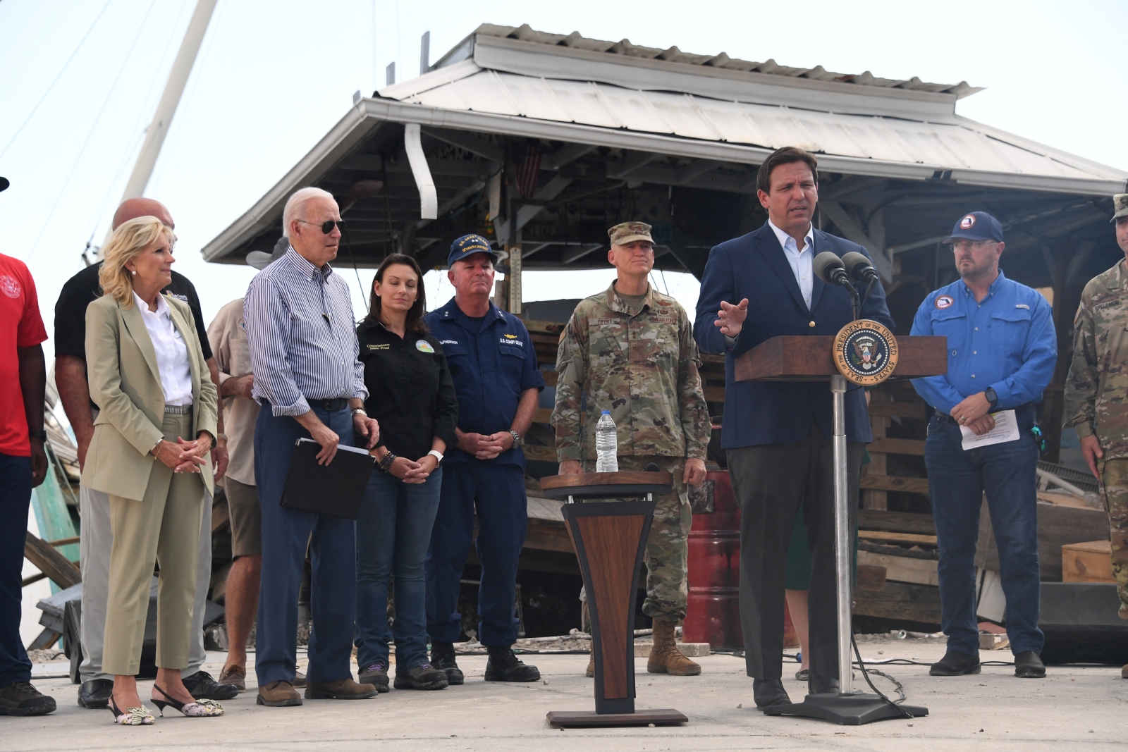
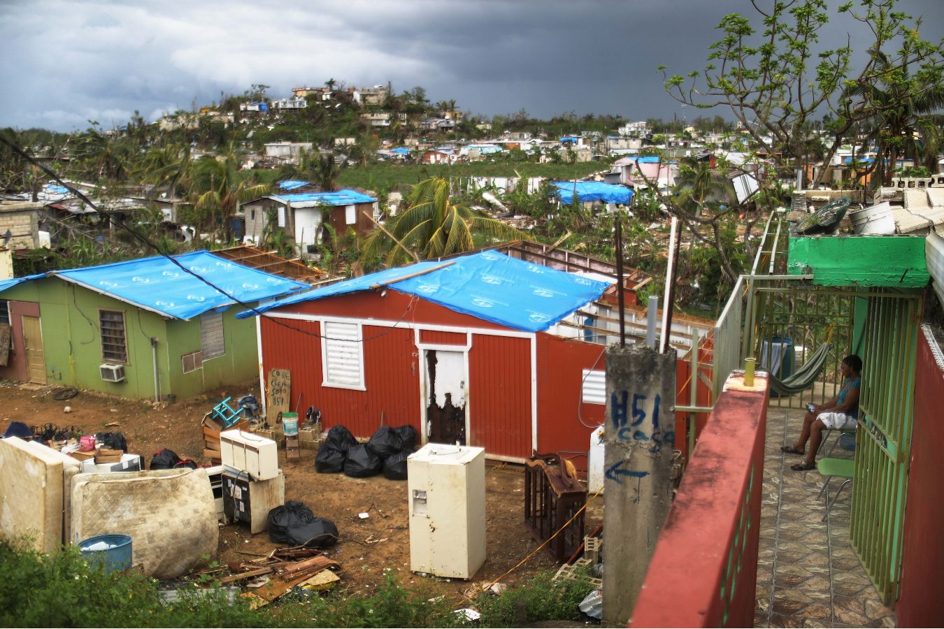
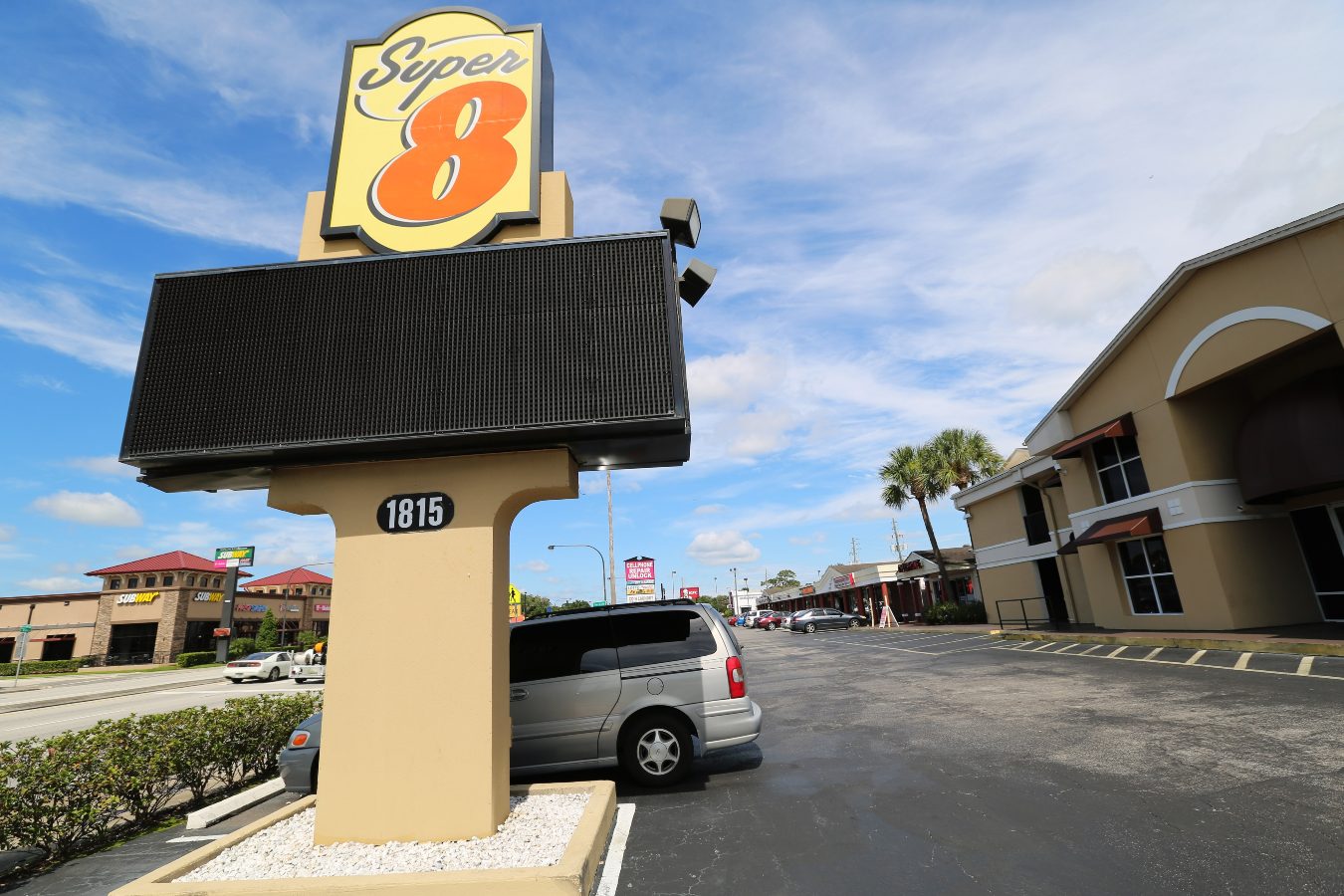
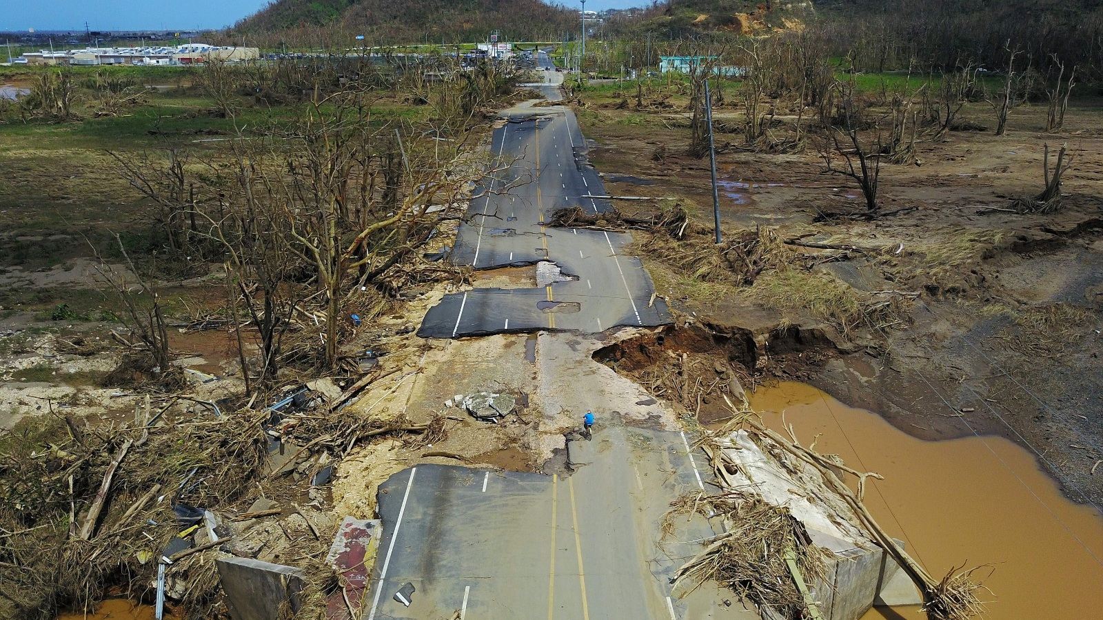
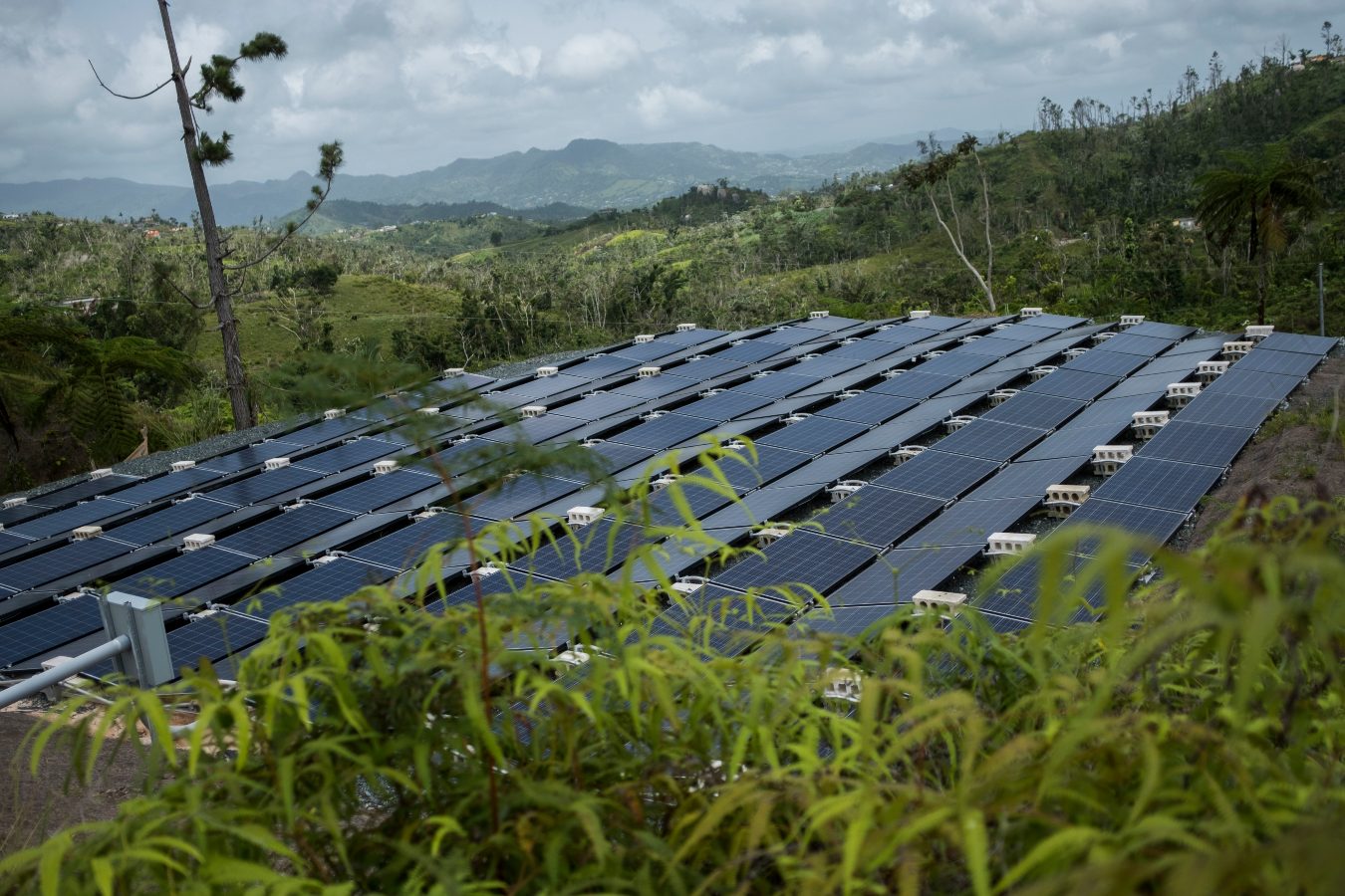

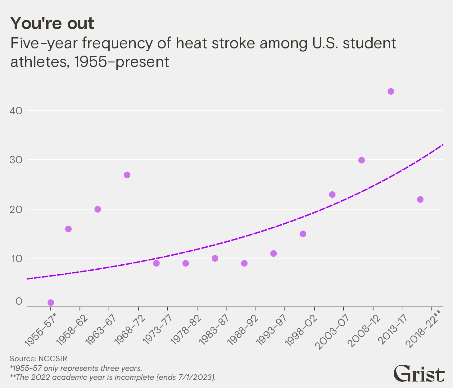
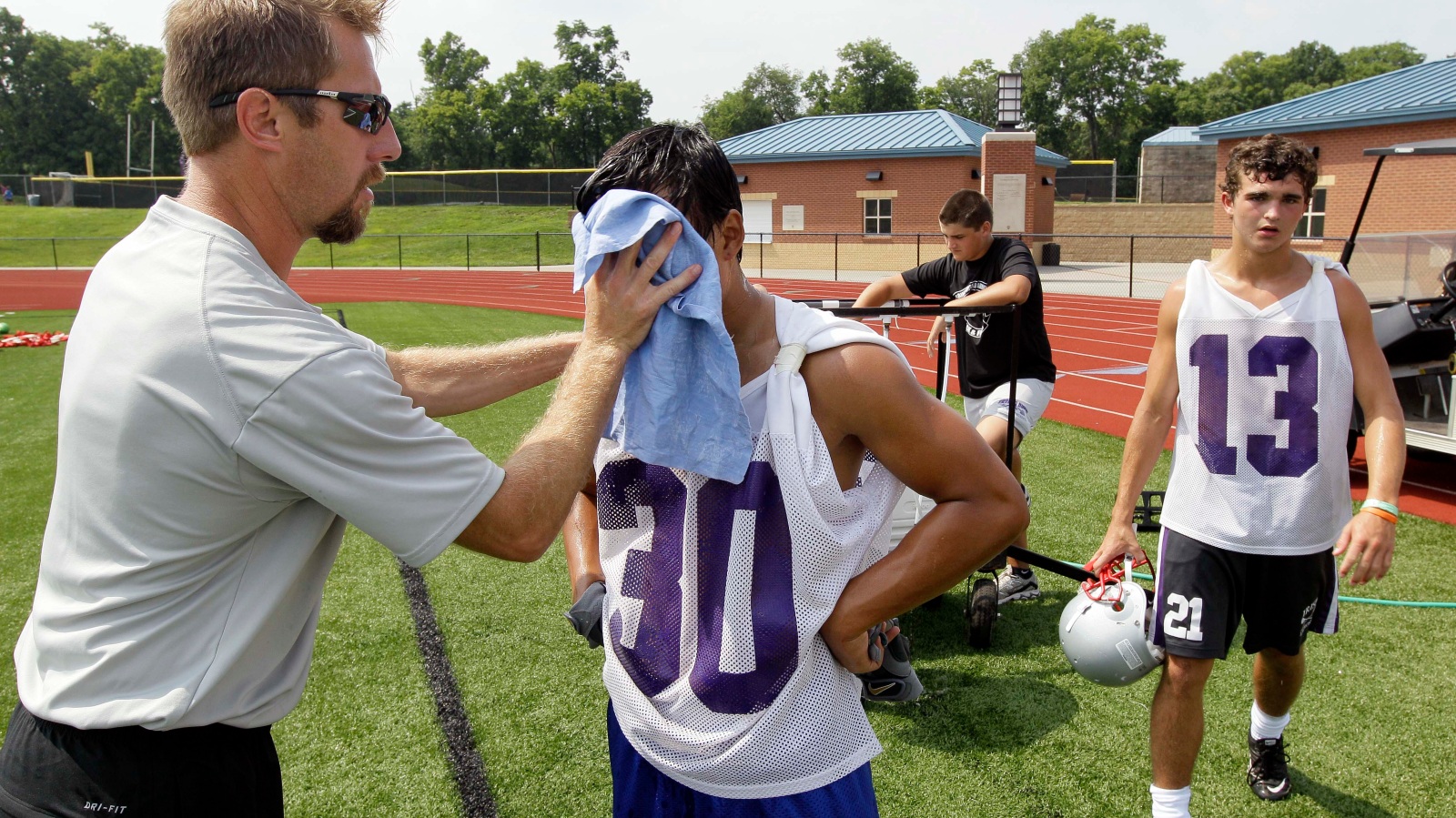
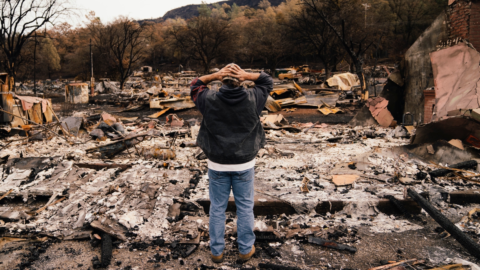
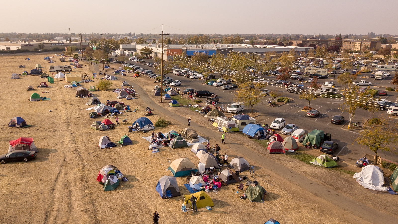
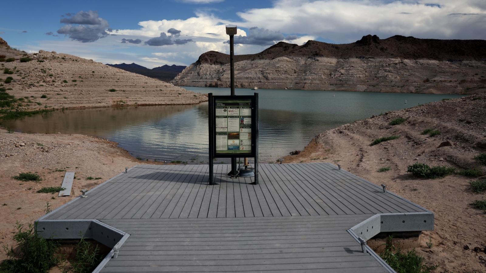
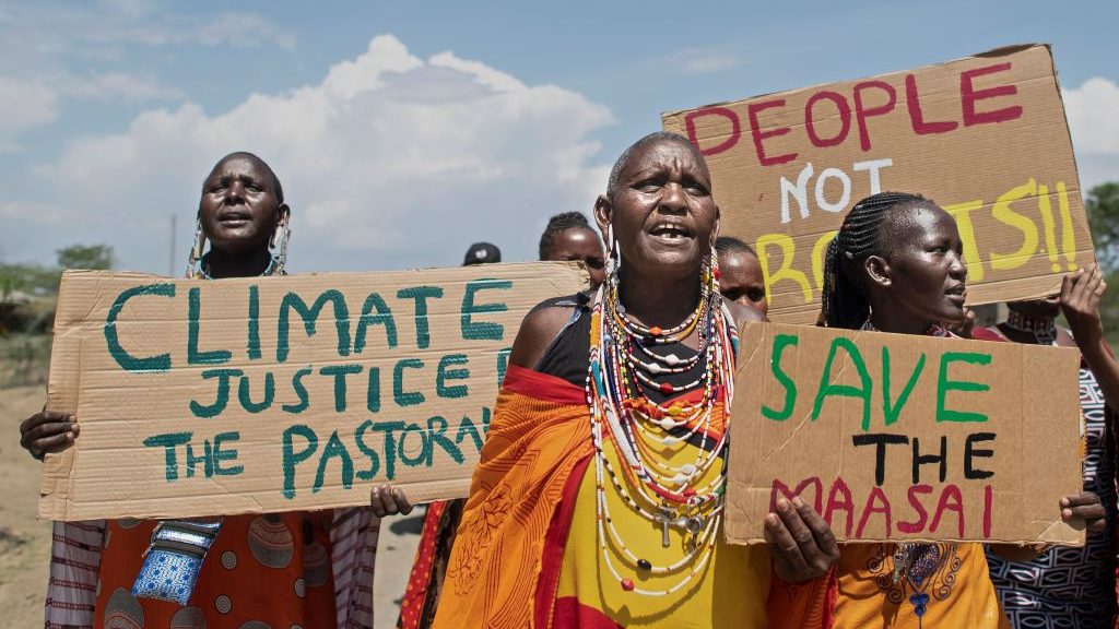
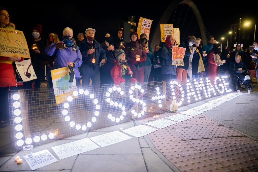
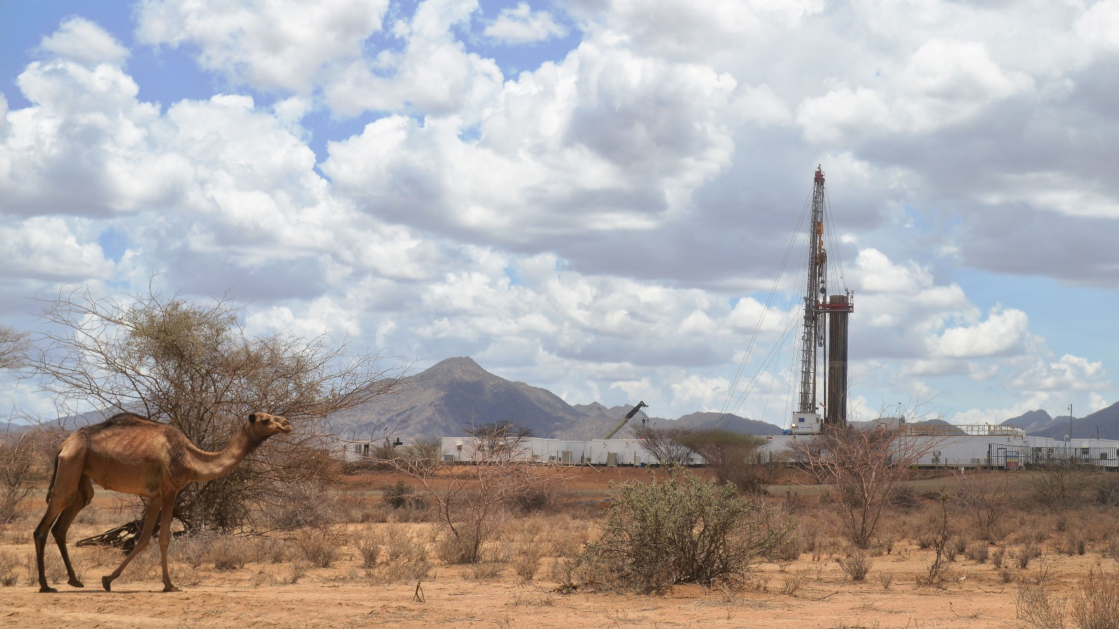
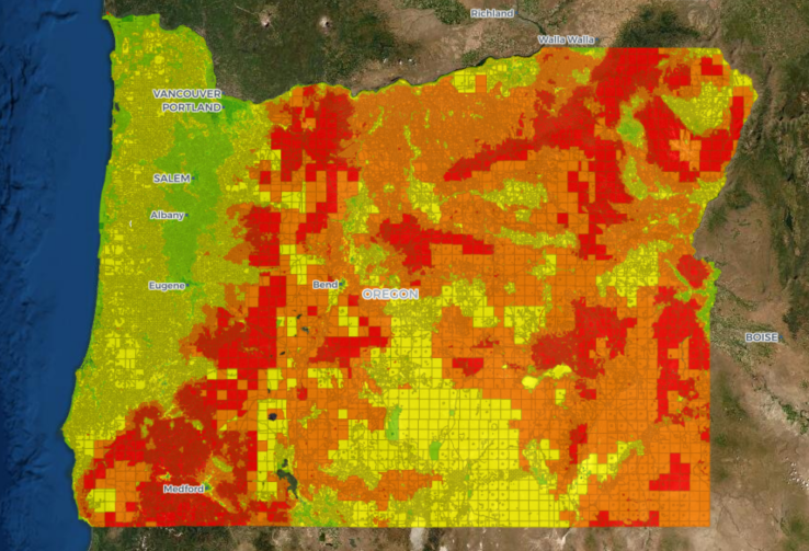

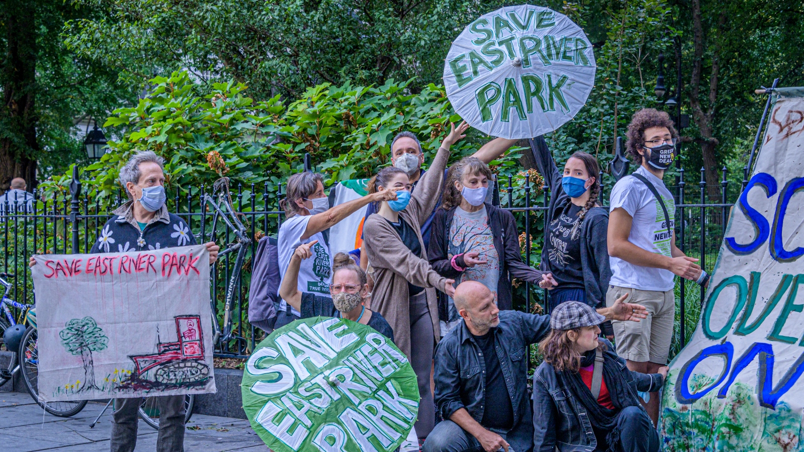

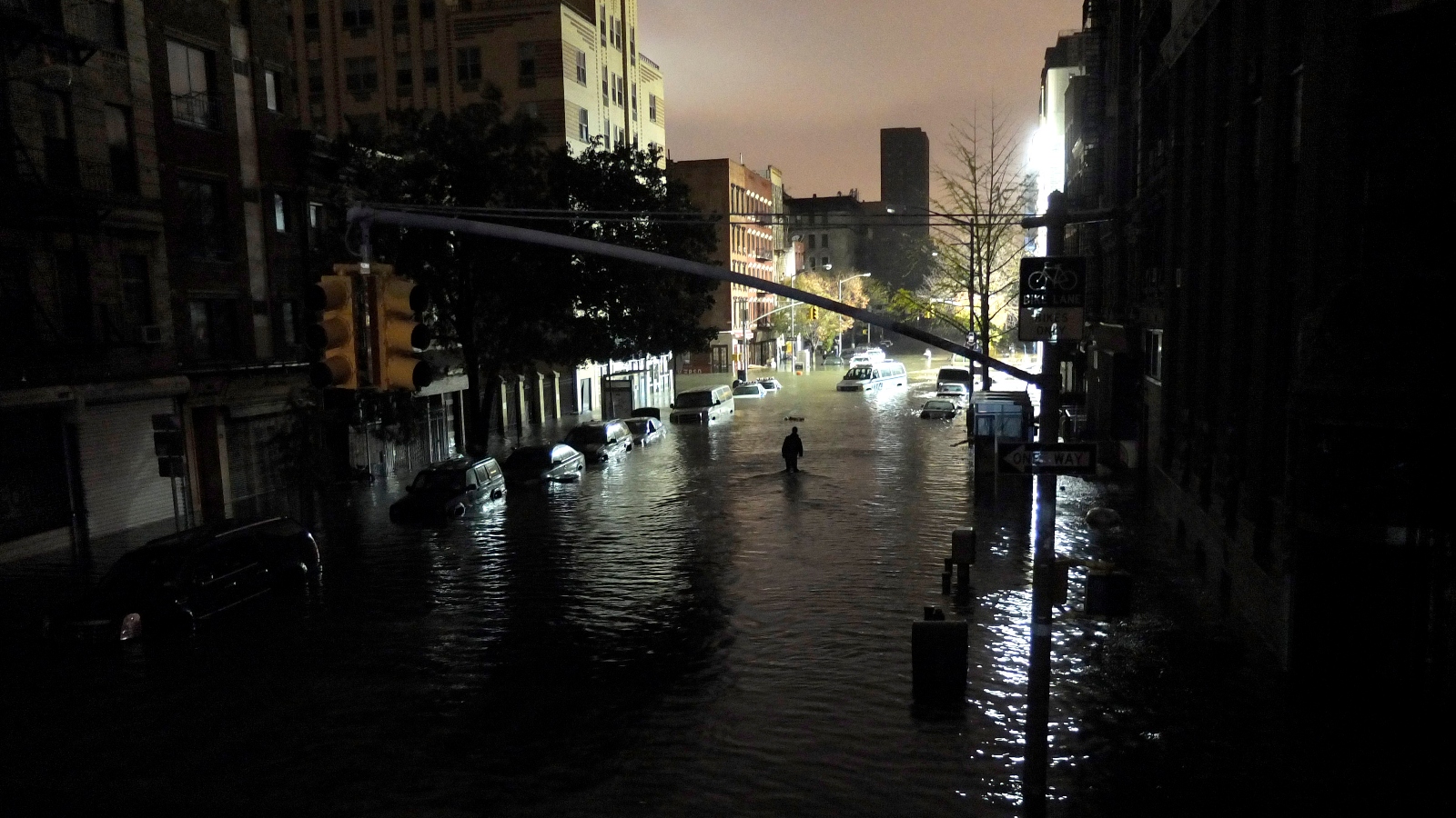

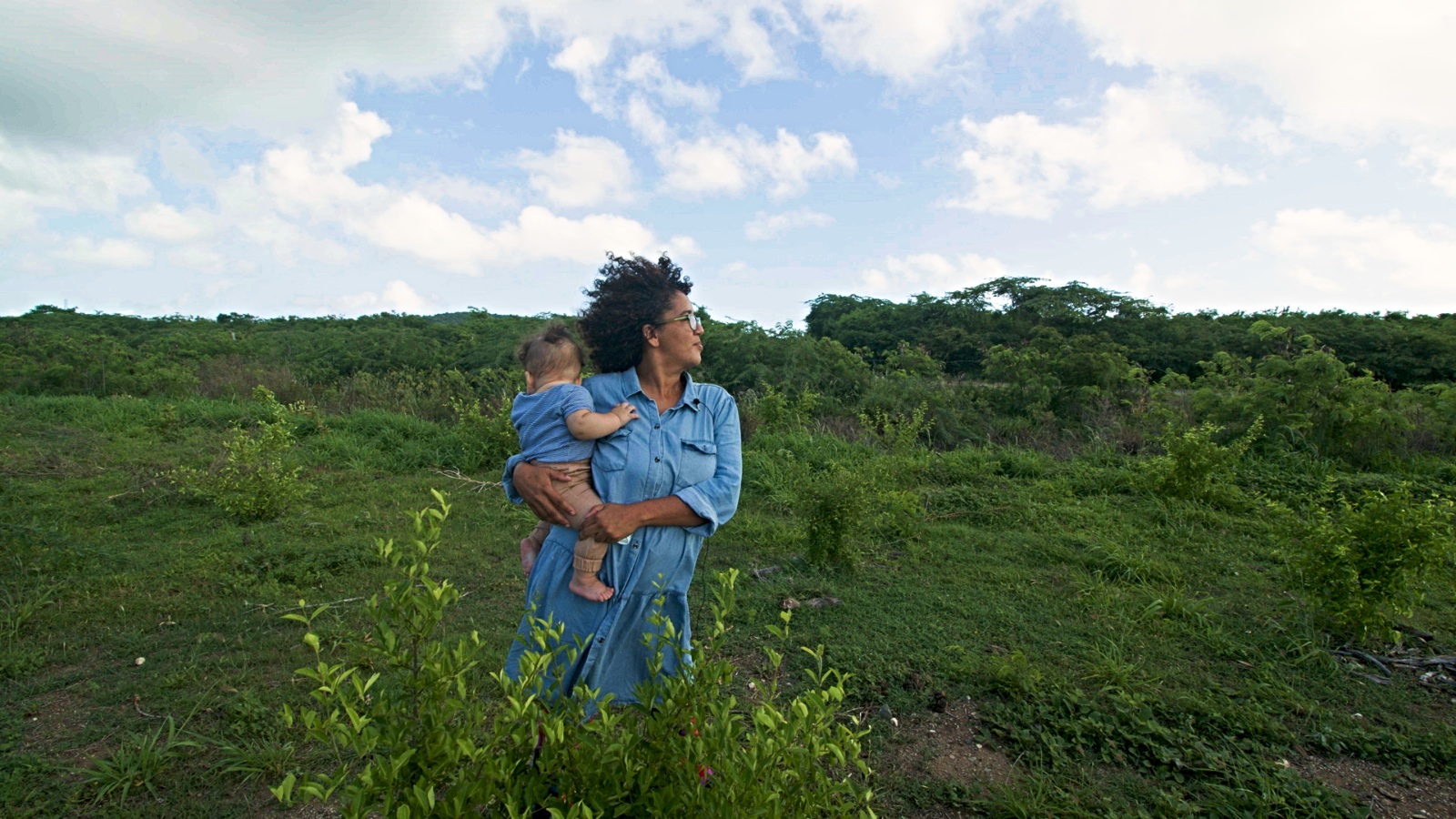


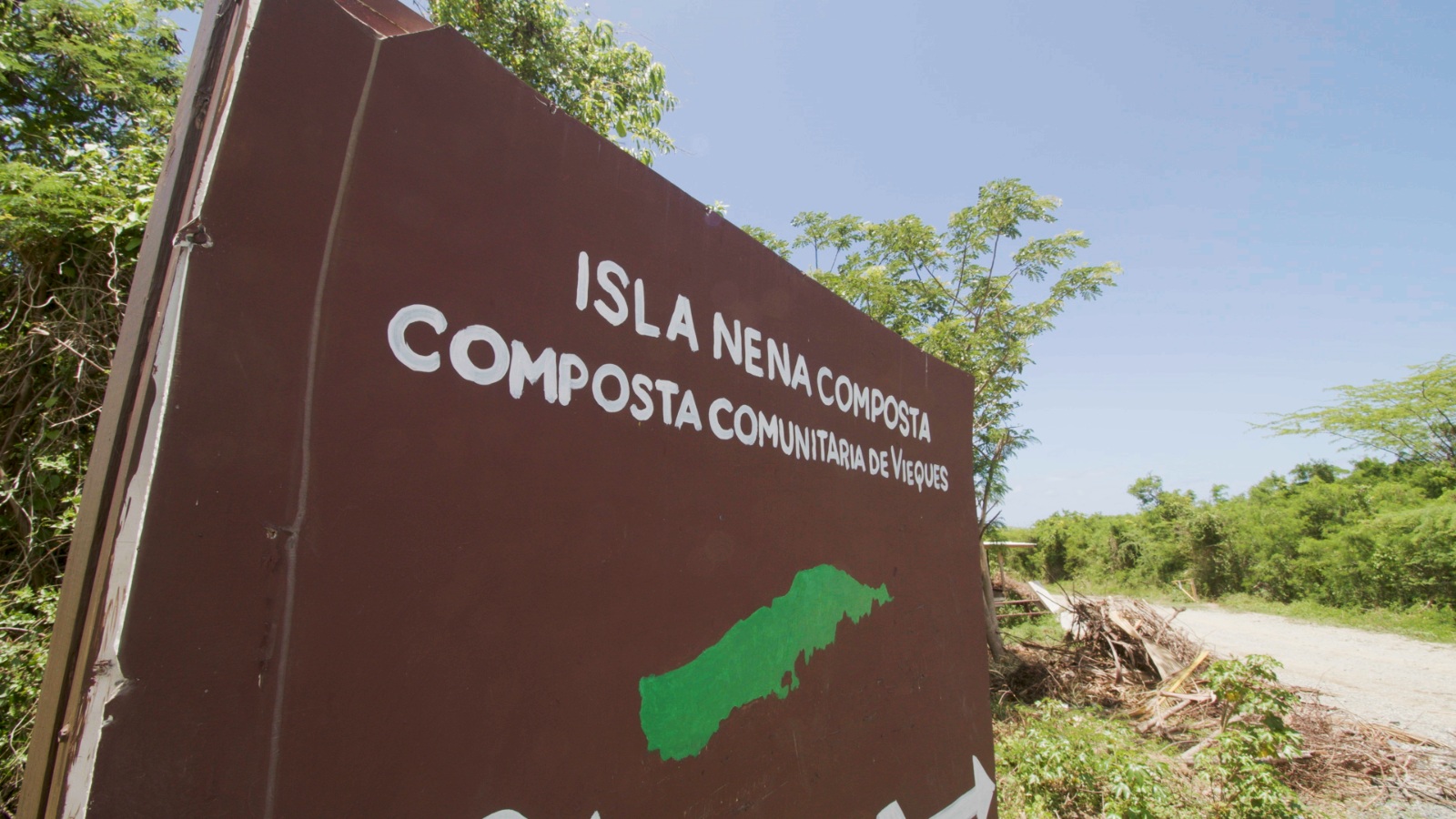


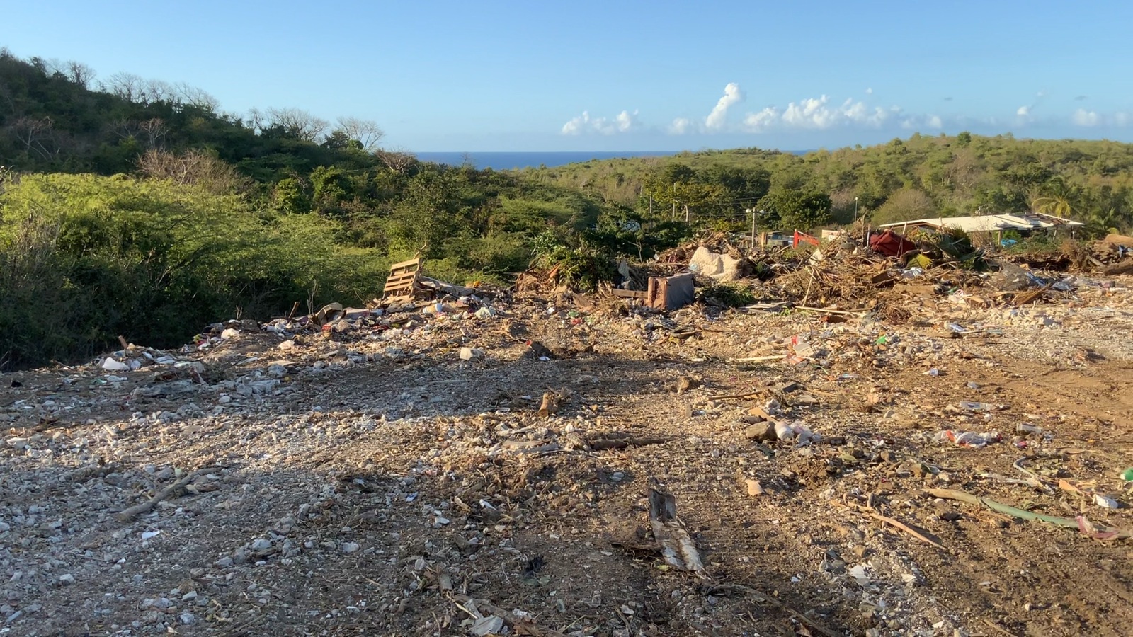

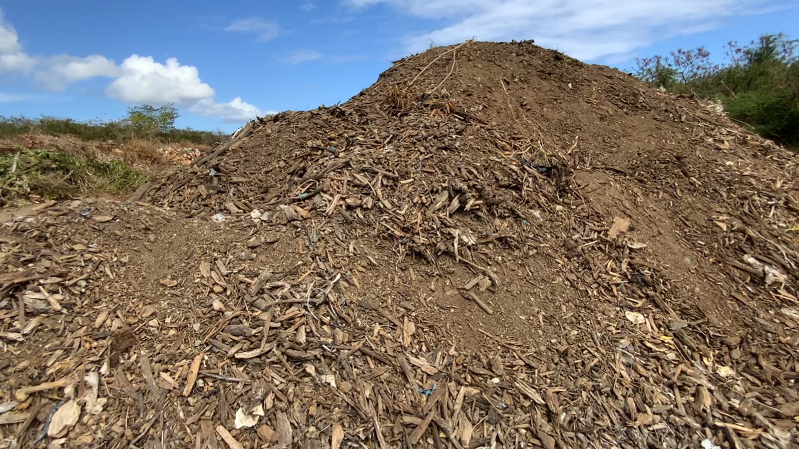


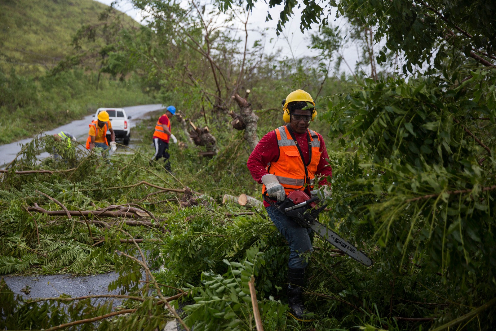
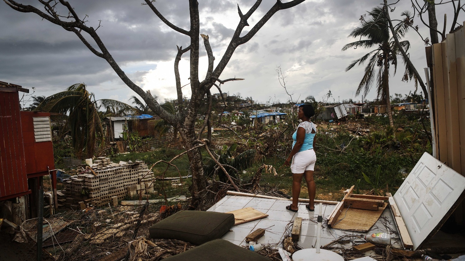
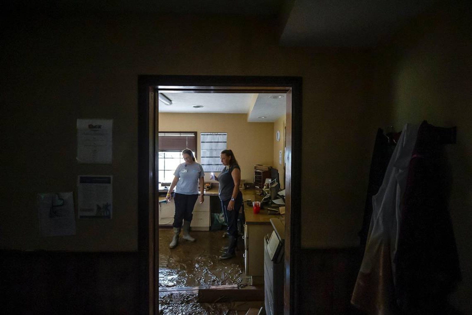
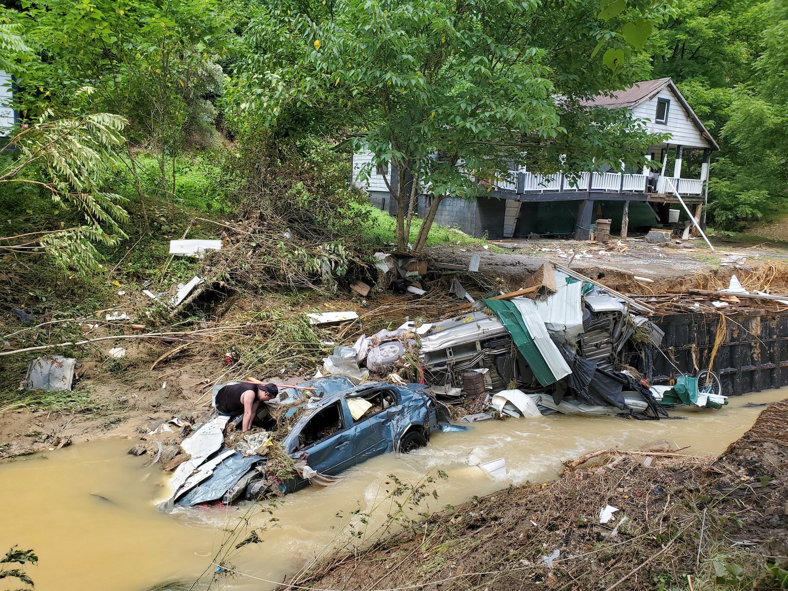