In Southern Africa, a series of cyclones and tropical storms have done enormous damage in Mozambique, Madagascar and Malawi.
The most recent Cyclone Gombe resulted in the displacement of thousands of people in Mozambique and Malawi. An earlier Tropical Storm Ana struck Madagascar along with Mozambique and Malawi.
Cyclone Gombe reached the coast of Mossuril district in Nampula Province in Mozambique on March 11. The severe tropical event was marked by winds as high as 190km/h (118 miles) with rainfall at 200/24h (7.874 inches).
Gombe came just two months after Ana which struck Mozambique in January. In addition to this there was Tropical Depression Dumako which landed in February. Just in Mozambique, 200,000 people were impacted in Nampula, Zambezia and Tete provinces.
Stretching for 186 miles along the border of Utah and Arizona, Lake Powell serves as one of two major reservoirs that anchor the Colorado River. Last week, the lake reached a disturbing new milestone: water levels fell to their lowest threshold ever, since the lake was created by the damming of the Colorado in 1963.
The precipitous drop is the result of the decades-long drought in the American West that has ravaged the Colorado River for years, forcing unprecedented water cuts in states like Arizona. This newest milestone on Lake Powell, though, is significant for another reason. The reservoir also sustains a hydroelectric power plant, Glen Canyon Dam, that provides energy to millions of people. That power source, critical for rural and tribal communities across the region, is now in jeopardy.
The federal government expects Lake Powell’s levels to rise again this spring as mountain snow melts across the West, but there’s still a significant chance that the reservoir will reach the so-called “dead pool” stage some time in the next few years, at which point it will stop producing hydroelectric power altogether. The dry spell has been causing slowdowns or shutdowns at power plants in California and Nevada, creating yet another challenge for officials trying to adapt to a seemingly endless water shortage.
If reservoirs like Lake Powell keep falling, millions of people across the West will have to turn to dirtier and more expensive energy at a time when transitioning to renewable power is of paramount importance for reducing carbon emissions.
The Colorado provides water for more than 40 million people. While the river has gone through several wet and dry spells over the past century, it’s never faced a challenge like the present “megadrought,” which scientists say has no precedent in the last millennium. As precipitation levels have remained low year after year, inflow from the river’s tributaries has slowed to a trickle, and its reservoirs have started to run dry.
When Lake Powell is full, its surface sits some 3,700 feet above sea level, but the reservoir hasn’t reached that threshold in some time. Water levels have fallen over the past several years of rainless winters, reaching a new low of 3,525 feet last week. The lake is now only a quarter full, and water levels are just 35 feet above the dead pool threshold for power generation. Officials say there is a significant risk of a dead pool in the next few winters.
Lake Powell’s “bathtub ring,” seen here in June 2021, is a marker of how far water levels have fallen during the West’s current megadrought.
Photo by Justin Sullivan/Getty Images
When federal officials built a dam at the southern end of Glen Canyon, forming Lake Powell, they assumed there would always be enough water moving through the Colorado River system to turn the turbines, and thereby generate a supposedly endless supply of cheap renewable energy. The customers who bought this clean power were rural towns, electrical cooperatives, and tribes, many of whom didn’t have many alternate power sources.
In recent years, as Lake Powell has begun to dry up, the turbines have become less efficient. The federal Bureau of Reclamation has already shaved down power deliveries from the dam.
“We are already seeing reduced generation from Glen Canyon Dam,” said Lisa Meiman, a spokesperson for the Western Area Power Administration, a government authority that markets hydroelectric power from around the region. “[Generation] has been dropping pretty consistently as the lake elevations have declined, so we’re about a third less efficient in terms of power production now than we are at an average elevation.”
When that happens, Meiman said, “we have to go out and purchase replacement power in the spot market, which is typically more expensive.” It also comes from dirtier sources like coal and gas, she said. For most customers who buy power from the dam, losing it won’t be all that big of a deal. For them, hydroelectric power accounts for only a fraction of their overall power needs, and any price increases get spread out over thousands of users, keeping costs down.
For some customers, though, the shutdown of the dam will be far more painful. Utility bills have already started to rise as the dam becomes less efficient, and a total shutdown would lead to significant cost increases for the small and remote entities that rely on it.
Hardest hit will be the 50-odd tribal nations dependent on hydroelectric power not only for residential energy needs but also to power revenue-generating commercial ventures like casinos. Thanks to generations of underinvestment by the federal government, many tribes that buy electricity from Lake Powell don’t have their own power generation capacity to replace it, and building new power sources isn’t cheap. According to a report produced by a consulting firm looking at the impact of a Glen Canyon Dam shutdown, tribal nations would experience the “the most troubling” consequences of the power loss.
The dam’s largest tribal customer is the Navajo Tribal Utility Authority, or NTUA, which provides electricity to some 30,000 residential customers on the Navajo reservation.
“It’s a very sensitive issue for all of us right now,” Walter Haase, the tribal utility’s general manager, told the Associated Press last week on the heels of the water level announcement from the Bureau of Reclamation.
The NTUA is spending millions of dollars to build out renewable energy capacity that could help soften the blow of a dam shutdown. Other tribes that can’t afford to build such new power sources, though, will have to pay higher rates for replacement electricity out of pocket, which could strain revenues. The consultants’ report pointed to the Hopi Tribe, which does not have a casino to bolster its finances, as being especially vulnerable to these cost hikes.
Small municipalities that depend on the dam are also feeling the pain.
“Hydro is very low-cost, renewable energy, [so] our energy costs will go way up,” said Bryan Hill, the general manager of Page Utility Enterprises. The company services the town of Page, Arizona, which sits on the edge of Lake Powell. Hill said he’s already been feeling the pain as deliveries have slowed down.
“They’ve got a tourniquet on in the form of slowing down the generation and trying to reduce the bleeding,” he said, “but we’re already losing money. Unless things change, there will be a significant rate adjustment.” The exact scale of that adjustment isn’t clear, but residents of Page who have come to rely on cheap power will see a noticeable rise in their annual bills. Because spot-market energy is also getting more expensive as the nation’s power system transitions from coal and gas toward renewables, the rate increase will be compounded.
Glen Canyon Dam isn’t the only hydroelectric source that’s struggled amid the drought: Power generation at the larger Hoover Dam in nearby Lake Mead has fallen by around a quarter, and officials in California shut down a hydroelectric plant at Lake Oroville last year as water levels in the lake fell below the generation threshold. The two dams together serve about 2 million customers. These power losses further drive up prices and strain the grid at a time when energy is already getting more expensive as older coal plants come offline.
To make matters worse, though, the power shortage in Lake Powell is intertwined with the larger water shortage on the Colorado. If the water level in Lake Powell continues to fall, federal officials will have to balance between the needs of water users and the needs of power users. If they hold enough water back in Lake Powell to keep the turbines running, they’ll be withholding water from farmers and homeowners who rely on it farther downstream. If they push as much water as they can toward the end users, they’ll spike the power bills of the small entities who rely on the dam.
The agency has yet to decide on its priorities should the historic lows continue, but time is running out. The latest models suggest there’s a 1 in 4 chance the dam won’t produce power by 2024.
“Glen Canyon Dam and Lake Powell serve many purposes, many divergent purposes,” said Meiman. “For a ton of stakeholders who are all going to be affected by declining lake elevations, there is not going to be a simple solution or an easy solution.”
Grounds cloaked in greenery weave around a towering ivory chapel in the heart of downtown Key West, Fla. Founded in 1832, St. Paul’s Episcopal Key West is not only the oldest Christian congregation in the area, but one of the oldest congregations of any religious tradition south of St. Augustine.
The church is on its fourth building, the first three lost to fires and a hurricane. After nearly two hundred years of its congregation working to keep it standing, Reverend Donna Mote, the newest rector at St. Paul’s, is now worried about a more subtle risk: rising seas.
“It would be a shame to preserve all these buildings, and then have people scuba diving in them in 100 years,” Mote said.
St. Paul’s is located on one of the highest points of Key West; one of the 1,700 islands that make up the Florida Keys, where 90 percent of the land mass sits only five feet above the Atlantic Ocean. While scuba divers won’t be visiting the church in the coming century, with seas rising and storms intensifying, the eight-square-mile island city is facing more frequent and chronic flooding.
Local officials and organizations are working to hold back the seawater climbing higher, threatening to plunge the area underwater by the turn of the century. But billion-dollar resilience projects in the pipeline — intended to raise roadways and flood-proof infrastructure to combat flood risk — will depend on community buy-in.
Just five months into her role at St. Paul’s, Mote intends to roll out a renewable energy audit of the church site to see how they can use cleaner energy. She also tries to set a sustainable example for her parishioners: She’s on a plant-based diet and encourages them to bike instead of drive, when possible.
While St. Paul Episcopal Key West sits on land high enough to protect it from all but the worst storm surges, a Climate Central analysis found that by 2080, rising seas will introduce a 1 percent annual chance of coastal flooding to the church’s property. That creates a one-in-four chance of a flood impacting the site every 30 years — a hazard so severe only 3 percent of the U.S. population currently lives in areas subject to this kind of risk.
Mote belongs to one of several faith-based communities in Florida turning their attention to climate action, making religious cases for environmental preservation, clean energy, and emissions reductions. At St. Gregory’s Episcopal Church in Boca Raton, parish members lead beach clean-ups. The First Presbyterian Church of Tallahassee donates to the city’s sustainability carbon fund as they seek to reduce their carbon footprint to net zero. The First Baptist Church of Orlando has been recognized by the U.S. Environmental Protection Agency for reducing pollution through energy efficiency.
Experts and faith leaders say provincial places of worship have a leading role to play in facilitating that support, and helping people engage in local environmental and justice issues. “We can either preach now to help people realize this,” said Ryan Gladwin, Palm Beach Atlantic University associate professor of ministry and theology. “Or we’re just going to have to be mourning with them, in the future, what we’ve lost.”
Key West is home to more than 24,000 permanent residents and attracts millions of tourists each year. Cobblestone walkways line tourist-saturated storefronts, adjacent to a sprawling, weathered dock overlooking the ocean. It’s picturesque until it starts to pour. Many locals are quick to name two converging streets downtown — Front and Greene — as frequent flood zones. In the lowest-lying parts of the longest island in the archipelago, heavy rainfall and high tides cause streets to flood, damage homes, and submerge vehicles. Monroe County expects another 17 inches of sea-level rise by 2040.
“The flooding has definitely been more than I’ve ever seen,” said Stephanie Piraino, manager at the Key West Key Lime Company, just a two-minute walk from the waterfront. Piraino said heavy rains can be brutal on the older properties and high tides often mean she’s taking her shoes off before wading through ankle-deep water in the parking lot.
Hurricane Irma swept through in 2017, the force of the Category 4 storm surge strong enough to flip the store’s giant hundred-pound freezers upside-down. “We had everything covered. We put tarps in front of everything, did the sandbags with wood next to the door, but there’s really no way around it,” she said. Up to a foot of seawater came in.
After Irma made landfall, Piraino remembers how a handful of local churches supplied donations to those in need. “Bug spray and charcoal saved the week for me and my kids,” she said.
Downtown Key West. mauinow1 / Getty Images PLus
She used to live in a trailer in the nearby community of Stock Island, where dealing with chronic flooding was just a part of life. “Every time there was a high tide, the water would flood so much that it would come all the way to my front porch,” she said. She’d often struggle with electrical outages because of seawater submerging parts of her mobile home.
With an average housing market value of just over $700,000, Key West is one of the most expensive cities to live in Florida. Workers need to earn $33 an hour to afford rental rates, according to the Florida Housing Data Clearinghouse. Although more than 11.6 percent of the population falls below the national poverty threshold, the city only has 390 properties set aside as affordable housing stock for those that can’t manage steep rental costs. Black, Indigenous, and Latinx people make up the highest proportions of extremely low-income renters. In Key West, where 37 percent of the population are Black or Hispanic, more than 43 percent of those residents live in poverty.
It’s those residents who feel the consequences of climate change more intensely. Post-disaster government assistance programs are structured in ways that disadvantage them. “The least expensive, or the most affordable housing, also tends to be the most unsafe,” said Tom Callahan, executive director of Monroe County’s Star of the Sea SOS Foundation, run by the local Catholic church, which distributes 2 million pounds of food every year to nearly 10,000 residents in the Keys.
Nonprofits and places of worship are critical resources for those community members reeling from a hurricane or flood. Churches are often a place of solace for residents seeking help, offering everything from food to housing repairs to counseling.
Many also serve as staging areas during a storm, or places to stay for emergency response volunteers. A 2020 FEMA assessment of faith-based responses to disasters found that after Hurricanes Katrina and Rita hit Louisiana, “local churches and community organizations often served disenfranchised groups missed by formal response efforts.”
The Star of the Sea Foundation lost its roof during Hurricane Irma; it took six months to rebuild. Restoration funding came partially from the Archdiocese of Miami, which is made up of 118 Catholic parishes and missions spread across South Florida. Archbishop Thomas Wenski oversees all of those coastal congregations, where he says people are reminded of climate change every time there’s a hurricane or high tides.
But as oceans rise, so do social divides. Climate gentrification is threatening affordable housing in Miami and across the region, as developers pour investment into premium elevation areas, pricing out existing residents.
Faced with employment instability, rising rent, and increasing floods, Callahan said a similar story is unfolding in Key West, as many moved north to find affordable housing options and work. Four percent of the Keys population left following the 2017 hurricane because of a lack of affordable housing options. Three years later, the coronavirus pandemic meant the islands were sealed off for months. Since then, many businesses have rebounded, but the recent, record-breaking surge of the COVID-19 delta variant in Florida has exacerbated the problems.
In June, Monroe County moved forward with a $1.8 billion plan to raise 150 miles of roads over the next 25 years. But that elevation solution will only apply to unincorporated roads in Monroe County, or non-governed areas outside of city limits.
Earlier this year, the U.S. Army Corps of Engineers released a storm risk management study for the Keys that proposed investing almost $3 billion into floodproofing infrastructure and elevating nearly 4,700 homes, 43 percent of which are located in Key West, costing the city about $1.2 billion. The federal government will cover 65 percent if it is approved by Congress. The proposal is being formally submitted soon, according to Monroe County Chief Resilience Officer Rhonda Haag.
Silhouettes of boats and yachts by Mallory Square of Key West, Florida. krblokhin / iStockphoto via Getty Images Plus
“We have a list of infrastructure projects and we’re ready to move forward, but the biggest problem is the funding,” Haag said. Increased taxes will be likely. “We’re going to need the residents and businesses to work with us.”
Houses of worship could wield considerable influence on a small island. “Stories move people, right? And we know that pastors are very, very effective public speakers,” said Erum Sattar, a lecturer at Tufts University and a former Harvard Law Visiting Fellow of The Program on Law and Society in the Muslim World. “They can get to your heart and they can motivate action.”
But after working for the city for nine years and living in Key West for more than two decades, city of Key West sustainability coordinator Alison Higgins can only think of one local church that has been vocal about climate change.
That doesn’t mean it isn’t on their minds, though. “There’s no concern about flooding at this site, not at 11 feet above sea level,” said Reverend John Baker about the Basilica St. Mary Star of the Sea, one of the largest and oldest places of worship in Key West. “But if there’s a storm surge, it doesn’t matter if you’re 11, or 20, feet above sea level, you don’t know what’s gonna happen.”
A Climate Central analysis found that by 2070, about half the Basilica site will become subject to occasional flood risk. By 2080, the whole area will face at least a 1 percent annual chance of flooding. By century’s end, the likelihood of flooding for the more than 200-year-old church property will increase 10-fold.
Baker’s led the only Catholic church on the island for 14 years. He’s less worried about flood risk at the church, and more about the consequences of climate change for the region. Although he’s quick to cite Pope Francis’s 2015 encyclical, a landmark document credited with driving faith-based environmental action, Baker doesn’t believe it’s his role to engage his congregation on the need for climate action.
“I talk about Jesus Christ. And that’s why people come here. To discuss something that’s a controversial issue, you’re not bringing people together,” Baker said. “It’s best to not touch it because of that divisiveness,” he added.
A new study published in Environmental Research Letters found that over the last five years, a majority of U.S. Catholic bishops have been “nearly silent and sometimes even misleading,” in their official messaging to parishioners about climate change and the pope’s encyclical.
But a member of the Basilica St. Mary Star of the Sea’s congregation, Callahan, from the food bank, doesn’t think local government is doing enough to prepare for climate change, especially for the groups that need it most.
“Climate change is the 800-pound gorilla that the county is trying to ignore,” Callahan said. “But they have finally, most recently, at least, started looking at it.”
The city’s preparing an adaptation plan for vulnerable infrastructure, like the low-lying roads and historic buildings already enduring flooding, which they expect to be ready by 2023. They’re also collaborating with the U.S. Navy to map flood patterns by tracking high tide as it moves through the island.
“I think it’s kind of a good thing that we have been getting our feet wet once in a while,” said city sustainability coordinator Higgins. “You’re learning to live with that water because that’s what you’re going to have to do if this community is going to survive.”
Higgins hopes more religious sanctuaries will get involved with their adaptation and mitigation plans. “They’re an incredibly trusted messenger,” she said. She sees those collaborations as opportunities for local places of worship to help amplify support for such initiatives; including everything from urging their congregations to get involved with ongoing projects to planning events that promote them.
“They can call me anytime to come and talk to them about how we can work together.”
In the meantime, some faith leaders like Mote, from St. Paul’s Episcopal, are taking the moral call to environmental action more urgently. Mote has a background in disaster chaplaincy, or providing on-the-ground spiritual guidance to those affected by a crisis, such as a hurricane, and has trained other members of the clergy to be effective first responders.
“We are called to be on the ground in the wake of a disaster,” Mote said. “What about our role in addressing the factors that are leading to the increase of these disasters?”
When you hear wireless internet providers talk about “expanding the 5G cellular Network,” your first thought is probably, “Oh good.” That’s because there’s a lot of wireless data streaming to the world’s many many smartphones, tablets, and laptops. But scientists are increasingly worried that all that mobile device bandwidth will come at a cost — our ability to forecast the weather quickly and accurately.
While most people know that they’re paying their wireless provider to connect them to the internet, they may not realize that wireless providers are tapping into a finite resource: a narrow band of radio frequencies known as spectrum (not the cable company). Spectrum-range radio wavelengths are unique for a few reasons. For one thing, they can transmit data through solid objects – such as the walls of your house or windows of your car – making them ideal for wireless communication. But they are also important because the Earth’s atmosphere naturally emits radio waves, which can be picked up by satellite sensors and translated into weather data like temperature and precipitation.
The problem is, the radio wave frequency used by wireless cellular networks is similar to the ones used to monitor atmospheric conditions; the 24 GHz band is increasingly being used for telecommunications – notably for 5G cellular networks. The nearby 23.8 GHz band is reserved for scientific purposes, including weather satellites. As these two spectrum bands come under greater use, they can interfere, making the dissemination of weather and climate information slower and less accurate.
Wireless data bandwidth can be a bit like a highway in a growing city. Unless more highway lanes are added as the population grows, traffic will get worse. As more and more people receive wireless service, the signal can slow if companies don’t look to expand bandwidth for mobile devices. As a result, many companies are asking the Federal Communications Commission, or FCC, to auction off additional spectrum bands for wireless communications.
Federal Communications Commission Chairman Ajit Pai, looks at his electronic device before testifying before a Senate Appropriations Subcommittee hearing about the spectrum auctions program for fiscal year 2021. Chip Somodevilla / Getty Images
But atmospheric scientists say auctioning off additional spectrum bands could reduce their ability to give communities a heads-up about extreme weather events like hurricanes and tropical storms — events in which time is of the essence in order to save lives.
“This would degrade the forecast skill by up to 30 percent,” said Neil Jacobs, former acting NOAA Administrator, in a 2019 federal hearing about interference between cellular and scientific spectrum bands. “This would result in the reduction of hurricane track forecast lead time by roughly two to three days.”
Precise and timely information about the weather is especially important in our age of extreme weather. In 2012, for example, the National Hurricane Center was able to give the state of Louisiana an accurate prediction for when and where Category 1 Hurricane Isaac would make landfall about two days in advance of the storm. The original warning came five days in advance but misestimated the location of the landfall by 250 miles. The two-day lead time still gave the Federal Emergency Management Agency and the state time to alert people about the risk and make evacuation orders.
In the end, the storm resulted in about $612 million in damages and at least 5 deaths in the state. Without that forecast correction, it’s likely many more lives would have been lost.
A satellite view of Hurricane Isaac in 2012.
Stocktrek Images via Getty Images
But getting a storm’s theoretical timing and trajectory right is notoriously tricky. Atmospheric water vapor – a crucial component in weather forecasting and climate modeling – primarily releases radiation in the 23.8 GHz frequency spectrum band. In a 2021 hearing before the House Committee on Science, Space, and Technology, David Lubar, Senior Project Leader of the Civil Systems Group at the Aerospace Corporation, described the water vapor monitoring as “trying to hear a whisper in San Francisco while standing 500 miles away in San Diego.”
For this reason, federal law and international agreements state that the 23.8 GHz spectrum band should be reserved for earth science and radio astronomy observations only. Sensors on some satellite systems operated by the big federal agencies like the National Atmospheric and Ocean Administration, or NOAA, and National Aeronautics and Space Administration, or NASA, are designed to pick up these signals. Interference from adjacent spectrum bands — also known as “out-of-band” emissions —has been a concern of the remote sensing community for quite some time. For satellite sensors that rely on incredibly sensitive measurements to provide accurate weather forecasting data, this problem is magnified.
A figure presented to the House Committee on Science, Space, and Technology shows satellite microwave radiometers’ “noise floor” as it relates to atmospheric data. Interpreting the signals requires extremely sensitive measurement devices and many scientists are worried about interference from wireless carriers. Committee on Science, Space, and Technology, U.S. House of Representatives
Scientists, however, have felt left out of the decision-making process as the FCC continues to auction off nearby spectrum bands for commercial uses.
“The FCC process is very complex and confusing for the scientific community, and most scientists do not have the resources available to them or advocates for such a process,” Bill Mahoney, Director of Research Applications Laboratory at the National Center for Atmospheric Research, said in the same hearing.
But there are things the government could do to limit spectrum band interference. Following a 2019 auction in which the FCC issued 2,904 commercial licenses to use the 24 GHz spectrum band, the commission proposed limits on spectrum interference. But these out-of-band emissions standards were significantly less stringent than what the scientific community had advocated for.
As a result, experts say commercial spectrum interference could bring U.S. weather forecasting accuracy back to levels not seen since the 1970s.
This loss in weather forecasting accuracy could also be quite costly. While the FCC’s 2019 auction of the 24 GHz spectrum band generated $2 billion in revenue for the Department of the Treasury, the costs from severe weather could be much greater. During the 2021 hearing, Mahoney noted that out-of-band emissions are degrading forecasting accuracy “during a period when our country is facing significant increases in billion-dollar weather disaster events.”
With commercial spectrum allocation likely to continue, some proposals have been made to protect weather forecasting accuracy despite interference. The government could limit spectrum band interference. Similar to sound-proofing a studio to make sure you don’t bother your neighbors, “out-of-band” emissions can be reduced. In the 2021 hearing, Lubar recommended adding devices to satellite sensors that “would identify the interference contamination, do some significant computation on the spacecraft, and flag that data so that it doesn’t contaminate the downstream weather process.” Presently, however, there is no funding allocated for NASA’s or NOAA’s joint satellite missions to provide such an instrument.
A spectrum mitigation plan will likely be needed as the FCC is considering future proposals to share more bands. In particular, the agency is considering sharing the 1675 to 1680 MHz frequency band. That’s the same band used by NOAA’s Geostationary Operational Environmental Satellite to provide real-time weather information – notably for severe weather and flooding.
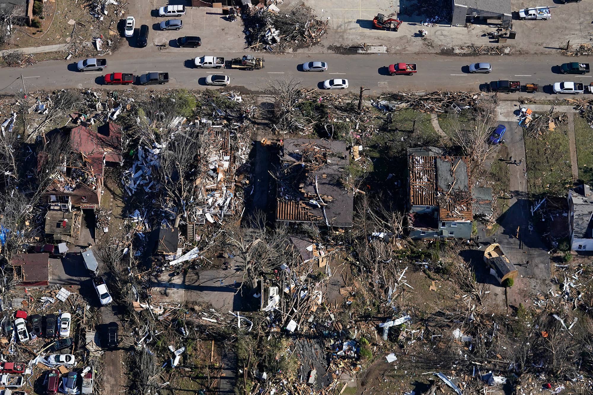
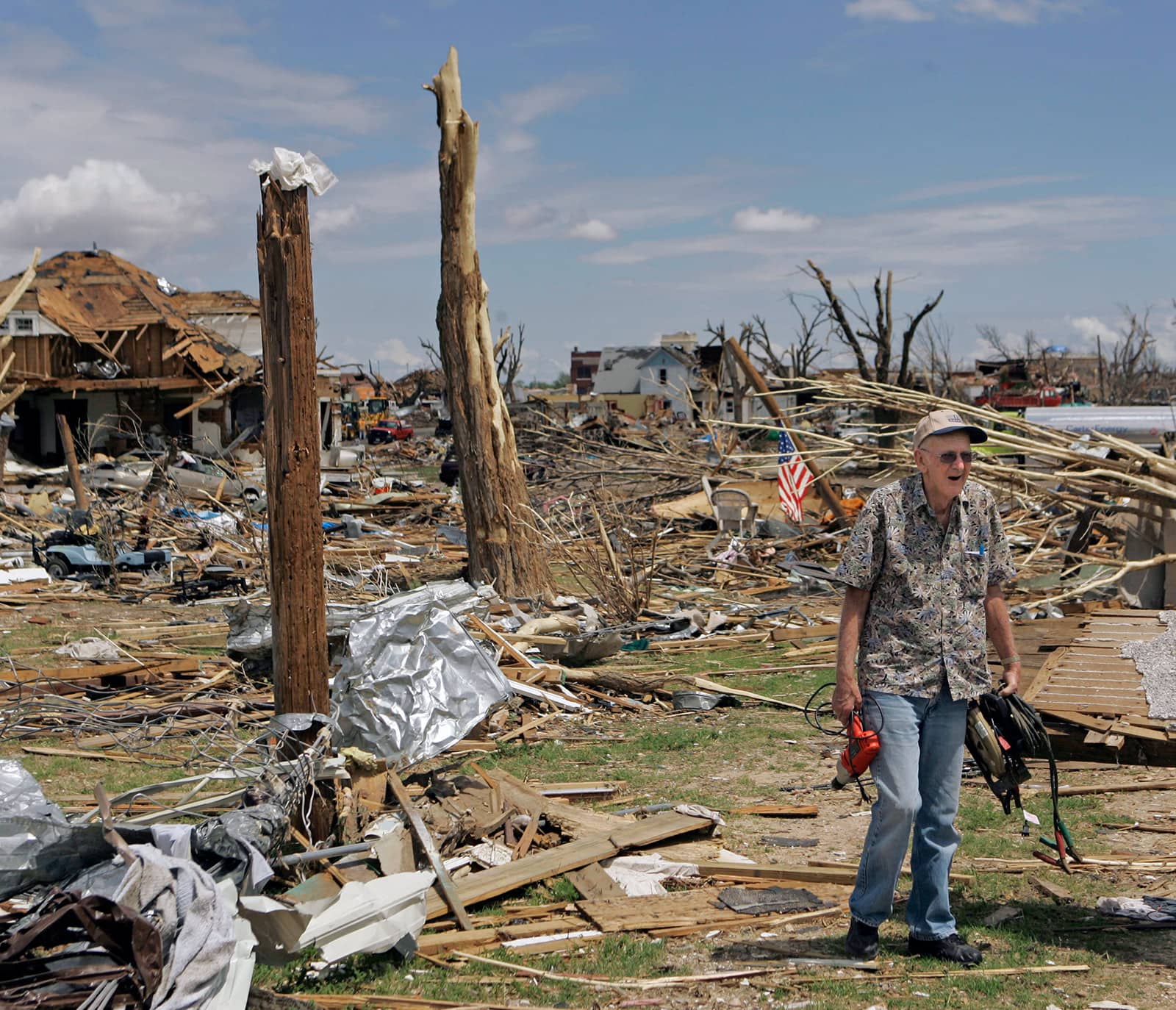
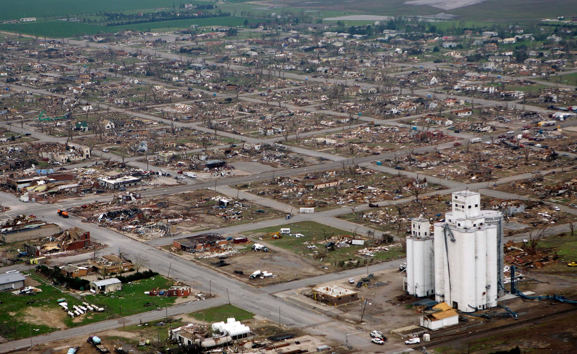
The instinct to return home, and the planning, saving and grappling with underinsurance that requires, is unfolding amid the backdrop of the western United States’ worst drought in 1,200 years and what’s morphed into a year-long fire season. Winter wildfires by the names of Emerald and Airport have scorched thousands of acres in California; led to the destruction of over 100 structures in Kansas; and amid this writing, prompted the evacuation of 1,100 houses in the Florida Panhandle — at a time of year when those with intimate knowledge of the cycles of burning and regeneration once relied on wetter and cooler conditions to keep blazes at bay.
According to a February 23 report by the United Nations, extreme wildfires such as the Marshall fire are on track to increase by up to 50 percent by 2100 due to the climate crisis. “We have reached a point where there is no future scenario in our lifetimes that does not see an increase in wildfire,” Molly Mowery, executive director of the Community Wildfire Planning Center, told Truthout. “So we must accept fire and learn to live with it.”
But in Colorado, many looking to build back on their land have no plans — or no ample budget — to upgrade the houses they’ll erect again to be any less flammable than the structures that just burned down.
Colorado is one of just eight states without a minimum building code, and some critics are urging officials to act on this problem. The lack of comprehensive state policy means that fireproofing is not required in Superior and Louisville, the towns that were leveled by fire on December 30, so residents may build back with the same combustible materials.
In contrast with Colorado, Oregon passed a wildfire mitigation bill requiring a set of uniform standards in high-risk areas in 2020, following a slew of destructive fires. Early research shows that enforcing a building code that includes fire-resilient materials may reduce the chance that a building is lost during a wildfire by 40 percent, according to a December 2021 working paper by the National Bureau of Economic Research.
Beyond the Forest
Numerous factors are at play in the rise of extreme fires, wildfire ecologists say. A heightened concentration of oxygen in the atmosphere as a result of changing climatic conditions, for instance, acts on smaller fires much like blowing on embers to stoke flames in a wood stove. A paper published in February 2022 in Nature found that an increase in nighttime temperatures across burnable areas of the earth has had the overall effect of weakening the “brakes” on wildfires — the overnight window during which a landscape is less flammable, dew sets in and flames die down — thus allowing for even longer, stronger fires.
Another major factor driving the rise in destructive and traumatic fire events is the expansion of human designs — namely, suburbs — into what’s known as the wildland-urban interface (WUI), where the built environment intermingles with ecosystems lush with flammable vegetation. Nearly a third of all wildfires in the U.S. occur in the WUI — just about all of them caused by human activity such as downed power lines, fireworks, cigarettes, and potentially in the case of the Marshall fire, which is still under investigation, smoldering underground coal mines.
And yet we continue to build in the WUI. According to a study of public records on 200 million parcels accessed through Zillow, between 1992 and 2015, the number of residential homes built in the WUI rose by 32 million. That’s on track to double by 2030.
“The general public tends to think that they aren’t in a fire-prone environment if they don’t see the forest right up against the neighborhood,” John Abatzoglou, head of the University of California Merced’s Climatology Lab, told 5280, of the grassland areas throughout Boulder County. “By thinking that way, we may be increasing the vulnerability of communities that are not in forested environments but are still quite fire-prone,” Abatzoglou said.
As some social scientists point out, the expansion into these hyper-flammable zones is also driven by our system of unencumbered economic growth and the absence of a strong social safety net. Unaffordable housing has pushed some residents to purchase homes or build in the WUI, where it’s cheaper, further expanding burnable structures in the most flammable places.
Often, discussions around resilience to fire center on hardening homes through measures such as surrounding a foundation with gravel and blocking vents with mesh to prevent materials like pine needles and embers from getting inside.
But Sasha Plotnikova, an independent scholar and architect based in Los Angeles, told Truthout that we also need to look at the often-horrendous conditions that working-class tenants and unhoused people are forced into. “As long as the places where we live are understood as commodities, we’ll only further entrench ourselves in a system premised on the exploitation of poor people and natural resources,” Plotnikova said.
The Housing Crisis Is a Fire Factor Too
In Louisville, Colorado, the coal-town-turned-suburb that the Marshall fire leveled, Mirek Maez, general contractor and owner of Cooper Building Group, says supply chain issues and the doubling in cost of building materials means the lumber and metal plates he’s ordering to help residents build back won’t show up for a year and a half.
“People are just ordering and ordering and ordering and well now, we have another 1,000 people ordering,” he told Denver-area NBC-affiliate 9News. “It’s a snowball effect that doesn’t seem to be ending.”
That delay is exacerbating what was already a housing crisis, with former homeowners now displaced by fire stressing the rental market. The spike in demand is continuing to drive up rental prices even further.
“Landlords’ incentive right now is to push out long-time residents, do a superficial renovation, and jack up the rent,” Plotnikova said.
The principle of “degrowth,” which holds that scaling back what we consume could actually improve overall quality of life, could also, perhaps, slow expansion into the most flammable locales. If housing was more accessible and not driven by a growth-oriented economic model, the argument goes, there may not be reason to continue carving out the WUI, “to pull ever-larger swaths of nature into circuits of extraction and production,” as leading degrowth scholar Jason Hickel said of the concept in his book, Less Is More.
Short of system change, however — or while we work towards it — the reality is that houses and buildings must be adapted, or “hardened,” as soon as possible, to prevent loss of life and repeat infernos. Proactive mitigation includes measures such as replacing wood fences with metal ones and retrofitting homes with fire-resistant shingles.
Unlike flood risk, fire risk must be viewed at the micro and the macro scales, Mowery said, “because property owners can make choices that can change their [and their neighbors’] risk.”
Luckily, more data on fire risk is available than ever before. A new map — the first-ever comprehensive tool to chart fire risk — was created by the USDA Forest Service under the direction of Congress in 2021. Signing up for local emergency alerts is also critical, Mowery said, along with tuning in to programs like Ready, Set, Go! and Firewise.
Additionally, Rebecca Samulski, executive director of Fire Adapted Colorado, told Truthout that as long as construction is still occurring in the WUI, which is expected, wildfire professionals can also forge relationships with groups that encourage urban infill over sprawl in the WUI for benefits like transportation and sustainable infrastructure. “We cannot and should not exclude fire from our environments, but we can have wildfires without having wildfire disasters,” Samulski said.
We’ve Done It Before
We tend to think of flame-laden landscapes as uniquely of the Anthropocene — haunting and heartbreaking, which indeed they are. But human communities have actually lived in WUI-like conditions for millennia, according to a 2021 paper coauthored by Christopher Roos, assistant professor of anthropology at Southern Methodist University.
“One dimension of the issues that human communities seem to be facing … is a lack of historical perspective,” Roos said at a March 2021 Southwest Fire Science Consortium webinar.
Roos and his coauthors partnered with Jemez Pueblo fire experts as well as members of Hopi, White Mountain Apache and Zuni tribes, to study former “fire wise” villages and towns in the Jemez Plateau, in what is now northern New Mexico. “Fire and smoke would have been as commonplace as birdsong,” Roos said of how local Indigenous groups lived with frequent patches of controlled surface fires, prior to being displaced by settler-colonial dynamics. “In a matter of decades, modern human-natural systems at the WUI have developed a pathological relationship with fire,” the paper reads.
Place-based, Indigenous-influenced fire management practices have been catching on in some state legislatures. In 2021, California and New Mexico both passed prescribed burn bills. Notably, Colorado’s forest service is one of the only state agencies that is not allowed to conduct prescribed burns under state law, as Colorado Public Radio reported.
Chris Toya, archaeologist and tribal historic preservation officer for the Jemez Pueblo, who spoke alongside Roos, noted that the kind of controlled fires that keep grasses and other combustible growth in check have not occurred on the Jemez Plateau since before the Jemez population was removed to the Village of Walatowa around the turn of the 17th century and his ancestral lands later placed under management by federal agencies, including the U.S. Forest Service and the National Park Service. “As far as purposefully putting fire on the ground [now], we’re very limited to pretty much just the areas that we manage down here in the valley,” Toya explained.
More co-management relationships between state and federal agencies and tribes could help with the learning curve. “It all comes down to education,” Toya said. “We can manage our forest more efficiently, that way not only Jemez people can enjoy the forest but also anybody else that wants to be out there to get the benefits of being outdoors.”
Not since Charlemagne was crowned Holy Roman Emperor in 800 A.D. has the American West been so dry. A recent study in Nature Climate Change found the period 2000 to 2021 was the driest 22 years in more than a millennium, attributing a fifth of that anomaly to human-caused climate change. The megadrought has meant more fires, reduced agricultural productivity, and reduced hydropower generation. Last summer, the United States’ two largest reservoirs — Lake Mead and Lake Powell — reached their lowest levels ever, triggering unprecedented cuts in water allocations to Arizona, Nevada, and Mexico.
Desperate for water, several Western states have expanded decades-old programs to increase precipitation through cloud seeding, a method of weather modification that entails releasing silver iodide particles or other aerosols into clouds to spur rain or snowfall. Within the past two years, Idaho, Utah, Colorado, Wyoming, and California have expanded cloud seeding operations, with seeding a key plank in the Colorado River Basin Drought Contingency Plan.
Cloud seeding operations have also expanded in water-stressed regions outside the U.S. The United Arab Emirates, which currently gets more than 40 percent of its water through desalination plants, has built a weather enhancement factory that can churn out 250 cloud seeding flares a week. China has long had a far more substantial weather modification infrastructure, with millions of dollars spent each year seeding clouds in the semi-arid north and west, often with anti-aircraft guns launching silver iodide flares into the sky. In 2020, the central government announced that the weather modification program would expand to include more than half of the country, with a grand vision of a “sky river” carrying water from the humid south to the drier north.
A cloud-seeding rocket is launched in an attempt to make rain on May 15, 2021 in Shijiazhuang, Hebei Province of China.
Zhang Haiqiang / VCG via Getty Images)
Some of the renewed attention on cloud seeding is driven by fresh evidence that it actually works — at least when seeding for snow. In 2020, a group led by researchers at the University of Colorado and the National Center for Atmospheric Research reported the results of a study conducted at a cloud seeding operation in Idaho. Called SNOWIE, the study used sophisticated radar and meteorological methods to demonstrate unambiguously that cloud seeding can increase snowfall.
“Cloud seeding works,” says Katja Friedrich, an atmospheric scientist at the University of Colorado and lead author of the SNOWIE study. “We know that. We know that from experiments in the lab. We also have enough evidence that it works in nature. Really the question is: We still don’t have a very great understanding of how much water we can produce.”
Governments and users aren’t waiting for more certainty to pursue projects. In the U.S. West, the need for water is so acute and cloud seeding so cheap that even a very slight increase in precipitation is worth it, says Friedrich. “Cloud seeding is something people consider in areas where they’re desperate for water,” she says.
But cloud seeding should not be thought of as a response to drought, experts agree. For one, in a drought there are likely to be fewer seed-able storms. And when there are storms, even the estimates from cloud seeding companies themselves show the practice increases precipitation by only around 10 percent in a given area. That might be worth the effort when every acre-foot counts, but it’s not going to end a drought across an entire region.
Cloud seeding, if it’s done at all, is most effective when practiced continually, seeding in wet years and dry years alike to try to keep reservoirs full and soil moist. Along with conserving and using water more efficiently, “it’s just another tool in the toolbox for water supply,” says Mike Eytel, a senior water resource specialist for the Colorado River District. “It’s not the panacea that some people think it is.”
Cloud seeding got its start because of a problem with planes. When pilots began to fly through clouds, ice sometimes accreted on the wings, impacting their ability to fly. During World War II, this was a major issue for American planes flying from India over the Himalayas to supply Chinese forces, a treacherous trip known as “The Hump.” Many planes turned back after icing up. After the war, General Electric began studying how supercooled water in clouds — water that is below freezing temperature but still liquid — became ice. “They were creating the supercooled water clouds in this freezer, and they threw some dry ice in there,” says Frank McDonough, a meteorologist at the Desert Research Institute. The dry ice caused the supercooled water to form ice crystals — snow.
View of a US Army Air Transport Command cargo plane as it flies over the snow-capped, towering mountains of the Himalayas, along the borders of India, China, and Burma.
PhotoQuest / Getty Images
Soon, General Electric scientists were running experiments in real clouds, first with dry ice, then with silver iodide, crystals of which resemble ice. When silver iodide particles are released into a cloud, droplets of supercooled water form crystals around them, which fall to the ground as snow. Clouds can be seeded from rockets, planes, or from the ground by burning silver iodide in acetone, so the particles rise in smoke. Warm weather seeding for rain works somewhat differently. Instead of silver iodide, “giant aerosols” such as salt are released into clouds by planes, causing larger droplets to form among the trillions of supercooled droplets too small to fall, which can spark a chain reaction leading to rain.
The finding that weather modification was possible generated a lot of interest, but attempts to demonstrate that seeding reliably caused more precipitation were inconclusive. Stymied by a limited understanding of cloud physics and the difficultly of running well-controlled experiments in nature, researchers were unable to distinguish the effects of cloud seeding from natural variability. The ambiguous evidence, combined with some overzealous promises, gave weather modification a reputation for charlatanism, and research dwindled.
In 2003, recognizing that a number of states had continued cloud seeding programs despite the limitations of prior research, the National Research Council revisited the literature on weather modification. “The Committee concludes that there still is no convincing scientific proof of the efficacy of intentional weather modification efforts,” the report found. “In some instances there are strong indications of induced changes, but this evidence has not been subjected to tests of significance and reproducibility.”
The 2020 study from SNOWIE, which demonstrated that seeding for snow can work in the right meteorological contexts, changes that picture. “In terms of research, this is a really exciting time for cloud seeding,” says Sarah Tessendorf, a researcher at the National Center for Atmospheric Research and another author of the SNOWIE study, though she is careful to qualify the results.
For one, the SNOWIE findings don’t apply to warm weather seeding for rain, which exploits a different mechanism within different types of clouds. And what worked in Idaho doesn’t necessarily apply elsewhere, Friedrich says; even within the SNOWIE study itself, increased snowfall was not observed after every seeding run. Further, the sophisticated radar methods used in the study are not available to analyze every operation, and many questions remain about when, where, and with what methods cloud seeding is most effective, with robust data in short supply.
Cloud seeding operators submit annual reports to states estimating additional precipitation caused by their efforts, often claiming hundreds of thousands of additional acre-feet, but “it’s kind of crude,” says Eric Hjermstad, who runs Western Weather Consultants, a cloud seeding company that manages several seeding operations in Colorado. For instance, company reports make comparisons between seeded areas and unseeded areas at different altitudes or with different levels of humidity, or they make assumptions about the amount of snow that actually ends up in river systems. “I don’t think they are really off in what they are saying,” says Friedrich. “But sometimes we need to question these [reports].”
To address this, Friedrich, Tessendorf, and others aim to use the SNOWIE data to develop more accurate cloud seeding models, which could improve predictions of how much additional precipitation is caused by given operations and determine where and when cloud seeding is most effective — not that cloud seeding operations are waiting around for better models.
Cloud seeding projects are often funded through cost-sharing agreements between state and local governments, and private parties, such as ranchers or ski resorts, willing to accept some risk that their money is for naught, says McDonough. And many are convinced that cloud seeding is having an effect, despite considerable uncertainty in the annual reports. “They know their local water supplies and snowpack well enough that I think they feel like they’re seeing the results,” he says. “These people don’t have that much money. I think that if they had doubts, they probably would have stopped a long time ago.”
Lake Mead, a water reservoir formed by Hoover Dam on the Colorado River in the Southwestern United States, is viewed at 30 percent capacity in January 2022. George Rose / Getty Images
Since 2000, more than 800 reports from more than 50 weather modification projects have been submitted to the National Oceanic and Atmospheric Administration, with most focused on increasing precipitation. State weather modification budgets typically range in the hundreds of thousands of dollars. Utah, which has one of the most extensive seeding programs in the U.S., spends a little more than $700,000 a year on seeding, with contributions split between the state, municipalities, and other states in the Lower Colorado River Basin.
The recent efforts to expand long-standing cloud seeding programs have largely not met opposition, though some projects have been controversial. In New Mexico, which has no active cloud seeding operations, a proposal to begin seeding in the north of the state was abandoned in January after facing public backlash over concerns about environmental impacts, as well as the lack of consultation with tribal governments. Another proposal to seed clouds in the east of the state is under review.
Cloud seeding costs money, but the cost is relatively low compared to the value of water, even if the reports overstate increased precipitation, proponents say. And there do not appear to be environmental downsides to seeding. People are often concerned about contamination from silver iodide because silver can be toxic in high concentrations, Tessendorf says, but studieshave found levels of silver iodide in cloud seeded areas are comparable to levels in unseeded areas and are unlikely to accumulate to toxic levels. Because seeding affects such a small portion of the total moisture in a given cloud, there also aren’t likely to be significant downstream effects where “you’re robbing Peter to pay Paul,” she says. In other words, seeding clouds over Colorado doesn’t deprive Utah of snow.
In New Mexico, some commenters opposed to cloud seeding expressed concern that it represents a kind of hubris, that humans shouldn’t “play God” or mess around with nature. Such arguments have been made since seeding became possible. It’s worth pointing out, says McDonough, that seeding or not, “clouds aren’t pristine things.” In many cases, car exhaust and other industrial pollution has reduced the efficiency with which clouds precipitate by shrinking the size of cloud droplets. “Cloud seeding may be putting the clouds back to a more efficient state where they may have been prior to humans,” he says. Or at least prior to Charlemagne.
All week, a trio of wildfires has blazed through more than 34,000 acres in the Florida Panhandle, gorging on downed trees that Hurricane Michael left in its wake more than three years ago. The fires have forced more than 1,100 people from their homes.
The three wildfires, collectively called the Chipola Complex, represent a collision of impacts from climate change — and show how stalled disaster recovery can worsen the blow down the road. Hurricane Michael is “the storm that just keeps on giving and giving,” Jimmy Patronis, the state fire marshal and chief financial officer, said in a press conference on Tuesday. “It’s like a ghost. We can’t get rid of the damn thing.”
Hurricane Michael swept across Florida in 2018, killing at least 50 people and razing 2.8 million acres of forests. The dense jumble of dead trees and vegetation — as much as 100 tons per acre — provided ample fuel for intense, towering flames, and an obstacle for the firefighters attempting to control them. “We all saw the potential implications that this storm had for future wildfires,” said David Godwin, director of the Southern Fire Exchange, a regional fire science-sharing program. Experts considered it only a matter of time before the thicket of timber went up in flames.
Though wildfires in the West get more attention, the threat is creeping up in the Southeast United States, too. That means yet another existential threat for Florida to contend with — besides heat, hurricanes, and sea level rise — as the climate warms. A recent UN report said that the threat of wildfires is rising around the world, projecting a 50 percent increase by 2100. “The heating of the planet is turning landscapes into tinderboxes,” the researchers wrote, “while more extreme weather means stronger, hotter, drier winds to fan the flames.”
As of Friday morning, according to the Florida Forest Service, the Bertha Swamp Road Fire, the biggest of the three, smoldered over 33,131 acres east of Panama City and was 40 percent contained. The other two, the Adkins Avenue Fire and Star Ave. Fire, are 875 and 197 acres respectively, and have both been 95 percent contained. On Wednesday, firefighters welcomed the first rainfall in several days, which allowed them to make progress in areas they couldn’t reach before.
Across the Southeast, thriving forests and wetlands actually depend on fire, which tribes have long used to manage the land and cultivate certain plants. Southern states have led the nation in prescribed fires, low-intensity burns used to manage flammable shrubs and brush on the forest floor and prevent dangerous wildfires.
But the sheer volume of Hurricane Michael’s wreckage was overwhelming, according to Godwin. To complicate matters, unlike the West’s vast swathes of public forests, most forests in the Southeast are in small, privately owned tracts where slash and loblolly pine trees are grown for timber. That limited the Florida Forest Service’s ability to clear out the dead trees, Godwin said, and complicated the clean-up effort with “the economics of the pocketbooks of the private landowners.” The costs of removing and replanting trees are steep, and he noted many of the ruined forests are in rural, low-income areas.
Unusually dry weather has dialed up Florida’s fire risk, leading the National Interagency Fire Center to forecast “above normal significant fire potential” in the state on March 1, just days before the first flames of the Chipola Complex, which quickly grew under gusty winds. The fires, which have not led to any fatalities so far, mark an ominous start to Florida’s fire season, which runs March through June.
Scientists have found that as climate change worsens droughts and dry spells in the Southeast, the region’s fire seasons are getting longer. At the same time, it’s narrowing the window in which forest managers can safely use prescribed fires. The hurricanes that drop all that fuel on the ground are also intensifying.
All of this means more opportunities for wildfires. Godwin said states need to restore fire-resilient trees like longleaf pine and work with landowners to use prescribed fires even more — especially after hurricanes. That may require tapping into federal funds or creating a system similar to crop insurance, in which farmers are insured against losses from drought or floods, but for forests. Recovering privately owned forests after hurricanes to prevent dangerous blazes “provides greater community resilience and benefits,” he said. “We’re all in this boat together.”
One balmy summer evening in mid-July last year, the tiny river Kyll flowing out of the Eifel Mountains in Germany turned from its normal placid flow into a raging torrent that engulfed several riverside towns in its path. By the morning, more than 220 people had died here and along several other German and Belgian mountain rivers. It was the worst flood disaster in Western Europe in several decades.
Politicians rushed to blame climate change for the intense rains that flooded the rivers that night. The world had to be “faster in the battle against climate change,” said German Chancellor Angela Merkel, as she toured devastated communities. Climate scientists later concluded that a warmer atmosphere had made such downpours up to nine times more likely.
But there was another factor behind the floods that few politicians or media have mentioned, then or since. Hydrologists monitoring the river flows say that the spread of farms in the once-boggy hills where the rainfall was most intense had destroyed the sponge-like ability of the land to absorb heavy rains. Field drains, roadways, and the removal of natural vegetation channeled the water into the rivers within seconds, rather than days.
That suggested a way to prevent future floods here and elsewhere that would be much faster than fixing climate change. Unpublished analysis of the Kyll by Els Otterman and colleagues at Dutch consultantcy Stroming, reviewed by Yale Environment 360, had found that blocking drains and removing dykes to restore half of the former sponges could reduce peak river flows during floods by more than a third.
Of course both climate change and land drainage were important in causing the floods. But while one will take decades of international action to fix, the other could be healed locally.
This is not just about what happened in Germany. There is a growing debate among environmental scientists about whether it is counterproductive to always focus on climate change as a cause of such disasters. Some say it sidelines local ways of reducing vulnerability to extreme weather and that it can end up absolving policymakers of their own failures to climate-proof their citizens.
“Stop blaming the climate for disasters,” says Friederike Otto of Imperial College London, a climatologist who is co-founder of World Weather Attribution, an international collaboration of scientists dedicated to identifying the underlying causes of weather-related disasters. She is determined to call out climate change where it contributes to disaster but cautions that “disasters occur when hazards [such as climate change] meet vulnerability.” And vulnerability has many causes, including bad water or forest management, unplanned urbanization, and social injustices that leave the poor and marginalized at risk.
The danger too, she concluded in a paper in January with Emmanuel Raju, a disaster researcher at the University of Copenhagen, and Emily Boyd of Lund University in Sweden, is that knee-jerk attribution of disasters to climate change creates “a politically convenient crisis narrative … [that] paves a subtle exit path for those responsible for creating vulnerability.”
Highway in the Ahrtal, Germany two months after the big flood. J-Picture / Getty Images
Jesse Ribot, of American University, and Myanna Lahsen, of Linkoping University in Sweden, agree. “While politicians may want to blame crises on climate change, members of the public may prefer to hold government accountable for inadequate investments in flood or drought prevention and precarious living conditions,” they write in a paper published in December.
“A really striking example is the current food crisis in Madagascar, which has been blamed on climate change quite prominently,” Otto told e360. Last October, the UN’s World Food Programme said more than a million people in the south of the African country were starving after successive years of drought. Its warning that the disaster “could become the first famine caused by climate change” was widely reported. Madagascar’s President Andry Rajoelina said: “My countrymen are paying the price for a climate crisis that they did not create.”
But in December, Luke Harrington of the New Zealand Climate Research Institute concluded that climate change played at most a minor role in the drought, which was a reflection of past natural variability in rainfall, as evidenced by records dating back to the late 19th century. He instead pinned the blame for the crisis on poverty and poor infrastructure, such as inadequate water supplies to irrigate crops — issues that had gone unaddressed by Rajoelina’s government.
An even more glaring example may be how climate change is blamed for the continuing dry state of Lake Chad in West Africa and its huge security and humanitarian consequences.
Half a century ago, Lake Chad covered an area the size of Massachusetts. But during the final quarter of the 20th century, its surface shrank by 95 percent, and it remains today less than half the size of Rhode Island. Deprived of water, local fishers, farmers, and herders have lost their livelihoods. Deepening poverty has contributed to a collapse of law and order, growing jihadism, and an exodus of more than 2 million people, many heading for Europe.
Nigeria’s president Muhammadu Buhari says it is clear where the blame lies. “Climate change is largely responsible for the drying up of Lake Chad,” he told an investors summit last year. The African Development Bank has called the shriveled lake “a living example of the devastation climate change is wreaking on Africa”.
But there is another explanation. While the initial decline in the lake was clearly due to long droughts in the 1970s and 1980s, which some have linked to climate change, the lake has remained stubbornly empty over the past two decades, while rainfall has recovered. Why? Hydrologists say the answer is that rivers out of Cameroon, Chad, and Buhari’s Nigeria that once supplied most of its water are being diverted by government agencies to irrigate often extremely inefficient rice farms.
A 2019 analysis headed by Wenbin Zhu, a hydrologist at the Chinese Academy of Sciences, found that water diversions for irrigation explained 73 percent of the reduction in flow into Lake Chad from the largest river, the Chari, since the 1960s — a proportion that rose to 80 percent after 2000. Variability in rainfall explained just 20 percent.
Robert Oakes of the United Nations University’s Institute for Environment and Human Security in Bonn says that “the climate-change framing has prevented the identification and implementation of appropriate measures to address the challenges.” Those measures include restoring flow to the rivers that once fed the lake.
Some warn that any effort to downplay the importance of climate change in such disasters as providing succor to deniers of what British TV naturalist David Attenborough told a UN Security Council meeting last year represents the “biggest threat modern humans have ever faced.” And that in any case it is misguided since, in the words of UN Secretary-General Antonio Guterres at the same meeting, climate change is a “crisis multiplier” that makes every other issue worse.
UN Secretary-General António Guterres and German Chancellor Angela Merkel. Kay Nietfeld / Getty Images
Kevin Trenberth of the National Center for Atmospheric Research has argued that, “because global warming is unequivocal,” the conventional approach to climate-change attribution should no longer start from an assumption of no impact – the null hypothesis — and then try to prove otherwise. Instead “the reverse should now be the case. The task, then, could be to prove there is no anthropogenic component to a particular observed change in climate.”
There is growing concern too that the international community’s focus on climate change is skewing other conservation priorities.
“Threats to biodiversity are increasingly seen through the single myopic lens of climate change,” complains Tim Caro, an evolutionary ecologist at the University of California Davis. That is hard to justify when his analysis of Red List extinction data shows that habitat loss is still three times more important than climate change in vertebrate extinctions. Ignoring this fact, he says, is undermining strategies needed to prevent deforestation and other threats to habitat.
The assumption that forest wildfires in the American West and elsewhere are escalating predominantly because of climate change may also hamper action to prevent the fires.
In late 2020, as his state’s forests burned, the governor of Washington, Jay Inslee, declared, “This is not an act of God. This has happened because we have changed the climate.” He was not wrong. An attribution analysis by Otto, of Imperial College London, and others found that the heat wave in the Pacific Northwest in July would have been “virtually impossible” without global warming.
But there are other causes for the infernos, notably misguided fire suppression that over many decades has dramatically increased the amount of fuel on the forest floor. Of course, we should halt climate change, says fire researcher Crystal Kolden of the University of California, Merced. But without a radical increase in deliberate controlled fires to reduce the fuel available during the lengthening fire season, “more catastrophic wildfire disasters are inevitable.” Forestry practice is changing, but she reckons California should be doing five times more prescribed burning.
Other ecosystems need similar TLC. Take the Pantanal in the heart of South America, the world’s largest tropical wetland. Up to a quarter of the Pantanal was on fire during 2020. With temperatures in the region up 3.6 degrees F since 1980, and humidity down 25 percent, it is hardly surprising that discussions in Brazil have “emphasized climate change as almost the sole driver” of the fires, according to Rafaela Nicola, who heads the nonprofit Wetlands International in Brazil. Even Brazilian President Jair Bolsonaro, a climate-change skeptic, called the fires “an inevitable consequence” of high temperatures.
Lucas Ninno / Moment / Getty Images
“No doubt climate changes intensified the situation,” says Nicola. “However other drivers are key.” Encouraged by Bolsonaro’s land policies, farmers have been advancing into the north of the Pantanal, where most of the fires occurred. “The highest concentrations of fire foci are adjacent to the agricultural frontier,” concluded Juliana Fazolo Marquez of the Federal University of Ouro Preto, after a detailed mapping.
The climatic conditions in 2020 were exceptional, but Brazil’s government “is ignoring the causes of the fires: a combination of inadequate fire management, climate extremes, human behavior and weak environmental regulations,” says Renata Libonati, a forest ecologist at the Federal University of Rio de Janeiro.
At the Glasgow climate conference last November, rich nations promised to spend tens of billions of dollars helping poorer nations adapt to climate change. All well and good, says Otto. But she “fears very much” that this money will be spent on the wrong things. The Nigerian government has been pushing for Lake Chad to be refilled by diverting water 2,400 kilometers from the Congo River in central Africa. Bizarrely, the proposed canal would take the water right past the irrigation projects currently leaving the lake empty.
Meanwhile, many policymakers in rich nations have not gotten wise to the fact that adaptation is needed at home too. In Europe, ecologists estimate that up to 90 percent of the continent’s former wetland sponges have lost capacity to absorb water, mostly due to drainage for urban development and agriculture, resulting in the floods that engulfed parts of Germany last summer.
Jane Madgwick, CEO of Wetlands International, estimates that sponges across 50,000 square miles of upland river catchments across Germany, France, Belgium, and Luxembourg could be restored to reduce flood peaks downstream. “Yes, of course we need to fight climate change,” she says. But in the meanwhile, “extreme meteorological events don’t have to turn into extreme flooding events. As we work to fix the climate, we must fix the landscape too.”
Thousands of homes are without power after Storm Dudley swept through parts of the UK. Capel Curig in Wales experienced gusts of up to 81mph, with Emley Moore in West Yorkshire and Drumalbin in South Lanarkshire seeing 74mph winds.
Northern Powergrid said 1,000 properties still had no lights on Thursday morning due to the weather.
(PA Graphics)
Trying to get the lights back on
Northern Powergrid’s spokesperson said:
Our teams have restored power to some 19,000 homes and businesses impacted by Storm Dudley, and we are working to get the lights back on for around 1,000 properties still affected,
On Wednesday evening at 9pm, around 4,000 people were thought to still be without power. About 14,000 customers were originally affected by the weather but 10,000 had been reconnected. National Rail said as of 7am Thursday, dozens of train companies have been affected in the north of England, the Midlands, Wales and across most of Scotland, including LNER, Transport for Wales and ScotRail.
It added that due to damage to the overhead electric wires between Bedford and St Albans, some lines are currently blocked on the East Midlands Railway and Thameslink lines.
Weather warnings for Storm Eunice
The Met Office has issued yellow weather warnings until 10am on Thursday for Scotland, with wintry showers overnight leading to a risk of ice. It comes ahead of Storm Eunice, which is predicted to bring in winds in excess of 95mph in coastal areas while inland areas could still see gusts to around 80mph, the weather service added.
(PA Graphics)
It has warned there is a potential for fallen trees, damage to buildings and travel disruption as a result of the storm.
Regional wind warnings
National Highways, with The Met Office, have issued a severe weather alert for strong winds covering the East of England, East Midlands, West Midlands, South East and South West, between the hours of 6am and 6pm on Friday.
The agency added “there is a particularly high risk that high-sided vehicles and other ‘vulnerable’ vehicles such as caravans and motorbikes could be blown over” in areas including the East of England, Midlands, South East and South West. The Environment Agency had two flood warnings in place as of Thursday morning in northern areas of England.
Flood duty manager Katharine Smith said: “Strong winds could bring coastal flooding to parts of the west, south-west and south coast of England, as well as the tidal River Severn, through the early hours of Friday morning and into the early afternoon.
A reminder that the Met Office is warning of significant winds for the South West, South East, West Midlands, East Midlands and East of England on Friday 18th. National Highways has issued a Severe Weather Warning for travellers.https://t.co/hlpIpJc480https://t.co/C5rXUuAoi9
This is due to Storm Eunice resulting in high waves and potential storm surge coinciding with the start of a period of spring tides.
She said agency teams were making preparations, erecting barriers and clearing screens where flood debris can build up. Green Flag has predicted a spike in breakdowns across the country over the coming days.
Mark Newberry, commercial director at Green Flag, said:
As a result of these weather conditions, we urge drivers to remain cautious and to carry out the relevant safety checks before setting off on their journeys.
It’s particularly important that people are as prepared as possible to withstand the high expected wind speeds and potential snow in some areas.
More than a third of the American population is currently experiencing rapid, above-average rates of temperature increase, with 499 counties already breaching 2.7 degrees Fahrenheit of heating, a Guardian review of climate data shows.
The United States as a whole has heated up over the past century due to the release of planet-warming gasses from burning fossil fuels, and swaths of the U.S. West, Northeast, and upper Midwest – representing more than 124.6 million people – have recorded soaring increases since federal government temperature records began in 1895.
Though the climate crisis is convulsing the U.S., it is doing so unevenly. Hotspots of extreme warming have emerged in many of America’s largest cities, and places as diverse as California’s balmy coast to the previously frigid northern reaches of Minnesota, while other places, particularly in the South, have barely seen their temperatures budge.
“The warming isn’t distributed evenly,” said Brian Brettschneider, an Alaska-based climate scientist who collated the county temperature data from the National Oceanic and Atmospheric Administration (NOAA). “Many places have seen dramatic changes, but there are always some places below the average who will think, ‘It didn’t seem that warm to me.’ The impacts differ depending where you are.”
Ventura county in California has heated up more than any other county in the contiguous U.S., according to the NOAA data, experiencing a 4.75 degrees F increase in total warming in the period from 1895 to 2021. Meanwhile, counties that include many of America’s largest cities, including New York, Los Angeles, Miami, Philadelphia, San Francisco, and Boston, have all seen their average temperatures rise far beyond the national average, which stands at about a 1.8 degrees F increase on pre-industrial times.
Mark Jackson, a meteorologist at the National Weather Service based in Oxnard in Ventura county said the county’s temperature increase was “a remarkable number, it’s a scary number when you consider the pace we are looking at.” Jackson said the county had seen a large increase in heatwaves, including a spell above 100 degrees F last summer that “really stressed” the local community.
Ventura county, which hugs the Californian coast north-west of Los Angeles, is known for a pleasant Mediterranean climate cooled slightly by the proximity of the ocean. But Jackson said that recent heatwaves have seen warm air flow down from mountains in the nearby Los Padres national forest to the coast, while the ocean itself is being roiled by escalating temperatures. “It’s been really remarkable to see it get that hot right up to the coast,” he said.
California is in the grip of its most severe drought in 1,200 years and scientists say this is fueling the heat seen in many places in the state – Los Angeles has warmed by 4.2 degrees F since 1895, while Santa Barbara has jumped by 4.38 degrees F – by reducing moisture in soils, which then bake more quickly.
Higher temperatures are also worsening the risk of wildfires in the state. “We lost everything,” said Tyler Suchman, founder of online marketing firm Tribal Core who in 2017 fled with his wife to escape a huge wildfire that razed their home in Ojai, in Ventura county. “It was harrowing. The winds were blowing like crazy and the hills lining the highway were all on fire, I had never seen anything like it.”
Just 11 months later, a separate wildfire destroyed the couple’s next home, in Malibu, as their neighbor scooped up water from his hot tub in a desperate attempt to tackle the flames. “No one wants us to move next to them now,” Suchman said. “You can see how the area has changed over the 18 years since we moved to Ojai. It’s a beautiful place but regrettably we can’t live there now, the risk is too great.”
Hotspots of above-average warming are found across the U.S. Grand county in Utah, a place of sprawling deserts, cliffs, and plateaus, is the second fastest warming county in the lower 48 states, while every county in New Jersey, Massachusetts, and Connecticut has warmed by more than 2.7 degrees F since 1895.
It’s the more northern latitudes that have experienced the most extreme recent heat, however, with counties in Alaska making up all of the top six fastest warming places since 1970 (comparable temperature data for Alaska does not go back further than the 1920s). Alaska’s North slope, situated within the rapidly warming Arctic, has heated up by an enormous 6.6 degrees F in just the past 50 years.
“There really is a climate shift under way in Alaska, everyone can see things are different than they used to be and everyone is concerned about what the future here will look like,” said Brettschneider, who added that even his teenage children had noticed the retreat of sea ice, an elongating fire season and a dearth of cold days.
The warmth is also melting frozen soils, known as permafrost, causing buildings to subside and roads to buckle. “If you drive on the roads near Fairbanks you better have a strong stomach because it feels like you’re riding a rollercoaster,” said Katharine Hayhoe, a climate scientist at Texas Tech University and chief scientist at the Nature Conservancy.
Other locations traditionally used to severe cold have also seen sharp temperature increases. Roseau and Kittson counties, in northern Minnesota, are both in the top five fastest warming counties in the lower 48 states, with their warming driven by winters that have heated up by around 7 degrees F in the state since modern record keeping began.
Winters are warming more quickly than summers because more heat usually escapes the land during the colder months, but it is now being trapped by greenhouse gases. “Some might say ‘well I like warmer winters’ but people are noticing negative impacts, such as changes to the growing season and the loss of cultural practices such as cross-country skiing races,” said Heidi Roop, a climate scientist at the University of Minnesota. “Even small temperature changes have big consequences.”
Globally, governments set a goal in the 2015 Paris climate agreement to avoid a temperature rise of 2.7 degrees F above the pre-industrial era. Beyond this point, scientists say, the world will face increasingly punishing heatwaves, storms, flooding, and societal unrest.
While certain areas of the U.S. have already passed 2.7 degrees F, the important metric is still the global average, Hayhoe said. “In some places a 3.6 degrees F increase is fine but 4.5 degrees F is when the wheels fall off the bus, some locations are OK with 5 feet of sea level rise because of their elevation while others can’t cope with 5 inches because they are low-lying,” she said. “Local vulnerability is very customized. What’s relevant for communities is whether the world meets its targets or not, it’s a collective target for the world.”
That global threshold is in severe peril, with some forecasts warning that 2.7 degrees F could be breached within a decade without drastic cuts to carbon emissions. Communities will need to brace themselves for the consequences of this, according to Roop.
“The warming we are seeing is pushing at the bounds of lived human experience, of what we thought was possible,” she said. “We are paying the costs for that and we need to prepare for the changes already set in motion, as well as to prevent further warming.”
When it comes to building more flood-proof U.S. cities, there’s good news and bad news. The good news is, there’s plenty of federal funding available to build new infrastructure like storm drains. The bad news is, cities say they can’t make these plans without accurate federal rainfall data – records which, in some cases, are half a century out of date.
Much of the urgency around flood resilience is based on climate change: One report from the Northeast Regional Climate Center found that “100-year” storm events could be as much as 50 percent rainier by the end of the century. Recent major rainfall events like Hurricane Ida, which killed 56 people and caused $95 billion in damages across the Northeast last year, are making it clear that 100-year and 500-year storm events are no longer taking centuries to happen.
In light of these changing rainfall dynamics, wastewater managers in many cities are struggling to figure out how to upgrade local infrastructure. In the U.S., the National Oceanic and Atmospheric Administration’s, or NOAA’s precipitation frequency data is supposed to tell everyone from city managers to average people how often a certain amount of precipitation is likely to fall. This information is especially critical to municipalities as they design flood-resilient sewage systems, green spaces, and even roads. As Chad Berginnis, executive director of the Association of State Floodplain Managers, told NPR, this data is “core to probably hundreds or thousands of development decisions everyday.”
Unfortunately, NOAA’s precipitation frequency data is quite outdated – as much as 50 years in some states, according to NPR. That’s not all that surprising considering that regularly updating this information is something of a herculean task for the federal agency. The maps and figures produced by the precipitation frequency data are dependent on a series of precipitation reports, known as Atlas 14.
These reports intake data (often in inches of rainfall) from weather stations throughout a state or region. These weather stations, however, are not always owned or operated by NOAA. Many stations are operated by state, local, and other federal agencies. In order to generate one Atlas 14 report, NOAA has to go through the time-consuming — and costly — process of collecting data from all of these sources.
Additionally, not every weather station feeding into Atlas 14 records precipitation data the same way or over the same time period. Some stations record total precipitation daily. Other stations might take records every 15 minutes. Some stations may have been active for 75 years, while others have been active for 20 years. For example, an Atlas 14 report for Northeastern states was the product of 7,629 weather stations, managed by 23 different agencies. This standardization and analysis process produces reports that are hardly skimmable — each one can be over 250 pages long.
Due to these logistical hurdles, NOAA only updates Atlas 14 reports when states request and pay for them. As the chart below shows, data modernization is uneven. Northeastern states have precipitation frequency data updated within the last five years, while the Pacific Northwest is using data from the 1970s.
Grist / Clayton Aldern
In response to NPR’s story about NOAA’s outdated rainfall data, the agency itself acknowledged that the staggered data update approach is far from ideal.
“It would be much more efficient to do the whole country all at once,” Mark Glaudemans, director of NOAA’s Geo-Intelligence Division, told NPR.
It’s possible that funding from last year’s $2 trillion infrastructure bill could go toward Atlas 14 modernization – and thus update rainfall projections. The bill calls for updates to precipitation data generally, but NOAA has yet to confirm whether Atlas 14 will be included.
In the absence of these updated reports, however, many cities have begun partnering with local universities to do precipitation modeling. The University of Washington’s Climate Impact Group developed an online resource that the cities of Portland and Seattle have used to upgrade their stormwater infrastructure for more extreme flooding. However, this model is only feasible in larger cities with connections to large university systems.
“Rural and smaller communities simply don’t have the resources and typically access to technology to make those estimates,” Berginnis told NPR.
As temperatures climb with climate change, the world’s poorest will increasingly take the brunt of the heat, according to a new study in the journal Earth’s Future. Lower-income countries are already 40 percent more likely to experience heat waves than those with higher incomes. The researchers expect this disparity to widen in coming decades.
By 2100, the study says, people in the lowest-income quarter will experience 23 more days of heat waves each year than those in the highest. The top quarter is expected to maintain about its current level of discomfort, power outages notwithstanding.
Discrepancies were expected, said Mojtaba Sadegh, a climatologist at Boise State University, in a statement. “But seeing one-quarter of the world facing as much exposure as the other three-quarters combined … that was surprising.”
Location shapes exposure: Many lower-income countries, like Madagascar and Bangladesh, are in the tropics. Access to air-conditioning, water, cooling shelters, and electricity matters, too. Without them, heat waves hit harder.
Climate change exacerbates the problem, magnifying heat waves and upping their severity and frequency. Last year brought plenty of examples. In June, a heat dome gripped the Pacific Northwest — an event one expert said was “virtually impossible without human-induced climate change.” The event left some 600 excess deaths between Oregon and Washington, and another 600 in British Columbia, in its wake. The same month, temperatures in the Middle East spiked to 125 degrees, while extreme heat and drought in Kazakhstan killed scores of livestock.
Some countries are taking steps to protect the most vulnerable. After a deadly heat wave in 2010, the Indian city of Ahmedabad developed a comprehensive heat plan, which has since been scaled-up across the country. In the United States, outdoor workers, such as those in agriculture or construction, are more vulnerable to heat stress. Last October, the Occupational Safety and Health Administration began the process of setting the first national heat standard, a significant step toward improving protections for workers in a warming world.
The fire had started its rush toward Grand Lake, Colorado, when Johanna Robinson sat down to a bowl of soup, a meal she now remembers as the last time she felt anywhere like home.
For two and a half years, Robinson and her husband, a painting contractor, had rented a tiny cabin near the western edge of Rocky Mountain National Park. Outfitted with a wood stove and no indoor plumbing, it was their attempt at a simpler life as empty nesters. They made daily trips to a well for water. Her husband had painted the outside of the home a robin’s egg blue to match the bright alpine skies.
“It was awesome,” Robinson, 61, said. “It was ‘Little House on the Prairie.’”
On their last day at the cabin, October 21, 2020, those skies darkened with wildfire smoke from the East Troublesome Fire. Twenty miles to the west, high winds shifted from a jog to a sprint. What followed was an unprecedented blow-up well past the end of Colorado’s traditional fire season.
As the wind roared, her husband, Steve, stepped outside to watch pieces of wood and ash rain down onto his roof. A mandatory evacuation order soon followed. In less than 10 minutes, Steve and Johanna gathered their bare essentials — jackets, shoes, and documents — and drove off. The Robinsons joined a rush of neighbors clogging the only major highway out of town.
The community avoided a large death toll. The East Troublesome blaze skirted the town center and the traffic jam of evacuees, only killing one couple that refused to evacuate. But despite that stroke of luck, the fire destroyed 366 homes in Colorado’s Grand County. The Robinsons’ cabin was among the losses. When they returned, only the concrete foundation and a charred iron stove remained. Even Steve Robinson’s aluminum ladders melted, leaving silver streams atop the black soil.
Smoke from the East Troublesome Fire fills the sky above buildings in Estes Park on October 22, 2020. Matthew Jonas/MediaNews Group/Boulder Daily Camera via Getty Images
Many residents now worry the lost housing stock could forever change the community’s demographics. Grand County centers around Middle Park, a mountain basin with hot springs and freshwater lakes less than an hour and a half drive from Denver. Railroads made it a tourist hotspot in the 19th century. In the many decades since, it’s grown into a cheaper mountain destination than posh haunts like Aspen and Vail, drawing ski bums, raft guides, and people like the Robinsons, who wanted a high-elevation lifestyle without sky-high prices.
Before the East Troublesome Fire, a rush of investment after the 2008 housing crisis had already started to change the equation. City dwellers snapped up property for second homes and vacation rental units, leaving fewer options for local full-time residents. By the time the Robinsons lost their home in the fire, they couldn’t find an affordable place to rent or buy in Grand Lake. A return of Johanna’s breast cancer added to their financial problems.
It’s been well over a year since the last embers died out. The family, unable to find permanent housing, is currently living in a church basement. Johanna has a hard time talking about their situation without her voice cracking.
“We don’t own a place and we don’t have a place to rent that has a lease with our name on it,” she said. “It is ‘homeless,’ which is a hard word to say.”
Similar situations have become more common as climate change has increased the size and severity of wildfires across the U.S. California’s 2018 Camp Fire stands as the most remarkable example. The disaster not only killed 86 people but displaced almost 50,000 in what was once an oasis of somewhat affordable housing in northern California.
Housing prices spiked in response to the surge in demand and loss of supply. A study prepared for a local nonprofit organization found rents climbed 10 to 20 percent in communities around the burn scar in the first few months after the fire. Median home prices also went up in Paradise and surrounding communities.
The remains of a Grand Lake home destroyed by the East Troublesome Fire in 2020. Kevin J. Beaty/Denverite
Further research has shown those sudden fluctuations don’t hit all residents equally, even though flames can burn a mansion just as easily as a trailer park. A 2018 study led by scientists at the University of Washington found 29 million Americans live in areas vulnerable to extreme wildfires. Of these, about 12 million lack the basic resources needed to recover from a disaster. Those protections include insurance, savings, and a place to live during the rebuilding process — resources that are even more crucial in the wake of a wildfire as costs increase and housing supplies dry up.
After a fire, unequal distribution of those resources can lead to rapid demographic changes. Peter Hansen, a researcher at Chico State University, studied where some former Paradise residents settled after the Camp Fire. He found older and less wealthy residents were more likely to find new homes more than 30 miles away.
Early evidence suggests similar patterns could be playing out in Grand County. Many year-round locals, like the Robinsons, have struggled to rebuild or find new housing in the wake of the East Troublesome Fire. Others have opted to leave the community.
Colorado’s recent Marshall Fire will test whether similar dynamics apply in a suburban community. The climate change-driven grassfire ignited on December 30, 2021, and destroyed more than 1,000 homes in Louisville and Superior, two relatively affordable suburbs northeast of Denver, in a conflagration that has become the most destructive ever recorded in Colorado.
Tim Howard, a town trustee for Superior, worries many fire victims could lack sufficient insurance coverage to rebuild. Those difficulties could push long-time residents to move elsewhere.
“I’ve had multiple residents reach out to me expressing this concern,” Howard said. “We need to work hard to find solutions to that.”
A family walks through the remains of a grandparent’s house destroyed by the Marshall Fire on January 2 in Louisville. Officials reported that 991 homes were destroyed in the blaze, making it the most destructive wildfire in Colorado history. Michael Ciaglo/Getty Images
One way to understand the changes could be “climate gentrification.” Jesse Keenan, an associate professor of real estate at Tulane University who coined the term, said the phenomenon occurs when a climate-driven disaster — or the threat of one — changes housing demand. That’s different from what he describes as “classical gentrification,” where a rush of investment attracts new residents to the area by increasing the housing supply.
“Climate gentrification is a shift in consumer preferences. It’s the recognition that there are risks in investing and living in certain places,” he said.
In coastal communities, the pattern could occur due to rising seas, as people seek out homes away from coastlines. After wildfires, housing prices could overwhelm some residents, leaving the area to people who can handle the financial weight of climate change.
After the East Troublesome Fire, Grand County faces both types of gentrification. A construction boom continues to increase the overall housing supply. In Winter Park, the town closest to the county’s largest ski resort, there’s a constant choir of construction crews erecting new homes and condos.
Builders can’t keep up with a pandemic buying frenzy in Colorado mountain towns. A recent real estate survey found the average price for a Grand County home climbed to more than $650,000 in 2020, a 34 percent increase over the previous year. Local residents only purchased a third of those homes, the survey found.
Those numbers confirmed a trend many locals had long suspected: Wealthy newcomers who could afford higher costs had pushed up housing prices for everyone. Once purchased, many of these homes stayed empty in anticipation of Airbnb guests or owners’ short-term stays. According to the 2020 U.S. Census, almost 60 percent of Grand County’s housing sits vacant most of the year, suggesting it belongs to second-home owners.
A construction crew builds a multifamily dwelling in Winter Park, Colorado, in 2020. The average price for a home in Grand County jumped 34 percent at the start of the COVID-19 pandemic. AP Photo/David Zalubowski
For years, local leaders have worried that a major wildfire could further constrict the community’s housing supply. Megan Ledin, director of the Grand Foundation, a nonprofit organization trying to protect local affordable housing, created an emergency assistance fund in 2020 to collect and distribute donations in the event of a fire. “Just in case something happened, knock on wood,” she said.
Two months later, county officials leaned on the nonprofit to help displaced residents after the East Troublesome Fire. As millions of dollars in donations poured into the disaster fund, so did phone calls from fire victims looking for assistance with temporary housing. The organization tracked each family’s situation to best distribute the money.
Ledin began to see how a housing boom can hinder a wildfire recovery. By December 2021, more than a year after the disaster, the county building department received only 89 applications for permits to rebuild properties lost to the East Troublesome Fire — a small portion of the 366 homes lost in the blaze.
There’s a simple explanation for the gap, Ledin said. With so much construction already underway across Grand County, many fire victims can’t book a company to rebuild their homes. Others have found their insurance claims aren’t enough to cover the cost of construction in the rapidly gentrifying community.
An aerial view of the East Troublesome Fire just north of Granby, Colorado, on October 22, 2020. maps4media via Getty Images
According to the Grand Foundation survey, about 10 percent of the fire victims have no plans to rehabilitate their property. Ledin says it’s unclear how many families have left the county for good, but she knows some families have opted to restart their lives elsewhere.
“They’ve moved,” she said. “It’s too expensive to rebuild.”
Even if fire victims have the resources, rebuilding a home isn’t easy in Grand County. Jodie Kern, a 911 dispatcher, lost her two-story house in the East Troublesome Fire. She assumed her homeowner’s insurance policy would pay to rebuild the property and cover the cost of a temporary residence.
Her policy included money for a rental through a “loss of use” provision. She found that it capped the payout to $65,000, an amount the family burned through in about a year as they bounced between rentals. “Then the panic set in like we’ve mismanaged this money a little bit,” she said.
The family is paying rent out-of-pocket until construction crews finish their new home, which is expected to be completed in April. Many of the surrounding homes were untouched by the fire, a sign of how the East Troublesome blaze showered the neighborhood with embers sparking random spot fires.
On a recent afternoon, Kern and her husband, Donnie, proudly stood in the future kitchen of their home, then a wood skeleton awaiting drywall. The room is outfitted with a vast opening for a window that faces a low rise of fire-scarred mountains dusted with snow.
The Kern’s finances worked out this time, but they fear climate change could fuel another fire in Grand County. Pine beetles have left a wake of dead, brown trees. The couple has also noticed an uptick of hotter days, higher winds, and lower snow totals.
Jodie and Donnie Kern sit on a pile of lumber in the skeleton of their new home in Grand Lake. Their home on the same site burnt down in the East Troublesome Fire. They’ve managed to rebuild under their insurance policy, but the couple says it hasn’t been easy to stay housed in the meantime. Sam Brasch, CPR News
“We wouldn’t do this again,” Donnie Kern said. “Once was enough for anyone.”
Other fire victims navigated the Grand County housing market without the benefit of insurance protection. Steve and Johanna Robinson, the couple now living in a church basement, rented their cabin from a real estate investor, who they said promised to sell them the property after three years. Given the nature of the arrangement, the couple didn’t see a reason to buy renter’s insurance.
Meanwhile, their landlord, a Nebraska businessman, held the homeowners’ insurance on the property. After it burned down, emails show the couple helped the property owner file a claim, assuming he’d use it to rebuild the home. Months later, they saw it for sale in the local paper. “He sold it out from under us,” Steve Robinson said.
The former landlord did not respond to multiple requests for comment.
Since then, the Robinson’s have failed to find a home to buy or rent in their price range. After living in a friend’s cottage immediately after the fire, they moved into Stillwater Church in Grand Lake. Their stay runs out in April, after which the couple hopes to find a more permanent home. The Robinsons considered moving somewhere cheaper, but they decided it would be too difficult to re-establish Steve’s painting business in a new community.
The Grand Foundation has identified four other uninsured or underinsured families still on the hunt for an affordable place to live, said Ledin, the nonprofit’s director. Since the fire, the families have been forced to couch surf and camp on public land. At the onset of winter, she helped them move into nightly hotels to keep out of the cold.
Steve Robinson paints a real estate office in Grand Lake. As second homeowners gobble up housing in Colorado mountain towns, many local workers have struggled to find a place to live. Sam Brasch, CPR News
Ledin said she’s now almost secured a more permanent fix: a set of condo units in Grand Lake. The foundation plans to purchase the properties on behalf of the local housing authority in the next few months. If the deal works out, it will shelter the remaining fire victims and other low-income workers. Rents will be capped at a portion of each resident’s income.
Johanna Robinson said she and her husband hope to be among the first residents. “We will see what happens with the purchase,” she said by text message. “Hopeful!”
Without more projects like it, Ledin fears Grand County risks becoming a tourist economy unable to house its own workforce. Resorts and restaurants have struggled to hire people for the ski season. While the East Troublesome Fire has worsened the problem, she hopes it also revealed to the community its own inequalities.
“You still have fire families that don’t have a permanent place to live, but as a result of taking care of them, you could solve a bigger problem in the future for your community,” Ledin said.
In 2007, Michelle Roberts took an early retirement from Alaska Airlines and moved to Nooksack Tribal housing in northwest Washington. “My thought was that we are going to have a nice life being surrounded by family members, being close to my parents,” she said. That all changed when Nooksack Tribal police officers served her an eviction notice in December. “Never did I think that Nooksack would try and kick us out after fifteen years.”
Roberts’ eviction is the latest step in a bitter nine-year fight over tribal membership in the Nooksack Indian Tribe. The families facing eviction are part of a group of 306 people that the Nooksack Tribal Council has tried to disenroll multiple times since 2013. The group of 306, which represents about 15% of the tribe, are descendants of a woman born in 1875 who the Tribal Council claim was not Nooksack because she did not appear on a 1942 census. Her three daughters married Filipino immigrants and their descendants then enrolled in the 1980s. In 2019, the Council passed a new policy that only members could live in Tribal housing. Since then, eight households have received eviction notices and thirteen have been told they are next because they are on the Tribe’s disenrollment list.
Facing eviction, and what she calls persecution from her own tribe, Roberts has nowhere else to go. In the last year alone, Whatcom County has faced a deadly, unprecedented heat wave, record-breaking rainfall, and landslides. Historic flooding in November caused nearly $50 million in disaster costs – the highest ever in Whatcom County – and damaged more than 800 homes displacing hundreds of people in the region. Both temporary and affordable housing is nearly full.
Access to housing is especially important in Indigenous communities and communities of color due to higher vulnerability to climate disasters, and affordable, tribal housing can serve as an antidote to housing challenges. A 2017 HUD study of housing issues across Indian Country concluded that 68,000 new homes would need to be built to address overcrowding and inadequate living conditions. A 2021 Housing Matters at Urban Institute Initiative article highlighted the issue saying that tribes needed more flexible and accessible federal resources to address tribal housing challenges and mitigate worsening and future climate threats.
“All the money they spent on this disenrollment, they could have been building houses,” Roberts said. “But they haven’t built houses in 15 years.”
With few options, Roberts and other families facing eviction took the unusual step of turning to the United Nations High Commissioner for Human Rights in December, who issued an unprecedented statement last week calling on the Federal government to stop the evictions. The statement, written by two United Nations High Commissioner on Human Rights experts, stressed the health and cultural damage eviction would cause. Gabe Galanda, an attorney representing the “Nooksack 306” believes this may be the first time the UN has weighed in on an internal Native American dispute.
“It’s hard to imagine a worse time in modern history to attempt these mass evictions. The idea that they would evict 63 people from 21 homes, during a pandemic and amid historic inclement weather caused in great part by climate change is mind boggling,” Galanda said. “It should be unfathomable.”
In recent years, the UN and other organizations have called attention to the connection between housing and climate change. According to the Aspen Institute, “As climate change intensifies, housing stability will be increasingly under threat.”
Without access to Tribal housing, Roberts and the others face an extremely difficult housing market. In Whatcom County, the median home sale price increased by double the amount that median income increased in the past five years while the rental vacancy rate is around 1%. Michelle Roberts’ uncle, who was also targeted by the Tribal Council for disenrollment, lost his home in nearby Sumas to flooding and fire last year. He is now living in a hotel, still searching for a new home to rent.
But because the Nooksack are a Federally recognized, sovereign nation, they determine their own membership and housing policies. This means outside groups like the UN or the federal government have little power to influence proceedings. Assistant Secretary for Indian Affairs, Bryan Newland, released a written statement last Thursday: “Although the Interior Department has found that the Nooksack Tribe appears to have followed its internal administrative process, we implore the Tribe’s leaders to stop their planned evictions.”
The Nooksack Tribal Council maintains that those facing eviction are not Nooksack and housing should go to those who are. “We have homeless people, including elders, who need a place to live and we need those who aren’t Nooksack to move,” Chairman Ross Cline Sr. said in a statement.
Cline also disputes the allegation that he is singularly focused on disenrollment, saying “Disenrollment occurred a number of years ago, but the Nooksack Tribe continues on with business and social services.” Cline points to the Tribe’s new marijuana dispensary, housing plans, and environmental work on salmon as evidence of their progress.
Nooksack leadership have demanded a retraction from the UN, saying that the UN never contacted the Tribe and their release contained many inaccuracies, such as the number of people being evicted. The Tribe plans to move forward with eviction proceedings but has not set a date.
Roberts says she doesn’t know what will happen next, but said that, “All we know is that we are going to stand our ground.”
Extreme flooding has struck almost every corner of the country over the past year, from rural areas in Tennessee and California to the Michigan suburbs and the streets of Brooklyn, New York. Floods have always been by far the most widespread and costliest weather disaster in the U.S., and they have only gotten worse as climate change has accelerated. Total damages from floods and hurricanes last year eclipsed $100 billion, according to data from the National Oceanic and Atmospheric Administration, or NOAA.
A new study published this week in the journal Nature Climate Changeprojects that the number of people in the U.S. who are exposed to flooding will almost double over the next 30 years — but not for the reasons you might think. Most new risk will come not from climate change but from population growth in areas that are already vulnerable to flooding. The findings underscore a hard truth with dire implications for climate adaptation policy: The lion’s share of U.S. flood risk does not stem from the changing nature of storms and seas, but instead from our decisions about where to build and where to live.
That’s not to say climate change isn’t playing a major role: The study’s authors found that climate change will render around 700,000 more people vulnerable to flooding by 2050, mostly as a result of rising sea levels and stronger hurricanes. The lion’s share of current flood risk is borne by low-income white communities in places like Appalachia, but the new climate-driven risk that will arrive by 2050 will fall hardest on Black communities. (People of color are more likely to live in flood zones overall.) Many of these are located in coastal cities or hurricane-vulnerable Southern states, which puts them right in the crosshairs of rising seas and whopper storms.
When the authors measured the role of future population growth on flood vulnerability, though, they found an even stronger effect. The report finds that population growth in flood-prone areas will put over 3 million more people at risk of flooding by 2050 — four times the increase that will result from climate change. Unlike the new risk that results from climate change, most of the new risk from population growth will come in places that don’t have very much exposure to flooding right now, from Arkansas to Kansas to Idaho. As cities and suburbs in these areas sprawl out onto untouched land, more people will put themselves in the water’s way.
“Yes, climate change will intensify floods on average across America,” said Oliver Wing, a researcher at the University of Bristol and the lead author on the study. “But the much more sensitive component is where people are going to be living. Because ultimately, a flood is only risky if there are people and property in the way of it.”
This study complements other recent research about the relationship between climate change and population dynamics, though it adds a concerning twist. A landmark study published last year in Nature found that more people are moving into flood-prone areas across the globe, ratcheting up risk levels worldwide; the study concluded that the world’s flood-prone population grew by as much as 25 percent between 2000 and 2015. Population data from the recent U.S. census shows that Americans are still rushing to vulnerable coastal cities like St. Petersburg and Fort Myers, Florida, and that more people than ever are living in the hurricane-prone Gulf of Mexico. The long-term demographic shift toward Sun Belt cities has yet to slow down.
According to a recent survey by the real estate company Redfin, almost half of Americans say climate change is a factor in their moving decisions, which suggests that people are growing more cautious about moving to places that have suffered the worst climate disasters. Even if Americans begin to move away from these places, though, they may only be laying the groundwork for future disasters.This danger is exacerbated by the fact that U.S. flood mapping is widely believed to underestimate risk: A 2020 New York Timesanalysis found twice as many flood-vulnerable properties nationwide as appeared on the official government flood maps issued by the Federal Emergency Management Agency, or FEMA.
The study points to a gaping hole in existing climate adaptation policy. In the past few decades, the federal government has pumped more and more money into adaptive measures such as home buyouts and living shorelines, which use natural materials to absorb flood impacts. The infrastructure bill signed into law by President Joe Biden last year contains billions of dollars more for such measures. If executed well, such projects could reduce risk in areas that are already vulnerable to flooding or stand to suffer from a changing climate. By erecting coastal storm surge barriers or buying out neighborhoods in the floodplain, the federal government can counteract some of the new climate-driven risk that Wing’s paper projects.
When it comes to forestalling future population growth, though, the policy solutions are much trickier. The federal government doesn’t have direct authority over local zoning codes, which means it’s up to local towns and cities to choose whether they permit development in flood-prone areas. From an economic perspective, most municipalities have strong incentives to allow this kind of development: More houses means more people, which means more jobs, which means more revenue from sales taxes and property taxes.
“There’s not really an established practice by which a town or village or city can say, ‘well, we’re going to lose population from a particular area based on this increasing hazard, so what does that look like?’” said Mathew Sanders, a manager of the Pew Charitable Trust’s Flood-Prepared Communities initiative. In other words, governments don’t have much practice moving beyond a narrowly-focused pro-growth mentality.
Still, added Sanders, more development doesn’t have to mean more flooding.
“It’s not a fait accompli,” he told Grist. “We have enough landmass to accommodate everyone, so it’s about strategic decision-making.”
Sanders pointed to measures like the Federal Flood Risk Management Standard, an investment guideline just reinstated by the Biden administration that sets standards for what can be built in floodplains with federal money, as an example of how the government can channel resources toward safe development. He also said that new tools like the First Street Foundation’s Flood Factor mapping tool should help developers make decisions about flood risk without relying on outdated FEMA maps.
“The conclusion that the study draws — that is a possible outcome,” says Sanders. “I don’t think that has to be the ultimate outcome.”
But the risk posed by future growth means that climate adaptation is far more complicated than just moving to high ground. Reducing flood risk will require not only intensive federal investment but also a sea change in local policy. There are examples of such policies already, such as the resilience-based zoning code implemented in Norfolk, Virginia, but in most of the country it’s still business as usual. For as long as that’s the case, said Wing, the cost of flooding is going to keep going up.
“The majority of [flood] risk is historical risk — risk that has failed to be dealt with right across decades of policy failure,” he told Grist. “The compound risk [of climate change] is interesting, but the bigger problem is not adapting to the problem in front of us.”
Temperatures over the Great Barrier Reef in December were the highest on record with “alarming” levels of heat that have put the ocean jewel on the verge of another mass bleaching of corals, according to analysis from U.S. government scientists seen by Guardian Australia.
Conservationists and scientists mostly welcomed the pledge, but many said the government needed to greatly improve its greenhouse gas emissions targets and stop supporting fossil fuel projects.
In the three months leading up to December 14, an analysis from scientists at the National Oceanic and Atmospheric Administration, or NOAA, said heat stress over the corals reached a level “unprecedented in the satellite record” for that time of year.
According to the analysis, temperatures were so hot that between mid-November and mid-December, the minimum temperatures over more than 80 percent of the reef were higher for that period than previous maximums.
In the quest to save the Great Barrier Reef, researchers, farmers and business owners are looking for ways to reduce the effects of climate change as experts warn that a third mass bleaching has taken place.
Jonas Gratzer / LightRocket via Getty Images
William Skirving, of NOAA’s Coral Reef Watch, said his team “were surprised, shocked, and concerned” when the analysis, covering each year from 1985, was completed.
“There’s never been heat stress like that in our records. It’s completely out of character and speaks to the fact that the minimum temperatures were higher than the previous maximums. This is almost certainly a climate change signal,” Skirving said.
“Being a scientist in this field in this day and age is sometimes a bit nightmarish. Sometimes I wish I knew a little bit less.”
As greenhouse gas emissions accumulate in the atmosphere, the world’s oceans are getting hotter, and scientists say coral bleaching will become more frequent in the short term, whatever happens to emissions.
The 1,400 mile reef has seen five mass bleaching events – in 1998, 2002, 2016, 2017, and 2020 – all caused by rising ocean temperatures driven by global heating.
According to the NOAA analysis, which has not been peer reviewed but has been accepted to a scientific journal, the reef headed into the summer with “more accumulated heat than ever before”.
Average water temperatures in mid-December were at least 0.9 degrees Fahrenheit hotter than the corresponding period for any previous summer when the reef bleached.
The peak period for heat stress tends to be in late February and March.
Corals get most of their food and color from the algae that live within them. But if temperatures get too high, the algae separates and leaves the animal bleached white.
Corals can recover from mild bleaching but are weaker, more susceptible to disease and reproduce less in the following years.
“The impact is considered minor at this point, however we are watching conditions closely, recognizing the heat accumulation in the system,” said Mark Read, the assistant director of reef protection at the Great Barrier Reef Marine Park Authority.
There were reports of heat-stressed corals and some bleaching from offshore reefs between Cooktown and Mackay and inshore reefs near Townsville.
“The risk of broad-scale coral bleaching in the Great Barrier Reef is reliant on weather conditions over the next couple of weeks,” he said, noting extended periods of cloud cover, rainfall, and wind could all help reduce temperatures.
Australian Bureau of Meteorology meteorologist Shane Kennedy said monsoonal conditions could deliver cloud and rain in the coming week, but this could clear south of Cairns in the coming days.
Associate professor Tracy Ainsworth, a coral biologist at the University of New South Wales, said cloud cover could reduce the extra stress on corals from sunlight.
“It’s sad we’re in a position where we’re hoping for conditions that minimize coral mortality.”
Professor Jodie Rummer, a Townsville-based marine biologist, said some corals were bleaching at Magnetic Island, near Townsville.
“I’m concerned for the reef and this funding pledge feels a bit like a last-ditch effort [to stop the reef being listed as in danger],” she said.
Last week, the Australian Prime Minister, Scott Morrison, was in Cairns to announce the funding which, if his government was re-elected, would target projects across water quality, pollution, illegal fishing, and outbreaks of coral-eating starfish.
Reef health monitoring, habitat restoration, and scientific research into making corals and habitats more resilient would also be funded.
Australian Prime Minister Scott Morrison.
Rohan Thomson / Getty Images
The world heritage committee is due to decide in July whether to place the reef on its “in danger” list.
United Nations Educational, Scientific, and Cultural Organization (UNESCO) science advisers recommended the listing last year, and the $1 billion pledge came just days before a February 1 deadline for the government to send a progress report to UNESCO.
Associate professor Mike Van Keulen, the chair of marine science at Murdoch University, described the coalition’s pledge as “a cynical token action.”
Conservation groups have long called for extra funding to improve water conditions over the reef, which experts say can improve the health of corals and give them a better chance of surviving as temperatures rise.
Richard Leck, the head of oceans at WWF-Australia, said the pledge was “positive news for our national icon” and would keep funding at broadly their current levels.
“Progress on reducing water pollution has fallen behind the government’s targets to protect the reef, so it’s vital that this investment is applied in a way that markedly improves water quality.”
But he said it “needs to be complemented by real action on climate to drive down emissions this decade”.
Anita Cosgrove, a Queensland campaigner with the Wilderness Society, said the package was “insufficient to overcome the breadth of challenges”.
The Australian Academy of Science president, John Shine, said global heating threatened the reef’s “extraordinary variety of habitats and species”.
The Australian Marine Conservation Society water quality expert, Jaimi Webster, said funding to address water pollution and illegal fishing was welcome, but insufficient.
Gavan McFadzean, of the Australian Conservation Foundation, said: “A government that is fair dinkum about protecting the Great Barrier Reef would urgently phase out coal, oil and gas – and would not continue to subsidize the growth of fossil fuel industries – to give the reef a chance to survive.”
The Queensland Conservation Council director, Dave Copeman, also said the government’s support for fossil fuel projects was putting the reef under threat.
The Australian Labor Party’s deputy leader, Richard Marles, questioned whether the Morrison government would follow through on its $1 billion pledge.
“This is a prime minister who throughout his time in office has completely failed to take any meaningful action on climate change,” he said, adding “you cannot take action on the reef without being serious on climate change, and Scott Morrison is not”.
The Australian Greens’ senator for Queensland, Larissa Waters, said: “A belated cash splash on the Great Barrier Reef is a joke from a government that has turbo-charged the climate crisis imperiling the reef by giving billions to fossil fuels and backing new coal and gas.”
Morrison’s pledge was also criticized by one of his own backbenchers. The Queensland Liberal National party senator Gerard Rennick told the ABC it was “unnecessary funding” that was only aimed at “appeasing the United Nations”.
Last year, Chris Hemsworth took a moment out of training for the sequel to his latest action film, Extraction, to promote the upcoming World Expo in Dubai, the largest city in the United Arab Emirates, or UAE. In a video featuring flying robots, levitating trains, and what appeared to be a terraformed Mars, the one-time “sexiest man alive” beckoned viewers to “the future.” Silver stallions galloped in the air as Hemsworth danced with a robot in a pink luminescent dress.
“This is Dubai,” his voice boomed. “And this is the world’s greatest show.”
The reality has been less fantastical. In October, opening day festivities at the Expo were marred by visitors fainting from temperatures above 100 degrees Fahrenheit. When I visited in late November, they still hovered around 90 degrees in the afternoon. The sugar cane and banana trees planted around the site looked parched, the leaves brown and droopy.
Though the heat may have come as a shock to the international tourists at the Expo, for me it felt familiar. Growing up in the Emirates, I was accustomed to 100-degree days. Summer months in the UAE were usually punctuated with news of construction worker deaths and videos of reporters and residents attempting to fry eggs on the sun-scorched pavement — and often succeeding. Still, after a few years in California’s Bay Area, I couldn’t help but be amazed that a place can be this hot in late autumn.
I had returned to my childhood home to visit family and explore the Dubai Expo. You’ll be forgiven if you haven’t heard of it. Commonly known as a world’s fair, the Expo is an international showcase that takes place once every five years, providing an opportunity for each country to promote its accomplishments and self-image. The Expo typically shows off technological innovations and architectural marvels: The Palace of Fine Arts near the Golden Gate Bridge in San Francisco, for instance, is a remnant of the 1915 World Expo and was meant to prove to the world that the city had recovered from the 1906 earthquake.
A traditional band performs in front of Terra, the Sustainability Pavilion at the Dubai Expo on November 27. GIUSEPPE CACACE/AFP via Getty Images
The Dubai Expo, which finally opened in October after a year of COVID-related delays and will run through the end of March, is built on a sprawling 1,083-acre site on the outskirts of the glistening metropolis. Each country has exhibits in one of three pavilions dedicated to the broad themes of mobility, opportunity, and, most curiously, sustainability. No expense appears to have been spared to prove the sustainability pavilion’s green bona fides. At its center sits Terra, a saucer-shaped building with solar panels on its roof. Along with 18 solar “energy trees” surrounding it, Terra produces enough energy to sustain itself and is expected to receive LEED Platinum certification. It also collects rainwater and dew that it recycles for use on site.
But as with the UAE itself, a different picture emerges when you scratch the Expo’s sleek surface. While Terra may be producing its own renewable energy, the Expo’s water is supplied by desalination, an energy-intensive process that removes salt from sea water and is primarily dependent on burning oil and gas. And while the Expo is powered by a solar park nearby, Dubai is still reliant on the Al Hassyan coal plant — the only such facility in the entire Middle East.
The UAE rose to global prominence over the last four decades on the strength of oil and gas reserves unearthed in the middle of the last century, and fossil fuels remain responsible for almost a third of the country’s gross domestic product. Though its oil production pales in comparison to larger neighboring rivals like Saudi Arabia, the small Gulf nation nevertheless accounts for about 6 percent of global petroleum exports. Oil funded the country’s rapid growth and famously lavish lifestyles. Today, its per capita carbon footprint is among the highest in the world — higher even than that of the U.S.
The country is nevertheless trying to position itself as a leader on climate action. In 2017, it announced a national climate change plan, and more recently it unveiled plans to produce half of all its energy needs from renewable sources. It aims to achieve net-zero emissions by 2050 and just won a bid to host next year’s COP28, the United Nations conference that brings countries from around the world together to coordinate climate action.
Still, the UAE is not kicking fossil fuels anytime soon. Construction of the Al Hassyan power plant began just a few years ago, shortly after the country expanded its environment ministry’s mandate to tackle climate change and as it announced it would teach climate change in schools.
Visitors at the Expo’s sustainability pavilion walk by an exhibit showing rising carbon dioxide emissions. Grist / Naveena Sadasivam
In its energy strategy for 2050, the country expects “clean coal” will provide 12 percent of its energy needs. Another 50 percent will come from “clean energy” — presumably solar — and nuclear power. How the country plans to square emissions from coal and natural gas with its net-zero goal is unclear. After weeks of back-and-forth, a spokesperson for the UAE’s Ministry of Environment and Climate Change declined my request for an interview, citing the minister’s busy schedule. The spokesperson did not respond to a request for written responses to questions in time for publication.
What’s more, the country’s net-zero goal ignores an enormous swath of its carbon ledger. In 2020, the UAE’s state-owned oil company announced the discovery of new oil reserves and efforts to increase oil production by almost 20 percent by 2030. A quirk in global carbon accounting rules mean that the petrostate may well cut carbon emissions domestically and reach its net-zero targets while continuing to expand oil and gas exports. Someone will burn those fuels — but as long as it’s not the country that pulled them out of the ground, it doesn’t count against the UAE’s ambitious targets. For this reason, the country’s climate strategy calls into question the meaningfulness of net-zero plans and exemplifies why some scientists oppose net-zero targets altogether.
Ultimately, the UAE’s climate efforts may amount to nothing more than a creative way to extend the shelf life of its oil and gas assets. Every drop of oil that it conserves domestically — where energy is heavily subsidized — can be exported globally at market price.
“They don’t want to be left with a valueless asset in the future,” said Justin Dargin, a Middle East energy expert and a former Harvard University research fellow. “So they’re trying to produce as much as possible and export it before that nail in the coffin for oil consumption.”
The UAE is home for me — although it has never accepted me as one of its own. I’m one of the hundreds of thousands of people whose families immigrated to the country in the 1990s on work visas. After being overlooked for a promotion at the telecommunications company he worked for in southern India, my dad one day declared he was going to find a job in the Middle East. Within six months he moved to Saudi Arabia. When he found a job in Dubai a couple years later, my mom and I joined him. I was five at the time.
As a child, I didn’t understand the tradeoffs my parents made. For college-educated South Asians, the UAE offered career opportunities and economic mobility. It was safe and relatively socially progressive. Home was just a four-hour flight away, and to top things off: No taxes. In exchange, we lived with the uncertainty of being second-class in a country that wanted our labor but offered no safety net. We were on the lower rungs of a social hierarchy that valued native Emiratis and Western expats. We had no path to citizenship no matter how long we lived there. We lived with the knowledge that if the ruling sheikhs woke up one day and decided we were no longer useful to them, we would be on the next flight out. For this reason, my dad converted one of his old briefcases into a go-bag. Stored on a shelf above his neatly-ironed office wear, it held our passports and other important documents. I memorized the briefcase’s code when I was nine.
Photos of Grist reporter Naveena Sadasivam growing up in Dubai. Courtesy of Naveena Sadasivam
None of this struck me as odd growing up, though we spoke in hushed tones when we criticized the rulers because we’d heard a tenth of the population spied for the government. During the summers, we surmised that the government tampered with weather reports because the temperature never officially hit 50 degrees Celsius (122 degrees Fahrenheit), even though it sure felt like it.
It’s only as an adult, having moved out of the country, that I’ve been re-examining my childhood memories. We still don’t really know how many people spy for the government, but we do know that the country has used Israeli spyware to track dissidents and launched a messaging app that covertly spied on users. And while there’s absolutely no evidence the government altered weather reports, it was an easy rumor to believe considering the country’s notoriously harsh conditions for migrant workers doing manual labor. Given the rulers’ determination to build the tallest buildings, the largest malls, and man-made islands, it seemed impossible they’d let a little heat stand in their way, even though we’d heard local laws required outdoor work to halt above 50 degrees C. It was easier to imagine that the government would tweak weather reports instead.
Another reason these rumors seemed believable is that the country has always been obsessed with optics. It has carefully concocted an image that projects luxury, prosperity, and a sort of multicultural progressiveness. Dubai’s ruler has long been a fixture at the Royal Ascot, wearing a sharp top hat and hobnobbing with British royals. When the world’s airlines cut back amenities after the 2008 recession, Dubai’s airline, Emirates, doubled down with first-class cabins, in-flight showers, and lie-flat beds. Emirates continues to sign multi-million dollar deals with soccer clubs in the United Kingdom, a practice it began in the early 2000s. You can’t watch a soccer match any more without seeing a flash of Emirates’ logo on a jersey or on a sideline board on the field. The glitz obscures the harsh reality of life for many who built the country.
At the same time, it’s no exaggeration to say that the UAE — and Dubai in particular — has been a pioneer in the Middle East. When my family moved to Dubai, most hadn’t heard of the city, let alone could correctly point it out on a map. But three decades later, Dubai has become a tourist destination and trade hub, while the UAE is a powerful broker in Middle Eastern politics and a close ally of the United States. So much of its success is a credit to the country’s savvy rulers, who spent billions of dollars in profits from oil and gas exports to turn the dusty desert city into a gleaming metropolis. Its model of development has been inspirational to other Gulf countries.
The Dubai city skyline, as photographed in February 2021. Paula Bronstein/Getty Images
When the UAE developed industrial zones for trade and manufacturing and poured billions into developing Dubai as a tourist destination, neighboring Gulf countries aped the strategy. After Dubai launched the Emirates airline, Bahrain, Qatar, and Oman followed suit. After Abu Dhabi signed deals with the Louvre and Guggenheim to build art museums in the city, Qatar, Kuwait, and Saudi Arabia raced to build their own.
The UAE’s latest sustainability efforts may be both a recognition of its role as a regional leader and a public relations ploy to maintain its polished progressive image. It’s already working: After the UAE announced its net-zero target during COP26, Saudi Arabia announced a net-zero target of its own.
Ghiwa Nakat, the executive director of Greenpeace’s Middle East and North Africa office, said that it’s important to view the UAE’s climate efforts in the context of others in the region, where climate change has not been a priority. In this context, “we have to give [the UAE] credit,” she said.
“UAE has always had a pivotal leadership role in the region, and they are very good at challenging the status quo and driving positive change in the region,” said Nakat. “If anyone could drive this change within the region and achieve real zero [emissions], it’s UAE.”
Jim Krane, a longtime Associated Press correspondent who was posted in Dubai and is now a professor at Rice University in Houston, Texas, views the UAE’s attempts to stay ahead of the pack in business terms. “The UAE, and Dubai in particular, have always tried to get first-mover advantage,” he said.
Workers bend rebar at a construction site in Dubai in 2007. KARIM SAHIB/AFP via Getty Images
True to its reputation as a country of superlatives, the largest solar park in the world is being built in Abu Dhabi, the Emirati capital. The UAE has also promised to invest $163 billion in renewable energy by 2050 and has committed to providing $400 million to a fund that helps accelerate the energy transition in developing countries. The fund is managed by the International Renewable Energy Agency, which is headquartered in Abu Dhabi.
The UAE’s investments — in green energy, aviation, tourism, trade, and expanding fossil fuel exports — seem almost perfectly calibrated to get the country to net-zero with as little sacrifice as possible. Like fossil fuel production for export, aviation and shipping emissions are not included in a country’s emission totals. Even emissions from Emirates, which is owned by the Dubai government and is the largest international airline in the world, are not added to the UAE’s carbon footprint. Similarly, shipping emissions from Dubai’s bustling ports are ignored.
“They’ve got a long way to go,” Krane summarized. “But it’s going to be an easier ride for them than it would be for many other countries.”
Even if it overshoots its goals, the UAE is poised to continue contributing to a warming planet. With no exit strategy for oil and gas production and the country’s coffers still heavily reliant on fossil fuels, Greenpeace’s Nakat warned that the UAE’s sustainability efforts could all be for naught. “They have to reduce their exports,” she said, “because even if it’s not burnt locally, the fossil fuel that is exported will have an impact on them.”
As the planet continues to warm, the UAE’s nearly 10 million residents will feel its effects acutely. The Middle East has been warming at a rate twice the global average, and the UAE is already 1.5 degrees C warmer than the preindustrial baseline. Researchers have found that if temperatures continue to rise, extreme heatwaves will make Dubai and Abu Dhabi uninhabitable by 2070.
A view of Burj Khalifa and the Dubai skyline covered by fog during a winter sunset in 2018. Artur Widak/NurPhoto
Summers in the UAE have always been a challenge. Some of my earliest memories are tied to the relentless, draining heat: Sweating through my gray pinafore in elementary school, second showers after school, turning on the cold tap only to be blasted with scalding water. The sweet relief of stepping onto air-conditioned buses in fourth grade. Excitedly waiting for the winter months because it meant barbecues and picnics every weekend.
While the heat was mostly an inconvenience for me, it was deadly for others. At the height of its construction boom, the UAE depended on cheap labor mostly from South Asian countries. (Today, almost 90 percent of the UAE’s residents are expatriates, and half of all migrant workers are South Asian.) Many migrant laborers, particularly those who worked in the construction industry, were overworked, underpaid, and often found themselves trapped in a system of exploitation. With their passports seized by their employers, they were required to work long hours in the punishing heat, where many died of heat stroke. To this day, tallies of worker deaths and their causes are hard to come by.
According to a report by the International Labor Organization, workers lose half of their work capacity as temperatures reach 93 degrees Fahrenheit. Temperatures routinely approach 120 degrees during summer months in the UAE. As the planet warms, the report projects that the UAE will lose the equivalent of 164,000 full-time jobs due to lost productivity by 2030 — the highest among Arab countries. And that’s not counting how many migrant workers may lose their lives.
Construction workers drink water at a building site in Dubai in 2007. Temperatures in the city regularly exceed 100 degrees Fahrenheit during the summer months. KARIM SAHIB/AFP via Getty Images
The effects of climate change are also set to alter the UAE’s coastline. The country’s seven Emirates, including Dubai and Abu Dhabi, lie along the coast, and the cities have developed billions of dollars worth of waterfront properties. Dubai has also created entire man-made islands in the shape of palm trees and a map of the world. Luxury hotels, bungalows, and apartment buildings boasting sea-front views line the islands. As the seas rise, both the UAE’s coast and the islands are likely to be submerged. Under one extreme climate scenario, researchers predict that sea levels along the UAE’s coast will rise by 9 meters, flooding most of Dubai and Abu Dhabi.
It’s unclear whether Expo organizers considered climate projections in selecting its location. After the Expo winds down in March, the structures built for it are supposed to be repurposed into a “smart and sustainable city” called District 2020. If Dubai executes this plan, it may just put more people in harm’s way. Even a “mild” two-meter rise in sea levels will likely submerge the Expo site.
On the sticky November day I visited, no one appeared to be thinking about such dire futures. In the sustainability pavilion, people seemed thrilled to be outside and marvel at Dubai’s latest architectural wonders. Temperatures were dropping, winter was almost here, and with the Omicron variant still early in its spread, the mood was jubilant. As a group of men in kanduras tested their mizmars and drums, readying to sway to a traditional Emirati folk song, my tour guide leaned in with a bemused smile.
“I don’t know what they told you when you bought the tour,” he half-laughed. “Most people don’t want any sustainability knowledge. You tell them, ‘no water, no food’ — they don’t want that. They want some fun, some entertainment.”
When hurricanes hit the Gulf Coast, news of industrial facilities submerged in floodwaters and catching on fire invariably follows. As hurricanes make landfall, refineries and petrochemical plants are often forced to shut off their operations in a hurry. High wind speeds and flooded electrical lines cause facilities to malfunction. Power outages may prevent pollution control technologies from working. All this results in the burning of petrochemicals and the release of hazardous pollutants such as benzene, hydrogen sulfide, and particulate matter. Exposure to such chemicals is correlated with asthma and other respiratory disorders and various types of cancer.
In a new report released last week, the Texas Commission on Environmental Quality (TCEQ), the state environmental protection agency, tallied just how much facilities like these polluted during four major natural disasters since 2017. Based on self-reported data from facilities, the agency estimates companies released at least 20 million pounds of pollutants during Hurricanes Harvey, Laura, and Delta, as well as Winter Storm Uri. A majority of the pollution events occur in the immediate aftermath of the disaster, but state air monitors are often offline during this time. “This generates a gap in our knowledge of air quality at a time when emissions may be greatest,” the report noted.
Texas’ air monitoring network is supposed to catch spikes in pollutants. As the state air pollution regulator, TCEQ has a network of more than 200 stationary monitors across the state. But the agency typically shuts down air monitors during hurricanes in order to safeguard them. Due to safety concerns, it also waits days after a hurricane makes landfall to send personnel with handheld monitors and additional equipment. As a result, state air monitoring data do not capture the pollution that may be burdening residents.
During Hurricane Harvey, for instance, facilities reported emitting more than 14 million pounds of pollution. By the time the hurricane made landfall on August 25, 2017, TCEQ had shut down its air monitors in Houston and on other parts of the coast. The agency started bringing the monitors back online in Houston on September 6, and it took until the end of the month for the monitors that had been damaged by Harvey to be fully operational. But facilities were reporting pollution events at the end of August, which likely means TCEQ’s monitors missed a big chunk of disaster-related emissions. The state’s monitors were also turned off during Hurricane Laura in 2020.
Still, after reviewing the available data, the agency came to the conclusion that only a handful of air quality measurements exceeded thresholds that could threaten human health. “These chemical concentrations were only slightly higher than their comparison value and exposure would not be expected to cause health effects,” the agency said in a press release.
Corey Williams, a researcher and policy director with the environmental nonprofit Air Alliance Houston, called the report “flawed” and said the state had “cherry-picked” data. “They really seem to want to use this analysis to come to the conclusions that they want to come to,” he said. “They left out the part where they didn’t have any monitoring for several days at a time, and yet they draw the conclusion that they didn’t see very many exceedances of the health values.”
Ryan Vise, a spokesperson for TCEQ, said that the report was part of an ongoing effort to evaluate the agency’s air monitoring capabilities. Vise rejected any arguments that the report came to predetermined conclusions about the health effects of excess pollution events during natural disasters. “There was no selectivity or predetermined conclusion in the report, which was based on an analysis of over 5 million data points,” he said.
It’s no secret that natural disasters fueled by climate change often worsen local pollution. Hurricanes can be particularly dangerous: With floodwaters rising and power outages, hazardous chemicals leak into water sources and toxic pollutants are spewed into the atmosphere and neighboring communities. Communities of color are most at risk. In Texas, a large number of petrochemical facilities and polluting industries are found close to Black and brown communities on the Gulf Coast. In the aftermath of hurricanes, residents who live near refineries have reported nausea, headaches, and itchy throats.
In addition to the natural disasters, the TCEQ report also examined pollution during two disastrous fires at industrial facilities in 2019. The two fires resulted in at least 17 million pounds of pollution, according to company estimates submitted to TCEQ. Air monitoring conducted by the state documented 258 instances when chemical levels around the time of the fires were higher than health and odor thresholds established by the state.
“The monitoring data collected around industrial events demonstrates an increased frequency of exceedances of health-based CVs, compared to the natural events,” the report stated. “This underlines the importance of monitoring ambient air quality after industrial events to assess potential health concerns.”
With climate change increasing the severity of natural disasters across the U.S., the consequences for communities in the paths of hurricanes and wildfires are far-reaching — and the effects on essential services like education are only beginning to be understood.
The most vulnerable Americans bear the brunt of this disruption: According to a new federal government report, U.S. public school districts that have been hit by climate disasters have higher rates of students experiencing social vulnerabilities such as housing instability and food insecurity. The report, released earlier this week by the Government Accountability Office, or GAO, looked at school districts that received federal disaster recovery grants and found that these schools face a challenging recovery process that can exacerbate educational inequalities.
More than 300 presidentially-declared major disasters have occurred across 50 states and U.S. territories since 2017, the GAO wrote in its January 18 report to Congress. “Many natural disasters have had devastating effects on K-12 schools and the communities in which they are located — especially socially vulnerable communities,” the office concluded.
The GAO found that more than half of all public school districts were in counties that experienced presidentially-declared major disasters from 2017 through 2019, representing more than two-thirds of all U.S. students. Five percent of all K-12 school districts received funding from the Federal Emergency Management Agency’s Public Assistance program and the Department of Education’s Immediate Aid to Restart School Operations program (known in short as the Restart Program) following these disasters. Many of these school districts are located on the East Coast, Gulf of Mexico, and in the Caribbean, which were most commonly impacted by hurricanes. Districts in the Midwest, West, and on the Pacific coast experienced other disasters such as tornadoes, wildfires, and volcanic eruptions.
The GAO found that the districts receiving federal grants tended to have above-average rates of students from socially-vulnerable groups compared to all school districts nationwide, with higher proportions of students who are eligible for free or reduced-price lunch, for example.
The aftermath of climate disasters on students who have experienced the cumulative effects of poverty, stress, and housing instability can lengthen the disaster recovery process. School officials interviewed for the GAO’s report noted that students struggled with the loss of their homes and belongings, food insecurity, a caregiver’s job loss, and disconnection from their social networks. In some cases, years after a disaster students were still struggling with unmet psychological and emotional needs, and some officials reported that on-going access to mental health care was crucial to the recovery of students who had suffered the trauma caused by disasters like hurricanes.
This trauma can “follow students into the classroom and affect their ability to focus on academics,” the report noted. School officials in a large majority of districts told the GAO that educators needed to “prioritize emotional recovery before academic recovery could begin.” Some school officials suggested that standardized testing requirements be waived for schools undergoing disaster recovery, to lower stress levels.
One county education official told the GAO that the school districts in their county had narrowed gaps in high school graduation rates and college attendance rates between white and Latino students over the previous decade — but after climate disasters, those rates worsened for Latino students. Other educational officials shared that the lost instruction time after disasters most severely affected vulnerable students, including those with disabilities, English learners, and those from low-income families.
The GAO conducted the audit as part the provisions outlined in the federal Additional Supplemental Appropriations for Disaster Relief Act of 2019, which provides for a review of how school districts who received federal disaster recovery grants served students from certain socially-vulnerable groups, what those recovery experiences were like for school districts in socially-vulnerable communities, and how the Restart program supported that recovery. To do this, the GAO reviewed grant reports submitted by states as part of the Department of Education’s Restart program. The office found that districts used the funds to provide counseling and tutoring to students, repair school facilities, replace damaged textbooks and laptops, and provide transportation to displaced students.
To address declines in academic achievement that occur in the aftermath of disasters, school officials emphasized the importance of offering additional academic and supportive services. One state educational agency sought Restart funding to help students after disaster-related school closures and homelessness caused gaps in the learning process. Other districts addressed basic necessities such as food, clothing, toiletries, housing, and counseling, so students could focus on learning, while others provided tutorials, as well as after-school and summer programs to counter lost classroom time. Ultimately, the GAO concluded that school districts serving socially-vulnerable students may need more recovery assistance compared to districts with fewer vulnerable students.
The climate crisis is damaging the health of fetuses, babies, and infants across the world, six new studies have found.
Scientists discovered increased heat was linked to fast weight gain in babies, which increases the risk of obesity in later life. Higher temperatures were also linked to premature birth, which can have lifelong health effects, and to increased hospital admissions of young children.
Other studies found exposure to smoke from wildfires doubled the risk of severe birth defects, while reduced fertility was linked to air pollution from fossil fuel burning, even at low levels. The studies, published in a special issue of the journal Pediatric and Perinatal Epidemiology, spanned the globe from the United States to Denmark, Israel, and Australia.
“From the very beginning, from preconception, through early childhood into adolescence, we’re starting to see important impacts of climate hazards on health,” said Gregory Wellenius, who edited the issue with Amelia Wesselink, both professors at the Boston University School of Public Health.
“This is a problem that affects everybody, everywhere. These extreme events are going to become even more likely and more severe with continued climate change [and this research shows] why they’re important to us, not in the future, but today.”
The link between heat and rapid weight gain in the first year of life was found by scientists in Israel. They analyzed 200,000 births and found that babies exposed to the highest 20 percent of night-time temperatures had a 5 percent higher risk of fast weight gain.
The work has “important implications for both climate change and the obesity epidemic,” the researchers, from the Hebrew University of Jerusalem, said, because infancy is critical in determining adult weight and because obese people may suffer more in extreme heat. “It’s an interesting hypothesis that’s very much worth following up,” Wellenius said.
Globally, 18 percent of children are now overweight or obese. A possible mechanism for the rapid infant weight gain is that less fat is burned to maintain body temperature when the ambient temperature is higher.
A California study found a mother’s exposure to wildfires in the month before conception doubled the risk of a birth defect called gastroschisis, where a baby’s intestines and sometimes other organs protrude out of the body through a small hole in the skin.
The scientists examined two million births, 40 percent of them to mothers living within 15 miles of a wildfire and the resulting air pollution, which was already known to be harmful to pregnant people and their fetuses. They found a 28 percent rise in the risk of the birth defect in mothers living close to wildfires in the first trimester of pregnancy.
Fetal gastroschisis is rare – there are about 2,000 cases a year in the U.S. But cases are rising worldwide. “Human exposure to wildfires is anticipated to increase in coming decades,” said Bo Young Park, at California State University. “Therefore, a thorough understanding of the negative health outcomes associated with wildfires is critical.”
Two new studies examined the link between high temperatures and premature birth. The first assessed almost one million pregnant people in New South Wales, Australia, from 2005 to 2014, of whom 3 percent delivered their babies before 37 weeks.
The researchers found that those in the hottest 5 percent of places in the state in the week before birth had a 16 percent higher risk of premature birth. Previous research had found a similar effect in the warmer sub-tropical city of Brisbane, but this was the first in a more temperate region of Australia.
“The risk of [premature] birth is likely to increase with the expected increase in global temperatures and heatwaves – this is a potentially serious concern,” said the researchers, led by Edward Jegasothy at the University of Sydney.
The second study analyzed 200,000 births from 2007-2011 in Harris County, Texas – which includes Houston – where people are accustomed to heat. The period included Texas’s hottest summer on record in 2011.
A quarter of the mothers were exposed to at least one very hot day while pregnant, days when temperature reached the top 1 percent of historic summer temperatures. The risk of any premature birth was 15 percent higher the day after these very hot days, the scientists found. But the risk was even higher for especially early births, tripling for babies born before 28 weeks, and was also higher for the most disadvantaged 20 percent of the mothers.
“Public health warnings during heatwaves should include pregnant people, especially given our finding of stronger associations earlier in gestation when the consequences of preterm birth are more severe,” said the researchers, led by Lara Cushing, at the University of California, Los Angeles. How heat triggers premature births is not known but it may be because of the release of labor-inducing hormones.
This new research adds weight to a 2020 review of 68 studies, comprising 34 million births, that linked heat and air pollution to higher risks of premature birth, low birth weight, and stillbirth. Bruce Bekkar, an author of the review and retired obstetrician, said: “We are already having generations weakened from birth.”
Wellenius said: “Even moderate levels of heat can affect the developing fetus, pregnancy complications, and children and adolescents. Although the risk to an individual is modest, because so many people are exposed, the total number of excess events, whether they be premature births or deaths, is substantial.”
Hotter temperatures also increased the number of admissions of young children to emergency departments in New York City, another new study found. The scientists looked at 2.5 million admissions over eight years and found that a 12.6 degrees Fahrenheit rise in maximum temperature led to a 2.4 percent increase in admissions in under-fives. Young children lose proportionally more fluids than adults and their ability to regulate their body temperature is immature, the researchers said.
The burning of fossil fuels drives the climate crisis but also causes air pollution and a new study in Denmark assessed the impact of dirty air on 10,000 couples trying to conceive naturally. It found that increases in particle pollution of a few units during a menstrual cycle led to a decrease in conception of about 8 percent.
A recent study in China also found that air pollution significantly increased the risk of infertility, but the average pollution level was more than five times higher than in the Danish study. “Air pollution [in Denmark] was low and almost entirely at levels deemed safe by the European Union,” said Wesselink. “Current standards may be insufficient to protect against adverse reproductive health effects.”
Wellenius said an important aspect of the studies was that they showed that vulnerable people often suffered the worst effects, for example people of color and those on low incomes who did not have air conditioning or lived in areas with higher air pollution.
“This is absolutely a health equity and justice issue,” he said.
The data is in: 2021 was another no good, very bad year for the planet and the people who live on it.
According to multiple comprehensive assessments of annual surface temperature data published by three national climate monitoring entities this week, 2021 was the one of the hottest years on record. The reports were published by the European Union’s Copernicus Climate Change Service, the Japan Meteorological Agency, and a consortium of American groups including the National Oceanic and Atmospheric Administration. Each of these organizations uses slightly different methods to calculate global surface temperatures, but all the assessments found that 2021 was hotter than any year before 2015 and among the seventh hottest years ever recorded. That’s especially bad considering that these temperatures were recorded in a year when La Niña conditions developed, which should have contributed to slightly cooler temperatures globally. Scientists say it may have been the hottest La Niña year ever.
The European Union’s Copernicus Climate Change Service released its annual land and sea temperature findings which show that, globally, 2021 was among the seven warmest on record. This graphic shows air temperature at a height of two meters for 2021, shown relative to its 1991–2020 average. Copernicus Climate Change Service / ECMWF
For the third year in a row, the world ocean set a record for the hottest temperature ever logged by humans, according to a study published Tuesday in Advances in Atmospheric Sciences. The heat contained by the world ocean was 14 zettajoules (that’s 14 x 1021 joules) higher in 2021 than in 2020 — “the equivalent of seven Hiroshima atomic bombs detonating each second, 24 hours a day, 365 days a year,” according to Climate Signals, an initiative that tracks climate records.
On Monday, the National Oceanic and Atmospheric Administration published a report that shows 20 weather and climate disasters individually caused at least $1 billion in damages in the United States in 2021. Together, these 20 disasters killed nearly 700 people and cost the nation $145 billion in damages — helping to make 2021 one of the three costliest years for disasters in U.S. history.
National Oceanic and Atmospheric Administration
These impacts are a direct result of what happens when unchecked consumption of fossil fuels heats up the planet. As the years tick by and Earth continues to warm, scientists will continue to clock record-breaking temperatures on land and sea, and countries will continue to experience record-breaking disasters that claim lives and cost billions.
Ironically, when we look back on 2021 in the future, we’ll remember it as one of the coldest years of the 21st century. That’s the message Andrew Dessler, a professor of geosciences at Texas A&M University, emphasizes when he communicates with the public about record hot temperatures. Here’s Dessler’s template auto-response for the media requests he receives asking him to comment on record-breaking temperatures every year.
“Thank you for emailing me asking for comment about 20__ being one of the hottest years on record,” it reads. “Here is a comment you can use for your story: ‘Every year for the rest of your life will be one of the hottest in the record. This means that 20__ will end up being among the coolest years of this century. Enjoy it while it lasts.’”
With towns and cities across the United States increasingly deluged by ferocious storms and rising sea levels, a group of disaster survivors has pleaded with the federal government to overhaul a flood insurance system they say is ill-equipped for an era of climate crisis.
A petition of nearly 300 people who have dealt with floods, and their advocates, is set to be sent to the Federal Emergency Management Agency, or FEMA, to call for a drastic overhaul of the government-run flood insurance system that underwrites most flood policies in the U.S.
“We’ve lived without electricity, running water, and secure shelter,” reads the petition, organized by Anthropocene Alliance, an environmental nonprofit. “We’ve heard our children cry from the absence of friends, school, and safety. And we’ve confronted homelessness, illness, and mind-numbing red tape from insurance companies and government agencies.”
The survivors are calling for a ban on “irresponsible” housing development in flood-prone areas, new rules that would provide buyers with the present and future flood risks of a property before purchasing it and a greater focus on relocating communities and elevating properties away from floodwater rather than simply funding rebuilding flooded homes in the same place as before.
“To continue to build in vulnerable places does not make sense and needs to come to a halt,” said Stephen Eisenman, director of strategy at Anthropocene Alliance. “A lot of people are suckered into buying in these places because there’s no federal disclosure laws. This is turning into a crisis, especially for poorer people… We are beginning to see the start of a great American flood migration and that exodus is only going to accelerate in the next decade. To keep building in these areas is just crazy.”
A particular controversy is a process called “fill and build” where developers heap soil upon flood prone areas, elevating them slightly before building housing upon the compacted dirt. Critics say this simply diverts floodwater to neighbors and is a short-term fix to a chronic problem.
“We have developers building on wetland areas that can’t hold water anymore so it just flows off onto us,” said Amber Bismack, a petition signatory who lives in Livingston County, Michigan, which is a part of Detroit’s metropolitan area. Bismack moved to the area, close to a tributary of the Huron river, seven years ago and has seen her neighborhood flood on 15 occasions in this time.
The flooding has become so bad at times that Bismack has had to don waders to carry her children home through floodwater. The family had to temporarily move out of the house, too, when the drains stopped working because of the flooding. She said that the worsening floods are taking its toll on the local community.
“I can’t tell you how much depression we are seeing in the community because it just floods over and over again, we’ve seen a real decline in people’s mental health,” said Bismack, who is part of a community group that is calling for Congress to mandate flood risk disclosure to all potential homebuyers.
“I know someone who thought their flood insurance would be $1,000 a year but couldn’t find out the true risk until they bought and it was deemed by FEMA to be high risk with a premium of $13,000 a year, which is unlivable,” she said. “People are just stuck.”
The national flood insurance scheme was launched in 1968 and has become the default for millions of Americans unable to get mortgages without flood insurance, which is routinely denied by private providers. The system has been driven into debt, however, with some homes repeatedly rebuilt in the same place only to be flooded again.
FEMA deems homes at risk if they are in something called the 100-year flood plain, which means they have a 1 percent risk each year of getting a foot of water in flooding. This system does not account, however, for the proximity to water or the unfolding climate crisis, meaning that many of the flood maps are inaccurate and premiums do not reflect the actual risk. “FEMA is a joke, it doesn’t update its flood maps,” said Jackie Jones, a resident of Reidsville, Georgia, a town that often floods following heavy rainfall. “I wouldn’t have bought this house if I knew I’d get so much water but based on FEMA’s maps, there’s no flooding here. They need to step up and take some control.”
In October, FEMA unveiled a new system, called Risk Rating 2.0, that aims to address a situation where nearly half of the flood claims received by FEMA are from people outside zones where insurance is required. Around three-quarters of the 4.9 million federal insurance policyholders will pay more for their premiums. “We’ve learned that the old way of looking at risk had lots of gaps, which understated a property’s flood risk and communicated a false sense of security,” said David Maurstad, a senior executive of the national flood insurance program, told AP.
The elevated premiums have been opposed by some members of Congress, who argue it will hurt people who require affordable housing, but Eisenman said the reforms do not go far enough as they do not actually curb new building on risky floodplains. “Much more profound changes are needed,” he said.
Instances of ‘nuisance’ flooding, where high tides exacerbated by sea level rise cause streets and homes to fill with water, have increased dramatically along U.S. coastlines in recent years and more powerful storms, fueled by a heating atmosphere, are bringing heavier bursts of rainfall to parts of the country. Rising sea levels alone could force around 13 million Americans to relocate by the end of the century, research has found.
For many people, however, moving is not an option, due to financial constraints or ties to home. “There is a great concern and fear because everything is at risk, even people’s lives,” said Rebecca Jim, who lives in the Cherokee nation in Oklahoma. Miami, a city in the area, has been regularly flooded by water that washes toxins from a nearby mining site onto homes, schools, and businesses.
“It’s foolish and criminal that more building is allowed on floodplains. But much of what is flooded here is tribal land and people here aren’t moving from that.”
When a heavy storm hit in October, residents of the floating community of Schoonschip in Amsterdam had little doubt they could ride it out. They tied up their bikes and outdoor benches, checked in with neighbors to ensure everyone had enough food and water, and hunkered down as their neighborhood slid up and down its steel foundational pillars, rising along with the water and descending to its original position after the rain subsided.
“We feel safer in a storm because we are floating,” said Siti Boelen, a Dutch television producer who moved into Schoonschip two years ago. “I think it’s kind of strange that building on water is not a priority worldwide.”
As sea levels rise and supercharged storms cause waters to swell, floating neighborhoods offer an experiment in flood defense that could allow coastal communities to better withstand climate change. In the land-scarce but densely populated Netherlands, demand for such homes is growing. And, as more people look to build on the water there, officials are working to update zoning laws to make the construction of floating homes easier.
“The municipality wants to expand the concept of floating because it is multifunctional use of space for housing, and because the sustainable way is the way forward,” said Nienke van Renssen, an Amsterdam city councilor from the GreenLeft party.
The floating communities in the Netherlands that have emerged in the past decade have served as proof of concept for larger-scale projects now being spearheaded by Dutch engineers not just in European countries like Britain, France, and Norway, but also places as far-flung as French Polynesia and the Maldives, the Indian Ocean nation now facing an existential threat from sea level rise. There is even a proposal for floating islands in the Baltic Sea on which small cities would be built.
“Instead of seeing water just as an enemy, we see it as an opportunity,” says a Rotterdam city official.
A floating house can be constructed on any shoreline and is able to cope with rising seas or rain-induced floods by floating atop the water’s surface. Unlike houseboats, which can easily be unmoored and relocated, floating homes are fixed to the shore, often resting on steel poles, and are usually connected to the local sewer system and power grid. They are structurally similar to houses built on land, but instead of a basement, they have a concrete hull that acts as a counterweight, allowing them to remain stable in the water. In the Netherlands, they are often prefabricated, square-shaped, three-story townhouses built offsite with conventional materials like timber, steel, and glass. For cities facing worsening floods and a shortage of buildable land, floating homes are one potential blueprint for how to expand urban housing in the age of climate change.
Koen Olthuis, who in 2003 founded Waterstudio, a Dutch architectural firm focused exclusively on floating buildings, said that the relatively low-tech nature of floating homes is potentially their biggest advantage. The homes he designs are stabilized by poles dug roughly 65 meters into the ground and outfitted with shock-absorbent materials to reduce the feeling of movement from nearby waves. The houses ascend when waters rise and descend when waters recede. But despite their apparent simplicity, Olthuis contends they have the potential to transform cities in ways not seen since the introduction of the elevator, which pushed skylines upward.
Floating houses in Steigereiland Noord, Amsterdam in 2015. Sonia Mangiapane / Universal Images Group / Getty Images
“We now have the tech, the possibility to build on water,” said Olthuis, who has designed 300 floating homes, offices, schools, and health care centers. He added that he and his colleagues “don’t see ourselves as architects, but as city doctors, and we see water as a medicine.”
In the Netherlands, a country which is largely built on reclaimed land and a third of which remains below sea level, the idea is not so far-fetched. In Amsterdam, which has almost 3,000 officially registered traditional houseboats across its canals, hundreds of people have moved into floating homes in previously neglected neighborhoods.
Schoonschip, designed by Dutch firm Space&Matter, consists of 30 houses, half of which are duplexes, on a canal in a former manufacturing area. The neighborhood is a short ferry ride from central Amsterdam, where many of the residents work. Community members share nearly everything, including bikes, cars, and food bought from local farmers. Each building runs its own heat pump and devotes roughly a third of its roof to greenery and solar panels. Residents sell surplus power to one another and to the national grid.
“Living on water is normal for us, which is exactly the point,” said Marjan de Blok, a Dutch TV director who initiated the project in 2009 by organizing the collective of architects, legal experts, engineers, and residents that worked to get the project off the ground.
Rotterdam, which is 90 percent below sea level and the site of Europe’s biggest port, is home to the world’s largest floating office building, as well as a floating farm where cows are milked by robots, supplying dairy products to local grocery stores. Since the 2010 launch of the Floating Pavilion, a solar-powered meeting and event space in Rotterdam’s harbor, the city has been ramping up efforts to mainstream such projects, naming floating buildings one of the pillars of its Climate Proof and Adaptation Strategy.
“Over the last 15 years, we’ve reinvented ourselves as a delta city,” said Arnoud Molenaar, chief resilience officer with the City of Rotterdam. “Instead of seeing water just as an enemy, we see it as an opportunity.”
A Dutch firm is working on a proposed series of floating islands in the Baltic Sea with housing for 50,000 people.
To help protect cities against climate change, in 2006 the Dutch government undertook its “Room for the River” program, which strategically allows certain areas to flood during periods of heavy rain, a paradigm shift that seeks to embrace, rather than resist, rising water levels. Olthuis says the housing shortage in the Netherlands could fuel demand for floating homes, including in “Room for the River” areas where floods will be, at least for a portion of the year, part of the landscape. Experts say that relieving the Netherland housing shortage will require the construction of 1 million new homes over the next 10 years. Floating homes could help make up the shortage of land that is suitable for development.
A rendering of a floating city planned for the Maldives, which is threatened by rising seas.
Koen Olthuis / Waterstudio
Dutch firms specializing in floating buildings have been inundated with requests from developers abroad to undertake more ambitious projects. Blue21, a Dutch tech company focused on floating buildings, is currently working on a proposed series of floating islands in the Baltic Sea that would house 50,000 people and connect to a privately funded 15 billion euro underwater rail tunnel that would link Helsinki, Finland and Tallin, Estonia; the project is backed by Finnish investor and “Angry Birds” entrepreneur Peter Vesterbacka.
Waterstudio will oversee construction this winter of a floating housing development near the low-lying capital of Male in the Maldives, where 80 percent of the country sits less than one meter above sea level. It is composed of simply designed, affordable housing for 20,000 people. Underneath the hulls will be artificial coral to help support marine life. The buildings will pump cold seawater from the deep to power air conditioning systems.
“There’s no longer this idea of a crazy magician building a floating house,” Olthuis said. “Now we’re creating blue cities, seeing water as a tool.”
Floating homes pose numerous challenges, however. Severe wind and rainstorms, or even the passing of large cruise ships, can make the buildings rock. Siti Boelen, the Schoonschip resident, said that when she first moved in, stormy weather made her think twice before venturing up to her third-floor kitchen, where she felt the movement the most. “You feel it in your stomach,” she said, adding that she has since gotten used to the feeling.
Floating homes also require extra infrastructure and work to connect to the electricity grid and sewer system, with special waterproof cords and pumps needed to link to municipal services on higher ground. In the case of Schoonschip in Amsterdam and the floating office building in Rotterdam, new microgrids had to be built from scratch.
But the benefits may outweigh the costs. Rutger de Graaf, the cofounder and director of Blue21, said that the growing number of disastrous, unprecedented storms around the world has spurred both city planners and residents to look to the water for solutions. Floating developments, he said, could have saved lives and billions of dollars in damage as recently as last summer, when deadly floods hit Germany and Belgium, killing at least 222 people.
“If there are floods, it’s expected that many people will move to higher ground. But the alternative is to stay close to coastal cities and explore expansion onto the water,” says De Graaf. “If you consider that in the second half of the century, hundreds of millions of people will be displaced by sea level rise, we need to start now to increase the scale of floating developments.”
These snowless scenarios, while still an exception, are set to become much more common as early as 2040, according to a paper published in Nature Reviews Earth and Environment. Drawing from years of snowpack observations, the researchers project that in 35 to 60 years, the Mountain West will be nearly snowless for years at a time if worldwide greenhouse gas emissions are not rapidly reduced. This could impact everything from wildfires to drinking water.
The purpose of the study was twofold. First, researchers wanted to highlight the extent of snow loss in the last several decades, and in those to come. “This is not an issue in a hypothetical future,” said Erica Siirila-Woodburn, a research scientist at the Lawrence Berkeley National Laboratory and one of the study’s lead authors. The Mountain West has already lost 20 percent of its snowpack since the 1950s and could lose another 50 percent by the end of the century. Another key objective, said Siirila-Woodburn, was to provide more accurate and usable information to water managers and policymakers who need precise information on how much time they have to prepare for a future with much less snow.
To do that, the researchers created models that classify the degree of snow loss across four mountain regions. For example, in April 2015, the Sierra Nevada’s peak snowpack was only 5 percent of normal, something the researchers describe as an “extreme” event. And while extreme events will continue to happen with greater frequency, what will also start to become common are “episodic low-to-no snow” events, when at least half of a mountain basin experiences low-to-no snow for five consecutive years. That could happen as early as 2047 in the Sierra Nevada. Persistent snow loss, defined as when at least half of such an area experiences low-to-no snow for 10 consecutive years, could begin in California in the late 2050s, in the Pacific Northwest in the early 2060s, and in the Upper Colorado by the late 2070s.
The white line indicates the 10-year average snow cover of each basin area. Yellow vertical dashed and solid lines indicate the emergence of episodic (low-to-no snow for 5 consecutive years) and persistent (low-to-no snow for 10 consecutive years) snow disappearance.
Siirila-Woodburn et al.
The effects will extend far beyond just shuttered ski resorts. The study points out that the declining snowpack is already contributing to another growing problem in the West: extreme wildfires. Lack of snow after wildfires could make it much harder for forests to recover. “Snow matters after the fire in terms of facilitating or fostering the revegetation of the area,” said Anne Nolin, a snow hydrologist and professor at the University of Nevada, Reno, who has studied the connection between snow and post-wildfire forest recovery. (Nolin was not involved with the paper.) And with more precipitation falling as rain instead of snow, this could permanently alter the kind of vegetation that grows back, as well as the structure of the soils, which can lead to issues like erosion. “This all has cascading impacts,” Nolin said.
But perhaps the biggest impact will be on water supply. About 75 percent of the water used in the Western U.S. comes from snowmelt. The Colorado River, for example, is fed by mountain snow and supplies drinking water for more than 40 million people. Western rivers also generate electricity and provide irrigation for millions of acres of farmland. “Every state in the West that is dry or uses Colorado River water is being impacted,” said Nolin. That includes Lake Mead, which is fed by the Colorado. Nolin recently flew over the reservoir and was shocked by how low it was. Water lines on the rock, staining the rocks white, were visible several feet above the actual water surface.
Other dry areas, like California’s San Joaquin Valley, are already facing a water crisis brought about by drought and shrinking aquifers. With the snowpack receding, drought lingering, and the groundwater getting sucked up by agriculture, several communities have already lost all access to their drinking water.
Less snow will have significant implications for climate and water justice in these areas. “The folks who lose their water first are the lowest-income communities in the state and are often overwhelmingly communities of color,” said Camille Pannu, founding director of the Water Justice Clinic at UC Davis and co-director of the Community and Economic Development Clinic at UC Irvine. “Climate change is a major factor and perhaps one of the most existential factors right now when it comes to water access.”
The authors offered potential solutions in the paper, suggesting ways that water managers can adapt to a drier future and increasingly critical water supply issues, such as by using weather and hydrologic forecasts to selectively release or store water for flood control, or purposefully recharging groundwater and aquifers for water storage. “The main point is to try to be proactive about all of this, rather than reactive,” said Alan Rhoades, a hydroclimate research scientist at Berkeley Lab and one of the paper’s lead authors.
Paul Brooks, a hydrologist at the University of Utah who was not involved in the paper, said that the changing snow patterns are one of the greatest threats we face from climate change. “The next few decades need to be ‘all hands on deck’ with partnerships between researchers, managers, and policymakers to address these challenges.”
Tens of thousands of Coloradans were forced to flee their homes Thursday as two fast-moving wildfires — whipped up by wind gusts reaching 110 mph — tore through communities just outside of Denver, engulfing entire neighborhoods in flames and destroying hundreds of buildings.
Colorado Gov. Jared Polis hasdeclareda state of emergency to help aid the disaster response as officials characterized the late-December fire event as among the worst in the state’s history.
“None of this is normal,”saidColorado state Rep. Leslie Herod (D-8). “We are not OK.”
Experts said the combination of months of unusually dry conditions,warmwinter temperatures, and ferocious winds set the stage for the devastating blazes, which meteorologist Eric Holthausviewedas further evidence that “we are in a climate emergency.”
The Colorado branch of the Sunrise Movement agreed, writing on social media that the fires were “fueled by the climate crisis.” A growingbody of evidencehas detailed the extent to which human-caused climate change is driving more frequent and intense wildfires in the U.S. and across the globe.
“People are losing their homes and running for their lives from a fire that started December fucking 30th,” Sunrise Coloradotweetedbefore turning its attention to Sen. Joe Manchin (D-W.Va.) and theBig Oil-friendlyinfrastructure law he helped craft.
“Sen. Manchin, your Exxon highway bill isn’t going to save our homes or our lives,” the group said. “Your greed and corruption is not only torching our future. It’s burning our communities and destroying lives tonight.”
Manchin, a close ally of the fossil fuel industry, is currentlyblocking progresson Democrats’ Build Back Better Act, a $1.75 trillion reconciliation package containing hundreds of billions of dollars in climate-related investments.
Officially known as the Marshall and Middle Fork fires, the blazes have thus far torched nearly 600 homes and 1,600 acres in the Boulder County area. Avista Adventist Hospital, a 114-bed facility in Louisville, was forced to evacuate its intensive care units.
No deaths and several injuries had been reported as of late Thursday as firefighters worked to contain the damage, an effort they hope will be assisted by a forecasted New Year’s Eve snowstorm.
Colorado Public Radioobservedthat while the exact cause of the destructive blazes is not yet clear, “early evidence suggests a sparking power line could have ignited the fires.”
“Late-December wildfires aren’t unheard of in Colorado, but the colder fall and winter months used to mean a break from the state’s peak fire season,” the outlet noted. “Scientists and fire ecologists sayclimate change, fueled by human-made carbon emissions,has added 78 days to the fire season since the 1970s.”
Environmentalist Bill McKibbenlikenedthe horrific images emerging from Colorado to “when the comet hits in ‘Don’t Look Up,’” aglobally popular new filmsatirizing climate denial.
“So look. Long and hard,” McKibben said. “And then get to work breaking the power of the fossil fuel industry.”
A new report out Monday shows that 2021 continued the trend of annual climate devastation worldwide that is costing the global economy hundreds of billions of dollars as planet-heating emissions unleash exactly the kind of damage scientists have warned about for decades.
The new report by Christian Aid — entitled “Counting the Cost 2021: A Year of Climate Breakdown” — analyzed the 15 “most destructive climate disasters” around the world over the last twelve months of the year and found that the top 10 events alone, based mostly on losses documented by insurance claims, came to approximately $170 billion. With the next five smaller events assessed by the study not included in that total — and recognizing that the real costs are much higher overall than those available by insurance figures alone — the true figure is certainly much higher.
In the United States, the Texas Winter Storm earlier this year that cost $23 billion came in as the third most destructive event worldwide in 2021 while the devastation of Hurricane Ida, totaling $65 billion across numerous states, took the number one spot. At $43 billion, extreme floods that hit European nations over the summer collectively represented the second-most costly disaster of the year.
Some of the disasters in 2021 hit rapidly, like Cyclone Yaas, which struck India and Bangladesh in May and caused losses valued at $3 billion in just a few days. Other events took months to unfold, like the Paraná river drought in Latin America, which has seen the river, a vital part of the region’s economy, at its lowest level in 77 years and impacted lives and livelihoods in Brazil, Argentina and Paraguay.
Four of the ten most costly events took place in Asia, with floods and typhoons costing a combined $24 billion. But the impact of extreme weather was felt all over the world. Australia suffered floods in March which displaced 18,000 people and saw damage worth $2.1 billion while floods in Canada’s British Colombia led to $7.5 billion in damage and 15,000 people having to flee their homes. Insurance and financial loss data on the recent tornadoes in the U.S. is incomplete, so is not included in this report but may be included in next year’s study.
Christian Aid said that while their report focuses on financial costs, typically higher in richer countries due to higher property values and the existence of insurance markets, “some of the most devastating extreme weather events in 2021 hit poorer nations, which have contributed little to causing climate change.”
Dr. Kat Kramer, the group’s climate policy lead and author of the report, said dollar signs alone cannot calculate the losses caused by extreme weather.
“The costs of climate change have been grave this year, both in terms of eye-watering financial losses but also in the death and displacement of people around the world,” Kramer said. “Be it storms and floods in some of the world’s richest countries or droughts and heatwaves in some of the poorest, the climate crisis hit hard in 2021.”
Kramer said that there was some progress made at the recent U.N. climate summit in Glasgow, but that the latest findings show “it is clear that the world is not on track to ensure a safe and prosperous world.”
The figures for 2021 fall into a steady pattern in which the costs of extreme weather events and climate destruction continue to climb, just as climate scientists have long warned.
The report notes that “unless the world acts rapidly to cut emissions these kinds of disasters are likely to worsen,” and references data by U.K.-based insurance giant Aon which show that 2021 is now likely to be the sixth time over the last decade in which global destruction from extreme weather events have crossed the $100 billion insured loss threshold. “All six have happened since 2011,” the report states, “and 2021 will be the fourth in five years.”
Responding to the new report, Rachel Mander, a member of the Young Christian Climate Network and who took part in activism related to the COP26 summit in Glasgow, said: “Climate change will bankrupt us, and along the way, we will lose so much more than money. To avoid this eventuality we need to take courageous action — making sure that the burden of costs are distributed and do not worsen global inequality, while also making activities which drive climate change more expensive.”
The weekend of December 10-11, 2021, saw a reported 30 tornadoes hitting several states from Arkansas to Illinois; as of this writing, 74 people are confirmed dead and several buildings severely damaged or totally demolished.
All the cases of death and destruction are devastating; however, the most telling and unconscionable are the deaths of eight people at a candle-making factory in Mayfield, Kentucky, and six in an Amazon facility in Edwardsville, Illinois. What makes these two cases significant is that they most likely could have been avoided, but once again capitalism’s insatiable greed is significantly responsible for these people’s death.
The trade union is the most effective tool the working class has in confronting and challenging capitalism in its attack on workers’ rights and quality of life.
This story is part of Grist’s 2021 Comic Recap — an illustrated look back on some of the year’s biggest climate stories. Read the other installment here.
2021 was a banner year for extreme weather. Here’s a review of some of this year’s biggest events — and what role climate had to play.
Grist / Alexandria Herr
In February, a winter storm in Texas left over 4 million without power for days — and killed 210 people, according to state agencies, or as many as 702, as revealed by an independent analysis by Buzzfeed.
Grist / Alexandria Herr
The link between climate change and extreme cold is disputed, but some researchers suggest that warming temperatures in the Arctic can lead to a weakening of the polar vortex, causing pockets of cold air to move farther south.
Grist / Alexandria Herr
In May, Lake Charles, Louisiana, was hit by a “once-in-a-century” rain storm — dumping 15 inches of rain in just 12 hours (more rain than during either Hurricane Delta or Laura) on a city that had already been hit by three hurricanes in 2020.
Grist / Alexandria Herr
Extreme weather might already be driving climate migration in the U.S. — a form of managed retreat. The population of Lake Charles, for example, dropped 6.7 percent due to residents moving out of the city.
Grist / Alexandria Herr
Climate change is making storms like Ida stronger and wetter as they pass over the warm waters of the Gulf of Mexico. In September, Hurricane Ida battered Louisiana as a Category 4 storm and its remnants brought deadly flooding all the way up to New England.
Grist / Alexandria Herr
Over the summer, the West was gripped by an ongoing megadrought and mega heatwave conditions, both fueled by climate change, exposing 40 million people in the U.S. alone to temperatures over 100 degrees in the normally temperate Pacific Northwest.
Grist / Alexandria Herr
With dry conditions comes fire. While fires in 2021 didn’t burn as many acres as last year’s record-setting season, California’s Dixie Fire clocked in as the second-largest in state history.
Grist / Alexandria Herr
Fires in Canada and the West blanketed the country in smoke, darkening skies in the Midwest and East Coast, bringing with it fine particulate matter, which poses risks to respiratory health.
Grist / Alexandria Herr
Increasingly, it’s hard to avoid the effects of extreme weather. And in a year filled with disasters, the concept of a ‘natural’ disaster may be going out the window – according to Google Ngram, which tracks how often terms are used in books, the phrase’s usage has decreased in the last decade.
Grist / Alexandria Herr
The ‘natural’ in “natural disaster” can obscure both the role of climate change and inequality in fueling the impacts of extreme weather; the more that climate change fuels extreme weather, the more ‘unnatural’ disasters will become.
Surfside Beach, South Carolina is on the frontlines of climate change. Rising sea levels have left daunting prospects for the city’s heavily tourism-dependent economy. In a population of 4,000, roughly half of the workforce is centered on the business of tourism: retail, food service, and entertainment. Five years ago, Hurricane Matthew destroyed the main tourism attraction, the Surfside Beach Pier. But in a region that has an 80 percent chance of being hit by a tropical storm each year, little federal aid has appeared to fund more climate-resistant infrastructure.
Instead, the small coastal town’s sliver of federal support against climate change will now be coming in the form of a military armored vehicle.
Last week, the Surfside Beach town council unanimously passed a motion to participate in the U.S. Department of Defense’s “1033 Program.” The program, created in 1997, allows the U.S. military to transfer weapons, gear, and vehicles once used in foreign wars to the possession of local law enforcement agencies. Over the program’s existence, more than 8,000 local law enforcement agencies have requested $7 billion worth of excess military equipment, everything from assault rifles to respirators.
According to reporting by WMBF News in South Carolina, police chief Kenneth Hofmann will use the program to procure several pieces of military equipment, including generators and armored tactical vehicles, such as “humvees” and “5-ton trucks” to “help the department when hurricanes come through.” Although the surplus program was not originally designed to mitigate the logistical problems created by severe weather events, municipalities across the country have increasingly named weather events as a justification for their inclusion in the program.
Over the last few years, hundreds of local agencies have cited “catastrophic storms, blizzards, and especially floods to justify why they ought to receive an armored vehicle,” according to a recent HuffPost investigation. But most departments, according to the investigation, rarely use the equipment for severe weather events.
A woman takes a photo near an armored military vehicle in Washington, DC.
SAUL LOEB/AFP via Getty Images
In Johnson County, Iowa, for example, sheriffs have never used their military-grade “mine-resistant” armored vehicle to support residents during blizzards as it was originally procured for in 2014. Instead, it has been used to do things like disrupting Black Lives Matter protests and serving arrest warrants. Across the country, 1033 equipment has even been used to dispel protests against global warming causing pipeline projects, including during protests against the Dakota Access Pipeline.
Despite ample examples of misuse, last year Congress tweaked the 1033 Program to give priority access for armored vehicles to police and sheriffs’ departments that claimed to need them for disaster-related emergencies. Following the racial uprisings of 2020, a nationwide campaign spearheaded by the American Civil Liberties Union showed how local municipalities were abusing the equipment and turning communities into “war zones.” This fall, however, Congress whiffed at the chance to dramatically limit the program’s power.
It’s unlikely that an armored vehicle will be used to suppress racial protests in Surfside Beach, which is 95 percent white. But the continued use of the military program under the guise of combating climate change leaves many justice-oriented organizations worried. Advocates understand the need to prepare cities for climate disasters, but many contend regions will be better equipped and more safely prepared if these functions were transferred from police departments to dedicated disaster response networks that don’t require people equipped with guns or tanks, as outlined in various federal proposals such as President Joe Biden’s Civilian Climate Corps or aspects of the Green New Deal.
If anything, the 1033 program highlights the country’s weak protections against climate change, Lindsay Koshgarian, program director of the National Priorities Project, told Grist. “It shows that our funding priorities are all backward and it’s completely hobbling our ability to do anything about climate change,” she said. “When there are terrible hurricanes, when we need search and rescue operations, or when there are wildfires, we have military being deployed because we won’t fund other programs to deal with these things.”
Among other things, Koshgarian and other advocates point out the hypocrisy of the program, namely using equipment that helped fuel climate change to combat its impacts. The U.S. military is one of the largest polluters in history, emitting more greenhouse gasses than 140 countries combined, according to a 2019 study by researchers at Lancaster University in England. Not to mention, every year the U.S. spends more than $80 billion to position its military in oil-heavy regions to “protect” the global oil supply.
“We’re constantly told we can’t afford a Green New Deal, we can’t afford the modest half-measures for climate change that are in the Build Back Better Act,” she said. “But the Pentagon just got a $770 billion budget to fuel its petroleum guzzling.”
While it seems like the Build Back Better Act – the most comprehensive climate change spending plan in U.S. history – is not totally dead yet, other parts of the country’s climate policies need more attention, too. The 1033 program is only expected to grow after the withdrawal of the American troops from Afghanistan.
In less than a week in mid-December, two enormous storm systems plowed through the South, Midwest, and Great Plains, spawning 17 tornadoes and killing almost 100 people between them. The worst of the wreckage occurred in western Kentucky, where a tornado packing 190-mile-per-hour winds and bearing a footprint nearly a mile wide etched a 163-mile path of destruction that included the town of Mayfield. When President Joe Biden visited Mayfield the week after the tornado, he observed a town half-standing, many of its homes, businesses, and public infrastructure rubbed off the map by one of nature’s most powerful and bewildering disasters. Biden was quick to pledge limitless aid to Kentuckians affected by the event.
Men sort through a destroyed business Saturday, Dec. 11, 2021, in Mayfield, Ky.
AP Photo / Mark Humphrey
“The president’s message today is that he and the federal government intend to do whatever it takes for as long as it takes by providing any support that is needed to aid recovery efforts and to support the people of Kentucky,” White House deputy press secretary Karine Jean-Pierre told reporters. It’s an assurance the Biden administration has had to give out many, many times over the course of the president’s short time in office, after hurricanes, wildfires, and floods. But emergency management experts say that until the United States reforms its emergency management system from the ground up, sending the Federal Emergency Management Administration, or FEMA, out to clean up communities in the aftermath of disasters is akin to stanching a catastrophic injury with a Band-Aid. Ultimately, it’s unsustainable.
Right now, the U.S. responds to disasters almost exclusively with FEMA’s muscle. A disaster occurs, and FEMA comes in to repair the damage and dole out disaster aid. Meanwhile, states and municipalities haven’t done the work required to prepare for these events, mitigate damage and loss of life, and chart out a course for recovery ahead of the event. In many cases, towns don’t have the resources they need to make those plans or the know-how to access the federal grant money that exists to help them recover from extreme weather. In the view of experts Grist spoke to, this month’s tornadoes are more proof that the status quo isn’t working.
“Until local agencies have their capacity substantially expanded in essentially every community across the country, we’re going to keep running into problems,” Sam Montano, an assistant professor of emergency management at the Massachusetts Maritime Academy, told Grist. “Either local governments can start funding them, state governments can start funding them, or the federal government can fund them. I don’t really care where the funding comes from, but that’s what needs to happen.”
In this aerial photo, cars drive past destroyed homes in the aftermath of tornadoes that tore through the region, in Mayfield, Ky., Sunday, Dec. 12, 2021.
AP Photo / Gerald Herbert
Residents of Greensburg, Kansas, know exactly what people in Mayfield are going through right now. On a Friday night in May 2007, an EF5 tornado — the strongest designation a tornado can receive, meaning that it has winds over 200 miles per hour — struck Greensburg head on, killing nine people. When the sun rose on Greensburg Saturday morning, more than 90 percent of the town was gone. “From Main Street west, there was nothing but piles of rubble three feet high,” John Janssen, who was head of the Greensburg city council at the time and later became the mayor of Greensburg for 11 months during the peak of its recovery efforts, told Grist. “There wasn’t much you could identify.”
Instead of rushing to build Greensburg back to the way it was before the tornado hit, the Greensburg city council decided to build back better — and, surprisingly, greener. Three months after the disaster occured, Greensburg had published a long-term community recovery plan in collaboration with its county and FEMA. The plan established an office of Sustainable Development, which would be dedicated to building out renewable energy capacity and transforming Greensburg into a hub of sustainability in the middle of red-state Kansas. It established a Housing Resource Office that identified and applied for grants and loan programs and helped residents use those programs to rebuild and repair their homes. It revamped its building and zoning codes to encourage energy efficiency and tornado safety.
Money and resources flowed into Greensburg from nonprofit aid groups, private funders, the Department of Agriculture, and the Department of Energy. The president at the time, George W. Bush, had just emerged from a scandal in New Orleans two years prior, when FEMA severely botched the Hurricane Katrina recovery effort. Greensburg indirectly benefited from that disaster — FEMA money came raining down.
With help from Greensburg’s new Housing Resource Office, most homeowners rebuilt their homes stronger and more efficiently than before, with six-inch thick styrofoam walls reinforced with concrete. The thicker walls made houses cooler in the summer, warmer in the winter, and more resistant to tornado damage than the four-inch walls that were the norm in the 20th century. Homeowners also put in stronger roofs made of metal instead of shingles. Today, tornado shelters in Greensburg are plentiful; the Sustainable Comprehensive Plan recommended residents take advantage of FEMA funding for safe rooms and enhanced garage doors that help fortify basements, and many people did. Janssen built a safe room directly into his house.
Irvin Schmidt, age 75, looks for items in a field next to his demolished home in Greensburg, Kan. Thursday, May 10, 2007
AP Photo / Charlie Riedel
Greensburg is not tornado proof. The town knows that even the best building materials can’t withstand an EF5. But it’s considerably safer than it once was. Other towns in tornado-prone areas need to do what Greensburg did, preferably before a tornado comes through and levels every structure in its path. But not every town has the resources and expertise to follow in Greensburg’s footsteps, even if they might want to. “It’s just crazy that there’s no blueprint, no expertise, no guidance to help towns,” Daniel Wallach, a Greensburg resident and former executive director of Greensburg Greentown, a nonprofit he co-founded after the tornado to help the town rebuild.
If the federal government did work with states to put together a blueprint to help towns prepare for tornadoes, emergency preparedness experts say it would include a few common-sense solutions that work best with ample communication between residents, local politicians, and local emergency managers. First, every town needs an emergency manager — someone whose job it is to prepare residents for disasters and coordinate recovery efforts after an event occurs. Right now, many towns don’t have room in their budget to hire a full-time emergency manager. Experts say local governments and states need to start prioritizing those positions, and the federal government needs to earmark funding for them if state or local funding doesn’t exist.
Next, municipalities need an effective emergency alert system in place to alert residents to extreme weather events — which is not always as simple as it sounds. Stephen Strader, a professor of geography at Villanova University, remembers attending an emergency management conference in Alabama a few years ago, where he suggested sending out tornado warning alerts to people’s cell phones to a local emergency manager. The manager “looked at me and he goes, ‘That would be great, except half of my county doesn’t have cellphone coverage,’” Strader said. “It made me realize that what’s going to work for one big city won’t work for a lot of places.” This is why it’s important for local officials to play an active role in emergency preparedness, instead of leaving it to the federal government. Following its tornado in 2007, Greensburg took advantage of the National Weather Service’s Storm Spotter training sessions, which trained volunteers how to spot severe weather events. Greensburg taught residents what to pack in their go-bags and where to evacuate to.
In this May 5, 2007 file photo, Widespread destruction in shown in Greensburg, Kan. after the city of 1,400 was ravaged by a F-5 tornado.
AP Photo / Orlin Wagner
The next step is the most straightforward: everyone who lives in tornado country needs to have access to a safe place to shelter. But some places don’t have tornado shelters due to lack of funds. “We have to provide programs and tax dollars for people to have shelters, particularly in places where they don’t have basements or can flee their homes,” Strader said. Cities and towns should build public tornado shelters, and homeowners should have access to grants to reinforce their basements or build tornado shelters into their homes.
Another way local governments could keep people safe during tornadoes would be to implement smarter building codes that require people to build stronger and more resilient houses, like Greensburg did, and incentives for homeowners of mobile homes to anchor their units into the ground. Eric Holdeman, former emergency management director for King County, Washington, told Grist that building codes are key to preventing damage during all kinds of extreme weather events. People who live in substandard housing in the U.S., frequently low income and minority communities, have to bear the brunt of these increasingly frequent and intense disasters. Policies that require a certain standard for new buildings and policies that mandate retrofits of existing residential structures would help alleviate some of that burden. “We’re letting people put themselves in danger,” Holdeman said, “and they’re in danger sometimes only based on where they can afford to live and the quality of housing they have.”
It would be great if every town could make the investments Greensburg made. But right now, a federal program to help communities prepare for disasters doesn’t really exist.
In this photo taken April, 18, 2014, wind turbines rise beyond a sign welcoming visitors to Greensburg, Kan.
AP Photo / Charlie Riedel
FEMA used to administer a program called Project Impact, a $25 million initiative started in 1997 that ran until George Bush’s administration cut it in 2001. It gave out grants to communities seeking to prepare themselves for extreme weather events. Manhattan, Kansas, is one of the communities that used Project Impact funds to prepare for tornadoes. When a massive tornado struck the town in 2008, people ran into tornado shelters the program helped fund. “I’m sure it saved lives,” Dori Milldyke, the former director of Project Impact, said in a 2009 interview with the site Govtech. “One couple lived by hiding in their shelter under their concrete steps. Others found safe refuge in group safe rooms built in mobile home parks. And others knew where to grab the safest improvised shelter, following our Project Impact preparedness tips.”
FEMA administers a program now called Building Resilient Infrastructure and Communities, or BRIC. The bipartisan infrastructure bill that Biden signed into law in November directs billions more dollars to FEMA for resilience work. But BRIC is directed toward communities that have already experienced a major disaster, and it still isn’t funded at the scale necessary to ensure every community that needs it can access funds. More importantly, some places don’t have the know-how to apply for those funds in the first place.
“We know that there are disparities in which communities are getting those dollars,” Montano said. A community that has a dedicated emergency manager is more likely to be able to tap into the federal government’s disaster aid programs. Communities without an emergency manager are far less likely to be able to get the help they need. “They don’t have the knowledge, the staff, and the expertise to even be able to apply for those mitigation grant programs,” Montano said.
Until towns are equipped with the tools they need to prepare for disasters and recover from them in smarter ways, tornadoes and other disasters will continue to destroy communities. Add climate change into the mix, and it’s clear that without serious emergency management reform, people will continue to die in events that could have been less catastrophic with the right planning. “If we don’t do that, we’re going to be stuck in this cycle,” Strader said. “We’re doomed.”
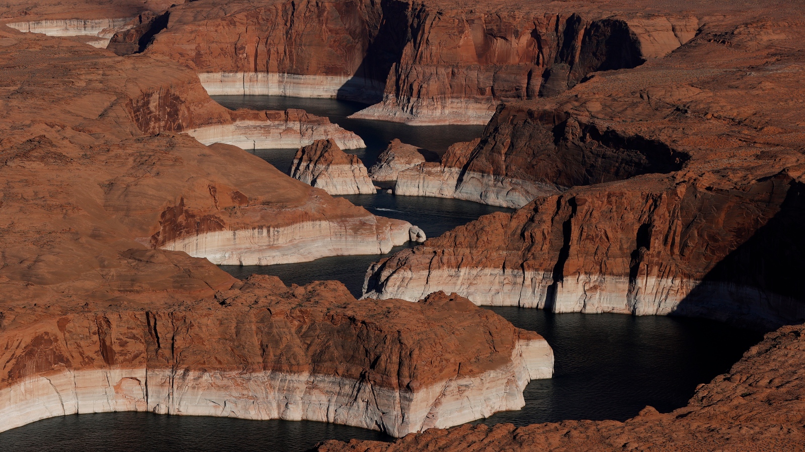


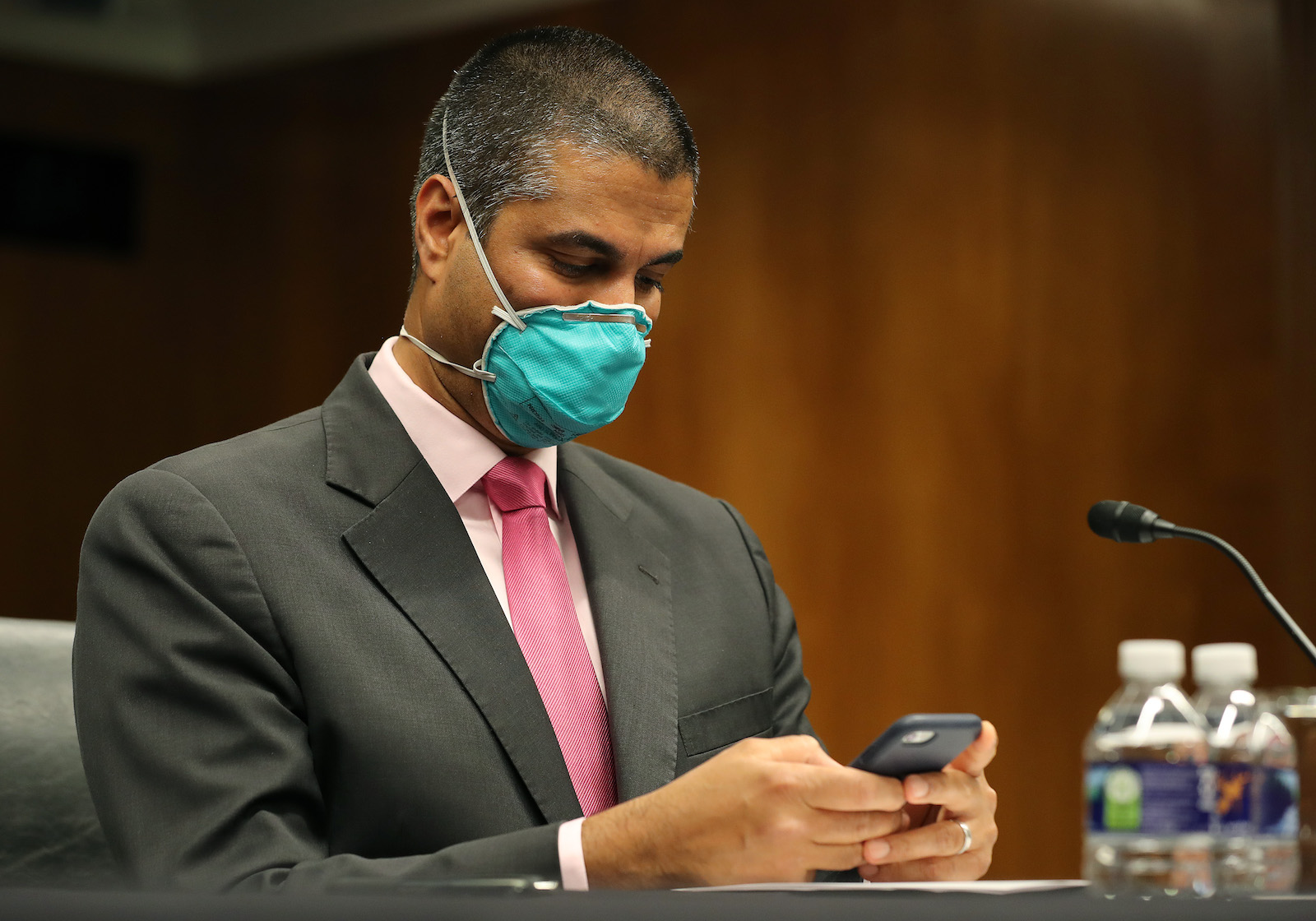
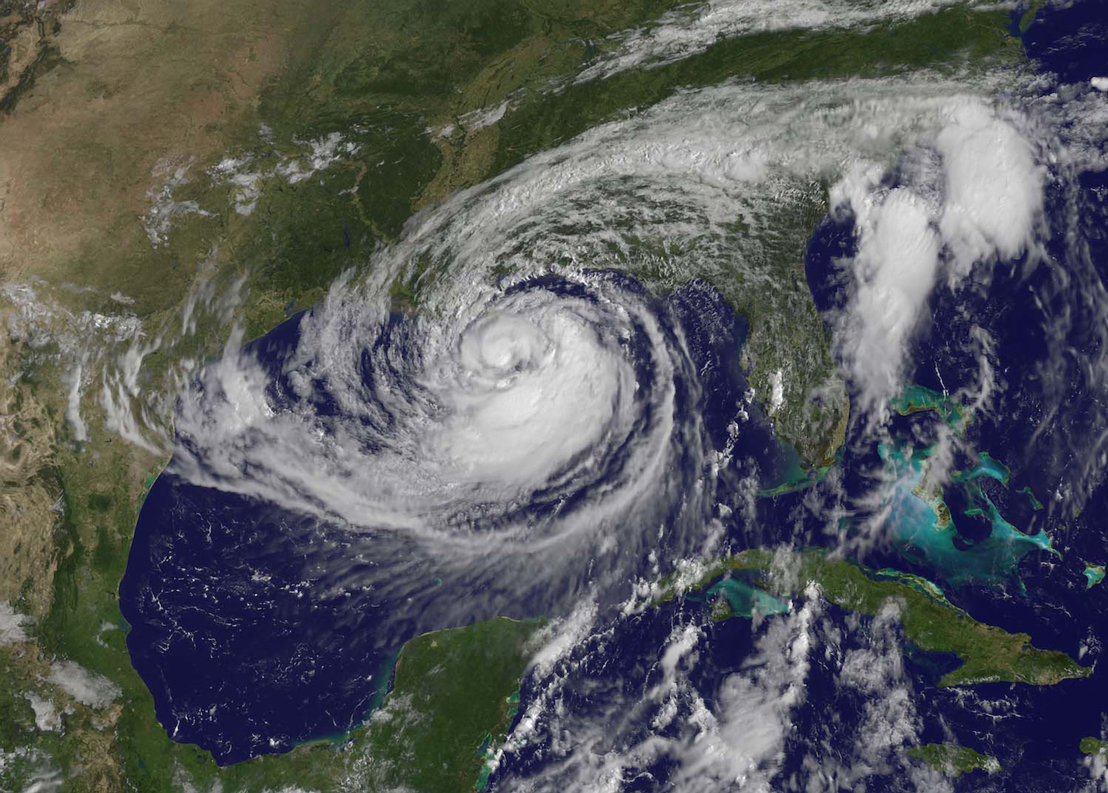


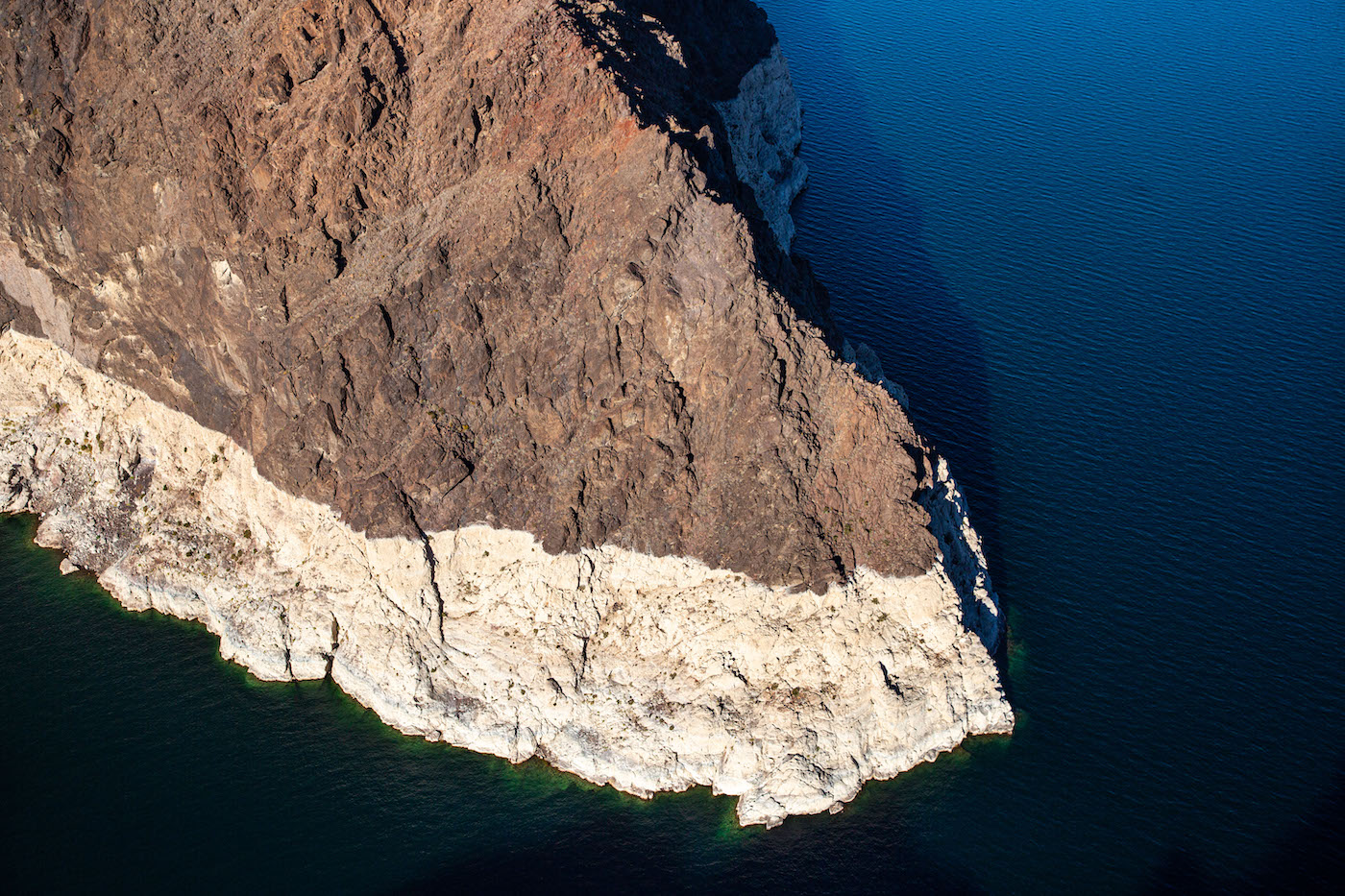
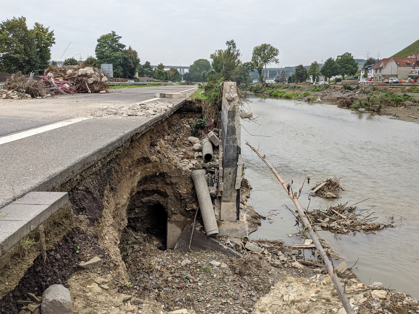

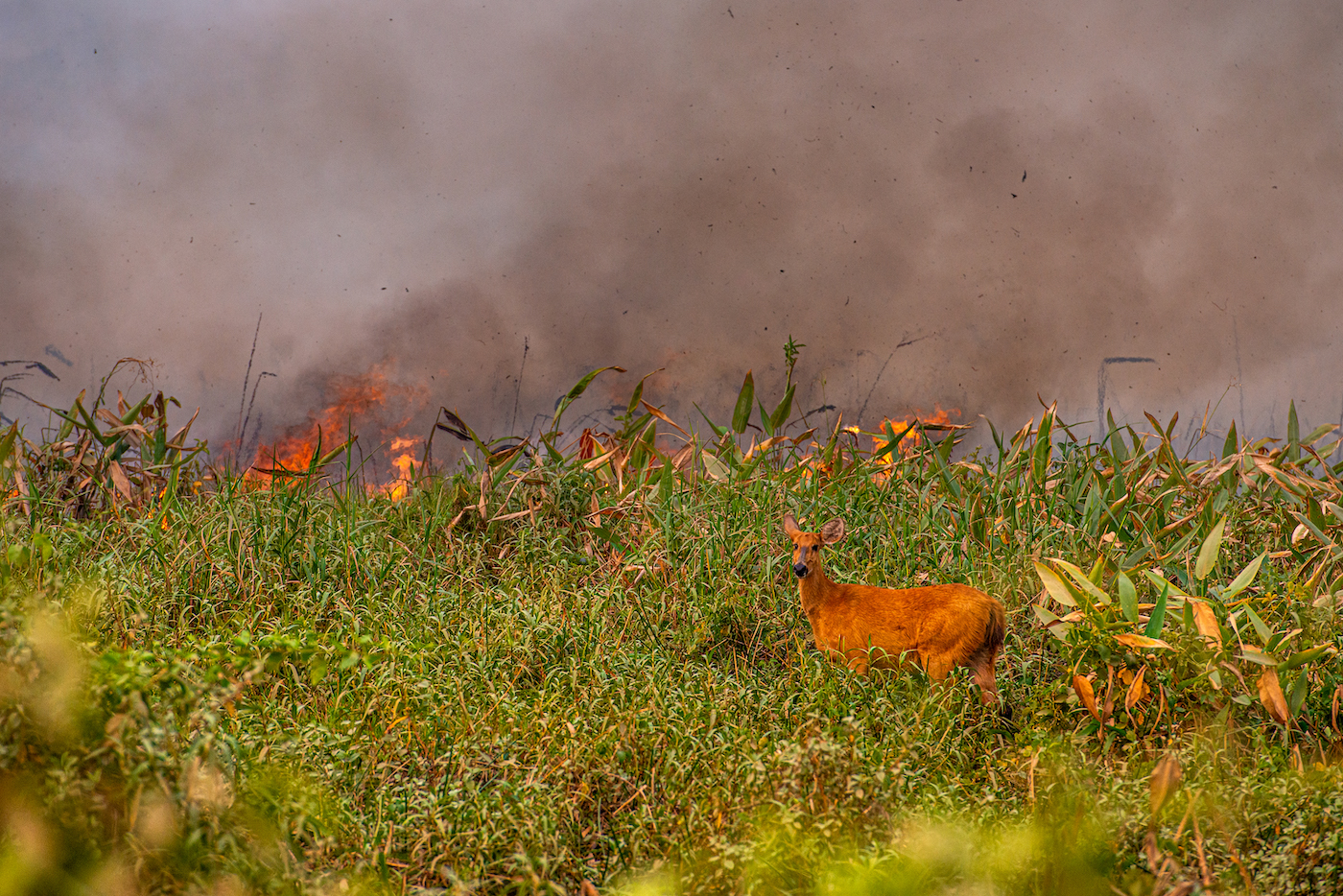
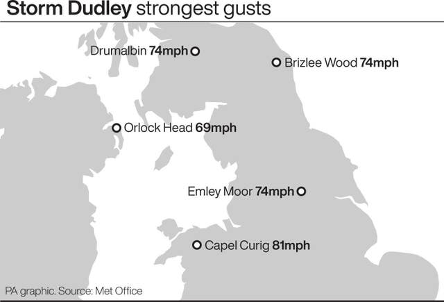
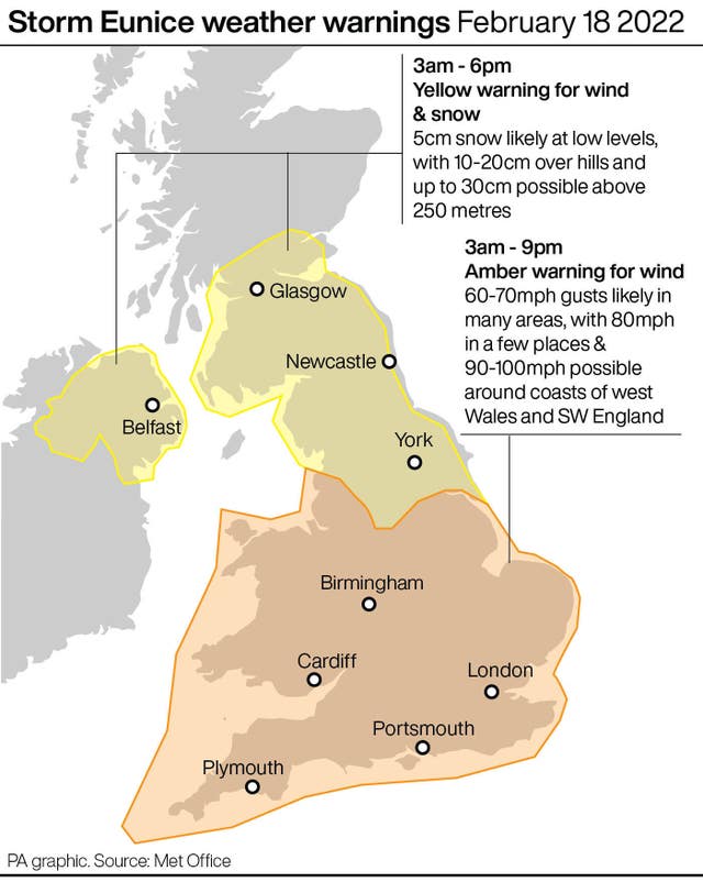
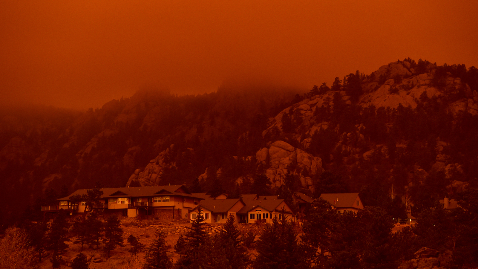

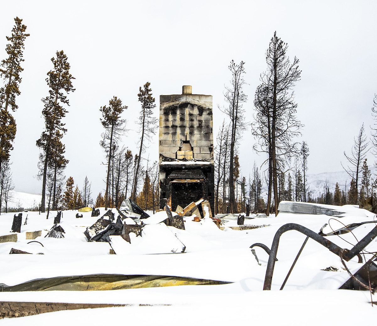
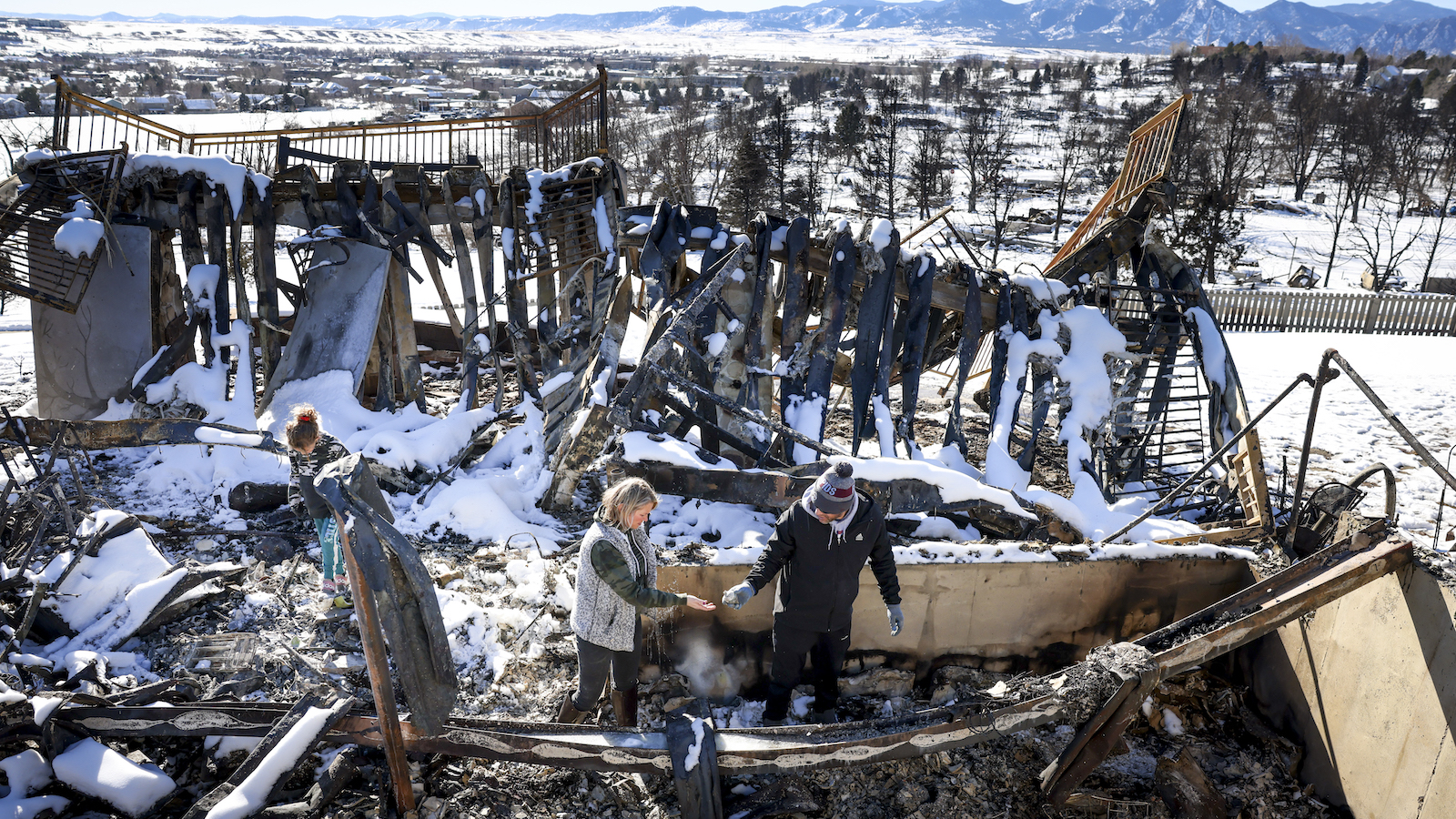
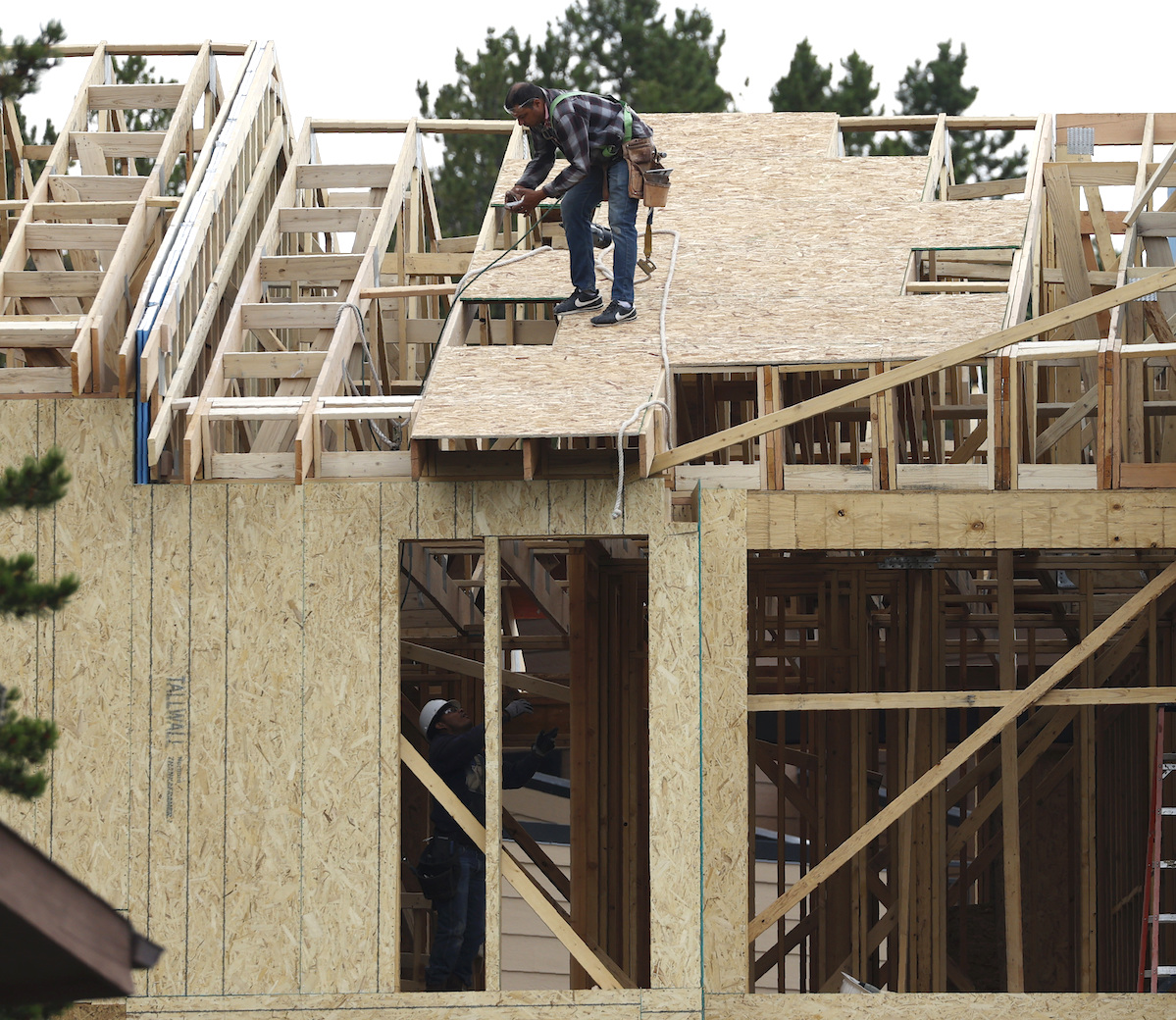


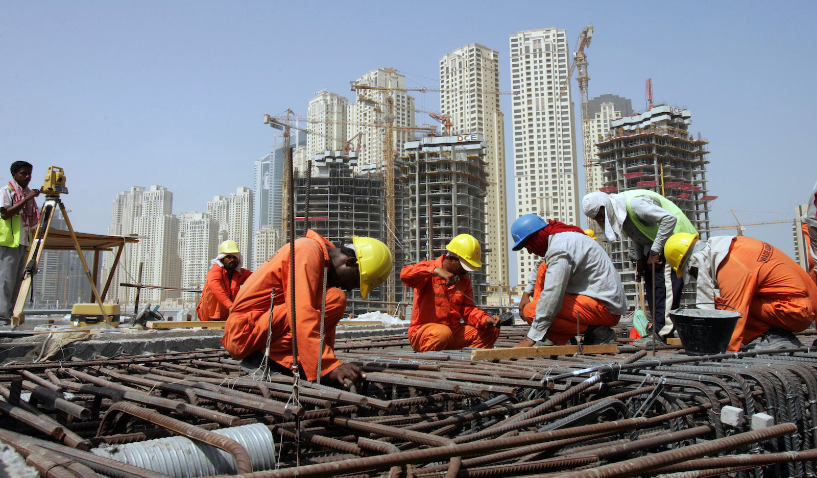
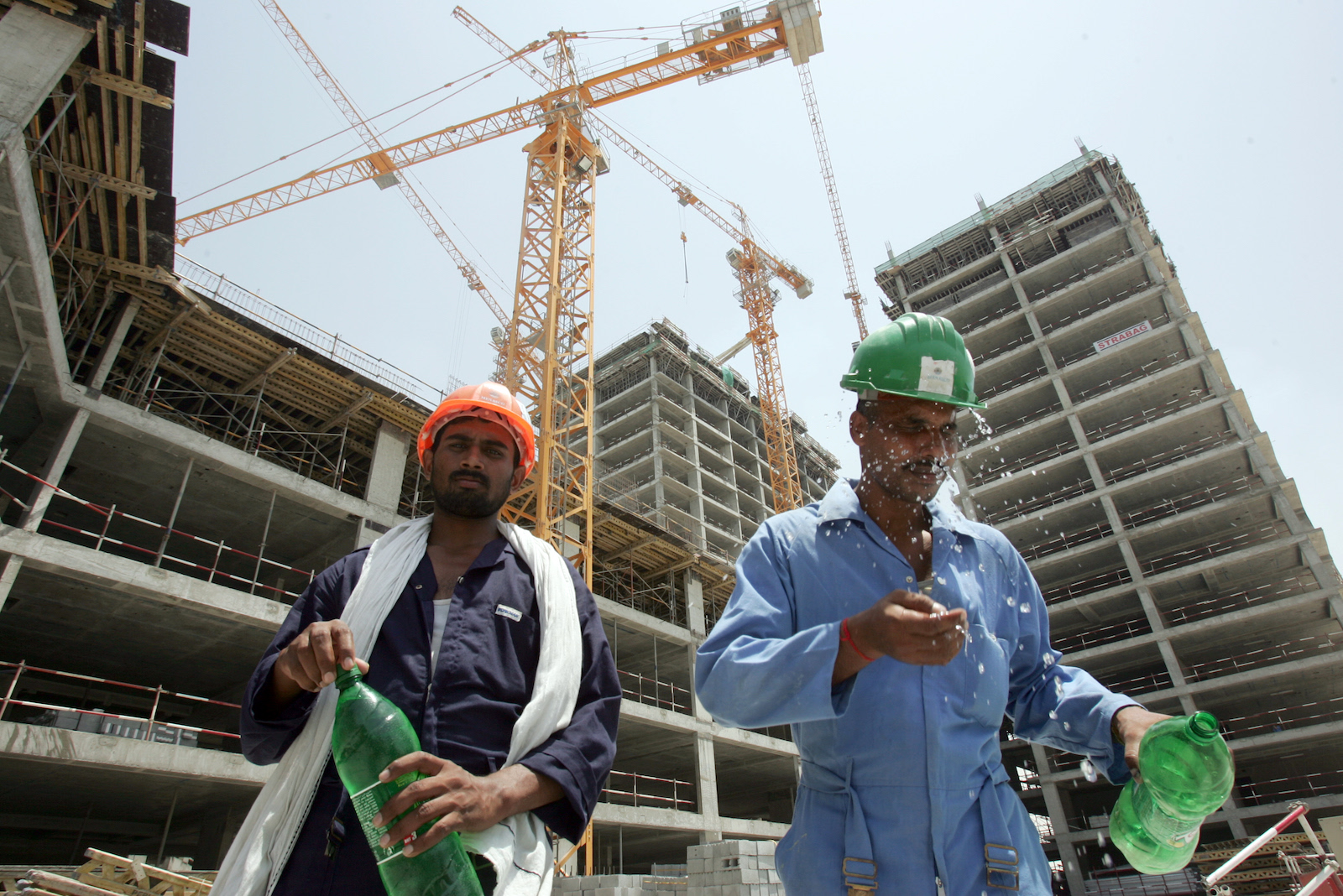
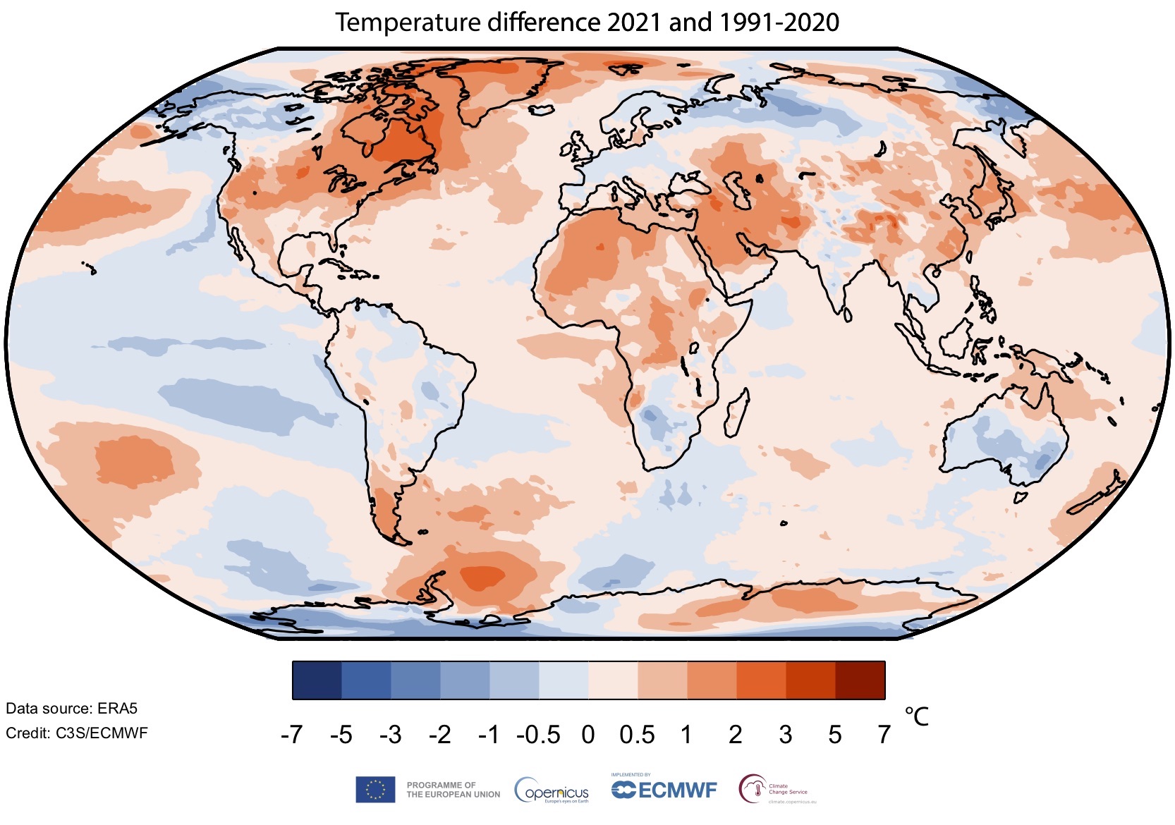
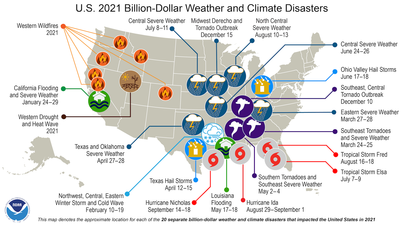

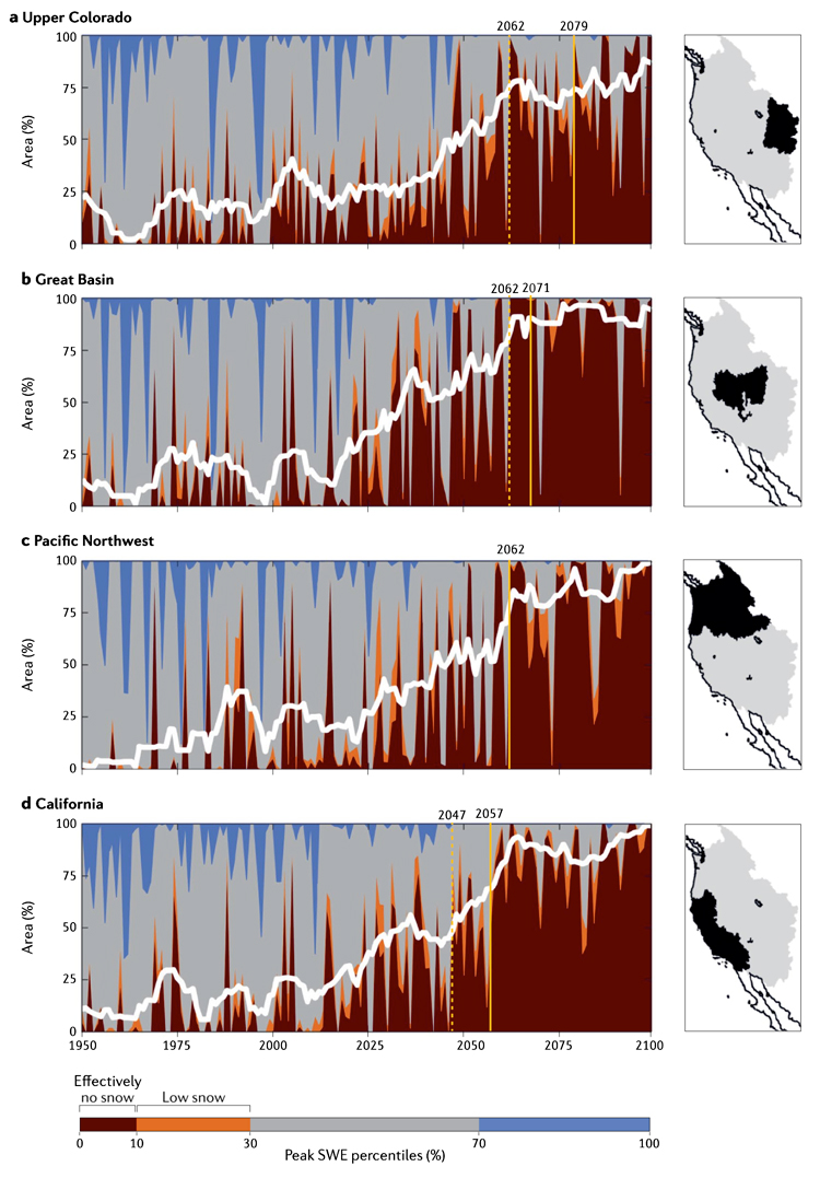
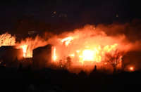
 FIRE EVACUATIONS