Category: Extreme weather

  • This story is part of the series Getting to Zero: Decarbonizing Cascadia, which explores the path to low-carbon energy for British Columbia, Washington, and Oregon. This project is produced in partnership with InvestigateWest and other media outlets.

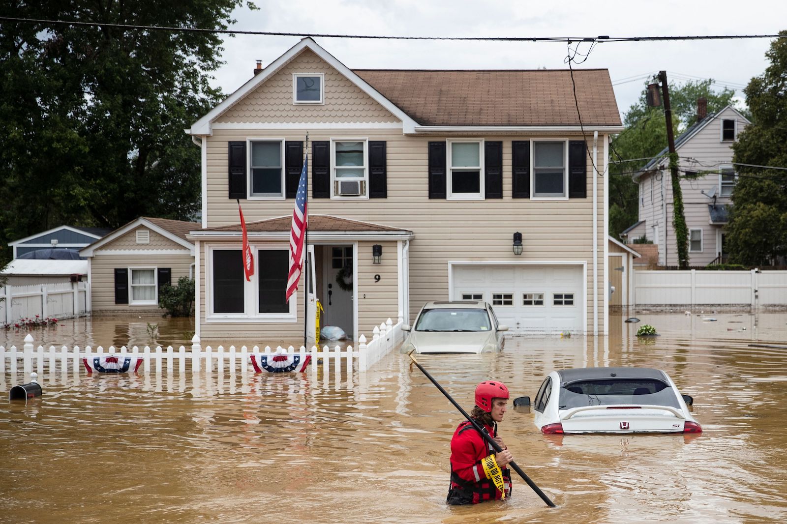
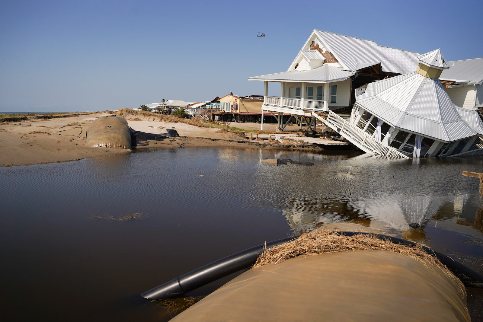
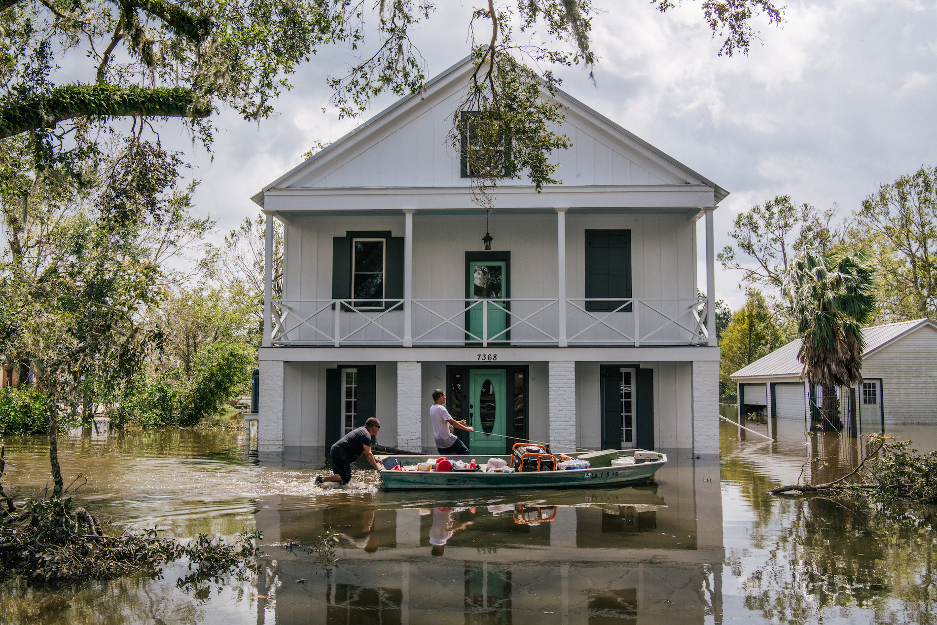
    Worried about the climate crisis? You’ve got plenty of company after the events of 2021: Heat waves, hurricanes, fires, and floods hit new and deadly extremes. Global leaders belly-flopped well short of the pool at a pivotal climate-protection summit, even after the United Nations declared a “code-red” emergency. 

    And, in the United States, political gridlock chopped the heart out of Congress’ most ambitious clean energy plan. 

    Meanwhile, across the dewy-green region north of California, supposedly eco-friendly governments of Oregon, Washington, and British Columbia that failed to fulfill climate promises for a decade have once again pledged to do better. But planet-warming emissions just keep on increasing, according to analysis of the latest data by InvestigateWest for the series “Getting to Zero: Decarbonizing Cascadia.” 

    And yet there is hope. The climate news coming out of British Columbia and the U.S. Pacific Northwest – “Cascadia” to many – is decidedly positive in three important ways, as the yearlong Getting To Zero series demonstrated:

    • Cascadia has in its possession or within its reach all the technological firepower needed to go carbon-neutral by midcentury. If not sooner. 
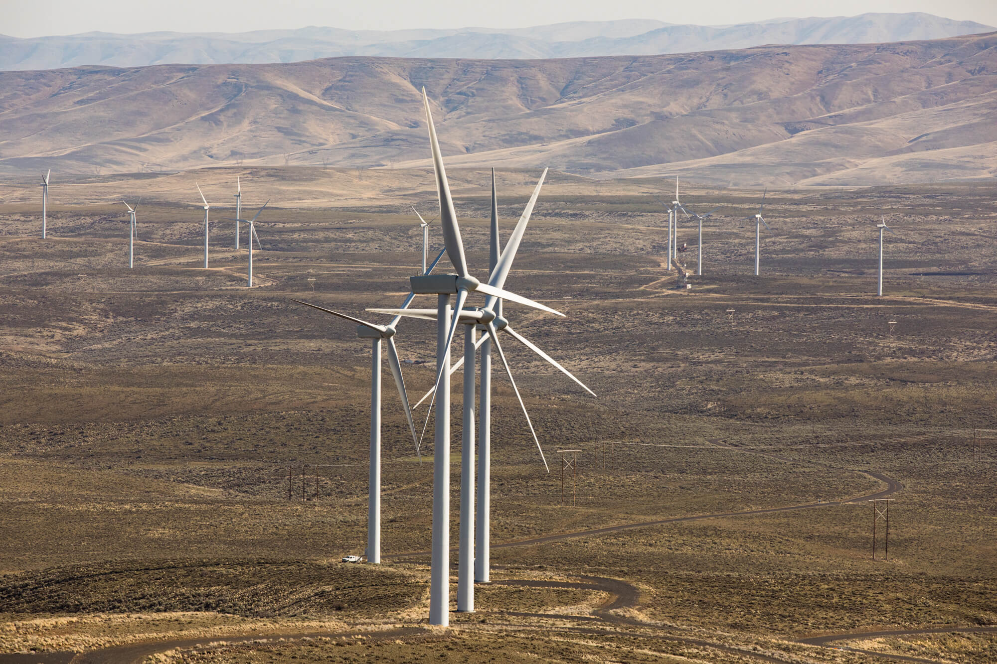
    • The economics of carbon-free living have fallen into place. Renewable solar and wind power now typically costs less than fossil-fuel alternatives. This is also largely true across North America, and beyond.
    • In British Columbia, Premier John Horgan’s government detailed policies to nearly double climate-protection efforts. And the Oregon and Washington legislatures passed their most concrete plans to date to rein in climate-wrecking greenhouse gases. 

    “This legislative session seems like a new beginning,” said Darcy Nonemacher, lobbyist for the Washington Environmental Council, a coalition of the state’s biggest environmental groups. 

    None of that ensures that the region known for its pro-environment leanings will actually get the job done. All three governments have failed to meet previous promises. Much work remains.

    And yet, “This region still has an extraordinary opportunity,” said KC Golden, a longtime Seattle-based climate campaigner and board director at international climate group 350.org. “Day by day, we keep making progress.”

    The lessons emerging here can translate to other regions. Reporters for InvestigateWest and news partners Grist, Crosscut, The Tyee, Jefferson Public Radio, and the South Seattle Emerald interviewed more than 200 people, including energy and policy experts, utilities officials, economists, community, labor activists, environmentalists, tribal officials, fossil fuel lobbyists, and more. 

    The journalists sussed out what it will take for the region to transition to a fully climate-friendly economy. It turns out that — viewed through that lens — the news is pretty encouraging. Here are the takeaway messages about what’s available and required to carry out the energy transformation:

    Generate lots of clean energy

    Yes, this first item on the list seems like a no-brainer. But it’s the key to the transition scientists say is necessary to keep the climate disruption humanity is experiencing today from becoming tomorrow’s climate catastrophe — a future in which civilization is upended by refugees, food and water shortages, deadly heat waves, and worse.

    Arresting climate change means ratcheting down greenhouse gas emissions steeply over the next eight years. That’s looking more doable as renewable-energy prices drop, providing an alternative to fossil fuels. Over the last decade, solar costs fell more than 80 percent, and wind costs are quickly declining as well. 

    Jeffrey Sachs, an economist at Columbia University, said leaving behind fossil fuels is “feasible, necessary … and not very expensive” when compared to the overall economy. 

    Sachs’ view was backed in a July 2021 study from the San Francisco-based think tank Energy Innovation, which pulled together eight research efforts by universities and other experts. They concluded that the transition: 

    • Will have marginal costs. 
    • Is bound to create jobs. 
    • Will improve public health. 
    • Is challenging but feasible. 
    • Would make electricity more dependable.
    The Wild Horse wind and solar farm east of Ellensburg, Washington on Whiskey Dick Mountain generates electricity for suburban Seattle utility Puget Sound Energy. The rotors on its 149 wind turbines are larger than the wingspan of a Boeing 747, capturing enough energy to power over 400 homes.
    The Wild Horse wind and solar farm east of Ellensburg, Washington on Whiskey Dick Mountain generates electricity for suburban Seattle utility Puget Sound Energy. The rotors on its 149 wind turbines are larger than the wingspan of a Boeing 747, capturing enough energy to power over 400 homes. Dan DeLong/InvestigateWest

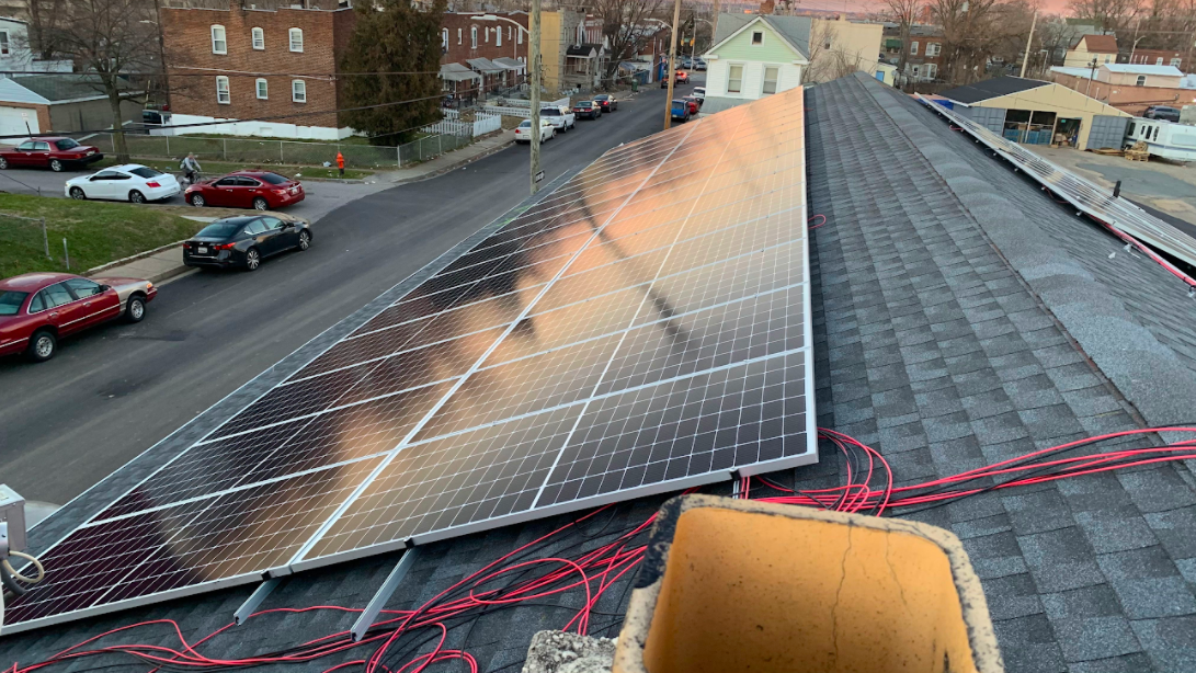
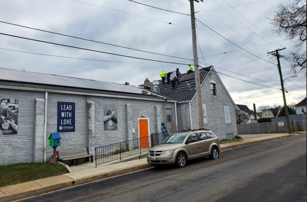
    Use that green energy to electrify everything possible

    Once the juice flowing through the lines is green, we need to use it as widely as possible. 

    This starts with cars and trucks. Here again, the news is good. Electric vehicles are making huge inroads in the market. The infrastructure bill passed by the U.S. Congress last month allocates $7.5 billion to help build out a nationwide network of EV charging stations. The current 50,000 or so stations are to be expanded to 10 times that by 2030.

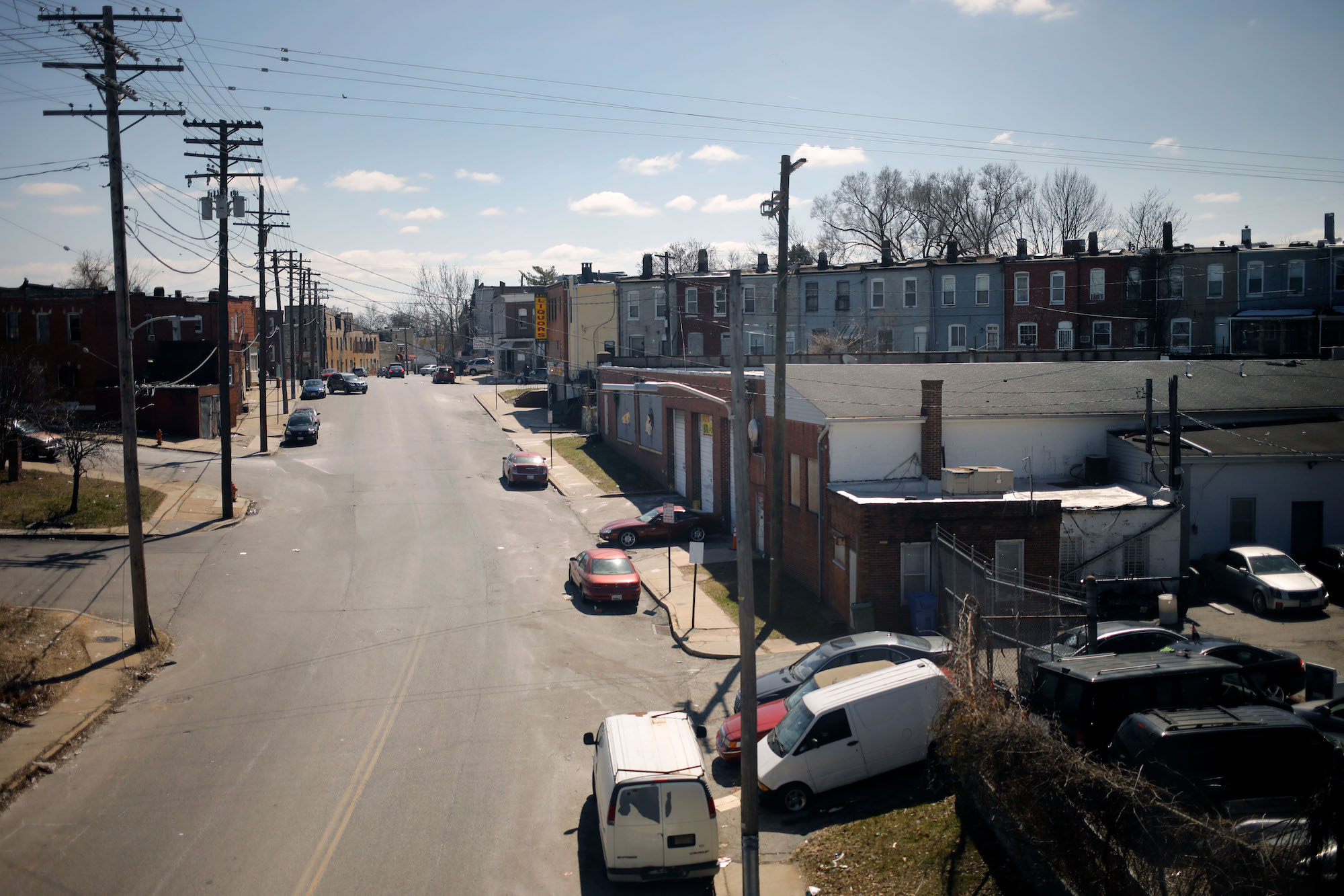
    The second most important target for green power is replacing fossil fuel use in buildings, especially growing use of natural gas for heating; in Vancouver, British Columbia, that causes nearly 60% of the city’s carbon pollution.

    Electric heat pumps can replace furnaces and, despite their name, they can actually heat and cool. That’s one reason why heat pumps seem destined to follow electric vehicles in popularity, said Merran Smith, executive director of Vancouver-based nonprofit Clean Energy Canada. “Heat pumps used to be big huge noisy things,” Smith said. “Now they’re a fraction of the size; they’re quiet and efficient.”

    Combined with other innovative devices such as electric induction cooktops, heat pumps mean we can completely stop feeding so-called “natural” gas to buildings. And that’s crucial. 

    Natural gas made sense as a “bridge” to a carbon-free future back when environmentalists began promoting it as an alternative to dirtier coal and petroleum two decades ago. But now that bridge has grown too long and too wide. 

    Thanks to “fracking” technology that made natural gas cheap and abundant, its consumption went wild, along with methane leaks from gas pipes that further plague the climate. Given the imperative to cut carbon wherever possible, it’s time to start closing lanes on the natural-gas bridge.

    That’s begun in Cascadia. Seattle this year passed a law to phase out natural gas in new commercial establishments and large apartment buildings. And in Vancouver, British Columbia, the City Council is requiring zero-emission space and water heating in all low-rise residential buildings constructed after this year.

    Clean up what you cant plug in

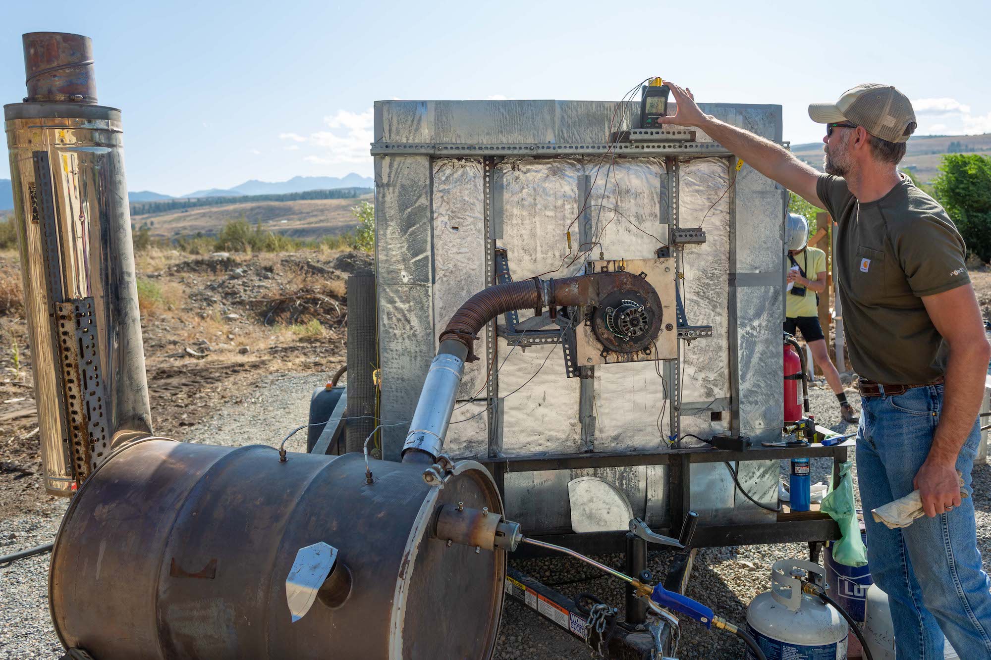
    The biggest challenge beyond electrifying buildings and reining in natural gas is figuring out how to refuel gasoline- and diesel-powered trucks, ferries, buses, and trains, and airplanes. This one is going to be hard, especially for the biggest vehicles. 

    “The scale of this is huge,” said John Holladay, who directs transportation fuels research at the U.S. Department of Energy’s Pacific Northwest National Laboratory in Richland, Washington. “It’s a very aggressive scenario.”

    The key will be making low-carbon fuels without creating new problems. Right now a smidgen of cleaner fuel is produced from plant and animal waste. But that’s a limited source. As such 

    “biofuels” scale up, producers will shift to using wood harvested from forests and oils produced from crops. That could boost food prices, cause ecological harm and even increase carbon emissions if not carefully monitored. 

    Going further is going to require new fuels that are still being perfected, such as hydrogen and low-carbon “synthetic” fuels — clean energy carriers that are gaining ground overseas but aren’t a big factor yet in the U.S. and Canada.
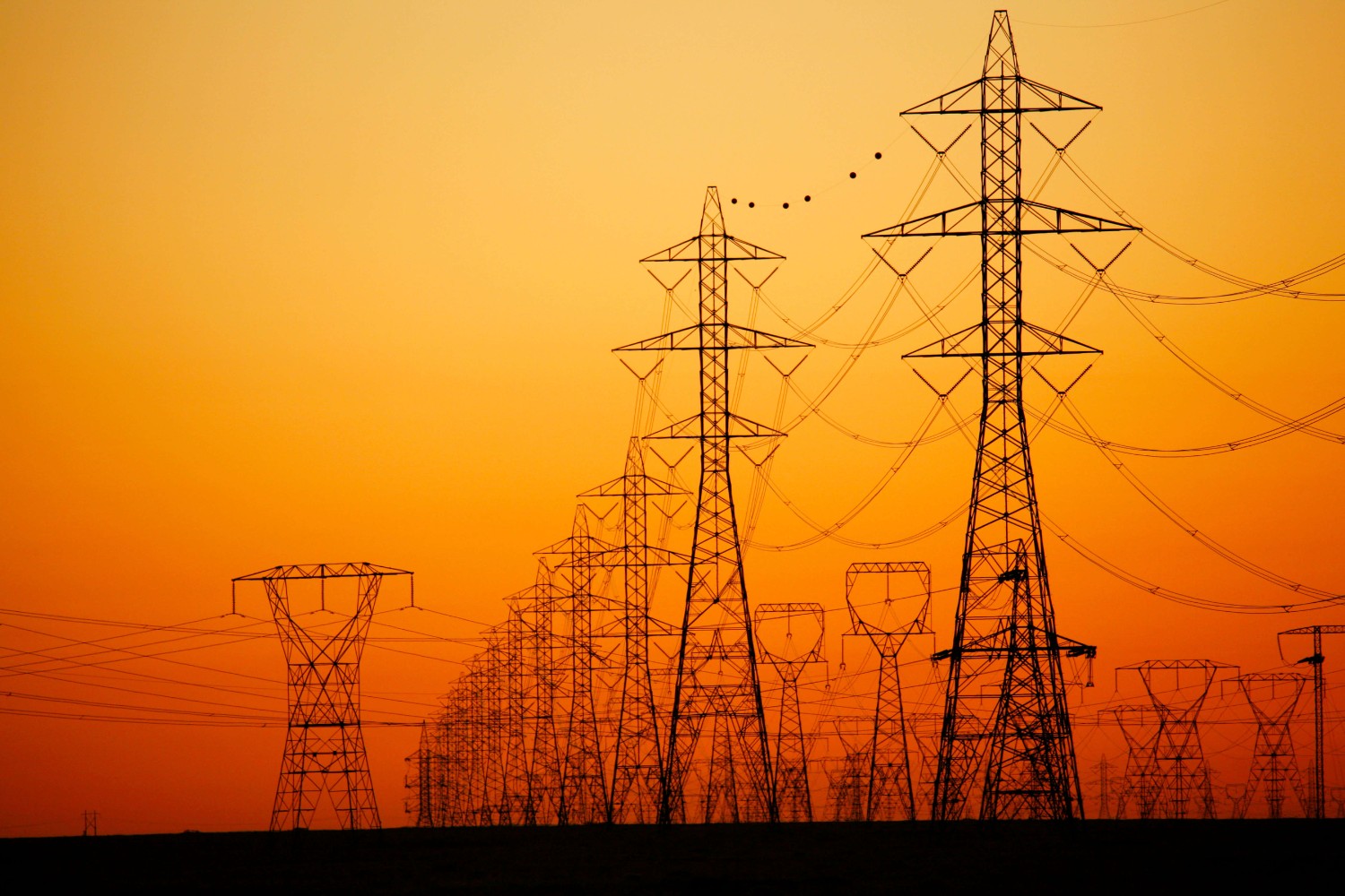
    Invest in the grid

    Beefing up the electrical grid is a precondition for any carbon-free electricity solution, worldwide. Additional lines are needed to connect a lot more wind and solar plants, and even more capacity is needed to deliver their power.

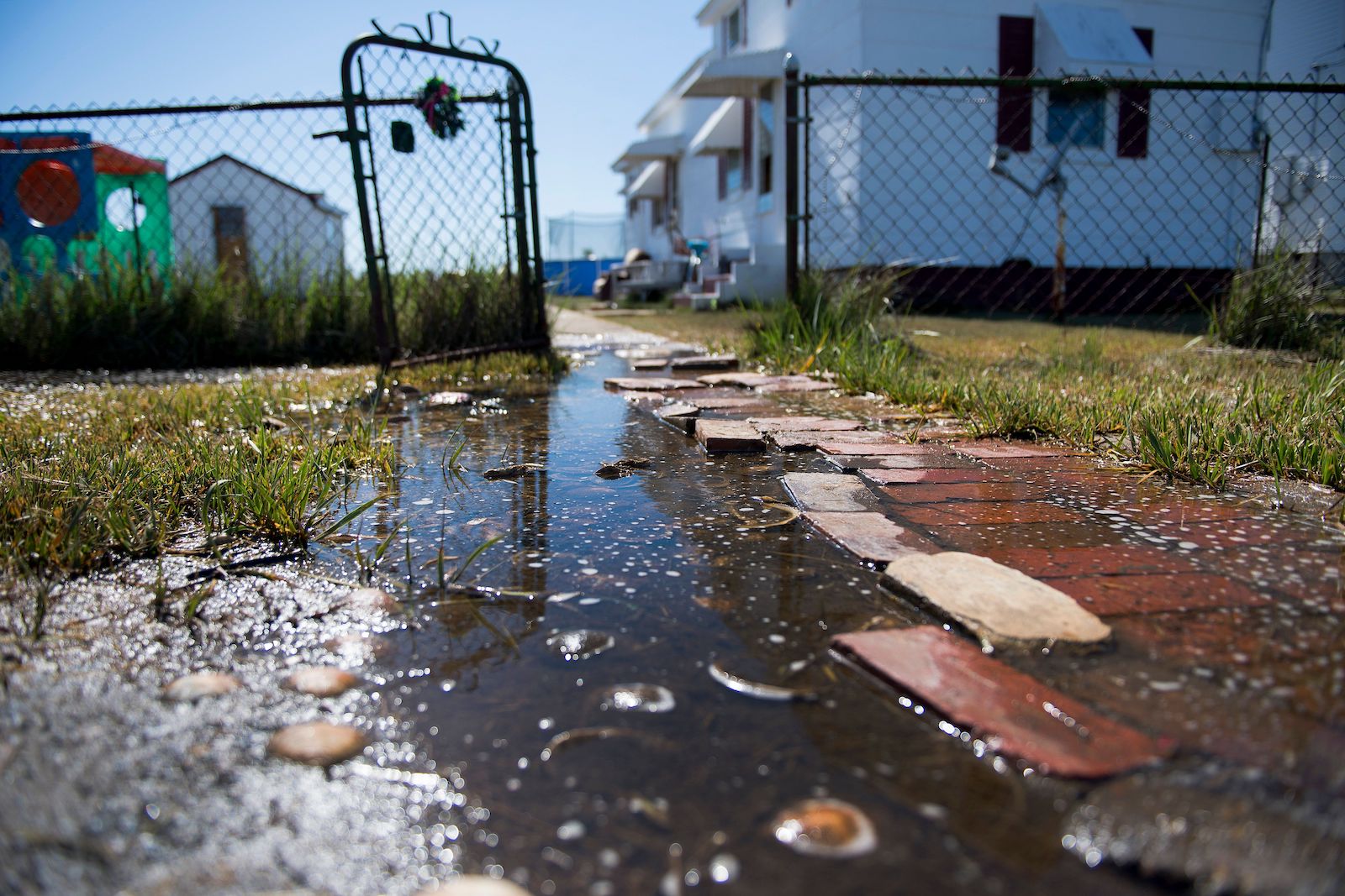
    A spring 2019 cold spell vividly illustrated this need for Cascadia. The fall 2018 rains had faltered, leaving reservoirs low behind dams that produce hydroelectricity, the region’s go-to, low-carbon energy source. Being connected to a grid whose 136,000 miles of transmission lines span all of Canada and the U.S. west of the Rockies would usually provide some backup. But in this case work on power lines in Southern California and mechanical problems at the Centralia, Washington coal-fired power plant left power supplies short.

    Cascadia came close to experiencing the rolling blackouts that have since disrupted California and Texas.

    “We really had a very close call,” said Scott Bolton, senior vice president for transmission development at Portland-based PacifiCorp.

    Investing in a more robust grid may sound mundane, but it’s vital to how a primarily renewable energy system of the future can work. When the wind is blowing in, say, Montana, long transmission lines mean people in Portland can still cook their dinner and heat their homes even if overcast skies are sapping output from their rooftop solar panels. And if the wind fails in Montana, it’s a good bet that solar, wind and/or water power dispatched from Cascadia could help save their day.

    This opportunity to trade energy for mutual advantage stretches far beyond Cascadia. Alas, three major electrical grids serve Canada and the U.S., and very little power can actually be shared even within the Western grid. Solving that problem and in general rebuilding a sturdier grid could go a long way toward helping both Canada and the U.S. move toward a carbon-free energy future.

    High voltage transmission lines along the Columbia River.
    High voltage transmission lines along the Columbia River. Alamy

    Give consumers more power

    Energy planners increasingly are recognizing the value of consumers generating at least some of their own power. This currently is mostly achieved through rooftop solar and is increasingly augmented with big batteries. 

    If consumers install batteries, excess power generated when the wind is blowing and the sun is out can be stored for use at night, during dark days or when wind dwindles. Costs for batteries are declining steadily, and especially steep cost cuts are projected for the next few years.

    An important study released in February found that coordinating big grid upgrades with consumer-scale solutions could translate into the U.S. hitting its clean-energy goals while also saving consumers more than $470 billion, mostly between 2030 and 2050. 

    New technologies coming online are helping to smooth the coordination challenge, preventing power glitches when consumers saturate the local lines with solar energy. Other equipment is helping prevent blackouts by moderating consumption from “smart” appliances when the grid’s appetite for power is surging.

    Promote new technologies like hydrogen

    Meanwhile, research and development continues to examine additional ways to produce green energy. One of the most promising is “green hydrogen.” 

    Here’s how this works:  Pretty much anywhere there is cheap or excess power – in Cascadia the classic example is hydropower when the spring snowmelt goes bonkers – a device called an electrolyzer can use that electricity to split water into hydrogen, a combustible fuel, and oxygen. 

    As wind and solar energy soars, hydrogen, or liquid fuels made from it could be used to replace fossil fuels for heavy vehicles, as well as industries that are difficult to plug into the grid. 

    In addition, the green hydrogen can be stored in bulk, providing reserves of climate-friendly energy to generate electricity during extended dark and windless periods. It would make the power system far more resilient and less subject to nature’s whims.

    Political will

    “Political will” is the shorthand used by environmentalists for what they say society needs from politicians: leadership to rejigger our fossil-fueled economy in spite of attacks from political opponents and powerful interests such as oil companies and utilities. 

    “The constraining factor has always been political feasibility, not economic feasibility,” said Mark Jaccard, a political economist and energy modeling expert at Simon Fraser University in Burnaby, British Columbia. 

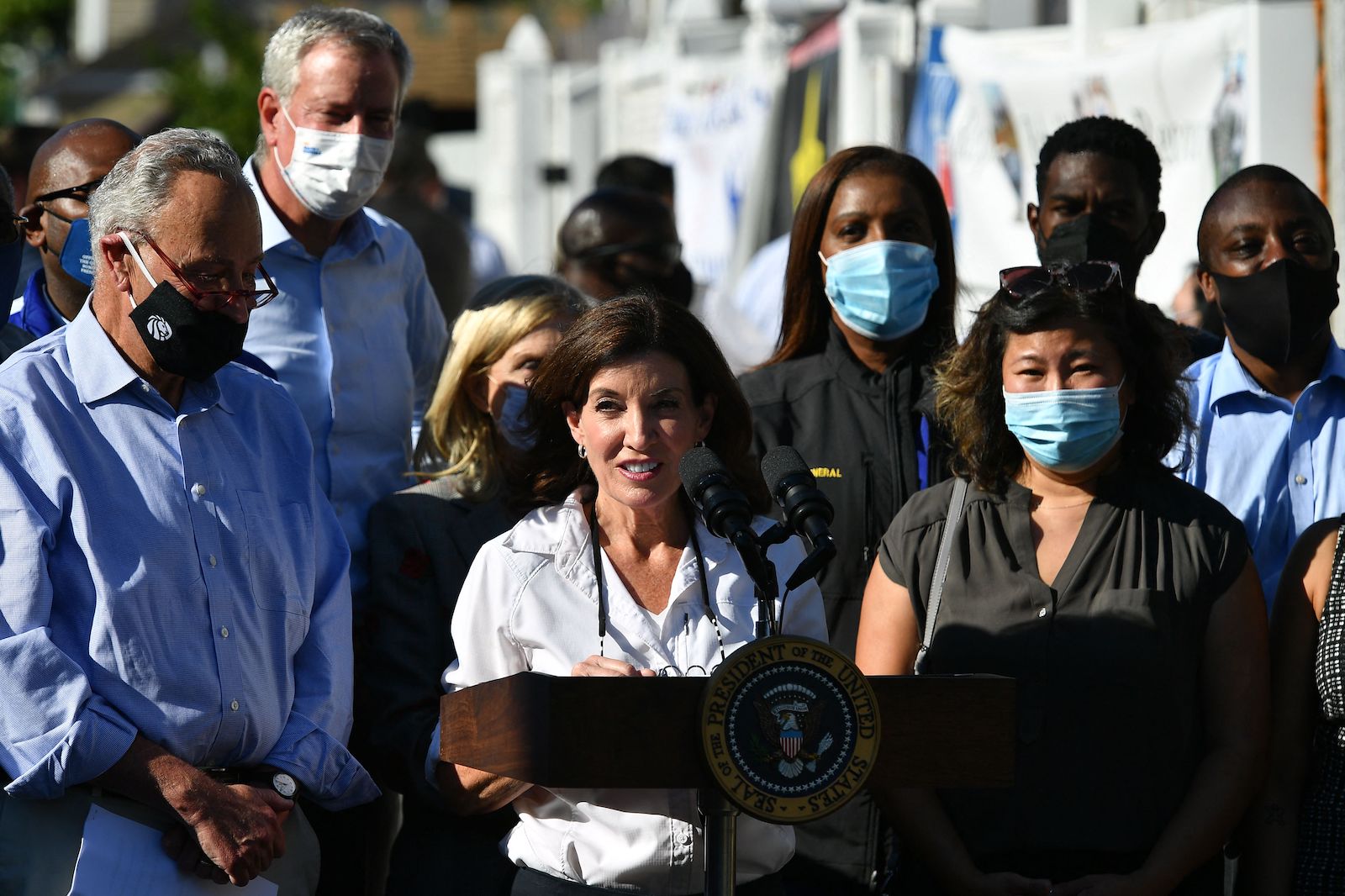
    One could scarcely ask for a better example of how this plays out in the real world than Washington Gov. Jay Inslee. The governor based his 2020 presidential run almost entirely on his convictions about fighting climate change. Yet under Inslee’s watch, Washington has allowed expansion of highways, gas-fired power plants and a new terminal for liquefied natural gas, among other actions that increased climate pollution. 

    It’s that day-in, day-out work that government traditionally has done. And it inspired lawsuits from youth in Washington and Oregon.

    “Washington has been defending itself by saying, ‘We have been doing the best we can. We have got Inslee. Look at the progress,’” said attorney Andrea Rodgers, who represents the eight young people who sued in Washington. “But emissions don’t lie, and the emissions keep rising.”

    The plaintiffs in Oregon and Washington lost their final appeals last year and in October, respectively. But youth in the U.S. and Canada continue to push a pair of related challenges against their federal governments.

    The list of well-heeled interests lobbying against a fast transition to clean power — the one scientists say is needed to avert climate disaster — is long. The ones that present the greatest roadblock for the energy transition are natural gas companies and unions representing trades such as pipefitting, which continue fighting efforts to fully electrify buildings and phase out gas. Gas firms and labor unions are pulling out the stops politically by financing candidates, running pro-gas advertising campaigns and even, in some cases, hiring actors to pose as concerned citizens at public hearings.

    In short, changing the energy system is going to involve economic losers and winners. Politicians have to stand strong and follow through on policies that make sense for society as a whole, and for future generations.

    Jobs, jobs, jobs

    While much of this list focuses on items that may initially cost consumers and businesses more, it’s important to remember that an out-of-control climate is expected to wreak much more costly havoc. It’s also important to factor in how employment can transition along with energy. As job losses occurred at, say, the coal-burning Centralia power plant, other jobs are being created at wind and solar energy sites, factories for electric semi-trucks and buses, and beyond.

    One study projected more than 60,000 additional jobs could be produced in Washington with an ambitious plan to replace old and inefficient equipment and construction of renewable power plants. Compared to Washington’s 3.6 million current jobs, that is not huge. But it represents a net increase in employment. 

    People power

    To ensure that politicians stand strong and build the future, citizen-activists say they must keep pressure on the politicians and spotlight backsliding. Environmentalists and community activists in Cascadia and California surprised even themselves with their success in a decade-long campaign that blocked dozens of proposals to export fossil fuel from the U.S. interior across the West Coast to Asia, as one Getting To Zero story explored.

    Now, the struggle is much broader and affects vast areas of the entrenched economic system. Another story in the series reported on recent successes by citizen activists at the local level who have lobbied for outright bans on a range of fossil fuel handling facilities, from refineries to airports. 

    Even though the climate-action movement is making progress, those who’ve witnessed its history say continued pressure will be key to driving an energy transition. The news here, too, is good.

    “Concern and a sense of urgency are way up,” said longtime Seattle climate activist Patrick Mazza. “The climate movement is in the streets, with broad and inclusive engagement. Such a contrast with the early days!”

    Listening to and protecting traditionally marginalized communities

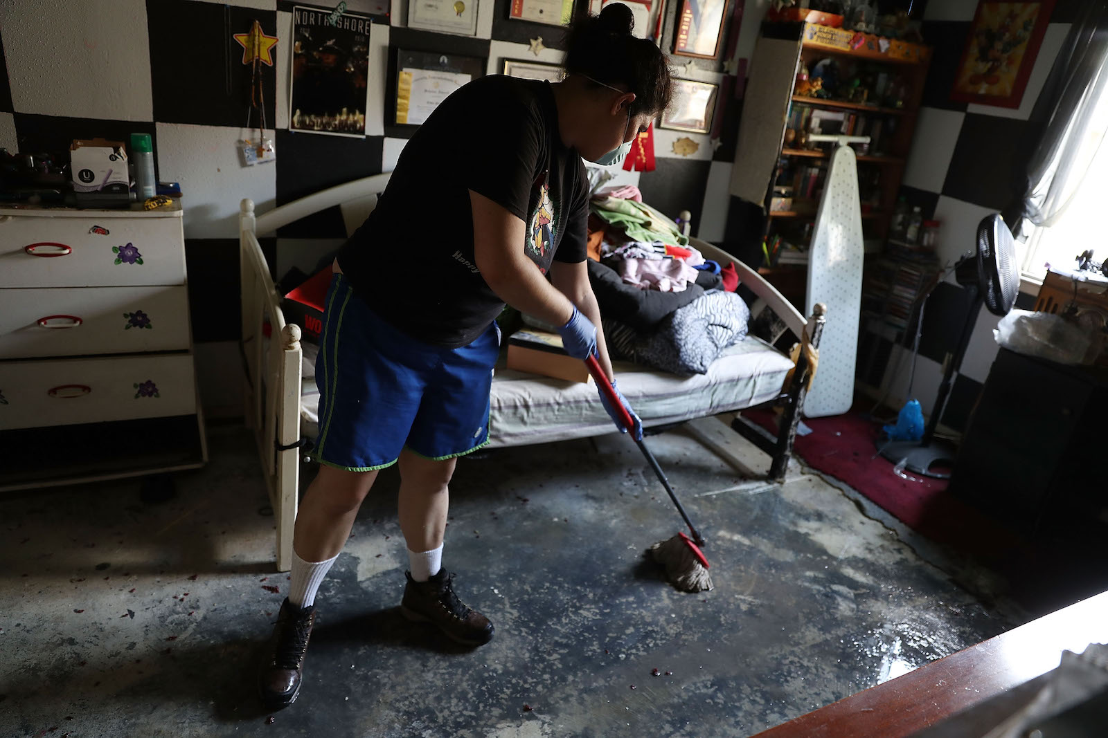
    When Mazza mentions “inclusive engagement,” part of what he is talking about is growing involvement of people of color and sovereign Tribes and First Nations in the climate movement. That’s essential, not least because climate disruption poses a disproportionate threat to people in traditionally marginalized communities, as an early Getting To Zero story explored.

    Planning for a climate-hammered future involves looking not simply at which communities are most threatened by floods, fires, and heat waves, but also at which communities are the least prepared to deal with disaster because of their socioeconomic makeup. People who are scraping by economically are unlikely to have the money they need to install a fireproof roof, for example, or to rebuild after flooding destroys their town.

    Going forward with a clean-energy transformation also means taking explicit steps to ensure that people at the bottom end of the economic spectrum are protected economically.

    For example, a Getting To Zero story about retrofitting buildings highlighted the Ramos family of Portland, who saw punishing air-conditioning and heating bills ease after installation of a low-energy “heat pump” at public expense. The nonprofit Energy Trust of Oregon shelled out money to better insulate the Ramos’ house as well.

    Bringing real-dollar help to those on the lower end of Cascadia’s socioeconomic spectrum will be important, say those researching how to speed the transition to a climate-friendly economy.

    “The heat pump system works like a charm,” said Francisco Ramos. “I can’t express enough what a big difference this system made in my life.”

    Heal the land, heal the climate

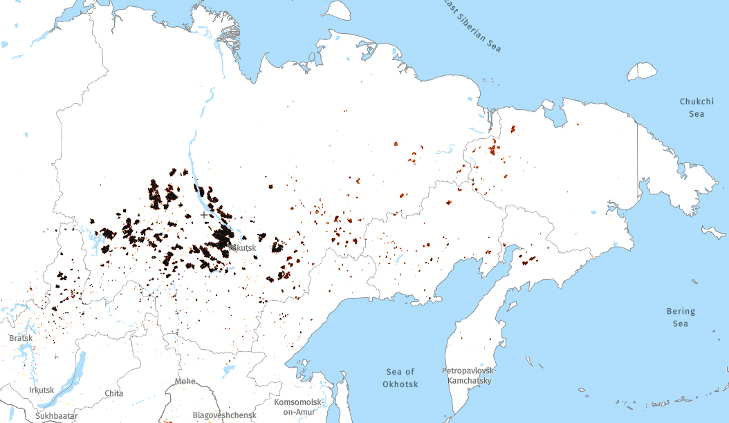
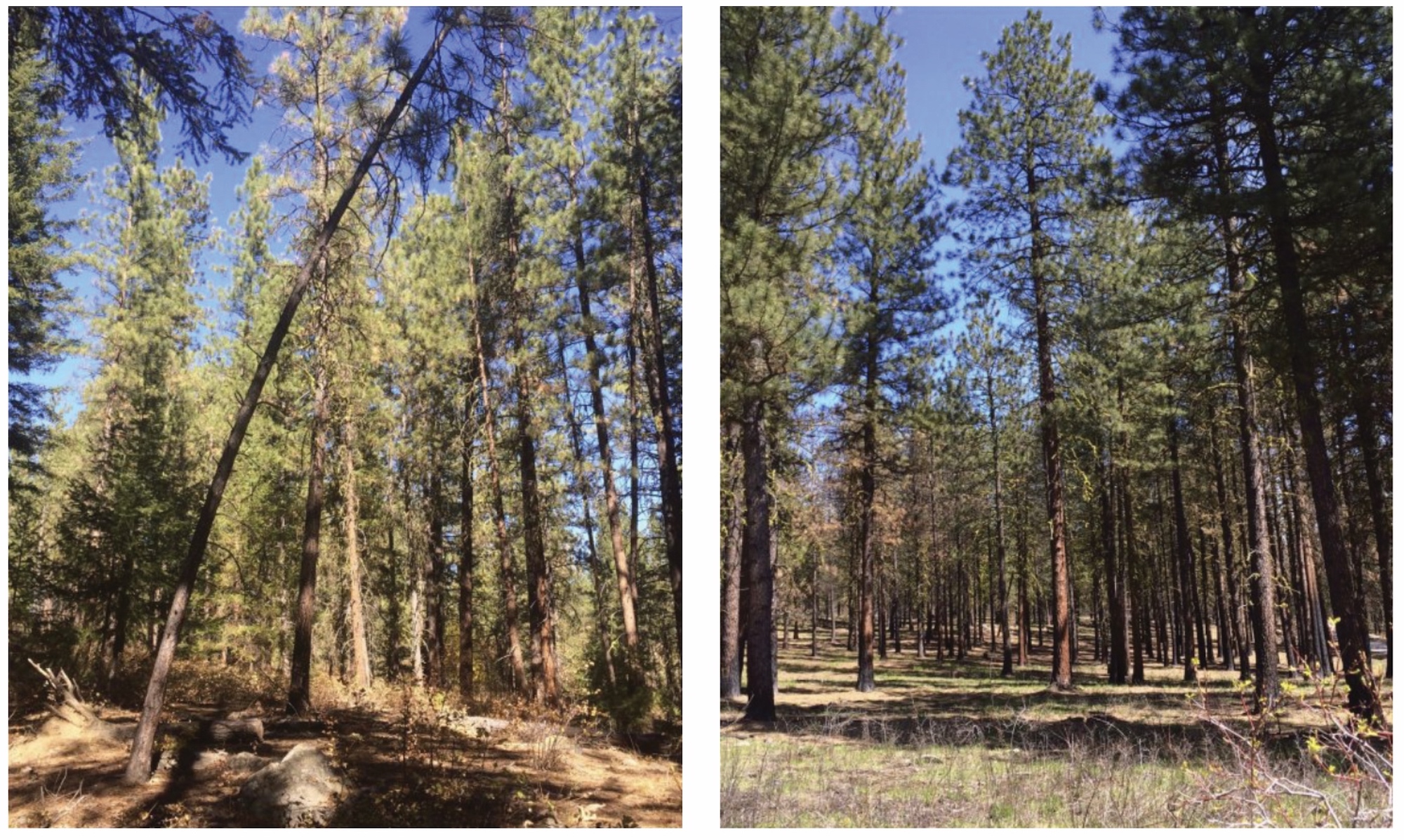
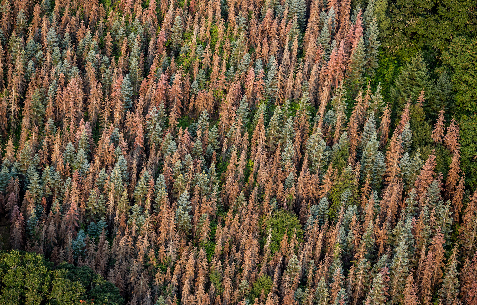
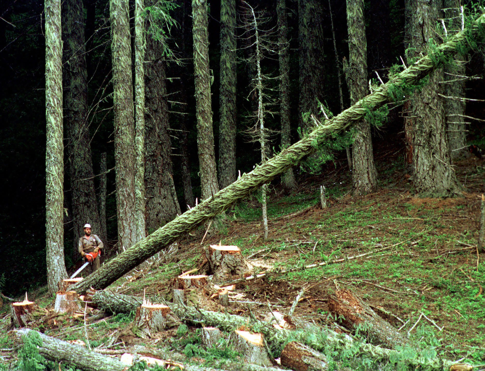
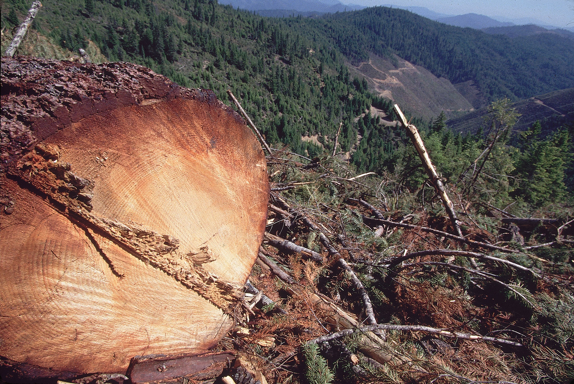
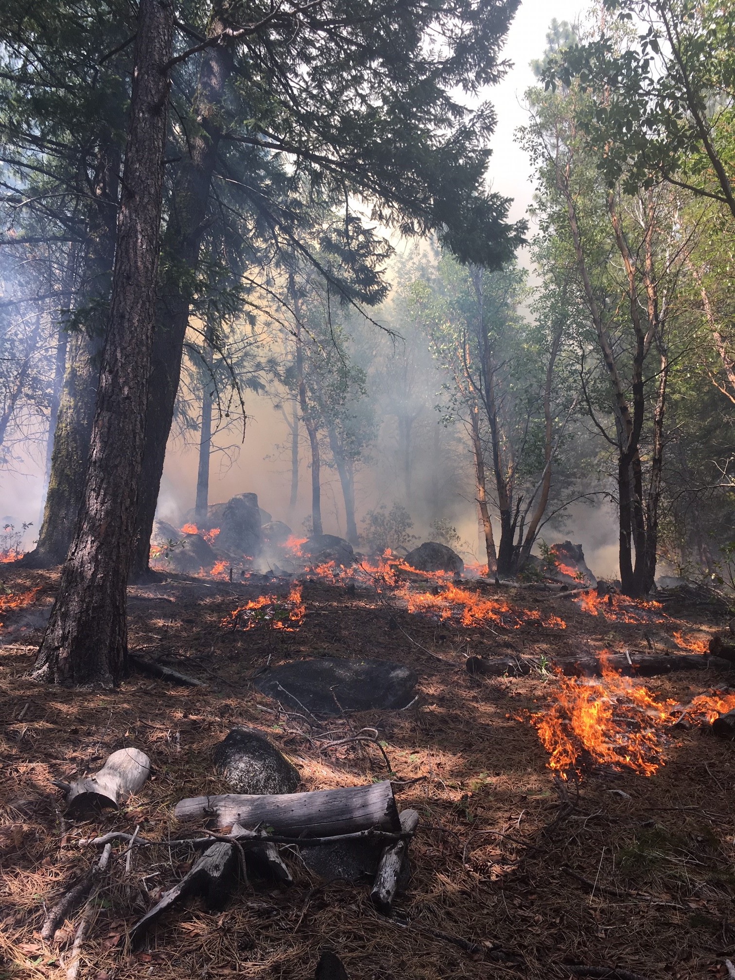
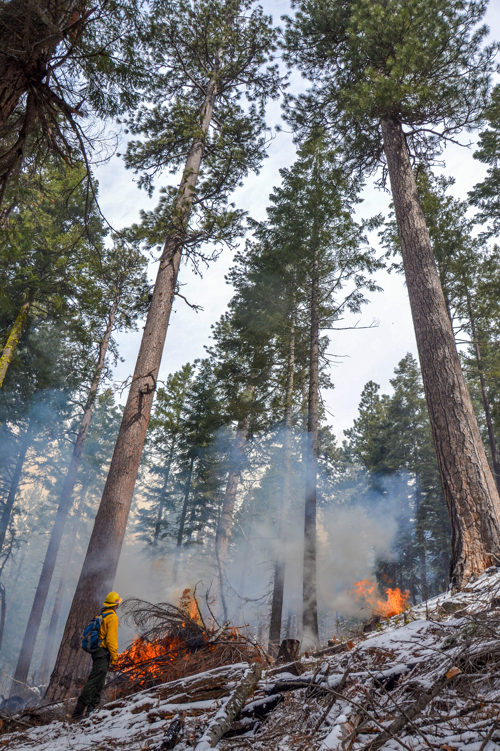
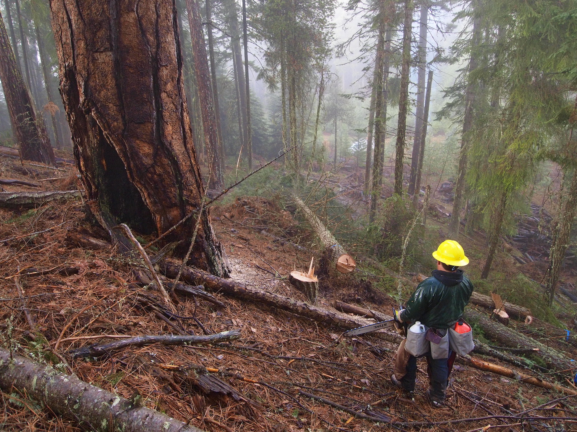
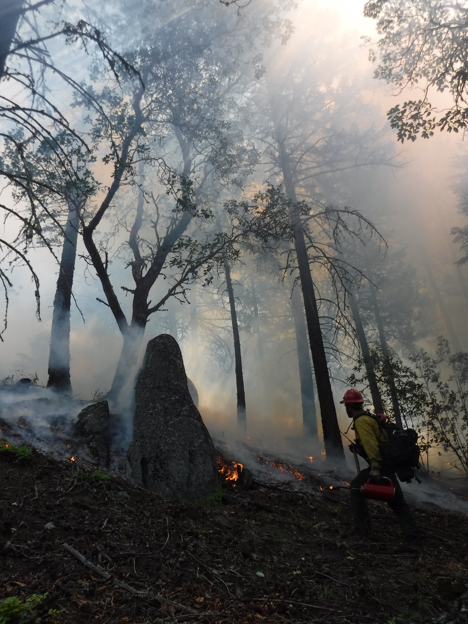
    One of the most important and yet under-the-radar requirements to reduce Cascadia’s planet-warming emissions is rethinking how we are managing the region’s once-abundant forests.

    On the way to the current climate reckoning, an interesting thing happened to the region’s forests: They’ve been transforming from green swaths of landscape, which reliably helped suck up airborne carbon since the Industrial Revolution, into sources of the most prolific greenhouse gas, carbon dioxide.

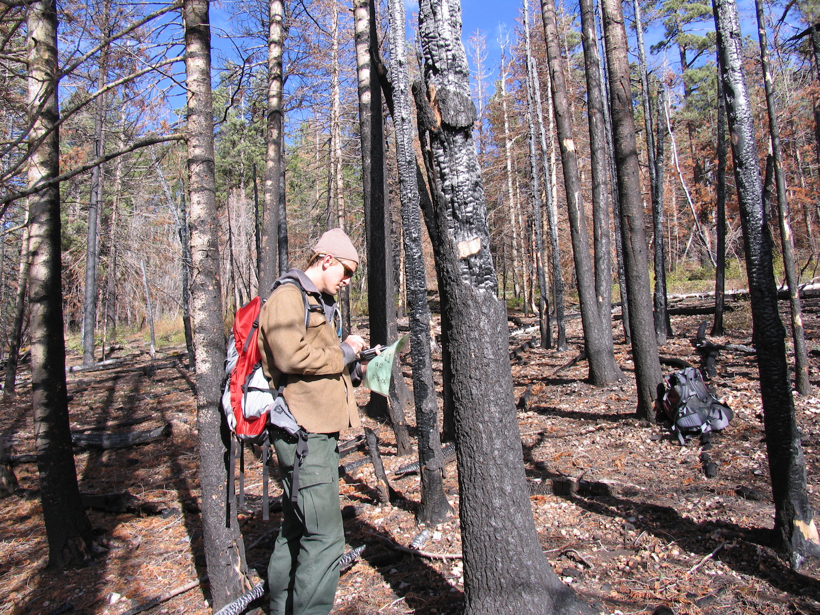
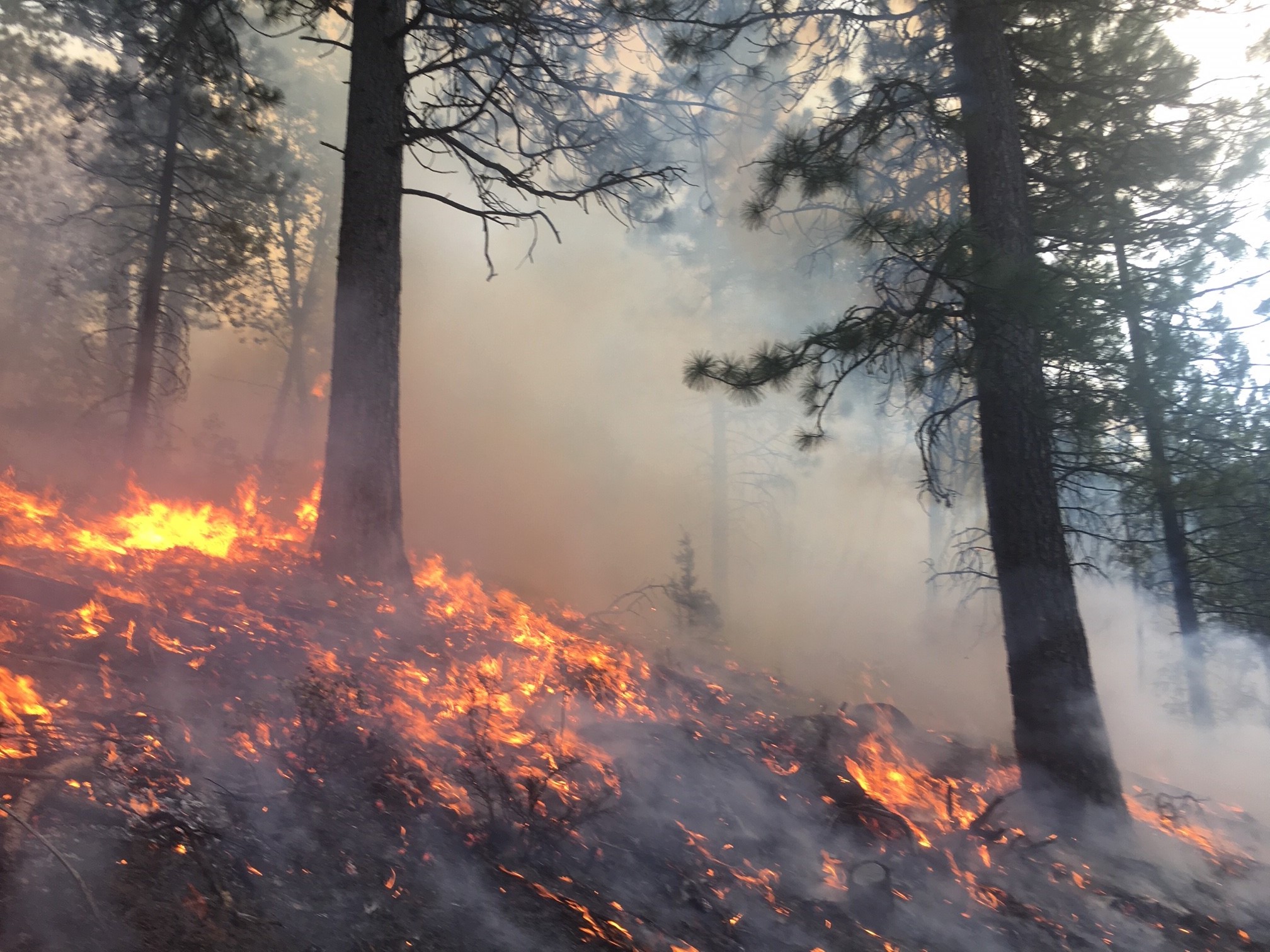
    This happened in part because of a century-plus-old policy of extinguishing every forest fire possible. The legacy of putting out forest fires: lots of small shrubs and trees that in centuries past would have been regularly cleared out by fires. Instead they now crowd forests that are tinder dry thanks to hotter, drier weather wrought by climate change. The result is the unnatural “mega-fires” that blanket the Cascadia region in smoke most every year, send residents fleeing or to hospital, decimate tourist economies, and pump millions of tons of carbon dioxide skyward.

    The most basic solution? Adapt forestry practices for the climate-altered world we live in. Thin forests rather than clearcut. Harvest less often to allow trees to soak up more carbon. And plant trees, a lot of trees — as long as they’re adapted to their location.

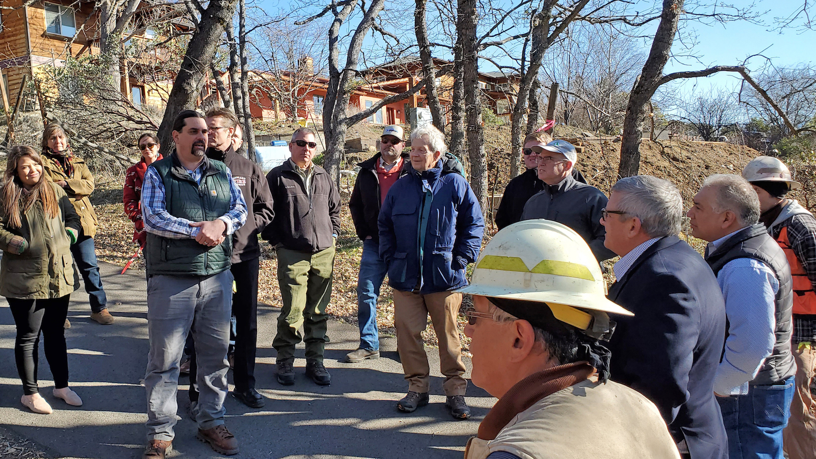
    “There are no foolproof solutions,” said Natasha Kuperman of Seed the North, whose silviculture experiments in northern British Columbia were profiled in one story. “This is harm reduction. This is mitigation. And that is the best thing that we can do with our lives.”

    Can Cascadia carry through?

    This part of the world has inherent advantages in its bid to go completely carbon-neutral, including a moderate climate, an increasingly progressive electorate and the massive amount of low-carbon energy generated from its dammed rivers. 

    Certainly more could and should be done, environmental campaigner Golden says. 

    He quotes the groundbreaking economist John Maynard Keynes, who observed, “The difficulty lies not so much in developing new ideas as in escaping from old ones.”

    Breaking through long-standing patterns of economic development, long spurred by that network of power-producing dams, represents an extraordinary opportunity, he says. Even more needs to be done to make that system work in tandem with all the other clean-energy sources coming on line and thus to show the rest of the world how to do this, he said.

    “This region’s got an awful lot going for it,” Golden said. But, he added, “I still don’t think we’re using all our advantages to our maximum potential.”

    With reporting from Iris Crawford, Andrew Engelson, Michelle Gamage, Lizz Giordano, Mandy Godwin, Amanda Follett Hosgood, Ysabelle Kempe, Braela Kwan, Erik Neumann, Shannon Osaka, Levi Pulkkinen and Jack Russillo.

    This story was originally published by Grist with the headline Lessons from a year of reporting on climate solutions in Cascadia on Dec 15, 2021.

    This post was originally published on Grist.

  • After tornadoes barreled through six U.S. states late last week, killing at least 88 people and flattening warehouses, nursing homes, and factories, many were quick to blame the warming climate for at least some of the damages. 

    Over the weekend, many in the news media speculated that global warming may have played a role and pressed policymakers for answers. Deanne Criswell, the administrator of the Federal Emergency Management Agency, or FEMA, called the devastating tornadoes “our new normal.” President Joe Biden, responding to a question from reporters at a press conference on Saturday, said that “everything is more intense when the climate is warming — everything” but emphasized on Monday that “we can’t say with absolute certainty” that climate change was to blame. 

    The questions are hardly a surprise: After all, it’s become increasingly common — and scientifically supported — to blame floods, heat waves, and even intense hurricanes on the increasing temperatures from fossil fuel use. Friday’s record-breaking heat caused many to speculate that climate change might have played a role in the disaster; there’s also evidence that tornadoes are shifting eastward, perhaps because of changing temperatures.

    But tornadoes, scientists say, are extremely difficult to link to climate change. According to a 2016 report from the National Academies of Sciences, tornadoes are the most challenging weather event to attribute to global warming — after heat waves, wildfires, extra-tropical cyclones, and even heavy snowfall. “They are the single extreme that we have the least confidence around,” said Zeke Hausfather, a climate scientist and the director of climate and energy at the Breakthrough Institute. 

    That’s for several different reasons. First, most studies linking climate change to weather events (a field known as “extreme event attribution”) model the world’s climate in two different ways: with human-caused warming and without. But those climate models don’t have a fine-enough resolution to simulate tornadoes, making it hard for scientists to see how twisters might change in the coming years. 

    “Our models don’t produce tornadoes,” Hausfather said. Climate models, he explained, split the world into 100- or 25-kilometer wide boxes and simulate what happens in each box. But tornadoes form in areas that are less than one kilometer wide — much too small to be easily modeled. 

    That means scientists have to use other methods to analyze how twisters will be affected by the warming climate. Tornadoes require a few different ingredients to form: first, potential energy created by warm, moist air near the ground and cool, dry air overhead. In so-called “Tornado Alley” in the central U.S., for instance, tornadoes are formed by warm air flowing in from the Gulf of Mexico to the southeast, and cool air coming from over the Rocky Mountains. Second, they require “wind shear,” a change in wind speed or direction from the ground to the sky, to wind up the tornado’s spin. 

    Harold Brooks, a senior scientist at the National Severe Storms Laboratory, says that there is evidence that a warming climate could affect one of those ingredients, but not the other. There’s good evidence, according to Brooks, that the potential energy of storms could increase as the world heats up. But wind shear could decrease or increase in a warming planet,  and scientists aren’t yet sure which effect will win out. 

    To make matters more complicated, tornadoes can also be affected by the precise way that thunderstorms form — whether they form as isolated storms, as in Friday’s disastrous events, or as a huge line. Isolated storms, Brooks says, are more likely to create tornadoes. But, he adds, there’s no understanding yet of how global warming could influence the exact mechanisms of thunderstorm formation. 

    Researchers argue that there could come a point when research clearly demonstrates a link between tornadoes and a warming world. “Absence of evidence is not evidence of absence,” Hausfather said. But at the moment, there’s no clear data to indicate that tornadoes are increasing in number or intensity. (There are more tornadoes now than in the 1950s, but scientists say that’s because of changing monitoring techniques.) 


    And there are risks that come with getting too far ahead of the science. In a paper released last week in the journal WIREs Climate Change, researchers from Sweden and the U.S. made the case that connecting climate change to extreme weather events can obscure how poor planning and failing infrastructure turns weather events into disasters. “Even where science can attribute such events to human emissions of greenhouse gasses with some rigor,” the authors wrote, “the damages that follow are centrally a function of vulnerabilities on the ground.”

    Stephen Strader, a professor of geography at Villanova University, similarly argues that focusing too much on the role of global warming can let policymakers off the hook. “It creates an air of ‘what can we do, our hands are tied,’” he said. “Climate change is only one side of the disaster coin.”

    In this case, Strader explained, the tornadoes were particularly dangerous for a few reasons: Many of them struck at night, when people were more likely to be asleep or unwilling to evacuate, and they struck the southeast of the United States, where there are many mobile homes and homes without basements or tornado shelters. (Last year the Southeast experienced 83 percent of tornado-related deaths.) Many of the deaths, meanwhile, occurred in a few buildings — an Amazon warehouse and a candle factory — that were razed to the ground. 

    Strader said he hopes that the recent spate of tornadoes will boost efforts to prepare — and that policymakers will shore up building safety and learn how to encourage people to take shelter quickly and safely. “There’s a narrow window of opportunity to prevent and prepare for the next one,” he said.  

    This story was originally published by Grist with the headline Why tornadoes are the hardest disasters to link to climate change on Dec 14, 2021.

    This post was originally published on Grist.

  • First responders surround an Amazon Fulfillment Center in Edwardsville, Illinois, on December 10, 2021, after it was hit by a tornado.

    Amazon was accused Saturday of putting corporate profits above worker safety following the tornado-caused partial collapse of a St. Louis-area warehouse that left at least six people dead.

    “Time and time again Amazon puts its bottom line above the lives of its employees,” said Stuart Appelbaum, president of the Retail, Wholesale and Department Store Union (RWDSU), in a statement. “Requiring workers to work through such a major tornado warning event as this was inexcusable.”

    Appelbaum’s remarks came after an outbreak of over 20 devastating tornadoes late Friday tore through multiple states and killed dozens of people. In addition to Illinois, affected states included Arkansas, Kentucky, Mississippi, Missouri, and Tennessee.

    Among the buildings struck was an Amazon facility in Edwardsville, Illinois — a community about 30 minutes from St. Louis. Local officials said Saturday that at least six people died from the collapse.

    Local KMOV reported:

    The walls on both sides of the building collapsed inward, causing the roof to fall. The 11-inch-thick, 40-feet-tall walls could not sustain the tornado that hit the building Friday night.

    The National Weather Service confirmed that it was a category EF-3 tornado that went through Edwardsville Friday night. Winds picked up to as much as 150 mph.

    The number of workers inside the building at the time of collapse is not yet determined. Edwardsville Fire Chief James Whiteford said at a press conference late Saturday that one person was injured and 45 people were rescued.

    According to the St. Louis Post-Dispatch:

    By Saturday evening, first responders had shifted from an emergency response to a recovery effort. While they would continue to go through the rubble during daylight hours over the next three days, Whiteford said he doesn’t know whether any other victims will be found inside.

    Shortly before the facility was hit the National Weather Service’s Storm Prediction Center warned of an increasing “damaging wind and tornado threat” for the area.

    As some observers pointed out on social media, Amazon has previously failed to close warehouses in the face of extreme weather events:

    “How many workers must die for Amazon to have a policy for extreme weather events?” sociologist Nantina Vgontzas tweeted Saturday. “It’s currently up to local management and this is clearly disastrous. Condolences to the families and survivors of this horrific, avoidable tragedy.”

    In his statement, Appelbaum called the event “another outrageous example of the company putting profits over the health and safety of their workers, and we cannot stand for this.”

    “Amazon cannot continue to be let off the hook for putting hardworking people’s lives at risk,” he said, vowing that his union would “not back down until Amazon is held accountable for these and so many more dangerous labor practices.”

    Adding to the fresh scrutiny of the online giant’s labor practices, as Bloomberg reported Saturday, are its policies regarding employees’ mobile phone access. From the reporting:

    Amazon had for years prohibited workers from carrying their phones on warehouse floors, requiring them to leave them in vehicles or employee lockers before passing through security checks that include metal detectors. The company backed off during the pandemic, but has been gradually reintroducing it at facilities around the country.

    “After these deaths, there is no way in hell I am relying on Amazon to keep me safe,” one unnamed worker from another Amazon facility in Illinois told Bloomberg. “If they institute the no cell phone policy, I am resigning.”

    This post was originally published on Latest – Truthout.

  • In the wake of hurricanes, floods, and other disaster events, most Americans know that you can apply for aid from the Federal Emergency Management Agency, known as FEMA. What they don’t know is that since 2002, nearly half of those applicants were turned down. 

    Since that year, some 15 million households applied for support through the agency’s Individual Assistance Division; roughly 7.5 million households were denied help, according to an E&E news analysis. Journalists and watchdog groups have been offered little insight into why. Demographic information, such as race, ethnicity, sex, tribal membership, marital status, and education level, has been nonexistent, making it impossible to track the federal agency’s equity priorities and to screen for discrimination. 

    That could change. 

    Recently, the agency made the move to request authority from the Office of Management and Budget, or OMB, to begin asking people to provide such demographic information as they’re applying for FEMA aid, as first reported by E&E News and confirmed to Grist by a FEMA official. The move will allow government watchdogs and the federal agency to determine if there is discrimination in how the group distributes such funds. FEMA has distributed roughly $26 billion through its Individual Assistance Division since 2002.

    However, the demographic details will not be used to determine if an applicant is eligible for disaster aid, the FEMA official said. 

    Historically, the official said, the agency was barred from collecting demographic data because it was not used to determine eligibility, which is why the agency requires approval first from the OMB to update the application process.

    A New Market Volunteer Fire Company rescue crew member wades through high waters following a flash flood, as Tropical Storm Henri makes landfall, in Helmetta, New Jersey, on August 22, 2021.
    A rescue worker wades through the flooded streets of Helmetta, New Jersey, after Tropical Storm Henri made landfall there in August. TOM BRENNER/AFP via Getty Images

    The move, which comes on the heels of years of organizing by disaster recovery and housing nonprofits, comes as the agency’s aid distribution amounts are expected to rise with climate change continuing to fuel more severe weather events and climate-induced displacement. In 2021, there were at least 18 disasters with more than $1 billion in damages, up 300 percent from the early 2000s. The data will help to confirm any inequities in whom disasters affect and which demographics are more likely to face disasters. 

    “Systematic barriers can make disaster recovery more difficult for historically disadvantaged or underserved people,” the FEMA spokesperson told Grist. “Collecting this information during the application process will allow FEMA to better evaluate, identify and remedy inequity-related issues within disaster assistance programs.”

    Using broad demographic data from the census, advocacy groups have found patterns of discrimination, but household level data would definitively prove it. In a national poll released this week by the nonprofit political organizing group Black to the Future Action Fund, 46 percent of Black respondents experienced severe weather events this summer. In comparison, an analysis by the Washington Post found that 32 percent of all Americans experienced weather disasters this summer. 

    Diane Yentel, president and CEO of the National Low Income Housing Coalition is expected to testify about inequalities in disaster recovery to the United States Commission on Civil Rights on December 10, the first time in U.S. history that the commission has probed FEMA or the results of a disaster recovery plan. 

    Yentel shared her testimony in advance with Grist, including “Black and brown communities are often located in areas at higher risk of disaster and have less resilient infrastructure to protect residents from harm. Long-term recovery resources tend to go to white communities that face lower risks.” 

    She is expected to testify that rather than dismantling racial segregation, FEMA’s aid and other federal rebuilding efforts “tend to entrench racial disparities.” 

    A storm-damaged house at a busted levy on the beach after Hurricane Ida on September 4, 2021 in Grand Isle, Louisiana. Ida made landfall as a Category 4 hurricane six days before in Louisiana and brought flooding, wind damage and power outages along the Gulf Coast. Sean Rayford/Getty Images

    FEMA contends that an applicant’s demographic data is never a reason for rejection. Typically, FEMA says, the biggest reasons for rejections are that people can’t prove their residency or that applicants’ homes faced pre-existing damage not caused by a disaster. Yentel and other advocates contend rejections disproportionately affect renters, people facing housing insecurity, undocumented immigrants, and people with disabilities.

    While natural disasters may uproot families and their homes, landlords have used hurricanes, floods, and other wild weather events as an opportunity to kick renters out. After Hurricane Katrina, for example, thousands of low-income renters in Louisiana and Mississippi faced mass evictions and illegal price gouging, which dwindled their chances of receiving FEMA aid.

    FEMA’s criteria for receiving aid, Yentel says, leaves many low-income survivors, who tend to be people of color, “at increased risk of displacement, eviction, and, in worst cases, homelessness.” A 2018 study by Rice University found that white people who live in counties that faced disaster damage and FEMA support actually saw their personal wealth rise following the disaster while Black residents lost wealth. 

    So while the disparities are more than apparent, more centralized data collection might move the needle in addressing them. The next step, advocates contend, is making sure FEMA makes the data publicly available. FEMA has not said if the demographic information will be publicly available or when data collection protocols might be approved. 

    As climate disasters become a regular component of American life, Yentel said, “Our country must develop a new disaster housing recovery system that centers the housing needs of the lowest-income and most marginalized survivors.” 

    This story was originally published by Grist with the headline Who gets help after a hurricane or flood? FEMA will start tracking it by race on Dec 10, 2021.

    This post was originally published on Grist.

  • It’s December, and Denver, Colorado, has no snow, breaking its record for the latest first snowfall since record keeping began in 1882. Meanwhile, nearly 4,000 miles and half an ocean away, Hawaii faced blizzard warnings over the weekend on its high peaks. 

    While it’s not unusual for Hawaii to get snow on its mountains, it’s rare for a blizzard warning to happen there before winter really hits the rest of the United States, according to the National Weather Service.

    Across the country, the weather is just plain weird right now. Parts of the Pacific Northwest and British Columbia just had their wettest fall on record, driving widespread flooding and mudslides. Hawaii’s blizzard warning turned into catastrophic flooding, with more than 2 feet of rain expected, prompting leaders to declare a state of emergency. Sixty-five weather stations from Virginia to Wyoming recorded record-high temperatures last week. Some locations in Alaska just had their coldest November on record. Then yesterday, the state experienced an “abrupt turnaround” with above normal temperatures, coastal flooding, and blizzards.

    And in Montana, record-setting temperatures and strong winds, combined with historic drought conditions, sparked prairie fires that burned at least 12 homes and businesses, several grain elevators, and left melted railcars in their wake. 

    “It’s definitely not a good sign that it is this dry in December and this warm,” Brock Linker, a farmer and firefighter in Montana, told the New York Times. “We’ve had zero moisture since May and no sign of any in the future.”

    It is hard at this point to attribute all of these weather patterns to global warming, Brian Brettschneider, a climate scientist in Anchorage, Alaska, told Grist. But certainly, “climate change is making every place warmer.”

    And this year, “the markers of the beginning of the winter season are just really, really late in most places,” he said. 

    It is a trend that is expected to continue: According to new research, in less than four decades, mountain states in the Western U.S. could be without snow for several years at a time. Due to warming air temperatures, the area has already lost 20 percent of its snowpack since 1950. The warmer temperatures could affect freshwater resources as well. When the snow melts, more freshwater will be lost to the air and soil and a warmer and drier climate, with less making it to reservoirs. 

    Some of this month’s wild weather is being caused by La Niña, a climate pattern that generally occurs every two to seven years. “La Niña winters have a lot of variability,” Brettschneider told Grist. 

    La Niña affects climate patterns worldwide. In the U.S., it tends to cause drought and warmer-than-normal temperatures in the southern half of the country, heavy rains in the Pacific Northwest, and cooler than normal temperatures in the north.

    The National Weather Service summed up the erratic behavior best in a tweet on Monday. “It’s beginning to look a lot like…hmmm, maybe not.”


    This story was originally published by Grist with the headline Blizzard warnings in Hawaii, no snow in Denver: What’s behind this month’s wild weather? on Dec 7, 2021.

    This post was originally published on Grist.

  • This story was originally published by The Guardian and is reproduced here as part of the Climate Desk collaboration.

    All coral reefs in the western Indian Ocean are at high risk of collapse in the next 50 years due to global heating and overfishing, according to a new assessment.

    From Seychelles to the Delagoa region off the coast of Mozambique and South Africa, the reef systems are at risk of becoming functionally extinct by the 2070s, with a huge loss of biodiversity, and threatening the livelihoods and food sources for hundreds of thousands of people.

    The study, published today in the journal Nature Sustainability, examined coral reefs in 10 countries around the western Indian ocean. It analysed the health of 11 sub-regions using the International Union for the Conservation of Nature’s (IUCN) red list of ecosystems framework, akin to the method used to examine a plant or animal’s risk of extinction.

    The assessment found reefs in island nations in particular were highly threatened due to rising water temperatures driven by global heating, which is making bleaching events – when corals expel algae living in their tissue, causing them to turn completely white – more common. Reefs in eastern and southern Madagascar, the Comoros and Mascarene Islands were all classified as critically endangered.

    Reefs in north Seychelles and along the entire east African coast were classified as vulnerable to collapse due to overfishing – especially of top predators – which is altering their ecology and promoting a build-up of different algae that can smother coral.

    David Obura, chair of the IUCN corals group, who led the study, said that while the global decline of coral reefs has been established for some time, region-specific assessments of specific regions provided greater clarity about the causes and the extent of the damage.

    “The most urgent threat is from climate change up to 50 years from now. But while we estimate 50 years into the future, whether we can meet the 1.5C [rise] future or not depends on what we do in the next 10 years. So, it’s really a 10-year horizon that we have to be concerned about,” he said.

    “The collapse of a reef means it becomes functionally extinct as a reef system. You might still find some species there but they won’t be able to construct a reef any more. All of the services we get – coastal protection from sea-level rise, tourism, fisheries, especially for low-income households and communities – are at risk. The tourism sector is huge in east Africa and it depends on heathy reefs.”

    Since the 1950s, the world’s coral reef cover has halved due to global heating, overfishing, pollution and habitat destruction. The decline of the ecosystems, which are vital nurseries for juvenile fish globally, is expected to continue as the climate continues to heat.

    Mishal Gudka, a senior scientist at Cordio East Africa and a co-author of the study, said their assessment detected overfishing of top predators on all the reefs from which there was data.

    “These results highlight the need to improve local fisheries management to ensure the health of reef systems and secure sustainable fish stocks, which support jobs for a quarter of a million people in the region,” Gudka said.

    Alongside cuts to greenhouse gas emissions, Obura said better enforcement of fishery regulations and greater involvement of local communities in reef management could help maintain their survival.

    “This assessment reaffirms the urgency of the interlinked climate and biodiversity crises addressed by Cop26 last month in Glasgow, and Cop15 [biodiversity summit] in a few months in Kunming. We need to take decisive action to address both global threats to corals from climate change, and local ones, such as overfishing,” he said.

    This story was originally published by Grist with the headline Coral reefs in western Indian Ocean ‘at high risk of collapse in next 50 years’ on Dec 7, 2021.

    This post was originally published on Grist.

  • Despite years of preparations, New Orleans Mayor Latoya Cantrell said there was no time to issue a mandatory evacuation order as Ida rapidly intensified into a powerful Category 4 hurricane. She urged city residents to “hunker down.” Mass evacuations require coordination among multiple parishes and states, and there wasn’t enough time. In several surrounding parishes, people were told to evacuate, but in low-lying and flood-prone areas, many residents couldn’t afford to leave.

    Hurricane Ida became the most destructive storm of the busy 2021 Atlantic hurricane season, which ended Nov. 30. It was one of eight named storms to hit the U.S. as the season exhausted the list of 21 tropical storm names for only the third year on record.

    The post US Isn’t Prepared For Climate Disasters That Push People Deeper Into Poverty appeared first on PopularResistance.Org.

    This post was originally published on PopularResistance.Org.

  • To many Americans, California is defined by its ranging coastline and the sandy beaches and multi-million dollar homes that line its 840-mile stretch. As sea levels continue to rise, it’s no secret then, that the state and its inhabitants are facing a crisis. Hollywood knows this, too, as movie after movie over the last decade has depicted the state’s biggest monuments being taken by the sea. 

    Lucas Zucker and Amee Raval have bigger fears, however, than the Santa Monica Pier being eaten by the ocean. “People tend to only think about certain destinations, your Malibus and Santa Barbaras — places where celebrities live — these loom large in the public imagination and they shape how policymakers think about sea-level rise,” Zucker, a policy director at Central Coast Alliance United for a Sustainable Economy, or CAUSE, told Grist. 

    But, Zucker says, if you actually took the 840 mile trip along the coast, you’d see a different reality. “You would see huge swaths of the coast that have been primarily used for heavy industry, commercial shipping, and toxic military bases,” he explained. And those swaths would be home to majority Black and Latino communities, who are no strangers to the effects of pollution and toxic chemicals. 

    These two environmental justice activists, whose communities are nearly 400 miles apart, represent a group of California residents in predominantly Black and Latino communities that are five times more likely than the general population to live within half a mile of a toxic site that could flood by 2050, according to a new statewide mapping project led by environmental health professors at UC Berkeley and UCLA (including Grist board member Rachel Morello-Frosch). The study outlines more than 400 hazardous facilities that will face major flooding events by the end of the century, exposing residents to elevated levels of toxic water and dangerous chemicals. 

    The Reliant power plant on the wetlands of Ormond Beach is one of more than 400 toxic facilities in California at risk for severe flooding events before 2100.
    The Reliant power plant on the wetlands of Ormond Beach is one of more than 400 toxic facilities in California at risk for severe flooding events before 2100. Ricardo DeAratanha/LAT via Getty Images

    The Toxic Tides project is a first-of-its-kind look at the consequences of sea-level rise on California’s historically neglected environmental justice communities in hopes of urging more federal and state officials to address the expected crisis and transition away from the use of these toxic facilities. “It adds to the urgency,” Raval, policy director at the Asian Pacific Environmental Network, or APEN, told Grist. “We’re equipped and supported now with the data and the research to legitimize our community concern and our vision for a just transition.”

    CAUSE, based in Ventura County, and APEN, based in Richmond and Oakland, along with three other environmental justice groups and academic researchers, spent three years combing through federal toxic landmark databases in addition to interviewing community members throughout the entire state to produce the new maps. In all, the coalition created a series of searchable maps and databases to weave together California’s flooding hotspots, which industrial facilities face particular risk, and how lower-income communities of color would be disproportionately impacted. The hotspots they found were unsurprising, Raval told Grist, but nonetheless damning. 

    “We know who the polluters are. The same big polluters that are destabilizing our climate and driving sea-level rise,” Raval said. “When these toxic facilities flood, they will release even more toxins into our air, water, and land.”  

    The project outlined three major hotspots: Wilmington, Richmond, and Oxnard, California. In Wilmington, a pocket of South Los Angeles dubbed an “island in a sea of petroleum,” at least 20 industrial facilities, landfills, oil terminals, and incinerators are expected to regularly flood this century. In Oxnard, there are at least nine hazardous sites prone to flooding. Up the coast in Richmond, there are more than a dozen toxic sites at risk, including the Chevron oil refinery, which produces more than 10 million gallons of oil every day, making it the 27th biggest refinery in the country.

    Wilmington, a small community along the Port of Los Angeles, is home to roughly 20 toxic facilities that are prone to flooding caused by sea level rise. Adam Mahoney/Grist

    Because of the immediate impact to be felt by affected community members, advocates like Zucker and Raval knew how important it was to not just present this data to policymakers, but to the people who live there. This was particularly important in the three areas spotlighted by the project, all of which are home to thousands of non-English speakers. As an environmental justice organizer, Raval says, it’s vitally important to meet people where they are and to meet their specific needs. The group spent months explaining their findings to residents up and down the state in an effort to combine their research “with making those authentic partnerships with community members and advocates who live this reality every day.” 

    Beyond educating and organizing their communities, the Toxic Tides coalition is actively working to secure funds to help clean up and transition away from these toxic sites, while not reinforcing existing social inequalities and environmental injustices. The groups are advocating for funds set aside in the newly passed Bipartisan Infrastructure Law’s Superfund cleanup provisions to be used on many of the sites outlined in the project. On a state level, the coalition is hoping to leverage California’s recent $30 billion budget surplus to be used on these frontline environmental justice communities. 

    “We can’t be dismissed or not taken seriously anymore,” Zucker said. “Our communities already knew of all this was going on in our backyards, but now we have the numbers and the data visualizations to back it up to scholars, planners, and elected officials.” 

    This story was originally published by Grist with the headline Toxic Tides: Climate change expected to cause 400 toxic California sites to flood by 2100 on Dec 3, 2021.

    This post was originally published on Grist.

  • A roundup of the struggle for human rights and freedoms, from Pakistan to Poland

    Continue reading…

    This post was originally published on Human rights | The Guardian.

  • Devastating floods ripped through British Columbia and Western Washington this week, forcing thousands to evacuate their homes and cutting off Vancouver, Canada’s third-largest city, from the rest of the mainland. 

    As rain poured down on the region, highways were submerged or broken in half by the rising deluge. All 7,000 residents of the town of Merritt, British Columbia, were forced to evacuate due to a complete failure of the city’s wastewater treatment plant. Farmers in Abbotsford rescued stranded cattle via jet-ski. According to one meteorologist, some areas of B.C. received as much rainfall in 24 to 36 hours as would normally fall during the entire month of November. Across the border in Washington state, the town of Sumas reported that 75 percent of homes were damaged by water, and a mudslide shut down Interstate 5. 

    Many were quick to link the deluge to climate change. “I’ve been at this dais over the past two years now talking about challenging times we have faced,” said John Horgan, the premier of British Columbia, in a speech on Wednesday declaring a state of emergency in the province. “For those who understand and recognize that these events are increasing in regularity because of the effects of human-caused climate change, there is hope.” 

    Washington State Governor Jay Inslee similarly declared a state of emergency in 14 counties. “We have to realize that we’re going to face decades of increased floods in our state of Washington,” he said at a press conference on Wednesday. 

    The connection between the flooding and global warming is not clear-cut — but then, links between climate change and disaster rarely are. The immediate cause of the floods was an atmospheric river, a thick band of air that transports huge amounts of moisture north from the tropics. Earlier this week, some areas of British Columbia witnessed almost 8 inches of rain in a single day. 

    Scientists aren’t yet certain exactly how atmospheric rivers will change in a warming climate. According to a study published last month in Nature Climate Change, atmospheric rivers were stable between 1920 and 2005, despite rising temperatures; researchers found that aerosols from industrial pollution, which have a cooling effect, had counterbalanced warming. In the future, though, researchers predicted that precipitation from atmospheric rivers would increase. 

    Similarly, a NASA-led study in 2018 found that while the number of atmospheric rivers might decrease over the next 80 years, heavy rain and strong winds caused by these “rivers in the sky” could increase by up to 50 percent.

    The atmospheric river isn’t the only factor at work in the destructive floods. The Pacific Northwest was pummeled this summer by baking heat and devastating wildfires. This type of “weather whiplash” — boiling heat and droughts, followed by intense rainfall — is exactly the type of pattern climate scientists have been expecting in the West under global warming. 

    Wildfires, meanwhile, can paradoxically cause more intense flooding, by burning up the top layer of vegetation and soil. Without that layer, water isn’t absorbed as easily into the soil, and rainfall can quickly turn into devastating mudslides. Foresters and environmentalists have also warned that clear-cut logging can intensify floods and mudslides by removing stabilizing vegetation and loosening soils. 

    The floods are yet another reminder of how even the seemingly mild climates can be devastated by warming temperatures — and how difficult it can be to prepare. In July 2019, a report by the government of British Columbia predicted that “extreme precipitation and landslide” could endanger cities by cutting them off from the rest of the province. They estimated that such an event could be “possible” in 2050, but was currently “unlikely.” 

    Like many climate disasters, this one came early.

    This story was originally published by Grist with the headline ‘Weather whiplash’ in the Pacific Northwest is a sign of what climate change has in store on Nov 19, 2021.

    This post was originally published on Grist.

  • Regardless of the outcome of COP26, one inevitability is that the rich and powerful celebrate whatever the conference produces as vital progress. Only a disaster on the level of COP15 in Copenhagen might put a stop to the self-congratulatory triumphalism. Already, though, most observing the negotiations with a critical eye are highlighting how inadequate their product will be. Ed Miliband has said we’re ‘miles from where we need to be’ and Greta Thunberg declared COP26 to be a ‘failure’.

    These condemnations are backed up by analysis from Climate Action Tracker (CAT), assessing governments’ short-term commitments for the next decade. Its study reveals that our trajectory coming out of COP26 would take us to a devastating 2.4oC warming by the end of this century.

    The post 2.4 Degrees Is A Disaster – But COP Won’t Stop It appeared first on PopularResistance.Org.

    This post was originally published on PopularResistance.Org.

  • Whenever David Schulte came home from studying Tangier Island in recent years, he couldn’t stop talking about what he was seeing. The spit of land in the Chesapeake Bay was washing away faster than any of the baseline predictions. Rising seas, spurred by climate change, had kicked erosion into overdrive, and the town, where people have lived for at least 200 years, was sinking under the waves.

    His high-school aged son, Zehao Wu, listened with fascination. “It was all he could talk about at the dinner table,” Wu said. He was particularly struck by the plight of the islanders, most of whom lacked the resources to move elsewhere: The median household income on Tangier is $42,000 a year.

    This week, Wu and Schulte, a marine biologist with the U.S. Army Corps of Engineers, published a paper in the journal Frontiers in Climate showing that Tangier Island has lost more than half its habitable area since 1967, and predicting that it will be totally uninhabitable by 2051 without drastic measures. 

    Those measures are mind-bogglingly expensive. Staving off erosion enough that residents could remain on the island would cost at least $250 million, the researchers found. Moving the entire town to the mainland, meanwhile, would come with a price tag between $100 to $200 million. Both are expensive propositions, especially considering the town has just under 400 residents. That breaks down to between $550,000 to $750,000 per person to stay, or $220,000 to $430,000 per person to leave.

    Tangier Island is just one canary in a coal mine, signaling a much larger problem. Officials need to be preparing to relocate hundreds of communities, but there’s a stubborn attachment to place that keeps many people from moving, said Nicholas Pinter, who studies flooding at the University of California, Davis. “The city Pattonsburg, Missouri, moved after the 1993 flood — but it had been inundated 32 times before that,” Pinter said. 

    There are about 200 million people worldwide at risk of inundation by 2100, and that’s if countries manage to reduce greenhouse gas emissions. The numbers go up as emissions increase. Already, Boston is considering a mega barrier around its harbor, Norfolk is proposing a $1.4 billion seawall, and San Francisco is lifting buildings and moving freeways. The world is beginning to glimpse just how much work and money it will take “to do nothing.”

    “People are going to start getting a wakeup call on just how much climate change is going to cost us,” Schulte said. 

    Sea water collects on the front walk way of a home in Tangier, Virginia, May 15, 2017, where climate change and rising sea levels threaten the inhabitants of the slowly sinking island.
    Sea water collects on the front walk way of a home in Tangier, Virginia, May 15, 2017, where climate change and rising sea levels threaten the inhabitants of the slowly sinking island. Photo by JIM WATSON/AFP via Getty Images

    A wealthier community could afford to build seawalls, or might have the political connections to elicit government help. But the new research shows just how difficult it will be for smaller, low-income towns like Tangier to adapt. Schulte has worked on several plans to either move or protect communities from sea-level rise — all of them Native American villages with little money for resilience or relocation. The new infrastructure bill will provide some funding for that cause: It includes $47 billion for communities to prepare for floods, fires, and storms, with $100 million earmarked for moving Indigenous communities. But that’s a drop in the bucket. The Bureau of Indian Affairs has put a $5 billion price tag on the cost of moving Indigenous villages alone in the next 30 years

    “There is this very important disparity between those who are most affected by climate change and those who can afford to make the necessary adaptations,” Wu said. “That makes it more important for government to step in and help these people.”

    In 2015, Schulte published a study in the journal Scientific Reports suggesting that the residents of Tangier Island would need to abandon the town between 2030 and 2065. The study received widespread media attention, and Wu waited for news that Tangier would finally get the help it needed, in the form of money, infrastructure, or guidance. Instead, the mayor of the town, James “Ooker” Eskridge, received a call from former president Donald Trump. “He said not to worry about sea-level rise,” Eskridge, an ardent Trump supporter, told reporters. “He said, ‘Your island has been there for hundreds of years, and I believe your island will be there for hundreds more.’”

    It was a shock for Wu to see that no one acted: “I figured some help must be coming for these people, but no help came.”

    If no one else was going to do anything, Wu decided he should. He began studying aerial photographs of the island over the years, and realized he could see the waters creeping up. Lowlands turned dark as the seawater penetrated the soil. It was easy to distinguish these spongey wetlands from the lighter highlands, he said. He realized that if he plugged these images into mapping software, he’d be able to accurately chart the rate of inundation.

    “When he showed me the results, I got pretty excited,” Schulte said. Wu had figured out a way to strengthen a weakness of his dad’s 2015 paper, which based its predictions on the shrinking of the entire island rather than focusing in on the parts that mattered — the ridges where people live, which stand two to five feet above sea level.

    The paper’s findings suggest that sea-level rise is eroding these ridges more rapidly than previously thought. All the islands in the Chesapeake Bay are eroding, and several disappeared before the onset of climate change. Rising seas are accelerating the process. The first ridge will complete its conversion to wetlands by 2033, the second by 2035, and the highest and smallest ridge by 2051, Wu and Schulte predict. The impacts are already clear: The pair found that the population of the town has declined by more than half as the livable area shrunk.

    “When your front yard is converted into a swamp over the course of your life you tell your grandkids, ‘You’ve got to leave,’” Schulte said.

    This story was originally published by Grist with the headline What a tiny island in Chesapeake Bay teaches us about the costs of sea level rise on Nov 10, 2021.

    This post was originally published on Grist.

  • Flooding is already the most expensive natural disaster in the United States, costing the country more than $1 trillion in damages since 1980. And it’s only getting worse due to climate change.

    A quarter of all critical infrastructure in the United States, 36,000 facilities including airports, utilities, and hospitals, is at risk of becoming inoperable due to flooding today, according to a new report from the First Street Foundation, a New York-based research group. 

    In addition, 2 million miles of roads, nearly 1 million commercial buildings, and more than 12 million homes are also at risk of being shut down or severely damaged by flooding. 

    “As we saw following the devastation of Hurricane Ida, our nation’s infrastructure is not built to a standard that protects against the level of flood risk we face today,” Matthew Eby, founder and executive director of First Street, said in a press release, “let alone how those risks will grow over the next 30 years as the climate changes.”

    As global temperatures rise, “an additional 1.2 million residential properties, 66,000 commercial properties, 63,000 miles of roads, 6,100 pieces of social infrastructure, and 2,000 pieces of critical infrastructure will also have flood risk that would render them inoperable, inaccessible, or impassable,” the report found. 

    Change in flood risk to infrastructure over the next 30 years. First Street Foundation

    The research, “Infrastructure on the Brink,” looked at all types of flood risk in every city and county across the U.S. It is the most extensive analysis of its kind to date. 

    The parts of the country most at risk include the obvious contenders, Louisiana and Florida, but also some not-so-obvious ones: Kentucky and West Virginia. 

    Alan Fryar, a hydrogeologist at the University of Kentucky, told Grist that low-lying places in Kentucky and the Appalachian Mountains, areas already susceptible to flooding, have become “sitting ducks” in recent years, as rainfall has increased but investment in infrastructure has remained the same. 

    Along the Atlantic and Gulf coasts, flooding is expected to increase due to rising sea levels and increases in storm surge. In the Northwest, flood risk is expected to worsen due to more precipitation, and runoff from increased snowmelt. 

    “This report highlights the cities and counties whose vital infrastructure are most at risk today,” Eby said in the press release, “and will help inform where investment dollars should flow in order to best mitigate against that risk.” 

    The report is released amid intense debate in Congress over an infrastructure bill that would provide more than $1 trillion over the next 10 years to fund projects such as making buildings and roads more resilient to climate impacts. Many are pressuring Congress to pass the bill before the end of the month, ahead of the global COP26 climate summit. 

    “We’re at risk of losing our edge as a nation,” President Joe Biden told Michigan residents last week during a visit to promote the bill. “To oppose these investments is to be complicit in America’s decline.” 

    This summer was a blatant example of the increasing risk floods pose to communities across the U.S. Hurricane Ida was the fifth costliest hurricane in the nation’s history, according to data from the National Oceanic and Atmospheric Administration. In the aftermath of Ida, floods killed dozens of people in eight different states, left hundreds of thousands without power, and damaged a number of properties. 

    In areas like Cameron and Orleans Parish in New Orleans, up to 94 percent of critical infrastructure is at risk of becoming inoperable, according to First Street. So when natural disasters like Hurricane Ida occur, local emergency services are almost guaranteed to be overwhelmed, leading to a more catastrophic flood event than if the region had adequate infrastructure. 

    “Even if local folks are able to repair flood damage to their properties, flooded critical infrastructure may take a longer period of time to build back,” Fryar told Grist. “Water treatment plants, highways, electrical lines — it’s all of that. If that infrastructure hasn’t been maintained, that’s really cause for concern.”

    This story was originally published by Grist with the headline Flooding could shut down one-quarter of America’s critical infrastructure on Oct 13, 2021.

    This post was originally published on Grist.

  • When Hurricane Ida hit New York City on September 16, it dumped more than three inches of rain an hour. Sewers overflowed, streets turned into rivers, and thousands of homes and basements across the city’s five boroughs flooded. Assemblymember Jessica González-Rojas saw the devastation firsthand when she toured her constituent neighborhoods of Corona, East Elmhurst, Jackson Heights, and Woodside in Queens. Family after family, mostly low-income immigrants, told her they’d lost almost all of their possessions in the storm. But as González-Rojas encouraged residents to seek help from the Federal Emergency Management Agency, or FEMA, she learned that those who were undocumented were ineligible for aid.

    Other elected officials, including state representative Catalina Cruz and city council member Darma Diaz​​, discovered the same thing. Cruz’s office fielded dozens of phone calls from undocumented immigrants struggling to recover from the flooding, with no place to turn for help. As pressure mounted, Governor Kathy Hochul and Mayor Bill de Blasio announced a $27 million fund to help undocumented survivors of Ida in the city — the first initiative of its kind in the country. The fund will provide up to $72,000 to about 1,200 households with undocumented members to pay for things like repairing homes and replacing essential items.  

    “We have been fighting for this kind of disaster relief in our communities,” said Lucas Zucker, policy and communications director at the Central Coast Alliance United for a Sustainable Economy, or CAUSE, in California. “The fact that New York is taking this step is historic.” 

    New York Governor Kathy Hochul is standing in he middle of a street in Queens, talking through. microphone and accompanied by New York City's mayor Bill de Blasio and her team
    New York Governor Kathy Hochul speaks during a tour of neighborhoods affected by Hurricane Ida in Queens on September 7. Mandel Ngan / AFP via Getty Images

    Despite the growing impacts of climate-related disasters from coast to coast, the New York program is the first time a state or the federal government has invested in supporting undocumented immigrants after a disaster. This reality has left millions of people across the U.S. in a state of “hyper-marginalization,” explains Michael Méndez, an environmental justice and public health researcher at the University of California, Berkeley. “The way that we have set up our disaster infrastructure — at the federal, state, and local levels — are rendering invisible undocumented migrants because of cultural and racial norms of who is considered a worthy disaster victim.” 

    An estimated 10 million people live in the U.S. without legal authorization, according to the Pew Research Center. Most of them — around 61 percent — are concentrated in fewer than 20 metro areas located in some of the most vulnerable states to climate change, places like New York City, Miami, and Houston. Research has found that low-income, racial, and ethnic minorities, as well as the elderly, renters, non-native English speakers, and those with mobility challenges, are disproportionately affected by flooding. The legacy of racist urban planning practices like redlining also relegated Black, Latino, and other racial and ethnic minorities to flooding-prone neighborhoods in some major metro areas. 

    In the best-case scenarios, local authorities are jumping through hoops trying to help undocumented immigrants access federal aid only authorized for U.S. citizens or those with immigration papers, said Katy Atkiss, disaster equity manager at Houston Immigration Legal Services Collaborative, or HILSC. In the worst, they’re simply doing nothing.

    “One of the biggest barriers to climate resilience in our society is that millions of people in this country are almost completely excluded from the safety net due to their immigration status,” Zucker said. 

    Typically, after a disaster strikes, the federal government sets up a network of programs to support survivors: Homeowners who don’t have insurance or are underinsured can ask FEMA for funds to repair their houses. The U.S. Department of Housing and Urban Development, or HUD, provides federally-backed insurance and loans to cities, counties, and states to meet recovery needs in low-income communities. Families can apply for supplemental, short-term food stamps, as well as disaster unemployment assistance for up to 26 weeks. States can also tunnel federal funds from other programs to support survivors. 

    In theory, families with undocumented residents that have one or more U.S. citizens can apply for federal help. But many in this position are wary of asking for aid. FEMA is under the Department of Homeland Security, and its forms state that other Homeland Security agencies — including Immigration and Customs Enforcement, or ICE, in charge of deportations — could access the information, explained Mendez. Additionally, if the undocumented members eventually become eligible for citizenship, receiving federal funds while undocumented can play against them during their application. As a result, Mendez said, they avoid applying for disaster aid.

    Unauthorized immigrants often find themselves particularly vulnerable even before disaster strikes. 

    During the Thomas Fire, Mendez found, immigrants from different Mixtec Indigenous communities living in Southern California were unable to read the English and Spanish evacuation orders and recommendations. 

    In some cases, their migratory status keeps people away from shelters out of fear of being asked for ID, said Cesar Espinoza, executive director at FIEL, a grassroots group working in the greater Houston area. Espinoza recalls that when Hurricane Harvey hit Texas in 2017, Department of Homeland Security trucks were parked outside of the largest shelter in Houston to help secure the building. Many undocumented immigrants didn’t go because they were afraid of being asked for their papers. “They wondered, ‘Are we going to be safe there?’” he said.  “So a lot of people were in eight, nine feet of water” during the disaster.

    A woman with dark hair, wearing blue short and a black t-shirt, mops up floodwater in her bedroom in Houston, Texas following Hurricane Harvey in September 2017.
    A woman mops up floodwater in her bedroom in Houston, Texas following Hurricane Harvey in September 2017. Joe Raedle / Getty Images

    The unavailability of federal funds has left many nonprofits as the only sources of assistance for unauthorized immigrants in the wake of natural disasters. But these too are often hard for the undocumented community to access. In the aftermath of Harvey, many undocumented people in Texas not only lost their homes, they lost their cars and work-related tools as well, particularly those who worked in construction, Espinoza said. When they reached out to non-governmental organizations for help — those that didn’t exclude unauthorized residents from their funds — the fact that they couldn’t prove their identity, didn’t have proof of income, or didn’t have a bank account for the electronic transfer left them ineligible for support. So FIEL raised $300,000 that they distributed hand-to-hand in the community.

    In California, these organizations have struggled to deploy the infrastructure needed to assist so many people after fires, said Zucker. After the Sonoma Complex Fire scorched 87,000 acres of Sonoma County in 2017, the grassroots organization Community Foundation Sonoma County launched the first private disaster relief fund in the United States specifically for undocumented migrants. Others followed: After the Thomas Fire, the Ventura County Community Foundation raised $2 million to assist more than 1,400 families who were impacted by both the fire and the mudslides that followed.

    Yet it soon became obvious that the needs exceeded the organizations’ capabilities.“Our waiting list was over 1000 families long for months and months and months. People were lining up out the doors early in the morning. Our cellphones were just ringing off the hook. It took us over a year to get the relief for a lot of those families,” Zucker said. “As proud as I am of everything we’ve done, it does not make up for the lack of support and policy.”

    Things remained pretty much the same until last year when COVID-19 hit. Low-income people — with or without documents — were disproportionately suffering from the virus. “[The pandemic] really accelerated our learning and evolved how we’re dealing with disaster preparedness, response, and recovery,” Atkiss, of the Houston Immigration Legal Services Collaborative, said. 

    In early 2020, California, Oregon, and several cities and counties, including New York City and Harris County, Texas, launched funds for those who lost their jobs because of the pandemic, including undocumented immigrants. But it was Washington’s $40 million in COVID-19 relief funds that changed the game, Atkiss said. Besides state dollars, Washington used money from the federal Coronavirus Aid, Relief, and Economic Security Act, or the CARES Act. The state took advantage of a loophole in 1996 welfare reform, which limits cash help to authorized immigrants — except for one-time emergency disaster relief. Washington leaders argued that since COVID-19 is an emergency, they were allowed to give undocumented immigrants a one-time disaster relief payment, explained Atkiss.

    “Other places have used that loophole but not been so brazen about it for fear of lawsuits,” she said. “And as far as I know, Washington was not sued.” Now, she and other advocate groups in Texas are working to convince Harris County leaders to use the same legal argument to extend the eligibility of one of the county’s COVID-19 relief funds, which also uses federal dollars. A similar push is taking place in Iowa.

    Advocates believe the “one-time emergency” framework used during the pandemic opens the door for exploring similar strategies for natural disaster aid. 

    “Whether it’s a fire, whether it’s COVID, whatever kind of crisis comes, when you’re excluded from the safety net, you have nothing to put a roof over your kid’s head and food on the plate,” Zucker said. “That is a truly horrific and immoral thing.”

    This story was originally published by Grist with the headline Facing floods and fires, undocumented immigrants have nowhere to turn for help on Oct 12, 2021.

    This post was originally published on Grist.

  • People look at cars abandoned on the flooded Major Deegan Expressway following a night of extremely heavy rain from the remnants of Hurricane Ida on September 2, 2021, in the Bronx borough of New York City.

    When President Joe Biden toured storm-ravaged neighborhoods in Louisiana in September, he portrayed the damage of Hurricane Ida as a national issue. He claimed that “its destruction is everywhere,” and even more so, that, “it’s a matter of life and death, and we’re all in this together.” As comforting as it may be to hear the president taking storm relief seriously, Biden is getting it wrong.

    Natural disasters could not care less about the unity of the American people. And they hurt underprivileged communities the most.

    The year 2005 showed us a preview of how storms can unleash massive social and economic disruption. Hurricane Katrina hit the Gulf Coast that August, causing the loss of almost 2,000 lives and an estimated $125 billion in damage. Cities like New Orleans were swarmed with images of poor, mostly Black residents navigating the flooded streets.

    Floodwater had broken through the frail levees of New Orleans and taken over the Lower Ninth Ward, an overwhelmingly poor and Black area. Emergency food and medical aid took five days to come. A group of military contractors and the National Guard later organized the full evacuation of the city. Since then, Katrina has become a widely recognized symbol of neglect towards poor and Black communities, in addition to a blatant case of environmental injustice.

    Several studies in the aftermath of Katrina have exposed the relationship between the hurricane and class or racial divides. Research confirms that the storm damage was concentrated in low-income areas. In fact, there is substantive evidence that low-income people — particularly in communities of color — had been disproportionately vulnerable to unemployment and decreasing housing availability in the years following the storm.

    These unequal levels of devastation are not unique to Katrina. A 2018 paper pointed out that wealth inequality increases with the frequency and intensity of natural hazards, especially along lines of race, education and homeownership.

    For example, during a period of substantial natural hazards between 1999 and 2013, white Americans living in counties with $10 billion worth of property damage from storms gained an average net worth of $126,000 per county. Black Americans in the same areas lost $27,000 per county. Similar trends are visible when comparing college-educated to non-college-educated Americans, as well as comparing home-owning to non-home-owning Americans.

    It turns out that natural hazards are really good at making poor people poorer, and rich people richer.

    While hurricanes chase some people out of their homes and trap them into poverty, risk-taking investors follow the storm path in order to buy property that will make them even wealthier. Less obvious ways to make money from storms include selling flood-damaged cars without disclosing the damage (yes, this is legal), payday lending to desperate financially insecure people, or selling protective materials and simultaneously funding climate denial lobbies. These tactics purposely take advantage of vulnerable populations for profit. They are, by definition, predatory.

    What’s even more concerning is that federal aid doesn’t help reduce inequalities in the wake of a storm. For the past couple of decades, the Federal Emergency Management Agency (FEMA) has offered billions of dollars to counties and individuals coping with storm damage. Yet the more FEMA aid a county receives, the starker the wealth disparities become within its residents, possibly due to misallocation of funds. At the same time, private sources of community reinvestment are concentrated in predominantly white middle-class communities.

    This means that — like many others in the past — the current hurricane season created more than a natural disaster. It also fueled a social, economic and cultural calamity.

    FEMA has already filed over half a million applications since Ida. To date, it is the second-most intense hurricane to have hit the state of Louisiana, right behind Katrina. Moreover, Ida triggered a tornado outbreak and flash flooding across the Northeast, making it one of the costliest tropical cyclones in U.S. history.

    Could the situation get any worse?

    Actually, it probably will.

    Hurricanes form in the Atlantic Ocean every year, June through November. National climate prediction centers are expecting 2021 to be an exceptionally active season for tropical cyclones. In the upcoming years, hurricanes will likely only get stronger and more frequent as global temperatures continue to rise.

    This is an opportunity to do better: Apply the lessons learned from Katrina, commit to the fight against environmental injustice and pay more attention to the wealth trajectories of the country.

    If previous natural disasters taught us anything, it’s that we cannot abandon those who need the most assistance after a storm. Katrina exemplified how relying exclusively on the private sector and the military for disaster relief can lead to exploitation and violence. Instead, we must prevent large-scale physical damage by strengthening the infrastructure of hazard-prone areas. Furthermore, legislators should put a halt to predatory private companies and individual profiting from natural hazards — from enforcing laws against price gauging to banning the sale of damaged goods without disclosure. In the event of a natural hazard, FEMA should provide emergency aid quickly and equitably.

    It’s imperative that policymakers launch focused and comprehensive reforms that provide aid beyond short-term economic recovery. These could include targeted reemployment programs, unemployment benefits, relocation assistance, rent subsidies, education grants or infrastructural support — possibilities for holistic recovery following a natural disaster are endless.

    Making people feel united after a harrowing hurricane is cute. Now it’s time for the Biden administration to really address the aftermath of Ida.

    This post was originally published on Latest – Truthout.

  • In mid August, the leader of the Republic of Sakha, in Russia, told residents not to go outside, and to avoid breathing unfiltered air if at all possible. Wildfire smoke filled the streets of Yakutsk, reducing visibility to less than a block. Smoke spread to the North Pole for the first time ever. It spread across the Pacific Ocean. 

    Fires in California this year stunned forest stewards with their size and intensity. But they look puny compared to the fires raging in Siberia.

    We don’t yet know how much land has been consumed by wildfires this season, that satellite data is still coming in. A report from Greenpeace, based on statistics from Russian fire services, estimates that 65,000 square miles have burned — more than six times the area burned in the United States so far this year. At their peak, in August, 190 blazes were spreading across Sakha and Chukotka, Russia’s farthest northeastern regions. 

    In July and August, wildfires in northeastern Russia released 806 million metric tons of carbon dioxide into the atmosphere, according to a new report from Copernicus, the European Union’s satellite program. “That’s more carbon than the emissions of the entire country of Germany, one of the largest economies in the world,” observed James MacCarthy, a mapping expert who keeps an eye on the state of the world’s woodlands for Global Forest Watch. “And you are looking at a trend that’s increasing.”

    map showing Siberian fires
    Fires detected in July and August Global Forest Watch

    That trend stems from the fact that the world is getting warmer, especially at the ends of the earth. “For the last 14 years or so it’s been well accepted that the rate of heating of polar regions is happening two to four times faster than the rest of the world,” said Mark Parrington, a senior scientist at the Copernicus Atmosphere Monitoring Service.

    In 2020, the Russian town of Verkhoyansk reached 100.4 degrees Fahrenheit, the highest daily maximum temperature ever recorded north of the Arctic Circle. It was part of an arctic heatwave that would have been “almost impossible” without human-caused climate change, according to a recent attribution paper in the journal Climatic Change. The normally cold and wet Siberian taiga — or boreal forest, as we call it in North America — broiled and dried out. But that was nothing compared to this year, when the temperature rocketed past last year’s record: Verkhoyansk hit 118 degrees Fahrenheit in June. Already dry vegetation went crisp. Then came the lighting. 

    In the old days, lightning didn’t strike much north of the Arctic Circle — it simply lacked the warm air to rub up against cold clouds, the recipe for an electrical storm. But now, summers are bringing plenty of warm air to the Arctic, and lighting strikes there have tripled in the last decade.

    It’s no surprise that the combination of hot, dry forests and lightning is producing a lot of fires. Total carbon emissions from wildfires worldwide was 1.4 billion tons in August, about half as much as the monthly emissions from fossil fuels.

    A chart showing a dramatic peak in Siberian fire activity in 2021
    Global Forest Watch

    Historically, fires have been part of the planet’s annual cycle of respiration: Forests burn in the dry season, releasing carbon, but then grow back, sucking that carbon up again. But these Arctic fires represent a deviation from the cycle. It’s an example of a feedback loop, where climate change begins generating more greenhouse gases, leading to faster warming. Even if the world quickly ditches fossil fuels, increased emissions from Arctic fires may be locked in, at least for the next 100 years or so.

    But that doesn’t mean there’s nothing humanity can do. Even with the outsized fires in the Arctic, most emissions from fires worldwide still come from the tropical regions, Parrington said. In Africa, Latin America, and Southeast Asia, where people are cutting down forests and setting the wood alight to create pastures and farms. If governments protect forests from land grabbers, provide a path out of poverty for slash and burn agriculturalists, and provide the techniques and technologies that allow people to grow more food on less land, total wildfire emissions would plummet — even as conditions for wildfires worsen.

    This story was originally published by Grist with the headline You thought the U.S. fire season was bad. Russia’s is much worse. on Sep 30, 2021.

    This post was originally published on Grist.

  • Summer may be officially over, but mosquito season is showing no sign of abating. If you’re cursing the influx of winged whiners, save some vitriol for climate change, which definitely played a role in exacerbating this year’s mosquitogeddon. 

    It was an unusually warm summer — the hottest summer on record for the contiguous United States — and that has helped mosquitoes thrive. But experts say the chief reasons for the explosion in mosquito populations this year are the season’s record-breaking storms and above-average rainfall in many states. 

    Parts of the Northeast received a foot of rain in just three weeks in July, due to a series of back-to-back thunderstorms and the remnants of Hurricane Elsa. In August, Tropical Storm Fred and its remnants doused the East Coast from Florida to Massachusetts, and Tropical Storm Henri hit New England head on. Less than two weeks later, Ida soaked the Gulf Coast as a Category 4 and blasted the Northeast with record-breaking amounts of rainfall as a disorganized storm system. Meanwhile, in the Southwest, a “super” monsoon season eased drought conditions in parts of Arizona, producing Tuscon’s wettest month on record in July.  

    Climate change plays a role in exacerbating these storms. The air becomes 4 percent more saturated with water for every 1 degree Fahrenheit that the planet warms. The most torrential downpours in the Northeast now unleash 55 percent more rain compared to the 1950s, according to the most recent National Climate Assessment, and could increase another 40 percent by the end of the century. 

    Unfortunately for humans, the abundance of mosquitoes varies massively with rainfall. The more rain there is, the more scattered pools of water there are across the landscape that the insects can use to lay their eggs in. This summer’s rains basically turned half of the U.S. into a perfect breeding ground for mosquito larvae. 

    “The mosquito is the state bird of New Jersey,” Andrew Dobson, a professor of ecology and evolutionary biology at Princeton University, told Grist. “But this year seems much worse than normal.”

    It’s early to say how, exactly, this year stacks up to previous years in terms of mosquito populations. But the uptick in mosquitoes has been clocked by experts and officials in multiple states so far. 

    “This is actually one of the worst mosquito seasons in recent memory with a record number of the bugs plaguing communities across New York,” Senator Chuck Schumer, Democrat from New York, said at a press conference over the weekend. He called on federal agencies to make funds available to New York to fight off the invasion. In Luzerne County, Pennsylvania, officials told a local news station that 2021 has brought more mosquitoes to their county than they’ve seen in the past decade. In New Orleans, city officials reported more mosquitoes than usual, and nearby St. Tammany Parish reported a 300 percent increase in two types of mosquitoes. Steven Oscherwitz, an infectious disease specialist in Arizona, told Grist that he’s seen an increase in mosquitoes in the Southwest, too, due to the extremely heavy monsoon season. Even Southern California is seeing more mosquitoes than usual, due not to rain but to heat and humidity.

    Some of those mosquitoes are more than just a nuisance. The Culex genus of mosquito carries West Nile virus, a disease in the Yellow Fever family that causes no symptoms in most people but severe disease — including high fever, headaches, tremors, paralysis, and even death — in older and immuno-compromised people. Multiple state public health departments have issued warnings about West Nile virus in recent weeks. Arizona, Arkansas, California, Idaho, New Jersey, and Texas have each reported one to two deaths related to the disease so far, and many more states have recorded human cases of West Nile. 

    West Nile virus is relatively new to the U.S., as far as vector-borne diseases go. The first cases were reported roughly 20 years ago. The illness has no cure, and there is no vaccine available to prevent infection. But Dobson, from Princeton, said that many Americans have immunity to West Nile without knowing it, because they’ve been exposed to bites from mosquitos carrying the virus for multiple summers in a row. The COVID-19 pandemic, however, may have contributed to decreased immunity this year, Dobson hypothesized, because people were stuck inside last summer and weren’t getting bitten as much, leading to a drop in the number of people getting immunity from the virus last year. “You might expect to see more cases of West Nile because people have been isolating themselves because of COVID,” Dobson said. 

    Climate change has helped mosquitos carrying West Nile and other diseases like malaria and dengue fever move around to new and higher ground, where warmer temperatures are helping the insects survive and bite humans. And higher temperatures can also affect the quantity of virus the mosquitos carry, Oscherwitz said. “When it’s really hot, the West Nile virus can multiply in them more, so they each carry a higher load of that virus than they would if we had cooler weather,” he said. 

    The impact of climate change on vector-borne disease more generally has experts worried. “We’ve got to be thinking much more cogently about planet change and what we’re going to do to stop it,” Dobson said. “Otherwise we’re going to have more floods, more diseases.”

    This story was originally published by Grist with the headline How climate change gave rise to a monster mosquito season on Sep 24, 2021.

    This post was originally published on Grist.

  • Sadadra Davis spends hundreds of dollars every month to talk to her fiancé, Johnion Davis, on the phone. They’re inseparable, she says, even though he has spent the last few months incarcerated at Nelson Coleman Correctional Center in St. Charles Parish, Louisiana, and each call runs about $5. But then Hurricane Ida made landfall on August 29. 

    That afternoon on the phone with him, Davis said she heard what sounded like “the wind taking the roof off” the top of the jail. St. Charles Parish was flooding, and winds touching 100 miles an hour ripped through the neighborhoods bordering the Mississippi River. Although the parish was under a mandatory evacuation order, Johnion and more than 300 other inmates were left at the facility. 

    “I was like, ‘You know y’all are under mandatory evacuation,” Davis recalled saying. “He responded basically with, ‘These people aren’t worried about us.’”

    Within minutes of Ida reaching St. Charles, the jail lost power and running water. Davis, who lives more than two hours away in Lafayette, was worried about her fiance but couldn’t get any information from the sheriff’s office in charge of the facility. Friends and family members, too, were left in the dark. 

    Ida, a fast-moving storm that turned into a hurricane in three days after forming, tested local governments’ emergency response plans. Some areas, like New Orleans, told residents to shelter in place, whereas towns in neighboring parishes were under evacuation orders. But Davis isn’t alone in thinking that officials neglected incarcerated people: More than a dozen civil rights groups have raised questions about why some detention facilities in Hurricane Ida’s path weren’t evacuated before the storm.

    Louisiana is known for getting battered by hurricanes. It also puts more of its citizens behind bars than any other state in the U.S., with 1,094 of every 100,000 residents behind bars. If the state were a country, it would have the highest incarceration rate in the world. (1.6 times higher than the actual leader, the United States.) Unlike those on the outside, people inside of prisons depend entirely on jail officials and local governments to keep them safe during a natural disaster. But there is no coordinated or mandated system to manage prisons during these kinds of events.

    Volunteers Desiree Nye (Top L) and Kyler Melancon (Top R) help lift a person in a wheel chair out of a high water truck as they assist people evacuate from their homes after neighborhoods flooded in LaPlace, Louisiana on August 30, 2021 in the aftermath of Hurricane Ida. PATRICK T. FALLON/AFP via Getty Images

    According to the U.S. Department of Justice, Louisiana also has the highest in-custody mortality rate. The coronavirus pandemic has made this much worse: At one point last year, 42 percent of the state’s inmates had tested positive for COVID-19. The health risks are heightened by the prevalence of pre-trial detainment, in which people, like Johnion, are sometimes incarcerated for months without ever being convicted of a crime. 

    The lack of a coordinated plan for jails leaves more than 50,000 incarcerated people in Louisiana facing elevated threats from natural disasters, with patchwork efforts for ensuring prison conditions are livable after the initial danger subsides. These risks have long been known: In 2005, following Hurricane Katrina, a reported 7,000 prisoners went days without electricity, trapped in cells filled chest-high with sewage water. 

    “When we think about people who are incarcerated, I would argue that they are on the front lines of climate change,” said Andrea Armstrong, a law professor at Loyola University New Orleans. “There are deliberate structural reasons behind this: Detention facilities are where government authority is at its highest and individual power is at its lowest.”

    Currently, Armstrong says, there are no statewide guidelines for protecting incarcerated people during disasters in Louisiana’s more than 130 detention centers. It leaves those in charge of the facilities — county governments, sheriffs, and the state’s Department of Public Safety and Corrections — to come up with their own emergency response plans

    As a result, activists say, disasters tend to linger longer inside of prisons than outside of them.

    “The most loss of life doesn’t occur during the storm itself but in the days following, when people have no access to drinking water, electricity, and sometimes food,” said Mei Azzad, a member of the national environmental justice organization Fight Toxic Prisons.

    In the week after Ida hit southern Louisiana, the Nelson Coleman Correctional Center’s phone system was shut down for days, and Davis said the sheriffs didn’t respond to any of the emails she sent from four different accounts. Unable to find answers online, Davis made the trek from Lafayette to the jail, 30 miles outside New Orleans. She had recently found out that their 4-month-old child was prone to seizures and wanted to hear Johnion tell her that everything would be OK. But when she made it to the jail, she said she was turned away immediately and given no information. 

    Officials from St. Charles Parish, who have jurisdiction over the jail, did not respond to Grist’s requests for comment, but St. Charles Parish Sheriff Greg Champagne publicly said inmates weren’t evacuated because the $28 million facility constructed in 2001 was built to withstand a Category 5 hurricane. Yet Davis, advocates, and others in touch with those incarcerated at the facility have told Grist they heard the building has had flooding and rolling power outages. 

    In Lafourche Parish, where Ida made landfall, a mandatory evacuation order was issued, but no evacuation was implemented for the roughly 600 people locked in the Lafourche Parish Detention Center. On August 30, the day after the storm first hit, the jail, which sustained damage and lost power, made news for posting video footage of inmates — some of whom were reportedly detained pre-trial — filling up sandbags to protect property across the parish against flooding. In Baton Rouge, young people detained at a city-run juvenile detention center were not evacuated from the facility, and the center lost power for a day and a half, according to the advocacy law group Promise of Justice Initiative in New Orleans.  

    It wasn’t much better for facilities that did evacuate. Inmates in Orleans Parish and Plaquemines Parish were moved north of Baton Rouge to the Louisiana State Penitentiary, known as Angola. But an outdated inmate search system prevented their family members from knowing about it. Once inmates were moved back to their respective county jails, local sheriffs opted to impose mandatory quarantines rather than letting people go through routine COVID tests, according to the Promise of Justice Initiative. This meant they couldn’t have visitors or go outside for at least another two weeks. Young people lucky enough to be evacuated, like those from the Youth Study Center, a detention center in New Orleans, were moved to adult facilities, an action that Louisiana public defenders have argued is illegal.

    Azzad and other activists argue that the entire system needs an overhaul. A better framework, they say, could take on two problems at once: climate change and mass incarceration. Revamping sentencing laws they consider outdated and racist would reduce the state’s prison population, save money, and make evacuations easier. For those incarcerated ahead of their trials, advocates have suggested allowing them to evacuate or shelter with their families, since they have yet to be convicted of a crime. 

     “What we need is holistic investments in our communities to keep us safe,” Azzad said. “Investing in job programs, accessible food systems, housing, and education would allow us to have fewer people in prison, but also access to more people for climate-resilient response systems.” 

    Armstrong thinks inmates need a voice in the conversation, too. Giving them agency could mitigate the psychological fallout from disasters, like post-traumatic stress, depression, and anxiety. Studies show an increase in disciplinary actions against prisoners following emergencies. After Hurricane Harvey in 2017, for instance, Houston inmates were punished for attempting to stockpile bottled water in anticipation of the storm. Incarcerated people in the region were reported to have been drinking from dirty toilets in the aftermath.

     “When incarcerated people are left out, they have to make adaptations on their own to survive,” Armstrong said, “and then they are typically disciplined for that. 

    For three weeks after the storm, Nelson Coleman Correctional Center lacked clean water — and inmates had just one opportunity to contact their loved ones, which only happened after intense protest by family members and community groups. 

    Davis finally heard from Johnion nearly two weeks after Ida hit. It was an odd call, she said, because her normally talkative fiance stayed on the phone less than three minutes before saying he had to go. She suspects that correctional officers were monitoring inmates’ calls to make sure they weren’t talking about how the jail handled the storm. 

    “They’re leaving us in the dark on purpose,” Davis said. “I know they want to just look at them like, ‘Oh, they’re just criminals,’ but they’re somebody’s family — these people have family that love them.”

    This story was originally published by Grist with the headline Floods, power outages, no running water: Jails during Hurricane Ida on Sep 21, 2021.

    This post was originally published on Grist.

  • This story is part of the series Getting to Zero: Decarbonizing Cascadia, which explores the path to low-carbon energy for British Columbia, Washington, and Oregon. This project is produced in partnership with InvestigateWest and other media outlets and is supported in part by the Fund for Investigative Journalism.

    “We don’t live in the Methow anymore,” says Gina McCoy. “We live in Mordor.”

    By the last week of July, there were fires burning on both sides of the Methow River. Air quality was bad enough to make the national news. In better times, Central Washington’s Methow Valley is a destination for world-class climbing, hiking and skiing. It’s remote. It’s beautiful. But like much of the West, it’s increasingly aflame.

    On Aug. 20, for the first time, Gina and her husband, Tom McCoy, fired up a machine they believe offers the best chance to reduce catastrophic wildfires in their valley — while simultaneously combating climate change, improving air quality and providing local jobs that help keep the forests healthy.

    Through C6 Forest to Farm, a nonprofit they founded last year, the McCoys plan to accelerate forest restoration by creating a local market for the small-diameter trees that are a symptom of unhealthy forests and fuel for giant fires. They’ll make biochar, a form of charcoal, from trees cut down during forest thinning. In doing so, the couple hopes to reduce emissions created by raging wildfires and the burning of slash piles.

    The machine that was recently delivered to the McCoys from the University of California, Merced is a pyrolyzer, which creates biochar from organic matter. Technology for making charcoal is one of the oldest known to humans. Historically, it consisted of digging a hole and burning wood in it. In technical terms, the method by which the McCoys plan to create charcoal is called pyrolysis: heating wood chips or sawdust in a low-oxygen environment to 750–1,100 degrees Fahrenheit. Pyrolyzing wood releases about half the emissions of open burning; the other half of the carbon is stored in the resulting biochar.

    A man wearing a grey shirt and blue jeans holds a measuring instrument on his left hand to check a gauge on a machine called a pyrolyzer, which looks like big, metal garbage container connected to a rusty metal barrel. He's outside, and the sky is blue.
    C6 Forest to Farm board member Bret Richmond checks a gauge on the nonprofit’s new pyrolyzer near Winthrop, Washington. The pyrolyzer creates biochar, a form of charcoal that can sequester carbon and serve as a soil additive for agriculture. This small-scale unit was provided by the University of California Merced to help the Methow-based group jump-start local applications for biochar. Tim Matsui / InvestigateWest

    Some large-scale pyrolysis methods require industrial-size facilities, but the research machine in the Methow is comparatively small: It fits on the back of a 5-by-5-foot trailer and now resides in a defunct 22-acre gravel pit owned by Okanogan County and is a short walk from the McCoys’ home. The McCoys plan on hosting regular public demonstrations soon. Their goals for this year are to make biochar from a slash pile left by a state restoration project, and from a 10-foot-high pile of woody debris that’s occupied the gravel pit since it was collected by the county during routine road-clearing operations.

    Research suggests biochar can persist in soil for hundreds of years. This makes it a potential tool in the fight against climate change, especially when made from materials like thinned trees or agricultural debris that, if burned, release stored carbon into the atmosphere. Biochar gained recognition in the early 2000s when scientists published findings about charcoal that was purposefully created by Indigenous people of the Amazon region to incorporate into their soil. The soil, which researchers called terra preta,or “black gold,” held large amounts of carbon that contributed to the richness of nutrients and plant life.

    In the decades since that study, many would-be biochar entrepreneurs have tried and failed to stay afloat in what remains an undeveloped market. But new uses for biochar and new ways of funding carbon storage are now emerging.

    After years of wildfires at their doorstep, the McCoys decided to devote themselves to creating a product that could help finance forest restoration as well as carbon storage. Their ultimate dream is to build a multimillion-dollar processing plant that will turn thousands of tons of woody material into biochar each year. This spring, the Washington Legislature took a chance on their pilot project by granting them $160,000 in state funds, to be paid out over the next two years.

    “These are the types of things that the state should give a nudge of support to,” says Sen. Brad Hawkins, who submitted the project for funding from the Legislature. This is especially true, he says, considering how many millions of dollars the state already has spent fighting wildfires.

    The goal: forest restoration

    In the couple’s backyard, in the shade of a hoop house, Gina crunches a stalk of homegrown dill. Tom points across the valley to a neighbor’s property where they watched a fire start in 2014, a fire that eventually consumed 11 homes. There are three routes in and out of the valley, and that year, fires temporarily closed all three. They say many neighbors have begun leaving the area during the summer fire season.

    A woman wearing a sea green shirt and khaki short pets a horse.
    Gina McCoy, a Methow Valley resident and cofounder of the nonprofit C6 Forest to Farm, blames decades of fire suppression for the area’s increasingly frequent and uncontrollable fires. “The federal government kind of owns this problem,”; says McCoy. “Their land management is fundamentally what is the huge threat to this entire community.” Tim Matsui / InvestigateWest

    Climate change has contributed to the problem, drying out vegetation and making it more flammable. But a 100 years of fire suppression wildly overstocked the forest with unhealthy trees. After catastrophic fires in the inland West burned 3 million acres and killed 87 people in 1910, the U.S. Forest Service adopted a policy of putting out every spark. By 1935, the agency had implemented the “10 o’clock” rule, stipulating that any observed fire had to be extinguished by 10 the following morning.

    Between natural lightning strikes and intentional burns ignited by Indigenous people, dry forests in an area like the Methow Valley historically endured low-intensity fires every 7–15 years. These fires cleared the underbrush and younger trees, making the Methow of olden days look like parkland, with stately ponderosa pines spaced far enough apart to let in sunlight.

    The consensus among scientists is that trees in the Methow Valley need to be removed much faster than is now being done. State and federal governments are enthusiastic about doing this — at least on paper. They call this “forest health treatment,” which typically involves leaving bigger trees standing while cutting and piling up the smaller ones into slash piles that are burned in the winter. But the rate of this thinning depends on government funding, and although agencies no longer follow the 10 o’clock rule, a ballooning portion of agency budgets are still directed toward firefighting, leaving little left over for restoration.

    “I’ve become really impatient about the pace and scale of those [forest health] treatments,” says Susan Prichard, a Methow Valley resident and fire ecologist at the University of Washington. “A good portion of that work is being done by wildfires themselves.”

    Prichard is a lead author of a set of three articles released in August in the scientific journal Ecological Applications. In a review of literature on the subject of wildfire management, dozens of collaborating scientists affirmed that forests need to be thinned, and that low-intensity fires need to be reintroduced in prescribed burns.

    Of the watershed surrounding the Methow Valley, 84% is federally owned; you can’t drive far without being welcomed into one national forest or another. Another 5% is state owned. For the people who live on private property, decades of forest management practices, largely beyond their control, now threaten their livelihoods and property.

    A January 2019 article in the Methow Valley News about the valley’s risk for fire damage  spurred Gina to think about what they could do about it. The fact that she was sitting at home with two sprained ankles during ski season helped the thought process. She knew the density of the forests was the prevailing issue, so she ordered a textbook on biomass processing and started figuring out what could best help their area.

    Instead of starting a business by looking at the landscape and asking what it could do for them, the McCoys began by asking what they could do for the land. It was natural for them to take this approach: Both had long careers in landscape ecology and were used to thinking about problems on a watershed scale. They met in the 1980s, when Gina went to work for the Yakama Nation a month after Tom did. He was a wildlife manager; she was a watershed manager. Her last job before retirement was as a fluvial engineer for the Washington Department of Fish and Wildlife, and his was as the manager of the 34,600-acre Methow Wildlife Area. In that job, Tom saw firsthand what fire suppression had done to the landscape and how much thinning was required.

    Two photos of the same location: on the left, a photo where smaller trees haven't been cleared off the landscape. On the right, a photo where they have. It's a forest and the sky is blue.
    A forest site in North Central Washington that has had no known thinning or burning treatment is shown at left. A site that was thinned and burned is shown at right. Large, fire-resistant ponderosa pine trees dominate the treated area, with little flammable ground debris such as shrubs and downed wood. Courtesy Susan Prichard / University of Washington School of Environmental and Forest Sciences

    The economic landscape

    A major impediment to thinning is the low value of small-diameter trees in the commercial timber market. And the Methow Valley doesn’t have a mill. To be turned into a useful product, small trees need to be trucked to the nearest mill in Kettle Falls, about 150 miles away. Economically, the math doesn’t work. Loggers would spend about twice as much money harvesting and transporting timber as they would get from a mill.

    This prevents forest restoration from occurring quickly, a point that the state Department of Natural Resources (DNR) explicitly tried to address in its 20-Year Forest Health Strategic Plan. The agency hopes to stimulate private investment in new products made from forest-thinning by-products, and biochar projects are just one of several possibilities. For example, Vaagen Timbers, a mill in northeast Washington, is using remnants from thinning the Colville National Forest to create cross-laminated timber, which can replace steel and concrete in offices and apartments.

    “The more opportunity there is to create value-added products from what is right now essentially a waste material, the more it’s going to improve conditions on the ground, reduce the risk of these catastrophic wildfires, and better prepare the forest for drought,” says Andrew Spaeth, a DNR environmental planner who helped write the 20-year plan. 

    A huge pile of logs rest on dried grass during a hot summer day.
    A pile of logs cut during this summer’s fire suppression efforts lies beside a Smokejumper training tower and an airfield hosting fire-fighting helicopters near Winthrop, Washington. The logs came from trees harvested by crews cutting fire breaks to control the Cedar Creek and Cub Creek 2 wildfires in the Methow Valley. Similarly small-diameter trees could be thinned out of the forests to reduce the risk or severity of future fires. Tim Matsui / InvestigateWest

    Tom hopes to soon produce 6,000–7,500 tons of biochar per year, “a football field 20–30 feet deep.” The next step would be to determine how to utilize and sell the biochar.

    After research on terra preta popularized it, many businesses leapt to market their own versions of biochar, with sales pitches that spoke glowingly of its ability to increase crop production. Biochar is still often sold as a soil amendment, and it can increase yields when added to some kinds of soil. But not all biochar is created equal. It can be made out of any organic compound, from rice to tires, and not all soils have equal use for it.

    Margins for farmers are razor-thin, and many are hesitant to bet on an unproven product. Research is ongoing, but a 2019 report from Washington State University concluded that there’s economic justification for Pacific Northwest farmers to use biochar only with one type of crop —vegetables — unless they’re also paid to sequester carbon as biochar. At the national level, the Department of Agriculture’s Natural Resources Conservation Service (NRCS) is running a three-year pilot program doing just that, paying farmers to use biochar as a soil supplement. States can opt into this program, but Washington has yet to do so.

    The first wave of enthusiasm for biochar didn’t consider how different source materials would affect the outcome. Conversely, the McCoys want to create what they call “designed biochar,” charcoal made from the specific materials, primarily ponderosa pine and Douglas fir, and intended for specific purposes. They’re still hopeful about its potential as a soil supplement, and Tom says that if Washington were to opt into the NRCS pilot program, that money alone could cover most of their expenses.

    For now, C6 is operating on funding from the Legislature and private donations, although it’s also exploring the state’s carbon offset program, born this year as part of cap-and-trade legislation. Carbon offsets give monetary value to the carbon-storing abilities of something like a forest and allow people to buy credits that support it. Sometimes individuals or companies voluntarily buy offsets, but in states with carbon regulations, large polluters often purchase offset credits to compensate for their own emissions.

    A white pick-up truck is parked next to big, white bags on the side of an unpaved road.
    C6 Forest to Farm board members monitor their small-scale research pyrolyzer near Winthrop, Washington, on Aug. 22, 2021. The system is designed to process slash piles like the one nearby – especially debris from forest thinning. Burning slash piles or leaving them to rot releases greenhouse gases, contributing to the droughts and rising temperatures that stoke megafires. In contrast, the pyrolyzer converts slash to biochar, a material that can enhance soils and simultaneously keep much of the wood’s carbon out of the atmosphere for decades or even centuries. Tim Matsui / InvestigateWest

    So far, offsets have had dubious success. A joint investigation by MIT Technology Review and ProPublica in April revealed that California’s offset program, on balance, may have added carbon to the atmosphere because of faulty methods used to account for the carbon stored in forests. Accurately calculating the carbon stored in soil is extremely complicated, and marketplaces that claim to measure it and sell credits are still fairly new. Still, some companies are trying to legitimize this process. Carbofex, a Finland-based company that creates biochar out of by-products from commercially managed European forests, uses it as a soil supplement or for water filtration, and sells offset credits on the Puro.earth marketplace. Washington legislators attempted to address concerns about offsets by making them a “bonus” when tallying lowered emissions. That is, companies can still purchase offsets, but unlike in California, offsets don’t eliminate requirements that polluters decarbonize their operations.

    Regardless of whether they’re able to join an offset market, the McCoys are considering using the biochar for water filtration, as compost or potting mix, or in a new form of pavement that an Australian company is making from biomass. They’re exploring all avenues, agnostic about the exact use, hoping that within a year they’ll have products that at least pay for the cost of making them.

    For the McCoys, biochar production is a way of dealing with the scale of the forest health problem in the short time they feel remains; that is, before another western megafire makes these questions moot. Research from the University of Washington suggests forests in the Sierra Nevada of California could, in an intense burst, burn for another decade or so, but then cease because there won’t be many trees left. The McCoys believe that this could happen in the Methow, too.

    With the drought that’s settled over the inland West, it’s not likely that trees lost to wildfire will return anytime soon. Research from the University of Montana indicates many ponderosa pine and Douglas fir forests will no longer regenerate after fires as they once did, suggesting that mature trees in these forests are now essentially nonrenewable resources.

    “If we can stop just one fire from becoming catastrophic, it will have been worth it,” Tom says.

    He means it sentimentally, but also economically: The state spent $60 million fighting the

    250,000-acre Carlton Complex fires of 2014 in the Methow Valley. Tom estimates that $60 million could run their biochar project for decades. As for effects on the climate, wildfires were the second-largest single source of carbon emissions in Washington in 2015, following only the transportation sector.

    “The forest health treatments are expensive, but not compared to fire suppression, property damage and the cost to the climate,” Gina says.

    The McCoys started their company as a nonprofit, an unorthodox decision for a venture dealing in industrial chemistry, and they clearly hope they can provide a model for others across the West to create local versions of the same thing.

    “If the economy, the way we have it structured, does not value our forests or our climate, what good is that economy?” Gina asks. “Our profit is the valley we love.”

    This story was originally published by Grist with the headline Nonprofit finds hope against wildfires with unexpected ally: charcoal on Sep 17, 2021.

    This post was originally published on Grist.

  • Tropical Storm Nicholas made landfall as a Category 1 hurricane in Texas early on Tuesday morning, bringing high winds and torrential rainfall to the state’s coastal communities. The storm has weakened into a tropical storm with sustained winds of 60 miles per hour, and is now moving slowly over the Houston area. 

    Heavy rain has been Nicholas’ main threat, with Galveston receiving nearly 14 inches as of 5 a.m. local time on Tuesday. On Monday, meteorologists declared a level 4 of 4 risk for excessive rainfall, predicting that Texas’ middle and upper coast could be inundated with 8 to 16 inches of precipitation by Tuesday or Wednesday. Some places could get as much as 20 inches, forecasters said.

    Nicholas could cause “life-threatening flash floods” across the deep South during the next couple of days, warned the National Hurricane Center.

    That includes much of Louisiana, as the storm moves northeast on Tuesday on Wednesday. Governor John Bel Edwards declared a state of emergency on Sunday, warning that flash flooding could impact South Louisiana communities that are still recovering from Hurricane Ida, which made landfall as a Category 4 storm a little over two weeks ago. Lake Charles, a Louisiana city that has been mercilessly pummeled by tropical storms in recent years, could get up to 10 inches of rain, experts have said. Nicholas could potentially hamper efforts to bring back electricity to the more than 100,000 Louisiana customers who still had no power as of Monday. 

    At least 8 million people across both Texas and Louisiana have been subject to flash flood watches. By Tuesday morning, a 3- to 4-foot storm surge had racked the upper Texas coast, which includes the Galveston Bay area. More storm surges of up to 5 feet are expected in the region and into the southwestern coast of Louisiana. 

    The Electric Reliability Council of Texas, which controls most of the state’s power grid, warned of electrical outages from high winds and falling tree limbs. As of Tuesday morning, some 500,000 Texas homes and businesses had lost power.

    In the Houston metro area, which is on alert for flash floods, officials prepared for Nicholas on Monday by placing barricades throughout the city and lowering Lake Houston by 1 foot. Houston Independent School District, the state’s largest district, canceled classes on Tuesday in anticipation of the storm. More than 300 flights into Houston have also been canceled, Port Houston terminals have been closed, and all county courts and offices were closed on Monday night. Residents have been directed to hunker down if possible.

    “Go home and stay there,” said Lina Hidalgo, the Harris County Judge, in a statement urging residents to find a secure place by 7:00 p.m. on Monday night. “Please do that for your safety and for the safety of our first responders.”

    Some parts of Houston have already received 6 inches of rain as of Tuesday morning, while more than 11 inches have been reported for the metro area southeast of the city, causing rivers and creeks to begin rising. Texas Governor Greg Abbott told reporters on Monday that area residents should prepare for “extreme high-water events,” deploying swift-water boats and helicopters to aid necessary rescue efforts for people trapped by the floodwaters.

    “Your life is the most important thing that you have,” Abbott said, warning locals not to drive into high water. Before Nicholas struck land, Abbott issued an emergency declaration for 17 Texas counties.

    Houston was overwhelmed four years ago by disastrous flooding from Hurricane Harvey, which caused some $125 billion in damages to the U.S.’s fourth-largest city. Nicholas is a much smaller and faster-moving storm than Harvey, a fact that some experts have noted with cautious relief.

    “We are just sitting ducks,” said Philip Bedient, an engineering professor at Rice University and co-director of the Severe Storm Prediction, Education, and Evaluation from Disasters Center, in an interview with Grist. He contrasted Houston’s hurricane preparedness efforts to the billions of dollars that New Orleans has spent on storm resiliency since Hurricane Katrina, including coastal restoration efforts and a $1.1 billion surge protection barrier in Lake Borgne. 

    Houston hasn’t done anything like that, Bedient said. “Very serious money needs to be spent on coastal defense systems.”

    This story was originally published by Grist with the headline Tropical Storm Nicholas drenches Houston, moves north toward Louisiana on Sep 14, 2021.


    This content originally appeared on Grist and was authored by Joseph Winters.

    This post was originally published on Radio Free.

  • After Superstorm Sandy hit New York in 2012, the city and state spent billions recovering from the storm and building new storm surge protections for its subway system. Seven years after the storm, a reporter asked then–Metropolitan Transportation Authority chair and CEO Pat Foye whether the subway was prepared for another Sandy. “The answer is ‘much better prepared,’” Foye said. But when the remnants of Hurricane Ida rolled through the tristate area earlier this month, the subway ground to a halt anyway, not because of storm surge, but because of extreme, rapid rainfall.  

    New York City didn’t focus on the wrong thing by investing in storm surge protections like sea walls. Storm surge badly affected the city in 2012, and it could happen again. But designing a flood-resilient city in the age of rapidly escalating climate change requires thinking more comprehensively — each part of the urban landscape needs to play a role. Urban resilience experts interviewed by Grist said it also requires thinking farther ahead, not just about how a policy measure or a piece of infrastructure will serve the city this decade, but two, three, and four decades from now. 

    Climate change is already intensifying flooding in much of the country, including the Northeast, the Mississippi River Valley, and the Midwest. The air becomes 4 percent more saturated with water for every 1 degree Fahrenheit that the planet warms. When that water comes back down as rain, it’s heavier than it used to be. The most torrential downpours in the Northeast now unleash 55 percent more rain compared to the 1950s, according to the most recent National Climate Assessment, and could increase another 40 percent by the end of the century. Flooding is one of the deadliest forms of disaster in the U.S. — the flooding from Ida’s remnants in the Northeast killed at least 52 people, less than two weeks after flooding in central Tennessee killed 22. This week, Tropical Storm Nicholas is dousing Texas and Louisiana, where the ground is still saturated by Ida’s rains, threatening more lives. 

    Data about flood risks could help cities make these kinds of events less deadly, but good data is hard to come by. The Federal Emergency Management Administration’s, or FEMA’s, flood maps are outdated and don’t account for “pluvial” flooding, the kind caused directly by extreme rainfall. “What FEMA’s flood maps don’t do is attempt to model the kind of flooding New York City just experienced,” Rob Moore, a senior policy analyst at the Natural Resources Defense Council, said. “This flooding is not caused by a river coming out of its banks, it’s flooding caused by too much water hitting the ground and having nowhere to go because the man-built environment can’t handle it.” 

    The First Street Foundation, a Brooklyn-based nonprofit that quantifies climate risk from flooding, makes its own maps that take more factors in account, such as intense rainfall. Those maps show that 70 percent of American homeowners are at risk of flooding that isn’t captured by FEMA’s maps. “At the community and city-wide level, the crucial element is to ensure governments have the data they need to understand the true risk to their populations from a changing climate,” Jeremy Porter, head of research and development for First Street, told Grist via email. 

    In cities, the stormwater infrastructure — street-level drains, concrete sewers that can capture and hold water, roadside ditches, and flood-control reservoirs — are the first lines of defense against intense rainfall. Most urban stormwater infrastructure needs an update. There are large-scale efforts underway in some cities to shore up stormwater infrastructure to better handle extreme flooding. Chicago is building a $4 billion project called Deep Tunnel that will funnel water into three huge reservoirs. North Dakota and Minnesota are constructing a $2.2 billion flood-diversion project that will usher water away from the Fargo-Moorhead area via channels. But these projects are expensive and won’t be completed until later this decade. 

    In the shorter term, “green” infrastructure projects to alleviate pressure on stormwater systems are the lowest-hanging fruit. Concrete functions like a giant waterslide when it rains — the water flows off of it and into storm drains, ditches, and canals. More green spaces could help soak up some of the water from those intense precipitation events by holding it where it falls instead of channeling it into a drain. But many cities are losing green space. 

    John Carr, an instructor of emergency and disaster management at Northwest Missouri State University, recently asked his undergraduate students to look at New Orleans, Isle de Jean Charles, Miami, and other areas susceptible to flooding and compare images from Google Maps 15 years ago to the same maps today. “In major cities, what they saw is that most of the green space has now been taken up by massive infrastructure projects,” he said. “We have to be careful because we’re turning cities into one giant sheet of concrete, and that’s going to make those flash flooding events even more serious.” 

    In New Orleans, some neighborhoods are testing out small-scale, affordable alternatives to concrete like bioswales — troughs of grasses and other plants that can soak up rainwater — and porous concrete blocks that let the water through into drains below instead of letting it pool at the lowest point of a street. These interventions could work in any city. 

    Preparing for climate change–driven flooding requires thinking carefully about not only which infrastructure to invest in, but which infrastructure not to put any more energy toward. City governments could adopt stronger building and zoning codes that would prevent developers from building in areas that are projected to flood over and over in the coming years. “When you’re trying to get out of a hole, you have to stop digging,” Moore said. 

    In Norfolk, Virginia, the city government passed a zoning ordinance in 2018 that requires developers to build on an elevated foundation, regardless of whether the property is technically in a flood zone. The ordinance also encourages people to make their way to higher ground by telling homeowners that the city will only be making “judicious” investments in protecting homes from flooding. In other words, the city said what most won’t say: Some neighborhoods are going to experience so much flooding that it doesn’t make sense to try to protect them. That doesn’t mean that homeowners can’t elevate their own houses, but the city basically said, “our energies are going to go into other initiatives,” Moore said. “The streets are going to be underwater no matter how many houses we elevate.” It’s a difficult and unpopular decision to make, but a necessary one. Relocating at-risk populations to safer neighborhoods was agenda item number one on a list of things cities could do to adapt to climate change provided to Grist by First Street. 

    These interventions can help alleviate the deadly consequences of extreme flooding. But it is yet to be seen whether a specific formula of climate infrastructure and policy can protect 100 percent of a city against flooding or any of the other impacts brought on by climate change. “Can we build our way out of climate change?” Moore asked. “I think the answer is a definite maybe.” 
    And, putting aside the question of whether it is actually possible to fortify America’s cities against climate change, what happens to the people who don’t get the protections afforded to major metropolitan centers? When Ida hit Louisiana, New Orleans was protected from storm surge by a new and improved, $15 billion system of levees it put in with the federal government’s help after Hurricane Katrina in 2005. But some parishes outside of the walls got swamped. “If fortification is the answer, the questions become: how many places is the federal government going to go to that expense to support that outcome?” Moore said. “And the second question is, who is going to be inside of those fortifications and who is going to be outside of them?”

    This story was originally published by Grist with the headline More flooding is coming. Here’s how cities can prepare. on Sep 14, 2021.

    This post was originally published on Grist.

  • Empowerment Temple, a predominantly Black megachurch in Baltimore’s Park Heights area, is a place neighbors can often go for free meals, school supplies, and drive-thru COVID-19 tests. Soon, they’ll also be able to visit the long, beige building to charge cell phones, refrigerate medications, and cool off (or warm up) during the next power outage.

    City and state agencies are providing hundreds of thousands of dollars to equip the Maryland church and other facilities with solar panels and battery storage systems — creating “resiliency hubs” that serve vulnerable communities following extreme weather events or grid failures.

    “A hallmark of our ministry is, ‘How can we help people in distressed situations?’” said Anthony Robinson, a church member and leader of the nonprofit Economic Empowerment Coalition, which is helping implement the clean energy project. “We see this as an opportunity to be of service to the broader community.”

    Construction is set to start this month on a 120-kilowatt rooftop solar array, which will supply electricity to banks of batteries at the church. Should tornadoes and flash floods knock down the grid — as they did this month in Ida’s wake — the building will become a pocket of energy in the neighborhood, which is largely low-income. Like other Baltimore resiliency hubs, Empowerment Temple will be able to also use the systems to help lower their own electricity bills by selling excess solar power to the utility company and drawing from the batteries when grid power is expensive.

    The church’s battery will have a capacity of nearly 500 kilowatt-hours, which is a measure of how much energy the system can store or discharge in an hour. (The average home in Maryland uses about 975 kilowatt-hours per month, according to 2019 data.) In practice, that battery capacity means Empowerment Temple can bank three days’ worth of backup power to keep lights and appliances running in a designated common area.

    “Low- to moderate-income communities are normally the places where, when disasters hit, they have the least amount of resources,” said Lenwood Coleman, chief program officer at Groundswell, a nonprofit solar developer working with the City of Baltimore to plan and design the hubs. The partners are identifying up to 30 more sites that could host solar-plus-storage systems, along with solar installer Suncatch Energy and technology provider A.F. Mensah.

    The initiative “allows us to look at churches and schools as a place where people can comfortably come during brownouts or blackouts to get support they would not normally get,” Coleman said.

    Cars park along a West Baltimore street in March 2018. DAVID GANNON/AFP via Getty Images

    Baltimore’s resiliency hubs are rolling out as solar-plus-storage takes off around the country. In recent years, the U.S. energy storage market has seen a more than 20-fold jump in annual growth, from 161 megawatt-hours of total new storage capacity in 2015 to an additional 3,700 megawatt-hours in 2020, according to the energy research and consultancy firm Wood Mackenzie. That includes utility-scale installations that absorb wind and solar power, as well as smaller systems in hospitals, industrial facilities, and single-family houses. 

    Residential storage alone — which in most cases means batteries paired with solar panels — is expected to see new project capacity nearly double in 2021 compared to last year’s total, said Chloe Holden, a Wood Mackenzie analyst. Falling costs and growing battery options are driving more people to install the technology. But Holden said “the main selling point” for battery storage is backup power. Without a battery system, most solar arrays will automatically shut off in the event of a grid-driven power outage. Major grid outages are becoming more frequent and longer-lasting as the nation’s aging infrastructure buckles beneath the barrage of climate-fueled weather events, an analysis by Climate Central found. 

    In the case of rooftop solar systems and electric vehicles, state and federal assistance programs have historically favored the “early adopters” with money or garage space to invest in emerging technologies. Community groups and policymakers in Maryland, California, Illinois, and other states are working to ensure that low-income residents are included from the start in energy storage programs.

    “We need to make sure that the [storage] market develops in an equitable way as it expands,” said Michelle Moore, CEO of Groundswell. “That it’s not just resilience for those who can afford it.”

    a rooftop view of shiny blue solar panels plus orange cables
    The sun shines on solar panels at South Baltimore’s City of Refuge. The nonprofit was also outfitted with a battery storage system. Courtesy of Suncatch Energy

    Power outages are common in Maryland, where extreme heat waves, severe flooding, and high winds regularly batter the grid. In Louisiana, outages caused by Hurricane Ida in late August are expected to persist for weeks. Earlier this year, more than 4 million customers in Texas lost power during a deadly winter storm. 

    “What people are now experiencing is a huge disruption all the time, and it’s all across the country,” said Vikram Aggarwal, CEO of EnergySage, an online marketplace for solar arrays and storage systems. He said the website’s traffic from Texas spiked in late February following the winter outages, and that a higher percentage of customers are searching for batteries today than they did before the storm.

    In drought-stricken California, utilities have started to preemptively cut off power to prevent electrical equipment from sparking fires on hot, windy days. Last year, California’s utility regulator authorized funding of more than $1 billion through 2024 for the state’s Self-Generation Incentive Program. Known as SGIP, the program provides upfront rebates for installing energy storage systems. It’s also largely why the Golden State has more than 80 percent of the nation’s small-scale storage capacity.

    Don Young, a homeowner in Northern California’s Marin County, said a nearly four-day-long power shutoff in 2019 prompted him to consider solar-plus-storage. His 4.8-kilowatt SunPower system can keep his lights and appliances running during brief power outages, of which he’s experienced two since installing the array in March. Young received a $2,000 rebate for the system, which cost north of $32,000. He said he expects to recover that sum in seven years by selling solar power and saving on utility bills.

    Still, for many people, such a price tag remains prohibitively expensive. Larger systems, including those installed in Baltimore, can cost several hundred thousand dollars to build and maintain. To that end, California offers “equity resiliency” SGIP rebates that can nearly, if not completely, cover the cost of battery storage systems of homes or critical facilities. In Oregon, policymakers recently allocated $10 million to expand the state’s Solar + Storage Rebate program, which enables low- to moderate-income customers to receive up to 60 percent of the cost of a storage system; other customers can get up to 40 percent. 

    “Low-income individuals do not have the extra income to even finance a solar panel, so we cannot expect them to finance storage,” said Olivia Nedd, the policy director of Vote Solar’s access and equity program. She said state energy storage policies should include “carve-outs” — guarantees that disadvantaged communities receive a certain percentage of funds or total installations — and should invest in customer outreach and demonstration projects so that people in low-income neighborhoods learn how to access such opportunities. Without deliberate steps, Nedd said, solar-plus-storage programs are bound to bypass the people who might benefit most from having emergency power. That includes the medically vulnerable and those who can’t leave town when the grid goes dark for extended periods.


    Not all solar equity programs focus on recruiting individuals. Some states have sought to expand participation through “community energy storage.” This typically refers to utility-owned projects that are designed to keep the lights on in areas that experience frequent service interruptions, particularly during extreme weather events.

    In Illinois, the utility ComEd launched one of the country’s first CES pilot projects in 2017 in the village of Beecher. The company installed a 25-kilowatt-hour lithium-ion battery, which is enough to supply about an hour of backup power to three participating houses, near existing grid equipment. David O’Dowd, a ComEd spokesperson, said the Beecher system remains in operation and that the utility is developing a handful of energy storage projects across the state. In Chicago’s South Side area, ComEd has two pilots underway to make electricity more reliable in the Bronzeville district. One of the new battery systems will connect to a 3,000-panel rooftop solar array sprawled across Dearborn Homes, a 16-building public housing development. 

    While community energy storage aims to keep grid infrastructure running smoothly, community-led initiatives like Baltimore’s resiliency hubs are designed to sustain power within vulnerable neighborhoods when the opposite happens. 

    Across town from Empowerment Temple, another hub is already operating its solar-plus-storage system. City of Refuge, a nonprofit organization, completed a 110-kilowatt solar array and 430-kilowatt-hour battery system earlier this summer at its youth center in South Baltimore’s Brooklyn neighborhood. The technology recently kept the center’s fridges humming and fans whirring during a power outage caused by thunderstorms. But the biggest impact so far has been the utility bill savings, said Billy Humphrey, City of Refuge’s founder and CEO. 

    a large building with the roof visible and workers adding solar panels
    Workers install rooftop solar panels on the nonprofit City of Refuge’s building in South Baltimore. Courtesy of Suncatch Energy

    He estimated that over the last few months, the organization has saved between 30 to 50 percent in electricity costs — money that can now go toward community service. Before the pandemic, City of Refuge served about 250 prepared meals a week in Brooklyn, which is considered a “food desert” for its lack of affordable, healthy food. Today, the organization is serving some 2,000 meals weekly, primarily to families grappling with unemployment.

     “Certainly the pandemic has helped us test our motto of a resiliency hub,” Humphrey said.

    And yet, even with such savings and the declining cost of batteries, the upfront expense of energy storage can still be enough to keep similar projects from moving forward, at least without additional funding. Partners in the Baltimore resiliency hub initiative say they’re hoping the federal government will provide much-needed support for the city’s next round of resiliency hubs, primarily through the $1 trillion infrastructure bill now floating in Congress. 

    The goal is to evenly distribute the next 30 solar-plus-storage systems throughout Baltimore so that nobody has to travel too far to find relief, said Brad Boston, founder and president of Suncatch Energy. The solar installation company is helping survey potential new projects, and it provides hands-on job training to people struggling to find work. Suncatch trained two people each on the City of Refuge project and another site in Southwest Baltimore.

    Boston reflected on how resiliency hubs might serve other extreme weather-prone cities like New Orleans, where many of his family members live. Although he acknowledges the technology can’t stop storms like Hurricane Ida outright, he says providing power is an important step to help locals recover more quickly. “There could’ve been a lot more places to go for people who couldn’t leave,” Boston said. “We’ve got to do everything we can do, everywhere.”

    This story was originally published by Grist with the headline Baltimore is hooking up a Black megachurch with some serious solar battery power on Sep 14, 2021.


    This content originally appeared on Grist and was authored by Maria Gallucci.

    This post was originally published on Radio Free.

  • It has been a week and a half since Hurricane Ida hit the Gulf Coast and the devastating impacts of the Category 4 storm are still being felt throughout the region. Some 418,000 people in Louisiana remain without power, unable to run air conditioning units to deal with scorching late summer temperatures or keep food fresh in homes and grocery stores. The storm has also forced hundreds of municipal water systems offline, creating a drinking water crisis that officials warn could last weeks.

    As of Tuesday, 51 water systems across Louisiana, each serving between 25 to 20,000 people, remained shut down due to Ida. Another 242 remained under boil water advisories. Around 642,000 people remain without access to clean water, according to the Louisiana Department of Health. In Mississippi, the state Department of Health has 10 active boiling water notices, affecting 7,142 people. 

    “There is no particular timeframe for all systems to come back up to 100 percent,” Kevin Litter, a spokesperson for Louisiana Department of Health, said in an email. “This will be different for every system and also based on location.”

    The reasons for the immediate water crisis are two-fold: Across Louisiana and Mississippi, Hurricane Ida ripped down power lines, leaving water systems unable to get the electricity they needed to pump groundwater or to run treatment facilities. Even though Louisiana mandates that all water systems have backup, fuel-powered generators, many don’t comply with the rule, Litter explained. Those who do have backup pumps are being affected by the extended blackout still crippling parts of the Gulf a week post-storm — a situation that has created fuel shortages that leave generators useless. Flooding on roads can also leave critical infrastructure, like water wells or pump stations, out of reach, making it impossible to fix storm damage. Lastly, the destruction of roads and bridges has literally ripped apart water pipelines, disrupting the whole system.  

    Intensified by climate change, Hurricane Ida is one of the strongest storms on record to hit the Gulf Coast. But the 150-mile-per-hour winds that took down electric lines, trees, and homes, as well as the powerful storm surge that briefly reversed the flow of the Mississippi River, can’t fully explain the state’s water systems failures. 

    People wade through water on August 31 in Barataria, Louisiana. Brandon Bell/Getty Images

    Underlying the immediate devastation is the fact that Louisiana has one of the worst water systems in the country, which has left it vulnerable to storms like Ida. In 2017, the American Society of Civil Engineers, or ASCE, gave the state’s drinking water system a D- in a recent infrastructure report card.

    “We have an antiquated water supply and water pumping system,” Craig Colten, professor emeritus of geography at Louisiana State University and an expert on resilience, told Grist. “Our sewage treatment system is aged, and our infrastructure has not been maintained.”

    Nearly 60 percent of Louisiana’s water systems — 1,335 — are more than half a century old. Most of these systems are chronically underfunded, according to the ASCE, creating threats to water quality. Just last year, 831 water systems (serving 606 communities) had 4,582 violations of water quality standards, according to the Louisiana Department of Health. National analyses from the Natural Resources Defense Council have found that drinking water systems in constant violation of the law are 40 percent more likely to serve populations with higher percentages of residents who are people of color.

    Many of these violations come from the fact that small towns can no longer fund the maintenance and repair of their water systems, explained Colten. Especially in northern and central Louisiana, people have been moving away from rural towns into bigger cities. As a result, many of those communities have found themselves unable to provide public services for those who stay, forcing some neighborhoods to take care of the systems themselves, according to reporting from The Advocate. The lack of resources has led to a situation in which about 20 percent of the state’s water systems are constantly violating the law, The Louisiana Illuminator reported earlier this year. 

    The pre-existing fragility of Louisiana’s water systems creates a situation in which, as demonstrated last week, it doesn’t take much to tip the scales from dysfunctional to full-blown shut downs. “It might be somewhat unrealistic to expect that systems that are serving 500 people or even the smallest systems, 25 people, would be resilient to a [hurricane like] Ida,” said civil and environmental engineer Christine Kirchhoff, an associate professor at the University of Connecticut.

    But the problems go beyond power and pipelines. With rising sea levels, approximately 30 percent of the state parishes are at risk of saltwater entering the wells and aquifers where they source their water, according to ASCE’s 2017 report card. The Investigative Reporting Workshop and WWNO/WRKF found that many aquifers in the state  are shrinking fast, mainly because agriculture and oil and gas industries are over-pumping groundwater reserves.

    Finding long-term solutions to the state’s water woes will not be easy, but experts say funding is a must. Louisiana’s drinking water infrastructure will need $7 billion in additional funding over the next 20 years, Karine Jean-Pierre, President Biden’s deputy press secretary, said in May at a press briefing. The $111 billion infrastructure bill recently approved in Congress will surely breathe some air into the asphyxiated finances of local water systems. 

    However, money to modernize infrastructure or buy backup generators for emergencies is not enough, said Kirchhoff. Part of what needs to happen, she said, is to have “a pool of staff who are available to these smaller systems to help them apply for funding or understand the regulatory changes, and be able to bring their system up to compliance.”

    Conservation and creating a water resource and management plan can also help. 

    “We’re a state that gets 60 inches of rainfall a year on the average, and we’re expecting more rain, more moisture with climate change,” Colten said. “There’s plenty of water. Water availability isn’t the issue.” We need to invest in water systems that can handle this influx, he said.

    This story was originally published by Grist with the headline Ida left behind a water crisis in the Gulf on Sep 8, 2021.

    This post was originally published on Grist.

  • Hurricane Ida, one of the strongest storms to hit the U.S. on record, intensified so rapidly before hitting New Orleans that city officials did not have enough time to issue a mandatory evacuation order. Limited exit routes from the city meant that people would have been stuck in traffic on the highway when the storm came. Those who stayed in the city and surrounding area were hit by 150-mile-per-hour winds and heavy rains that knocked out power to almost 1 million homes and businesses in Louisiana and Mississippi on Monday. By Thursday afternoon, in the midst of the blazing heat wave, Entergy, the utility that serves most of the region, reported that only 18 percent of its system had been restored.

    At the same time that stronger, wetter storms like Ida are exposing the dangerous weaknesses of the U.S. electricity grid, the clearest pathways to stop the effects of climate change from getting worse all involve people becoming more and more reliant on it — for example, by trading gas-powered cars for electric ones, or using renewable electricity to heat homes. As demand for electricity grows, experts say that the way utilities and policymakers address grid resilience, which is largely reactive rather than preventative, has to change.

    “The reality is, our infrastructure is built for the climate of the past, and we keep rebuilding it by incremental improvements,” said Roshi Nateghi, an assistant professor of industrial engineering at Purdue University. “And that’s just not gonna cut it.”

    Resilience is a slippery word. There’s no universally agreed-upon way to define or measure it. Experts say it’s unrealistic to expect a grid that never has outages, but there are at least three different kinds of solutions that Nateghi and others point to that could help our electricity system withstand stronger storms and, in the inevitable case of an outage, ensure that communities get the minimal service needed to remain safe.

    The first begins with what we’ll call the old, incremental way of thinking — a focus on the physical infrastructure that makes up the grid. The scale of the damage wrought by Ida was severe. Entergy reported that within its transmission system — the high-voltage poles and wires that deliver electricity from power plants to the distribution lines that serve customers’ neighborhoods — more than 200 wires and 200 substations had been put out of service by the storm. In its distribution system, about 10,000 poles, 13,000 wires, and 2,000 transformers were damaged or destroyed. 

    There’s a lot utilities can do to minimize this kind of damage during storms. They can design systems to withstand stronger winds by using stronger wires supported by poles spaced more closely together. They can replace wooden poles with concrete and steel, and be diligent about trimming trees nearby. But Nateghi said these kinds of fixes are piecemeal and may be more expensive in the long term than an often-debated solution with high upfront costs — burying power lines underground. “It’s always argued to be really expensive,” said Nateghi, who said that when you look at the full costs of these disasters, many of which enter the billions, it might not seem as expensive. Buried lines are protected from wind and can be insulated from flooding. The downside is that they are harder to access for repairs. 

    Logan Burke, the executive director of New Orleans-based nonprofit the Alliance for Affordable Energy, said there have been conversations about burying lines in New Orleans for decades. Part of the problem is that the cost of burying lines would likely get passed on to customers through their electric bills, and that the city, and Louisiana at large, has extreme levels of poverty and high energy burdens. Half of the low-income households in New Orleans spend more than 10 percent of their income on energy, according to a 2016 report, and a quarter spend more than 19 percent, compared to a national average energy burden of 3.5 percent.

    “The hesitance to burying lines is, how do we do this in a way that people can afford?” said Burke. Unless the federal infrastructure bill, or a reconciliation bill, provides additional dollars for that kind of project, she said, it’s simply not an option for Louisiana.

    The bipartisan infrastructure bill that the Senate passed in early August contained $65 billion for the power grid, with $10 billion to $12 billion specifically for building new transmission lines. The Biden administration also announced last month that it is making nearly $5 billion available through the Federal Emergency Management Agency for projects that improve community resilience to extreme weather.

    The second possible solution, which is cheaper than burying lines and something that utilities can take advantage of today, is using predictive computer modeling to identify where the biggest weaknesses in their systems are in order to make those incremental improvements more strategically. Nateghi and other academic researchers have published methods that use meteorological models of climate impacts and translate them into potential infrastructure damage to predict which areas are most likely to lose power. As part of her doctoral research, Nateghi worked with utilities in the southeast to incorporate such models into their planning and said they were able to cut costs and fare better in future storms. Farzad Ferdowsi, an assistant professor of electrical and computer engineering at the University of Louisiana who has worked with Entergy, agreed that one of the things the company could do to improve resilience is more comprehensive modeling. 

    But regardless, the grid will sometimes fail in one way or another. That’s why Burke thinks it’s more important to shift the conversation around resilience away from utilities to people. “We think it’s so important to be thinking about how to help people stay safe in their homes or where they’re sheltering, and that includes things like distributed solar and storage,” she said. New Orleans has a lot of rooftop solar, but most of it isn’t paired with batteries, which would allow it to provide power when the larger grid goes down. Burke imagines homes and community-based organizations like libraries, churches, and schools that have solar and storage systems that could be connected to form “neighborhood reliability corridors.” They would be able to operate as microgrids, independently from Entergy’s system, and allow communities to access cooling and other basic electricity needs in the aftermath of storms. 

    Entergy has forcefully fought proposals to allow for more locally produced and controlled electricity in New Orleans, instead convincing the city council to allow it to build a new gas-fired power plant in the city on the grounds of improved resilience during storms. That plant didn’t keep the power on during Ida because of damage to transmission and distribution lines. The company was able to start it up on Wednesday morning and provide power to a small part of New Orleans East, but most of the city is still blacked out, and Entergy has not yet provided estimates for when power will be restored.

    A power outage map of New Orleans that it almost entirely red
    New Orleans power outages as of the morning of Thursday, September 2 Entergy

    “We expect to complete assessing all damage today, and then we can begin providing estimated restoration times for customers,” said Deanna Rodriguez, Entergy New Orleans’ president and CEO, during a press conference on Thursday morning.

    Entergy can earn a rate of return on big capital investments like power plants, while locally produced solar would eat away at its profits. Like in other cities, Burke said that in the last month she has heard lots of calls for a public power utility that wouldn’t be subject to profit-motivated decision making. But she’s not very optimistic about a future for public power in New Orleans. 

    “New Orleans only has one Fortune 500 company, and it is Entergy,” she said. “They wield political power, they fund a lot of nonprofits. The kind of power that they have is fairly unmatched in the state. And so a movement to municipalize has a big heavy barrier up against it.”

    This story was originally published by Grist with the headline 3 ways to prevent the next mass power outage on Sep 3, 2021.

    This post was originally published on Grist.

  • NORCO, LOUISIANA — More than 72 hours after Hurricane Ida made landfall, plumes of dark black smoke were still rising from four towers at the Shell plant in Norco, Louisiana. Enormous flames billowed out of these towers in the heart of the petrochemical region known as “Cancer Alley,” and a thick smudge of smoke floated across the sky away from the plant. 

    The refinery has a history of significant flaring and compliance issues. In the last few years, the U.S. Department of Justice and the Environmental Protection Agency have fined it for flaring more than allowed — and the facility has run into trouble with state authorities for failing to prevent emissions of sulfur dioxide and other toxic chemicals.

    At least as of Thursday, it remained unclear when the flaring — where plants release gases into the air, often to relieve pressure and ensure safety — would stop.

    “As a result of impacts related to Hurricane Ida, Shell’s Norco Manufacturing site is without electrical power,” said Cindy Babski, a spokesperson for Shell. “While the site remains safe and secure, we are experiencing elevated flaring. We expect this to continue until power is restored.”  

    In response to a series of follow-up questions, Babski confirmed that the facility relies on power delivered from Entergy, the utility that serves part of Louisiana, Mississippi, Texas, and Arkansas, which has said it may be multiple weeks before power returns to the New Orleans metro area. Babski said the company did not have a timetable for restoring power to the plant.

    It’s unclear exactly what the facility is flaring and how much of it is being spewed into the air. The company is required to report unusual flaring activity to the Louisiana Department of Environmental Quality, the agency responsible for overseeing air quality in the state. A spokesperson for the agency told Grist that since the department’s records office had suspended normal operations due to the hurricane and loss of power, they weren’t sure if Shell had submitted flaring reports.  

    On the ground, residents noticed the increase in flaring. One resident in the nearby subdivision of Ormond Estates, who identified himself as Brad and was in the process of clearing debris from his yard, told Grist, “That’s not normal. That’s an ‘oh shit’ thing.” Julie Dermansky reported for DeSmog that many residents in the town of Norco said they’d never seen such significant flaring at the site. 

    Increased flaring has become an annual occurrence during hurricane season. When Hurricane Harvey hit the Texas coast in 2017, about 40 petrochemical plants released about 5.5 million pounds of pollutants into the atmosphere. During Hurricane Laura last year, a Grist analysis found facilities in Texas flared more than 4 million pounds of excess pollutants.

    On the one hand, flaring is a necessary evil to ensure the safety of operations. During hurricanes, when wind speeds top 130 miles per hour and there is potential for flooding, a refinery’s equipment is more likely to malfunction, and plant operators may abruptly need to shut down operations, forcing them to find a way to empty the equipment of any petrochemicals currently being processed. As a result, refineries often burn tens of thousands, if not millions, of pounds of pollutants to avoid the dangerous buildup of toxic chemicals. 

    These flares can also be avoided with adequate planning and preparation. By shutting down operations in a controlled manner well ahead of the hurricane making landfall and installing equipment that prevents excess flaring, refineries can prevent enormous pollution events during hurricanes.

    “Refineries and chemical plants have kept getting better at reducing their everyday emissions,” said Dan Cohan, a professor at Rice University who has studied fossil fuel infrastructure. “We’ve gotten to a point where an enormous proportion of emissions happen during these startup, shutdown, and upset events,” such as when facilities lose power or a piece of equipment breaks. 

    In the aftermath of Ida, flare fires could be observed at several major facilities in the New Orleans area. The Norco smoke in particular was darker and more voluminous than the smoke rising from several other plants, including the nearby Valero and Marathon complexes. Cohan said that given the dark color of the smoke coming from Norco’s towers, he imagined many of the flared compounds were toxic. 

    Cohan said that most plants are required to have some kind of backup power source so they can avoid flaring, but that Shell’s backup didn’t seem to be sufficient. “The challenge at these sites is that you’ve got hundreds of chemical processes occurring with dozens of toxic compounds, all of them requiring electricity to keep running properly,” he said. “There’s a lot that can go wrong.” 

    Norco’s abnormally voluminous flaring may be explained by its long and checkered history of noncompliance with environmental rules. In 1988, a massive explosion at the site killed seven workers and injured 42 others, kicking off a yearslong environmental justice campaign by the residents of Diamond, a small community sandwiched between the Norco facility and another Shell plant.  More recently, in 2018, after officials discovered that Shell had modified four of the company’s flares illegally to emit significantly more emissions, the company entered into a settlement with the EPA and Justice Department. As part of the settlement, Shell is required to spend $10 million on upgrades to reduce emissions from the four flares. The settlement also required the company to reduce the amount of waste gas it sent to the flares and pay $350,000 in fines. A Shell spokesperson said all upgrades required under the consent decree have been completed.

    The Norco facility has also come under scrutiny for emitting high levels of benzene, a toxic carcinogen. A 2020 analysis by the Environmental Integrity Project found that the facility exceeded a federal threshold for benzene levels that is safe for human exposure for most of 2019. By the end of the year, however, the company was able to reduce its benzene emissions and meet health standards.

    This year the facility ran into trouble with environmental authorities again. In June, the company emitted a slew of toxic chemicals, including sulfur dioxide, toluene, and volatile organic compounds into the atmosphere. Although the company reported it to the Louisiana environmental agency as an unpreventable event, the agency determined that the release was preventable. Staff forwarded the incident to enforcement officials within the department to review. 

    Despite Shell’s assurances that the Norco plant is “safe and secure,” several sections of the plant appeared to be inundated with the remnants of flash flooding from Ida, with water sitting more than two feet high in many places. At the front entrance of the plant on Highway 61, a security guard threatened to prosecute a Grist reporter for taking photographs of the flooded site.“We have cameras and can take down your plate number,” she said.

    The Norco facility sits right along the Mississippi River, occupying some of the highest land in the parish. Thus, it enjoys much better flood protection than many nearby residential areas. A study by Darin Acosta at the University of New Orleans found that the Norco plant and the nearby Shell Motiva refinery occupy almost 75 percent of the high ground in St. Charles Parish, with the result being that lower-lying communities on the edge of Lake Pontchartrain bear the brunt of storm surge flooding.

    Furthermore, Norco and other plants on the east bank of the Mississippi are protected from river flooding by a 20-foot river levee. Government officials can also open the nearby Bonnet Carre Spillway during times of high water to prevent the Mississippi from overtopping its banks, making it very unlikely that the river would overtop the flood walls and enter the site. 

    Even so, the riverside land beneath the plant is low-lying and has poor drainage, which means that flash floods and heavy rains from storms like Ida cause water to pile up fast and stay put for a long time. Shell didn’t respond to a question about how the Ida flood had affected the facility, but earlier this year the company reported  flood-related equipment failure to the Louisiana environmental agency. In March, after heavy rainfall, an oil sump at the plant was “overwhelmed and overflowed” into the surrounding area.

    The finer details of Ida’s impact remain unclear, but the waterlogged plant site and the plumes of black smoke are a testament to just how risky oil production in the Gulf Coast can be. The Shell facility and other plants around it all seem to have survived the storm, and chances are they’ll still be there for the next hurricane. 

    The question is what happens when that storm strikes.

    This story was originally published by Grist with the headline Ida’s aftermath shows the risks of petrochemical production in a hurricane zone on Sep 2, 2021.

    This post was originally published on Grist.

  • New York City was quiet early on Wednesday evening as the remnants of Hurricane Ida barreled toward the Tri-State Area. At 7 p.m., wind and rain had descended on the city, soaking pedestrians and sending rivulets down sidewalks. But the subway system was running, people were out drinking at bars and walking their dogs, and traffic was moving through city streets. 

    Just two hours later, walking outside meant putting your life in immediate danger. The torrential rain prompted the National Weather Service to issue a flash flood emergency for New York City, its first such warning for NYC ever. Service on every subway line was suspended, and videos from stations across the city showed waterfalls pouring from ceilings and flowing down subway steps. Geysers churned in the middle of subway platforms as cars bobbed like buoys in the streets above.

    Flooding in a New York City subway.
    Commuters walk into a flooded 3rd Avenue / 149th st subway station and disrupted service due to extremely heavy rainfall from the remnants of Hurricane Ida on September 2, 2021, in New York City. David Dee Delgado / Getty Images

    Some 150,000 customers lost power in New York, New Jersey, and Pennsylvania, and at least 24 people died in the flash flooding, trapped in their homes or cars. Parts of Central New Jersey clocked 11 inches of rain in less than 24 hours, and a tornado destroyed a neighborhood in South Jersey. Other parts of the region were badly hit as well. At least two tornadoes touched down in Maryland. Some towns in Connecticut got between seven and eight inches of rain. 

    “Global warming is upon us,” Senate Majority Leader Chuck Schumer, Democrat from New York, said at a press conference on Thursday. “When you get all the changes we have seen in weather, that’s not a coincidence.” Ida hit the Northeast less than two weeks after Hurricane Henri broke rainfall records in the regions. 

    It’ll be some time before climate scientists are able to calculate exactly how climate change affected Hurricane Ida, which devastated Louisiana and Mississippi earlier this week before charting a path toward the northeast. But climate science supports Schumer’s assertion that the storm system was supercharged by the climate crisis. 

    Hurricanes like Ida are a naturally occurring phenomenon. But global warming is responsible for making storms like Ida worse. “All storms, including Ida, are contaminated by this warming trend,” S.-Y. Simon Wang, a professor of climate dynamics at Utah State University, told Grist earlier this week. 

    Before Ida barreled into the Gulf Coast, it was a significantly less powerful tropical storm meandering around the Caribbean Sea. As it came closer inland, it sucked energy from the unusually warm sea surface temperatures in the Gulf of Mexico and transformed into the Category 4 behemoth that caused so much damage in Louisiana and Mississippi. 

    By the time it got to the Northeast, Ida was no longer an organized weather system, but it still managed to deliver the kind of flooding the Northeast hasn’t seen since Superstorm Sandy in 2012. That’s in part because climate change has primed the atmosphere for precipitation. The air becomes 4 percent more saturated with water for every 1 degree Fahrenheit that the planet warms. When that water comes back down as rain, it’s heavier than it used to be. The most torrential downpours in the Northeast now unleash 55 percent more rain compared to the 1950s, according to the Fourth National Climate Assessment, and could increase another 40 percent by the end of the century. 

    “In general, Ida is very consistent with exactly what we expect to see from climate change and also what we have been seeing in terms of a growing trend of more and more rainfall in these types of events,” Ilissa Ocko, a senior climate scientist with the Environmental Defense Fund, told Grist. 

    The remnants of Ida are emblematic of the kind of storms the region could get as global warming accelerates, and it’s clear that the Northeast has not adequately prepared for the forecast. On Thursday, the governors of New Jersey and New York emphasized the need for climate resiliency. “As it relates to our infrastructure, our resiliency, our whole mindset, the playbook that we use, we’ve got to leap forward and get out ahead of this,” New Jersey Governor Phil Murphy, a Democrat, said. “We haven’t experienced this before but we should expect it next time,” New York Governor Kathy Hochul, also a Democrat, said. “I don’t want this to happen again.” 

    Ocko says that we could continue seeing the kind of impacts that the tail end of Ida brought to the Northeast unless we start planning for the future differently. “We really have to do a big rethink of what our infrastructure is able to handle,” she said. “It’s no longer just about fixing the state of what it was. We need to think ahead to what it needs to be.” 

    This story was originally published by Grist with the headline How the remnants of Hurricane Ida turned into a disaster for the Northeast on Sep 2, 2021.

    This post was originally published on Grist.

  • When Hurricane Ida made landfall on Sunday in Port Fourchon, Louisiana, the Category 4 storm’s wind speeds clocked in at 150 miles per hour. The gales ripped roofs off structures, toppled transmission lines, caused mass power outages, and pushed an over 12-foot storm surge onto land, flooding wide swaths of coastal Mississippi and Louisiana. Preliminary data suggests it was the fifth strongest hurricane on record to hit the continental U.S., based on wind speed. 

    But there is another factor that made Ida particularly devastating: Sea levels in parts of the Gulf Coast have risen nearly two feet since 1950, due to both climate change and land subsidence. And scientists note the higher the water level, the more is pushed onto land and the further inland it reaches during a hurricane. 

    “Ida is an unnatural disaster, at least in part,” Jason West, a professor of environmental engineering at the University of North Carolina Gillings School of Global Public Health tweeted on Sunday. “Climate change makes it stronger, sea level rise makes it more damaging.” 

    Storm surges can often be the most destructive part of a hurricane — pushing water miles inland. Hurricane Ida’s storm surge was so powerful that it temporarily reversed the flow of the Mississippi River into the Gulf. It also drastically raised the river’s level; normally between 8 to 10 feet, the Mississippi rose to 16 feet during the storm. One levee toppled from the storm surge, sending over 7 feet of water into lower Jefferson Parish, trapping people in their attics. 

    The Gulf Coast has some of the fastest sea-level rise in the country, increasing 0.3 inches per year. Part of this rapid rise is due to climate change: As oceans warm, water is expanding. Freshwater entering the oceans as glaciers and ice caps melt are also contributing to the increase. The other part of the Gulf’s rapid sea-level rise is due to land subsidence, which happens both naturally and from human activities. Along the Gulf Coast, engineering decisions to drain swampland for development, extract groundwater and oil from the ground, cut canals through the bayous for shipping, and historic flood control measures have resulted in severe land subsidence issues, with places like New Orleans and Houston sinking at a rate of 2 inches per year.  

    “It’ll only get worse for as long as we continue burning fossil fuels and let global warming continue,” Jonathan Overpeck, a climate science expert at the University of Michigan, said in a press release. (Disclosure: The University of Michigan is an advertiser with Grist. Advertisers have no role in Grist’s editorial decisions.)

    According to the latest report by the Intergovernmental Panel on Climate Change, or IPCC, sea level has risen 8 inches globally since 1900. The report states: “Human influence was very likely the main driver of these increases since at least 1971.” 

    If the world meets the climate goals set out in the Paris Agreement to limit warming to 2 degrees Celsius, climate experts project that global sea level would still rise by between 1.3 to 2.2 feet by 2100, thanks to past emissions already baked into the climate system. 

    “Even if we were to stabilize global climate change now, the ice sheets will take a while to catch up,” Overpeck told Grist. “They will continue to lose mass, meaning raise sea level for a couple centuries. It’s kind of unstoppable.”

    And for coastal communities, sea level rise could continue to make hurricane damage more severe. In a study published in Nature Communications earlier this year, researchers found that sea-level rise was the cause of over $8 billion of the damages during Hurricane Sandy in 2012.  

    “This case study underscores that human-caused sea level rise has contributed to damages associated with other past coastal floods,” the study authors wrote, “and will increasingly aggravate damages in the future as sea levels continue to rise, driven by anthropogenic warming.”

    This story was originally published by Grist with the headline How sea-level rise is making hurricanes like Ida more destructive on Sep 1, 2021.

    This post was originally published on Grist.

  • They assembled in the parking lot outside the ranger station in Ashland, Oregon. They parked bikes, stepped out of cars, and covertly pulled ski masks over their faces. Then, as one, they ran at the front doors of the building, and before anyone inside could react, they had pushed their way in.

    Linda Duffy, the district ranger in charge, happened to be in the front reception area when the masked figures flooded in. She was on her normal morning rounds, greeting staffers once they’d had time to check their messages and drink a cup of coffee. Duffy, then in her early 30s, was one of those earnest Forest Service employees — “nose down, tail up” is how she describes herself — who could tell people without irony that she was from the government and there to help. 

    The masked figures filled the room shoulder-to-shoulder. Duffy was momentarily terrified. Everyone was talking, loudly, at the same time. 

    In the next instant, she realized it was up to her to control the situation. 

    “I’m a fairly small person, but I finally got their attention,” Duffy said, remembering the day of the protest in 1996. “Somehow I got them outside so my employees weren’t so traumatized, and I said, ‘OK — what do you want to tell me?’”

    The posse, a group of environmentalists, had a simple message: The Forest Service must not cut down a single tree in Ashland’s watershed. A note left in the doorway of the ranger station hammered home the point. It ended with the words, “Diplomatic channels have been exhausted. Consider yourself warned …”

    Duffy remembers asking the crowd, “Are you willing to help? Because this isn’t about cutting trees. We got a serious problem up there.”

    For decades, Ashland, located in Jackson County, atop the border with California, had been a booming hub for the logging industry. At its peak, some 15,000 people in the region depended on logging for their livelihoods, said David Schott, of the Southern Oregon Timber Industry Association. And in the early 1950s, the town had nine different timber mills slicing trees into boards. 

    By 1996, however, the town was best known not for its history of logging, but for its Shakespeare festival and its liberal politics. Only one of those timber mills remained open, and it would close two years later. 

    Things had started to change in Ashland in the ’60s and ’70s: A new generation of residents saw the forests of the Pacific Northwest not as an industrial resource for exploitation, but a place for recreation and serenity. Throughout the 1980s, activists set up camps to block logging roads, gave speeches outside ranger stations, filed lawsuits, and lobbied politicians — a period known as the Timber Wars. Then, in 1990, environmentalists got the spotted owl on the endangered species list, and shortly thereafter a judge stopped all logging on state and federal land in southeastern Oregon. 

    The Forest Service — no longer able to conduct the business of managing timber sales as usual — focused instead on building access roads for firefighters and thinning trees deemed a wildfire threat. “It was almost presto-chango,” said Timothy Ingalsbee, executive director of the nonprofit Firefighters United for Safety, Ethics, and Ecology. “All of a sudden the Forest Service, instead of doing timber extraction, was all about tinder reduction.”

    A dense forest near Ashland, Oregon, with red trees killed by drought and pine beetles in 2018. George Rose / Getty Images

    When Linda Duffy arrived at her post in Ashland, she had inherited a proposal to cut new firebreaks — or gaps to slow the spread of wildfires — into the ponderosa pine-covered ridgetops above the town. HazRed, they called it. Activists were convinced this was just another logging operation, thinly cloaked in the language of fire safety. 

    But the fire danger was real. Ashland residents didn’t have to venture farther than the city hall steps to see the ominous potential for wildfire: The Ashland watershed’s forest begins just across the street from the town center. Marty Main, a private forester who has been helping to manage city lands since 1991, said the foreboding signs were everywhere: Mature trees — competing with each other for moisture in the forest’s overly dense stands — were dying, while shade-loving species were crowding up from below, and the ground was thick with dry needles. It was the classic ladder of fuels that a fire might climb to the treetops. 

    “I could see that the watershed was in serious trouble,” Main said.

    The situation is the same in hundreds of communities across the American West. Forest Service bigwigs, fire chiefs, and governors are scrambling for ways to better manage forests and allow residents to coexist with worsening fire risk. While the techniques for doing that — retain bigger trees, less tightly packed, and perform more prescribed fire on the ground — are well established and clearly supported by science, long-standing conflicts between environmentalists and loggers have kept town after town paralyzed. 

    But Ashland, a historical hotbed of both the logging industry and environmental activism, has become an unlikely success story. That moment at the ranger station in 1996 was the catalyst for a protracted series of community meetings, patience-stretching failures of communication, multiple compromises, and finally the crystallization of trust and understanding between groups that long thought they would never be able to work together. 

    a sunset view of a town amidst tall fir trees
    An aerial view of Ashland, Oregon. DianeBentleyRaymond via Getty Images

    In 2004, the city began its first major thinning project. Because the forest runs right into Ashland’s core, there was no way to hide the felling. Dozens of logging trucks, heavy with trees, pulled through the city’s narrow downtown commercial district. 

    Don Boucher, a lifelong Forest Service employee, said he talked with one of the truck drivers who had driven logs through town a decade and a half earlier. “It was amazing to see people waving with all five fingers this time,” Boucher remembers him saying.

    This community — where the line between forest and city is blurred, located in a county with one of the highest occurrences of wildfire in Oregon — has become a model for finessing the politics of forest management in a changing climate.

    “If you can do it here,” Main said, “you can do it anywhere.”

    Fire seasons have gotten scary in the West over the past decade. Back in the 1980s, maybe 2 million acres would burn in an average year, 5 million in a crazy season. Now, the amount of land charred each year bounces between 5 million and 10 million acres

    It’s not like we stopped putting out wildfires: Suppression costs rose tenfold in the last 40 years — most dramatically in the last decade — and taxpayers now shell out more than $2 billion a year for wildland firefighting. The homes and other property that wildfires destroyed in 2017 and 2018 alone were worth over $40 billion. And then, of course, there are the carbon emissions, and the long-term health implications of all those tiny, lung-scouring particles billowing up into the air.

    Liberals tend to blame climate change for this explosion of flames, while conservatives blame environmentalists for blocking logging. But the history of forest mismanagement starts long before either side’s point of view calcified. 

    A worker in Oregon cuts down a large fir tree for commercial use. For years, environmentalists fought the logging industry, setting up camps to block roads, giving speeches outside ranger stations, and filing lawsuits in order to stop trees from being felled. Don Ryan / AP Photo

    Fires were frequent but relatively mild in the dry forests of the West in the era before the American conquest. Native Americans used fire as a tool to keep forests open — trees spaced to allow meadows for deer and other game — from the end of the last ice age up until the 1800s, when settlers (forcibly) took the land. When Theodore Roosevelt established the Forest Service in 1905 and took control of 172 million acres as public property, the agency made fire suppression its priority, aiming to have every new blaze out by 10 a.m. 

    Without fires, shade-loving firs grew between western forests’ ponderosa and sugar pines, dramatically increasing the number of trees per acre. Wildfires swelled in these denser forests: Instead of passing along the ground and clearing out the smaller growth, fire was more likely to leap to the treetops and leave nothing behind but charred trunks. 

    As the climate began to warm, the blankets of winter snow melted away sooner, and seasonal creeks went dry earlier. By the 1990s, in some places there were as many as 20 trees competing for the same scarce water where just one tree might have stood before the advent of European-style forest management — aggressive fire suppression and dense replanting to maximize timber production. The parched forests became susceptible to pests. When beetles chewed into the living tissue beneath pine bark, the trees were too depleted to repel the invaders, too dry to drown the burrows in sap. Instead, they succumbed, dying by the millions.

    This was the state of Ashland’s watershed when Duffy stood listening to the environmental activists in the ranger station parking lot. It was crowded, and vulnerable to drought, beetles, and fire.

    If you are looking for the recipe for an inferno, start with a dense forest where tree branches intertwine above and a foot of dry needles pads the ground below. Add historically high temperatures, then sit back and wait for lightning, a poorly maintained electrical line, or some lummox with a terrible idea for a gender reveal.

    Darren Borgias, a conservationist who worked with The Nature Conservancy to map the biodiversity of the Klamath Mountains of California and Oregon in the early 2000s, said that his team could see the rising danger of wildfire in its data. “We had recognized that logging, as it had been constrained, was no longer the greatest threat to the forest, but what we called ‘uncharacteristically severe fire,’” he said.

    Linda Duffy was an unusual Forest Service employee. She had no educational background in forestry, biology, or fire science. Her focus in college had been on human behavior. And so, when anti-logging protesters promised to stop the HazRed project — 1,631 acres of commercial logging, cutting, and pile burning to establish ridgeline firebreaks deep in the watershed — she didn’t try to solve it with science or better technical solutions. Instead, she became curious about the protesters themselves. What did it mean, she asked herself, that they’d decided that the best way to communicate with the Forest Service was to shove their way into her ranger station wearing ski masks?

    “This isn’t how it should be in managing public lands — lands that belong to them as much as any of us,” Duffy remembers thinking.

    She got in touch with Robert Brothers, better known as “Bobcat,” a leader of the local conservation group Headwaters. He had had experience mediating between warring factions. Bobcat has a long wizard-like beard and uniformly replaces the word “service” with “circus” when talking about the Forest Service. He told Duffy he’d talk with her on the banks of Ashland Creek. 

    “It’s a basic negotiating tactic — you meet on your terms,” Brothers told Grist. “It turned out we had different ideas, but we both wanted what was best for the forest. That established a personal trust.” 

    Brothers then agreed to set up a meeting where Duffy could sit down with some of the leaders of the ranger station protest. At that gathering, Duffy again asked for help. She said she genuinely believed the protesters could offer fresh ideas, science, and resources that the Forest Service could not access on its own.

    Many of the activists, some of whom were veterans of the Pacific Northwest’s Timber Wars, rejected any possibility of collaboration. They simply didn’t believe Duffy when she said the watershed required human intervention. They wanted to stop the Forest Service, not help it. But a few of the environmentalists saw some potential in this offer, and began to come to regular meetings that Brothers and Duffy convened, which also brought in representatives from the timber industry and the city. 

    Siskiyou National Forest of Oregon with a Clearcut Forest area.
    Trees litter the ground in a clearcut in the Siskiyou Forest in Oregon. Steve Starr / Corbis / Getty Images

    In the following months, Duffy had members of her forestry staff walk through the Ashland watershed with her and the environmentalists, to look at each tree marked for cutting and determine if it really contributed to the fire hazard. Mike Beasley, a young National Park Service employee working on then-cutting-edge experiments to allow fire back into forests, went on one of these walks and pointed out that the Forest Service had marked a lot of big trees for removal. These trees, with their high branches and thick, fire-resistant bark, were the least likely to fuel a catastrophic wildfire. Duffy agreed: Thousands of these trees should remain standing, she said. 

    Some of her staffers began to grumble, “They said, ‘We know that you aren’t a timber person, do you get that we need to sell some trees to pay for this?’” Duffy recalled.

    That had always been the model, said Don Boucher, a Forest Service lifer working in Ashland at the time: The agency used timber sales to finance the infrastructure for firefighting. A clear cut would pay for a section of fire road. The sale of some big trees would pay for the cutting of smaller trees and brush removal to form a fire break.

    If people within the Forest Service were skeptical of what Duffy was doing, environmentalists who’d refused to work with her were even more so. Though they’d won concessions, many environmental groups still believed that the HazRed project was a maneuver to circumvent legal barriers to logging. If the project went through, they feared, it would become a model for the Forest Service to greenlight timber sales in the name of fire safety. When the Forest Service issued its final Environmental Assessment for the project in 1998, no less than six environmental groups appealed to stop the felling. 

    Duffy decided to pull the plug on HazRed, and start over on a new version called the Ashland Watershed Protection Project. This time, the community, rather than the Forest Service, would take control of the process. The City of Ashland again sent representatives who tended to agree with the environmentalists, but they commanded more leverage: The city, because it relied on the watershed for its drinking water, had negotiated an agreement in 1929 giving it a say in the land’s management.

    Still, Duffy drew complaints from her colleagues: She was wasting agency resources on endless community meetings that never led to action. She was so focused on listening to the activists that she was not listening to her own experts. At some point, they said, you had to stop straining for consensus and simply do what needed to be done. In June 2000, her boss, Mike Lunn, the supervisor of the Rogue River-Siskiyou National Forest, called her into his office and told her she was being reassigned to an entirely different government branch due to her incompetent management style.

    A backlash ensued. The environmentalists and community groups that had been working with Duffy so closely were furious. “It felt like a betrayal,” said Jay Lininger, who was working for the environmental group Klamath Siskiyou Wild at the time. People called the higher-ups in the Forest Service chain of command. They called their political representatives. Both of Oregon’s sitting U.S. senators wrote letters objecting to Duffy’s dismissal. 

    Jay Lininger takes notes in burned section of woods near Ashland, Oregon. Courtesy Jay Lininger

    The political pressure must have worked. A few days later Duffy got a call from her boss’s boss, who asked for her side of the story, and then restored Duffy to her position. Lunn retired. 

    After another year of meetings and paperwork, the Forest Service approved the Ashland Watershed Protection Project. Environmentalists who had once thought that the notion of cutting down trees to reduce wildfire damage was simply a Trojan horse for loggers had engaged deeply with the evidence suggesting that human intervention could make the watershed resilient to fire. They had devised a plan of action they believed in. The doubters who had claimed that the environmentalists were obstructionists who would never agree to any real management watched in amazement as workers began cutting down trees.

    This first effort only covered 1,500 acres of the 15,000-acre Ashland Creek Watershed. The Forest Service quickly doubled down with a proposal to repeat the process and devise a long-term plan for the area as a whole. It would become today’s Ashland Forest Resiliency Stewardship Project. 

    The plan would return key sections of the forest to something more like the landscape that existed under Native American management. That meant a big initial push — sending in crews with chainsaws to clear brush and cut down trees where they grew thick enough to burn hot — followed by regular maintenance burns. Members of the community who had thought the forest would be better off without human intervention were influenced by fire experts from local tribes, said Belinda Brown, a member of the Kosealekte Band of the Ajumawi-Atsuge Nation in Northern California and the tribal partnerships director for the Lomakatsi Restoration Project, one of the partners now managing the watershed. 

    Ashland community leaders hoped to create a forest resilient to fire — that would burn cool and mild, leaving plenty of living trees to hold the soil in place and keep the city reservoir from filling up with eroding gravel. And they hoped to create areas where firefighters could stop a dangerous blaze before it reached the town. 

    An controlled understory burn in the Ashland Creek watershed in 2017. Courtesy of Lomakatsi Restoration Project

    Ashland’s environmentalists, who had been participating in the process for over a decade, were now on board. But how would the rest of Ashland’s residents feel? The plan would impact the forests through which locals rode mountain bikes, or hiked from town. And city leaders suspected that many residents would intuitively recoil from the idea of felling trees. 

    So Main, the private forester who was a core member of the community team designing the plan, extended an open-ended invitation to local residents and business owners: If anyone objected to the removal of any single tree, Main would visit that tree with them and reconsider the options. The city organized dozens of tours to show residents what they planned to do and why. Boucher from the Forest Service would often come along on these tours to help answer questions. On one, he remembers a white guy with dreadlocks — someone Boucher suspected might object to the idea of felling trees — who stayed at the back, remaining quiet. At the end of the tour he piped up: “‘People are saying you are up here cutting down the big trees and damaging the forest,’” Boucher recalled. “‘I’m going to tell them they are full of crap.’”

    In 2004, with the residents on board with the painstakingly negotiated forest management plan, helicopters lifted logs out of a steep ravine in Lithia Park — known to some as Ashland’s crown jewel — which follows a creek from the edge of town to a downtown plaza. 

    “There were literally logs flying over downtown Ashland,” said Chris Chambers, the city’s wildfire division chief. “I thought, ‘Wow, we’ve really come a long way.’”

    When the Ashland community partners came to the consensus that they’d need to remove a lot of trees to accomplish their goals in the watershed, they agreed that they didn’t want to simply hand the job off to the lowest bidder. They wanted someone with their own ethos in charge — basically, an environmentalist with a chainsaw. 

    And they had just the right guy living in Ashland.

    Marko Bey learned about forestry in the 1980s as a tree planter, sticking pines in the ground to grow new forests after logging operations. He hated the clear cuts, but came from a working-class background and needed the money, so he kept planting year after year, learning as he went.

    “My consciousness evolved from thinking we shouldn’t be logging anything to being someone who ran a chainsaw, and applied a lot of fire on the ground, and saw that we need to manage these forests as the dynamic, fire-dependent systems they are,” he said.

    meeting in the forest
    Marko Bey, seen here in the green vest, speaks with state, federal, and city government leaders while touring a restoration site in February 2020. Courtesy of Lomakatsi Restoration Project

    Bey started the Lomakatsi Restoration Project in 1995. Today, the nonprofit, along with the Forest Service, handles the boots-on-the-ground work of Ashland’s forest management plan.

    Bey didn’t expect it when he started Lomakatsi, but these days he barely ever gets out into the forest. As communities across the American West scramble to figure out how to coexist with forests in the face of more severe wildfires, Bey is increasingly spending his time in meetings. Sure, he acknowledged, these meetings can be frustrating. And it can feel like a waste of time when it seems like the world is burning down. But, he insisted, they are necessary. 

    Without those endless conversations, he said, Ashland would never have had prescribed fires burning annually. It never would have sent 14,000 board feet of timber down the road to local mills. All in the name of forest conservation.

    “Before community conversation, you had lawsuits,” he said. “You had no management happening. You had complete polarization. Even spending a couple of years in meetings and planning is a short-term investment for a long-term yield.”

    On a warm morning last April, some 30 people clad in yellow Nomex fire-retardant clothing fanned out along a ridgeline above Ashland, shepherding a crackling line of fire over the forest floor. Four fire trucks stood ready to quench the flames, and a drone searched for signs of trouble from above. Wispy white cedar-scented smoke rose through the branches. The fire would pass over some 15 acres that day.

    Since 2010, the partners carrying out Ashland’s plan — working under the umbrella of the Ashland Forest Resiliency Stewardship Project — have thinned trees and brush from nearly 15,000 acres and conducted controlled burns on 1,500 acres. There’s a lot more work that could be done on private land, and the community is beginning to grapple with the question of whether they need to tend to the higher altitude forests as well, Chambers said. But aside from the regular maintenance that will continue in perpetuity, the bulk of the planned restoration is complete. 

    Instead of taking the big trees that turn a profit at lumber mills, workers restoring Ashland’s forests felled the smaller trees that provide a ladder for fire to climb from the ground to the canopy. That’s increased the average trunk diameter in the watershed from 14 inches to somewhere between 16 and 19 inches. 

    While a few fires have come near Ashland in recent years, none have gotten close enough to truly test the work in the watershed. There are, however, lots of examples of big burns raging along the edges of areas under similar management, and then settling to the ground, as if tamed by the preparations. This year, scientists watched as that exact sequence of events happened with eastern Oregon’s Bootleg Fire. One study suggests that the thinning and burning in the Ashland watershed has reduced the potential for a fire to rise into the tree canopy by 70 percent.

    Residents are enthusiastic about the work. Mark Shibley, a sociologist at Southern Oregon University in Ashland, surveyed people as felling was starting, and again in 2019. As people saw the state of the forest, support for controlled burning rose from 52 percent to 76 percent, while support for thinning rose from 58 percent to 80 percent.

    A worker cuts down a tree in a forest near Ashland, Oregon, as part of a larger wildfire prevention strategy.
    Lomakatsi crew member cutting small diameter trees around a large old ponderosa pine. Courtesy of Lomakatsi Restoration Project

    The cheering isn’t universal, of course. Dominick DellaSala, a forest scientist who lives just north of Ashland, is well known for his minority perspective that forests are better off with little or no management. In his view, the Ashland Forest Resiliency Stewardship Project is degrading spotted owl habitat, and he says the work will do nothing to protect the town from fire, since all the management takes place away from homes and buildings: “What you do beyond 100 feet of a structure has no effect at all. Whatever you are doing in the backcountry is not helping the house.”

    Because the plan called for workers to take out small trees and leave the big ones, the thinning was strictly noncommercial on 80 percent of the project’s acres. But Ashland did recoup a little money by selling trees that workers did cut down. Some 3,000 trucks piled with logs have left Ashland’s surrounding forests headed for area sawmills, yielding enough lumber to build over a thousand homes. The project made $6 million off those logs — just a drop in the bucket compared to the costs.

    Ultimately, the project worked because the Forest Service was willing to give up its idea that each project should pay for itself, and allow the Ashland watershed restoration to lose millions. “It’s proof that you can get productive work done in a very challenging environment,” Chambers, the wildfire chief, said. “But it’s not a great example in as far as money goes: It is a really expensive project.”

    Courtesy of the Ashland Forest Resiliency

    The project received some $28 million dollars in grants, the bulk from the federal government, though the state, tribes, nonprofits, and philanthropies also contribute. In 2013, Ashland voted to add a couple of dollars to every water bill, adding up to $200,000 every year, to pay for managing the watershed. A lot of money was needed upfront for cutting trees and brush, but as the years go on, Chambers said, the work will shift mostly to controlled burns as maintenance.

    It’s a steep price tag, but perhaps not so steep when considered next to the country’s yearly $2 billion wildfire-fighting bill, the hundreds of billions of lost property, or the incalculable public health costs of heavy smoke exposure.

    “There has been a sea change in society’s readiness to figure out and do the right thing to make forests more resilient and safer,” said Borgias of The Nature Conservancy. “We are on the cusp, and I believe the Ashland Forest Resiliency Project has defined the way forward for this reorientation.”

    This story was originally published by Grist with the headline How one town put politics aside to save itself from fire on Sep 1, 2021.


    This content originally appeared on Grist and was authored by Nathanael Johnson.

    This post was originally published on Radio Free.

  • When Hurricane Ida came barreling toward Louisiana on Sunday, New Orleans wasn’t the only target. Several Native American communities, some based on narrow stretches of soil among the wetlands, were also hit hard by the storm.

    One of those communities was the United Houma Nation, which is recognized by the state but not the federal government, has about 19,000 members spread out over six southern parishes, with tribal offices in Golden Meadow, Louisiana. “Our tribe has suffered deaths and injuries. We just don’t have a count yet,” tribal chief August Creppel told Native News Online late Monday.

    Monique Verdin is a documentary filmmaker and member of the Houma Nation who evacuated to Florida before the storm. She spent Tuesday coordinating relief efforts and gathering supplies for the expected long recovery. “One thing that is quite clear is that they’re going to be out of power for close to a month, and maybe longer,” she said “It’s a big mess and they need everything, so we’re going to bring water and mold-cleaning supplies and tools to tear out walls.”

    While Louisiana’s Native communities share many of the same obstacles as surrounding towns when it comes to hurricane recovery, Indigenous residents often feel overlooked because of the lack of media representation. A post-Katrina study found that few people were aware that Native Americans still lived in Louisiana.

    Along with the increasing threat of coastal erosion, Verdin is concerned that the storm may have caused chemical spills at one of the many petrochemical facilities in the area. A series of spills was triggered by Hurricane Katrina in 2005, resulting in several million gallons of oil seeping into waterways throughout the region.

    “People came home to a flood line that was 8-feet high in their house, and then they would have a three-foot-high oil line where the oil seeped out into the community after the storm,” she said.

    Verdin also noted that the Mississippi River Delta and coastal Louisiana were already among the most rapidly disappearing geographic areas in the nation, losing roughly one football-field-size piece of land every 100 minutes.

    Scientists say Louisiana’s land loss is caused by several factors, including reduced sediment flow from the Mississippi River, rising sea levels, and a network of man-made channels created to support oil and gas development. Over time, those channels grew wider as their banks eroded, allowing saltwater intrusion to alter estuarine ecosystems and convert much of the previously sheltered wetlands to open water.

    Next door in Terrebonne Parish, a few hundred members of the Pointe-au-Chien Indian Tribe live in houses built on stilts. While the stilts help keep the water at bay, it also makes the houses more susceptible to wind damage, according to tribal chairman Charles Verdin. (Verdin is a common last name in Indigenous communities in southern Louisiana.)

    He agrees that decreasing land means that storms and hurricanes cause more havoc. He said the wetlands that used to buffer Pointe-au-Chien from storm surges have been deteriorating for decades.

    “Now, whenever we get a hurricane like this, the water comes in a whole lot quicker than before because there’s no marsh out there to slow it down,” Charles Verdin said.

    The chairman had planned on riding out the storm at his home, but decided to evacuate early Sunday morning as the storm intensified to a Category 4 hurricane. On Tuesday morning, Charles Verdin was navigating a debris-strewn highway as he returned to his community to assess the damage.

    Back in Florida, Monique Verdin said she hopes the federal response to the disaster addresses the needs of historically marginalized communities in southeastern Louisiana, which includes several state- and federally recognized tribes, as well as a number of predominantly Black neighborhoods. Having lived through severe storms in the past, she knows the struggle is far from over.

    “I’m just trying to help my people on the ground,” she said. “The storm is gone, but the disaster is going to be with us for a very long time.”

    This story was originally published by Grist with the headline Louisiana’s Native communities face a long recovery after Hurricane Ida on Sep 1, 2021.

    This post was originally published on Grist.

  • “We have authority by martial law to shoot looters,” Captain James Scott of the New Orleans Police department, or NOPD, told more than two dozen officers just days after Hurricane Katrina ripped through Southeastern Louisiana in 2005. In the ensuing weeks, New Orleans police officers shot at least 11 residents, killing five. 

    According to an investigation by ProPublica in 2010, officers were not only given orders to “shoot looters,” but also to “do what you have to do” to “take back the city.” To many residents, taking back the city appeared to have little to do with escorting stranded New Orleanians to safety. For days after the orders, many New Orleans residents remained trapped in their homes and on their roofs during continued flooding. While residents waited for aid, dozens of NOPD officers reportedly protected buildings, standing guard over private property with rifles rather than helping those stranded.

    The backlash was widespread. The department, which The Atlantic dubbed “a national symbol of corruption and dysfunction,” was placed under a federal consent decree by the Department of Justice for a years-long pattern of misconduct that was brought to light after Katrina. After the slew of NOPD shootings following Katrina, the city paid more than $13 million in police misconduct settlements. However, sixteen years and many hurricanes later, some residents fear the city hasn’t learned from its mistakes. 

    On Sunday morning, during the first joint press conference held by New Orleans Mayor LaToya Cantrell and NOPD Superintendent Shaun D. Ferguson in the wake of Hurricane Ida, the leaders emphasized the elevation of a newly-formed “anti-looting” task force without mentioning how police would offer supportive services as streets flooded and the entire city lost power. “Without power, that creates opportunities for some, and we will not tolerate that,” Ferguson said on Sunday, standing beside Mayor Cantrell. “We will implement our anti-looting deployment to ensure the safety of our citizens — ensure the safety of our citizens’ property.”

    Following the announcement of the city’s anti-looting task force, Cantrell and Ferguson reiterated the city’s controversial shelter-in-place directions and called on residents to sign up for the city’s emergency alert text system until it was safe for other support services to be deployed.

    “I’m really pissed off that the most visible recovery ‘effort’ I have seen is a bunch of army boots with machine guns sitting in front of stores,” New Orleans resident Allo Mumphrey wrote to Grist on Twitter. “They couldn’t bring us food and water yet, but they have guns.”

    Within hours of the press conference, NOPD had made dozens of arrests for stealing, as thousands of families, people with disabilities, and elderly people remained trapped in their homes. While the city of New Orleans has been portrayed as one of the bigger cities in America to “defund” its police department, the city’s disaster response highlights its actual spending priorities. According to the city’s 2021 adopted budget, more money ($1.1 million) has been allocated for litigating police misconduct cases than for the entire Office of Resilience & Sustainability ($160,000). Similarly, the police department’s budget of $177.8 million is more than nine times the amount of money allocated to hazard mitigation services through the city’s Office of Homeland Security and Emergency Preparedness — and 84 times the amount of money set aside for the city’s Housing and Environmental Improvement program.  

    With the increasing severity of climate change-inflected natural disasters like Ida, cities across the country are being presented an opportunity to reconsider their approaches to public safety. While it appears that New Orleans has not yet shifted its paradigm, one thing is clear: Whether public safety priorities change or not, the storms will keep coming. 

    This story was originally published by Grist with the headline Hurricane Ida shows how New Orleans is still trying to police its way out of disasters on Aug 31, 2021.

    This post was originally published on Grist.