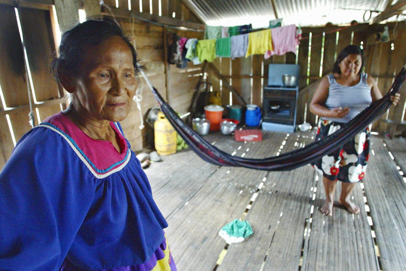
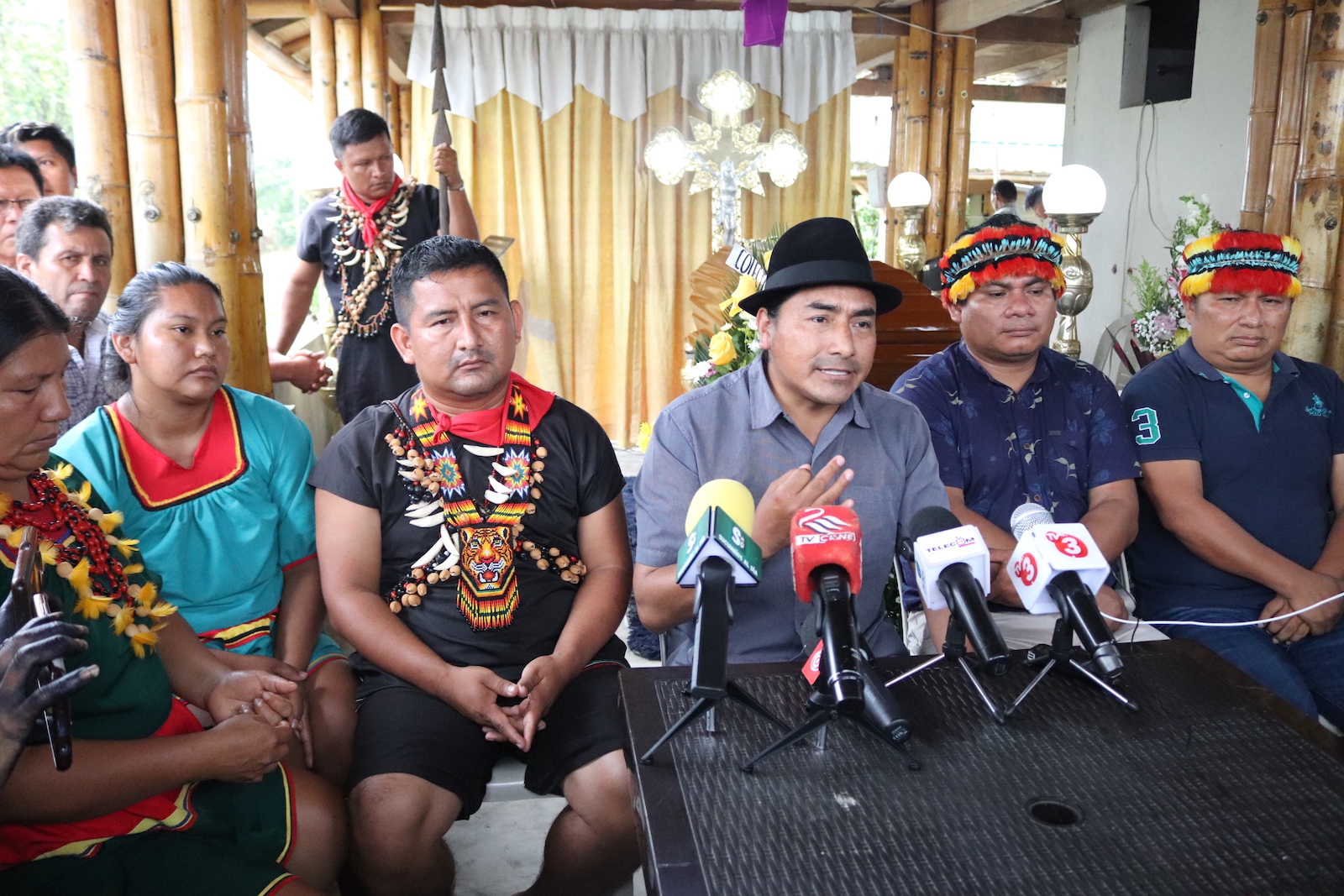
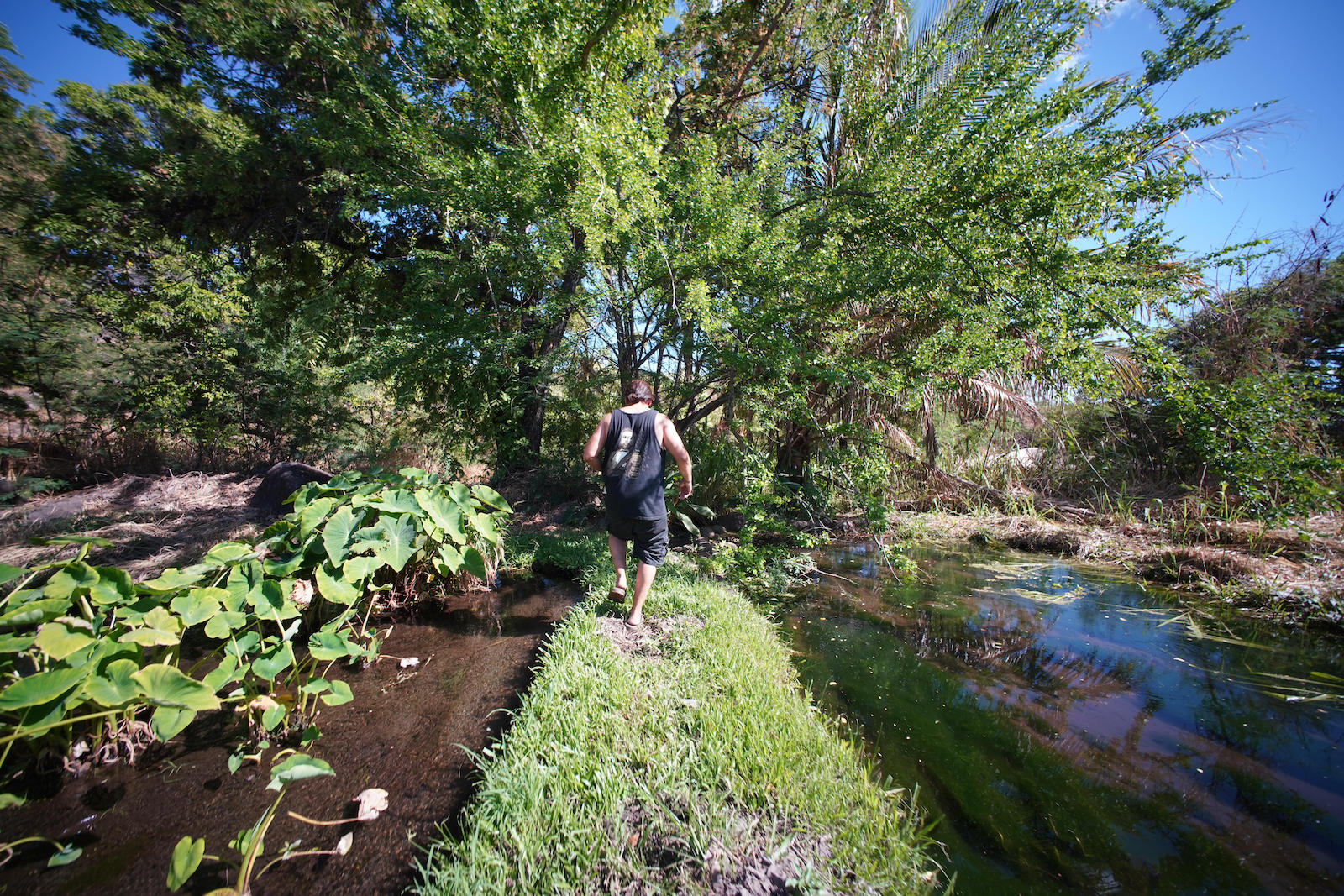
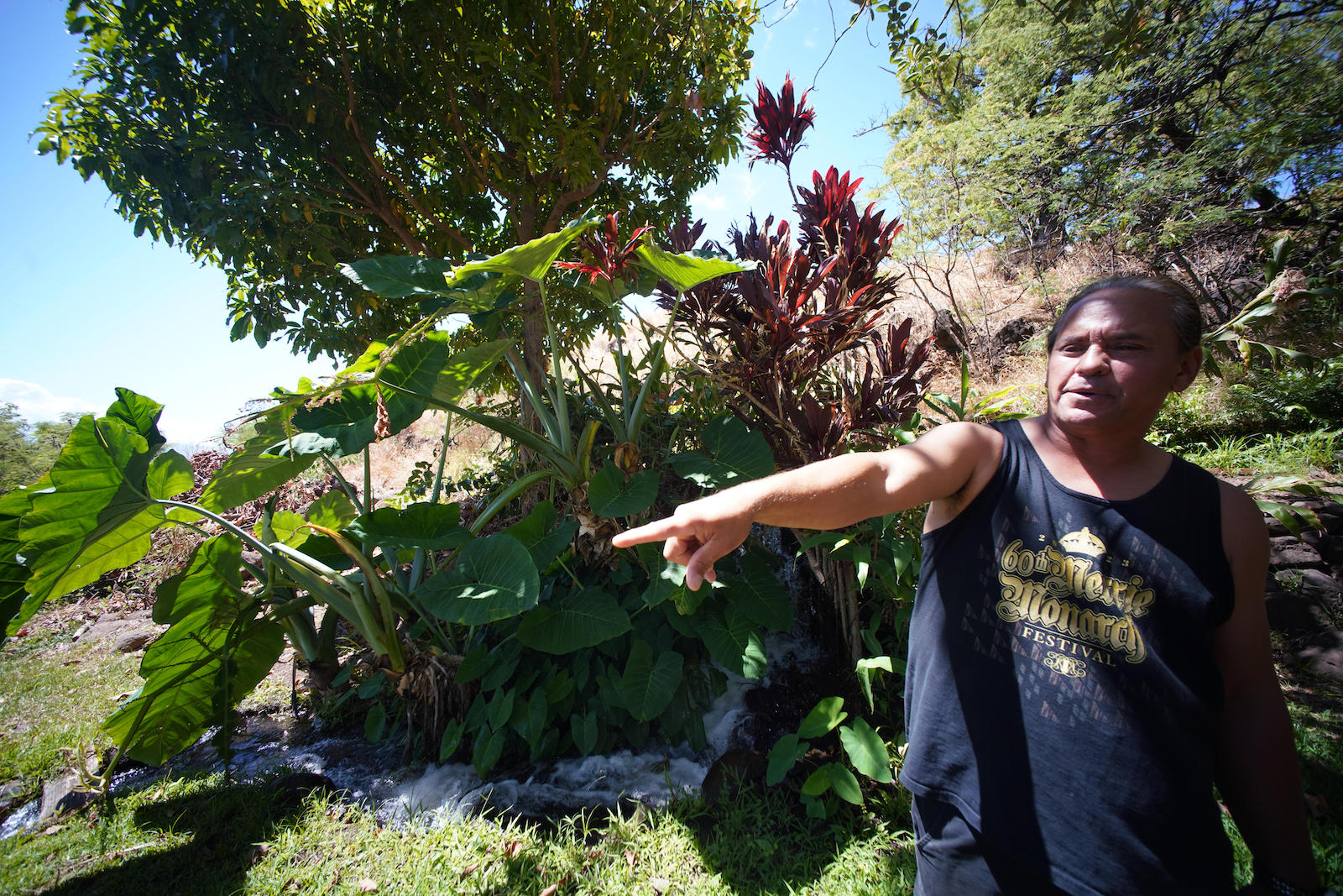
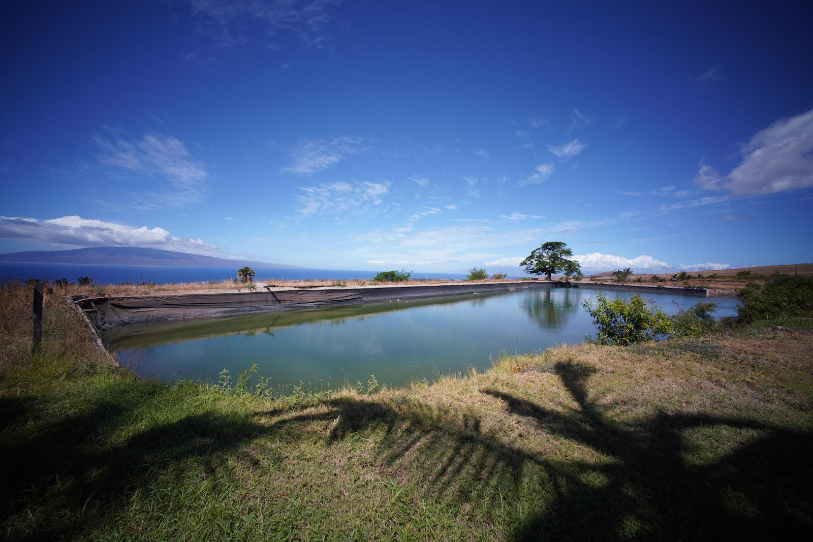
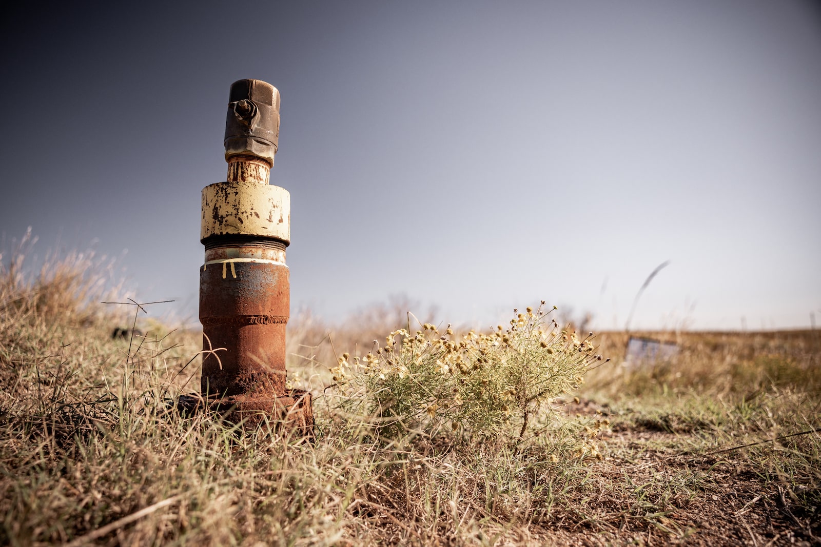
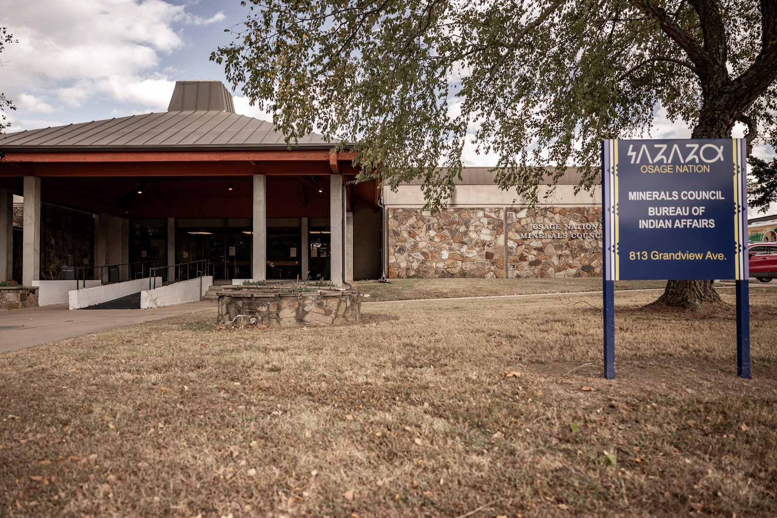
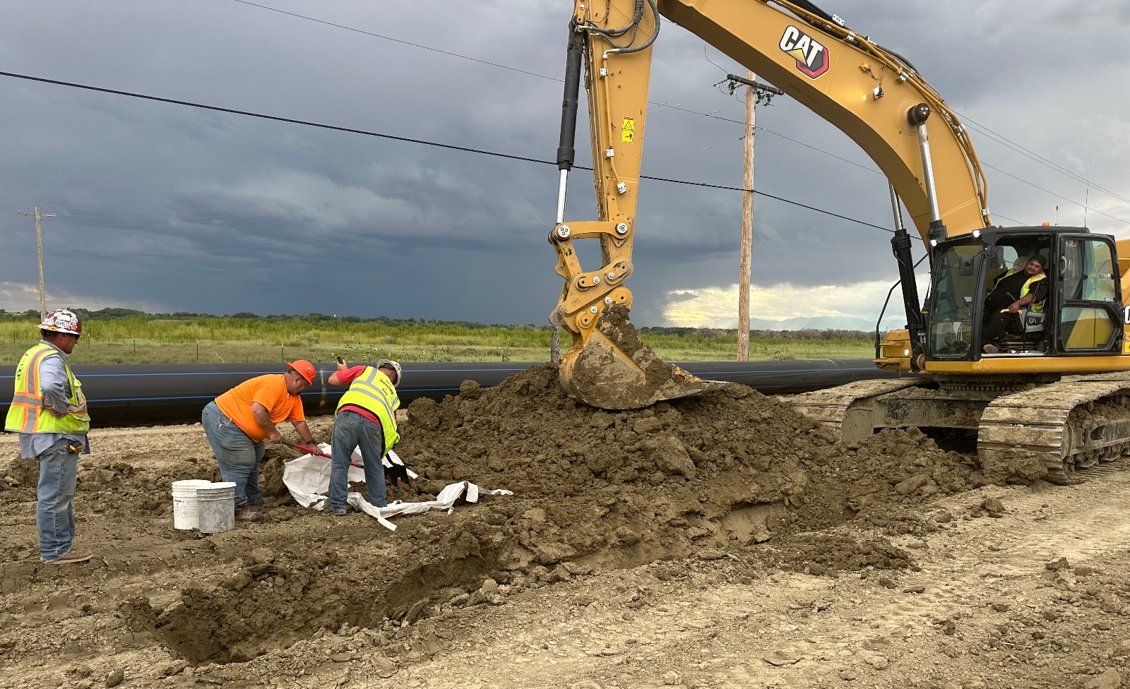
Indigenous nations, farmers, and ranchers throughout the Klamath Basin in the Pacific Northwest reached an agreement on Wednesday to collaborate on ecosystem restoration projects and to improve water supply for agriculture.
The memorandum between the Klamath Tribes, Yurok Tribe, and Klamath Water Users Association, which represents agricultural producers across 17,000 acres in both California and Oregon, serves as a major step in a long-running battle over access to water as the Klamath River dries up and federal officials cut flows to tribes and producers.
Drought in the region has often pitted Indigenous peoples and endangered fish against more than 1,000 farms that rely on the same water for their crops. In 2001, the Bureau of Reclamation shut off irrigation water to farmers in the midst of a drought, prompting protests from farmers and illegal water releases. Two decades later, amid another drought, the agency cut water to farmers to preserve endangered suckerfish, again heightening tensions. ”It’s not safe for Natives to be out in farmland during a drought year,” Joey Gentry, a member of the Klamath Tribes, told Inside Climate News after the 2021 water cuts.
In 2022, tribes won a long-running campaign to convince the federal government to remove four dams that stopped salmon from reaching their spawning grounds, marking a major win for Indigenous communities that rely on the Klamath. Now, Clayton Dumont, chairman of the Klamath Tribes, says the new agreement goes even further.
“We’re nowhere near finished, but this is a really strong beginning,” he said. “Getting adversaries like this together in a room and having to sit through a lot of bitterness to get to a point where we are now, I think it’s not just commendable, it’s pretty miraculous.”
Klamath Tribes were forced to cede 23 million acres in Oregon and California to settlers in exchange for a reservation, but an 1864 treaty gave the tribe the right to hunt and fish on those ceded lands forever. However, fishing hasn’t been consistently possible with drought and conflicting demands for water.
“What’s at stake is our very livelihood, our culture, our identities, our way of life,” Dumont said.
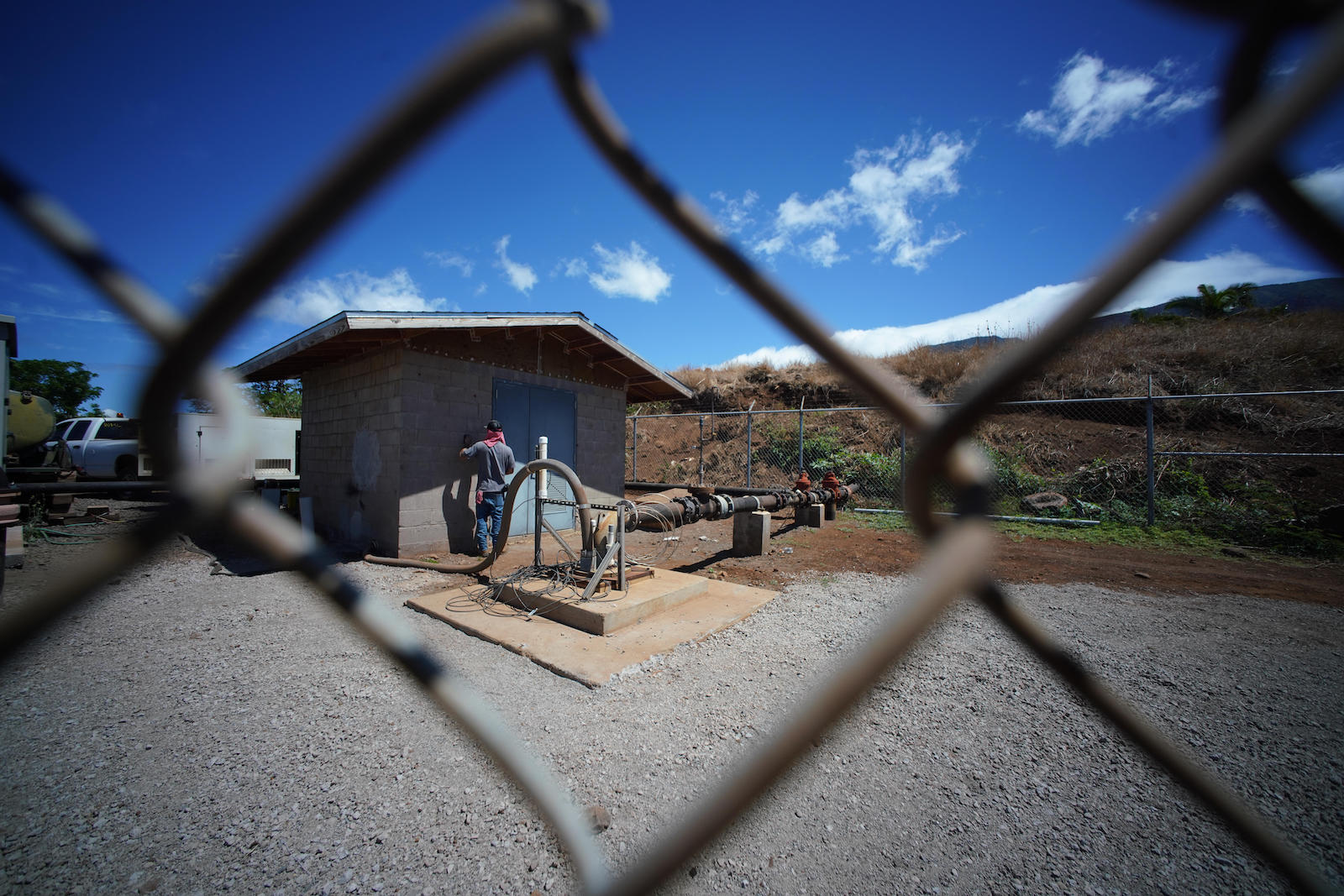
In the next month, tribes and agricultural producers will meet to decide on restoration projects that could be completed within the next two years and supported through existing federal or state programs. After the priorities are decided, officials from the U.S. Department of the Interior will identify both existing funding and new funding sources for the projects. The agency also plans to release more than $72 million to modernize agricultural infrastructure and restore the ecosystem in Klamath Basin.
Officials from the Klamath Water Users Association said in a press release that working together with the tribes will make both parties more effective in obtaining state and federal funding to support the region.
“I am hoping that this MOU will be the first step to bring all the different entities together to work on a solution to the conflicts over water that have hampered this region for decades,” said Tracey Liskey, president of the Klamath Water Users Association Board of Directors. “The water users want fish in our rivers and lakes and water in our irrigation ditches. This way, we all can have a prosperous way of life in the basin.”
Dumont says it helped that the administrations locally, statewide, and federally were all supportive of this agreement. However, he added that there’s no guarantee that the MOU will have any staying power after November.
“If the election goes the wrong way, all of this could dry up really quickly,” Dumont said.
This article was produced in partnership with Type Investigations, where Adam Federman is a reporting fellow.
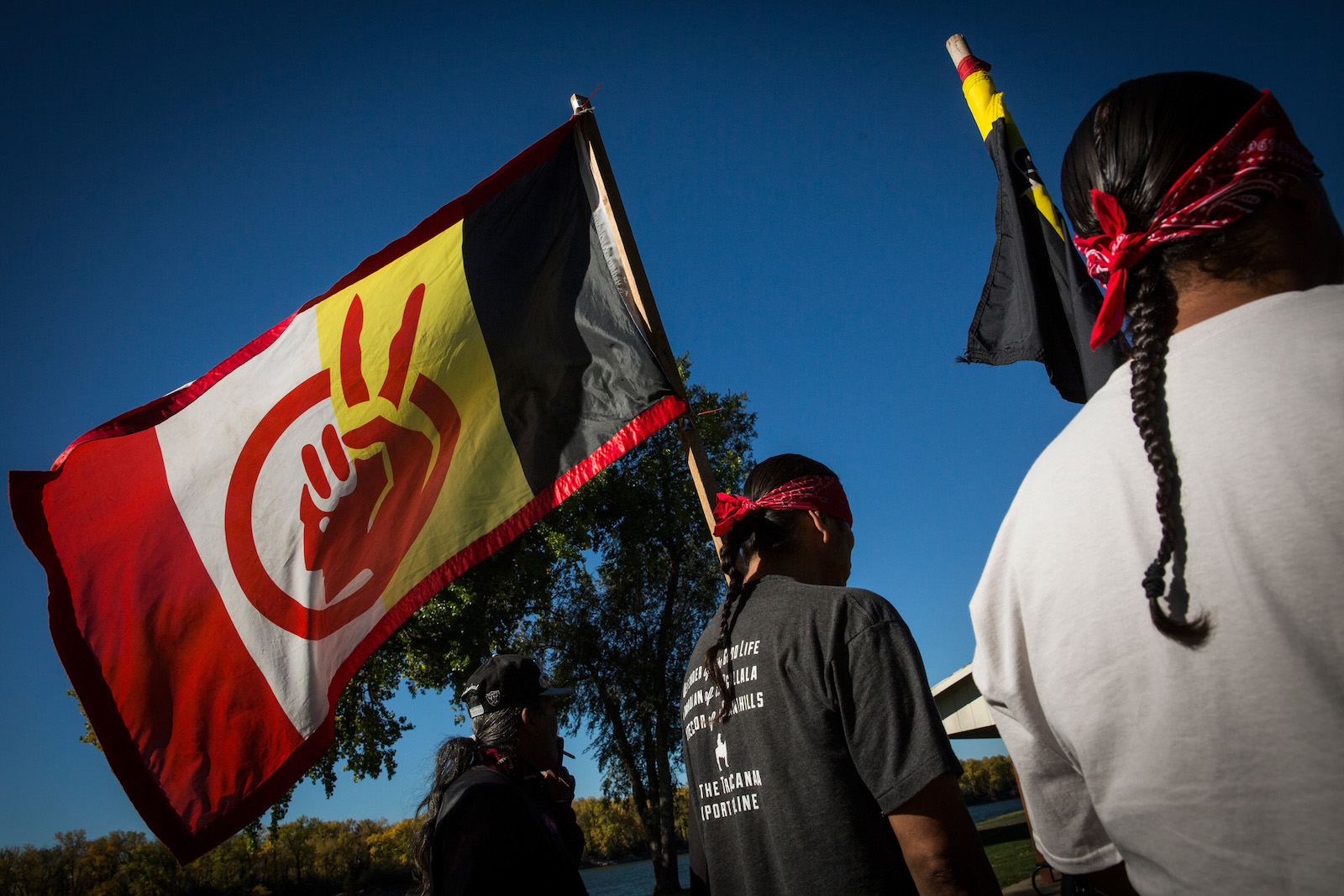
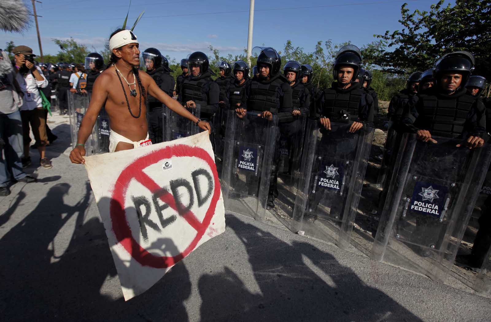
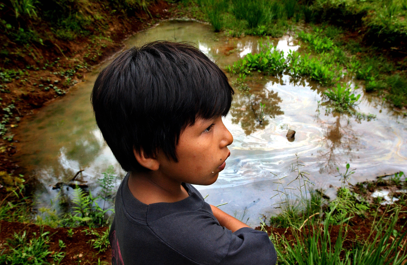
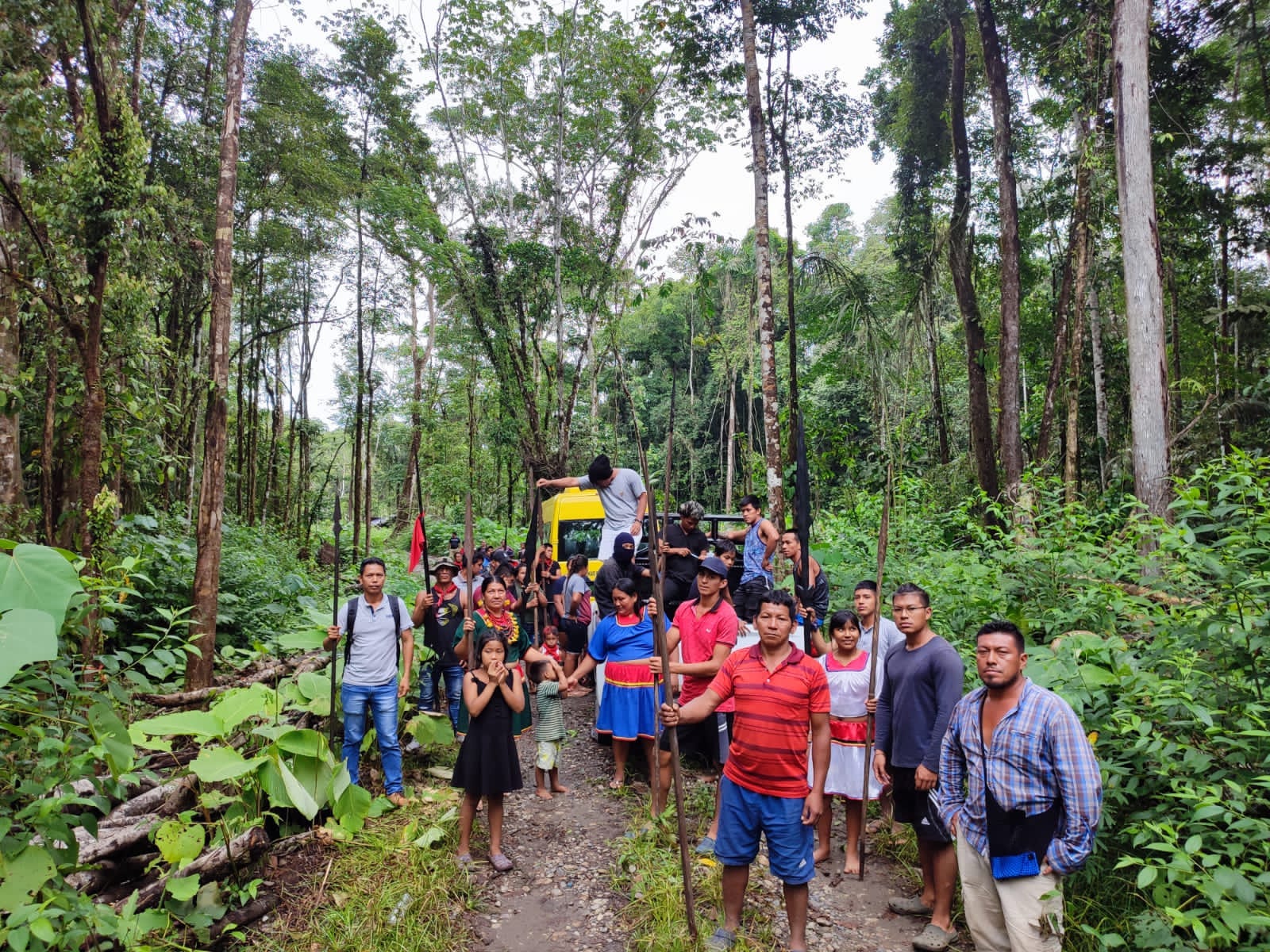
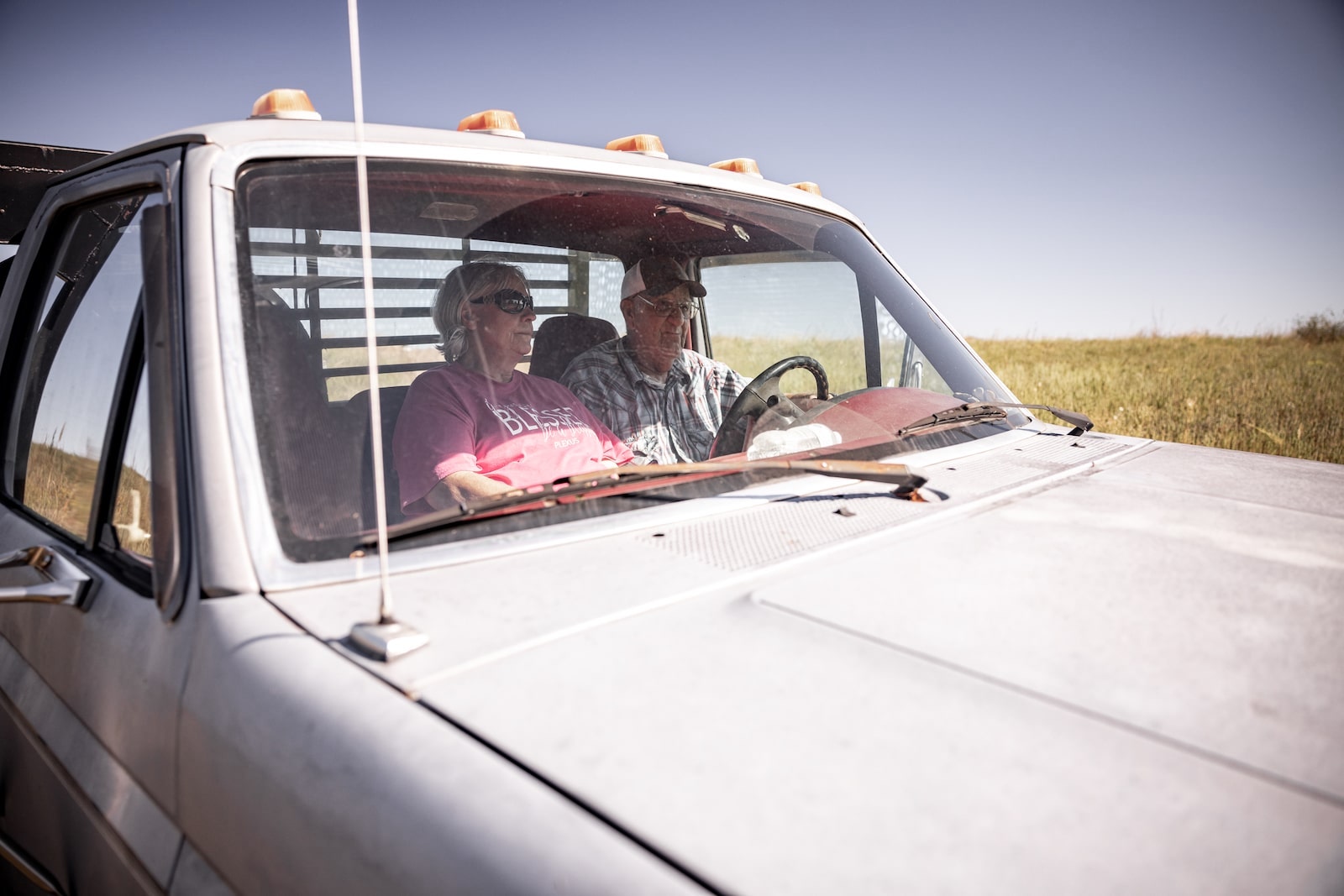
On the morning of March 5, 2012, Debra White Plume received an urgent phone call. A convoy of large trucks transporting pipeline servicing equipment was attempting to cross the Pine Ridge Reservation near the town of Wanblee, South Dakota. White Plume, a prominent Lakota activist, immediately dropped what she was doing and headed to the site, where, within a few hours, a group of about 75 people from the Pine Ridge Reservation gathered.
More than a dozen cars formed a blockade along one of the roads that runs through the reservation. Plume and other activists were outspoken critics of the proposed Keystone XL pipeline, part of a larger network carrying oil from the tar sands of northern Alberta, Canada, to refineries on the U.S. Gulf Coast. Many Indigenous nations in South Dakota, whose land the convoy was attempting to pass through on its way to the Canadian tar sands, fiercely objected to the project.
“We have resolutions opposing the whole entity of the tar sands oil mine and the Keystone XL pipeline,” White Plume declared after arriving at the site where the trucks had been stopped. “They need to turn around and go back. … They are not coming through here.” But the trucks were so big and unwieldy that the drivers said it would be dangerous, if not impossible, to turn them around.
The standoff in Wanblee was a relatively small protest compared to subsequent actions against the Keystone XL pipeline, which drew tens of thousands into the streets of Washington, D.C., and garnered national attention. Police arrested five activists, including White Plume (who died in 2020) and her husband, Alex White Plume Sr., on charges of disorderly conduct, and released them later that day. Beyond a few stories in Indigenous news outlets and regional papers, the protest hardly registered. Though tribes and landowners in the region had begun organizing around Keystone XL in 2011 and 2012, the pipeline had not yet become the galvanizing force for one of the largest campaigns in the history of the modern environmental movement.
Debra White Plume is arrested by U.S. Park Police in front of the White House in Washington, D.C., during a protest against the Keystone XL pipeline in September 2011. Luis M. Avarez / AP Photo
But the events in Wanblee did capture the attention of the Federal Bureau of Investigation, which began tracking Native groups campaigning against the pipeline in early 2012. According to documents obtained by Grist and Type Investigationsthrough a Freedom of Information Act request, the FBI’s Minneapolis office opened a counterterrorism assessment in February 2012, focusing on actions in South Dakota, that continued for at least a year and may have led to the opening of additional investigations. These documents reveal that the FBI was monitoring activists involved in the Keystone XL campaign about a year earlier than previously known.
Their contents suggest that, long before the Keystone and Dakota Access pipelines became national flashpoints, the federal government was already developing a sweeping law enforcement strategy to counter any acts of civil disobedience aimed at preventing fossil fuel extraction. And young, Native activists were among its first targets.
“The threat emerging … is evolving into one based on opposition to energy exploration related to any extractions from the earth, rather than merely targeting one project and/or one company,” the FBI noted in its description of the Wanblee blockade.
The 15-page file, which is heavily redacted, also describes Native American groups as a potentially dangerous threat and likens them to “environmental extremists” whose actions, according to the FBI, could lead to violence. The FBI acknowledged that Native American groups were engaging in constitutionally protected activity, including attending public hearings, but emphasized that this sort of civic participation might spawn criminal activity.
To back up its claims, the FBI cited a 2011 State Department hearing on the pipeline in Pierre, South Dakota, attended by a small group of Native activists. The FBI said the individuals were dressed in camouflage and had covered their faces with red bandanas, “train robber style.” According to the report, they were also carrying walking sticks and shaking sage, claiming to be “Wounded Knee Security of/for Mother Earth.”
“The Bureau is uncertain how the NA group(s) will act initially or subsequently if the project is approved,” the agency wrote.
Members of the Oglala Lakota Tribe participate in a protest against the proposed Keystone XL pipeline on October 13, 2014, in Pierre, South Dakota. Andrew Burton / Getty Images
The FBI also singled out the “Native Youth Movement,” which it described as a mix between a “radical militia and a survivalist group.” In doing so, it appeared to conflate a specific activist group originally founded in Canada in the 1990s with the broader array of young Native activists who opposed the pipeline decades later. Young activists would play an important role in the Keystone XL campaign and later on during protests against the Dakota Access pipeline at Standing Rock, but the movement had little in common with militias or survivalists, terms typically used to describe far-right groups or those seeking to disengage from society.
The FBI declined to respond to questions for this story. In an emailed statement, a spokesperson for the Minneapolis field office said the agency does not typically comment on FOIA releases and “lets the information contained in the files speak for itself.”
The FBI was not the only federal agency keeping tabs on Keystone XL pipeline protesters in the early years of the anti-pipeline movement. According to additional records obtained by Grist and Type Investigations, an obscure intelligence division within the U.S. State Department, which had jurisdiction over the pipeline because it crossed an international boundary, collected hundreds of pages of records on Keystone activists, landing one of them in jail on charges of trespassing (which were eventually dropped). Working in tandem with the FBI’s Joint Terrorism Task Force, the State Department created an email account to “track all Keystone XL protest incidents” and monitored events in cities across the country, including in Philadelphia, San Francisco, Houston, and Honolulu. The task force even highlighted candlelight vigils held in several major cities in 2014, describing one group of protesters as “peaceful, holding candles and signs.” These records reveal for the first time that the State Department was also involved in monitoring activists from late 2013 through the Obama administration’s decision to reject the pipeline in November 2015, though the case file wasn’t officially closed until November 2016.
A U.S. Park Police officer motions journalists away from a group of environmental activists gathered outside the White House in Washington, D.C., in August 2011. J. Scott Applewhite / AP Photo
The State Department was especially interested in the work of environmental groups D.C. Action Lab and 350.org, as well as the “pledge of resistance,” organized by groups including CREDO, a mobile phone company that supports progressive causes, which called for activists to engage in civil disobedience to stop President Barack Obama from approving the Keystone XL pipeline. By late 2015, tens of thousands of people had signed the pledge and environmental groups held direct action trainings in dozens of cities. Meanwhile, the Department of Homeland Security and state and local law enforcement agencies along the proposed pipeline route, according to previous reporting in The Guardianand other news outlets, were also intimately involved in investigating these activities, creating an unprecedented domestic surveillance network that is only now fully coming into focus.
In a written response, a State Department official said the purpose of tracking Keystone XL protesters was to “provide law enforcement with situational awareness of activities that could impact the security of State Department personnel, facilities, or activities.”
The department said it takes any potential threats against its personnel in the United States seriously but declined to comment on whether Keystone XL pipeline protesters had engaged in such behavior. In addition, the department declined to comment on why it singled out specific groups such as D.C. Action Lab and 350.org, as well as the CREDO campaign. The department said it is committed to upholding freedom of speech and assembly, “while also maintaining our security responsibility of protecting our facilities and U.S. personnel from those who may violate applicable laws.”
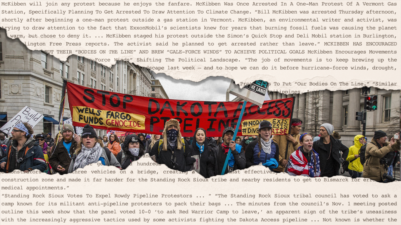
Environmental activists and attorneys who reviewed the new documents told Grist and Type Investigations that law enforcement’s approach to the Keystone XL campaign looked like a template for the increasingly militarized response to subsequent environmental and social justice campaigns — from efforts to block the Dakota Access pipeline at Standing Rock to the ongoing protests against the police training center dubbed “Cop City” in Atlanta, Georgia, which would require razing at least 85 acres of urban forest.
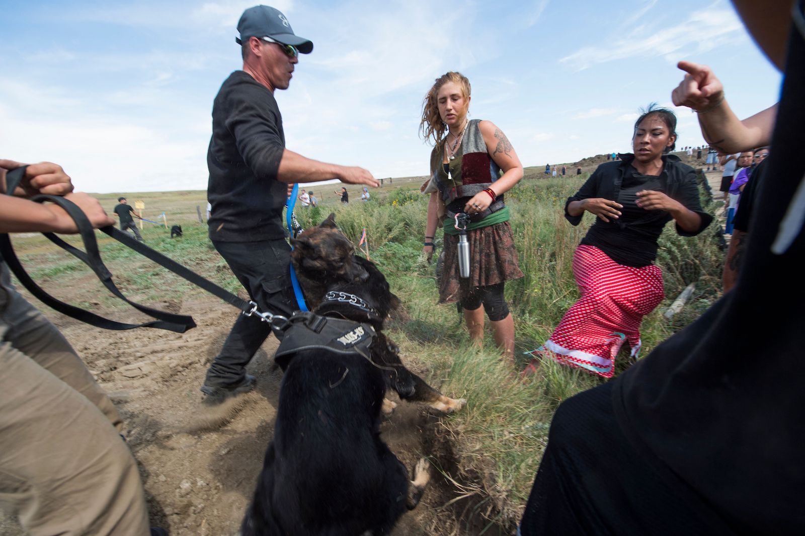
Private security guards hold back dogs near Dakota Access Pipeline protesters near Cannon Ball, North Dakota, on September 3, 2016.Robyn Beck / AFP via Getty Images
Protesters gathered in front of the New York City Public Library for a rally against the Dakota Access Pipeline are seized by police officers in March 2017.Andy Katz / Pacific Press/LightRocket via Getty Images
The FBI’s working thesis, outlined in the new documents, that “most environmental extremist groups” have historically moved from peaceful protest to violence has served as the basis for subsequent investigations. “It’s astonishing to me how such a broad concept basically paints every activist and protester as a future terrorist,” said Mike German, a former FBI special agent who is now a fellow at the nonprofit Brennan Center for Justice.
Sabrina King, an organizer with the conservation group Dakota Rural Action from 2012 to 2016, who went on to work for the ACLU in South Dakota, North Dakota, and Wyoming, spent nearly a month at Standing Rock. She believes the FBI’s characterization of the activist community — and Native youth in particular — as potential extremists helped set the stage for the increasingly aggressive government actions, including the use of FBI informants and heavily armed state and local police departments, directed at environmental protesters around the country in later years, from Standing Rock to the Line 3 pipeline in Minnesota.
“This is the direct line to Standing Rock,” said King, who reviewed the newly obtained FBI documents. “None of that just happened. These law enforcement agencies had literally been training for [years]for Keystone, but then they used it on Dakota Access.”
In the years after the Wanblee blockade, the campaign opposing Keystone XL gained broad public appeal. It tapped into both local concerns over damage to land and water and also a rapidly growing national movement to end fossil fuel extraction altogether. It minted a multigenerational coalition of activists, many of whom had not been previously engaged in environmental politics.
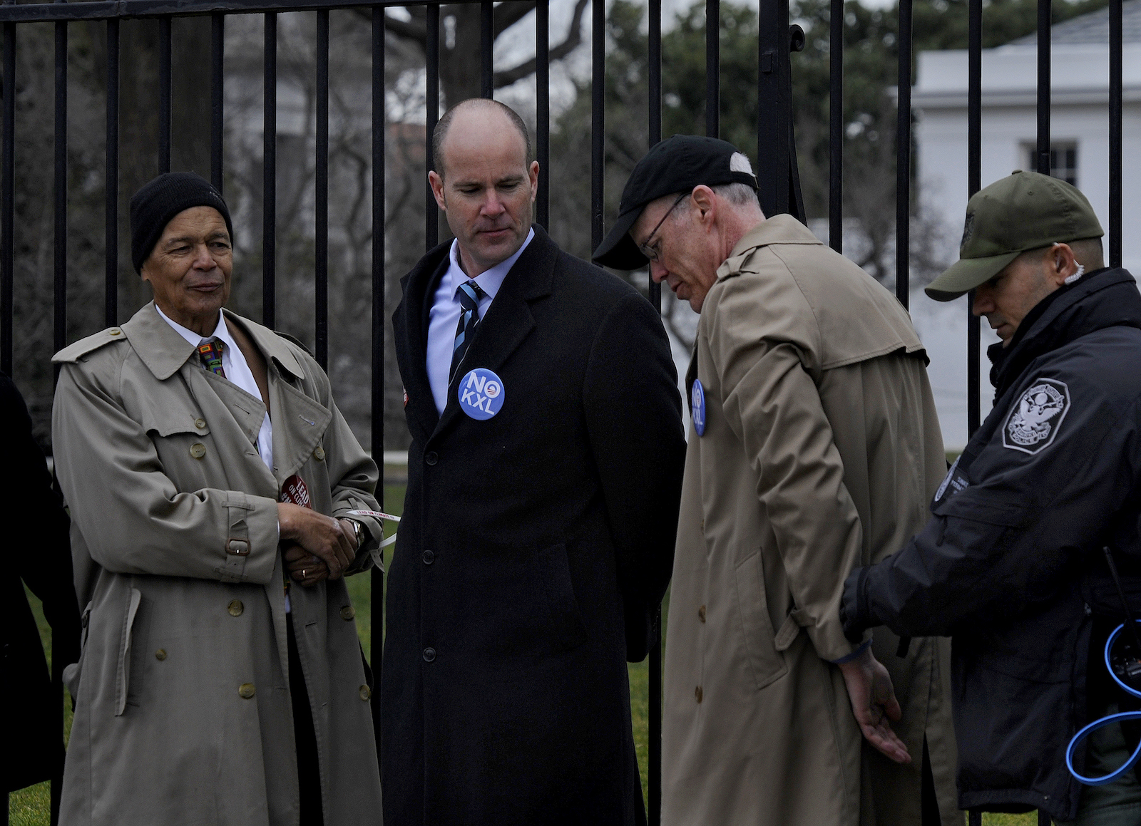
The campaign also openly embraced nonviolent direct action, which marked a new chapter for some environmental organizations. In 2013, for example, the Sierra Club broke its long-standing prohibition on members engaging in civil disobedience — earning it a mention in the newly obtained FBI files. That year, activists, including the Sierra Club’s then-executive-director Michael Brune, used zip ties to attach themselves to the White House fence, resulting in mass arrests. The campaign included mainstream liberals who supported Obama and felt he could be persuaded to block the pipeline, as well as veterans of the environmental movement who had long been willing to engage in confrontational direct action.
From left to right: Social justice activist Julian Bond, Sierra Club Executive Director Michael Brune, and activist Bill McKibben are arrested as they refused to leave the sidewalk in front of the White House on February 13, 2013. Michael S. Williamson / The Washington Post via Getty Images
This alliance posed an unexpected threat to companies involved in fossil fuel extraction, including TransCanada, the company behind the pipeline, and set off alarms within the federal government. Hundreds of pages of FBI and State Department files released through the Freedom of Information Act over the last decade highlight an increasingly close relationship between law enforcement agencies and the fossil fuel industry. The newly obtained documents show that, as early as 2012, the FBI was describing TransCanada, a multinational corporation headquartered in Calgary, Canada, as a “domain stakeholder” with direct access to the White House.
“Resistance to the Keystone XL pipeline was really the first pipeline campaign that I recall that there was organization on both sides of the fight,” said Lauren Regan, executive director of the nonprofit Civil Liberties Defense Center, which provided legal support to dozens of activists arrested during the campaign. “As we were collecting public records documents, organizers were shocked at how much running time TransCanada had with state and federal governments before any of them sensed that something was happening.”
Previously reported documents show that, less than two months after the FBI opened its investigation into Native activists, the agency held a “strategy meeting” with TransCanada and industry partners in Oklahoma City, Oklahoma, an hour away from Cushing, where many of the nation’s major pipelines converge. (In 2012, Obama delivered a campaign speech in Cushing announcing that he would fast-track the southern leg of the Keystone XL pipeline.) Representatives from the Department of Homeland Security, the National Guard, and state and local police departments were also present. Indeed, the author of the February 2012 FBI file from the bureau’s Minneapolis field office noted that they would be attending the “regional working group meeting” to “ensure coordination and resource management between bureau field offices affected and the domain stakeholder, TransCanada Corporation.”
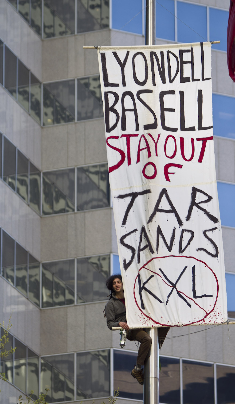
By the end of 2012, the FBI’s Houston field office also began collecting information for a domestic terrorism assessment that focused on Tar Sands Blockade, a scrappy coalition committed to nonviolent direct action, which had been at the center of the campaign to block construction of the pipeline in Texas. In one of their most prominent actions, Tar Sands Blockade had teamed up with a private landowner and set up tree-sits in the pathway of the pipeline. The FBI closely tracked protest activity among members of the group, one of whom later ended up being placed on a U.S. government watchlist for domestic flights, and cultivated at least one informant, according to files obtained in 2015 and previously reported in The Guardian. The investigation was initially opened without prior approval from the chief division counsel and the special agent in charge, in violation of FBI rules pertaining to “sensitive investigative matters” involving the activities of political organizations.
Protester Perry Graham climbs a flagpole to hang a sign to protest a pipeline by LyondellBasell, on March 27, 2013, in Houston, Texas. Nick de la Torre / Houston Chronicle via Getty Images
Meanwhile, starting in late 2012, TransCanada began delivering its own briefing to local law enforcement agencies along the proposed pipeline route. The PowerPoint presentations, which included profiles of organizers at 350.org, Rainforest Action Network, and Tar Sands Blockade, encouraged law enforcement to pursue federal anti-terrorism charges in conjunction with the FBI.
At the same time, tribes and landowners in South Dakota were busy raising awareness about the pipeline and the threats it posed to groundwater and Indigenous treaty rights. In September 2011, the Rosebud Sioux Tribe, along with First Nation Chiefs of Canada, held an “emergency summit” in South Dakota, after which they issued the Mother Earth Accord, also referenced in the new FBI files. The agreement, signed by most tribes in the state, called for a moratorium on tar sands development and an end to the shipping of equipment for the pipeline through the United States and Canada.
The blockade in Wanblee was one of several actions the FBI cited to support its conclusion that the movement could potentially turn to violence. The counterterrorism assessment documents other public meetings, including a protest held by the Oglala Lakota Nation in early February 2012, that the FBI acknowledged was “protected First Amendment activity.” The FBI warned that, after Wanblee, any commercial vehicles associated with the pipeline could now be held “hostage” by Native Americans “who oppose the exploration, extraction, refinement, and/or distribution of petroleum-based products.” The FBI file included the names of those arrested and noted that South Dakota’s U.S. attorney had considered prosecuting the activists under the Hobbs Act, a 1946 law designed to prevent racketeering in interstate commerce, typically through robbery or extortion. Violating the act can carry a punishment of up to 20 years in prison.
Along with monitoring protest activity, the agency was particularly concerned with the activities of Native youth. Certainly, Native youth played an important role in the Keystone XL campaign, and later in organizing opposition to the Dakota Access pipeline. But their actions hardly seemed like the work of a radical militia. In 2015, members of the Lakota Nation’s Cheyenne River Sioux tribe formed the One Mind Youth Movement, a kind of mutual aid society for teens struggling with suicide and depression. Eventually they turned their attention to the Keystone XL campaign and began networking with activists in other parts of the country and around the world. At Standing Rock, members of One Mind formed the International Indigenous Youth Council, which was known for its efforts to defuse tensions between law enforcement and protesters, even drawing criticism from some activists who felt they were too conciliatory.
The FBI saw things differently. According to the newly obtained files, the Minneapolis office appears to have opened another inquiry into what it described as the “Native Youth Movement” to “marshal information about extremist groups in Indian Country targeting a myriad of issues, to include threats to the proposed Keystone XL pipeline.” Those records may never be released, however. The FBI denied a Freedom of Information Act request for the material, and asserted that releasing the “investigative file” would reveal intelligence sources and methods or law enforcement techniques and procedures. In October, the Department of Justice rejected an appeal filed by Grist and Type Investigations, stating that “disclosure of the information withheld would harm the interests protected by these exemptions.”
Shortly after Obama and the State Department rejected the Keystone XL pipeline in 2015, Paula Antoine, the director of the Rosebud Sioux Tribe Sicangu Oyate Land Office, headed north to the Standing Rock reservation to meet with elders interested in establishing a prayer camp on the banks of the Missouri River. During the fight over Keystone XL, Antoine had helped to set up the first “spirit camp” near the community of Ideal, South Dakota, where she was raised. The idea caught on. Lewis Grassrope, a member of the Lower Brule Sioux Tribal Council, set up a camp on land belonging to his mother a few miles from the Missouri River. A third camp was erected on the Cheyenne Sioux Reservation. Each served as a gathering place for organizers and activists involved in the Keystone XL campaign. Now, activists spearheading the campaign to block the Dakota Access pipeline wanted to do the same thing.
“To me it [KXL] was like the precursor to No DAPL,” Grassrope said, referring to the campaign to block the Dakota Access pipeline. “We knew that the fight was coming, we just didn’t know when.”
Lewis GrassRope speaks at a 2023 political event in Philadelphia, Pennsylvania. Gilbert Carrasquillo / GC Images
The spirit camp at Standing Rock started out small and was maintained by a group of local activists and their allies. But by the fall of 2016, it had become the focal point of the growing movement to block the pipeline. Thousands of people taking on the mantle of “water protectors” eventually descended on the region. Standing Rock would capture the world’s attention.
But as the newly obtained files show, after years of tracking Keystone XL protesters, the fossil fuel industry and law enforcement had prepared for this moment. Energy Transfer Partners, the company building the pipeline, hired a private security firm that monitored activist groups and produced dozens of intelligence reports, which were later leaked and reported by The Intercept. This information was shared with law enforcement and the FBI, blurring the lines between public and private partnerships, with the fossil fuel industry at the center. The security firm, TigerSwan, collected intelligence on activists and used an ex-Marine to infiltrate anti-pipeline actions. At the same time,a Department of Homeland Security-funded fusion center in North Dakota developed a “links chart” to map out the leadership of the movement, focusing almost exclusively on Native American activists.
“We all had people following us,” said Antoine. “They knew who we were.”
As the encampment grew, the National Guard was eventually enlisted in what became one of the largest police and military deployments in North Dakota’s history, according to historian Nick Estes’s Our History is the Future, his book about the pipeline fight. “Cops in riot gear conducted tipi-by-tipi raids … They dragged half-naked elders from ceremonial sweat lodges, tasered a man in the face, doused people with CS gas and tear gas, and blasted adults and youth with deafening LRAD sound cannons,” Estes writes. Law enforcement also appeared to undermine parts of the movement from the inside. Red Fawn Fallis, a Lakota activist, was sentenced to a nearly five-year prison term for possession of a handgun, following a skirmish with police at Standing Rock. According to reporting by Will Parish in The Intercept, she had been involved in a romantic relationship with an FBI informant. It was later revealed that the weapon belonged to him.
Even after the camps at Standing Rock had been broken down and the last protesters had gone home, the surveillance continued. Grassrope, now 46, returned to the spirit camp he’d established on the Lower Brule reservation and, along with a handful of others, lived in tipis, yurts, and military tents. One day, the FBI called and said they wanted to inspect the camp. “They were pinpointing certain camps created after Standing Rock,” Grassrope said, which they believed were preparing to turn their attention, once again, to the Keystone XL pipeline, which then-President Donald Trump had revived.
Lauren Regan of the Civil Liberties Defense Center said that the fossil fuel industry and law enforcement agencies have continued to strengthen their partnership. In particular, the oil and gas industry’s information-sharing networks have become more sophisticated. In some cases, corporations have made direct payments to state and local law enforcement. For example, Enbridge, a Canadian multinational that recently upgraded its Line 3 pipeline, which cuts through tribal land in Minnesota, reimbursed state and local law enforcement to the tune of more than $8.5 million for their work policing protests against the pipeline.
More broadly, using the playbook that TransCanada developed, the industry has continued to push lawmakers to pursue enhanced felony charges for pipeline protesters. Lawmakers in nearly 20 states have passed legislation criminalizing actions that target “critical infrastructure.”
“It was definitely part of the state and law enforcement strategy to escalate repression to the point people wouldn’t want to continue taking action,” said Ethan Nuss, a senior campaigner at Rainforest Action Network who was involved in protests targeting the Keystone XL pipeline and Line 3.
Since the Keystone and Dakota Access pipeline fights, the law enforcement response to the environmental movement, and mass protest in general, has remained severe. In January 2023, six Georgia state troopers shot and killed Manuel Esteban Paez Terán, a 26-year-old medic involved in protests around the building of the police training center in Atlanta known to activists as Cop City. An autopsy requested by the family revealed that Tortuguita, as Terán was known, was likely sitting on the ground with both arms raised when they were killed, and an autopsy by DeKalb County found that they had been shot at least 57 times — the first time an environmental activist has been shot and killed by police on U.S. soil. Meanwhile, the state has charged dozens of protesters in Atlanta with domestic terrorism. And according to reporting by Grist and Type Investigations, the FBI has been tracking disparate groups involved in the campaign, some as far away as Chicago.
Despite this crackdown, however, actions targeting fossil fuel infrastructure continue to pop up across the country. In October, police in Virginia arrested three activists and charged them with trespassing and obstruction after they attached themselves to equipment used in building the last leg of the Mountain Valley Pipeline. Fast-tracked as part of negotiations over the Inflation Reduction Act, the 303-mile pipeline stands to release up to 40 million metric tons of carbon dioxide equivalent into the atmosphere every year once it is completed, according to its environmental impact statement. The developer has since sued two of the protesters, citing congressional approval of the project and arguing that the action caused “substantial delays and expenses” for the company.
“With the global warming crisis at its height, these fights are going to happen more regularly,” said Grassrope. “We have to move faster.That is what it comes down to.”
For the activist community, the Keystone XL campaign still serves as a source of inspiration. When the project was officially terminated in June 2021, Paula Antoine took her granddaughter out to the spirit camp on the Rosebud Sioux reservation. She made an offering and prayed, as she had many times before, for the continued protection of the land.
Samantha Gonsalves-Wetherell, a senior at the University of Arizona, has spent years urging university officials to take climate change seriously. As a leader of UArizona Divest, she and her classmates have been pushing the university toward three goals: to divest from fossil fuels by 2029; commit to no further investments in fossil fuels; and to implement socially responsible investing goals.
“It’s hard to both combat the climate crisis and also fund it,” said Gonsalves-Wetherell. She has met with university officials to ask them what stocks the university has invested in and how much revenue oil and gas investments bring in.
But until now, she had no idea that the university, like more than a dozen other land-grant universities created through the Morrill Act, earned millions more through another route: nearly 700,000 acres of land taken from Indigenous nations that is set aside for oil, gas and mineral leases.
A Grist investigation published earlier this week reported that 14 universities — including the University of Arizona — receive millions in annual income from more than 8 million acres of surface and subsurface land taken from 123 Native nations. Over the past five years, these properties have generated more than $2.2 billion. Nearly a fourth of the trust lands are dedicated to fossil fuels or mineral mining including coal mining.
University activists who have been lobbying their universities to pull their endowments out of fossil fuels say Grist’s findings are in line with what they’ve come to expect from their schools: a willingness to turn a blind eye to their complicity in climate change and societal injustice.
When Claire Sullivan, a senior at Colorado State University, learned of Grist’s findings, she thought of the land acknowledgement she’s seen on every syllabus and plastered on many walls all over campus.
The two-paragraph statement ends with this note: “Our founding came at a dire cost to Native Nations and peoples whose land this University was built upon. This acknowledgment is the education and inclusion we must practice in recognizing our institutional history, responsibility, and commitment.”
According to Sullivan, CSU says all of its fossil fuel investments are indirect, but it hasn’t made any promises to avoid direct investments or phase out any existing ones, despite the disproportionate harm that climate change is wreaking on Native peoples. Sullivan’s exasperation at the university’s intractable stance is topped only by her awe at what she describes as their hypocrisy.
“It’s just crazy that you could be making this commitment outwardly and just be doing the opposite in practice,” she said.
Not every divestment campaign has been so frustrating. Many university activists, such as at Harvardand Yale, have seen success. Gracelyn McClure is a senior and environmental sciences major at the University of Minnesota. She was only a sophomore when school officials decided to withdraw its investments from fossil fuels by 2028. It was a huge victory, but McClure said the group’s advocacy work isn’t over.
The group has been meeting with university officials to try to ensure that as contracts for fossil fuel investments expire, the money is being shifted into investments that aren’t similarly harmful. For example, they’ve asked the school not to reinvest in mining that’s opposed by Indigenous peoples.
Even though the initial campaign was successful, the students haven’t yet been able to garner any new promises to avoid nuclear energy or other mining that they fear could harm Native peoples. “They’re not super receptive all the time to our asks,” McClure said of the administration. But she thinks working with Native nations to ensure that reinvestment isn’t negatively affecting their communities isn’t asking for much.
“It’s the least that the university can do, considering how much they profited from Native land, and bodies too,” she said.
A spokesman for the University of Minnesota said the university has been working with tribal nations to address its history of stolen land, including returning about 3,400 acres to the Fond du Lac Band of Lake Superior Chippewa. The spokesman also cited the school’s investments in Native student tuition waivers, Indigenous language revitalization and staff training.
He added that the school can’t speak to land managed by the state. The University of Arizona and Colorado State University did not comment on the trust lands revenue.
Many students at universities that have pledged to divest from fossil fuels have been turning their attention to different but related causes, says Alicia Colomer, managing director at Campus Climate Network, which supports student climate activists. She worked on the successful New York University divestment campaign and says some of the newer student demands include asking schools to stop putting fossil fuel executives on their boards and stop accepting research money from oil companies.
To her, learning about the trust lands revenue feels like more of the same problem: “shocking but not shocking.”
She hopes students can sway their institutions to stop practices that are harmful to Indigenous lands and people.
Nadira Mitchell, a Navajo student at University of Arizona, hopes to be part of that change. She’s studying natural resources at the university in the hopes that she will be able to work for her tribal nation one day and make a difference. It has felt isolating to be one of the only Native students in her environmental courses.
Now, she’s struck by the juxtaposition between how Indigenous people like her own are disproportionately harmed by climate change and university’s investments in fossil fuels.
Stolen Indigenous land is the foundation of the land-grant university system. Climate change is its legacy.
Eliseu Cavalcante / Grist
This project was supported by the Pulitzer Center, the Data-Driven Reporting Project, and the Bay & Paul Foundation.
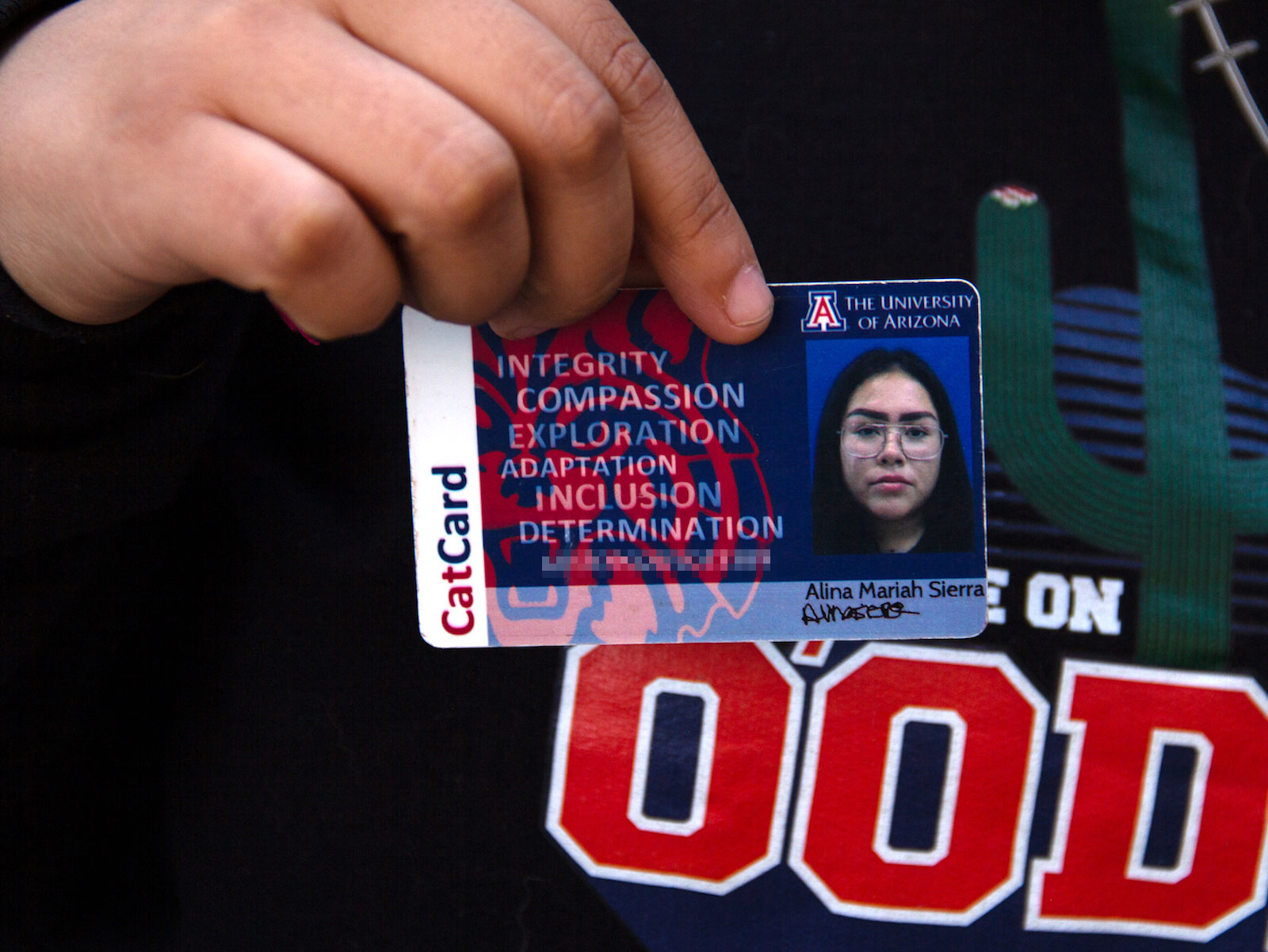
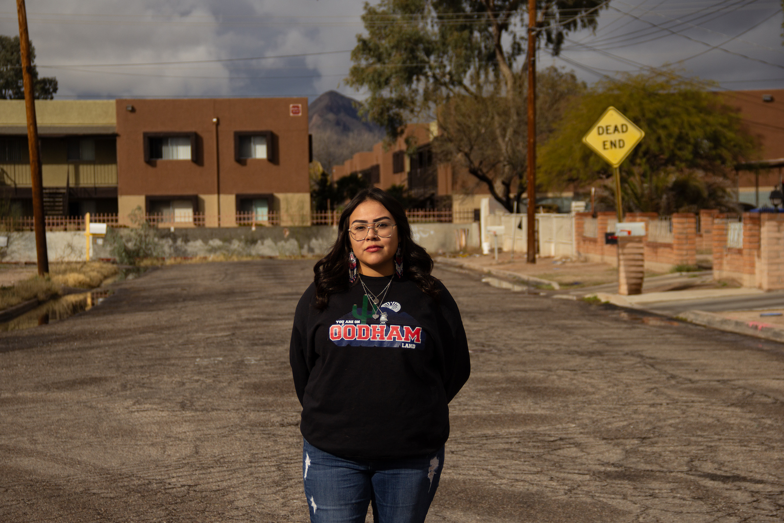
Alina Sierra needs $6,405. In 2022, the 19-year-old Tohono O’odham student was accepted to the University of Arizona, her dream school, and excited to become the first in her family to go to college.
Her godfather used to take her to the university’s campus when she was a child, and their excursions could include a stop at the turtle pond or lunch at the student union. Her grandfather also encouraged her, saying: “You’re going to be here one day.”
“Ever since then,” said Sierra. “I wanted to go.”
Then the financial reality set in. Unable to afford housing either on or off campus, she couch-surfed her first semester. Barely able to pay for meals, she turned to the campus food pantry for hygiene products. “One week I would get soap; another week, get shampoo,” she said. Without reliable access to the internet, and with health issues and a long bus commute, her grades began to slip. She was soon on academic probation.
“I always knew it would be expensive,” said Sierra. “I just didn’t know it would be this expensive.”
Bean Yazzie / Grist
Alina Sierra poses for a photo while wearing a locket containing the ashes of her godfather. “He would tell me, like, ‘Further your education, education is power,’” she said. “Before he passed away, I promised him that I was going to go to college and graduate from UofA.” Bean Yazzie / Grist
Alina Sierra reflects on her decision to leave University of Arizona and enroll in Tohono O’odham Community College. She’s glad she made the switch. “It’s free, they take care of your books and tuition,” she said of TOCC. In contrast, she still owes her former school over $6,000.
Bean Yazzie / Grist
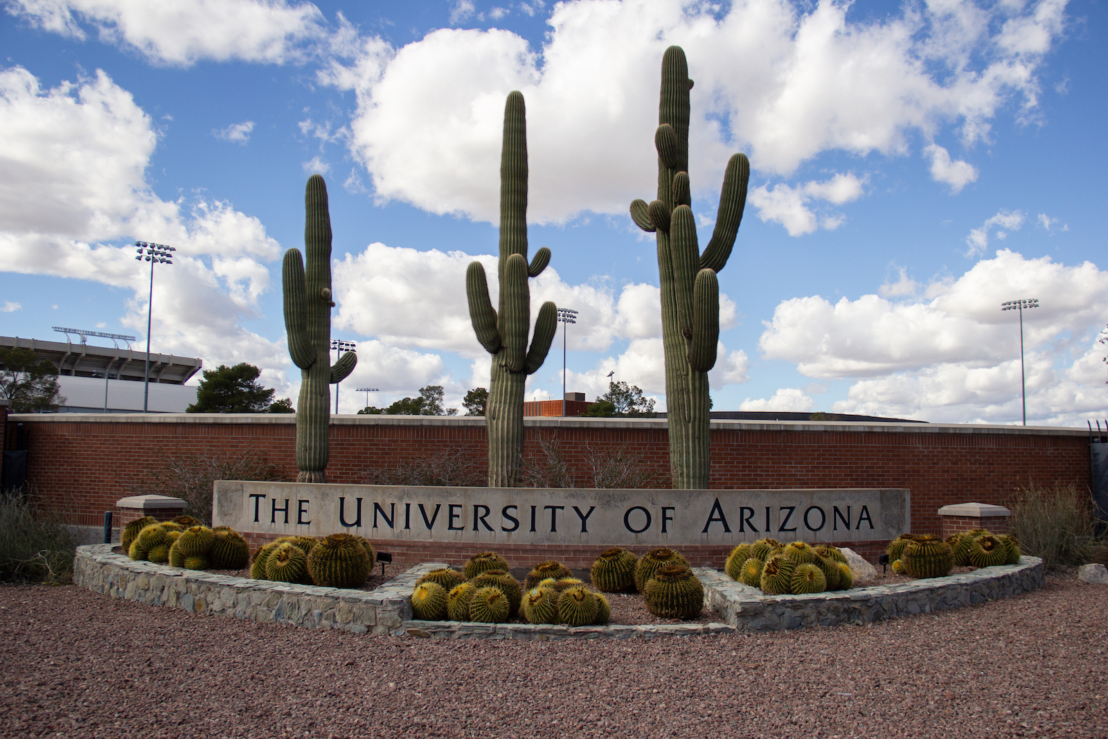
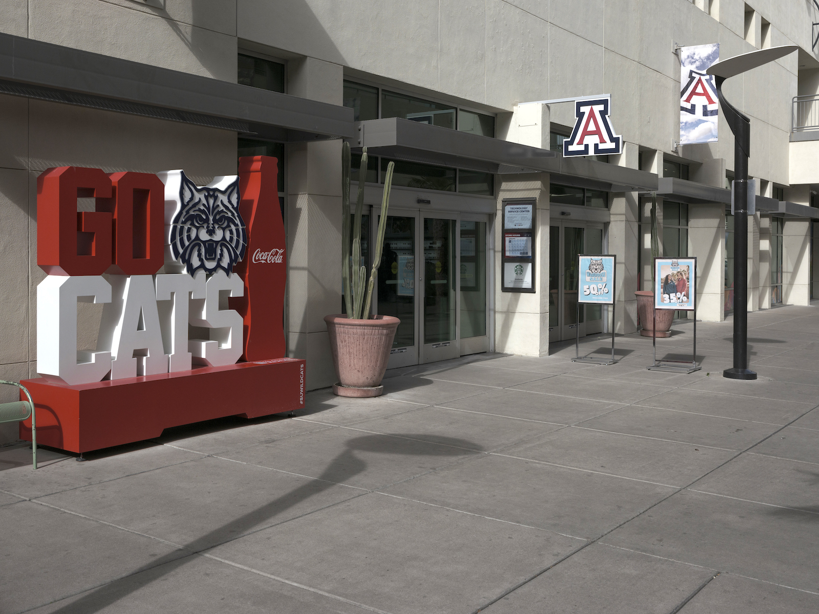
She was also confused. The university, known colloquially as UArizona, expressed a lot of support for Indigenous students. It wasn’t just that the Tohono O’odham flag hung in the bookstore or that the university had a land acknowledgment reminding the community that the Tucson campus was on O’odham and Yaqui homelands. The same year she was accepted, UArizona launched a program to cover tuition and mandatory fees for undergraduates from all 22 Indigenous nations in the state. President Robert C. Robbins described the new Arizona Native Scholars Grant as a step toward fulfilling the school’s land-grant mission.
Sierra was eligible for the grant, but it didn’t cover everything. After all the application forms and paperwork, she was still left with a balance of thousands of dollars. She had no choice but to take out a loan, which she kept a secret from her family, especially her mom. “That’s the number one thing she told me: ‘Don’t get a loan,’ but I kind of had to.”
Cacti grow behind a sign for the University of Arizona.
Bean Yazzie / Grist
Established in 1885, almost 30 years before Arizona was a state, UArizona was one of 52 land-grant universities supported by the Morrill Act. Signed into law by President Abraham Lincoln, the act used land taken from Indigenous nations to fund a network of colleges across the fledgling United States.
By the early 20th century, grants issued under the Morrill Act had produced the modern equivalent of a half a billion dollars for land-grant institutions from the redistribution of nearly 11 million acres of Indigenous lands. While most land-grant universities ignore this colonial legacy, UArizona’s Native scholars program appeared to be an effort to exorcise it.
But the Morrill Act is only one piece of legislation that connects land expropriated from Indigenous communities to these universities.
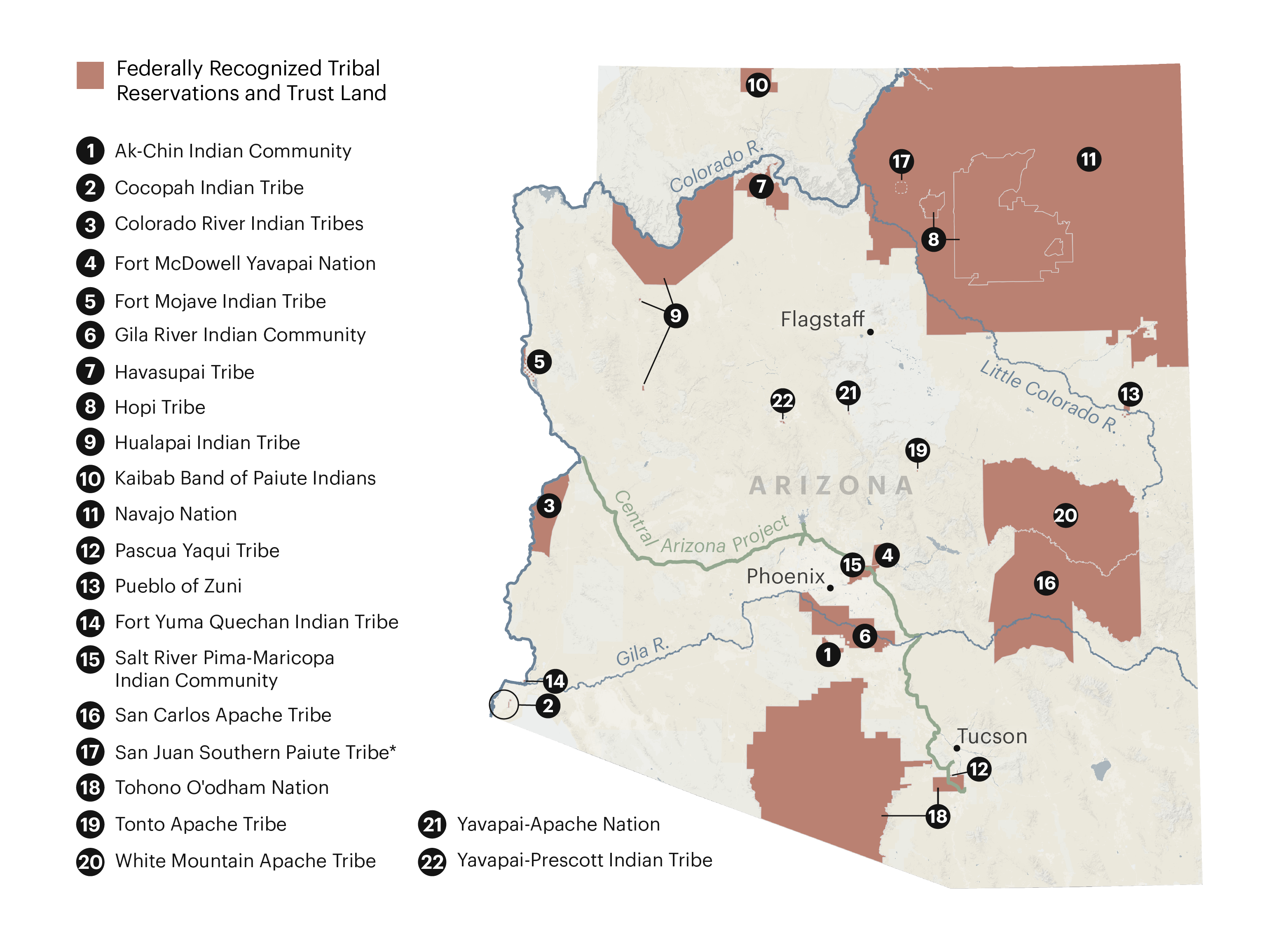
In combination with other land-grant laws, UArizona still retains rights to nearly 687,000 acres of land — an area more than twice the size of Los Angeles. The university also has rights to another 703,000 subsurface acres, a term pertaining to oil, gas, minerals, and other resources underground. Known as trust lands, these expropriated Indigenous territories are held and managed by the state for the school’s continued benefit.
A parcel of land in Willcox, Arizona, granted to the University of Arizona. Eliseu Cavalcante / Grist
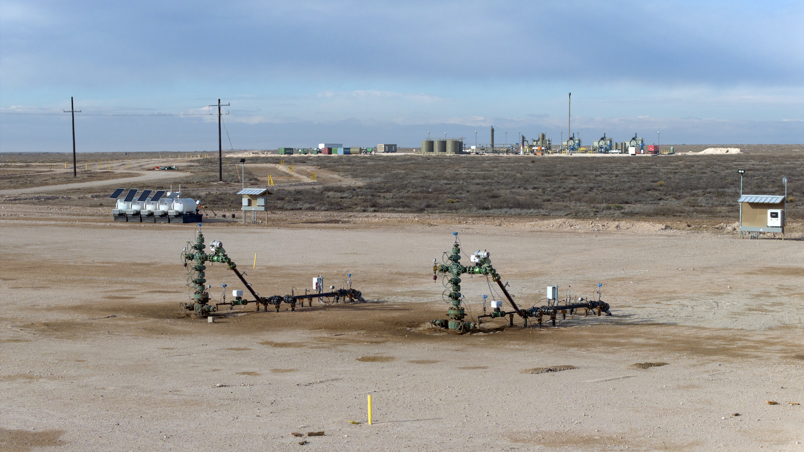
State trust lands just might be one of the best-kept public secrets in America: They exist in 21 Western and Midwestern states, totaling more than 500 million surface and subsurface acres. Those two categories, surface and subsurface, have to be kept separate because they don’t always overlap. What few have bothered to ask is just how many of those acres are funding higher education.
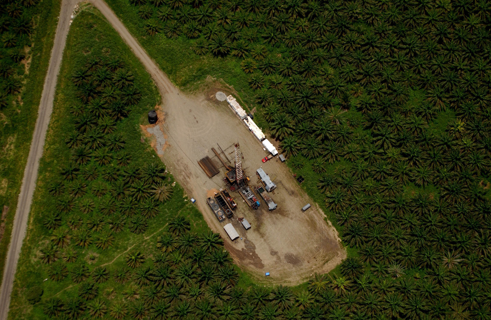
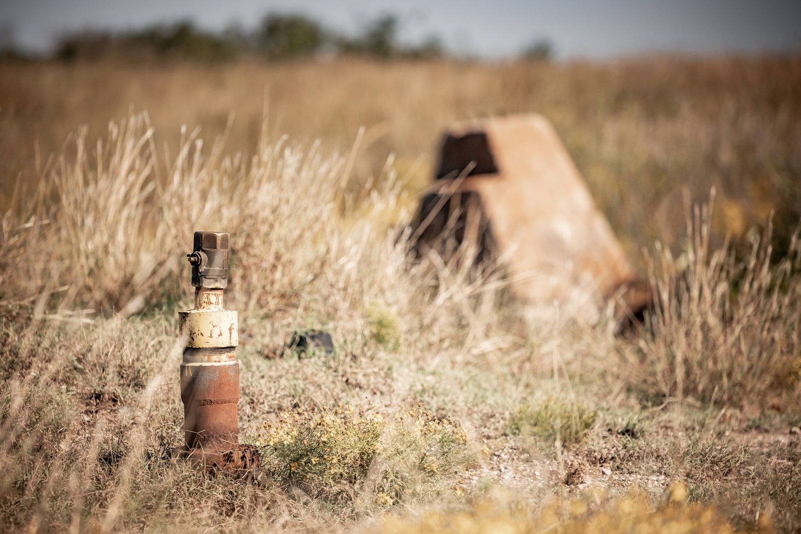
The parcels themselves are scattered and rural, typically uninhabited and seldom marked. Most appear undeveloped and blend in seamlessly with surrounding landscapes. That is, when they don’t have something like logging underway or a frack pad in sight.
In 2022, the year Sierra enrolled, UArizona’s state trust lands provided the institution $7.7 million — enough to have paid the full cost of attendance for more than half of every Native undergraduate at the Tucson campus that same year. But providing free attendance to anyone is an unlikely scenario, as the school works to rein in a budget shortfall of nearly $240 million.
A tribute to the University of Arizona’s wildcat mascot stands near a building on campus.Eliseu Cavalcante / Grist
A parcel of land in Willcox, Arizona, granted to the University of Arizona.Eliseu Cavalcante / Grist
Alina Sierra holds up her old student ID from the University of Arizona.Bean Yazzie / Grist
UArizona’s reliance on state trust land for revenue not only contradicts its commitment to recognize past injustices regarding stolen Indigenous lands, but also threatens its climate commitments. The school has pledged to reach net-zero emissions by 2040.
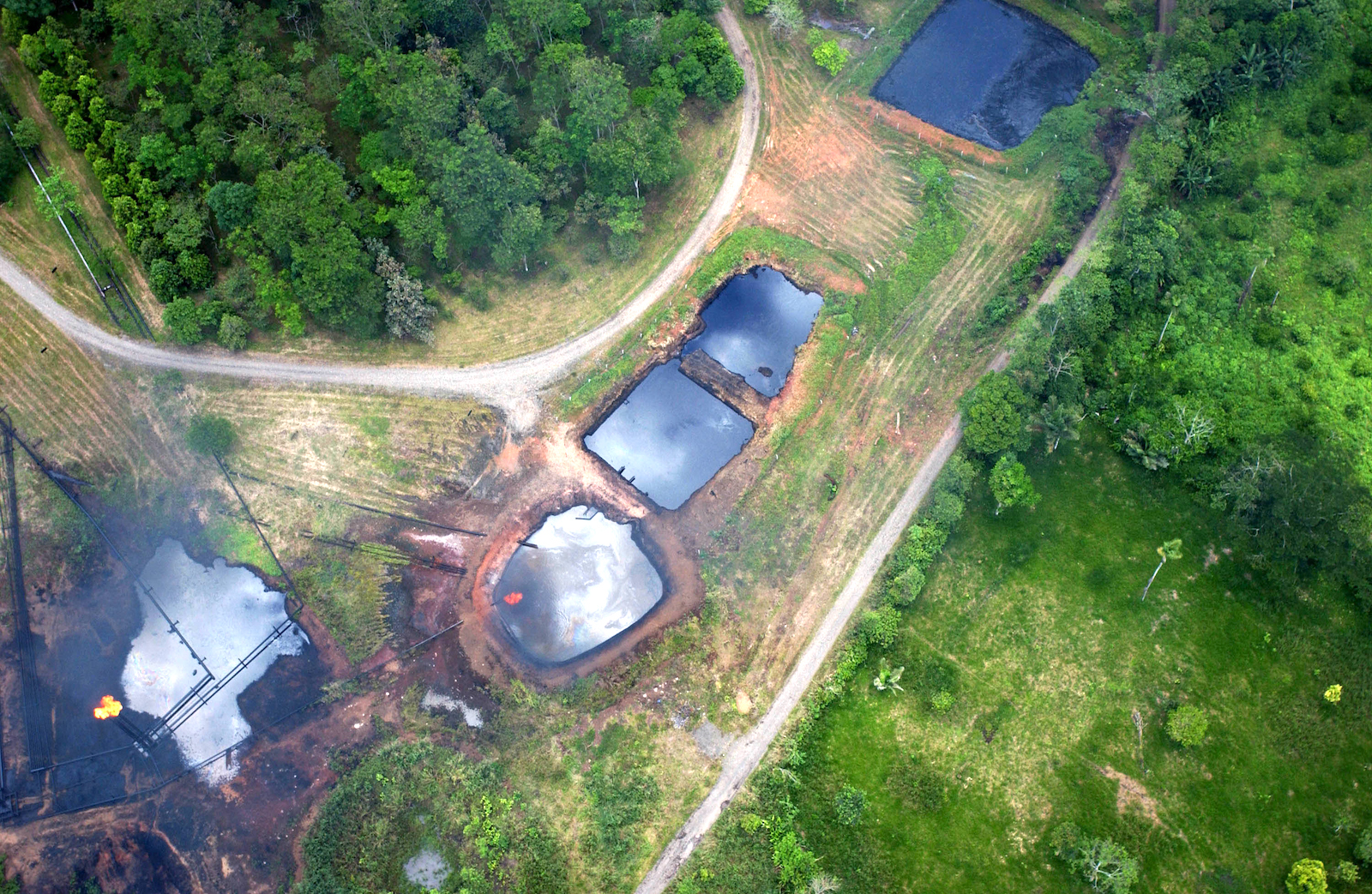
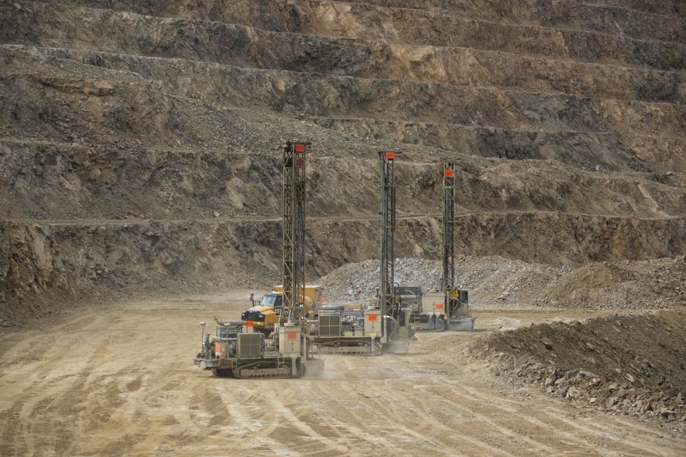
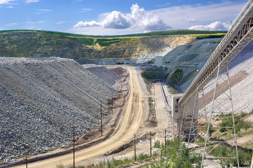
The parcels are managed by the Arizona State Land Department, a separate government agency that has leased portions of them to agriculture, grazing, and commercial activities. But extractive industries make up a major portion of the trust land portfolio. Of the 705,000 subsurface acres that benefit UArizona, almost 645,000 are earmarked for oil and gas production. The lands were taken from at least 10 Indigenous nations, almost all of which were seized by executive order or congressional action in the wake of warfare.
Over the past year, Grist has examined publicly available data to locate trust lands associated with land-grant universities seeded by the Morrill Act. We found 14 universities that matched this criteria. In the process, we identified their original sources and analyzed their ongoing uses. In all, we located and mapped more than 8.2 million surface and subsurface acres taken from 123 Indigenous nations. This land currently produces income for those institutions.
“Universities continue to benefit from colonization,” said Sharon Stein, an assistant professor of higher education at the University of British Columbia and a climate researcher. “It’s not just a historical fact; the actual income of the institution is subsidized by this ongoing dispossession.”
The amount of acreage under management for land-grant universities varies widely, from as little as 15,000 acres aboveground in North Dakota to more than 2.1 million belowground in Texas. Combined, Indigenous nations were paid approximately $4.3 million in today’s dollars for these lands, but in many cases, nothing was paid at all. In 2022 alone, these trust lands generated more than $2.2 billion for their schools. Between 2018 and 2022, the lands produced almost $6.7 billion. However, those figures are likely an undercount as multiple state agencies did not return requests to confirm amounts.
This work builds upon previous investigations that examined how land grabs capitalized and transformed the U.S. university system. The new data reveals how state trust lands continue to transfer wealth from Indigenous nations to land-grant universities more than a century after the original Morrill Act.
It also provides insight into the relationship between colonialism, higher education, and climate change in the Western United States.
Nearly 25 percent of land-grant university trust lands are designated for either fossil fuel production or the mining of minerals, like coal and iron-rich taconite. Grazing is permitted on about a third of the land, or approximately 2.8 million surface acres. Those parcels are often coupled with subsurface rights, which means oil and gas extraction can occur underneath cattle operations, themselves often a major source of methane emissions. Timber, agriculture, and infrastructure leases — for roads or pipelines, for instance — make up much of the remaining acreage.
By contrast, renewable energy production is permitted on roughly one-quarter of 1 percent of the land in our dataset. Conservation covers an even more meager 0.15 percent.
However, those land use statistics are likely undercounts due to the different ways states record activities. Many state agencies we contacted for this story had incomplete public information on how land was used.
“People generally are not eager to confront their own complicity in colonialism and climate change,” said Stein. “But we also have to recognize, for instance, myself as a white settler, that we are part of that system, that we are benefiting from that system, that we are actively reproducing that system every day.”
Students like Alina Sierra struggle to pay for education at a university built on her peoples’ lands and supported with their natural resources. But both current and future generations will have to live with the way trust lands are used to subsidize land-grant universities.
In December 2023, Sierra decided the cost to attend UArizona was too high and dropped out.
UArizona did not respond to a request for comment on this story.
Alina Sierra stands on a dead-end street near her home.
Bean Yazzie / Grist
Acreage now held in trust by states for land-grant universities is part of America’s sweeping history of real estate creation, a history rooted in Indigenous dispossession.
Trust lands in most states were clipped from the more than 1.8 billion acres that were once part of the United States’ public domain — territory claimed, colonized, and redistributed in a process that began in the 18th century and continues today.
The making of the public domain is the stuff of textbook lessons on U.S. expansion. After consolidating states’ western land claims in the aftermath of the American Revolution, federal officials obtained a series of massive territorial acquisitions from rival imperial powers. No doubt you’ve heard of a few of these deals: They ranged from the Louisiana Purchase of 1803 to the Alaska Purchase of 1867.
Backed by the doctrine of discovery, a legal principle with religious roots that justified the seizure of lands around the world by Europeans, U.S. claims to Indigenous territories were initially little more than projections of jurisdiction. They asserted an exclusive right to steal from Indigenous nations, divide the territory into new states, and carve it up into private property. Although Pope Francis repudiated the Catholic Church’s association with the doctrine in 2023, it remains a bedrock principle of U.S. law.
Starting in the 1780s, federal authorities began aggressively taking Native land before surveying and selling parcels to new owners. Treaties were the preferred instrument, accompanied by a range of executive orders and congressional acts. Behind their tidy legal language and token payments lay actual or threatened violence, or the use of debts or dire conditions, such as starvation, to coerce signatures from Indigenous peoples and compel relocation.
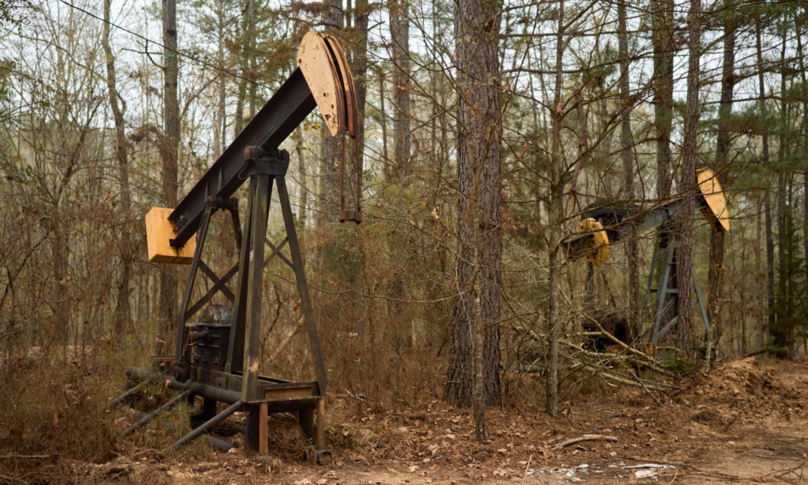
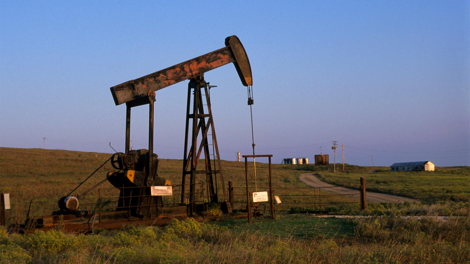
By the 1930s, tribal landholdings in the form of reservations covered less than 2 percent of the United States. Most were located in places with few natural resources and more sensitive to climate change than their original homelands. When reservations proved more valuable than expected, due to the discovery of oil, for instance, outcomes could be even worse, as viewers of Killers of the Flower Moon learned last year.
The public domain once covered three-fourths of what is today the United States. Federal authorities still retain about 30 percent of this reservoir of plundered land, most conspicuously as national parks, but also as military bases, national forests, grazing land, and more. The rest, nearly 1.3 billion acres, has been redistributed to new owners through myriad laws.
A missile range and military museum on a land-grant parcel in White Sands, New Mexico.Eliseu Cavalcante / Grist
Signs mark oil activity on parcels granted to Texas A&M in Pyote, Texas.Eliseu Cavalcante / Grist
A waste pond on a land-grant parcel in Carlsbad, New Mexico.Eliseu Cavalcante / Grist
When it came to redistribution, grants of various stripes were more common than land sales. Individuals and corporate grantees — think homesteaders or railroads — were prominent recipients, but in terms of sheer acreage given, they trailed a third group: state governments.
Federal-to-state grants were immense. Cram them all together and they would comfortably cover all of Western Europe. Despite their size and ongoing financial significance, they have never attracted much attention outside of state offices and agencies responsible for managing them.
The Morrill Act, one of the best known examples of federal-to-state grants, followed a well-established path for funding state institutions. This involved handing Indigenous land to state legislatures so agencies could then manage those lands on behalf of specifically chosen beneficiaries.
Many other laws subsidized higher education by issuing grants to state or territorial governments in a similar way. The biggest of those bounties came through so-called “enabling acts” that authorized U.S. territories to graduate to statehood.
Every new state carved out of the public domain in the contiguous United States received land grants for public institutions through their enabling acts. These grants functioned like dowries for joining the Union and funded a variety of public works and state services ranging from penitentiaries to fish hatcheries. Their main function, however, was subsidizing education.
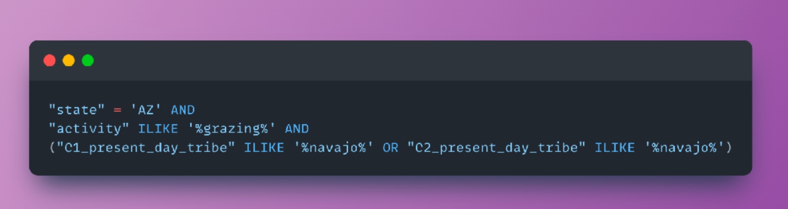
Tribal Land Cession Boundaries
1784-1894
1783
Public Land Survey System Townships
Washington State Trust Lands
Washington State Trust Lands
Connected to Washington State University
Since time immemorial, Indigenous peoples have lived with, and
cared for, the lands they call home.
But as settlers moved west, U.S. government and military officials
forced those communities from their lands, sometimes through the
signing of treaties, sometimes through military action.
Once ceded, those lands became territories and then states. With
statehood, those lands became part of America's real estate
system.
Lands inside newly formed states were overlaid with the Public
Land Survey System — a rectangular survey system designed by
early colonists to map newly acquired Indigenous lands.
One 6-by-6 mile square on the grid is known as a
township.
Inside each township are 36 more 1-by-1 mile squares called
sections.
In most states, sections 16 and 36 of every township were
automatically set aside to fund K-12 schools, known as common
schools at the time.
From the remaining 34 sections, states could choose which lands
would benefit other public institutions, like hospitals,
penitentiaries, and universities.
In the years since statehood, some of these lands have been sold
or swapped, but most Western states have held onto their trust
lands.
Spread across the Western U.S. land grid, trust lands are often
unseen, landlocked, and anonymous on the landscape.
Primary and secondary schools, or K-12 schools, were the greatest beneficiaries by far, followed by institutions of higher education. What remains of them today are referred to as trust lands. “A perpetual, multigenerational land trust for the support of the Beneficiaries and future generations” is how the Arizona State Land Department describes them.
Higher education grants were earmarked for universities, teachers colleges, mining schools, scientific schools, and agricultural colleges, the latter being the means through which states that joined the Union after 1862 got their Morrill Act shares. States could separate or consolidate their benefits as they saw fit, which resulted in many grants becoming attached to Morrill Act colleges.
Originally, the land was intended to be sold to raise capital for trust funds. By the late 19th century, however, stricter requirements on sales and a more conscientious pursuit of long-term gains reduced sales in favor of short-term leasing.
The change in management strategy paid off. Many state land trusts have been operating for more than a century. In that time, they have generated rents from agriculture, grazing, and recreation. As soon as they were able, managers moved into natural resource extraction, permitting oil wells, logging, mining, and fracking.
Land use decisions are typically made by state land agencies or lawmakers. Of the six land-grant institutions that responded to requests for comment on this investigation, those that referenced their trust lands deferred to state agencies, making clear that they had no control over permitted activities.
What happens on state trust lands?
State agencies likewise receive and distribute the income. As money comes in, it is either delivered directly to beneficiaries or, more commonly, diverted to permanent state trust funds, which invest the proceeds and make scheduled payouts to support select public services and institutions.
These trusts have a fiduciary obligation to generate profit for institutions, not minimize environmental damage. Although some of the permitted activities are renewable and low-impact, others are quietly stripping the land. All of them fill public coffers with proceeds derived from ill-gotten resources.
Marty Two Bulls Jr. / Grist
For a $10 fee last December, anyone in New Mexico could chop down a Christmas tree in a pine stand on a patch of state trust land just off Highway 120 near Black Lake, southeast of Taos. The rules: Pay your fee, bring your permit, choose a tree, and leave nothing behind but a stump less than 6 inches high.
“The holidays are a time we should be enjoying our loved ones, not worrying about the cost of providing a memorable experience for our kids,” said Commissioner of Public Lands Stephanie Garcia Richard, adding that “the nominal fee it costs for a permit will directly benefit New Mexico public schools, so it supports a good cause too.” The offer has been popular enough to keep the program running for several years.
The New Mexico State Land Office, sometimes described by state legislators as “the most powerful office you’ve never heard of,” has been a successful operation for a very long time. Since it started reporting revenue in 1900, it’s generated well over $42 billion in 2023 dollars.
All that money isn’t from Christmas trees.For generations, oil and gas royalties have fueled the state’s trust land revenue, with a portion of the funds designated for New Mexico State University, or NMSU, a land-grant school founded in 1888 when New Mexico was still a territory.
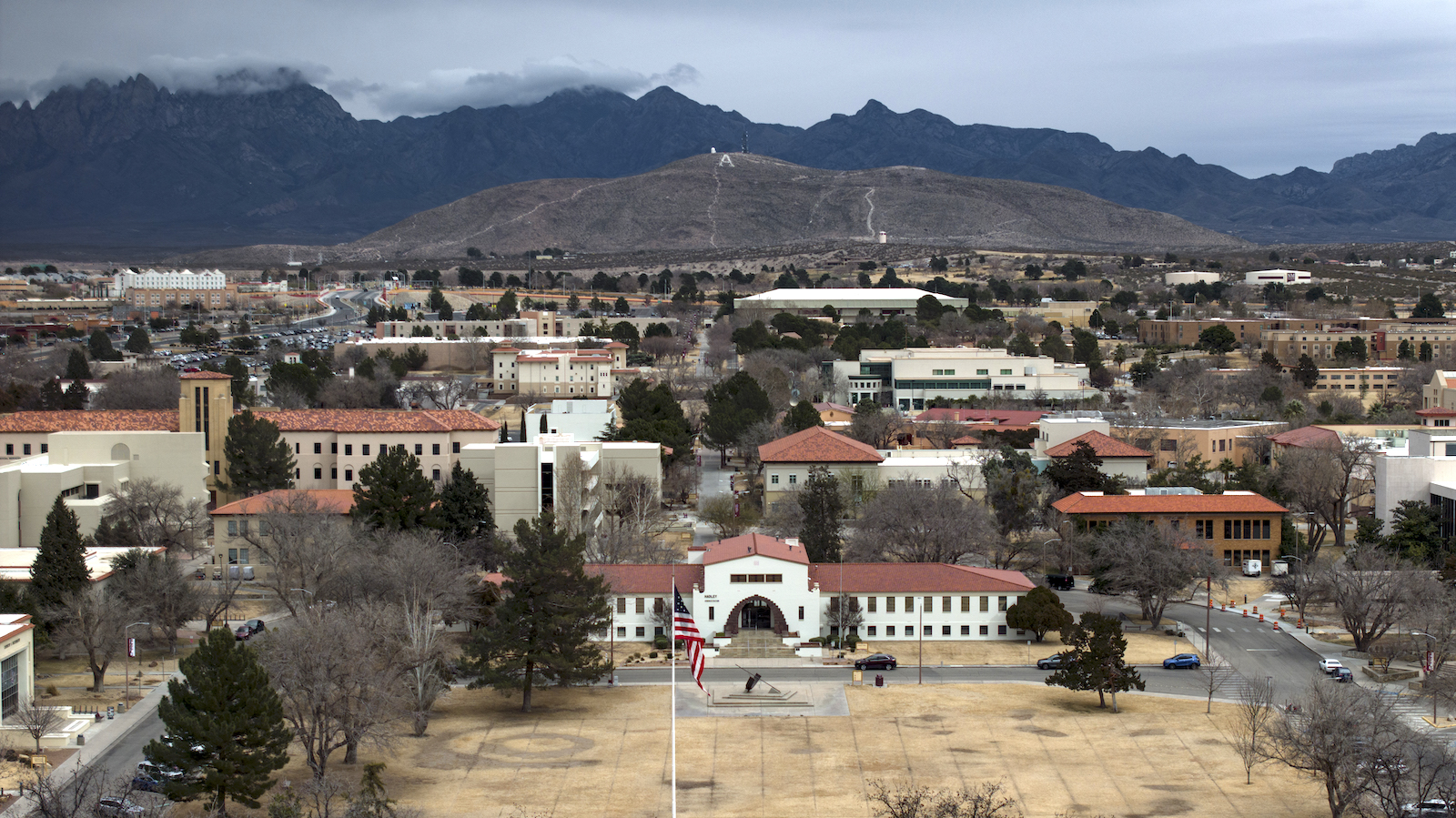
An aerial view of New Mexico State University, including Hadley Hall.
New Mexico State University, as seen in an aerial view, is a land-grant school founded in 1888. Eliseu Cavalcante / Grist
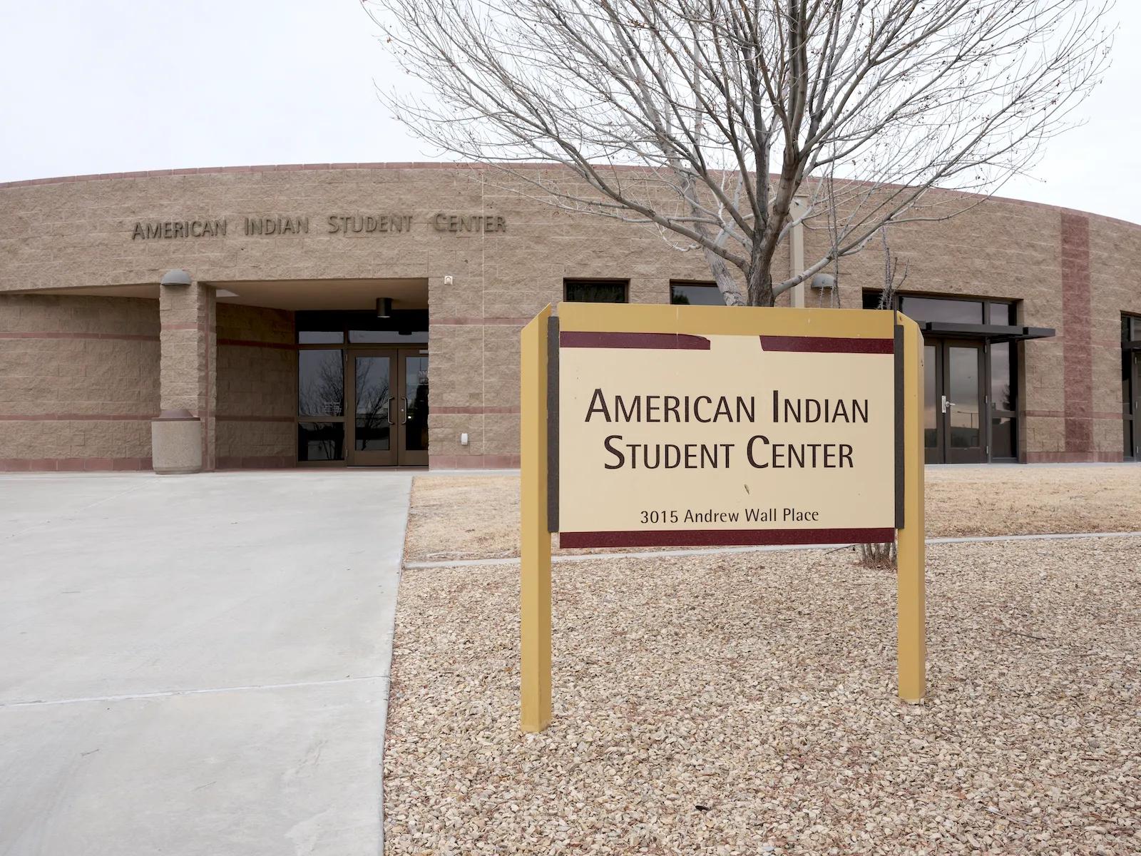
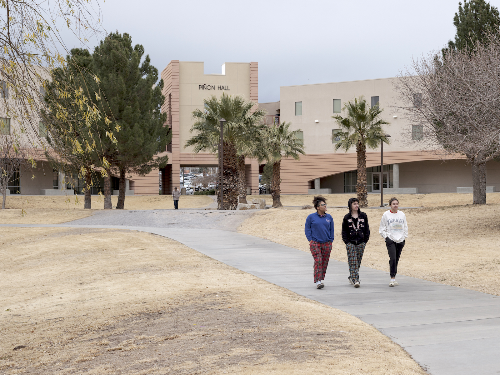
Students walk past Piñon Hall on New Mexico State University’s campus. The university, which still receives revenue from stolen Indigenous land parcels, has an American Indian Student Center. Eliseu Cavalcante / Grist
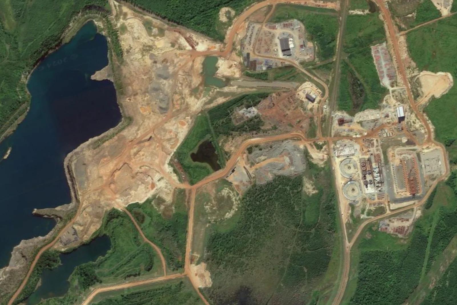
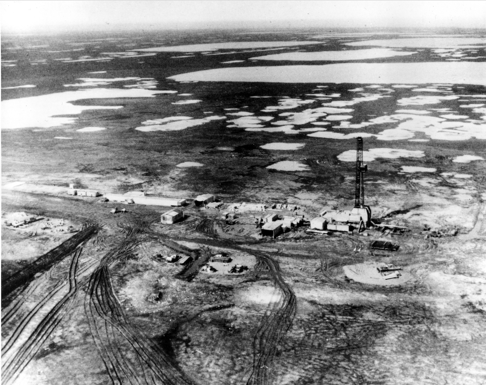
The oil comes from drilling in the northwestern fringe of the Permian Basin, one of the oldest targets of large-scale oil production in the United States. Corporate descendants of Standard Oil, the infamous monopoly controlled by John D. Rockefeller, were operating in the Permian as early as the 1920s. Despite being a consistent source of oil, prospects for exploitation dimmed by the late 20th century, before surging again in the 21st. Today, it’s more profitable than ever.
In recent decades, more sophisticated exploration techniques have revealed more “recoverable” fossil fuel in the Permian than previously believed. A 2018 report by the United States Geological Survey pegged the volume at 46.3 billion barrels of oil and 281 trillion cubic feet of natural gas, which made the Permian the largest oil and gas deposit in the nation. Analysts, shocked at the sheer volume, and the money to be made, have taken to crowning the Permian the “King of Shale Oil.” Critics concerned with the climate impact of the expanding operations call it a “carbon bomb.”
A parcel of land in Carlsbad, New Mexico, granted to New Mexico State University. Eliseu Cavalcante / Grist
As oil and gas extraction spiked, so did New Mexico’s trust land receipts. In the last 20 years, oil and gas has generated between 91 and 97 percent of annual trust land revenue. It broke annual all-time highs in half of those years, topping $1 billion for the first time in 2019 and reaching $2.75 billion last year. Adjusted for inflation, more than 20 percent of New Mexico’s trust land income since 1900 has arrived in just the last five years.“
Every dollar earned by the Land Office,” Commissioner Richard said when revenues broke the billion-dollar barrier, “is a dollar taxpayers do not have to pay to support public institutions.”
Trust land as a cost-free source of subsidies for citizens is a common framing. In 2023, Richard declared that her office had saved every New Mexico taxpayer $1,500 that year. The press release did not mention oil or gas, or Apache bands in the state.
Virtually all of the trust land in New Mexico, including 186,000 surface acres and 253,000 subsurface acres now benefiting NMSU, was seized from various Apache bands during the so-called Apache Wars. Often reduced to the iconic photograph of Geronimo on one knee, rifle in hand, hostilities began in 1849, and they remain the longest-running military conflict in U.S. history, continuing until 1924.
In 2019, newly elected New Mexico Governor Michelle Lujan Grisham began aligning state policy with “scientific consensus around climate change.” According to the state’s climate action website, New Mexico is working to tackle climate change by transitioning to clean electricity, reducing greenhouse gas emissions, supporting an economic transition from coal to clean energy, and shoring up natural resource resilience.
A parcel of land in Carlsbad, New Mexico, leased to New Mexico State University
Eliseu Cavalcante / Grist
“New Mexico is serious about climate change — and we have to be. We are already seeing drier weather and rising temperatures,” the governor wrote on the state’s website. “This administration is committed not only to preventing global warming, but also preparing for its effects today and into the future.”
No mention was made of increasingly profitable oil and gas extraction on trust lands or their production in the Permian. In 2023, just one 240-acre parcel of land benefiting NMSU was leased for five years for $6 million.
NMSU did not respond to a request for comment on this story.
More than half of the acreage uncovered in our investigation appears in oil-rich West Texas, the equivalent of more than 3 million football fields. It benefits Texas A&M.
Take the long drive west along I-10 between San Antonio and El Paso, in the southwest region of the Permian Basin, and you’ll pass straight through several of those densely packed parcels without ever knowing it — they’re hidden in plain sight on the arid landscape. These tracts, and others not far from the highway, were Mescalero Apache territory. Kiowas and Comanches relinquished more parcels farther north.
A flare glows on a land-grant parcel in Pyote, Texas, associated with Texas A&M. Eliseu Cavalcante / Grist
In the years after the Civil War, a “peace commission” pressured Comanche and Kiowa leaders for an agreement that would secure land for tribes in northern Texas and Oklahoma. Within two years, federal agents dramatically reduced the size of the resulting reservation with another treaty, triggering a decade of conflict.
The consequences were disastrous. Kiowas and Comanches lost their land to Texas and their populations collapsed. Between the 1850s and 1890s, Kiowas lost more than 60 percent of their people to disease and war, while Comanches lost nearly 90 percent.
If this general pattern of colonization and genocide was a common one, the trajectory that resulted in Texas A&M’s enormous state land trust was not.
Texas was never part of the U.S. public domain. Its brief stint as an independent nation enabled it to enter the Union as a state, skipping territorial status completely. As a result, like the original 13 states, it claimed rights to sell or otherwise distribute all the not-yet-privatized land within its borders.
Following the broader national model, but ratcheting up the scale, Texas would allocate over 2 million acres to subsidize higher education.
Texas A&M was established to take advantage of a Morrill Act allocation of 180,000 acres, and opened its doors in 1876. The same year, Texas allocated a million acres of trust lands, followed by another million in 1883, nearly all of it on land relinquished in treaties from the mid-1860s.
A Texas-sized trust
Texas A&M benefits from more than half of the state trust lands held
on behalf of universities.
Today, the Permanent University Fund derived from that land is worth nearly $34 billion. That’s thanks to oil, of course, which has been flowing from the university’s trust lands since 1923. In 2022 alone, Texas trust lands produced $2.2 billion in revenue.
The Kiowa and Comanche were ultimately paid about 2 cents per acre for their land. The Mescalero Apache received nothing.
Texas A&M did not respond to a request for comment on this story.
Marty Two Bulls Jr. / Grist
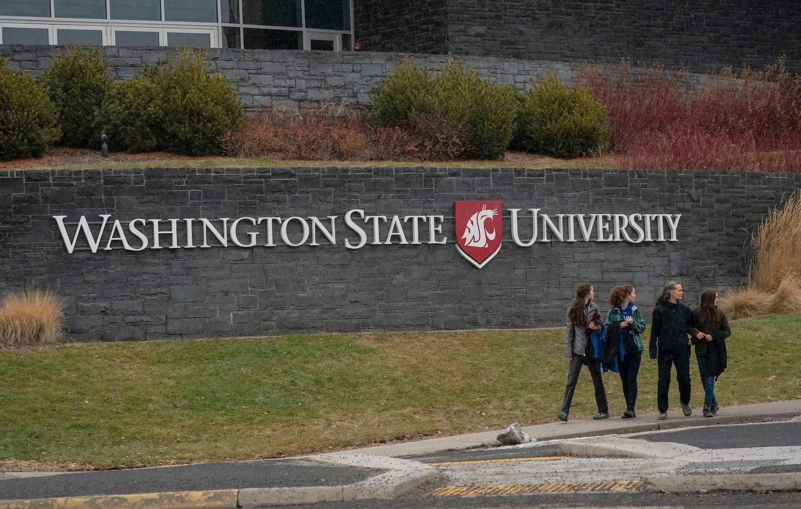
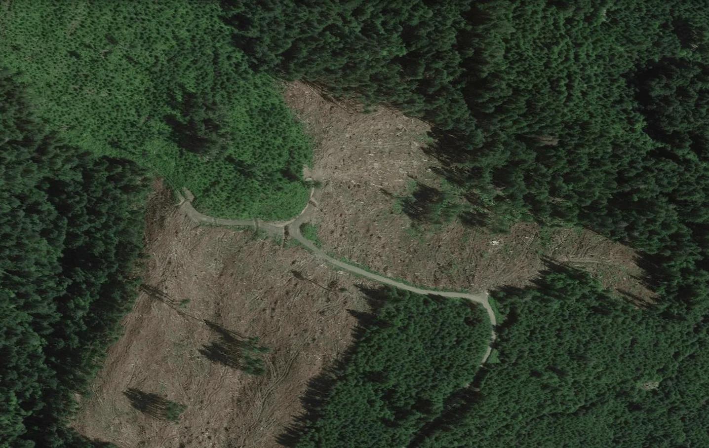
For more than a century, logging has been the main driver of Washington State University’s trust land income, on land taken from 21 Indigenous nations, especially the Confederated Tribes and Bands of the Yakama Nation. About 86,000 acres, more than half of the surface trust lands allocated to Washington State University, or WSU, are located inside Yakama land cessions, which started in 1855. Between 2018 and 2022, trust lands produced nearly $78.5 million in revenue almost entirely from timber.
But it isn’t a straight line to the university’s bank account.
“The university does not receive the proceeds from timber sales directly,” said Phil Weiler, a spokesperson for WSU. “Lands held in trust for the university are managed by the Washington State Department of Natural Resources, not WSU.”
Washington State’s mascot, Butch, leads the student section during a game.
David Ryder / Getty Images
Left, A trail cuts through a clearcut timber parcel granted to Washington State University. Right, Students exit Washington State University. Google Earth, David Ryder / Getty Images
This parcel granted to Washington State University is leased for timber extraction.
Google Earth
In 2022, WSU’s trust lands produced about $19.5 million in revenue, which was deposited into a fund managed by the State Investment Board. In other words, the state takes on the management responsibility of turning timber into investments, while WSU reaps the rewards by drawing income from the resulting trust funds.
“The Washington legislature decides how much of the investment earnings will be paid out to Washington State University each biennium,” said Weiler. “By law, those payouts can only be used to fund capital projects and debt service.”
This arrangement yielded nearly $97 million dollars for WSU from its two main trust funds between 2018 and 2022, and has generally been on the rise since the Great Recession. In recent decades, the money has gone to construction and maintenance of the institution’s infrastructure, like its Biomedical and Health Sciences building, and the PACCAR Clean Technology Building — a research center focused on innovating wood products and sustainable design.
That revenue may look small in comparison to WSU’s $1.2 billion dollar endowment, but it has added up over time. From statehood in 1889 to 2022, timber sales on trust lands provided Washington State University with roughly $1 billion in revenue when Grist adjusted for inflation. But those figures are likely higher: Between 1971 and 1983, the State of Washington did not produce detailed records on trust land revenue as a cost-cutting measure.
Meanwhile, WSU students have demanded that the university divest from fossil fuel companies held in the endowment. But even if the board of regents agreed, any changes would likely not apply to the school’s state-controlled trust fund, which currently contains shares in ExxonMobil, Shell, Chevron, and at least two dozen other corporations in the oil and gas sector.
“Washington State University (WSU) is aware that our campuses are located on the homelands of Native peoples and that the institution receives financial benefit from trust lands,” said Weiler.
Marty Two Bulls Jr. / Grist
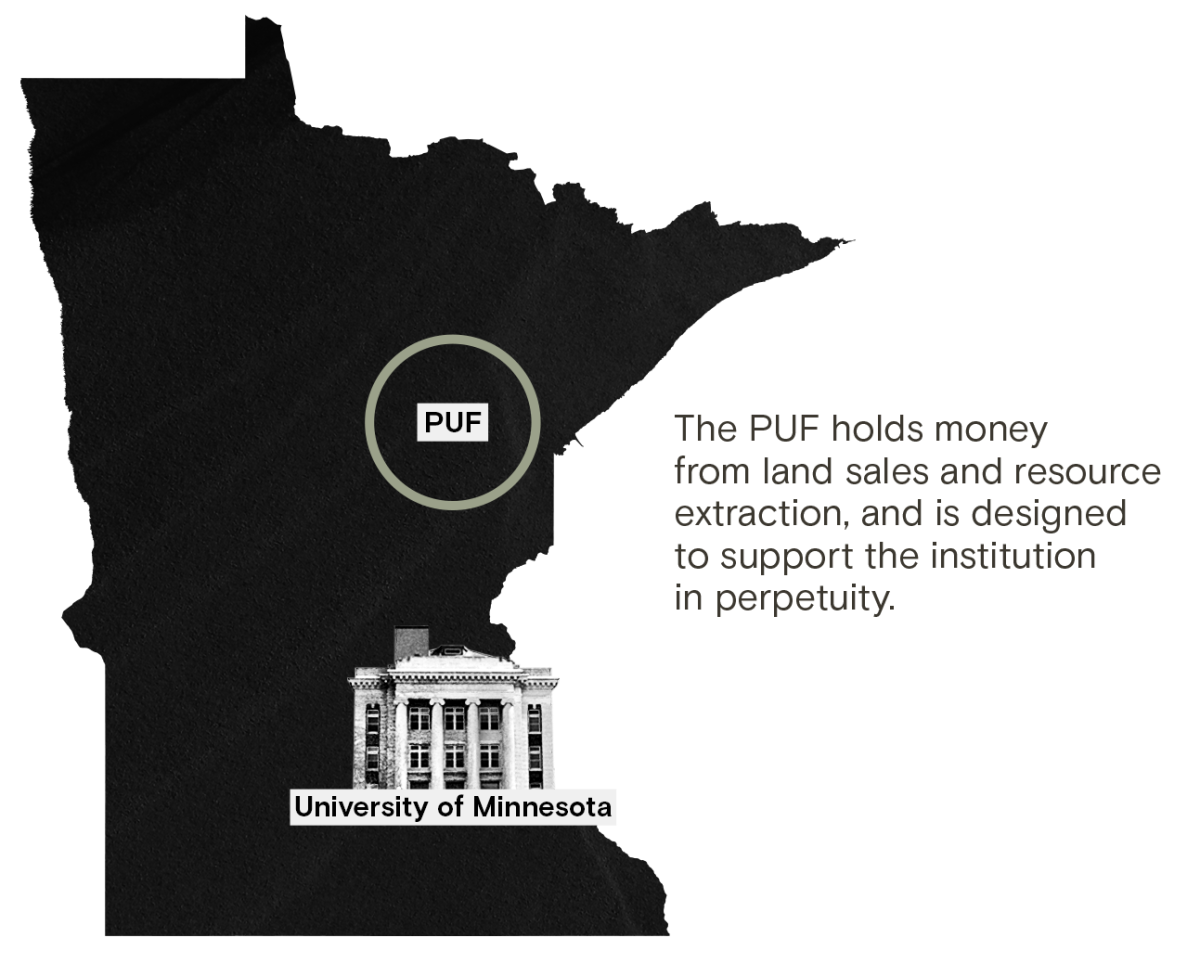
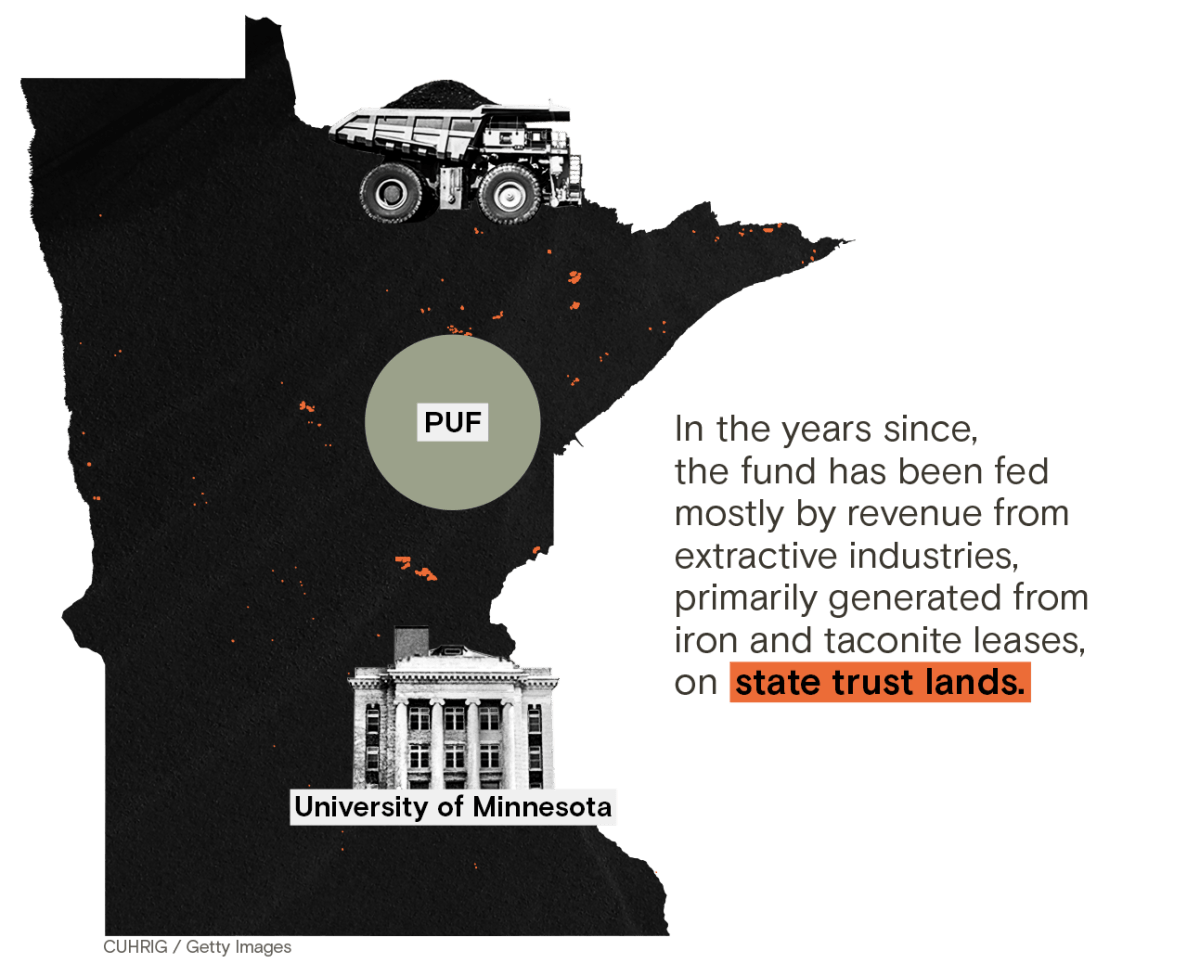
In states with trust lands, a reasonably comfortable buffer exists between beneficiaries, legislators, land managers, and investment boards, but that hasn’t always been the case. In Minnesota’s early days, state leaders founded the University of Minnesota while also making policy that would benefit the school, binding the state’s history of genocide with the institution.
Those actions still impact Indigenous peoples in the state today while providing steady revenue streams to the University.
Henry Sibley began to amass his fortune around 1834 after only a few years in the fur trade in the territory of what would become Minnesota, rising to the role of regional manager of the American Fur Company at just 23. But even then, the industry was on the decline — wild game had been over-hunted and competition was fierce. Sibley responded by diversifying his activities. He moved into timber, making exclusive agreements with the Ojibwe to log along the Snake and Upper St. Croix rivers.
His years in “wild Indian country” were paying off: Sibley knew the land, waterways, and resources of the Great Lakes region, and he knew the people, even marrying Tahshinaohindaway, also known as Red Blanket Woman, in 1840 — a Mdewakanton Dakota woman from Black Dog Village in what is now southern Minneapolis.
Sibley was a major figure in a number of treaty negotiations, aiding the U.S. in its western expansion, opening what is now Minnesota to settlement by removing tribes. In 1848, he became the first congressional delegate for the Wisconsin Territory, which covered much of present-day Minnesota, and eventually, Minnesota’s first governor.
But he was also a founding regent of the University of Minnesota — using his personal, political, and industry knowledge of the region to choose federal, state, and private lands for the university. Sibley and other regents used the institution as a shel corporation to speculate and move money between companies they held shares in.
University of Minnesota mascot Goldy the Gopher during a football game in 2022 in Minneapolis.
Nick Wosika / Icon Sportswire via Getty Images
Left, a mining parcel granted to the University of Minnesota. Right, University of Minnesota mascot Goldy the Gopher during a football game in 2022 in Minneapolis. Google Earth, Nick Wosika / Icon Sportswire via Getty Images
A mining parcel granted to the University of Minnesota.
Google Earth
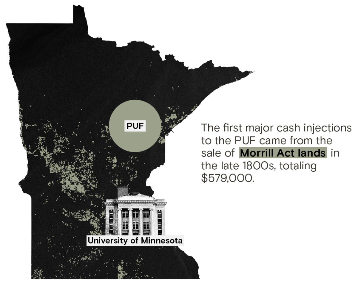
In 1851, Sibley helped introduce land-grant legislation for the purpose of a territorial university, and just three days after Congress passed the bill, Minnesota’s territorial leaders established the University of Minnesota. With an eye on statehood, leaders knew more land would be granted for higher education, but first the land had to be made available.
That same year, with the help of then-territorial governor and fellow university regent Alexander Ramsey, the Dakota signed the Treaty of Traverse De Sioux, a land cession that created almost half of the state of Minnesota, and, taken with other cessions, would later net the University nearly 187,000 acres of land — an area roughly the size of Tucson.
Among the many clauses in the treaty was payment: $1.4 million would be given to the Dakota, but only after expenses. Ramsey deducted $35,000 for a handling fee, about $1.4 million in today’s dollars. After agencies and politicians had taken their cuts, the Dakota were promised only $350,000, but ultimately, only a few thousand arrived after federal agents delayed and withheld payments or substituted them for supplies that were never delivered.
The betrayal led to the Dakota War of 1862. “The Sioux Indians of Minnesota must be exterminated or driven forever beyond the borders of the state,” said Governor Ramsey. Sibley joined in the slaughter, leading an army of volunteers dedicated to the genocide of the Dakota people. At the end of the conflict, Ramsey ordered the mass execution of more than 300 Dakota men in December of 1862 — a number later reduced by then-president Abraham Lincoln to 39, and still the largest mass execution in U.S. history.
That grisly punctuation mark at the end of the war meant a windfall for the University of Minnesota, with new lands being opened through the state’s enabling act and another federal grant that had just been passed: the Morrill Act. Within weeks of the mass execution, the university was reaping benefits thanks to the political, and military, power of Sibley and the board of regents.
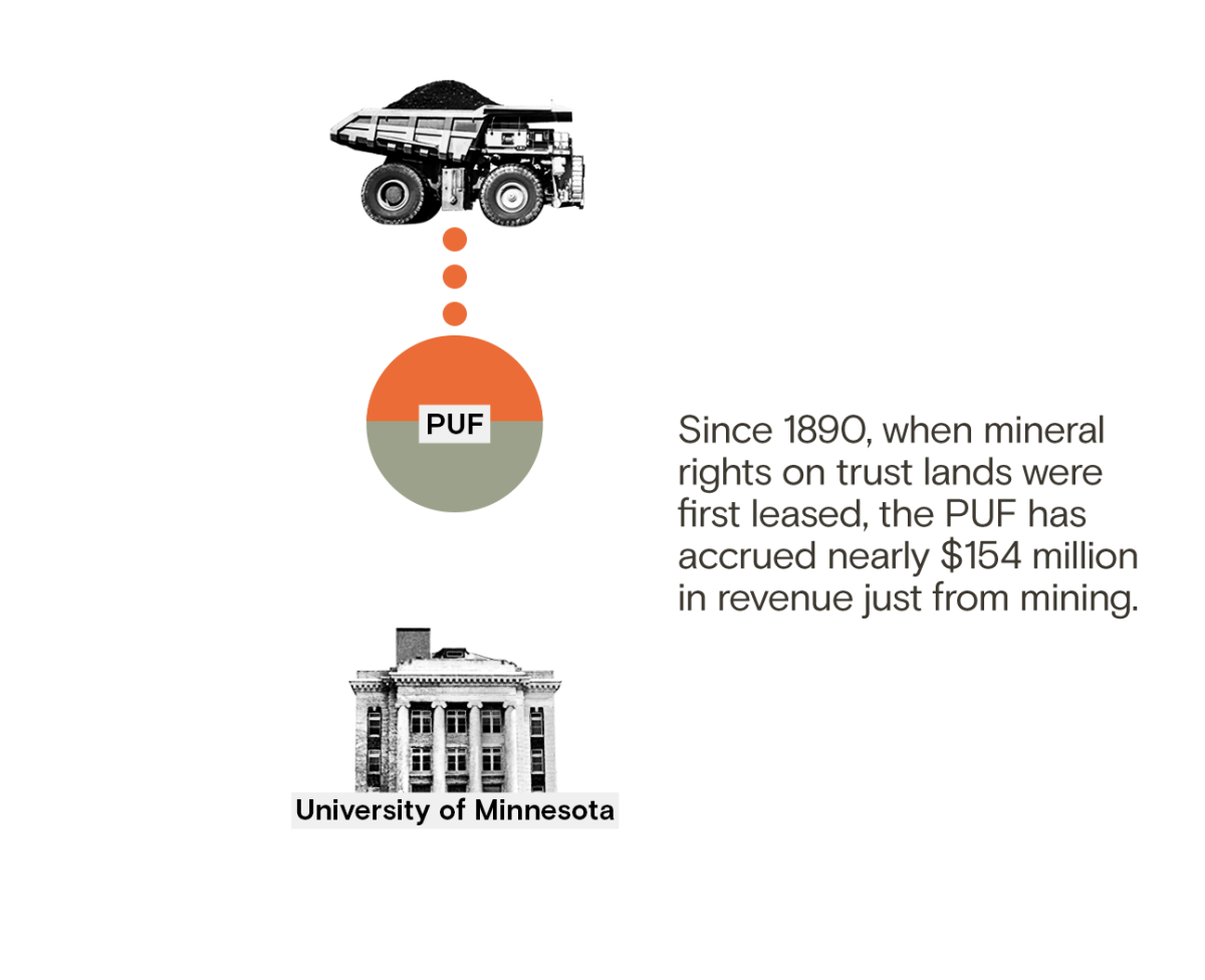
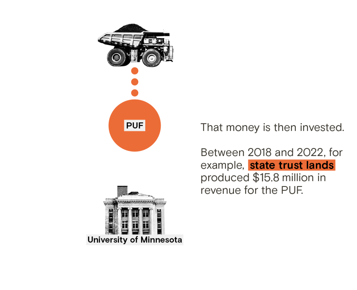
Between 2018 and 2022, those lands produced more than $17 million in revenue, primarily through leases for the mining of iron and taconite, a low-grade iron ore used by the steel industry. But like other states that rely on investment funds and trusts to generate additional income, those royalties are only the first step in the institution’s financial investments.
Today, Sibley, Ramsey, and other regents are still honored. Their names adorn parks, counties, and streets, their homes memorialized for future generations. While there have been efforts to remove their names from schools and parks, Minnesota, its institutions, and many of its citizens continue to benefit from their actions.
Less than half of the universities featured in this story responded to requests for comment, and the National Association of State Trust Lands, the nonprofit consortium that represents trust land agencies and administrators, declined to comment. Those that did, however, highlighted the steps they were making to engage with Indigenous students and communities.
Still, investments in Indigenous communities are slow coming. Of the universities that responded to our requests, those that directly referenced how trust lands were used maintained they had no control over how they profited from the land.
And they’re correct, to some degree: States managing assets for land-grants have fiduciary, and legal, obligations to act in the institution’s best interests.
But that could give land-grant universities a right to ask why maximizing returns doesn’t factor in the value of righting past wrongs or the costs of climate change.
“We can know very well that these things are happening and that we’re part of the problem, but our desire for continuity and certainty and security override that knowledge,” said Sharon Stein of the University of British Columbia.
A parcel of land in Pyote, Texas. Eliseu Cavalcante / Grist
That knowledge, Stein added, is easily eclipsed by investments in colonialism that obscure university complicity and dismiss that change is possible.
Though it’s a complicated and arduous process changing laws and working with state agencies, universities regularly do it. In 2022, the 14 land-grant universities profiled in this story spent a combined $4.6 million on lobbying on issues ranging from agriculture to defense. All lobbied to influence the federal budget and appropriations.
But even if those high-level actions are taken, it’s not clear how it will make a difference to people like Alina Sierra in Tucson, who faces a rocky financial future after her departure from the University of Arizona.
Alina Sierra reflects on her decision to leave the University of Arizona and enroll in Tohono O’odham Community College. She’s glad she made the switch. “It’s free, they take care of your books and tuition,” she said of TOCC. In contrast, she still owes her former school over $6,000. Bean Yazzie / Grist
In 2022, a national study on college affordability found that nearly 40 percent of Native students accrued more than $10,000 in college debt, with some accumulating more than $100,000 in loans. Sierra is still in debt to UArizona for more than $6,000.
“I think that being on O’odham land, they should give back, because it’s stolen land,” said Sierra. “They should put more into helping us.”
In January, Sierra enrolled as a full-time student at Tohono O’odham Community College in Sells, Arizona — a tribal university on her homelands. The full cost of attendance, from tuition to fees to books, is free.
The college receives no benefits from state trust lands.
CREDITS
This story was reported and written by Tristan Ahtone, Robert Lee, Amanda Tachine, An Garagiola, and Audrianna Goodwin. Data reporting was done by Maria Parazo Rose and Clayton Aldern, with additional data analysis and visualization by Marcelle Bonterre and Parker Ziegler. Margaret Pearce provided guidance and oversight.
Original photography for this project was done by Eliseu Cavalcante and Bean Yazzie. Parker Ziegler handled design and development. Teresa Chin supervised art direction. Marty Two Bulls Jr. and Mia Torres provided illustration. Megan Merrigan, Justin Ray, and Mignon Khargie handled promotion. Rachel Glickhouse coordinated partnerships.
This project was edited by Katherine Lanpher and Katherine Bagley. Jaime Buerger managed production. Angely Mercado did fact-checking, and Annie Fu fact-checked the project’s data.
Special thanks to Teresa Miguel-Stearns, Jon Parmenter, Susan Shain, and Tushar Khurana for their additional research contributions. We would also like to thank the many state officials who helped to ensure we acquired the most recent and accurate information for this story. This story was made possible in part by the Pulitzer Center, the Data-Driven Reporting Project, and the Bay & Paul Foundation.
The Misplaced Trust team acknowledges the Tohono O’odham, Pascua Yaqui, dxʷdəwʔabš, Suquamish, Muckleshoot, puyaləpabš, Tulalip, Muwekma Ohlone, Lisjan, Tongva, Kizh, Dakota, Bodwéwadmi, Quinnipiac, Monongahela, Shawnee, Lenape, Erie, Osage, Akimel O’odham, Piipaash, Očhéthi Šakówiŋ, Diné, Kanienʼkehá:ka, Muh-he-con-ne-ok, Pαnawάhpskewi, and Mvskoke peoples, on whose homelands this story was created.
As America grew westward in the 19th and 20th centuries, the federal government took land from Indigenous peoples and gave it to states for the creation of public colleges known as land-grant universities. A new Grist investigation reveals how many of these institutions continue to profit from this stolen land, largely through extractive industries including oil and gas production, mining, and logging.
Using publicly available data, our investigation locates millions of acres taken from more than a hundred Indigenous nations to provide ongoing sources of revenue for educational institutions. Our reporting reveals how Indigenous lands and resources bankroll land-grant universities, historically and today, and provides insight into the relationship between colonialism, higher education, and climate change.
Here are five takeaways from our investigation:
1 Fourteen land-grant universities generate revenue from 8.2 million surface and subsurface acres of Indigenous land.
State trust lands just might be one of the best kept public secrets in America: They exist in 21 Western and Midwestern states, totaling more than 500 million surface and subsurface acres. They are held and managed by state agencies and primarily exist to subsidize education. Using data from these state agencies, Grist located trust lands associated with specific land-grant institutions to determine where they are located and how they are used to benefit those colleges. “A perpetual, multigenerational land trust for the support of the beneficiaries and future generations” is how the Arizona State Land Department describes them.
2 Those 8.2 million acres were taken from at least 123 Indigenous nations through more than 150 land cessions, a legal term for the surrendering of territory.
Grist was able to compare state trust land data with federal data known as the Schedule of Indian Land Cessions, which documents Indigenous land cessions in the continental United States using extensive information on treaties and other land seizures. By joining these different datasets, we were able to get a glimpse of just how many Indigenous nations were impacted by the creation of these institutions.
3 Indigenous nations were paid approximately $4.3 million in 2023 dollars for these lands. In many cases, however, nothing was paid at all.
Based on accounting of historical payments to Indigenous nations by the Indian Claims Commission and the Court of Claims, Grist was able to identify the price paid per acre for each land cession and calculate the total amount paid to tribes for trust lands that benefit universities today. It’s important to note that in many cases, Indigenous nations were never compensated for the taking of their territory, and as our reporting reveals, those lands have continued to provide steady revenue streams to land-grant institutions. “Universities continue to benefit from colonization,” said Sharon Stein, an assistant professor of higher education at the University of British Columbia. “It’s not just a historical fact; the actual income of the institution is subsidized by this ongoing dispossession.”
4 Nearly 25 percent of land-grant university trust lands are designated for either fossil fuel production or the mining of minerals like coal and iron-rich taconite.
Utilizing datasets from state land agencies, we were able to determine what activities generated revenue for land-grant universities. While much of our focus is on the energy industry due to its massive climate impact, we found that grazing is permitted on about a third of the land, or approximately 2.8 million surface acres. Timber, agriculture, and infrastructure leases — for roads or pipelines, for instance — make up much of the remaining acreage. However, despite the somewhat smaller footprint that timberlands represent in our dataset, they are still significant sources of revenue: From statehood in 1889 to 2022, timber sales on trust lands in Washington provided Washington State University with at least $1.1 billion in revenue when adjusted for inflation.
5 In 2022, state trust lands generated more than $2.2 billion in revenue. Between 2018 and 2022: approximately $6.6 billion.
Trust land activities provide significant streams of income to land-grant schools, but most importantly, they subsidize higher education so citizens don’t have to. “Every dollar earned by the land office,” Commissioner of Public Lands Stephanie Garcia Richard of New Mexico said when revenues broke the billion-dollar barrier, “is a dollar taxpayers do not have to pay to support public institutions.”
In 1862, the Morrill Act allowed the federal government to expropriate over 10 million acres of tribal lands from Native communities, selling or developing them in order to fund public colleges. Over time, additional violence-backed treaties and land seizures ceded even more Indigenous lands to these “land-grant universities,” which continue to profit from these parcels.
But the Morrill Act is only one piece of legislation that connects land taken from Indigenous communities to land-grant universities. Over the past year, Grist looked at state trust lands, which are held and managed by state agencies for the schools’ continued benefit, and which total more than 500 million surface and subsurface acres across 21 states. We wanted to know how these acres, also stolen Indigenous land, are being used to fund higher education.
To do this, we needed to construct an original dataset.
Gristlocated all state trust lands distributed through state enabling acts that currently send revenue to higher education institutions that also benefited from the Morrill Act.
We identified their original Indigenous inhabitants and caretakers, and researched how much the United States would have paid for each parcel. The latter is based on an assessment of Indigenous territorial history, according to the U.S. Forest Service, associated with the land the parcels are on.
We reconstructed more than 8.2 million acres of state trust parcels taken from 123 tribes, bands, and communities through 121 land cessions, a legal term for the surrendering of land. (It is important to note that land cession histories are incomplete and accurate only to the view of U.S. law and historical negotiations, not to Indigenous histories, epistemologies, or historic territories not captured by federal data.)
This unique dataset was created through extensive spatial analysis that acquired, cleaned, and analyzed data from state repositories and departments across more than 14 states. We also reviewed historical financial records to supplement the dataset.
This information represents a snapshot of trust land parcels and activity present in November 2023. We encourage exploration of the database and caution that this snapshot is likely very different from state inventories 20, 50, or even 100 years ago. Since, to our knowledge, no other database of this kind exists — with this specific state trust land data benefitting land-grant universities — we are committed to making it publicly available and as robust as possible.
To identify what types of activities take place on state trust land parcels, we collected and compared state datasets on different kinds of land use. The activities in these data layers include, but are not limited to: active and inactive leases for coal, oil and gas, minerals, agriculture, grazing, commercial use, real estate, water, renewable energies, and easements. We then conducted spatial comparisons between these layers, explained further in Step 5 (see index below).
Users can also go to GitHub to view and download the code used to generate this dataset. The various functions used within the program can also be adapted and repurposed for analyzing other kinds of state trust lands — for example, those that send revenue to penitentiaries and detention centers, which a number of states do.
If you republish this data or draw on it as a source for publication, cite as: Parazo Rose, Maria, et al. “Enabling Act Indigenous Land Parcels Database,” Grist.org, February 2024.
STL Parcel: State trust land parcels, or land granted to states through enabling acts. The word “parcel” refers to defined pieces of land that can range in size and are considered distinct units of property.
PLSS Number: The surveying method developed and used in the United States to plat, or divide, real property for sale and settling.
CRS System: A coordinate reference system that defines how a map projection in a GIS program relates to and represents real places on Earth. Deciding what CRS to use depends on the regional area of analysis.
Dataframe: A dataframe is a “two-dimensional” way of storing and manipulating tabular data, similar to a table with columns and rows.
REST API: An API, or application programming interface, is a type of software interface that allows users to communicate with a computer or system to retrieve information or perform a function. REST, also known as RESTful web services, stands for “representational state transfer” and has specific constraints. Systems with REST APIs optimize client-server interactions and can be scaled up efficiently.
Deduplication: Deduplication refers to a method of eliminating a dataset’s redundant data. In a secure data deduplication process, a deduplication assessment tool identifies extra copies of data and deletes them, so a single instance can then be stored. In our methodology, we deduplicated extra parcels, which we explain in further detail in Step 4.
To reconstruct the redistribution of Indigenous lands and the comparative implications of their conversion to revenue for land-grant universities, we followed procedures that can be generally categorized in seven steps:
We identified 14 universities in 14 states that initially benefited from the Morrill Act of 1862 and currently receive revenue benefits from state trust lands granted through enabling acts.
Initially, 30 states distributed funds to higher education institutions, including land-grant universities, according to their enabling acts. We contacted all 30 states via phone and email to confirm whether they had state trust lands that currently benefitted target institutions. Multiple states continue to distribute revenue generated from state trust lands to other higher education institutions, as well as K-12 schools. However, those states are not included in our dataset as the lands in question are outside the scope of this investigation.
In other words, multiple states have trust lands that produce revenue for institutions, but only 14 have trust lands that produce revenue for land-grant universities.
Data acquisition
Once we clarified which states had relevant STL parcels, the next step was to acquire the raw data of all state trust lands within that state so we could then filter for the parcels associated with land-grant institutions. We started by searching state databases, typically associated with their departments of natural resources, or the equivalent, to find data sources or maps. While most of the target states maintain online spatial data on land use and ownership, not all of that data is immediately available to download or access. For several states, we were able to scrape their online mapping platforms to access their REST servers and then query data through a REST API. For other states, we directly contacted their land management offices to get the most up-to-date information on STL parcels.
(Please see Table 1 for a list of the data sources referenced for each state, as well as all state-specific querying details.)
After acquiring the raw data, we researched which trust names were associated with the 14 identified universities. As mentioned above, each state maintains trust lands for multiple entities ranging from K-12 schools to penitentiaries, and each state has unique names for target beneficiaries in their mapping and financial data. We used these trust names to manually filter through the raw data and select only the parcels that currently send revenue to university beneficiaries and checked those names with state officials for accuracy.
Once identified and filtered, we reviewed that raw data to identify whether there were any additional fields that would be helpful to our schema (typically locational data of some kind, like PLSS, though this occasionally included activity or lease information) and included those fields as part of the data we extracted from state servers or the spatial files we were given, in addition to the geometric data that located and mapped the parcels themselves.
It’s important to note that we could not find information for 871 surface acres and 5,982 subsubsurface acres in Oklahoma, because they have yet to be digitally mapped or because of how they are sectioned on the land grid. We understand that this acreage does exist based on lists of activities kept by the state. However, those lists do not provide mappable data to fill these gaps. In order to complete reporting on Oklahoma, researchers will need to read and digitize physical maps and plats held by the state — labor this team was unable to provide during the project period.
Please also note that our dataset is partially incomplete due to the Montana Department of Natural Resources & Conservation’s delay in responding to a public records request by the time of publication. In the summer of 2023, we requested a complete dataset of state trust lands that send revenue to Montana State University. However, when we conducted a data review fact check with the Montana DNR this winter, they informed us that the data they supplied was incomplete and thus, inaccurate. We currently have a pending public records request that has yet to be returned.
(Please see Appendix A for specific notes on the data processing for OK.)
Data cleaning
When working with this data, one of the main considerations was that nearly all the data sources came in different and incompatible formats: The coordinate reference systems, or CRS, varied and had to be reprojected, the references to the trust names were inconsistent, and some files contained helpful fields, like location-specific identifiers or land use activity, while others were missing entire categories of information. Once we narrowed down the data we wanted, we cleaned and standardized the data, and sorted it into a common set of column names. This was particularly difficult for two states, Oklahoma and South Dakota, which required custom processing based on the format and quality of the initial data provided.
(Please see Appendix A for specific descriptions of the data processing for OK and SD.)
This process required a significant amount of state-specific formatting. This included processes such as:
Querying certain fields in the source data to capture supplemental information, and then writing code to split or extract or take extra characters out of the values and assign the information to the appropriate columns.
Processing files that, either because of the way we had to query servers or because of how state departments sent us data, were split up by activity type, in a way that allowed us to capture all of the information so it wouldn’t be lost in downstream processes.
Creating functions that built off of information in the dataset to create new columns — like the net acres column, for example, for which we created an Idaho-specific function that calculated net acreage based on the percentage of state ownership, as indicated in the trust names.
Dataset merge
After all the data had been processed and cleaned, we needed to merge the various state files. The querying process ended up producing multiple files for each state, based on the number of trust names we were filtering for, as well as the rights type. Arizona, for example, had six trusts that sent revenue to the University of Arizona, each containing surface and subsurface acreage. Thus, we had 12 total AZ-specific files, since we generated six files, one for each trust, for surface acres, and another for subsurface acres.
These generated files are uniform to themselves, which means additional adjustments needed to be made for them to merge properly. So, before we merged all of a state’s files, we took each one — separated by rights type and trust name — and deleted the duplicate geometries that existed. We wanted to avoid repeating parcels that contained the same information because of the impact it would have on the acreage summaries, which is why we take a single file and delete information that contains the same rights type and trust name. In the process of geometric deduplication, we have taken particular care to aggregate any information that may be different — which, in our work, was mostly related to activity type. In these cases, if we deduplicated two parcels that were the same except for land use activity type that we noted in the raw data (not identified later in the activity match process), we combined both activities into a list in the activity field.
We can look at how the deduplication process plays out with an example in Montana and how it affects acreage. In our analysis, we report that Montana has 104,585.7 subsurface acres in its state trust land portfolio. However, that number refers to unique subsurface parcels in Montana. This is because we acquired the subsurface data as three separate files, identifying parcels affiliated with coal, oil and gas, or other minerals. Our process found parcels from different files that overlapped. So, we deleted the extra parcels and combined the activities. That way, we could use the main spreadsheet to determine that Montana’s subsurface acreage is broken down like this:
Coal: 2,013.4 acres
Oil and gas: 103,341.09 acres
Other minerals: 1243.51 acres
The sum of Montana’s subsurface acreage, by that analysis, is 106,598.
The difference in numbers is because some subsurface acres have multiple activities occurring on them. Our deduplication process identifies those acres with multiple activities and reduces that number to 104,585.7 acres.
As a note, we initially combined parcels that were geometric duplicates but had different rights types (for example, one had surface and the other had subsurface) to reflect that a parcel had both surface and subsurface rights. However, we found that this led to inaccuracies. In this final dataset, parcels have either surface or subsurface rights (or timber, in the case of Washington). Users should take care to note that instances of seemingly duplicated land parcels reflect this adjustment.
Prior to merging all state files into a single file, we calculated parcel acreage in the original source projection. Though most states record acreage of trust land parcels, several do not. So to assign acreage to parcels that had no area indicated and to create a consistent area measurement, we spatially calculated the acreage of all parcels through GIS to supplement the state-reported acres column. For accuracy, we calculated the acreage of the parcels in their initial source CRS and cross-referenced calculations with state agencies.
Mapping the land use activity
To identify what types of activity currently takes place on these parcels, we collected datasets on different kinds of land use from states, including, but not limited to, active and inactive leases for coal, oil and gas, minerals, agriculture, grazing, commercial use, real estate, water, renewable energies, and easements. We searched state databases or contacted land use offices to acquire spatial data, and we queried data through REST APIs. Initially, we called on state servers each time we ran our activity match operations, but the processing time was too inefficient, so we converted the majority of the datasets to shapefiles for faster processing.
It is important to note that states manage and track land use activity data in a variety of ways. Some states have different datasets for each type of activity, while some combine all land use activity into a single file. Some states indicate whether a certain lease or activity is presently active or not, some specify its precise status (prospecting, drilling, etc.), and some don’t include that information at all. Activities might be broadly classified as easement, agriculture, oil and gas, or coal — however, there might be a more specific description about its nature such as “Natural Gas Storage Operations,” “Access Road,” or “Offset Gas Well Pad.” Some states use numbers that require a key to interpret the activity. To accommodate these variations, we used the activity description that struck the best balance between being detailed and being clear, which either meant calling on the value of a specific column or titling the data layer as something general (“Oil and Gas”) and using that as the activity name. Users can look at the activity_match.py and state_data_sources.py files for further detail.
To identify how state trust land parcels are used, we gathered state datasets with spatial information on where land use activities take place. The data came as either points or polygons.
Users should note that, in the case of South Dakota, very few datasets on state land use activity were publicly accessible. Though we filed public records requests to obtain information, the state did not return our requests, leaving the activity fields for that state mostly empty of content apart from parcel locations. Because there were so many data points in the information coming from states that were being matched against each row in the Grist dataset, we needed to find a way to expedite the process. Ultimately, we organized the activity datasets from each state into their own R-trees, tree data structures that are used to index multidimensional information, which allowed us to group together nearby parcels (which we will use from here on to mean polygons or points). For point data, we established bounding “envelopes” around each point to create the smallest appropriate polygon. In the diagram below, you can see an example of how nearby parcels are grouped together.
Grist
This data structure works by collecting nearby objects and organizing them with their minimum bounding rectangle. Then, one activity-set-turned-R-tree was compared to our trust land dataset at a time. In that process, a comparison looked at one Grist parcel through an activity’s R-tree, which is like a cascading way of identifying what parcels are close together. Whenever a query is conducted to compare another dataset against information in this R-tree, if a parcel does not intersect a given bounding rectangle, then it also cannot intersect any of the contained objects.
In other words, instead of comparing every parcel in our trust land dataset to every single other activity parcel in all of the state datasets, we are able to do much faster comparisons by looking at bigger areas and then narrowing down to more specific parcels when it’s relevant.
When the R-trees were established, we also had a process that looked at the distance from bounding rectangles in a state activity dataset’s tree structure and the closest points in the Grist state trust lands dataset. We only tracked that an activity was present on a trust land parcel if it overlapped and was the same geometric feature. That first method of geographic overlap test was called on Geopandas GeoSeries operations, seeing if a Grist-identified parcel contained, crossed, covered, intersected, touched, or was within an activity parcel. If any of the conditions were true, we “kept” that data, and marked that activity as present on the associated parcel.
We also had a second set of containment criteria that, if met, resulted in that activity being recorded as present. If we pulled in an activity parcel and, in comparing it to our trust land parcel dataset, found that it was the same geographic location, size (in acreage), and shape (via indices), we considered it to be a “duplicate parcel,” and recorded the presence of the relevant activity. We included all activities as a full list in the “activity” field associated with any given parcel.
Additionally, it is important to note that we made three kinds of modifications specific to the various land use activity layers, depending on the available data. First, there were some layers that had a field within the dataset indicating whether or not it was active. For those, we were able to assign an activity match only if that row was reported as active. Second, there were several layers that had relevant details we could use to supplement the activity description, which we included. Lastly, we only included activities relevant to the rights type associated with a parcel. If a parcel had subsurface rights, for example, then we did not indicate activities that may have happened on the surface — say, agriculture or road leases. Similarly, if a parcel had surface rights, we did not include subsurface activity, like minerals or oil and gas. We made additional adjustments to layers that contained “miscellaneous” data, containing activities that were surface or subsurface activities in the same layer. For those layers, we created a list of subsurface activity terms that would appear on surface-rights based parcels. This way, we ensured that the miscellaneous data layers could be read in their entirety, without misattributing activities.
Users can look at the activity_match.py and state_data_sources.py files for further detail.
Lastly, we generalized land use activities in order to create the data visualizations that accompany the story — specifically, the land use activity map. For user readability, we wanted to give an overarching perspective on how much land is used for some of the most prevalent activities. To do this, we manually reviewed all the values in the activity field and created lists that categorized specific activities into subsets of broader categories: fossil fuels, mining, timber, grazing, infrastructure, and renewable energy. With fossil fuels, for example, we included any activities that mentioned oil and gas wells or oil and gas fields, offset well pads, tank batteries, etc. Or, with infrastructure, we included activities that mentioned access roads or highways, pipelines, telecommunications systems, and power lines, among others. Some parcels are associated with multiple land uses, such as grazing cattle and oil production. In these cases, the acreage is counted for each practice. These lists then informed what parcels showed up in the six broad categories we featured in the land use map. (For further detail, users can explore the GitHub repo for our webpage interactives.)
Join to USFS Cession data
For a more comprehensive understanding of the dataset in its historical context, we joined the stl_dataset_extra_activities.geojson file to cession data from the U.S. Forest Service, or USFS. This enabled us to see the treaties or seizures that transferred “ownership” of land from tribal nations to the U.S. government. We have included steps here on how to conduct these processes in Excel and QGIS, which is a free and open access GIS software system. Similar operations exist in programs like ArcGIS. The steps to conduct the join can be found in our README file and in stl_dataset_extra_activities_plus_cessions.csv on GitHub.
Calculate financial information
Based on accounting of historical payments for treaties performed for legal proceedings undertaken by the Indian Claims Commission and the Court of Claims, we identified the price per acre for Royce cession areas underlying the parcels in the dataset. Using the average price per acre for cessions, we calculated the amount paid to Indigenous nations for each parcel.
Some parcels were overlapped by multiple cession areas. In those cases, to calculate the total paid to Indigenous nations for a parcel, we added the amount paid for each individual overlapping cession together.
To adjust for inflation we used CPI-based conversion factors for the U.S. dollars. For more on conversion factors, see here. We derived inflation adjustment factors from the tabular data available here.
For example, if Parcel A had 320 acres and overlaps Cession 1 where the U.S. bought the land for $0.05 per acre, part of Cession 2 that was seized and had no associated payment, and part of Cession 3 where the U.S. bought the land for $0.30 per acre, we calculated:
Price of parcel = (Total acreage x Price described in Cession 1) + (Total acreage x Price described in Cession 2 …) etc.
So:
Parcel A Price = (320*Cession1Price[$0.05]) + (320*Cession1Price[$0]) + (320*Cession1Price[$0.30])
Parcel A Price = $16 + $0 + 96
Price of parcel A = $112.00
A total of $112 is the price the federal government would have paid to tribal nations to acquire the land. In our dataset, the financial information on cessions has already been adjusted for inflation and can be considered as the amount paid in 2023 dollars.
Note that there are some Royce Cession ID numbers that we determined, after further research, were not actually land cessions. Rather, they described reservations created. We excluded these areas from our payment calculation.
We do not yet have financial information for cession ID 717 in Washington. The cession in question is 1,963.92 acres, and its absence means that the figures for price paid per acre or price paid per parcel are not complete for Washington.
It is also important to note that when documenting Indigenous land cessions in the continental United States, the Royce cession areas are extensive but incomplete. Although they are a standard source and are often treated as authoritative, they do not contain any cessions made after 1894 and likely miss or in other ways misrepresent included cessions prior to that time. We have made efforts to correct errors (primarily misdated cessions) when found, but have, in general, relied on the U.S. Forest Service’s digital files of the Royce dataset. A full review, revision, and expansion of the Royce land cession dataset is beyond the scope of this project.
Generate summary statistics
We wanted to aggregate this information so people could analyze the parcel data associated with a specific university or with a specific tribal nation. We generated two summary datasets: First, we combined all of the parcels by university to show their related tribes and cessions and how much the U.S. would have paid for these lands that they then gave to the universities. We created a second equivalent summary analysis that organizes information by present-day tribes and shows the associated universities, cessions, and payments. This step was accomplished after merging land cession and U.S. Forest Service data for better ease interacting with tribal leaders and impacted communities, as well as the removal of historic names, some of which are considered offensive today.
Please note that there were seven instances of tribes with similar names that we manually combined into a single row.
Bridgeport Indian Colony, California, and Bridgeport Paiute Indian Colony of California
Burns Paiute Tribe of the Burns Paiute Indian Colony of Oregon and Burns Paiute Tribe, Oregon
Confederated Tribes and Bands of the Yakama Nation and Confederated Tribes and Bands of the Yakama Nation, Washington
Nez Perce Tribe of Idaho and Nez Perce Tribe, Idaho
Quinault Tribe of the Quinault Reservation, Washington, and Quinault Indian Nation, Washington
Confederated Tribes of the Umatilla Reservation, Oregon, and Confederated Tribes of the Umatilla Indian Reservation, Oregon
Shoshone-Bannock Tribes of the Fort Hall Reservation, Idaho, and Shoshone-Bannock Tribes of the Fort Hall Reservation of Idaho
This user guide is designed for both general users and experienced researchers and coders. No coding skills are necessary to work with this dataset, but a basic working knowledge of tabular data files in Excel is required, and for more experienced users, knowledge of GIS.
Over the past year, Gristhas located all state trust lands distributed through state enabling acts that currently send revenue to higher education institutions that benefited from the Morrill Act. We’ve also identified their original Indigenous inhabitants and caretakers, and researched how much the United States would have paid for each parcel, based on an assessment of the cession history (according to the U.S. Forest Service’s record of the land associated with each parcel). We reconstructed more than 8.2 million acres of state trust parcels taken from 123 tribes, bands, and communities through 121 different land cessions — a legal term for the giving up of territory.
It is important to note that land cession histories are incomplete and accurate only from the viewpoint of U.S. law and historical negotiations, not to Indigenous histories, epistemologies, or historic territories not captured by federal data. The U.S. Forest Service dataset, which is based on the Schedule of Indian Land Cessions compiled by Charles Royce for the Eighteenth Annual Report of the Bureau of American Ethnology to the Secretary of the Smithsonian Institution (1896-1897), covers the period from 1787 to 1894.
This information represents a snapshot of trust land parcels and activity as of November 2023. We encourage exploration of the database and caution that this snapshot is likely very different from state inventories 20, 50, or even 100 years ago. Since, to our knowledge, no other database of this kind — with this specific state trust land data benefitting land-grant universities — exists, we are committed to making it publicly available and as robust as possible.
For additional information, users can read our methodology or go to GitHub to view and download the code used to generate this dataset. The various functions used within the program can also be adapted and repurposed for analyzing other kinds of state trust lands — for example, those that send revenue to penitentiaries and detention centers, which is present in a number of states.
Note: If you use this data for your reporting, please be sure to credit Grist in the story and please send us a link.
This database contains a GeoJSON and CSVs, as well as a multi-tab spreadsheet that aggregates and summarizes key data points.
GeoJSON
National_STLs.geojson
CSVs
National_STLs.csv
Tribal_Summary.csv
University_Summary.csv
Excel
GRIST-LGU2_National-STL-Dataset.xlsx, with protected tabs that include:
– Main Spreadsheet – Tribal Summary – University Summary
The data can be spatially analyzed with the JSON file using GIS software (e.g. ArcGIS or QGIS), or analyzed with the CSVs or Excel main spreadsheet. To conduct analysis without using the spatial file, we recommend using the National_STLs_ALL_Protected.xlsx sheet, which includes tabs for the summary statistics sheets. The CSVs will mostly be useful for importing the files into GIS software or other types of software for analysis.
Tips for using the database
Summary statistics
To understand the landscape of state trust land parcels at a quick glance, users can reference the summary statistics sheets. The Tribal_Summary.csvand the University_Summary.csvshow the total acreage of trust lands associated with each tribe or university, as well as context on what cessions and tribes are affiliated with a particular university or, conversely, what universities and states are associated with individual tribal nations.
For example, using the University_Summary.csv a user can easily generate the following text:
“New Mexico State University financially benefits from almost 186,000 surface acres and 253,500 subsurface acres, taken from the Apache Tribe of Oklahoma, Comanche Nation, Fort Sill Apache Tribe of Oklahoma, Jicarilla Apache Nation, Kiowa Tribe, Mescalero Apache Tribe, Navajo Nation, San Carlos Apache Tribe, Tonto Apache Tribe, and White Mountain Apache Tribe. Our data shows that this acreage came into the United States’ possession through 8 Indigenous land cession events for which the U.S. paid approximately $59,000, though in many cases, nothing was paid. New Mexico engages primarily in oil and gas production, renewables, and agriculture and commercial leases.”
Grist
To do so, simply fill in the sections you need from the tabular data of the university summary tab: [column B] benefits from almost [column D] surface acres and [column C] subsurface acres, taken from [column H] tribe (or [column G] total number of tribes). Our data shows that this acreage came into the United States’ possession through [column K] cessions (column K shows total number of cessions) for which the U.S. paid approximately [column F] though in many cases, nothing was paid. New Mexico engages primarily in [National_STLs.csv, column K].
Using Tribal_Summary.csvusers can also center stories through Indigenous nations. For example: “The Cheyenne and Arapaho Tribes of Oklahoma ceded almost 66,000 surface acres and 82,500 subsurface acres, through 2 land cession events, for the benefit of Colorado State University, Oklahoma State University, and the University of Wyoming. For title to those acres, the United States paid the Cheyene and Arapaho Tribes approximately $6.00.”
Grist
Similarly to the university tab, one can plug in relevant information: [column B] ceded almost [column F] surface acres and [column E] subsurface acres, through [column C] land cession events, for the benefit of [column H].
To get information on how much the United States paid tribes, if anything, filter for the parcels of interest in the ‘Main Spreadsheet’ of the National_STLs.xlsx file and add the price paid per parcel column [column X].
Navigating the data
For users who want to conduct analysis on and understand the landscape of state trust lands without using the spatial file, they can use the protected Excel sheet. (The sheet is protected so that cell values are not accidentally rewritten while users search the information.)
As an example, if users wanted to do research on a specific institution, they can adjust multiple columns at once in the Excel main spreadsheet to quickly isolate the parcels they are specifically interested in.
Say a user wanted to figure out how many acres of state trust lands specifically affiliated with the Navajo Nation are used for grazing in Arizona.
Start by opening the protected National_STLs.xlsx sheet.
In column B, click the drop-down arrow and select so that only Arizona parcels are showing.
Grist
Then, go to column K and use the drop-down menu to select parcels where “grazing” is listed as one of the activities. It’s important to note that many parcels have multiple activities attached to them.
Grist
Then, go through all of the present_day_tribe columns (AA, AE, AI, AM, AQ, AU, AY, BC) and filter for rows that list the Navajo Nation as one of the tribes. It is not always the case that tribes are present in all eight of the columns, and most parcels do not intersect with multiple cession areas.
When filtering through a column for specific entries, like selecting all parcels with any grazing present (even if other activities are there), we recommend users open up the filtering drop-down menu, unselect all entries, and then type the query you’re interested in in the search bar, and select the results that show up.
We find a total of 20,278 acres in Arizona that have grazing activity on Navajo land.
Grist
This kind of approach can be used to filter for any combination of parcels, and we encourage you to explore the data this way.
Visualizing parcels
To visualize this data, users can use the GeoJSON file in a GIS program of their choice. If users are unfamiliar with how to filter for specific parcels through those programs, they can identify the exact parcels they want in Excel and then use that to select parcels in a GIS program.
First, identify the specific parcels of interest using filters (like in the situation described above), and then copy the list of relevant object IDs (in column A) into its own CSV file.
Grist
Then, in the GIS software, import the CSV file and join it to the original National_STLs.geojson file.
Grist
Grist
Grist
Grist
After the file is joined, there will be an additional column to the National_STLs layer, and users can filter out the blank rows (which would be blank because they did not match with parcels of interest in the CSV file) and select the polygons that represent the parcels the user is interested in.
Grist
Grist
In QGIS, you can use the “Zoom to Layer’” button to visualize the resulting query.
Grist
As an alternative to performing the filtering in Excel and executing the self-join as described above, users may also filter the dataset directly in the GIS program of their choice using structured queries. For example, to replicate the query illustrated above, use the following filter expression in QGIS on the main GeoJSON file:
Grist
Calculating acreage
The acreage of trust lands within a state has been determined as consisting of acres with surface rights or subsurface rights. For further background on this process, please see our methodology documentation.
We also included a column for net acreage, since in some places — like North Dakota and Idaho — the state only has partial ownership over some of the parcels. If the field is blank, the state has 100 percent ownership of the parcel. To calculate this, we multiplied the acreage of a parcel by percentage of ownership.
Missing cession payment
We do not yet have financial information for cession ID 717 in Washington. The cession in question is 1,963.92 acres, and its absence means that the figures for price paid per acre or price paid per parcel are not complete for Washington.
It is also important to note that when documenting Indigenous land cessions in the continental United States, the Royce cession areas are extensive but incomplete. Although they are a standard source and are often treated as authoritative, they do not contain any cessions made after 1894 and likely miss or in other ways misrepresent included cessions prior to that time. We have made efforts to correct errors (primarily misdated cessions) when found, but have, in general, relied on the U.S. Forest Service digital files of the Royce dataset. A full review, revision, and expansion of the Royce land cession dataset is beyond the scope of this project.
Missing Oklahoma lands
It’s important to note that we could not find information for 871 surface acres and 5,982 subsubsurface acres in Oklahoma, because they have yet to be mapped, digitally, or because of how they are sectioned on the land grid. We understand that this acreage does exist based on lists of activities kept by the state. However, those lists do not provide mappable data to fill these gaps. In order to complete reporting on Oklahoma, researchers will need to read and digitize physical maps and plats held by the state — labor this team has been unable to provide.
Additional WGS84 files in data generation
In addition to the GeoJSON files output at each step, our workflow produces a version of each GeoJSON file using the World Geodetic System 84 (WGS84) datum and a spherical geographic coordinate system (EPSG:4326). This is the standard coordinate reference system (CRS) for all GeoJSON files according to the specification; prior versions of the specification supported alternate CRSs, but have since been deprecated. In the source code, we rely on GeoPandas’.to_crs method to perform the transformation to EPSG:4326.
WGS84 versions of GeoJSON files are necessary when mapping datasets using popular web-mapping libraries like Leaflet, Mapbox, MapLibre, and D3. These libraries all expect data to be encoded using EPSG:4326; they expose various projection APIs to reproject data on-the-fly in a browser. You should use the _wgs84 versions of the pipeline’s GeoJSON files if you’re trying to visualize the datasets using one of these libraries. For QGIS users, ensure your project CRS is set to EPSG:4326 before uploading these GeoJSON files.
Using the code
Users will be able to explore the codebase on the GitHub repository, which will be made public upon the lifting of Grist’s embargo. Further details on how to run each step and an explanation of all required files are available in the README.md document.
Creative Commons license
This data is shared under a Creative Commons BY-NC 4.0 license (“Attribution-NonCommercial 4.0 International”). The CC BY-NC license means you are free to copy and redistribute the material in any medium or format; and remix, transform, and build upon the material. Grist cannot revoke these freedoms as long as you follow the license terms. These terms include giving appropriate credit, providing a link to the license, and indicating if changes were made. You may do so in any reasonable manner. Furthermore, you may not use the material for commercial purposes, and you may not apply legal terms or technological measures that legally restrict others from doing anything the license permits.
If you republish this data or draw on it as a source for publication, cite as: Parazo Rose, Maria, et al. “Enabling Act Indigenous Land Parcels Database,” Grist.org, February 2024.
File Descriptions
National_STLs.geojson
The schema for this document is the same as the National_STLs.csvand National_STLs_Protected.xlsxfiles.
This spreadsheet contains 41,792 parcels of state trust lands that benefit 14 universities. Each row describes the location of a unique parcel, along with information about the entities currently managing the land, what rights type and extractive activities are associated with the parcel, which university benefits from the revenues, and its historic acquisition by the United States, as well as the original Indigenous caretakers and the current tribal nations in the area.
An important note about rights type: Washington categorizes timber rights as distinct from surface rights, and we present the data here accordingly. Note that other states do not adhere to this distinction, and thus timber parcels in other states are considered surface parcels. If you would like to generate national summaries of surface rights in a more colloquial sense, consider adding Washington’s timber parcels to your surface calculations.
The file contains the following columns:
object_id
A unique, Grist-assigned identifier for the specific state trust land parcel
state
State where parcel is located
state_enabling_act
Name of the enabling act that granted new territories statehood, along with stipulations of bestowing Indigenous land as a part of the state trust land policy
trust_name
Beneficiaries of state trust land revenue can be identified within state government structure by the trust name; we used the trust name to identify the funds that were specifically assigned to the universities we focused on
managing_agency
Name of the state agency that manages the state trust land parcels
university
Land-grant university that receives the revenue from the associated state trust land parcel
acres
Reported acreage of the state trust land parcel from the original data source by the state
gis_acres
Acreage calculated by analyzing the parcels in QGIS
net_acres
The net acreage of a parcel, determined by the percentage of state ownership related to that parcel specifically.
rights_type
Indicates whether the state/beneficiary manages the surface or subsurface rights of the land within the parcel, or both
reported_county
County where parcel is located, as reported by the original data source
census_bureau_county_name
County where parcel is located, based on a comparative analysis against Census Bureau data
meridian
A line, similar to latitude and longitude lines, that runs through an initial point, which together with the baseline form the highest level framework for all rectangular surveys in a given area. It is also the reference or beginning point for measuring east or west ranges.
township
36 sections arranged in a 6-by-6 square, measuring 6 miles by 6 miles. Sections are numbered beginning with the northeasternmost section (#1), proceeding west to 6, then south along the west edge of the township and to the east (#36 is in the SE corner)
range
A measure of the distance east or west from a referenced principal meridian, in units of 6 miles, that is assigned to a township by measuring east or west of a principal meridian
section
The basic unit of the system, a square piece of land 1 mile by 1 mile containing 640 acres
aliquot
Indicates the aliquot part, e.g. NW for northwest corner or E½SW for east half of southwest corner, or the lot number.
block
A parcel of land within a platted subdivision bounded on all sides by streets or avenues, other physical boundaries such as a body of water, or the exterior boundary of a platted subdivision.
data_source
Data on state parcels was acquired either from a records request to state agencies or from requests to a state server; if a state server was used, the website is recorded here
parcel_count
In our merge process, we combined some parcels, particularly in Minnesota, and this column captures how many parcels were aggregated together, to maintain accurate parcel count and acreage
agg_acres_agg
The sum of acres across all parcels contained in a given row. For most states, this field will equal that of the acres field. For Minnesota, some small parcels were combined during the spatial deduplication process, and this field reflects the sum of the corresponding acres field for each parcel. (See methodology for more information.)
all_cession_numbers
Refers to all the land cessions (areas where the federal government took the Indigenous land that later supplied state land) that overlap with this given parcel
price_paid_for_parcel
The total price paid by the U.S. government to tribal nations
cession_num_01-08
A single cession that overlaps a given parcel
price_paid_per_acre
The price the U.S. paid (or didn’t pay) per acre, according to the specific cession history
C1[-C8]_present_day_tribe
As listed by the U.S. Forest Service, the present day tribe(s) associated with the parcel
C1[-C8]_tribe_named_in_land_cessions_1784-1894
As listed by the U.S. Forest Service, the tribal nation(s) named in the land cession associated with the parcel
Tribal_Summary.csv
This spreadsheet shows summary statistics for all state trust land data we gathered, organized by the present-day tribes listed by the U.S. Forest Service.
present_day_tribe
As listed by the U.S. Forest Service, the present day tribe(s)
cession_count
Total number of cessions associated with a present-day tribe
cession_number
List of cessions associated with a present-day tribe
subsurface_acres
Total number of subsurface acres associated with a present-day tribe
surface_acres
Total number of surface acres associated with a present-day tribe
timber_acres
Total number of timber acres associated with a present-day tribe (only relevant in Washington state)
unknown_acres
Total number of acres with an unknown rights type (only relevant for two parcels in South Dakota)
university
Universities that receive revenue from the parcels associated with a present-day tribe
state
States where the parcels associated with a present-day tribe are located
Total number of acres with an unknown rights type (only relevant for two parcels in South Dakota)
university
Universities that receive revenue from the parcels associated with a present-day tribe
state
States where the parcels associated with a present-day tribe are located
University_Summary.csv
This spreadsheet shows summary statistics for all state trust land data we gathered, organized by land-grant university.
university
Land-grant institution that receives revenue from specific state trust land parcels
subsurface_acres
Total number of subsurface acres associated with a present-day tribe
surface_acres
Total number of surface acres associated with a present day tribe
timber_acres
Total number of timber acres associated with a present day tribe (only relevant in Washington state)
unknown_acres
Total number of acres with an unknown rights type (only relevant for two parcels in South Dakota state)
price_paid
Sum of the price that the U.S. federal government paid to tribes for all the parcels associated with a particular university (the sum of the price paid per parcel column)
present_day_tribe_count
Total number of present-day tribes associated with a land-grant university
present_day_tribe
List of present-day tribes associated with a land-grant university
tribes_named_in_cession_count
Total number of present-day tribes associated with a land-grant university
tribes_named_in_cession
List of present-day tribes associated with a university
cession_count
Total number of cessions associated with a land-grant university
all_cessions
List of cessions associated with a land-grant university
* WARNING: Aboriginal and Torres Strait Islander readers are advised that this article contains images and references to a person who has recently passed away.
One of Australia’s most renowned and respected Aboriginal activists, Yankunytjatjara woman Lowitja O’Donoghue has passed away this morning. She was 91 years of age.
Dr O’Donoghue, a former nurse, was a government-appointed chair of the Aboriginal and Torres Strait Islander Commission, and helped draft Native Title legislation that came from the historic Mabo High Court win in 1992.
She was the first Aboriginal woman to receive an Order of Australia (in 1976), awarded in recognition of her work as a member of the Aboriginal Legal Rights Movement, and later as Regional Director of the Australian Department of Aboriginal Affairs.
Dr Lowitja O’Donoghue, pictured in 1979 on her wedding day with Gordon Smart. (IMAGE: O’Donoghue family)
Deb Edwards, niece of Dr O’Donoghue and a spokesperson for the O’Donoghue family and the Lowitja O’Donoghue Foundation, issued the following written statement, a short time ago.
“Today we announce with great sadness and sorrow in our hearts, the passing of our dearly loved Aunty and Nana Lowitja.
Yankunytjatjara woman, Dr Lowitja O’Donoghue AC CBE DSG, aged 91, died peacefully on Sunday 4 February 2024 on Kaurna Country in Adelaide, South Australia with her immediate family by her side.
Our Aunty and Nana was the Matriarch of our family, whom we have loved and looked up to our entire lives. We adored and admired her when we were young and have grown up full of never-ending pride as she became one of the most respected and influential Aboriginal leaders this country has ever known.
Aunty Lowitja dedicated her entire lifetime of work to the rights, health, and wellbeing of Aboriginal and Torres Strait Islander peoples. We thank and honour her for all that she has done – for all the pathways she created, for all the doors she opened, for all the issues she tackled head-on, for all the tables she sat at and for all the arguments she fought and won.
We thank her for being a formidable leader who was never afraid to listen, speak and act. Always with strength, determination, grace, and dignity.
She was admired and respected universally, sought after to meet with dignitaries of the highest standing from all over the world, whilst being equally as loved in her own nation.
We thank her for being a loving and devoted daughter, sister, Aunty and Nana to our families, always ensuring that we were looked after and cared for. As an Australian ‘National Living Treasure’, we shared her with admirers far and wide, but we always loved having her home close to us.
We ask that you continue to honour Aunty Lowitja’s legacy through using your Voices to recognise Aboriginal and Torres Strait Islander peoples and to share the stories of her incredible life, which always had our First Peoples at the heart of all that she worked for and achieved.
Aunty Lowitja’s legacy will continue through the work of the Lowitja O’Donoghue Foundation, which was established with her blessing on her 90th birthday in 2022.
It was her wish that future generations would learn and prosper from the pathways she had created, and that through the Foundation, Aboriginal and Torres Strait Islander peoples would be supported with strong impact through new opportunities and positive outcomes.
We acknowledge that many will feel a deep loss upon the news of her passing.
There will only ever be, one, Lowitja O’Donoghue. She who always believed that ‘we shall overcome some day.’
Thank you Aunty, you are home now, eternally safe in the arms of your family and beloved husband Gordon, who have been waiting for you in Spirit. You are forever and always in our hearts.
We acknowledge and share our immense gratitude for the health professionals and care staff who have cared for and supported our Aunty in recent years.
At this time, we graciously ask for privacy for our family, whilst we make arrangements to honour Aunty Lowitja.”
In December, a federal judge found that Enel Green Power, an Italian energy corporation operating an 84-turbine wind farm on the Osage Reservation for nearly a decade, had trespassed on Native land. The ruling was a clear victory for the Osage Nation and the company estimated that complying with the order to tear down the turbines would cost nearly $260 million.
Attorneys familiar with Federal Indian law say it’s uncommon for U.S. courts to side so clearly with tribal nations and actually expel developers trespassing on their land. But observers also see the ruling as part of a broader trend: Gone are the days when developers could ignore Indigenous rights with impunity. Now, even if projects that threaten Native land and cultural resources ultimately proceed, they may come with years-long delays that tack on millions of dollars. As more companies look to build wind and solar farms or mine minerals for renewable energy, failing to recognize Indigenous sovereignty could make the clean energy transition a lot more expensive and much further away.
“I think tribes are starting to see that they have more leverage than they thought, and that they’ve previously exercised, over all this infrastructure that’s on their land,” said Pilar Thomas, an attorney, member of the Pascua Yaqui Tribe of Arizona and former deputy director of the Office of Indian Energy Policy and Programs at the U.S. Department of Energy. “They want to make sure that they’re getting their fair share.”
Rick Tallman, a program manager at Colorado School of Mines’ Center for Native American Mining and Energy Sovereignty who has spent more than two decades working on financing and consulting for clean energy projects, calls the Osage Nation ruling a wake-up call.
“If you’re going to develop energy in the U.S. you’ve got to do it with the support of tribal communities,” he said.
According to Tallman, investors don’t like uncertainty. He said a lot of infrastructure funders are very conservative and won’t back a project unless they are confident it will succeed, which includes getting the buy-in of affected Indigenous Nations. There’s no upper limit to how much the project could cost if investors don’t get it right.
Marion Werkheiser, founding partner of Cultural Heritage Partners, said the costs are so high that some renewable energy projects never even get off the ground, citing the Cape Wind project in Nantucket Sound that was opposed by members of the Wampanoag Tribe.
And it’s not just a U.S. trend; Indigenous peoples around the world are fighting to enforce their rights, especially the right to free, prior and informed consent to projects on their land–a concept enshrined in the United Nations Declaration on the Rights of Indigenous Peoples. However, the U.S. hasn’t codified that into law, and compliance globally is spotty.
“Renewable energies are actually not that good in respecting Indigenous rights,” said Genevieve Rose from the International Work Group for Indigenous Affairs. “They have this feeling that because they bring up something good, something green, that they are automatically a good thing.”
But her colleague David Berger said there’s more awareness and resistance from Indigenous peoples, and companies are being forced to factor in those costs. He pointed to Norway, where the state-owned company that developed an illegal wind farm has agreed to pay Indigenous Sámi people about $675,000 every year for the next 25 years for violating their rights. “What’s good is you have that legal structure so communities can push back,” Berger said.
Wesley Furlong, an Anchorage-based senior staff attorney at the Native American Rights Fund, said more tribes are filing lawsuits in the U.S., partly because the legal landscape is changing. For example, the National Historic Preservation Act, a federal law managing the preservation of historic resources, has been around since 1966, but it was only in 1999 that the federal government codified regulations related to communicating with tribes about projects that affect them, and the rules weren’t fully in effect until 2004. Some tribes are just now learning about their rights.
Another reason for the increase in lawsuits is because some tribal nations have more resources to fund litigation. “Indian gaming has been a game-changer for tribes to be able to raise revenue and hire attorneys,” Furlong said.
That combination of more legal tools, more financial resources and more education about Native rights, Furlong said, has led to more tribes getting involved in energy developments on their traditional and ancestral territories, including lands with historic connections and are not owned by a tribe. And he only expects that to continue: Most of the U.S. reserves of lithium, copper, cobalt and nickel — metals key to the clean energy transition — are within 35 miles of Federal Indian Reservations, according to a study by the investment firm MSCI.
That’s something renewable energy developers need to be aware of, said Thomas. “I am a staunch believer that if you are within spitting distance of a tribe that you should be engaged in outreach to the tribe,” she said.
Not every project is going to get buy-in, she adds, but she encourages companies to have patients and continue to reach out to tribes even if they don’t respond. Furlong from the Native American Rights Fund said project proponents may erroneously assume that tribes will always be opposed, forgetting that tribal governments want what’s in the best interest of their citizens.
Bottom line, it’s much less costly for companies to invest in tribal consultations and get them right from the get-go, says Daniel Cardenas, the head of the National Tribal Energy Association and a member of the Pit River Tribe who has consulted with tribes and companies regarding fossil fuel projects. “The cost of engagement is almost nothing compared to the cost of what they’re going to have to pay [if they don’t do it right],” he said of developers.
Werkheiser has seen some progress, with some banks, insurance companies and energy developers adopting Indigenous peoples policies to guide their investments and some companies undergoing voluntary certifications to show their projects are ethical and respectful of Indigenous rights. “Financial institutions are recognizing that this is a real business risk and they’re building it into the cost of capital for these companies,” she said.
But overall, change is slow, she said.
“For the most part, the renewable energy developers are repeating the mistakes that fossil fuels developers have made over the years,” she said. “They’re not engaging with tribes early as potential partners and information sources during their planning process, and they are basically deferring their own relationship with tribes to the federal government.”
That’s a mistake, said David Kane, a consultant who leads WindHorse Strategic Initiatives. Energy companies often mistakenly perceive tribal chairs as though they are the equivalent of small-town mayors, rather than recognizing them as heads of state.
Because of that, he says companies often disrespect tribes from the beginning by sending lower-level representatives to liaise with them, and many companies may never even step foot on a reservation or go before tribal councils. Developers often complain that it takes a long time to build relationships with tribal members but Kane says it’s better to do so before projects get underway.
“There’s still a lot of mistrust of white men and with good reason,” he said. And the energy industry, including renewables, he said, is still predominantly white and male.
Another challenge is that sometimes companies assume what will work with one tribe will work with another, said Cardenas from the National Tribal Energy Association.
“There’s 574 tribes, and each one operates differently and independently,” he said. “So if you know one tribe, you just know one tribe.”
He thinks tribal nations should be seen as partners, even sponsoring partners, with shared equity in the developments. There’s growing interest: Over the past two decades, tribal nations have pursued hundreds of clean energy projects, with the Inflation Reduction Act recently increasing funding for such projects.
But in the meantime, costly litigation continues. Last week in the U.S., four tribal nations sued a developer to prevent a $10 billion wind energy transmission line from going into operation. And in Oklahoma, the Osage Nation is now seeking damages from Enel. A judge still needs to decide how much that will cost the company.
On a windy day last August, President Joe Biden signed a proclamation protecting the canyons, cliffs, and plateaus surrounding the Grand Canyon National Park, nearly a million acres abutting the Navajo Nation and Havasupai Indian Reservation.
To Carletta Tilousi, one of the leaders of the Havasupai Tribe who have called the Grand Canyon home for more than 800 years, Biden’s presence and his words felt momentous. “Finally, the small voices of Indigenous people have been heard in the White House,” she thought.
But she knew the fight was not over. The monument prevented hundreds of mining claims, but two uranium mines were grandfathered in, in part due to an 1872 law that guaranteed their right to operate. And now, nearly 40 years after first gaining permission to extract uranium, a Colorado-based company is cashing in.
On December 21, Energy Fuels Resources announced it had started mining uranium at Pinyon Plain Mine, which lies within the borders of the national monument and has lain dormant until now.
The 17-acre Pinyon Plain Mine is 12 miles from the Grand Canyon, six miles from the Grand Canyon National Park, and four miles north of Red Butte, a site sacred to the Havasupai people where Biden gave his August address. The Havasupai Tribe sued along with environmental groups to prevent the mine from starting production, but lost its case in 2022.
Energy Fuels plans to operate the mine for three years to six years and estimates that it will generate 2 million pounds of uranium, says Curtis Moore, senior vice president of marketing and corporate development.
“After mining operations are complete, the Pinyon Plain area will be fully reclaimed and returned to its natural state,” the company has promised. “There will be virtually no evidence a mine ever occupied the site.”
Amber Reimondo is doubtful. She’s energy director at the Grand Canyon Trust, a nonprofit dedicated to protecting the Grand Canyon and the Colorado Plateau that sued to prevent the mine along with the Havasupai Tribe, and says uranium mining threatens the aquifer in the greater Grand Canyon area.
“Of course we want to reduce carbon emissions, [but] we want to make sure that we do that in a way that doesn’t continue to impact Indigenous communities,” she said.
According to Reimondo, water systems in the landscape are complex and interconnected. Energy Fuels’ mining process involves drilling a mine shaft through shallow aquifers into uranium deposits, and water flows into the shaft, mixing with the ore, before being pumped out. The concern is that contaminated water will be mixed back into the groundwater.
To date, the company has removed about 49 million gallons of water from the shaft, leaving it to evaporate in an aboveground pool or sharing it with local ranchers for their cattle once treated to EPA standards. Reimondo worries that water could eventually contaminate not only drinking water sources but the creeks and waterfalls throughout the Grand Canyon.
“It’s really, really difficult for researchers to understand exactly what that risk is, because the region is so highly fractured and because we don’t know exactly where water flows to and from,” Reimondo said.
Energy Fuels’ Curtis Moore thinks that concern is overblown. He said that the water that the company pumps out of the shaft is already highly concentrated in uranium because it has been in contact with the rocks long before their mining operations started.
“Their implication is that we are contaminating groundwater, which is simply false — it’s naturally not appropriate for human consumption,” he said. He pointed to a 2022 permit from the state of Arizona that concluded the geology of the mine site — like the slope of the land and type of rock — are “expected to prevent any potential impacts to groundwater resulting from mining operations.”
That potential for negative long-term effects are what Havasupai Tribe members are concerned about. Dianna Uqualla, a Havasupai Tribal Council member, says if there’s pollution in the aquifer years from now, she doubts anyone will take responsibility.
“Who’s going to pay the price?” she asked. “Who’s going to be the one to say, ‘Yeah, I did it’? I don’t think anybody’s going to do that. They’re just going to say, ‘Well, one less tribe, and we’re happy for that,’ is what the non-Natives will probably think.”
Despite that ban, once mined, the uranium ore from Pinyon Plain Mine will be trucked to the White Mesa Mill in southern Utah along state and federal highways, including through Navajo Nation. Navajo President Buu Nygren has implored the federal government to step in on the matter.
Once the ore makes it to White Mesa Mill, the company will extract natural uranium concentrate from the uranium ore, before selling the powder to U.S. nuclear power facilities, which arrange for the concentrate to be sent to other facilities for conversion and enrichment.
Moore says that uranium mining is much safer and better regulated than it was decades ago, and trucking the uranium ore is safe. Uqualla and Tilousi remain skeptical.
Tilousi wishes that Congress would update the 1872 mining law that allowed Energy Fuels to continue operating a mine on a national monument. That’s something the Biden administration has recommended too, in part because the law allows companies to hold mining rights for long periods of time, which sows distrust among local communities including Indigenous peoples.
Tilousi is hopeful reform can happen but doesn’t expect it anytime soon.
“As a Native American living in this country, we are always fighting something,” Tilousi said. “It seems like we are always fighting for our existence.”
When salmon all but vanished from western Alaska in 2021, thousands of people in the region faced disaster. Rural families lost a critical food source. Commercial fisherfolk found themselves without a major stream of income. And Alaska Native children stopped learning how to catch, cut, dry, and smoke fish — a tradition passed down since the time of their ancestors.
Behind the scenes, the salmon shortage has also inflamed a long-simmering legal fight among Native stakeholders, the Biden administration, and the state over who gets to fish on Alaska’s vast federal lands.
At the heart of the dispute is a provision in a 1980 federal law called the Alaska National Interest Lands Conservation Act, which gives rural Alaskans priority over urban residents to fish and hunt on federal lands. Most rural families are Indigenous, so the law is considered by some lawyers and advocates as key to protecting the rights of Alaska Natives. State officials, however, believe the law has been misconstrued to infringe on the state’s rights by giving federal regulators authority over fisheries that belong to Alaskans.
Now, a lawsuit alleges the state has overstepped its reach. Federal officials argue that state regulators tried to usurp control of fishing along the Kuskokwim River in western Alaska, where salmon make up about half of all food produced in the region. The suit, originally filed in 2022 by the Biden administration against the Alaska Department of Fish and Game, escalated this fall when the state’s lawyers effectively called for the end of federal oversight of fishing across much of Alaska. Indigenous leaders say the state’s actions threaten Alaska Native people statewide.
“What’s at stake is our future,” said Vivian Korthuis, chief executive officer of the Association of Village Council Presidents, a consortium of more than 50 Indigenous nations in western Alaska that’s one of four Alaska Native groups backing the Biden administration in the case. “What’s at stake is our children. What’s at stake is our families, our communities, our tribes.”
The lawsuit is a microcosm of how climate change is raising the stakes of fishing disputes around the world. While tensions over salmon management in Alaska aren’t new, they’ve been exacerbated by recent marine heat waves in the Bering Sea and Gulf of Alaska and rising temperatures in rivers like the Yukon and Kuskokwim, where king, chum, and coho salmon populations have plummeted. In warmer waters, salmon burn more calories. They’re more likely to become malnourished and less likely to make it to their freshwater spawning grounds. With fewer fish in places like western Alaska, the question of who should manage them — and who gets access to them — has become even more urgent.
The Alaska dispute erupted in 2021, when state regulators on the Kuskokwim issued fishing restrictions that conflicted with regulations set by the U.S. Fish and Wildlife Service. People along the river, who are predominantly Yup’ik, were forced to navigate contradictory rules about whether and when they could fish legally — adding to the pain and frustration of an already disastrous season shaped by the coronavirus pandemic and historic salmon shortages.
“We can face large penalties and fines if we make mistakes,” Ivan M. Ivan, an elder in the Yup’ik village of Akiak, said in an affidavit.
The conflict spilled into 2022, another year of abysmal salmon returns, when state and federal regulators again issued contradictory restrictions. Alaska officials blamed the U.S. Fish and Wildlife Service for opening up fishing prematurely, before salmon had begun their migration upstream, and with an “apparent lack of concern” for the species’ conservation. The Biden administration sued, arguing that the state illegally imposed its own rules in the Yukon Delta National Wildlife Refuge, a federal reserve of wetlands and spruce and birch forest that encircles more than 30 Indigenous communities.
The fight played out quietly for more than a year — until September, when the state’s attorneys filed a brief that explicitly asked the court to undo legal precedent widely viewed as a safeguard for rural, mostly Indigenous families who depend on salmon. That move caused Alaska’s biggest Indigenous organization, the Alaska Federation of Natives, to join three smaller Native groups that had intervened on behalf of the federal government.
Those organizations are concerned that the state wants to reverse a string of court decisions, known as the Katie John cases, which held that rural Alaskans have priority to fish for food in rivers that flow through federal conservation areas, including long sections of the Yukon, Kuskokwim, and Copper rivers. Alaska Native leaders fear that doing away with that priority would endanger salmon populations and limit access for locals by opening fishing up to more people.
“It really will put a lot of pressure on stocks,” said Erin Lynch, an Anchorage-based attorney at the Native American Rights Fund, which is representing the Association of Village Council Presidents.
That concern isn’t limited to western Alaska. Ahtna Inc., a corporation owned by Indigenous shareholders in the Copper River region — some 500 miles east of the Kuskokwim — has also sided with the Biden administration. Without federal protections on the Copper River, Ahtna anglers would risk getting “pushed out,” according to John Sky Starkey, a lawyer representing Ahtna.
“There are only so many fish. There are only so many places [to fish],” Starkey said. “It’s a significant danger.”
State officials see the issue differently. They say there would be no threat of overfishing or competition between urban and rural residents, partly because rivers like the Yukon and Kuskokwim are so hard to reach from cities like Anchorage. They note that state law explicitly protects the subsistence rights of all Alaskans, including Alaska Natives. And they blame the feds for picking the fight by taking the issue to court.
“We did not initiate this lawsuit,” said Doug Vincent-Lang, commissioner of the Alaska Department of Fish and Game. “We provide for subsistence priority, and we take that seriously.”
The state’s lawyers also claim that federal policy is unfair for Alaska Natives who have moved to cities because it bars them from fishing with relatives in rural areas. Some Indigenous leaders see it as flawed, too, but they disagree with the state about the solution. Rather than do away with federal management, they have called on Congress to strengthen protections for Alaska Natives.
The case, now before the U.S. District Court for Alaska, is likely to heat up even more in the coming months. A ruling is expected in the spring.
Sámi reindeer herders have reached a partial agreement with Norway over the Fosen wind farm, Europe’s largest onshore wind power project located in Central Norway, closing one chapter of a more than 20-year conflict over the wind turbines.
In October 2021, Norway’s Supreme Court ruled that the Fosen wind farm violated the Sámi’s human rights, sparking multiple demonstrations in Oslo, the nation’s capital. The latest demonstration marked the two-year anniversary of the ruling and drew attention to Norway’s refusal to take on the case, resulting in 11 ministries being closed and entrances to Statskraft, the state-owned company behind the project, being blockaded by human rights campaigners. Sámi youth eventually met with King Harald V of Norway in a final effort to secure support.
“I am happy that those in south Fosen now have security and a guarantee that they can continue their livelihood and culture with reindeer husbandry,” said Silje Karine Muotka, President of the Sámi Parliament of Norway. “But what has happened here is gravely serious. It is a human rights violation.”
The agreement, reached earlier this week, only covers reindeer herders to the south of the Fosen wind farm, but there are two communities, known as “siidas,” that have been impacted by the project. For siidas to the south of Fosen, Statskraft will pay 7 million Norwegian crowns ($674,211) each year, for 25 years — the expected lifespan of the wind turbines. The wind farm will continue operating for that time, after which the south Fosen siida will be able to decide on the project’s future, preventing Statkraft from applying for license extensions or renewals at the site without Sámi consent. As well, the Norwegian government will help reindeer herders to use additional winter grazing areas near the Fosen reindeer-herding district with the aim of securing those lands by the winter of 2026.
“The Fosen case has been challenging for all parties,” said Terje Aasland, Minister of Petroleum and Energy. “I am therefore pleased that the parties and the state, through the mediation process, have arrived at a mutually agreed, good, and forward-looking solution. My hope is that this will enable new generations to continue reindeer herding at Fosen.”
However, no agreement has been made with the impacted siida north of Fosen, which has continued to demand the demolition of more than 40 wind turbines which are owned by a different company, Aneo — a Norwegian renewables group.
“I do not want to criticize the south Fosen siida, though I do imagine that the government now sees this as a possibility to invade first and solve it later with payment,” said Terje Haugen, a reindeer herder from the impacted siida. “We in the north Fosen district are standing firmly in our decision.”
A representative from Aneo could not be reached for comment by publication. Minister Aasland said that it’s the government’s position that the best solution for all parties will be to reach an amicable agreement.
Around 98 percent of electricity in Norway comes from renewable resources, and nearly 20 percent is exported to the European Union. The Fosen wind park produces enough energy to power the nearby city of Trondheim, population 220,000.
“I can’t imagine that it is a good business idea for governments and companies to continue invasions and breaking human rights, and then to repair it,” said Muotka. “Never again Fosen is what I say, and hope.”
The Line 5 oil pipeline that snakes through Wisconsin and Michigan won a key permit this month: pending federal studies and approvals, Canada-based Enbridge Energy will build a new section of pipeline and tunnel underneath the Great Lakes despite widespread Indigenous opposition. You may not have heard of Line 5, but over the next few years, the controversy surrounding the 645-mile pipeline is expected to intensify.
The 70-year-old pipeline stretches from Superior, Wisconsin, through Michigan to Sarnia, Ontario, transporting up to 540,000 gallons of oil and natural gas liquids per day. It’s part of a network of more than 3,000 miles of pipelines that the company operates throughout the U.S. and Canada, including the Line 3 pipeline in Minnesota where hundreds of opponents were arrested or cited in 2021 for protesting construction, including citizens and members of the Red Lake Band of Chippewa Indians and White Earth Band of Ojibwe.
Now, Enbridge Energy, with the support of the Canadian government, is seeking approvals to build a new $500 million conduit to replace an underwater section of Line 5 in the Straits of Mackinac, while facing lawsuits backed by dozens of Indigenous nations as well as the state of Michigan.
A key concern is the aging pipeline’s risk to the Great Lakes, which represent more than a fifth of the world’s fresh surface water. Environmental concerns are so great that three years ago, Michigan Governor Gretchen Whitmer ordered Enbridge’s dual pipelines that run for 4 miles at the bottom of the Straits of Mackinac to cease operations.
“The state is revoking the easement for violation of the public trust doctrine, given the unreasonable risk that continued operation of the dual pipelines poses to the Great Lakes,” the governor’s office said at the time.
The move came just a year after the Bad River Band tribal nation filed a lawsuit against Enbridge regarding another, separate section of Line 5 in Wisconsin located across 12 miles of the Bad River reservation. The pipeline had been installed in 1953 and, at the time, had received easements to do so from the Bureau of Indian Affairs.
But the easements expired, and in a court filing, the tribal nation said the company “has continued to operate the pipeline as if it has an indefinite entitlement to do so,” despite federal law that bans the renewal of expired right-of-way permits on Indian land and would require Enbridge to obtain new permits and approvals from the Band.
The Bad River won a key victory last summer when a Wisconsin judge ruled that the company must shut down the portion of its pipeline that trespasses on the reservation by 2026.
Enbridge has resisted calls to cease Line 5 operations. Instead, the company is appealing the Wisconsin judge’s decision, and has argued that building a new pipeline 100 feet below the lake bed through the Straits of Mackinac will virtually eliminate the chance of a spill.
“Line 5 poses little risk to natural and cultural resources, nor does it endanger the way of life of Indigenous communities,” company spokesperson Ryan Duffy said. “Line 5 is operated safely and placing the line in a tunnel well below the lake bed at the Straits of Mackinac will only serve to make a safe pipeline safer.”
To that end, Enbridge successfully appeared before the Michigan Public Service Commission, the state’s top energy regulator, this month and got permission to build a new concrete tunnel beneath the channel connecting Lake Michigan and Lake Huron. The commission cited the need for the light crude oil and natural gas liquids that the pipeline transports, and said other alternatives like driving, trucking or hauling by barge or rail would increase the risk of a spill.
The commission’s approval contradicts Governor Whitmer’s efforts to shut down the pipeline. In the wake of the permit, the governor’s office told reporters the state commission is “independent.” Both of the governor’s appointees on the board voted in favor of the permit.
The approval doesn’t mean that the project will proceed, but it is encouraging for the company as it seeks federal clearance. The U.S. Army Corps of Engineers is in the process of putting together a draft environmental impact statement for the project. That document isn’t expected to be published until spring 2025.
In the meantime, Line 5 has gotten lots of support from the government of Canada, where Enbridge Energy is based. The government has repeatedly invoked a 1977 energy treaty between the U.S. and Canada to defend the pipeline.
That’s frustrating to Indigenous peoples who have seen their treaty rights repeatedly violated.
“What we’re simply trying to continue to preserve and protect is an Indigenous way of life, which is the same thing our ancestors tried to preserve and protect when they first entered into those treaty negotiations,” said Whitney Gravelle, chairperson of the Bay Mills Indian Community, one of numerous tribal nations opposing Line 5.
The Straits are also the site of Anishinaabe creation stories, the waters from which the Great Turtle emerged to create Turtle Island, what is currently called North America. Gravelle said that maintaining clean lakes where Indigenous people can fish is about more than just the right to fish. It’s about the continuation of culture.
“It’s about being able to learn from your parents and your elders about what fishing means to your people, whether it be in ceremony or in tradition or in oral storytelling, and then understanding the role that that fish plays in your community,” she said.
Last summer, José Francisco Calí Tzay, United Nations special rapporteur on the rights of Indigenous Peoples, called for suspending the pipeline’s operations “until the free, prior, and informed consent of the Indigenous Peoples affected is secured.” Free, prior, and informed consent is a right guaranteed to Indigenous Peoples under international law that says governments must consult Indigenous nations in good faith to obtain their consent before undertaking projects that affect their land and resources — consent that Bad River, for instance, has refused to give.
“Canada is advocating for the pipeline to continue operations, following the decision of a Parliamentary Committee that did not hear testimony from the affected Indigenous Peoples,” Calí Tzay wrote, adding the country’s support for the pipeline contradicts its international commitments to mitigate climate change in addition to the risk of a “catastrophic spill.”
Part of what makes Line 5 such a flashpoint is the importance of the Great Lakes and Enbridge’s spotty environmental record. As the Guardian reported last month, the Great Lakes “stretch out beyond horizons, collectively covering an area as large as the U.K. and providing drinking water for a third of all Canadians and one in 10 Americans.”
In 2010, two separate pipelines run by Enbridge ruptured, spilling more than a million gallons of oil between them into rivers in Michigan and Illinois. The Environmental Protection Agency found that Enbridge was at fault not only for failing to upkeep the pipeline but also for restarting the pipeline after alarms went off without checking whether it failed. The company eventually reached a $177 million settlement with federal regulators over the disaster.
A 2017 National Wildlife Federation analysis found that Line 5 has leaked more than a million gallons on 29 separate occasions. The section on the floor of the Straits of Mackinac has been dented by boat anchors dropped in the lakes, including from Enbridge-contracted vessels.
Despite Indigenous peoples’ concerns, Line 5 continues to gain momentum, in part because of the amount of energy it supplies to the U.S. and Canada and the countries’ continued dependence on fossil fuels. While the international community agreed to curb fossil fuels this month at COP28, there’s no agreed-upon timeline for actually doing so, and the consumer demand for affordable energy remains high, especially in light of inflation driving the prices of food and housing.
Meanwhile, more than 60 tribal nations, including every federally recognized tribe in Michigan, have said the pipeline poses “an unacceptable risk of an oil spill into the Great Lakes.”
“The Straits of Mackinac are a sacred wellspring of life and culture for tribal nations in Michigan and beyond,” the nations wrote in an amicus brief supporting a lawsuit challenging the pipeline.
To Gravelle from the Bay Mills Indian Community, the issue is deeply personal and goes beyond maintaining access to clean water and the ability to fish safely. Fishing is deeply intertwined with her peoples’ culture. When a baby is born, their first meal is fish, and when her people hold traditional ceremonies, they serve fish.
“Our traditions and who we are as a people are all wrapped up into what we do with fish,” Gravelle said. “Our relationship with the land and water is more important than any commercial value that could ever be realized from an oil pipeline.”
This story was produced by Grist, co-published with InfoAmazonia and is part of The Human Cost of Conservation, a Grist series on Indigenous rights and protected areas.
Albeiro Mendúa was still in elementary school when the blockade began. For 10 days in October of 1998, hundreds of Indigenous A’i Cofán peoples joined together to stop oil workers from entering the community. Outraged by crude oil that had spilled into their streams and rivers, the A’i Cofán demanded the closure of Dureno 1, the well responsible for the contamination, and that Petroecuador — the state petroleum company of Ecuador — leave the area.
“Before the oil companies came, the community always lived in peace and we were all friends,” said Mendúa. “As a child, I went out to play and there was harmony between families and leaders, but that has now changed.”
Over the course of the protest, the Ecuadorian military was called in to monitor the situation. But in the end, the pressure exerted by the A’i Cofán became too much for the company’s management to handle: The government accepted their demands and agreed to temporarily close the well.
Indigenous Ecuadorians and environmental activists rally in front of the state attorney’s office in downtown Quito in December 1998 to demand the government’s support in their litigation against the oil company Texaco. Martin Berenetti / AFP via Getty Images
In 1969, Texaco drilled the Dureno 1 well inside the territory of the A’i Cofán peoples. But by 1992, the well had changed hands, eventually becoming Petroecuador’s, as did the mineral estate; in Ecuador, Indigenous communities like the A’i Cofán often hold title to land, but the minerals underneath, like oil and gas, and copper or gold, belong to the state.
Since the discovery of oil, the A’i Cofán village of Dureno in the northeastern part of the Ecuadorian Amazon has been threatened by a growing energy industry coupled with explosive population growth, the expansion of agriculture, and intense deforestation. More than two-thirds of the deforestation in the last two decades took place between 1990 and 2000. At the same time, the region’s population grew at a rate of about 5 percent each year.
After the closure of the Dureno 1 well, the A’i Cofáns lived in peace. At the age of 18, Mendúa received a scholarship to attend university in the city of Cuenca, 432 miles away. He graduated in 2010, with a degree in Educational Sciences and Research in Amazonian Cultures. His next goal: take what he learned back home in defense of his community.
When he came home, he noticed a change. Petroecuador had returned, and this time, they had a new tactic: offer incentives to the community, divide, and drill. When it came to economic development or the protection of lands, families had begun fighting and friends were in conflict.
Albeiro Mendúa poses for a photo near a group of police officers. Courtesy of Albeiro Mendúa
At that time, his community survived by hunting, fishing, and collecting fruits, and Mendúa worked to develop projects that would protect their way of life, and their rights. For some time, Mendúa was vice president of the Confederation of Indigenous Nationalities of the Ecuadorian Amazon, an Indigenous organization that represents nearly 1,500 communities across the Amazon, and now leads the Fundación Hijos de la Selva, or Children of the Rainforest Foundation, an environmental organization focused on Indigenous rights.
“We continue to fight and resist,” Mendúa said. “But the leaders must be vigilant, and we need to defend ourselves.”
The A’i Cofán peoples hold legal title to more than 1,500 square miles of land across five sovereign territories in Ecuador’s northeast, along the Aguarico and San Miguel rivers, that contain dense tropical rainforests rich with plants and animals. Along the Aguarico, which begins in the Andes Mountains and runs 230 miles, narrow channels and lagoons provide homes to dolphins, manatees, and caimans.
In 2008, Ecuador’s Ministry of Environment, Water and Ecological Transition, also known by the acronym MAE, approached the A’i Cofán with a proposal to protect their homelands by paying residents to guard their forests.
An A’i Cofán guard manipulates a camera trap to report the entry of hunters and mining and oil companies on their lands in Sinangoe, Ecuador, on September 11, 2022.Rodrigo Buendia / AFP via Getty Images
A’i Cofán guards tour their territory, on the lookout for hunters and mining and oil companies on their lands in Sinangoe, Ecuador, on September 11, 2022.Rodrigo Buendia / AFP via Getty Images
At first, many residents rejected the idea, fearing it was a ploy by the Ecuadorian government to obtain control of their territory. However, after trying multiple times to court the A’i Cofán and meeting with community members during open assemblies, the A’i Cofán decided unanimously to sign an agreement with MAE, and in 2008, they did just that, joining a national program called Socio Bosque, a cornerstone initiative behind the government’s promise to develop incentives that protect nature and ecosystems from development.
“The decision was made together, with the participation of young people, elders, women, experts, and leaders,” Mendúa said. “We started with 27 square miles of conservation area, and it was there that we raised our guard. We worked hard on the recovery of flora and fauna, and the community respected the terms.”
Today, the Dureno region is one of 222 Socio Bosque sites throughout Ecuador, consisting of nearly 6,330 square miles of protected land of which almost 5,605 square miles belong to Indigenous communities and other collective landowners. In Dureno, the A’i Cofán receive about $54,000 each year through Socio Bosque, and the money is used to train forest guards, improve surveillance strategies, and protect the territory from illegal miners and other threats.
A’i Cofán leader Alexandra Narváez takes part in the first meeting of the Indigenous guard in charge of protecting Native territories from resource exploitation, in Sinangoe, Ecuador, on September 11, 2022. Rodrigo Buendia / AFP via Getty Images
“The A’i Cofán have always been caretakers of the forests without receiving anything in return,” said Medardo Ortiz, who is also a member and former treasurer of the A’i Cofán community in Dureno. He says the agreement allowed them “to obtain economic resources and cover the needs of families.”
Forests inside A’i Cofán territory are some of the last remaining areas of pristine forest in the Ecuadorian Amazon, covering nearly 7,000 square miles. Through the Socio Bosque program, about 800 community members receive payment, collectively, each year to protect 30 square miles of land from logging and agricultural land grabs while preserving the land. The money is a windfall in a region where 54.45 percent of the population lives under the poverty line — and the program works. By 2025, the program aims to protect 7,000 square miles of forest across Ecuador.
“In general, deforestation rates in the northern Ecuadorian Amazon have remained relatively unchanged or even decreased in some areas since the early 2000s,” said Santiago Lopez, an associate professor of geography and the environment at the University of Washington, Bothell. “Socio Bosque is a very helpful program that has allowed individuals and communities to financially benefit from preserving their forests.”
But the expansion of energy development in and around Dureno, again, threatens to undermine the Socio Bosque project, potentially upending decades of conservation efforts and imperiling millions of dollars in international funding tied directly to the state’s protected area program.
A’i Cofán guards prepare to fly a drone for surveillance of the Aguarico River in Sinangoe, Ecuador, on September 11, 2022. Rodrigo Buendia / AFP via Getty Images
Since 2012, Petroecuador has drilled 70 new oil wells across 155 square miles of rainforest near Dureno, creating the largest oil field in the country and increasing production by approximately 75,000 barrels per day. And in 2017, the Ecuadorian government announced plans to expand drilling.
Last year, Ecuador produced approximately 482,000 barrels of oil a day, most of which was sourced from the Amazon region. More than 60 percent of the Ecuadorian Amazon is under oil concession, with almost 28,000 square miles of oil blocks in operation. By 2025, production is expected to ramp up to 756,000 barrels per day.
Near Dureno, nearly 70 oil wells drilled before and after 2012 ring the Socio Bosque protected area, and two are producing oil inside the established boundaries. Frequent oil spills from those wells pollute the lands and waters that are connected to Socio Bosque, contaminating waterways and inflicting serious loss and damage on the region’s biodiversity, threatening its last undeveloped forests. Between 2012 and 2022, an estimated 969 cases of oil damage were reported on 51 different Indigenous lands across the country.
Grist / Clayton Aldern
“All the waste and pollution from that field goes into the rivers that cross the community,” said Alexandra Almeida, coordinator of oil affairs at Acción Ecológica, an environmental advocacy organization based in Quito, Ecuador. “A’i Cofán people in Dureno are very affected. They can no longer hunt or fish. It is really tragic.”
More broadly, a total of 68 oil wells are located within protected areas governed by Socio Bosque agreements, or within 31 miles of protected borders, while three oil fields owned by the state overlap Socio Bosque lands. One field, the Shushufindi block, produced nearly 12 percent of the country’s total crude oil production in 2022.
As oil exploration begins to eat into Ecuador’s forests, Socio Bosque provides a window into just how protected areas actually are when faced with the lure of oil and gas profit.
“I think it has good intentions,” said Kevin Koenig, the climate, energy and extractive industry director at Amazon Watch. “There’s a whole bunch of questions around if the program is really achieving what it is supposed to achieve.”
Ecuadorean Cofan Telia Chapal, left, and Mariana Anguinda, right, stand inside their home in the village of Dureno.
Rodrigo Buendia / AFP via Getty Images
In 2008, the Shuar Arutam peoples became the first community to contract with Socio Bosque. With homelands between the Santiago, Zamora, and Kuankus rivers in the southeastern region of Ecuador, the agreement covered nearly 800 square miles of land and supported almost 100,000 people in 27 Shuar communities.
The Shuar received an annual income of $452,000, which was used to conserve forests, improve community finances, and build educational facilities for their children. But despite signing contracts with the government, in 2019, Ecuadorian officials granted several mining concessions to Canadian, Chinese, and Australian companies within the established protected areas.
“Families who had never benefited from public institutions of the state were given resources for education, health, productive development,” said Jaime Palomino, president of the Shuar Arutam community. “The idea was good, but the Ministry of Environment, Water and Ecological Transition took advantage of this opportunity to distract us and continue advancing with the permits for mining concessions, which was not the vision of our people.”
A Shuar Arutam man listens to Ecuador President Rafael Correa speak during the 2014 opening of a village, Comunidad del Milenio Panacocha, in Ecuador’s Amazon region. The country’s government says it is using revenue from oil to build small villages equipped with basic services for the Indigenous communities living near extraction sites.
Dolores Ochoa / AP Photo
Environmental activists protest in 2012 outside China’s embassy in Quito, Ecaudor, holding a sign that reads in Spanish, “Chinese companies get out of Ecuador.”Dolores Ochoa / AP Photo
Throughout 2020, former President Josefina Tunki and other campaigners presented a series of demands to the Ecuadorian government, with the main goal of getting the contracts withdrawn. In response, they were subjected to threats and harassment by the mining companies and the state.
In 2020, Ecuadorian authorities carried out violent raids in the community. That same year, Josefina Tunki, who gained prominence as a key leader in the community’s resistance, received death threats from the vice president of the Canada-based mining company Solaris Resources, Federico Velásquez, who reportedly told her, “If you keep bothering me with national and international complaints, we will have to cut someone’s throat.”
As a result of the state granting concessions inside areas governed by Socio Bosque contracts, the MAE has terminated its contract with the Shuar Arutam peoples, claiming that the community failed to comply with the program’s requirements. According to a report issued by Amazon Watch on Socio Bosque, researchers called implementation “rife with irregularities and inconsistencies.”
“The government failed to provide support for proper implementation of the agreement and still allowed mining companies into [the Shuar Arutam peoples’] territory,” said the report. “The termination of the program has created even more economic difficulties for the [Shuar Arutam peoples], creating divisions among communities and families that could drive them into the arms of mining companies — a perverse outcome of a program aimed at forest protection.”
Torsten Krause, a senior lecturer in sustainability science at Lund University Centre for Sustainability Studies, has researched the conservation benefits of the Socio Bosque program.
“People were confused, because the state was coming in and asking them to join this conservation scheme for 20 years and then the same state, only a week later, came back and said they were looking to open a mine or auction the licensing rights for oil drilling there,” Krause said. “They were like, ‘Wait a second, you want us to sign this contract, but then you are also going to approve oil concessions?’ That’s confusing.”
Each Socio Bosque contract lasts 20 years, and the MAE pays landowners to protect their territory. To ensure compliance, the Quito-based Socio Bosque central office monitors each site using remote sensors and semi-annual field visits. Each time communities violate the terms of their contract, a payment is lost. If the violation is caused by someone outside the community — like an illegal logger, for instance — beneficiaries must report the incident to the central office within five days or lose a payment. After three consecutive violations, Socio Bosque can terminate the contract and force landowners to pay back a percentage of the payments received since the beginning of the contract.
In cases where landowners fail to meet their contractual obligations because of state-sponsored projects, communities are still required to pay.
“We acknowledge that there are still challenges to be addressed,” said Luis Suarez, the vice president of Conservation International in Ecuador. “We trust that through coordinated efforts among the government, civil society organizations, and international technical cooperation, these concerns can be addressed while respecting the rights of local communities and conserving nature.”
Socio Bosque areas are considered protected under the National System of Protected Areas of Ecuador and form part of the country’s national REDD+ scheme — a voluntary, international climate change mitigation program developed by the United Nations Framework Convention on Climate Change aimed at reducing deforestation and forest degradation by paying communities to stop development and conserve ecosystems. The goal is to incentivize conservation, improve living conditions of communities engaged in the work, and reduce greenhouse gas emissions on approximately 52 million square miles of forest areas in 60 countries.
Indigenous and civil society organizations often reject programs that provide payments for ecosystem services, also known as PES, which provide landowners and communities monetary transfers to improve conservation outcomes, as is the case with the U.N. REDD+ program, because they say it is “not a real solution to confront climate change.”
An activist from Via Campesina, an international movement of peasants, demonstrates against REDD, the U.N. program to reduce deforestation and forest degradation in developing countries, next to riot police during the U.N. climate conference COP16 in Cancun, Mexico, in 2010. Eduardo Verdugo / AP Photo
A recent study from the Berkeley Carbon Trading Project into the main methodologies used by REDD+ found that project managers often “stretch reality and create a vast quantity of carbon credits for projects that have questionable climate impacts.” Their findings raise doubts about the effectiveness and credibility of REDD+ projects, with experts calling for more transparent carbon accounting and greater safeguards for Indigenous communities.
In Ecuador, the Socio Bosque program also has its critics. Instead of protecting land for conservation, the Confederation of Indigenous Nationalities of Ecuador, or CONAIE, and the Confederation of Indigenous Nationalities of the Ecuadorian Amazon, or CONFENIAE, argue Socio Bosque is a threat to Indigenous lands, traditions, and identities. For them, the program fails to address the true drivers of climate change, such as the extraction and burning of fossil fuels, agribusiness, and deforestation, which threaten the environment and their livelihoods.
In a letter addressed to the Secretary General of the U.N. in 2011, CONAIE said: “We oppose the policies that are being developed in Ecuador, such as the Socio Bosque plan, as well as the new environmental regulations that aim to commercialize our forests, water, and biodiversity. And we similarly reject private initiatives to grab land and sell environmental services.” To combat climate change, policies must respect the rights of Indigenous peoples and stop the expansion of oil and agribusiness, they argued.
Darwin Guerra, 11, stands by a pond laced with petroleum residue by his home outside the village of San Carlos, Oriente. Guerra’s family started to dig the pond to raise fish before abandoning the project because of the contaminated grounds.Ann Johansson / Corbis via Getty Images
Contaminated pools stand on an oil site that used to be operated by Texaco but today is owned by Petroecuador, in Shushufindi, Oriente, Ecuador. Ann Johansson / Corbis via Getty Images
More than $50 million has been invested in the Socio Bosque program since the project began. Most of the money comes from Ecuador but is supplemented by international institutions and private donors.
In 2014, Banco del Pacífico, a private sector bank based in Ecuador, signed a three-year contract with Socio Bosque to provide $8,635 a year toward conserving and restoring Ecuador’s ecosystems. That same year, General Motors signed a five-year contract, in which they promised to transfer $23 per 2.4 acres of protected area each year. But the program’s largest donor by far is KfW, a German state-owned investment and development bank, which signed a contract with Ecuador in June 2010 and has provided the program a total of $29.4 million.
“The existing legal framework of Ecuador creates the possibility that mining areas overlap with Socio Bosque areas, which in our view is definitively not ideal,” a representative of KfW said. “We consider the Socio Bosque program an overall success story in tropical forest protection. However, we surely also continue to carefully regard any upcoming changes, unintended impacts, or technical flaws of the program prior to any additional financing.”
Then there’s the details. When Petroecuador wants to drill for oil on a new site, they must obtain an environmental license. To do so, they have to get an intersection certificate from the MAE proving that the proposed drilling area doesn’t overlap with a nationally protected area. Under the National System of Protected Areas of Ecuador, Socio Bosque areas are protected, but Petroecuador denies this. “Our environmental licenses do not require intersection certificates for private areas within the Socio Bosque program,” said a representative of the company, adding that “Socio Bosque is not a protected area.”
According to Verónica Andrade Estrada, Socio Bosque’s technical director, in areas where concessions are granted by the Ecuadorian government for oil and gas development, “these areas are removed from the conservation polygon, since within the properties under conservation it is not possible to carry out extractive industries,” she said.
A Petroecuador oil rig in the Oriente region explores for oil in a field surrounded by an African palm plantation. Ann Johansson / Corbis via Getty Images
“According to our understanding of the legal framework, a breach of the agreement due to, for example, government-sponsored activities does not result in a partner being in breach of contract, and therefore the partner does not have to repay the incentive,” said a representative of KfW. “In this case, a mutually agreed termination of the agreement should be reached.”
Representatives with Socio Bosque did not respond to requests for clarification or detailed questions about communities needing to pay the state for its development activities in contractually protected areas.
While Socio Bosque channels $7.9 million in investments per year into the environment, that income pales in comparison to oil profits: In the first three months of 2023, the Ecuadorian government received $1.5 billion in income from Petroecuador’s oil exports.
“In order to maintain a harmonious coexistence with projects that are implemented to benefit the development of the country, Socio Bosque carries out a thorough review of the environmental management plans that are presented prior to the licensing of projects that overlap with Socio Bosque areas,” said the Ministry of Environment, Water and Ecological Transition. In those cases, they establish “specific preventive, mitigating, and compensatory measures” and, “if the state prioritizes resource extraction, the area is removed from the conservation scheme.”
In 2021, when Guillermo Lasso, the nation’s outgoing president, came to power, he announced that he wanted to “extract every last drop of benefit from our oil” in Ecuador. In 2022, his administration began negotiating with Silverio Criollo, former A’i Cofán president of Dureno, for more oil wells inside the Socio Bosque borders — a negotiation that ignited divisions within the community.
“It was a huge blow,” Albeiro Mendúa said. “We complained to the government and said that we had an agreement signed and that they should respect it.”
Members of the A’i Cofán community in Dureno set up a blockade to
prevent oil workers from accessing the entrance to the proposed oil site.
CONAIE
Just months after meeting with Criollo, the Ecuadorian government authorized the construction of 30 new oil wells by Petroecuador, and by June of 2022, the A’i Cofán had again constructed a blockade to prevent oil workers from entering the community. The standoff lasted until January 12, 2023, when members of Ecuador’s Armed Forces and the National Police tried to evict them, resulting in a violent confrontation that left six people seriously injured.
Then, on February 26, Mendúa’s brother, Eduardo, one of the most prominent faces in the community’s resistance to Petroecuador and then-president Criollo, was assassinated outside his home in his garden.
CONAIE, and other nongovernmental organizations, along with Mendúa’s family members, have accused Petroecuador of being responsible for the attack. Petroecuador denies the allegations and adds that the company has “been in constant conversations with the communities, and the A’i Cofán are fully informed about the intervention of the oil company in their territory,” said Petroecuador’s deputy manager María Soledispa.
Leonidas Iza, president of CONAIE, speaks during the funeral of Eduardo Mendúa while Albeiro Mendúa, sitting to his left, listens. CONAIE
“Dureno has become a conflict zone,” Mendúa said. “I have had to leave the community to live somewhere else for my personal safety.”
Mendúa now spends his days in exile from Dureno, campaigning against oil operations from a distance. Living at home, he says, comes with constant death threats from oil workers and community members in favor of oil exploration, and the murder of his brother makes for a reminder of how real those threats are.
In August, 60 percent of Ecuadorians voted to free Yasuní National Park, a 3,948-square-mile protected area and home to many uncontacted Indigenous communities, from oil exploration in a historic referendum. The outcome, which will require Petroecuador to leave over 726 million barrels of oil underground, was hailed as a victory by environmental advocates across the globe.
“It shows us that the greatest national consensus at this time is in the defense of nature, the defense of Indigenous peoples and nationalities, the defense of life,” said Pedro Bermo, a spokesperson for the environmental collective Yasunidos, in a statement.
A voter marks their ballot during the snap election in Guayaquil, Ecuador, on August 20. In a historic decision, Ecuadorians voted against oil drilling in Yasuni National Park, which is a protected area in the Amazon that serves as a biodiversity hotspot.Martin Mejia / AP Photo
Waorani Indigenous protesters attend an event promoting a “yes” vote on a referendum against extracting oil in Quito on August 14.Dolores Ochoa / AP Photo
But Mendúa feels less hopeful about the results. He says communities in territories outside of Yasuní aren’t safe. “We are sure, or at least I am, that the government will try to enter with force.”
Mendúa says he is now working to come up with alternative projects the community can undertake to protect their homes and keep oil companies away. He and others are fighting for the legal right to manage more of their historical and ancestral territories, which they believe would strengthen the survival of the Cofán peoples and represent a huge victory for conservation.
“We have the capacity to manage and defend these territories,” Mendúa said. “Our fight is not just for the Cofáns — we are also fighting against climate change.”
This coverage is made possible through a partnership with Grist and Interlochen Public Radio in Northern Michigan.
During a heated public meeting last Friday, Michigan’s top energy regulator granted the Canadian company Enbridge Energy a permit to build a new pipeline and tunnel under the environmentally sensitive Straits of Mackinac, in an important — but not final — step in the controversial project’s approval process.
Construction can’t begin unless the U.S. Army Corps of Engineers grants it a federal permit. Before that happens, the Army Corps has to release its assessment of the project’s environmental impacts.
The Michigan Public Service Commission’s decision sparked strong reactions from opponents and supporters of the tunnel.
Line 5 carries oil and natural gas liquids 645 miles from Superior, Wisconsin to Sarnia, Ontario. Two pipelines run 4 miles along the lakebed, between lakes Huron and Michigan. Enbridge is proposing to replace those with a single 30-inch wide pipeline housed in a concrete tunnel in the bedrock below.
On Friday, the Public Service Commission said building the tunnel would meet the public’s energy needs while protecting that section of the pipeline from damage and preventing leaks.
Opponents called the decision “disastrous.”
The state has been in talks with Enbridge regarding the tunnel since 2017.
In 2018, an anchor struck the pipeline in the straits, damaging it. Commission Chair Dan Scripps cited that incident as an example of how vulnerable the pipes are, and why it was important to build this tunnel.
“We have a responsibility to approve the infrastructure needed to meet our energy needs, and to take steps necessary to get the current pipelines off the bottom lands,” he said.
Enbridge, which submitted a proposal for the tunnel in 2020, applauded the commission’s decision. Spokesperson Ryan Duffy said in an emailed statement on Friday that it is a “major step forward in making the Great Lakes Tunnel Project a reality.”
State Sen. John Damoose, a Harbor Springs Republican, was among the lawmakers cheering the decision; in a news release he called it a “major development toward energy security in the region” and “tremendous news for residents of northern Michigan and the Upper Peninsula.”
But many people strongly oppose the tunnel and the pipeline.
The commission said it received more than 23,000 comments ahead of its decision, and people who spoke during Friday’s meeting said granting Enbridge a permit threatened their communities, their health and the environment.
After the decision was announced, project opponents voiced their anger with the commission.
“You were supposed to protect the Great Lakes, protect us,” said Andrea Pierce, a citizen of the Little Traverse Bay Bands of Odawa Indians and chair of the Anishinaabek Caucus. “These pipelines and tunnels are going to go through my tribal lands, through my people’s lands, through my community. And I think that’s just reprehensible.”
All 12 federally recognized tribal nations in Michigan oppose Line 5. The Bay Mills Indian Community in the Upper Peninsula has been leading a legal fight to stop the tunnel project for years, citing threats to treaty rights, resources and ways of life.
Bay Mills is challenging a separate tunnel permit from the state Environment, Great Lakes and Energy department.
“Today’s decision is another notch in a long history of ignoring the rights of Tribal Nations,” Bay Mills President Whitney Gravelle said in a statement. “We must act now to protect the peoples of the Great Lakes from an oil spill, to lead our communities out of the fossil fuel era, and to preserve the shared lands and waters in Michigan for all of us.”
Enbridge pipelines have ruptured multiple times. In what was one of the nation’s worst inland oil spills, a section of the Line 6B pipeline burst in 2010 and poured more than 840,000 gallons of oil into a tributary of the Kalamazoo River. (The Environmental Protection Agency estimated that 1.2 million gallons were recovered from the river in the following years.)
In 2020, Gov. Gretchen Whitmer ordered Enbridge to shut down Line 5 in the Straits of Mackinac by the spring of the following year, saying that Enbridge was violating its 1953 easement to operate there and that it threatened the Great Lakes with an oil spill. Enbridge defied that order.
In addition to the threat of a spill, opponents say the project is a foe in the global fight against climate change.
The 70-year-old pipeline transports more than 22 million gallons of oil per day. Opponents of the tunnel project say this permit shows that the state will continue to rely on fossil fuels.
In 2021, the Michigan Public Service Commission agreed to consider greenhouse gas emissions when reviewing Enbridge’s tunnel proposal under the state’s Environmental Protection Act.
It was the first time the commission considered climate impacts under the law when making its decision about a project like the pipeline. As part of that process, environmental groups submitted expert testimony to the commission.
Peter Erickson, then a climate policy director at the Stockholm Environment Institute, testified that construction of the tunnel would lead to the release of 27 million metric tons of carbon dioxide into the atmosphere annually, compared to a scenario where Line 5 was shut down and no tunnel was built.
The commission said last week that it found no feasible alternatives to the tunnel project, and that many alternatives “would have a greater environmental impact.”
Commissioner Scripps acknowledged that a transition away from fossil fuels is taking place, mentioning the energy legislation recently signed into law by Governor Gretchen Whitmer, which requires that the state transition to 100% clean energy by 2040. Scripps said that in the meantime, the commission had a responsibility to approve infrastructure necessary to meet the state’s energy needs.
But there’s also disagreement on just how much Michigan relies on Line 5 for its energy. For instance, Enbridge says that the pipeline provides over half of Michigan’s propane, and that it’s central to energy security in the Upper Peninsula. But environmental groups like the Michigan League of Conservation Voters say there are alternatives. A report released in October by PLG Consulting said that with enough notice of a Line 5 shutdown, the state’s energy markets could adapt without supply shortages or price hikes.
While Friday’s decision by the commission was a big step toward the tunnel’s construction, it’s not the last.
Along with a slew of legal challenges, the U.S. Army Corps of Engineers will need to weigh in with its determination of the environmental impacts of the project. A decision on whether to grant the project a federal permit is expected in 2026.
New research from the Swedish University of Agricultural Sciences has identified a key to successful forest restoration: long term, local governance by Indigenous peoples or local communities. The more formalized the land tenure rights, the better the outcomes. Research shows that Indigenous and rural communities are the best stewards of the forests they live in, but the study’s novel finding is that community-managed forests yield better, more positive results for both environmental and social outcomes.
“Where people depend upon forest resources for a range of livelihood benefits, like firewood, timber, food, various things, they often have an incentive to take care of those forests. It’s really quite simple,” said lead author Harry Fischer. “When you give communities the opportunity to manage in those ways, you will often see better outcomes.”
Forest restoration is a critical tool for global climate change mitigation, and is particularly important to the 1.8 billion people living in, and relying on, forests for their livelihoods. Restoration projects have historically prioritized environmental outcomes like planting trees to improve biodiversity, or monetizing carbon sequestration through carbon credit schemes. But typically, those interests take precedence over the interests of local communities. The authors argue that a locally-focused, rights-based approach means that those interests don’t have to be mutually exclusive.
The study analyzed data collected by the International Forestry Resources and Institutions over three decades, from 314 community-managed forests, across 15 nations in Asia, Africa, and Latin America. Researchers wanted to understand what the best forests had in common in order to better inform future restoration efforts. The study focused on tropical ecosystems because of the high prevalence of forest restoration efforts in these regions, like the Trillion Trees project and other tree planting initiatives. Common measures of successful forest restoration include healthy biodiversity, like planting trees or stopping deforestation, climate change-mitigation services, like carbon sequestration and carbon credits, and improved livelihoods for local communities in the form of access to forests for food and housing. But the forests with the best results across all three measures were the ones where local communities determined the rules for forest management.
Fischer and the other researchers’ critique of those efforts is that they are target-based. Forest projects focused on planting trees or selling carbon credits saw benefits concentrated in those areas, but poor performance in other areas, particularly when it comes to improving the livelihoods of local peoples. That means that while those projects may be good on paper for international conservation groups or investors, they don’t provide positive spillover effects to the people that live there.
“What we’re saying in our study is, OK, planting trees is not bad,” Fischer said. “Giving power to local people is going to be more effective over the long term. If they have power, the interventions are going to be more legitimate. They’re going to have more local buy-in for that.”
But that transfer of power isn’t being applied. Additional reports show that the world remains off track from reversing forest degradation and meeting decarbonization goals — in part due to a failure to work with Indigenous peoples or local communities, or recognize their rights. A study earlier this month from the Forest Declaration Assessment, a nonprofit that tracks forest conservation efforts, analyzed the National Biodiversity Strategies and Action Plans of 27 countries with substantial forest ecosystems and Indigenous populations. According to the study, those plans to establish national conservation efforts had gaps where Indigenous peoples were performatively included or completely left out. Less than a third of those countries engaged Indigenous peoples when developing their plans.
Levi Sucre Romero, coordinator of the Mesoamerican Alliance of Peoples and Forests and co-chair to the Global Alliance of Territorial Communities, says this low rate of inclusion is one of the critical issues on the table at COP28 in Dubai.
“This implies that decisions are still being made from desks, from cities, for an issue as crucial as forests and those of us who are living and protecting those forests are not taken into account,” Romero said. “The world’s rulers must hear that they can no longer continue making promises about the problem of climate change if they are not going to fulfill them.”
Fischer says that a forest restoration approach that prioritizes local livelihoods instead of making them a secondary benefit will take time — but on average will generate the best results for both environmental and social concerns.
“If we’re going to have participation, let’s do it in a way that really sort of redistributes power over a long, long period,” Fischer said. “[Then], people are able to really manage and get practice, and these practices get institutionalized over time.”
People in Alaska’s rugged Interior have long known the hills surrounding the Native Village of Tetlin hid gold. As tribal member Kevin Gunter grew up, his elders told him such riches should be left alone. Nothing good would come of digging them up, they warned. Now, Gunter fears what might happen as an open-pit mine comes to his tribe’s land.
Kinross, the majority owner and operator of the project, plans to haul the ore roughly 250 miles on public roads to a mill at another mine, called Fort Knox, outside Fairbanks. To learn more about the company’s plans for the new mine, named Manh Choh, Gunter took a job as a senior electrician at Fort Knox about a year ago. He soon grew frustrated by the culture. “Nobody’s doing any quality control,” he said. “They won’t plan a job. And they won’t work the plan.”
Grist
That didn’t inspire confidence in Kinross sending 80-ton trucks rumbling down the primary highway linking Fairbanks to Canada and the Lower 48. So Gunter started digging into how and why his tribe approved the company’s lease for the land. He and other tribal officials found what they allege is a series of questionable background deals, corruption, and self-serving arrangements by the former chief and current tribal leaders.
In a written statement to Grist, Kinross insists that the company has acted in good faith and within the rights provided by its lease, while investing in things like a road to the community. But the Tetlin Native Corporation, a for-profit business owned by tribal shareholders, claims it is the rightful owner of some of the land — and that it was not party to the negotiations and did not approve the lease. It alleges that the mineral lease broke tribal laws. The corporation hopes to establish its claim to the land. This may call the lease with the tribal council into question, potentially delaying, or even stopping, the project.
The corporation’s allegations are one of two looming legal actions that could scuttle Kinross’ plans. In late October, a group of citizens called Committee for Safe Communities filed a lawsuit claiming the project violates state transportation regulations. It has asked the state to pause the truck haul pending an independent review of public safety concerns Grist previously reported.
Gunter grappled with his decision to speak out. As a single father, he worried about the repercussions for his family. The project has been contentious, as some locals cheer the jobs it promises, while others worry about the safety and environmental impacts. But one night while making his daughter dinner, he decided he had to take action. “I just thought, what kind of a s****y father would I be if I just let this happen to her,” he said.
Kevin Gunter poses for a photo at work.Courtesy of Kevin Gunter
Kevin Gunter’s daughter as a baby.Courtesy of Kevin Gunter
He felt a duty to his tribe to reveal what he’d found. “When you tell the truth, it becomes a part of your past,” he added. “But if you lie, that becomes part of your future. And we’re gonna be seeing everybody’s future here real soon.”
Until 1968, vast, unbroken tundra stretched across the northern reaches of Alaska, windblown hummocks resting beneath sweeps of curving sky. Then British Petroleum — the company now known as BP — struck oil in Prudhoe Bay. That lucrative discovery created a huge problem: Building an 800-mile pipeline to a shipping terminal on the other side of the state required figuring out who owned the land it would traverse.
Much of it belonged to Native communities who didn’t rely on written documents like deeds and titles. As oil companies pushed the state, established just nine years earlier, to quickly settle the issue and get the pipeline started, activists like Iñupiaq politician Eben Hopson pointed out how long it would take to litigate claims with hundreds of villages. “This is our land,” Hopson declared in a public hearing in 1969, as the fight unfolded. “If you want it, pay fair value for it.”
This 1968 aerial view shows Prudhoe Bay, on the Arctic slope 390 miles north of Alaska.
AP Photo
That tension led to the federal Alaska Native Claims Settlement Act of 1971. The law attempted to secure better treatment for the Indigenous peoples of Alaska than those in the Lower 48 had received. The federal government transferred 44 million acres — almost 10 percent of the state — to for-profit Alaska Native companies that serve tribal shareholders. These business ventures aimed to facilitate the economic development of Native communities and provide greater control over their natural resources.
The Tetlin Native Corporation received 743,147 acres. Unlike many other village corporations, it retained the rights to subsurface resources like minerals. While the corporation is responsible for the tribe’s business investments, the tribe’s chief and council govern Tetlin, overseeing things like the tribal court and social services. Ideally, the two entities work together on the community’s behalf, but things grew complicated when their leadership overlapped.
Donald Adams, whom everyone called Danny, was named Tetlin’s chief in 1989. He was also the president of the tribal corporation. Adams sported a wispy goatee, a love of cards, and a passion for sharing Tetlin’s culture. He was known to hunt ducks in the spring and live off the land. “You have to have that link to where you came from, and what your culture means to you,” he once told a filmmaker.
In 1994, Chief Adams led the council in applying for a casino license. The National Indian Gaming Commission denied the application because the corporation, not the council, owned the land. The following year, Adams’ attorney suggested transferring the tribe’s land to solve that problem. A majority of the corporation’s roughly 125 shareholders was required by state law to approve this move, but they never did so.
Nevertheless, in 1996, Adams transferred 643,147 acres to the council, leaving the corporation with 100,000 acres that was under litigation after a wildfire. The move rendered the corporation insolvent, leading dissenting shareholders to sue for “breach of fiduciary duties.” In 2006, the state Supreme Court ruled that Adams abused his authority in the “wrongful transfer.” The corporation removed Adams, but the tribal council allowed him to remain chief.
Before a new deed could be drawn up restoring the corporation’s ownership of the land, Adams met Brad Juneau, a clean-cut businessman fond of purple ties who owned a prospecting company in Texas. In June 2008, Adams brought Juneau to a tribal council meeting, where Juneau proposed exploring for minerals, gas, and oil. Roy David, a council member at the time, and others expressed wariness at the idea and requested more information. He believed Juneau should answer the council’s questions before any further action was taken.
But the following month, Adams unilaterally signed a mineral lease for 780,000acres — more land than Congress ever allocated to the corporation — during a closed-door meeting with Juneau’s exploration company. Adams “manipulated and controlled all transactions outside of the council’s knowledge,” David later said in notarized testimony.
Although tribal law requires a council majority to approve all contracts, David and at least one other council member said they never knew about the lease. He began hearing rumors about something happening with a mining company, and was disturbed when Adams refused to provide details. Frustrated by the stonewalling, he resigned from the tribal council.
Juneau went on to form a joint mining venture with several companies, eventually including Kinross, the Toronto-based mining business that now manages the operation. The details of the contract remained a closely guarded secret until 2015, when it was filed with the state Department of Natural Resources. When he finally saw it, David said, “the mineral lease from the first page on had false information.”
In the midst of all this turmoil, Roy David walked into the Wings of Healing Church in Fairbanks. The pastor, David Flenaugh, often turned to Scripture when his congregation was facing trouble. “Hell and destruction are never full; So the eyes of man are never satisfied,” he said, quoting Proverbs 27. But if greed isn’t serving you, he said, “we need to do something different.”
Flenaugh’s sermon resonated with Roy David, who invited the minister to Tetlin. Flenaugh, who runs a construction company, was struck by the lack of playgrounds there and offered to build some. Over time, he grew more involved with the community, eventually becoming the corporation’s general manager in 2011, paying its bills out of his own pocket. As he dug into the corporation’s finances to help it return to solvency, he discovered it couldn’t borrow money or use its land for collateral because the title remained clouded by Adams’ transfer. “It became our goal to clean that up,” Flenaugh said. He hired researcher Loretta Smith to help.
It turned out the mining deal Adams brokered had included an initial payment of $50,000 to Tetlin for negotiating expenses. The SEC filings don’t show who received that money, and the contract expressly stated “Tetlin shall not be responsible to [Brad] Juneau to account for the expense payment.” The mining venture named one of the project’s most promising areas the “Chief Danny Prospect.” Chief Adams also approved a finder’s fee to Rickey William Hendry, another Texan who brought Juneau to Tetlin in the first place: As a “friend of the tribe,” Hendry and his heirs would receive 10 percent of any future net profits from mineral exploration on the land in perpetuity. It is unclear whether anyone else knew at the time that the tribe had surrendered so much of its profits. As Grist previously reported, Tetlin will receive royalties of just 3 to 5 percent from Manh Choh, though similar endeavors elsewhere in Alaska often give tribes much higher returns, as well as partial ownership. Red Dog, for example, is a large zinc mine leased from the Iñupiat in northwest Alaska, who now receive 35 percent of its net profits.
Juneau’s company Contango ORE — which now owns 30 percent of the Manh Choh mine — later hired Adams as a consultant for $60,000 a year, citing his “special knowledge and experience with governmental affairs and tribal affairs issues.” Roy David later said in an affidavit that, “[Neither] I, nor any other council member were aware of this and would never have consented as this practice is prohibited under our governing laws.” Although the contract said that none of Adams’ work would relate to a “certain mineral lease” he had approved, it allowed for discretionary bonuses — payments which totalled an additional $80,000. All told, the payments to Adams came to more than $250,000. Chief Adams may have needed the money: Before he died in 2015, he had a federal $157,042 tax lien, according to the IRS.
Pieces of machinery drive through Fort Knox, Alaska.
Kinross Gold
Pieces of mining machinery drive through Fort Knox, Alaska. Courtesy of Kinross Gold
Manh Choh, Alaska.
Kinross Gold
A conveyer belt, left, carries ore in Fort Knox, Alaska. Kinross plans to transport ore more than 250 miles from the Manh Choh mining site, right, to Fort Knox for processing. Courtesy of Kinross Gold
A conveyer belt carries ore in Fort Knox, Alaska.
Kinross Gold
When Adams passed away, the tribe elected a man named Michael Sam to be chief, and a slate of new members joined the council. But fresh leadership didn’t help resolve the dispute with the tribal corporation. When Flenaugh sat down with Chief Sam in 2016, meeting notes show Sam didn’t know much about the joint venture, though he “stressed that it was his preference to see the miners leave.” Subsequent conversations proved difficult, and it appeared his attitude changed. The corporation’s emails and calls went unanswered. When Flenaugh sent a certified letter to the council, Kristie Charlie, the tribal administrator, returned it to the postmaster unopened. “We have no idea as to why our mail was refused,” Flenaugh later wrote to Sam, who did not respond to Grist’s interview requests.
According to Kevin Gunter, Sam recently has been seen driving new trucks and recreational vehicles and taking vacations that suggest to him an unusual increase in income. “Tetlin is a small village, but when tribal members see something out of place — word will spread,” Gunter wrote in an open letter he distributed among tribal members in October. “Is it possible the KINROSS mining partnership is paying Chief Sam for his tribal position like they did Chief Adams?” He’s now collecting signatures from tribal members, asking Kinross to publicly reveal if they are providing any compensation to Chief Sam or any other tribal officer. Gunter claims tribal council officers visited the homes of those who signed his letter, in what he considers an attempt to intimidate them into removing their names from the petition.
Gunter, who spent his own money consulting lawyers as he tried to parse the tribal council’s dealings, was furious. “You’re gonna sell your whole people out for a $90,000 pick-up truck? And give away all their resources just so you can feel special for a moment?” He scoffs. “Good Lord, you’d live forever if you just fought for your people — they’d always remember you. But that’s just not the choice that was taken.” If the mine’s going to move forward, he says the tribe should at least benefit. “Right now, we’re in generational poverty, and it’s just a dirty cycle,” he said. “It becomes — mentally, physically, spiritually — who you are.”
Questions about the Tetlin Tribal Council’s financial dealings go beyond the Kinross lease. Federal records show that in 2020 and 2021, the council received nearly $10 million in federal grants and contracts, including $4,841,963 in coronavirus relief funds for roughly 380 members. As the pandemic stretched on, tribal members repeatedly called the Tetlin Native Corporation, asking for help tracking down their checks. Since the tribal council received and distributed that cash, the corporation didn’t know anything about it. Under federal law, anyone who disburses more than $750,000 of federal assistance in a fiscal year must obtain an audit. Based on data from the Federal Audit Clearinghouse, it appears the council has never done so. “What happened to the money?” Gunter asked.
Tribal members aren’t the only ones posing such questions of the council; in May, the federal Office of Family Violence Prevention and Services sent the Tetlin Native Corporation a delinquent notice regarding a grant awarded to the council. Flenaugh told the agency that the corporation was not involved, and asked what services the grant was meant to provide. “Tribal shareholders living in Tetlin, when asked, report knowing little to nothing about your grant,” he wrote in a response to the office’s inquiry.
With these financial inconsistencies as a backdrop, the Tetlin Native Corporation is trying to raise awareness about how the mining companies have portrayed their relationship with the tribal council. The joint venture misrepresented the tribal council to both the state and the SEC as a village corporation — something anyone familiar with ANSCA knows is not possible. The corporation alleges this “misappropriation of the Corporation’s ANSCA status [was] to entice investors,” who are often leery of dealing with tribal governments, given the sovereign laws and courts that entails.
When confronted, the joint mining venture wrote a letter saying it “inadvertently suggest[ed]” that status and amending its permit application — directly contradicting the language in its own lease. At that point, though, “they already got what they wanted, and did what they wanted to do,” Smith said. In a statement sent to Grist, the tribal council, which supports the mine and wants the project to proceed, said, “The Tribe reserves all of its legal rights and remedies with respect to the false and defamatory statements” by the corporation.
But the biggest problem may be much more fundamental. Eight years ago, the Tetlin Native Corporation conducted a licensed survey of the 100,000 acres it retained after the council’s 1996 takeover. It alleges some of the Manh Choh mine is on land it still owns. A surveyor the corporation hired earlier this year concurred. Indeed, in 2012, the joint venture that Kinross has since joined admitted in an SEC filing, “We have no assurance of title to our Properties.”
Kinross, of course, disagrees, and told Grist in a written statement “the Manh Choh mine is entirely on this Tetlin [Council]-owned land.” In a 2021 letter to Flenaugh, a lawyer for the mining venture denied any encroachment on any of “the lands reserved to the TNCorp in the 1996 Deed.” In its statement to Grist, Kinross said the council “owns in fee the surface and subsurface rights of their land” and that “[o]ur mineral lease with the Native Village of Tetlin provides access to explore and develop mineral resources on Tetlin Tribal lands.” It also said the venture has acted in good faith with all existing agreements with the tribal council, and that it has invested $600,000 in amenities for the area.
Yet the Tetlin Native Corporation insists that that 1996 deed is defective because the council and the corporation were still disputing the land rights when the lease was signed. Smith says this is an example of “tortious interference,” a legal term for when a third party wrongfully interferes in a business relationship. The tribal corporation wants to quiet the title, a legal process that would clearly establish its ownership of at least the 100,000 acres everyone agrees it retains, and possibly revisiting the wrongful transfer of the 643,147 acres to the council..
In part because its financial resources are limited — Flenaugh continues paying the corporation’s expenses — the corporation has had difficulty asserting its claims. Many lawyers have conflicts of interests; the state of Alaska has invested in the project, and it’s difficult to find a law firm that hasn’t previously worked for the state. Some environmental groups that might normally get involved have stayed quiet, not wanting to tread on tribal sovereignty or dampen fundraising by appearing to take sides against a tribe. But the impression that Tetlin was united in its approval of the mine is mistaken, Gunter said. “We keep our shame. We may talk about it with each other, but we won’t — culturally, we just don’t really go after the leader.”
On a chilly day this fall, Barbara Schuhmann was watching her granddaughter at home in Fairbanks while fielding calls and emails about Manh Choh. A retired lawyer, Schuhmann’s concerns about the ore haul’s threat to public safety led her to join Tracy Charles-Smith, the president of Dot Lake, another tribe on the trucking route, and Patrice Lee, a retired teacher who’s been fighting chronic air pollution in Fairbanks. They founded the non-profit Committee for Safe Communities to demand greater safety and accountability for the project. “All we’re doing is asking a court to order the DOT to follow the law, and its own rules,” Schuhmann said. In October, the Committee sued the Alaska Department of Transportation, seeking an injunction requiring the agency to follow all state regulations before allowing Kinross to haul ore on public roads.
A truck carrying black covered containers drives along the Alaska Highway
Courtesy of Advocates for Safe Alaska Highways
As Gristpreviously reported, the agency plans to use federal highway funds for road and bridge construction and improvements to accommodate the Kinross trucks — without conducting an environmental impact statement. The Committee also alleges that the 95-foot long trucks violate state restrictions governing vehicle length on roads that aren’t specifically designated for industrial use. A state consultant hired to conduct an independent review found that, contrary to previous DOT statements, bridges between the mine and Fort Knox cannot withstand the mining traffic. In some cases, the trucks will be twice as heavy as the federal maximum vehicle weight. The winding highway only has two lanes, and in some places the massive vehicles’ top speed will be about half the posted speed limit, creating dangerous traffic situations.
The DOT did not follow the necessary procedures and public process for adding these bridge replacements to the statewide transportation plan. As a result, this fall, the Federal Highway Administration told the agency to remove them — and froze federal funds for 2024 highway projects for the entire state until this is resolved. “This is extremely rare that a state DOT has ever been in this situation,” says Jackson Fox, executive director of Fairbanks Area Surface Transportation Planning. “It’s a pretty significant issue.” The local planning committee voted Nov. 8 to reject adding the bridge replacements to the DOT’s transportation plans, saying it pushed more urgent projects down the priority list — a move which will make it more difficult to resolve the DOT’s problem with the federal agency.
Darrel VanDeWeg, who recently resigned as the chief of the Salcha Fire and Rescue department, said “anytime somebody puts more vehicles on the road, that’s concerning.” The majority of the first-responders on the route are volunteers. As more commercial vehicles drive on the state’s roads, the risks grow. “It’s not just this road, it’s all the roads in Alaska,” he said. “I just don’t know what the limit is.”
Meanwhile, this fall Governor Mike Dunleavy named DOT Commissioner Ryan Anderson to the board of trustees for the Alaska Permanent Fund, which has invested $10 million in Manh Choh. “Like he doesn’t have enough to do, running the transportation system and the railroad and airports and ferry system and the roads and bridges,” Schuhmann said with a laugh.
Despite the concerns of people like Schuhmann and Gunter, and the pending lawsuits, the mine is slated to begin production by the end of the year. There is less and less time for those who oppose the project to make their voices heard. And though he died eight years ago, Adams’ influence still looms. In a video filmed shortly before he passed away, Adams sat in a camo jacket in a rough-hewn log cabin, reflecting on being a Tetlin tribal member in changing times. “Our everyday, simple goals [are] being challenged by this lack of knowing who we are and where we should be,” he said.
Though he sees things differently, the same questions spur Gunter. For him, the Manh Choh project and the council’s signing away the land is another in a long list of examples of how his tribe has been slowly pushed from its home and its ways of being in the world. “There’s no people without the land. It’s who they are,” he said, part proud, part frustrated at having to explain. “And a lot has already been lost.”
Lois Parshley is an award-winning investigative journalist. Follow her reporting @loisparshley on social media.
Ozawa Bineshi Albert wants the world to stop relying on fossil fuels. So last year, the co-executive director of Climate Justice Alliance flew from the U.S. to Egypt to make her voice heard at COP27, the international conference on climate change where world leaders gather to negotiate new commitments to battle the climate crisis.
But at COP27, Albert, who is Anishinaabe and Yuchi, noticed that Indigenous peoples like herself were outnumbered by fossil fuel lobbyists. She was also struck by how many people touted nuclear energy as an alternative to burning oil and gas.
“Nuclear is one of the most dirty, damaging energy sources, particularly for Indigenous people,” she thought. “It touches Indigenous communities all along its lifecycle from where it gets mined, to where it gets processed, to where nuclear power plants are placed, to where nuclear waste gets stored.”
That observation was just one indication of how the perspectives, and experiences, of Indigenous peoples aren’t always reflected in the broader environmental movement. As COP28 kicks off in the United Arab Emirates this week, hundreds of Indigenous advocates are making their way to Dubai with the hope of ensuring that their communities aren’t overlooked by global leaders.
Though the conference doesn’t officially begin until Thursday, the work has already started. Jennifer Tauli Corpuz is Kankanaey-Igorot from the Philippines and is managing director of policy at Nia Tero. She spent eight hours Tuesday in an auditorium with about 350 fellow members of the Indigenous Peoples Caucus, a delegation representing Native peoples, working on the details of a two-minute opening statement that the Caucus will be allowed to give during COP28’s opening ceremony. Corpuz says it’s not easy to distill everyone’s perspectives and issues into such a short statement and the work required interpreters in five languages.
Apart from ending fossil fuel reliance, Indigenous advocates at COP28 want to ensure that funding to offset the impacts of climate change reaches their communities; ensure Indigenous knowledge is seen as a solution to climate change; and prevent governments and private actors from violating their rights, especially as those actors pursue green energy projects.
Corpuz said the caucus plans to approve advocacy papers outlining their positions Wednesday. Then comes the work of convincing negotiators to listen. But it’s not easy.
The estimated 350 Indigenous peoples at COP28 is an attendance record for Native advocates, but it’s still far fewer than the 600 fossil fuel lobbyists who attended COP27 last year. As well, the most important work at the conference, negotiating the exact language of international climate change treaties, gets done behind closed doors among designated representatives from United Nations member countries.
Corpuz estimates that perhaps 20 of the 350 Indigenous people at COP28 this week have government badges that allow them access to negotiations. But even then, because they aren’t credentialed delegates representing a negotiating party, they are only able to watch and listen, not speak, she said.
Still, it’s an improvement over past years when Indigenous peoples’ representatives were locked out from even more rooms, said Corpuz. At least now Indigenous representatives will be able to hear the details of the negotiations, the perspectives of international representatives, and carry the information back for advocates to lobby government delegates. “A lot of the work of the Indigenous Caucus happens in the hallways,” Corpuz said.
A key question that’s expected to be decided this year is how much money wealthy nations like the U.S. should pay in order to cover the costs of climate disasters in the Global South, an initiative known as the loss and damage fund. One study estimates that nations in the Global North are responsible for 92% of excess carbon emissions each year, compared with 8% in the Global South.
“What’s at stake is how these finance mechanisms are going to impact and be accessible to Indigenous communities and other impacted communities, how they will be funded, and to what levels will they be funded,” Albert said. “And will those resources actually get to communities and not be taken up by agencies that will administer them?”
Eriel Deranger of the Athabasca Chipewyan First Nation in Canada and executive director of Indigenous Climate Action, thinks that it makes sense that wealthy countries would be paying for climate impacts, but Deranger also wants the money to be available to Indigenous people no matter what country they live in due to already extreme climate impacts, many of which are exacerbated by colonization and land theft.
“If Canada, for example, or the U.S. is contributing to the loss and damage fund and we don’t have access to it as Indigenous people in North America or in the Global North, where are we going to see those kind of climate reparations and restitution for the damages that we are facing from the climate crisis?” Deranger asked.
But money is only part of the equation, said Kandi White, a citizen of the Mandan, Hidatsa, and Arikara Nations in the U.S. and program director at the Indigenous Environmental Network, which sent a 25-member delegation to Dubai. “For Indigenous peoples, it’s not just about the money, but it’s also about the return of our sovereignty over our lands,” said White.
Both Deranger and White, who are in Dubai this week, also hope to establish a grievance procedure through which Indigenous peoples whose rights are infringed upon could hold governments accountable. “We need there to not just be lip service of, ‘We recognize Indigenous rights,’ but we need to see language that has teeth,” Deranger said.
But securing that level of accountability may be an uphill battle. Even when world leaders make promises, they don’t always fulfill them: wealthy countries blew a 2020 deadline to spend $100 billion a year to help poorer nations cope with climate impacts and make progress toward decarbonization. One study suggested that goal may have been met last year, two years late, even as the world hurtles toward 3 degrees of warming.
The combined challenges—a lack of access to negotiating tables and tepid commitments by global leaders—have fueled disillusionment. Moñeka De Oro, who is Chamorro from the Mariana Islands and co-executive director of the Micronesia Climate Change Alliance, says that last year at COP some Indigenous Caucus members discussed boycotting the convention, “no longer being a part of these processes that continuously degrade our input,” she said.
“If you’re going to continue to continuously be ignored and continuously be just erased from the entire process, I don’t know how much longer we want to be complicit in attending these sorts of things,” she said.
The power imbalances can be discouraging but Ozawa Bineshi Albert still feels determined.
“COP is not a place that we go to thinking we’re going to get everything we want,” she said. To her, the overarching question is: “How can we make sure that we at least hold the line and make sure the least amount of damage and the least amount of harm is caused to frontline and Indigenous communities?”
Editor’s note: Nia Tero is a funding partner with Grist. Funding partners have no role in Grist’s editorial decisions.
Just weeks after the deadliest wildfire in modern U.S. history ripped through the coastal town of Lāhainā, Native Hawaiian taro farmers, environmentalists, and other residents of West Maui crowded into a narrow conference room in Honolulu for a state water commission hearing.
The chorus of criticism was emotional and persistent. For nearly 12 hours, scores of people urged commissioners to reinstate an official who had been key to strengthening water regulations and to resist corporate pressure to weaken those regulations. One after another, they calmly and deliberately delivered scathing criticism of a developer named Peter Martin, calling him “the face of evil in Lāhainā” and “public enemy number one.”
One person summed up the mood of the room when he said, “F— Peter Martin.”
More than 100 miles away on Maui, Martin followed parts of the hearing through a livestream on YouTube. Despite the deluge of criticism, he wasn’t upset. He wasn’t even surprised. After nearly 50 years as a developer on Maui, he’s used to public criticism.
“When you’re around a gang of people, a mob, the commissioners just listen to the mob, they don’t listen to reasoned voices,” Martin told Grist. “I’m not comparing these people to Hitler; I’m just saying Hitler got people involved by hating, hating the Jews.”
Martin, who is 76, has long been controversial. He moved to Maui from California in 1971 and got his start picking pineapples, teaching high school math, and waiting tables. Before long, he began investing in real estate. His timing was perfect: Hawaiʻi had become a state just 12 years earlier, and Maui’s housing market was booming as Americans from the mainland flocked there. By 1978, local headlines were bemoaning the high price of housing, and prices only went up from there.
Developer Peter Martin West Maui Land Company displays a map during an interview with Grist reporter Anita Hofschneider.
Cory Lum / Grist
Developer Peter Martin told the New Yorker that protecting water for Native Hawaiian cultural practices was “a crock of shit,” and that invasive grasses and “this stupid climate change thing” had “nothing to do with the fire.”
A bible stands on top of a stack of papers next to West Maui Land Company developer Peter Martin.
Cory Lum / Grist
Martin points to a map of West Maui, indicating an area where he hopes to build homes. Next to him is his Bible, which he often quotes in conversations and emails. Cory Lum / Grist
Developer Peter Martin West Maui Land Company points to development locations on a map of west Maui during the interview. September 18, 2023.
Cory Lum / Grist
Over the last five decades, Martin has made millions of dollars off this real estate boom, building a development empire on West Maui and turning hundreds of acres of plantation land into a paradise of palatial homes and swimming pools.He owns or holds interest in nearly three dozen companies that touch almost every aspect of the homebuilding process: companies that buy vacant land, companies that submit development plans to local governments, companies that build houses, and companies that sell water to residents. His real estate brokerage helps find buyers for homes built on his land, and he’s even got a company that builds swimming pools.
Companies associated with Martin own more than 5,500 acres of land around Lāhainā, according to an analysis of county records, making him one of the area’s largest private landowners, and his web of businesses wields immense influence in West Maui, which is home to about 25,000 people. He drives his white Ford F-150 around the island with a large, black Bible on the center dashboard and peppers his conversations and emails with quotes from Scripture or libertarian economist Milton Friedman. He once served on the Maui County salary commission, where he helped determine pay for elected officials and county department heads, and he has donated $1.3 million to the Grassroot Institute of Hawaii, a libertarian think tank that has fought Native Hawaiian sovereignty. So extensive is the reach of his land empire that the command center for the response to the August wildfires is located on land owned by a company in which he has a stake.
Development on Maui, where the median home price now exceeds $1 million, often sparks controversy, and Martin is far from the only builder who has inspired opposition. But his staunch ideological commitment to free market capitalism and Christianity, coupled with his companies’ persistent pushback against water regulations intended to protect Native Hawaiian rights, has evoked particularly passionate distaste among many locals. “F— the Peter Martin types,” reads one bumper sticker spotted in Lāhainā.
And that was before the wildfire. Just two days after the outbreak of a blaze that would go on to kill 97 people, fueled in part by invasive grasses on Martin’s vacant land, an executive at one of Martin’s companies sent a letter to the state water commission. Glenn Tremble, who works for West Maui Land Company, wrote that the company’s request to fill its reservoirs on the day of the fire had been delayed by the state. He also asked the commission to loosen water regulations during the fire recovery.
“We anxiously awaited the morning knowing that we could have made more water available to [the Maui Fire Department] if our request had been immediately approved,” he wrote.
Residents of Martin’s West Maui developments have gorgeous views of the Pacific Ocean — and now many also look out on the burned remains of Lāhainā. Cory Lum / Grist
Tremble’s letter implied that a state official key to implementing local water regulations — and the first Native Hawaiian to lead the state water commission — had impeded firefighting efforts. He soon walked back the claim, but his first letter had immediate effect. The state attorney general launched an investigation into the official, the governor suspended water regulations, and the official was temporarily reassigned. Critics saw it as an attempt to capitalize on the grief of the community for profit.
It didn’t help that within weeks, when the Washington Post asked about the role the invasive grasses on Martin’s land played in the deadly wildfire, Martin said he believed the fire was the result of God’s anger over the state water restrictions.
Most people in West Maui get water from the county’s public water system. But Martin-built developments such as Launiupoko, a community of a few hundred large homes outside of Lāhainā, draw their water from three private utility systems that he controls, siphoning underground aquifers and mountain streams to fill swimming pools and irrigate lawns. More than half of all water used in the Launiupoko subdivision, or around 1.5 million gallons a day, goes toward cosmetic landscaping on lawns, according to state estimates. Just over a quarter is used for drinking and cooking.
The scale of this water usage is stunning: According to state data, Launiupoko Irrigation Company and Launiupoko Water Company deliver a combined average of 5,750 gallons of water daily to each residential customer in Launiupoko, or almost 20 times as much as the average American home. The development has just a few hundred residents, but it uses almost half as much water as the public water system in Lāhainā, which serves 18,000 customers.
Martin says he didn’t set out to make Launiupoko a luxury development, but that its value spiked after Maui County imposed rules that limited large-scale residential development on agricultural land. Martin’s development was grandfathered in under those restrictions, and demand for large homes drove up prices in the area. He says criticism of swimming pools and landscaped driveways is rooted in envy.
“People come over and make their land beautiful by using water,” he said.
Martin also maintains that there’s more than enough water for everyone, but that doesn’t seem to be the case. Annual precipitation around Lāhainā declined by about 10 percent between 1990 and 2009, drying out the streams near Launiupoko, and now Martin sometimes can’t provide water to all his customers during dry periods. The underground aquifer in the area is also oversubscribed, according to state data, with Martin’s companies and other users pumping out 10 percent more groundwater than flows in each year on average. Climate change could exacerbate this shortage by worsening droughts along Maui’s coast: Projections from 2014 show that annual rainfall could decline by around 15 percent over the coming century under even a moderate scenario for global warming.
In response, the state water commission has intervened to stop Martin and other developers from overtapping West Maui’s water, setting strict limits on water diversion and fining his companies for violating those rules. Last year, the state took full control of the region’s water, potentially jeopardizing the future of Martin’s luxury subdivisions and making it harder for him to build more in the area.
Now, though, Martin is poised to play a key role as West Maui recovers from the Lāhainā wildfire, which destroyed 2,200 structures, including six housing units Martin had developed. Nine of his employees lost their homes. As of early November, more than 6,800 displaced people on Maui remained in hotels or other temporary lodging. Millions of dollars in federal funds are expected to flow into the state for reconstruction. Martin, with his dozens of development companies and thousands of acres of vacant land, is perfectly positioned to build new homes. And his concerns about water regulations slowing development may find a more sympathetic audience as local officials seek to address a post-fire housing crisis.
Moreover, he is itching to build. Before the fire, county and state officials were shooting down most of his new building proposals amid a concern about overdevelopment, even the ones that Martin pitched as affordable workforce housing. Martin thinks he can mitigate West Maui’s fire risk and and its housing crisis by getting rid of the barriers that prevent developers like himself from building more houses with irrigated farms and green lawns.
“What I just want is the water to be able to be used on the land, which God intended it to,” he said.
Daniel Kuʻuleialoha Palakiko doesn’t know what deity Martin is referring to.
“Ke Akua is a God of love and restoration and abundant life,” he told the water commission during September’s hearing, using the Hawaiian word for God. Palakiko had flown to Honolulu with many other Maui residents to urge the state officials to uphold their responsibility to protect water.
Daniel Kuʻuleialoha Palakiko kneels next to a taro plant on his family farm. The starch is a traditional part of the Native Hawaiian diet and is also spiritually important: Indigenous histories describe Hawaiians as being descended from the plant, known as kalo. Cory Lum / Grist
Palakiko doesn’t take his land, or water, for granted. He was a teenager in Lāhainā in the 1980s when his family started getting priced out by rising rents. That’s when his dad remembered that his own father had once shown him the family’s ancestral land in nearby Kauʻula Valley. According to Palakiko’s grandfather, the family had been forced out by the Pioneer Mill sugar plantation, which had diverted the Palakikos’ water to irrigate crops. Palakiko’s family still owned the title to the land, and his father was determined to find a way to reclaim it.
First they cleared brush by cutting firebreaks and burning the overgrowth, controlling the flames with five-gallon buckets of water hauled from a nearby river. Once they had opened enough land to build a house, the Palakikos worked out a deal with Pioneer Mill to restore free water access to their property, connecting their home to the plantation’s water system with a series of 1½-inch plastic pipes.
Access to that water meant that the Palakikos could live on their ancestral land for the first time in generations. Back then, Palakiko says, their property felt isolated from Lāhainā, accessible only by old cane field roads that could take 45 minutes to reach town. But the family didn’t mind. It was enough to be able to stay on Maui when so many other Native Hawaiians were forced by economic necessity to leave.
That isolation didn’t last. In 1999, Pioneer Mill harvested its last sugar crop, ending 138 years of cultivation in Lāhainā. The abandoned fields turned brown and Palakiko heard that the company was selling off thousands of acres. Where once the Palakikos had seen Filipino plantation workers tending to crops, they noticed fair-skinned strangers and surveyors exploring the fallow grounds.
The Palakikos soon realized that the land was now in the hands of Peter Martin, who had joined other local investors to buy everything he could of the old plantation land. These new owners soon subdivided the land and sold parcels at ever higher prices as demand for the area known as Launiupoko kept increasing. It didn’t matter that the area was zoned for agriculture: Like many other developers, Martin took advantage of a legal provision that allowed homeowners to build luxurious estates on such land as long as they did some token farming of crops like fruit or flowers, no matter how perfunctory it might be.
Daniel Kuʻuleialoha Palakiko walks walks through his family’s land in West Maui, which they’ve owned since before the U.S. overthrew the Kingdom of Hawaiʻi. Their farm relies on water from Kauaʻula Stream, from which Martin also pulls water. Cory Lum / Grist
By the time Martin finished the development, which included around 400 homes on around 1,000 acres, he was diverting almost 4 million gallons from the stream every day, according to state data, almost as much as the 4.8 million gallons Pioneer Mill had diverted each day before it shut down.
Some days the Palakiko family would wake up to find no water running through the pipes. By the afternoon, puddles along the stream would evaporate and fish would flop on the hot rocks, suffocating. It wasn’t just the Palakikos who were suffering, but the whole river system: As Martin diverted water from the mountains, the waterway dried up farther downstream, threatening the native fish and shrimp that lived in it. Palakiko appealed to Martin’s new water utility, Launiupoko Irrigation Company, but he said the company was hostile. First it tried to shut off the water the family had been receiving through plastic pipes, then asked the family to pay for water they’d always drawn for free, only relenting after the Palakikos fought back.
In addition to diverting water away from Native Hawaiian families, Martin has tried to force some from their land. In 2002, his Makila Land Company filed a so-called “quiet title” case against the Kapus, another farming family whose land borders the Palakikos, seeking to claim a portion of the family’s ancestral land as its own. This legal strategy, which allows landowners to take control of properties that may have multiple ownership claims, later gained notoriety when Mark Zuckerberg used it to consolidate his holdings on Kauai.
Water gushes behind Daniel Kuʻuleialoha Palakiko on its way to his family’s taro patch, known as a loʻi. Farther behind him is a stretch of dry, invasive grass, similar to the grass that fueled the Lāhainā fire. Cory Lum / Grist
When the Kapus fought back, the company kept them in court for almost two decades, appealing over and over to gain the rights to a 3.4-acre parcel. The situation between Martin and the Kapu family became so tense that in 2020, Martin sought a restraining order against one member of the family, Keeaumoku Kapu, accusing him of “verbally attack[ing] me with an expletive-laced tirade” and blocking Martin’s access to the disputed land. The court imposed a mutual injunction against Martin and Kapu later that year; two years later, Kapu finally prevailed in court and secured the title to his property.
Martin’s companies filed multiple quiet-title lawsuits over the years as Martin sought to consolidate control of the land around Launiupoko. Just after it began litigation against the Kapus, Makila Land Company made a similar claim against a neighboring taro farmer named John Aquino, seeking to seize a portion of the land belonging to Aquino’s family. The company won the slice of land in an appellate court in 2013, but the Aquino family stayed put. Police arrested Aquino in 2020 after two of Martin’s employees drove a semi onto the land; Aquino had smashed the truck’s windows with a baseball bat. Makila later filed a trespassing lawsuit in 2021 against Brandon and Tiara Ueki, who also live near the Kapus. The parties agreed to dismiss the case the following year after an apparent settlement. More recently, Martin has fanned even more frustration by selling properties with contested titles, prompting at least one ongoing legal battle.
The offices of West Maui Land Company, the firm at the center of Peter Martin’s development enterprise. The company has been the subject of multiple lawsuits in the wake of the August wildfire. Cory Lum / Grist
Meanwhile, Martin and his fellow investors sought to expand to other parts of West Maui with several large-scale developments in areas along the coastline. In one instance, he and another pair of developers named Bill Frampton and Dave Ward proposed building 1,500 homes, including both single and multifamily housing units, in the small beachfront town of Olowalu, even though water access in the area is minimal and rainfall is declining. The developers later scrapped the project following protests from environmental activists, but in the meantime, Martin sold off a few dozen more lots in Olowalu, where he has a home. He also created another utility, Olowalu Water Company, to supply homes in the area with stream water.
Hawaiʻi, like most of the Western United States, allocates water using a “rights” system: A person or company can own the right to draw from a given water source, often on land they own, but they can’t own the water source itself. In states like Oregon and Arizona, this system has led to conflicts between settlers and tribal nations, but in Hawaiʻi the law provides explicit protection for Native Hawaiian users. State law stipulates that traditional and cultural uses, such as taro farming, “shall not be abridged or denied.” In times of shortage, Native users have the highest priority.
In 2018, the state water commission imposed so-called “flow standards” on several West Maui streams, capping the amount of water that Launiupoko Irrigation Company and Olowalu Water Company could divert at any given time. Palakiko had mixed feelings about this: He didn’t want to cede more control over the water that his family had used for generations, but it felt necessary in order to ensure someone could hold the companies accountable.
Even after these rules took effect, though, Martin’s water utility companies violated them dozens of times. When the state threatened to fine the companies, Launiupoko Irrigation Company stopped taking water from its stream completely. Residents of the lush Launiupoko subdivision soon had to ration irrigation water, and the Palakikos lost their access altogether. Their pipes stayed dry for more than a week until a judge ordered Martin’s company to turn on the tap back on.
West Maui Land Company has been struggling in recent years to secure approval for new developments. The wildfire could now spur a surge in housing construction on Maui. Cory Lum / Grist
The new restrictions started to hamper Martin’s development activities. Last year, his Launiupoko Water Company applied to the state’s utility regulator for permission to deliver water to a new area near Lāhainā. The company said it had agreed to supply a nearby landowner with potable water for 11 new homes, and told the state it needed to increase its groundwater pumping by at least 65,000 gallons per day. The regulator rejected the expansion plan, saying the company had omitted “basic information” about where it would get this new water. The landowner that would have received the water was another company in which Martin has an ownership stake.
Even as his companies’ plans faced headwinds, Martin continued to benefit. He loaned Launiupoko Irrigation Company a total of $9 million in recent years as the company tried to expand its Lāhainā well system, charging 8 percent interest. The company tried in 2021 to secure a bank loan for the project, but three banks turned it down, with one noting that the company’s “interest payments to Pete” were “substantial.”
Glenn Tremble, a top executive at West Maui Land Company, the company at the center of Martin’s development empire, said in response to a list of questions that Grist’s statements were “generally false and often libelous.” Tremble noted that Martin has built affordable housing units on West Maui and donated to churches. He said that Martin is “well positioned to assist with recovery and efforts to rebuild.”
If Martin’s track record with water and land made him infamous in Lāhainā, it also invigorated local support for even stricter water controls. Palakiko’s long campaign for more attention to the region’s water problems finally bore fruit last year when the state designated West Maui as a “water management area.” Instead of just setting limits on how much water Martin’s companies could take from West Maui streams at any given time, the state water commission announced that it would revamp the area’s entire water system, giving highest priority to Indigenous cultural uses like taro farming. That may mean limiting access for Martin’s luxury developments, though Tremble disputes this.
“We’ve heard a lot from the community about the development of West Maui Land’s holdings in Launiupoko,” said Dean Uyeno, the interim chair of the state water commission, about the decision. “To continue building in these types of ways is going to keep taxing the resource.” The question, Uyeno said, is whether developers “can … find a way to [be] building more responsible development that balances the resources we have.”
A worker checks on a water well that serves one of Martin’s housing developments in West Maui. Cory Lum / Grist
Martin thinks the argument that water is a scarce resource is a “red herring.” He argues that the market is calling for more housing, not more water for native fish that rely on the streams.
“All the people [who] ever come to me say, ‘Peter, can you get me a house? I want a place to live,’” he said. “They don’t go, ‘Oh, I wish I had [shrimp] for dinner.’ That’s not what people tell me. They say, ‘Can’t you give me some house, some land?’ I go, ‘I’d love to but the government won’t let me.’”
In the days before the wildfire, Martin’s executives worked long hours in his West Maui Land Company office filling out 30 state applications justifying their current water usage and seeking more, in accordance with the state’s revamp of the area’s water system. They submitted the applications just days before the state’s August 7 deadline. The day after the deadline, Lāhainā burned.
To Martin, this is not a coincidence. He believes the state water commission’s efforts to more strictly regulate water enabled the fire by preventing more construction of homes with irrigated lawns — in other words, more development would have made West Maui more resilient to fire. The day before the water commissioners met in September, he wondered if the commissioners would acknowledge their responsibility for the wildfire deaths and regretted not pushing harder against their restrictions.
“I feel I actually have blood on my hands because I didn’t fight hard enough,” he said.
Developer Peter Martin told Grist that concern about invasive grass fueling wildfires is a “red herring,” and asked, “How could this stuff that’s 8 inches, or 10 or 12 inches, or very low on the ground be the culprit?” Cory Lum / Grist
There’s no evidence that the state management rules, which are still in the process of going into effect, had any bearing on the fire. When Grist relayed this argument to the interim leader of the state’s water commission, he was stunned.
“That actually leaves me speechless,” said Uyeno. “I don’t know how to respond to that.”
Palakiko and his family spent the day of the fire watching the smoke rising from the coastline, watering the grass on their property and praying the winds wouldn’t shift, sending the flames their way. Five years earlier, another fire fueled by a passing hurricane had burned down two homes on their land.
That day, their prayers were answered. But when Palakiko’s son, a firefighter, came home shaken from his shift fighting the blaze, the family realized that the West Maui they had known their whole lives was gone.
Two days later, Palakiko received another shock when he read Tremble’s letter accusing Kaleo Manuel, the deputy director of the water commission, of delaying the release of firefighting water. The letter argued that Manuel had waited to release water to West Maui Land Company’s reservoir until he had checked with the owners of a downstream taro farm. That farm belongs to the Palakikos.
The company’s allegations were explosive. The state attorney general launched an investigation and requested that the commission reassign Manuel, who had been instrumental in establishing the Lāhainā water management area and was the only Native Hawaiian to ever hold that position. Governor Josh Green temporarily suspended the rules that limit how much water Martin’s companies and other water users can draw from West Maui streams. The state later reinstated Manuel and restored the rules. In a statement to Grist, Tremble said he respects Manuel’s “commitment and his integrity” and said that “the problem is the process, or lack thereof, to provide water to Maui Fire Department and to the community.”
A reservoir owned by one of Peter Martin’s water utilities in the hills outside Lāhainā. The reservoir delivers water to a subdivision built by another of Martin’s companies. Cory Lum / Grist
While there was no evidence that filling the reservoir would have stopped the fire from destroying Lāhainā, and firefighting helicopters wouldn’t have been able to access the reservoir due to high winds on the day in question, there’s a growing consensus among scientists in Hawaiʻi that one factor in its rapid spread was the proliferation of nonnative grasses on former plantation lands — including lands that Peter Martin owns.
Before the overthrow of the Hawaiian Kingdom in 1893, before the dominance of the sugar industry allowed plantations to divert West Maui’s streams, Hawaiian royalty lived on a sandbar in the midst of a large fishpond within a 14-acre wetland in Lāhainā, which was known as the Venice of the Pacific.
After plantation owners diverted streams for their crops, the royal fishpond became a stagnant marsh, and later was filled with coral rubble and paved over. Now, Palakiko imagines what it would be like if the streams were allowed to resume their original paths: what trees would grow, what native grass could flourish, what fires might be stopped. He doesn’t think this vision is at odds with the need to address Maui’s housing crisis.
For Palakiko, the fight over the future of water in Lāhainā is about more than just who controls the streams in this section of Maui. It’s also in some ways a referendum on what future Hawaiʻi will choose: one that reflects the worldview of people like Palakiko, who see water as a sacred resource to be preserved, or that of people like Martin, who sees it as a tool to be used for profit.
To Martin, such a shift is unsettling.
“I mean, for a hundred years, you could take all the water, and all of a sudden these guys come in, and say, ‘Oh, you can’t take any water,’” Martin said. “And they made it sound like I’m this terrible person.”
For now, it’s only a gaping hole in the ground, 100-by-100 feet, surrounded by farm machinery and bales of hemp on a sandy patch of earth in the Lower Sioux Indian Reservation in southwestern Minnesota.
But when construction is complete next April, the Lower Sioux — also known as part of the Mdewakanton Band of Dakota — will have a 20,000-square-foot manufacturing campus that will allow them to pioneer a green experiment, the first of its kind in the United States.
They will have an integrated vertical operation to grow hemp, process it into insulation called hempcrete, and then build healthy homes with it. Right now, no one in the U.S. does all three.
Once the tribe makes this low-carbon material, they can begin to address a severe shortage of housing and jobs. Recapturing a slice of sovereignty would be a win for the Lower Sioux, once a largely woodland people who were subjected to some of the worst brutality against the Indigenous nations in North America.
They lost most of their lands in the 19th century, and the territory finally allotted to them two hours south of Minneapolis consists of just 1,743 acres of poor soil. That stands in contrast to the fertile black earth of the surrounding white-owned farmlands.
The Lower Sioux, also known as the Mdewakanton Band of Dakota, have several fields where they grow their own hemp to process into hurd for their hempcrete projects. Aaron Nesheim / Grist
Nearly half of the 1,124 enrolled members of the tribe need homes. Some of the unhoused camp on the hard ground outside the reservation, with nowhere else to turn. Those who do have shelter live in often moldy, modular homes with flimsy walls that can’t keep out the minus-15 Fahrenheit winter cold.
Now, they have two prototypes that are nearly done and know how to build or retrofit more. While learning how to make the houses, the construction team developed a niche eco-skill they can market off the reservation as well.
“The idea of making homes that would last and be healthy was a no-brainer,” said Robert “Deuce” Larsen, the tribal council president.
“We need to build capacity in the community and show that it can be an income stream.”
That one of the smallest tribes in the country, in terms of population and land in trust, is leading the national charge on an integrated hempcrete operation is no mean feat, seeing that virtually no one in the community had experience with either farming or construction before the five-man team was assembled earlier this year.
“It’s fantastic,” said Jody McGuinness, executive director of the U.S. Hemp Building Association. “I haven’t heard of any other fully integrated project like this domestically.”
Besides, hempcrete as a construction material is normally the domain of rich people with means to contract a green home, not marginalized communities. That’s because the sustainable material is normally imported from Europe rather than made locally.
“It’s accessible to people with wealth, who can afford to build a bespoke house. It’s not accessible to the general public,” McGuinness said.
The project is the brainchild of Earl Pendleton, 52,a rail-thin man of quiet intensity, who until recently was the tribal council’s vice president. He grew obsessed with industrial hemp when reading about it 13 years ago.
Earl Pendelton, a former tribal council member, is responsible for driving the investment in hemp as a source of housing and revenue to hopefully sustain the tribe in the future.
Aaron Nesheim / Grist
Pendleton was intrigued to learn that the bamboolike plant has 25,000 uses, including wood substitutes, biofuel, bioplastics, animal feed, and textiles.
Hemp can grow in a variety of climates and, depending on the location, can yield more than one harvest a year. What’s more, hemp regenerates soil, sequesters carbon, and doesn’t require fertilizers.
“It blew my mind,” he recalled.
People often confuse hemp with its cannabis cousin, marijuana. But hemp has negligible THC, or tetrahydrocannabinol, the psychoactive component that creates a weed high. And this stalky variant is more versatile than the flowery CBD (cannabidiol) type.
Hempcrete is made by mixing mashed stalks with lime and water. The oatmeal-like substance is stuffed or sprayed into the cavities of framed walls. Once it hardens, it resembles cement to the touch (thus the name) but has different properties.
The petrified substance has airtight qualities that can dramatically cut down on heating and air-conditioning needs. Unlike many commonly used building materials, it is nontoxic and resists mold, fire, and pests.
While used in Europe, commercial hemp was banned in the U.S. until the 2018 Farm Bill. Since then, hempcrete has been slow to catch on, due to a chicken-and-egg conundrum. Farmers don’t want to plant without facilities nearby to process the stalks. Potential processors don’t want to buy expensive machinery without guarantees of raw material. And most American contractors don’t know anything about hempcrete.
Aside from the green value, Pendleton saw a chance to pivot from the reservation’s Jackpot Junction Casino, the tribe’s main source of income for the past 35 years. A bronze statue of a warrior spearing a buffalo stands in front.
For many years, as Pendleton managed the floor and worked blackjack, he saw gamblers lose their paychecks, and more. The Lower Sioux weren’t getting richer. The population on the reservation has expanded rapidly since 2000, which meant the per capita cut that each family got from the $30 million yearly profits shrank. For most families, it is the only income they receive.
“We sell misery. It’s nothing to be proud of, the money to be made here,” Pendleton said.
He added that the guaranteed money from the casinos killed many people’s ambitions to get education or training for jobs, or to seek work off the reservation.
It took a while for him to convince the tribal leadership to endorse his hemp vision. “When I would bring it up eight years ago, they’d say, ‘What? You’re going to smoke the wall?’ They associated it with weed.”
He had some learning to do, too. Pendleton knew nothing about the industry, so he binged on YouTube videos about techniques and drove around the country to meet experts.
“It was daunting,” he said.
Once the tribal council got on board three years ago, they cobbled together loans, government grants, and their own funds to earmark more than $6 million to build the first two prototype homes and the processing campus.
They have the potential to plant hemp on 300 acres and, at a given time, grow on between 100 to 200 acres. Test seeds came from New Genetics in Colorado and the Dun Agro Hemp Group, a Dutch company with a new processing facility in Indiana that is seeking partnerships with tribal communities.
Pendleton recruited Joey Goodthunder, a cheerful 33-year-old who had picked up farming cattle and corn from his grandfather, as agricultural processing manager. Goodthunder set to planting in a field called Cansa’yap, or “the place where they paint the trees red,” which is what the tribe used to do to mark territory.
Joey Goodthunder, whose primary job is growing the tribe’s hemp, looks over the beginnings of a foundation for a building to house the Lower Sioux’s processing equipment. Aaron Nesheim / Grist
Pendleton lured as project manager Danny Desjarlais, 38, a tattooed carpenter who had been thinking about becoming a long-haul truck driver for lack of other work.
“Earl found out and took me and my kids’ mom out to eat and told her, ‘If he drives a truck, he’s not going to be home every night. I’ll have him home for dinner every night,’” Desjarlais said.
Desjarlais entertained doubts about this bizarre product he had never heard of. Pendleton sealed the deal by taking him to a hemp building conference in Austin, Texas. “That was eye-opening,” Desjarlais said.
Pendleton signed up three other Lower Sioux, only one of whom had experience putting up walls. And he invited two luminaries in hemp building: Jennifer Martin, a partner in HempStone, and Cameron McIntosh of Americhanvre to teach the different application techniques. They are based, respectively, in Northampton, Massachusetts, and Pennsylvania.
Intrigued by what this project could achieve in terms of Native sovereignty, Martin traveled to Minnesota again and again to usher the crew through the project.
“What the Lower Sioux is doing is the most compelling and forward-thinking thing that’s happening in hempcrete today,” she said. “No one else is doing anything like this. And Danny is one of the smartest people I’ve ever worked with; he’s like a sponge.”
The venture has, unsurprisingly, experienced bumps. Equipment housed at another company’s warehouse nearby broke down. Replacement parts were backlogged due to pandemic supply chain issues. Since they couldn’t process hemp in the time allotted to build, the crew had to import some.
Goodthunder, meanwhile, struggled with harvesting techniques alien to conventional agriculture, such as leaving cut stalks to rot in the field for weeks so that unwanted seeds separate from the woody inner fiber, called hurd.
Yet they’ve made progress.
They began with a demo shed in September 2022, placed on a field where the tribe holds powwows, an annual celebration of music and dance. The kids used it as a concession stand to sell sodas and candies. The remaining skeptics all wanted their pictures taken next to it.
“Once they saw it, they changed their minds,” Desjarlais said. “They said, ‘Let’s build a house.’”
Danny Desjarlais, the project manager for the hempcrete initiative, stands next to a newly built duplex made with the tribe’s hempcrete.
Aaron Nesheim / Grist
Build they did. In a 14-day blitz in July, the team threw together a 1,500-square-foot lime-green ranch, without any blueprints. It’ll be used as two units of temporary housing for people coming from substance abuse treatment or jail.
“Everyone said, ‘It‘s impossible.’ Even people in the hemp world thought it was impossible,” Desjarlais said proudly. His muscled arm, tattooed with the words “Love Life,” pointed at the hempcrete blocks wedged securely into the 12-inch-thick walls. A pleasant, haylike smell wafted through the house.
Another four-room prototype is already framed and being filled with hempcrete. It will be rented out to community members when done.
The processing campus where they hope to manufacture blocks or panels of hempcrete has a solar greenhouse to store bags of lime and hemp, as well as equipment such as a combine harvester and a decorticator that separates the hurd from the softer fibers that can be used for textiles.
The project could serve as an example for the 573 other federally recognized tribes, many of which face similar critical shortages of jobs and housing. Native Americans retain 25 percent of U.S. land tenure in federal trust, and self-governing communities don’t have to wait for permits from other authorities.
Larsen, the tribal president, thinks hemp could provide a lucrative income stream for tribes that have the land to grow it and a trained crew that can offer its skills off the reservation.
“Native American tribes have an advantage, because they can build with materials that are new, without having to get them certified by a national agency,” said McGuinness. “They don’t have the bureaucracy holding them down.”
What’s more, he’s hearing about non-tribal companies, Dun Agro among them, that are viewing tribal communities as development partners.
Architect Bob Escher, who has four residential designs in the works involving hemp, sees demand for skilled hemp professionals increasing as green building takes off. So far, there are only a handful of these experts in the U.S.
“Who knew five years ago that a hempcrete consultant would be sitting at the same table with structural engineers, electrical contractors, HVAC installers, and interior designers to help me and the client develop the design program,” he said. “This is the pure definition of job creation.”
For now, the Lower Sioux undertaking has caught the eye of four other reservations in Minnesota, as well as Dallas Goldtooth, who plays the Spirit in the hit show Reservation Dogs on Hulu. Desjarlais said the actor was interested in a hempcrete build for his mother, who lives in the community.
Farther north, the Gitxsan First Nation in Canada invited Desjarlais to show them in August how to build. They’ve grown enough hemp for three prototype homes on their Sik-E-Dakh reserve 16 hours north of Vancouver and are seeking $5.5 million (Canadian) to get a similar integrated project off the ground.
Desjarlais left them inspired, said Velma Sutherland, a band administrator. “This could be the start of something big.”
Seven years after thousands of people converged in North Dakota to block the construction of the Dakota Access Pipeline, the public now has an opportunity to weigh in on the environmental risks associated with the section of the pipeline crossing half a mile north of the Standing Rock Sioux Tribe reservation.
The 2016-2017 protests brought prolonged, international attention to the Standing Rock reservation, and the Nation’s fight to protect its sacred sites and drinking water. Yet despite months of protests, the project eventually went through with the support of then-President Donald Trump. By June 2017, oil was flowing and today, up to 750,000 barrels of petroleum pass through the pipeline, which stretches from western North Dakota to southern Illinois.
But the story continued. In 2020, a federal court ruled that the Army Corps of Engineers had not done a thorough enough analysis of the project’s impacts, noting that the pipeline’s “effects on the quality of the human environment are likely to be highly controversial.” The court ordered the Army Corps to produce a full environmental impact statement on the section of the pipeline that crosses underneath Lake Oahe and stop the flow of oil. A higher court later determined that the pipeline could continue operating, but agreed that a more extensive environmental analysis needed to be completed.
That analysis is happening now, and Steven Wolf, chief of the public affairs office in the Omaha branch of the Army Corps, said the current public comment period is an opportunity for the public to weigh in on whether the draft environmental impact statement is adequate — essentially serving as a quality control check on the agency’s revised analysis.
“This is a way for the public to say, ‘Yes, you studied this thoroughly or no, we think you need to look at some more information,’” he said. “Public input will actually help us to do better analysis and also to ultimately reach a better decision.”
The Army Corps’ new draft environmental impact statement says there haven’t been any leaks from the pipeline since it began operating, although there have been some spills at aboveground facilities where the oil has been recovered. The draft analysis describes the possibility of an oil spill underneath Lake Oahe as “remote to very unlikely,” and concluded that oil would be more likely to spill if it were transported via car or train.
While the draft environmental impact statement acknowledges that the water in the Missouri River corridor is considered sacred to Indigenous peoples, Janet Alkire, chairwoman of the Standing Rock Sioux Tribe, is worried about the possibility of a petroleum spill that could contaminate her community’s water source. “Am I going to be the tribal chair that has to deal with a disaster? A pipeline that breaks? Am I going to be in that position?” she asked Army Corps officials at a meeting earlier this month.
The company behind the pipeline, Energy Transfer Partners, did not respond to a request for comment for this story.
Wolf says it’s important to remember that the public comment period deals strictly with the half-mile stretch of the pipeline under Lake Oahe. He added that the Army Corps only regulates land used by the company and has no authority to regulate the pipeline itself. “We don’t build pipelines,” said Wolf. “We don’t operate pipelines. We don’t regulate pipelines.” Wolf added that regulatory responsibility sits with the U.S. Department of Transportation.
Still, that authority is consequential. If Army Corps denies the easement, that could force Energy Transfer Partners to reroute the pipeline further away from the Standing Rock reservation.
One option is to move the pipeline 50 miles north of where it is currently, crossing nearly nine miles north of Bismarck, North Dakota. Energy Transfer Partners analyzed a similar route prior to building the pipeline. In its 2016 environmental assessment, the Army Corps supported avoiding that route, noting its proximity to municipal water supplies. Jade Begay, director of policy and advocacy at NDN Collective, said that the Army Corps’ decision to approve the pipeline’s placement near the reservation rather than the majority-white city of Bismarck was problematic.
“That crossing was really why so many people showed up because this was a symbol of blatant environmental injustice and environmental racism,” she said.
Steven Wolf says so far the Army Corps has already received tens of thousands of comments. However, many of them are form letters, which the Corps considers a single comment even if it is sent in by thousands of people. Wolf said the agency will respond to every unique issue raised. He estimated a final environmental impact statement on the section in question will take at least a year to complete.
Begay said the public comment period open now is an important opportunity for people to hold the federal government accountable.
“These laws that protect our landscapes, our water, our biodiversity, are really the things keeping us from seeing total destruction and disregard for our clean water and for environmental justice,” she said. “We have to keep the pressure on.” The Army Corps is accepting comments until December 13.
This story was originally published by the Arizona Mirror.
In an effort to address the ongoing drought affecting the Southwest, the Gila River Indian Community is taking an innovative step forward by launching its Solar Canal Project to construct the country’s first solar-over-canal project.
“A tribe is leading the way,” Gila River Indian Community Governor Stephen Roe Lewis said, adding that the shovel-ready project will immediately address water conservation.
The Gila River Indian Community and the U.S. Army Corps of Engineers signed an agreement on Thursday in Sacaton, Arizona, kicking off construction on the first phase of the Pima-Maricopa Irrigation Project Renewal Energy Pilot Project, which is expected to be completed in 2025.
“This new technology fits and supports our culture and tradition as we look forward to being sustainable in the future in a very real way,” Lewis said. The project may break new ground for the tribe, but he said it furthers their role as stewards of their water.
Lewis said they’re looking at this in terms of a Blue-Green Tribal Agricultural Economy, in which blue represents conserving water and green symbolizes renewable energy.
The GRIC has over 150 miles of canal that could ultimately be covered with solar panels, and this project could be a game-changer for creating energy.
The first phase of the project involves the construction of solar panels over a portion of the GRIC’s Interstate 10 Level Top canal, according to the tribe, and the project works to conserve water and generate renewable energy for tribal irrigation facilities.
David Deyoung, the director of the Pima-Maricopa Irrigation Project, said there are two ways this project can conserve water: reducing the evaporative water losses and minimizing water use for power generation. The combination, he said, will save about 200 acre-feet a year.
The project is expected to produce approximately 1 megawatt of renewable energy to offset energy needs and costs for tribal farmers, according to the GRIC.
The solar panels are expected to cover more than 1,000 feet of the canal as part of phase one of the project. Lewis said he hopes to launch phase two in December, which involves installing solar panels on top of more canals near Casa Blanca.
Lewis said it’s great to see all the plans come to fruition, and he believes that the Gila River Indian Community is setting new ground for other tribes to follow.
For the last 20 years, Walter Ritte has been working to restore a massive, human-made lagoon along the south shore of the island of Molokai. Before Hawaiʻi become a state, before the United States overthrew the Hawaiian Kingdom, this 55-acre pond was a fish farm — one of an estimated 450 brackish, coastal coves that fed an estimated 1 million people. Ritte is among a group of Native Hawaiians who have been working to bring the Molokai fishpond back to life.
“Our future is our history, and we’ve gone away from that,” he said. “If we’re not self-sufficient, we are gambling with our lives here.”
Ritte has rebuilt broken undersea walls and gates, removed predatory fish and invasive plants from the lagoon, reintroduced species that once thrived in the area, and monitored water quality. The goal, says Ritte, is to revive Indigenous aquaculture and reverse Hawaiʻi’s dependence on imported food, which makes up nearly 85 percent of all food on the islands.
But worsening rainstorms have raised worries. When the rain comes, it barrels down, transforming red dirt into mud that slides down the hillside into the sea, suffocating reefs and filling the fishponds Ritte has been trying to revive with sludge. As the impacts of climate change intensify, Ritte knows the challenge to revive, and preserve, Hawaiʻi’s aquaculture traditions will get harder.
“One of the big reasons why Molokai was known as ʻāina momona, which means the ‘fat land,’ is because we had so much protein coming off the reefs,” he said. “All of this is in jeopardy because of a hundred years of excess erosion.”
Indigenous peoples, like Ritte, bear both the weight of climate change’s impacts and carry knowledge that may help lessen its burden. That’s according to the latest National Climate Assessment published Tuesday, a federal, interagency report published by the U.S. Global Change Research Program every five years. The report’s authors emphasized that American land theft and colonization have made Indigenous peoples more vulnerable to climate change as shrinking coastlines and more frequent extreme weather events threaten historic sites, cultural practices, and food supplies.
“Historical abuses of Indigenous rights have significant responsibility for the heightened severity of climate disruption,” the report concluded.
The report cites a 2021 study that concluded that Indigenous peoples in the United States lost 99 percent of their territories through colonization, and that the lands that they were forced to move to face higher wildfire risk and worse drought than their traditional homelands. According to the authors, Indigenous peoples across the continental U.S. and its island holdings hail from more than 700 tribes and communities, and while each community has a different relationship with the federal government, all share similar experiences of colonization through stolen land, cultural assimilation, and persistent marginalization.
For example, the study noted that, on average, relocated Indigenous people endure two extra days of extreme heat. Nearly half saw an increased wildfire risk. More than a third of tribes studied are experiencing more frequent drought than they would if they were still living in their historical homelands.
More flooding is another challenge. According to the report, 70 out of 200 Alaska Native villages are at risk of “severe impacts” from flooding, erosion, and permafrost melt, according to one 2022 federal report. The problem prompted the Biden administration to launch a new federal program, last year, to pay tribes to move away from rivers and coastlines threatened by flooding and other climate change effects.
The report also detailed problems with the National Flood Insurance Program, a federal insurance program managed by the Federal Emergency Management Agency that helps homeowners insure against the risk of flooding, something that many insurance companies won’t cover. The program is supposed to help communities mitigate flood risk, but the report found that its implementation in Native communities has been flawed and ineffective: The program is mandatory for homeowners who live in flood-risk areas — even if they are Indigenous people who were forcibly moved to a danger zone — and premiums are costly. Tribes end up spending lots of money on floodplain managers and must shoulder the cost of creating and enforcing floodplain management ordinances, the report said.
“The [National Flood Insurance Program’s] inability to support a diversity of Indigenous jurisdictions and effectively communicate program information inhibits Indigenous peoples’ success as program operators and beneficiaries,” the authors concluded.
Many Indigenous communities also lack data on their flood risk, a problem that reflects broader climate-related data gaps for Native peoples that the report repeatedly noted. Despite the input of hundreds of expert collaborators, the report noted the absence of data on Indigenous peoples, including missing maps of historical ancestral homelands in American Samoa, missing data on wildfire risks to the U.S’s island territories, and a broad lack of environmental data from Indian Country. The absence of data, the authors noted, represents a major systemic obstacle that impedes policymaking.
Similarly, the report found that local, state, and federal governments often don’t do enough to involve Indigenous peoples in climate change response planning. Native communities that pursue such planning themselves are often hampered by lack of funding and staffing. Even when money is available to fund Indigenous-led projects, the money streams may not actually be constructed in a way to be actually accessible. Renewable energy projects, such as a wind farm pursued by the Rosebud Sioux Nation, for example, have faced many challenges, including inadequate funding, questions about ownership of infrastructure, and bureaucratic hoops.
The report concludes that supporting Indigenous self-determination is necessary to ensure Native communities’ needs are met, but also found that those efforts are undermined by policies and institutions that uphold state, local, or federal policies or prioritize the needs of the private sector.
“The right to self-determination means Indigenous peoples should be in the position to make decisions about how to respond to climate change in ways that meet community-defined needs and aspirations,” the report says.
Nationally, Native people lead more than 1,000 efforts to address climate change, drawing up hundreds of climate change adaptation and mitigation plans. In Washington state, the Swinomish Indian Tribal Community cultivates clam gardens to fight ocean acidification; in California, the Karuk Tribe has fought for their right to conduct prescribed burns.
Walter Ritte says the hot, humid summers are lasting far longer than when the 78-year-old Native Hawaiian activist was a boy on Molokai, and the rainstorms are more erratic, and fierce. Still, he is confident that better land management practices can help restore the fishponds, supporting more nearshore fishing, despite the climate threat.
“The water is getting warmer and killing the reef, but it’s also the erosion coming from the land, and that we have the ability to mitigate,” he said. “I don’t know how to mitigate the temperature of the ocean, but I know how to mitigate the land, because that’s where I’ve lived and our ancestors did it. So that’s what we hope we’re going to do, what we know we can handle.”
This story was produced in partnership with Osage News.
The sun wasn’t quite high in the Oklahoma sky when Nona and Wayne Roach piled into their old pickup truck, their teenage granddaughter Shaylee perched in the back. It was a hot September morning, but Osage County is known for searing summer temperatures that stretch into the fall. The heat and the hot air swirled around the two-lane road to their horses and cattle.
The Roaches have about 160 acres just outside the tiny town of Avant — population 320 — in the eastern part of Osage County, land that Wayne has worked since the mid-1970s and that his family has owned since the 1930s. He’s a former steer roper who lost two fingers trying to rope a calf on a bet in nearby Nelagoney. His grandfather gave him a calf a year, which is how he got his start.
The terrain is rock-ribbed and full of bluestem prairie, long grasses that are good for grazing livestock. The landscape is graced by bois d’arc trees, sometimes known as Osage orange or horse apple trees.
Then there are the oil wells, both active and abandoned. It’s Osage County, after all, and stories often lead back to oil. For a time in the early 20th century, oil made citizens of the Osage Nation some of the wealthiest people in the world. Martin Scorsese’s recent film Killers of the Flower Moon unravels one thread of that story.
But Nona is more concerned with the present. Why wasn’t she informed when an oil company filed for bankruptcy and just left their equipment on the Roach acreage? Why did it have to sit on her property for so long? Why did no one answer her calls? She’s not alone in her concerns. The Osage Nation is full of “orphan wells,” wells that are done producing and should be capped but often aren’t, left to sicken the land and people around them.
Nona and Wayne Roach drive around their property in Osage County. The couple own about 160 acres of land, which has been in Wayne’s family since the 1930s. Shane Brown / Grist / Osage News
Vast oil reserves were discovered beneath the Osage Nation reservation more than a century ago. Since then, the tribe’s roughly 2,300 square miles in northeastern Oklahoma have become pockmarked with abandoned oil and gas wells.
The companies that drill and operate these wells are legally obligated to close drill holes and clean up sites once they finish extraction, but when they go bankrupt or abdicate their responsibilities, tribal citizens and landowners are left to deal with the fallout.
Left unplugged, these wells become legacy sources of pollution. They can emit methane, a potent greenhouse gas, as well as leak saltwater, oil, and other toxic materials into the surrounding earth, posing an environmental and public health threat. Tribal officials have identified numerous abandoned wells releasing dangerous liquids and gases near schools, playgrounds, and homes.
Grist and Osage News analyzed Interior Department data and found that there are roughly 2,300 orphaned wells across the Osage Nation — a higher concentration per square mile than any state, including oil-rich Texas and Pennsylvania. Due to poor record-keeping by federal agencies and officials, the true number could be as high as 16,000. In recent years, the federal government has been stepping in to help clean up the mess, announcing $19 million in funds earlier this year. But with the cost of plugging wells in Osage running anywhere between $40,000 and $500,000 per well, it won’t be nearly enough to fix the problem.
Grist and Osage News analyzed Interior Department data and found that there are roughly 2,300 documented orphaned wells across the Osage Nation — though the true number could be as high as 16,000.
Data source: Osage Minerals Council; visualization: Grist / Lylla Younes
The challenges go beyond funding. Interviews with tribal officials, landowners, and Osage citizens revealed that a slew of bureaucratic hurdles and political challenges threaten to derail the cleanup. What’s more, new rules proposed by the Bureau of Indian Affairs, or BIA, the federal agency that oversees oil and gas drilling in Osage, continue to do little to hold companies accountable when they walk away from their environmental responsibilities. The regulations fail to address the underlying problem — unscrupulous oil and gas operators — ultimately ensuring the Nation may be dealing with ballooning orphan well counts for decades to come.
To complicate matters, about one-fifth of Osage Nation’s more than 25,000 citizens are shareholders of the tribe’s mineral estate and have a vested interest in seeing oil production increase. The Osage Minerals Council, however, which represents these shareholders, is wary of stricter federal regulations that might scare oil companies away and diminish the tribe’s already waning profits.
There are several reasons for the high concentration of orphan wells on Osage land. For one, oil and gas production in Osage County has been steadily declining since the 1970s. The Exxons and Chevrons of the world left Osage long ago, and a slew of mostly mom-and-pop operators are now squeezing every last drop of oil from wells that are at the end of their lives. Margins are slim, business is tough, and operators frequently go belly-up or leave the county. According to the Bureau of Indian Affairs, many of the wells in Osage were orphaned more than a half-century ago, making it impossible to locate the operators responsible for their cleanup. Some were plugged through crude methods long since deemed inadequate.
On average, Osage County produces less than five million barrels of oil annually — a small fraction of Oklahoma’s and the nation’s production. The BIA estimates that almost all of the nearly 300 oil and gas companies operating in Osage today are small businesses, with just two firms responsible for almost 40 percent of production in the county. Approximately 100 producers extract less than 1,000 barrels of oil a year — which roughly equates to less than a barrel a day per well.
“The smaller operators are out there managing and dealing with the wells themselves,” said Trevor Henson, an Oklahoma-based oil and gas attorney who has represented the Osage Producers Association, a trade group. “Those guys can’t survive when the prices go down.”
The BIA has failed for a century in its role of protecting and preserving the mineral estate for tribal members, and the amount that the agency requires operators to set aside for well cleanup is inadequate. Whatever cleanup funds it has collected from operators prior to drilling have also been mismanaged. In recent years, the BIA has had little to no funds to turn over to the Nation for orphan well cleanup. The result of these divergent interests and historical mismanagement is that many Osage citizens, including those without shares in the mineral estate, live on land poisoned with oil.
In response to questions from Grist and Osage News, a BIA spokesperson said that the agency “fully complies” with all federal laws and that the agency is currently revising its oil and gas rules for Osage to “bring them in line with the regulations governing oil and gas leasing and development throughout the rest of Indian Country.”
“The extent of this unmitigated problem is a monumental failure of the BIA to fulfill its trust responsibility for oil and gas development in our mineral estate over the past 100 years,” Paul Revard, a member of the Osage Minerals Council, told a congressional appropriations committee earlier this year. “No other Indian tribe in the United States has an orphaned-well problem like the problem impacting our lands. It is not even close.”
Nona Roach is petite with short, neat blond hair and the no-nonsense demeanor that usually accompanies people adept at navigating federal officials and oil wildcatters doing business on her family’s land. One thing you learn about Nona right away: She can recite the Code of Federal Regulations, or CFRs, in her sleep. The CFRs are the rules that govern oil production and leasing on the Osage Mineral’s estate. According to the Bureau of Indian Affairs, these rules require that the agency inform landowners in writing when it approves drilling and plugging permits, and that operators pay commencement fees. But when an operator files for bankruptcy, there are few safeguards in place.
Nearly 20 years ago, Nona noticed a company called McKee stopped operating on her land. Its equipment was idle. No oil was being pumped.
“I kept asking the BIA about it,” Nona said. She called and called. She found out later the company had filed for bankruptcy and that the BIA had terminated its leases. And despite Nona’s many calls, the BIA didn’t tell her. For months, pump jacks and other equipment remained on her land and the wells remained uncapped.
Nona Roach and her husband, Wayne on their land in Osage County, Oklahoma.
Shane Brown / Osage News
While McKee’s disappearance happened nearly two decades ago, it’s left an indelible mark on the Roaches and their land. In the family truck, Nona cited — from memory — CFR Title 25 Chapter 1 Part 226, which dictates what happens to the equipment when a lease is terminated.
“‘That when lease terminates, all such personal property shall be removed within 90 days or such reasonable extension of time as may be granted by the superintendent,’” she recited. “‘Otherwise, the ownership of all castings shall revert to the lessor and all other personal property.’”
She also points out in that same code the land must be restored “as nearly as practicable to the original state.”
Nona, who has worked for both sides in the oil production business — as an advocate for landowners and to help oil companies navigate regulations in Indian Country — felt like the BIA “did everything they could to make sure we didn’t even know the lease was terminated.”
A BIA spokesperson said that landowners may file complaints regarding operators at any time. “The BIA Osage Agency conducts an inspection and determines what action, if any, is needed,” the spokesperson said.
Wayne Roach says one attempt by a McKee employee to plug a well included cutting down a tree and then sticking its branches into a pipe that juts up from the ground. Then there are the wells, still active on the Roaches’ land, run by the current owner of the lease, a company called Grand Resources. Some of the wells they operate have what is known as a REDA cable that connects the motor to a nearby electrical box. Nona said Grand Resources didn’t use trained electricians and instead used field hands who, in her words, “did a poor job. Those lines have electrocuted and killed cows and horses.”
The Roaches’ property in Osage County has a number of inactive and active wells. Left unplugged, abandoned wells become legacy sources of pollution. Shane Brown / Grist / Osage News
“Our granddaughters could have been fried just as easy as those cows were, because they were here the day before,” Nona said, noting her granddaughters like to ride their horses around the property.
Active wells have leaked saltwater into nearby ponds where their cattle graze, and even more oozed into their bluestem prairie pasture, turning it brown. At one point, Nona recalls, Grand Resources had contaminated two of their ponds with saltwater at least three times each.
In an email, Scott Robinowitz, president of Grand Resources, disputes the Roaches’ allegations, adding that saltwater spills were cleaned up in conjunction with the Environmental Protection Agency and BIA according to their standards. Robinowitz also disputes Nona’s claims about the REDA cable, saying that all work was done by certified electricians.
Robonowitz characterized the relationship with the Roaches as “relatively cooperative but always at odds about something.”
The rules that govern mineral rights on other tribal lands and across the country don’t apply in Osage County, where a patchwork of tribal and federal bodies regulate oil production and the ensuing environmental fallout.
The Bureau of Indian Affairs Osage Agency building in Pawhuska, Oklahoma. Shane Brown / Grist / Osage News
Since the United States holds the title to the Osage Mineral Estate in trust for the tribe, it gives the federal government sweeping authority over fossil fuel extraction in the county, from issuing companies’ permits for drilling to calculating and distributing profits to shareholders, also referred to as “headright owners.” The BIA carries out these duties as a trustee of the tribe’s energy resources, a legal title that the Secretary of the Interior once described as one of “the highest moral obligations that the United States must meet.”
It plays out like this: Whereas an oil company hoping to drill in West Texas would lease land directly from the owner of a property’s mineral estate, operators in the Osage Nation get permission to drill from the BIA. The Osage Minerals Council, the mineral management agency for the Osage Nation, has the authority to accept bids for leases and works closely with the BIA to represent shareholder interests. According to the BIA, landowners “do not have a say in whether their land is leased for oil and gas mining, who the lessee is, or how long the lessee operates the lease on their land.”
“It’s unique,” said Henson, the oil and gas attorney. “I’m not aware of any individual group that owns all of their mineral estate in America.”
Over the past decade, headright payments have plunged and orphaned wells have endured as a county-wide public health threat. In a 2014 report, the Office of Inspector General, the oversight division within the Department of the Interior, blasted the BIA for policies that led to these conditions. The document, which was published after the Nation reached a settlement with the federal government for mismanaging its energy resources, identified dozens of systemic flaws with the agency’s program, including poorly defined environmental regulations, an antiquated data system, and inadequate protections to ensure oil and gas companies plug wells at the end of their lives.
It wasn’t the first time that the department identified issues with the BIA’s program. In 1990, officials identified many of the same problems, but nearly two decades later, the BIA had failed to carry out most of that report’s recommendations. Correcting these deficiencies, the 2014 report stated, was about more than crafting sounder regulations: It was a matter of fulfilling its trustee duty to the tribe.
“Not only does BIA have the authority, but it also has the obligation to manage the Osage Nation’s oil and gas resources effectively so that headright holders receive the best value for their oil and gas,” the report read.
In an email, the BIA said that it has taken steps to implement the report’s recommendations, and added that the agency fully complies with the National Environmental Policy Act and is working on modernizing existing regulations governing oil and gas leasing on Osage land.
Active wells on the Roaches’ property have leaked saltwater into nearby ponds where their cattle graze. At one point, Nona recalls, the oil operator Grand Resources had contaminated two of their ponds with saltwater at least three times each. Shane Brown / Grist / Osage News
The BIA has rules in place to protect the Nation and landowners from the environmental fallout that might result from a company filing for bankruptcy. But those rules were written in 1974 when the cost of plugging and the number of orphaned wells were lower. Today, those costs are higher in part due to hydraulic fracturing, or fracking, and a limited pool of pluggers.
When an operator applies to drill in Osage, the BIA requires the company to set aside money in the form of bonds in case it’s unable to fulfill its environmental obligations. These financial instruments involve a third-party guarantor. If an operator goes belly-up, the guarantor steps in to provide cleanup funds.
Operators in Osage are required to secure bonds for anywhere between $5,000 to $150,000 depending on the number of acres that they produce on. However, the requirements are wholly inadequate, because a single well can cost anywhere from $40,000 to $500,000 to plug. Collecting $150,000 for dozens of wells means the agency may only have a few thousand dollars — if that — to plug each well.
“Those bonds [were] set back in the 1970s, and it has not been adjusted for inflation,” said Jim Gray, a former principal chief of the Osage Nation. “There’s a justifiable need to update that bond amount just on that reason alone.”
Jim Gray, former chief of the Osage Nation, at Central Park in Skiatook, Oklahoma.
Shane Brown
Jim Gray, former chief of the Osage Nation, photographed at Central Park in Skiatook, Oklahoma. “I would think everyone has a shared interest in a successful plugging of a well,” he said, “that no one is in dispute over whether or not it needs to be plugged.” Shane Brown / Grist / Osage News
BIA rules require that companies secure bonds before they can operate in Osage, but historically, the agency has allowed firms to set aside money using a less stringent form of financial assurance called certificates of deposit, or CDs, a type of savings account that generates interest for a defined period of time.
The 2014 Inspector General report found that this type of “promissory note” from the bank doesn’t prevent companies from borrowing the money in the account. That means the operator may have set aside money on paper, but there may not be any tangible funds for cleanup — essentially, an empty promise. The report noted that in addition to allowing certificates of deposit, the agency did not periodically verify the funds to ensure operators weren’t withdrawing from the accounts. In total, the report found the BIA had secured just $5 million in CDs from nearly 400 operators, but because these had been collected as certificates of deposit, the actual money available for plugging was likely lower. The agency stopped accepting CDs in 2014 as a result of the Inspector General’s findings.
By the time the Osage Minerals Council began trying to plug wells in earnest in 2017, most of the money from the bonds and CDs collected had evaporated. In grant application documents submitted to the Department of Interior, the council noted it had been informed by the BIA “that there are no obtainable surety bonds” for the majority of the documented orphaned wells on Osage land. A BIA spokesperson said that there are approximately 300 lessees currently operating in Osage and that the agency has collected bonds from 30 lessees in the last decade. But the spokesperson did not disclose how much the agency holds in bonds or how much it collected from the 30 lessees.
“For more than a century, BIA has had little to no funding to plug abandoned wells on our Mineral Estate and failed to hold oil and gas developers responsible for plugging their wells,” Revard, the Osage Minerals Council member, told a congressional committee in March.
The Osage Nation Minerals Council building in Pawhuska, Oklahoma.
Shane Brown / Grist / Osage News
To complicate matters further, no tribal or federal agency seems to know for certain just how many orphaned wells there are in Osage County. In a letter to Secretary of the Interior Deb Haaland, Everett Waller, the chairman of the Osage Minerals Council, said the BIA had developed a list of approximately 1,600 abandoned wells by 2017. Using money provided by Congress during the past few years, the council has located almost 700 more. Sources in Osage County described the true scope of the problem as uncalculated, and say the current list of documented wells is likely a vast underestimate.
On its website, the Osage Minerals Council hosts a database of more than 40,000 oil and gas wells across Osage County that it says was created by the BIA. In an email, the BIA said they could not vouch for the authenticity of the data as it was maintained by the Osage Nation and not the federal government but would not confirm if they maintained a similar dataset. Approximately 16,000 of the wells in the list are designated as “ABD,” or abandoned.
Revard added that the true number of orphaned wells is unknown, many of the drill holes never registered in tribal or federal data.
“Some wells were drilled without permits,” he said. “So there’s no record of it. It wasn’t an honest thing to do, but it happened.”
Oilfield detritus near an oil well on Nona and Wayne Roach’s land. The true number of abandoned wells in Osage County is unknown, with many of the drill holes never registered in tribal or federal data. Shane Brown / Grist / Osage News
After the BIA failed for years to address Osage County’s orphaned wells, the Minerals Council decided to take matters into its own hands. In 2016, it appealed to Congress for funds to tackle the problem, and was granted $3 million in 2018 and an additional $1.1 million in 2022. The council got to work assembling a well-plugging committee, which involved identifying wells that posed the highest risk to communities and the environment and finding a group of contractors to close them up. The council has plugged more than 80 wells in Osage County using all of those funds.
In his congressional testimonies over the years, Revard has described the monumental challenges associated with plugging some of the trickier abandoned wells. In one case, the council closed a well that was leaking oil onto a school softball field, only to discover that it had begun venting gas from another opening nearby. To plug a different well, contractors had to reroute a creek and move a hill to haul equipment as well as avoid railroad tracks that ran along the site.
Those railroad tracks are “just one example of how our communities have grown up around these wells,” Revard noted. “Oil and gas development in the Osage Mineral Estate occurs in the same place where our families live, work, and play.”
Given its experience with well-plugging over the last several years, the Minerals Council applied for $49 million of additional funding from the Interior Department early this year, but found out a month later that its grant application had been denied. In its rejection letter, the agency explained that “the Osage Minerals Council is not eligible under the definition of a Federally Recognized Tribe as described in the guidance document.” Instead, $19 million of the funds would go to the Osage Nation, which had submitted its own application for $91 million over five years. There was no coordination between the two entities.
The situation raises tensions between the Nation, which represents all Osage citizens, and the Minerals Council, which only represents headright holders.
“After we spent over a year in this effort, it was really disappointing to not have received the requested funds,” Revard said. “We did all the hard work and we didn’t get any. And the chief got twice as much as what we asked for.”
Without a well-plugging program of its own, the Osage government will have to start from scratch, organizing contractors and identifying high-risk wells just as the council has done previously.
Jim Gray, former chief of the Osage Nation, said the Nation’s environmental department would ideally work in tandem with the Minerals Council to get the job done. However, he acknowledged that rival interests between stakeholders complicate the prospects of such a collaboration.
“I would think everyone has a shared interest in a successful plugging of a well,” he said, “that no one is in dispute over whether or not it needs to be plugged. This shouldn’t even be an issue, should be just getting done.”
The history of the U.S. government’s attempt to impede tribal economic development is a long one. From limiting taxing authority to creating bureaucratic hurdles for businesses, federal and elected officials have restricted the ability of many tribes to freely build sustainable economies. Nowhere are those restrictions more apparent than in the federal government’s involvement with the Osage mineral estate.
The Osage Nation purchased its own reservation in 1872 following the sale of many of its ancestral lands located in present-day Kansas. It’s the only tribe to buy its own reservation, but the 1906 law made the BIA — not the Osage Nation — manager of the day-to-day operation, use, and development of the oil and gas resources that belong to the tribe.
The Osage Nation purchased its own reservation — the only tribe to do so — but a 1906 law made the Bureau of Indian Affairs — not the Osage Nation — manager of the day-to-day operation, use, and development of the oil and gas resources that belong to the tribe.
Shane Brown / Grist / Osage News
The Osage Nation purchased its own reservation — the only tribe to do so — but a 1906 law made the Bureau of Indian Affairs, not the Osage Nation, manager of the day-to-day operation, use, and development of the oil and gas resources that belong to the tribe. Shane Brown / Grist / Osage News
For decades, the federal government also only recognized those Osages with a headright. The thousands of headright-owning Osage members could vote in tribal elections and run for office, but Osages without a share in the mineral estate were denied those rights. It was a unique system even among tribal governments. To rectify the issue, the Osage peoples created a new government with executive, legislative, and judicial branches and ratified a constitution. Today, there are more than 25,000 enrolled Osage members.
For the Osage Nation, protecting the mineral estate has been a priority. Quarterly payments can be a lifeline for headright owners, and over the years, shareholders have accused the BIA of mismanaging the estate. Two decades ago, the Osage Nation sued the agency, claiming that it had failed to pay shareholders the highest posted price on oil and gas leases and allowed buyers to purchase oil up to $2.30 less per barrel. Over the decades, it meant shareholders had likely been shorted billions of dollars.
In 2011, the Nation won a historic $380 million settlement from the United States. As part of that settlement, the Department of the Interior and the BIA were required to work with the Minerals Council on new rules for oil and gas leasing in Osage.
But when the BIA began working on rules in 2013, it caused an exodus of oil and gas operators. The agency’s new proposal made turning a profit near impossible, companies claimed, and the uncertainty over the effects the rules would have led to their departure. In the wake of those rules, oil production declined and royalty payments plunged. In 2012, the payout for a headright was $40,800. By 2020, that figure had dropped to $10,400.
“We had clients abandon the entirety of Osage County” when the rules were proposed, said Trevor Henson, the oil and gas attorney. “From an operator standpoint, they were looking at the fact that they were going to have to comply with these new regulations, and they were going to be so costly that most of them couldn’t afford it, and they just said, ‘Look, I’ll go find a place to operate wells elsewhere.’ The end result is that the Osage mineral estate makes less money.”
Asked why headright payments have declined so dramatically, the BIA made no mention of its regulatory history or its management of Osage resources.
“As with any mineral estate, revenues from the Osage Mineral Estate are impacted by fluctuating energy prices around the world,” a spokesperson said in an email.
The BIA is now attempting to rewrite those rules for the second time. Earlier this year, the agency released a new proposal that increases royalty payments to the Osage Nation but does little to address the agency’s chronically inadequate bonding requirements for orphan wells. If enacted, the new rule would require operators to post bonds depending on well depth or the number of acres they drill on. This highest bond amount is still $150,000. While the new regulations are a slight improvement from current requirements, the agency’s own analysis of the proposal shows that it expects to collect at most $2.4 million in additional bonds over 20 years — enough to plug perhaps 100 wells.
“These proposed revisions secure this special trust asset of the Osage Nation for generations to come through accountability and best industry practices,” Assistant Secretary of the Interior Bryan Newland wrote in a statement.
The agency is keeping bonding levels low in part because of the new round of pushbacks it has received from oil and gas companies as well as the Osage Minerals Council, according to a member of the council. Similar to the changes that arrived a decade before, for companies operating on the margins more stringent bonding requirements can push their financials into the red. And if operators abandon the county and walk away from their environmental responsibilities, orphan well counts could balloon. Fewer operators and less drilling also mean lower royalty payments to the Osage headright owners.
The new rules have little support from tribal officials. At a meeting about the proposed regulations, Principal Chief Geoffrey Standing Bear told Osage News the federal government is stepping on the Nation’s toes.
“They are issuing regulations that are so inclusive of what I think is the Osage Minerals Council business,” Standing Bear said. “It’s like the federal government is showing everyone they don’t have faith in the capabilities of our Osage Minerals Council. I don’t see the federal government going to ConocoPhillips and telling them how to run their business.”
Gray, the former Osage Nation chief, also emphasized the need for the tribe to take the lead in managing the estate. The blame for the vast problem of abandoned oil wells on Osage land, he said, ultimately rests with the oil and gas operators who came to the county to extract fuel and left gaping holes in the earth. But in their absence, the burden falls on the Osage government to clean things up, he said. Gray described this duty as a kind of test, an opportunity for the Nation to demonstrate that the groups within its governance structure can put aside their disagreements for the betterment of its citizens. It’s easy to be on the same page about buying Osage land back from the federal government or applying for a grant to carry out a needed public service in the community, he said. It’s harder to make the right calls on more contentious issues like energy resources.
“There’s a maturation process that I think has to happen,” Gray said. “And the way to get to the other side is by exercising our responsibility as a sovereign nation, in a good way and responsible way in good times, but especially in bad times.”
A view of the Roaches’ land in Osage County. “I think [oil producers] really need to just treat our land like it’s theirs,” says Nona Roach, “and not come in here and pollute and just destroy everything they touch.” Shane Brown / Grist / Osage News
The wells on the Roaches’ land are nearly 90 years old.
Nona Roach says that when McKee filed for bankruptcy, the company didn’t notify the Minerals Council and didn’t take steps to assess their wells — a critical step in the code of federal regulations and key to alerting the BIA on whether to keep the well in production or plug it.
The frustration is palpable. The Roaches say the BIA never sides with the landowner.
“That’s been the problem every time something would happen,” said Nona. “They would side with the operator because who’s making them the money: the operator.”
The couple say they know there’s a new regulation code in development, but they’re not optimistic: There are already laws in place that companies like McKee were supposed to follow. They just choose not to.
A representative with McKee could not be located for comment for this story.
“The whole thing comes down to this,” Nona said. “They already have the regulations and refuse to enforce them. They’re not going to enforce them any better if they have more of them. That’s the problem.”
The Roaches say they’ve had good oil producers on their land, people who clean up the mess, notify them when there is a saltwater leak, and maintain the roads. One producer even helped their cow give birth. Whether or not the new regulations will create an environment that encourages that neighborly attitude, however, and protect the land from orphan wells, the Roaches say they’ll wait and see.
“I think they just really need to just treat our land like it’s theirs,” said Nona. “Not come in here and pollute and just destroy everything they touch.”
This story was originally published by Grist with the headline Abandoned in Osage on Nov 3, 2023.
This story was originally published by ProPublica, a nonprofit newsroom that investigates abuses of power. Sign up for Dispatches, a newsletter that spotlights wrongdoing around the country.
In the 1950s, after quarreling for decades over the Colorado River, Arizona, and California turned to the U.S. Supreme Court for a final resolution on the water that both states sought to sustain their postwar booms.
The case, Arizona v. California, also offered Native American tribes a rare opportunity to claim their share of the river. But they were forced to rely on the U.S. Department of Justice for legal representation.
A lawyer named T.F. Neighbors, who was special assistant to the U.S. attorney general, foresaw the likely outcome if the federal government failed to assert tribes’ claims to the river: States would consume the water and block tribes from ever acquiring their full share.
In 1953, as Neighbors helped prepare the department’s legal strategy, he wrote in a memo to the assistant attorney general, “When an economy has grown up premised upon the use of Indian waters, the Indians are confronted with the virtual impossibility of having awarded to them the waters of which they had been illegally deprived.”
As the case dragged on, it became clear the largest tribe in the region, the Navajo Nation, would get no water from the proceedings. A lawyer for the tribe, Norman Littell, wrote then-Attorney General Robert F. Kennedy in 1961, warning of the dire future he saw if that were the outcome. “This grave loss to the tribe will preclude future development of the reservation and otherwise prevent the beneficial development of the reservation intended by the Congress,” Littell wrote.
Both warnings, only recently rediscovered, proved prescient. States successfully opposed most tribes’ attempts to have their water rights recognized through the landmark case, and tribes have spent the decades that followed fighting to get what’s owed to them under a 1908 Supreme Court ruling and long-standing treaties.
Courtesy of ProPublica
The possibility of this outcome was clear to attorneys and officials even at the time, according to thousands of pages of court files, correspondence, agency memos and other contemporary records unearthed and cataloged by University of Virginia history professor Christian McMillen, who shared them with ProPublica and High Country News. While Arizona and California’s fight was covered in the press at the time, the documents, drawn from the National Archives, reveal telling details from the case, including startling similarities in the way states have rebuffed tribes’ attempts to access their water in the ensuing 70 years.
“It’s very much a repeat of the same problems we have today,” Andrew Curley, an assistant professor of geography at the University of Arizona and member of the Navajo Nation, said of the records. Tribes’ ambitions to access water are approached as “this fantastical apocalyptic scenario” that would hurt states’ economies, he said.
Arizona sued California in 1952, asking the Supreme Court to determine how much Colorado River water each state deserved. The records show that, even as the states fought each other in court, Arizona led a coalition of states in jointly lobbying the U.S. attorney general to cease arguing for tribes’ water claims. The attorney general, bowing to the pressure, removed the strongest language in the petition, even as Department of Justice attorneys warned of the consequences. “Politics smothered the rights of the Indians,” one of the attorneys later wrote.
The Supreme Court’s 1964 decree in the case quantified the water rights of the Lower Basin states — California, Arizona and Nevada — and five tribes whose lands are adjacent to the river. While the ruling defended tribes’ right to water, it did little to help them access it. By excluding all other basin tribes from the case, the court missed an opportunity to settle their rights once and for all.
The Navajo Nation — with a reservation spanning Arizona, New Mexico and Utah — was among those left out of the case. “Clearly, Native people up and down the Colorado River were overlooked. We need to get that fixed, and that is exactly what the Navajo Nation is trying to do,” said George Hardeen, a spokesperson for the Navajo Nation.
Today, millions more people rely on a river diminished by a hotter climate. Between 1950 and 2020, Arizona’s population alone grew from about 750,000 to more than 7 million, bringing booming cities and thirsty industries.
McMillen agreed. The federal government “rejected that opportunity” in the 1950s and ’60s to more forcefully assert tribes’ water claims, he said. As a result, “Native people have been trying for the better part of a century now to get answers to these questions and have been thwarted in one way or another that entire time.”
Three missing words
As Arizona prepared to take California to court in the early 1950s, the federal government faced a delicate choice. It represented a host of interests along the river that would be affected by the outcome: tribes, dams, and reservoirs and national parks. How should it balance their needs?
The Supreme Court had ruled in 1908 that tribes with reservations had an inherent right to water, but neither Congress nor the courts had defined it. The 1922 Colorado River Compact, which first allocated the river’s water, also didn’t settle tribal claims.
In the decades that followed the signing of the compact, the federal government constructed massive projects — including the Hoover, Parker and Imperial dams — to harness the river. Federal policy at the time was generally hostile to tribes, as Congress passed laws eroding the United States’ treaty-based obligations. Over a 15-year period, the country dissolved its relationships with more than 100 tribes, stripping them of land and diminishing their political power. “It was a very threatening time for tribes,” Curley said of what would be known as the Termination Era.
So it was a shock to states when, in November 1953, Attorney General Herbert Brownell Jr. and the Department of Justice moved to intervene in the states’ water fight and aggressively staked a claim on behalf of tribes. Tribal water rights were “prior and superior” to all other water users in the basin, even states, the federal government argued.
Western states were apoplectic.
Arizona Gov. John Howard Pyle quickly called a meeting with Brownell to complain, and Western politicians hurried to Washington, D.C. Under political pressure, the Department of Justice removed the document four days after filing it. When Pyle wrote to thank the attorney general, he requested that federal solicitors work with the state on an amended version. “To have left it as it was would have been calamitous,” Pyle said.
The federal government refiled its petition a month later. It no longer asserted that tribes’ water rights were “prior and superior.”
When details of the states’ meeting with the attorney general emerged in court three years later, Littell, the Navajo Nation’s attorney, berated the Department of Justice for its “equivocating, pussy-footing” defense of tribes’ water rights. “It is rather a shocking situation, and the Attorney General of the United States is responsible for it,” he said during court hearings.
Arizona’s legal representative balked at discussing the meeting in open court, calling it “improper.”
Experts told ProPublica and High Country News that it’s impossible to quantify the impact of the federal government’s failure to fully defend tribes’ water rights. Reservations might have flourished if they’d secured water access that remains elusive today. Or, perhaps basin tribes would have been worse off if they had been given only small amounts of water. Amid the overt racism of that era, the government didn’t consider tribes capable of extensive development.
Jay Weiner, an attorney who represents several tribes’ water claims in Arizona, said the important truth the documents reveal is the federal government’s willingness to bow to states instead of defending tribes. Pulling back from its argument that tribes’ rights are “prior and superior” was but one example.
“It’s not so much the three words,” Weiner said. “It’s really the vigor with which they would have chosen to litigate.”
Because states succeeded in spiking “prior and superior,” they also won an argument over how to account for tribes’ water use. Instead of counting it directly against the flow of the river, before dealing with other users’ needs, it now comes out of states’ allocations. As a result, tribes and states compete for the scarce resource in this adversarial system, most vehemently in Arizona, which must navigate the water claims of 22 federally recognized tribes.
In 1956, W.H. Flanery, the associate solicitor of Indian Affairs, wrote to an Interior Department official that Arizona and California “are the Indians’ enemies and they will be united in their efforts to defeat any superior or prior right which we may seek to establish on behalf of the Indians. They have spared and will continue to spare no expense in their efforts to defeat the claims of the Indians.”
Western states battle tribal water claims
As arguments in the case continued through the 1950s, an Arizona water agency moved to block a major farming project on the Colorado River Indian Tribes’ reservation until the case was resolved, the newly uncovered documents show. Decades later, the state similarly used unresolved water rights as a bargaining chip, asking tribes to agree not to pursue the main method of expanding their reservations in exchange for settling their water claims.
Highlighting the state’s prevailing sentiment toward tribes back then, a lawyer named J.A. Riggins Jr. addressed the river’s policymakers in 1956 at the Colorado River Water Users Association’s annual conference. He represented the Salt River Project — a nontribal public utility that manages water and electricity for much of Phoenix and nearby farming communities — and issued a warning in a speech titled, “The Indian threat to our water rights.”
“I urge that each of you evaluate your ‘Indian Problem’ (you all have at least one), and start NOW to protect your areas,” Riggins said, according to the text of his remarks that he mailed to the Bureau of Indian Affairs.
Riggins, who on multiple occasions warned of “‘Indian raids’ on western non-Indian water rights,” later lobbied Congress on Arizona’s behalf to authorize a canal to transport Colorado River water to Phoenix and Tucson. He also litigated Salt River Project cases as co-counsel with Jon Kyl, who later served as a U.S. senator. (Kyl, who was an architect of Arizona’s tribal water rights strategy, told ProPublica and High Country News that he wasn’t aware of Riggins’ speech and that his work on tribal water rights was “based on my responsibility to represent all of the people of Arizona to the best of my ability, which, of course, frequently required balancing competing interests.”)
While Arizona led the opposition to tribes’ water claims, other states supported its stance.
“We thought the allegation of prior and superior rights for Indians was erroneous,” said Northcutt Ely, California’s lead lawyer in the proceedings, according to court transcripts. If the attorney general tried to argue that in court, “we were going to meet him head on,” Ely said.
When Arizona drafted a legal agreement to exclude tribes from the case, while promising to protect their undefined rights, other states and the Department of the Interior signed on. It was only rejected in response to pressure from tribes’ attorneys and the Department of Justice.
McMillen, the historian who compiled the documents reviewed by ProPublica and High Country News, said they show Department of Justice staff went the furthest to protect tribal water rights. The agency built novel legal theories, pushed for more funding to hire respected experts and did extensive research. Still, McMillen said, the department found itself “flying the plane and building it at the same time.”
Tribal leaders feared this would result in the federal government arguing a weak case on their behalf. The formation of the Indian Claims Commission — which heard complaints brought by tribes against the government, typically on land dispossession — also meant the federal government had a potential conflict of interest in representing tribes. Basin tribes coordinated a response and asked the court to appoint a special counsel to represent them, but the request was denied.
So too was the Navajo Nation’s later request that it be allowed to represent itself in the case.
Arizona v. Navajo Nation
More than 60 years after Littell made his plea to Kennedy, the Navajo Nation’s water rights in Arizona still haven’t been determined, as he predicted.
The decision to exclude the Navajo Nation from Arizona v. California influenced this summer’s Supreme Court ruling in Arizona v. Navajo Nation, in which the tribe asked the federal government to identify its water rights in Arizona. Despite the U.S. insisting it could adequately represent the Navajo Nation’s water claims in the earlier case, federal attorneys this year argued the U.S. has no enforceable responsibility to protect the tribe’s claims. It was a “complete 180 on the U.S.’ part,” said Michelle Brown-Yazzie, assistant attorney general for the Navajo Nation Department of Justice’s Water Rights Unit and an enrolled member of the tribe.
In both cases, the federal government chose to “abdicate or to otherwise downplay their trust responsibility,” said Joe M. Tenorio, a senior staff attorney at the Native American Rights Fund and a member of the Santo Domingo Pueblo. “The United States took steps to deny tribal intervention in Arizona v. California and doubled down their effort in Arizona vs. Navajo Nation.”
In June, a majority of Supreme Court justices accepted the federal government’s argument that Congress, not the courts, should resolve the Navajo Nation’s lingering water rights. In his dissenting opinion, Gorsuch wrote, “The government’s constant refrain is that the Navajo can have all they ask for; they just need to go somewhere else and do something else first.” At this point, he added, “the Navajo have tried it all.”
As a result, a third of homes on the Navajo Nation still don’t have access to clean water, which has led to costly water hauling and, according to the Navajo Nation, has increased tribal members’ risk of infection during the COVID-19 pandemic.
Eight tribal nations have yet to reach any agreement over how much water they’re owed in Arizona. The state’s new Democratic governor has pledged to address unresolved tribal water rights, and the Navajo Nation and state are restarting negotiations this month. But tribes and their representatives wonder if the state will bring a new approach.
“It’s not clear to me Arizona’s changed a whole lot since the 1950s,” Weiner, the lawyer, said.
For 5,000 years, the Inuit communities of the Arctic have relied upon the ocean and its wildlife to sustain them. But as climate change warms seas and melts ice, ships are venturing north in greater numbers. With them comes a sharp increase in undersea noise that disrupts sea creatures, adversely impacting the hunters who have pursued them for millennia.
In response, the Inuit Circumpolar Council, which represents about 180,000 Inuit from Alaska, Canada, Greenland, and Chukotla, has urged a United Nations agency that oversees commercial shipping to adopt mitigation guidelines that incorporate Indigenous knowledge.
Earlier this month, the International Maritime Organizationpublished recommendations that advise the shipping companies traversing the Arctic to draw on that experience and lists specific suggestions for reducing the din. It’s a significant recognition of the value of Inuit expertise, and the potential for their insights to mitigate the racket caused by ships breaking through ice and hauling cargo across miles of ocean.
“Inuit and Indigenous peoples have extensive knowledge about underwater radiated noise impacts on marine wildlife, and its impacts in sensitive areas,” the new Arctic-specific guidelines say. “This knowledge should be used by mariners in voyage planning and operations in order to minimize impacts to sensitive marine species and local communities.”
Because sound travels much further through water, the passing of a ship can impact marine life over great distances. Much of the noise these vessels create clutters the frequencies whales, fish, and other creatures use to communicate, hunt, mate, and navigate the inky depths. Persistent rumbling and droning above 120 decibels — about the volume of a chainsaw — can alter their behavior, and short blasts at 200 decibels or more can damage their hearing.
In warmer waters, research has linked the pings of Navy sonar to the stranding of Cuvier’s beaked whales. The vast expanse of the Arctic makes it harder to spot potential strandings, but scientists worry about the potential for loud noises to disrupt deep-diving cetaceans like narwhals.
In an effort to minimize the cacophony, the guidelines say shipping companies should consider using electric engines or changing the designs of vessels’ propellers and bows. They also ought to incorporate Inuit knowledge when gathering data on underwater radiated noise and share their findings with researchers and Indigenous communities, the agency wrote.
The maritime organization also emphasized the importance of helping Indigenous groups understand and manage the effects of underwater radiated noise themselves.
Melanie Lancaster, a biologist and expert on Arctic species at the World Wildlife Fund, told Grist the new guidelines are valuable but wishes they were mandates, not suggestions — something the Inuit Circumpolar Council has also called for.
The shipping industry has a patchy history complying with both mandatory and voluntary shipping speed limits. Just this week, the environmental group Oceana released a report saying that 84 percent of ships on the East Coast sped through stipulated slow zones between November 2020 and July 2023, threatening endangered whales. The National Oceanic and Atmospheric Administration disputed the findings.
The Arctic is generally quieter than other parts of the globe. Animals there may be less acculturated to noise due in part to the ice that settles like a blanket over the ocean, Lancaster said. At the same time, ships may need to break that ice as they pass through, compounding the undersea noise affecting seals, walruses, and other wildlife.
Lancaster considers mandatory speed limits in the Arctic especially important because noise pollution is increasingly common there as shipping increases. One report noted that such commotion doubled in parts of the region between 2013 and 2019.
“The ocean is opening due to climate change, which is melting the sea ice, and that’s actually enabling ships to go further,” she said. But, she added, the problem that creates is easily solved.
“It’s pollution with a solution,” she said. “If you stop doing it, it’s gone.”
Water is hard to come by on the Rocky Boy’s Reservation, and it has been for a long time. The Chippewa Cree tribe members who live on this reservation in north-central Montana get most of their water from a thin underground aquifer that is insufficiently replenished by occasional rainfall, and they’ve been under some form of water restriction for several decades. There’s only enough groundwater for cooking and hygiene, so residents aren’t allowed to water their yellowing lawns or run sprinklers. It’s illegal to operate a car wash.
“It’s been in place for most of my life,” said Ted Whitford, the director of the tribe’s water resources department. “And if we get a water main break on our main line, what happens is it drains the tanks, and pretty much puts everyone that’s on that system out of water.”
When the tribe reached a deal to obtain water rights for the reservation in 1997, the federal government agreed to pipe in water from a reservoir on the Marias River, almost 60 miles away, replacing the aquifer water. But for more than 20 years, that project proceeded at a crawl, with the government spending only enough money each year to build a small portion of the pipeline. In the meantime, the reservation’s water problems grew more dire with every spell of drought.
That changed last year. The federal Bureau of Reclamation, flush with money from the bipartisan infrastructure bill that Congress passed in 2021, directed $57 million to the Rocky Boy’s Reservation for the project. This year, the Bureau spent another $77 million, allowing construction crews to complete a new water treatment facility at the reservoir and build several miles of pipeline, extending the project closer to the reservation. In the coming years, the feds will pay more than 90 percent of the total project costs.
“When I became familiar with the project, in my mind, it was doomed from the beginning because it was a project that was scheduled to be completed over a 40- to 50-year period,” said Whitford. “We were getting spoon-fed funding. Now we can accelerate that process.” While he once doubted that the pipeline would reach the reservation’s central town of Box Elder in his lifetime, it now looks like the pipe could reach there as soon as 2025.
A looming depletion of groundwater across the U.S. has drawn nationwide attention in recent years, as local officials in states from Kansas to Arizona struggle to manage dwindling water resources even as homes and farms get thirstier. However, the federal government’s surprisingly robust push to address this crisis has drawn far less attention. With little fanfare, the Biden administration is funneling billions of dollars to a suite of infrastructure projects designed to break the country’s dependence on vanishing groundwater. An infusion of money from the 2021 infrastructure bill is now being deployed, reviving long-dormant proposals for pipelines, reservoirs, and treatment facilities in rural areas across the U.S. West.
These rural areas have long relied on underground aquifers as their only source of water, lacking access to the major rivers and reservoirs that sustain cities such as Denver, Colorado, and Los Angeles, California. As climate change leads to worsening droughts, the water level in these aquifers has fallen as there’s less rainfall to recharge them. As a result, many of these communities have suffered dire water access issues: Some have found their aquifers contaminated with unhealthy chemicals, while others have lost water access altogether as irrigated farms drain water away from household wells.
The $8.3 billion in funding from the infrastructure bill should help change that. By building pipelines to import clean water or facilities to treat contaminated groundwater, the administration will help address the sins of over-pumping in rural areas, cleaning up the mess made by a century of intensive agriculture. Under ordinary circumstances, the Bureau of Reclamation, which has managed Western water infrastructure for more than a century, would never have found the money to support big construction projects in cash-poor rural areas. The infrastructure bill has made the math for these projects much easier.
“We have had steady funding for these projects in our discretionary budget, but you need these bursts of investment because of the scope,” said Camille Camimlim Touton, the Bureau’s commissioner, in an interview with Grist. “It’s the octane to getting these done.”
Even though federal, state, and local officials all agree on the need for water projects like the one at Rocky Boy’s, the money for it only arrived thanks to the $550 billion legislative package that Democrats (and a small number of Republicans) passed before losing control of Congress in last year’s midterm elections. The new money is far from sufficient to address all the groundwater issues in the West, and there’s no guarantee that Congress will give Reclamation another burst of funding down the road. In the meantime, though, the Bureau has been able to complete projects that have languished for decades.
The largest of these projects — and the best indication of how Reclamation seeks to use its new windfall — is a $610 million pipeline effort called the Arkansas Valley Conduit. The 130-mile pipeline will deliver melted snow from a reservoir in the suburbs of Denver to a dry valley of southeast Colorado, relieving a long-standing water crisis in that area. Much of the Arkansas Valley’s groundwater contains high amounts of selenium, which can cause hair loss and cognitive impairment, as well as radionuclides that can increase cancer risk if consumed over long periods. Prolonged drought periods made this contamination even worse.
“Almost everybody down there drinks bottled water, because they can’t drink the water out of their faucets,” said Chris Woodka, the senior policy and issues manager at the Southeastern Colorado Water Conservancy District, which is managing the project. “They have to replace their appliances all the time because they get caked up with minerals. A lot of farmland has disappeared, and in some communities people have had to move out.”
Workers install a segment of pipeline near Pueblo, Colorado, as part of the Arkansas Valley Conduit project. The project is being funded by the bipartisan infrastructure bill Congress passed in 2021.
U.S. Bureau of Reclamation
Congress first tried to tackle this problem more than half a century ago when it authorized the Fryingpan-Arkansas Project in 1962 — then-president John F. Kennedy visited the valley that year to commemorate the effort — but funding for the project never materialized, and Reclamation had to shelve it. Aside from some preliminary construction in the 1980s, there was no progress on fixing the valley’s water issues. The amount of water needed to supply the parched communities was minuscule, but the area’s population was so sparse — most towns along the pipeline’s 100-mile length have just a few hundred residents — that providing the water was insurmountably expensive.
That changed last year when Reclamation announced its first suite of infrastructure grants. The Bureau pledged to fund around 80 percent of the dormant project, finished the final paperwork, and soon there were shovels in the ground. Woodka told Grist that the whole line should be operational by 2031, years earlier than previously projected.
“There are people who’ve been working on this for their careers who didn’t believe that it would happen,” said Touton. “So to be out there with six miles of pipe waiting to be put in the ground was just an amazing feeling.”
The new money has also been a game-changer in the llanos of eastern New Mexico, where federal dollars are helping to build a pipeline that will carry fresh mountain water from a reservoir called Ute Lake to two farming counties on the Texas border. In this case, the issue is quantity rather than quality: As big farming operations have expanded across the area in recent years, farmers have drained the local aquifers at an unprecedented rate, accounting for more than 90 percent of water usage in the area. Many of the area’s 73,000 residents have grown concerned that their wells will soon grow dry. After years of stasis, the local water authority is moving forward on an $666 million, 151-mile pipeline, with the federal government paying around 75 percent of the cost.
Grayford Payne, a deputy commissioner of the U.S. Bureau of Reclamation, speaks at the groundbreaking for the Ute Lake pipeline project in New Mexico. Reclamation allocated $160 million to the project last year. U.S. Bureau of Reclamation
Over the course of the next five years, as Reclamation doles out dozens of new grants, it will reach areas where federal investment is almost nonexistent. The beneficiaries include small towns in central Montana such as Ryegate and Lavina, which have populations of 223 and 136 respectively, and tribal nations such as the Jicarilla Apache, who have fought for water access on their remote New Mexico reservation for decades. Had it not been for the jump in funding, these areas might never have seen long-promised upgrades and repairs.
Even so, Reclamation’s focus on bolstering water supply has critics in some areas, who argue that reservoirs holding surface water are no more reliable than underground aquifers. Many of the Bureau’s projects are holdovers from a previous era when large water infrastructure projects such as dams and pipelines were more common. In recent years, this “water buffalo” policy — a term referring to politicians who solved water issues by seeking out new supplies — has given way to a focus on reducing usage and increasing water recycling.
In the case of the New Mexico pipeline, some in the area think the better solution to the area’s water problems is to reduce irrigation demand rather than importing new supply. Warren Frost, an attorney for rural Quay County, opposes the Ute Lake pipeline and is suing to stop it. He argues that the local governments in the region should buy out some of the farmers and ranchers that are using up the area’s groundwater and repurpose that water for residential use.
“They haven’t taken any steps to buy water rights from the irrigators,” Frost told Grist. “They’re not trying to save their groundwater there. They’re just letting them pump it while they’re building this pipeline.” Frost said that buying out agricultural water rights would be much cheaper than the pipeline, and furthermore that the surface water supply from Ute Lake isn’t reliable given future drought: As has become clear on the Colorado River, even large river reservoirs are vulnerable to overuse and can vanish during drought periods.
Meanwhile, in California, environmentalists have criticized a long-standing proposal to create a new reservoir in the mountains north of Sacramento, arguing it will help perpetuate a pattern of unsustainable water use for farms and ranches. The Bureau has spent $60 million on that effort.
Touton acknowledged that the United States has a water demand problem as well as a supply problem. Even so, she said, the projects will ease or prevent dire health concerns in rural areas that have no other options for firming up their water supplies.
“We’re the largest water deliverer, that’s our mission, and we look to use these tools to meet our mission,” said Touton. “But that also means that we need to have water to deliver, and part of that is recognizing that it has to be a sustainable system.”
On Monday, the U.S. military began draining jet fuel from 20 World War II-era storage tanks in Hawaiʻi, in a victory for Native Hawaiian activists and environmentalists who have, for years, warned of the risks the tanks pose to a critical source of drinking water on Oʻahu, the state’s most populated island.
The Red Hill Bulk Fuel Storage Facility consists of 20 underground tanks, about 250 feet tall and 100 feet in diameter, filled with more than 100 million gallons of petroleum, along with a system of pipelines and tunnels. It will take three months to drain the tanks, a process that involves releasing the fuel down three miles of pipelines to a pier at Pearl Harbor where it will be loaded onto tankers. From there, some will be stored on site or transferred to West Oʻahu. More fuel will be shipped to San Diego, the Philippines and Singapore.
Officials say some fuel and sludge will remain after the draining is complete and will require a much longer cleanup.
Constructed more than 80 years ago, the Red Hill facility has long been the source of multiple fuel spills, but it wasn’t until recently that calls to shut down the facility gained traction: In November of 2021, about 93,000 people were exposed to jet fuel-laced water.
The problem began the weekend after Thanksgiving when families in military housing noticed that their water smelled like gasoline. Some started to get headaches or feel nauseous, or noticed that their dogs refused to drink the water. When families raised concerns, Navy leadership initially said the water was safe to drink. Even after the state Health Department warned residents not to use the tap water, it took three more days for the Navy to confirm the petroleum contamination.
In the weeks after, the Navy continued to downplay the threat, contending that the jet fuel-laced water was “not a crisis”. A federal report later revealed that nearly 17,000 gallons of fuel leaked from the facility and at least 3,300 gallons contaminated the Navy’s drinking water system on Oʻahu.
The extent of the spill and the Navy’s bungled management of the situation gave ammunition to previously unheard calls from Indigenous and environmental activists to empty the tanks. Advocates contended that Red Hill threatened a critical aquifer, and they were joined by the Honolulu Board of Water Supply citing the potential for leaked fuel to contaminate the municipal supply. In December, the state’s Health Department joined the fight, and in March 2022 the Navy agreed to shut the facility down.
“We got here not because the U.S. Navy or the Department of Defense woke up one day and said, oh, ‘We’re going to do the right thing’,” said Healani Sonoda-Pale, one of the organizers of Oʻahu Water Protectors, a grassroots organization. “We got here because of the collective voices of the people who were calling for the shutdown of Red Hill and the protection of our aquifer here on Oʻahu.”
But while the defueling process is being seen as a victory, it’s not without its own risks. According to the Department of Defense’s environmental assessment, there’s still a chance for leaks or spills as the fuel makes its way through underground pipelines and is shipped to other locations. The agency says it’s worked to reduce that risk through repairs and training.
“We listened to the community and have taken significant precautions to mitigate risk and protect the aquifer and the environment as we safely and expeditiously defuel the facility,” Vice Adm. John Wade, JTF-Red Hill Commander said in a press release Monday.
Wayne Tanaka, who leads the local Sierra Club, is still worried. He says even a small amount of jet fuel leaking into the environment could be disastrous.
“We’ve been told repeatedly by the military that there’s nothing to worry about, that they have everything under control, that they thought of everything, and time and time again, unfortunately, events have proven them wrong,” Tanaka said. “Many of us are holding our breath, clenching our butts, and praying that for once, the [Department of Defense] will be able to execute.”
In preparation for the worst-case scenario, the Sierra Club has created a toolkit that urges local families to store clean drinking water and buy water quality testing kits.
Healani Sonoda-Pale, who is also the chair of the Red Hill Community Representation Initiative, a group of elected community members who have input on the defueling process, has pushed the military to set up a hot line so that people can more quickly alert authorities if the fuel transfer results in more water pollution. An Environmental Protection Agency consent order requires that the Department of Defense notify the organization within 24 hours of a threat to health and safety, but the community group also wants a commitment from the agency to notify them if anything doesn’t go according to plan, given that health risks may not be obvious right away.
Ultimately, Sonoda-Pale hopes that the land where the storage facility sits can be returned to Hawaiians.
“All of the bases sit on stolen Hawaiian Kingdom, Crown and government land,” Sonoda-Pale said. “When the overthrow happened in 1893, it was the U.S. military that landed troops to support a small group of American and European businessmen overthrowing a constitutional monarchy and literally stealing millions of acres of prime Hawaiian lands so that they can use that for their own self interests.”
She says it was only after the Navy poisoned their own people that politicians recognized how dangerous the underground storage tanks were and took action.
“If Hawaiians were in control of their own land and resources, this would have never happened.”
Outside of the royal palace, in Oslo, seven Sámi youths waited to speak with King Harald V of Norway. They wore gáktis, their traditional clothing, and on the lawn, near the neo-classical building, a lávvu stood – a temporary Sámi dwelling that resembles a teepee. Just after noon, the youths were granted an audience with the King.
The meeting was the culmination of several days of protests in Oslo that captured the boldness of young Sámi activists as well as the obstacle they face: challenging the government of Norway to respect its own laws and the rights of Indigenous Sámi people. To date, they have been unsuccessful.
The protests have been fueled by frustration and anger over the $1.3 billion Fosen wind farm, the largest wind project in Norway on the nation’s central-west coast. Exactly two years before protests began, Norway’s Supreme Court ruled that the wind park had been built illegally in Sápmi, the traditional territory of the Sámi, and violated the rights of Sámi reindeer herders as well as the cultural rights of the Sámi peoples. In the wake of the ruling, the Sámi parliament of Norway demanded the wind park be torn down and the land restored for reindeer herders, however, in the years since, Norwegian officials, including those at Statkraft, the state-owned power company responsible for the project, have refused to remove the turbines instead opting to negotiate with impacted communities in the hope that the park will continue to produce energy.
For the Sámi, that means the only authority left who may help them, is King Harald V.
According to Ella Marie Hætta Isaksen, one of the seven youths to meet with the King and a Sámi youth organizer, there was no other option.
“We have set up lávvus on Oslo’s main street,” said Hætta Isaksen. “We have occupied the parliament for a whole day. We have blocked Statkraft and closed down 11 ministries. What more can we do?”
The act of meeting with the King is grounded in history. In 1997, King Harald issued an apology for Norway’s treatment of Sámi peoples. “We must regret the injustice the Norwegian state has previously inflicted on the Sami people,” said King Harald. “The Norwegian state therefore has a special responsibility to create the right conditions for the Sami people to be able to build a strong and viable society. This is a time-honored right based on the Sami’s presence in their areas going back a long way.”
Hætta Isaksen said that they had inherited the fight from their ancestors, and that while the King made no promises, and carried little power to influence state leaders, the meeting was important. “We have been met with arrogance all week,” she said. “But to meet Norway’s highest leader, who understands us, [it] gives us strength to continue.”
The latest demonstration began last week, on the two-year anniversary of the Supreme Court’s ruling, when 14 Sámi activists, including Mihkkal Hætta who has been living in a lávvu outside parliament for a month, began a sit-in. By the end of the day, police carried activists out of the building but no arrests were made. By Friday, activists blocked the entrances to 11 government ministries and Statskraft until they were carried away by police, and through the weekend, campaigners continued to march through Oslo.
However, the Ministry of Petroleum and Energy has refused to heed Sámi demands. Earlier this year, Petroleum and Energy Minister Terje Aasland officially apologized to reindeer herders in Fosen and acknowledged that the wind park constituted a human rights violation, but has maintained that “demolition of the wind farms in their entirety is not a likely outcome.” Statkraft has also committed itself to reaching an agreement with reindeer herders that doesn’t require the removal of the wind park, as has Norway’s Prime Minister.
“We are having conversations about mitigating and are trying to find a solution,” said Prime Minister Jonas Gahr Støre. “Those who run those negotiations, and the reindeer herders are present, and I hope it can lead to a solution.”
Sámi rights defenders say neither apologies nor negotiations matter.
“It is simply political reluctance that stops the wind turbines from being demolished,” said Petra Laiti with the Saami Council’s Human Rights Unit. “What Nordic infrastructure projects in Sápmi call ‘green energy,’ to the rest of the world looks exactly like traditional colonialism.”
Almost 98 percent of Norway’s electricity comes from renewable sources like wind and hydropower. With a population of roughly 5 million people, Norway produces around 154 terawatt-hours of electricity each year. According to Statskraft, that’s enough energy to power 15 million homes in the United States for a year. In 2021, almost 26 terawatts of electricity were exported from Norway, mostly to Denmark.
“It is important for international observers to note that the image of Norway as a fair country governed by the rule of law is shattered: the true image is what we see today,” said Elle Rávdná Näkkäläjärvi a member of the Norwegian Sámi Association’s Youth Committee. “With two years of ongoing human rights violations, we see that Norway, as a democratic state, is not functioning”.
For now, the Fosen Wind Park is still producing energy for the state, and Sámi organizers have vowed to continue fighting.
“It has been incredibly emotional to be here today and see all the youth fighting,” said 75-year-old Niillas Aslaksen Somby. “They are probably as optimistic as we were back then.”
In 1979, Aslaksen Somby was one of seven hunger strikers that fought to stop a hydroelectric dam being built in Sápmi. Known as the Alta Action, Sámi leaders and activists also occupied a government building while Aslaksen Somby lost an arm during a failed act of sabotage to destroy a bridge on a construction road to the dam’s proposed site.
“Almost everyone who did the hunger strike with me back then are now resting in their graves,” said Aslaksen Somby. “But the fight for Sámi rights lives on”.
In September, Brazil’s Supreme Court ruled that marco temporal, a legal theory that would have limited Indigenous claims to land and opened those territories to extractive industries like mining and agriculture, was unconstitutional. The marco temporal case spent 16 years moving through the courts.
But following the ruling, Brazilian lawmakers approved legislation that would make marco temporal legal anyway, putting Indigenous lands and communities at risk again.
It’s estimated that Indigenous peoples safeguard nearly 80 percent of the planet’s remaining biodiversity with the Brazilian rainforest containing almost a quarter of all terrestrial biodiversity and 10 percent of all known species on earth. However, over the last four years, under former president Jair Bolsonaro’s policies, deforestation in the Amazon rose 56 percent with an estimated 13,000 square miles of land destroyed by development, and an estimated 965 square miles of Indigenous territories lost to extractive industries.
Brazil’s agribusiness sector, which holds significant influence over the country’s conservative congress, has supported efforts to make marco temporal law, citing economic development as the key reason to adopt the legislation. With passage, the law would mark a specific time for when Indigenous land claims could be accepted: if Indigenous communities weren’t on the land they claimed in 1988 – when the Brazilian constitution was passed – they would have no claims to those lands, opening them up for development.
According to Land is Life, an international Indigenous rights advocacy group, beyond ignoring the Supreme Court’s ruling, the bill infringes on the rights of Indigenous peoples. Global watchdogs like Cultural Survival, an organization promoting the self determination of Indigenous peoples plan to fight for the protection of Indigenous lands.
A coalition of seven Indigenous Brazilian organizations have sent an appeal to the United Nations denouncing violence against Indigenous peoples and warning that the approval of the marco temporal bill could lead to more. They have also urged president Luiz Inácio Lula da Silva to veto the bill.
In the runup to his election, president Lula said he would create a Ministry of Indigenous Affairs headed by an Indigenous person, recognize Indigenous land claims, and put a stop to illegal mining on Indigenous territories and rebuild the National Indian Foundation (FUNAI).
The bill now awaits Lula’s approval or veto, but even with a veto, lawmakers can override it with a majority vote in each chamber.